


Tlacotalpan
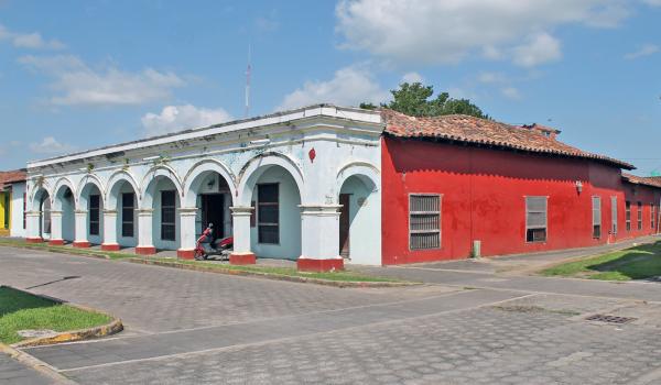
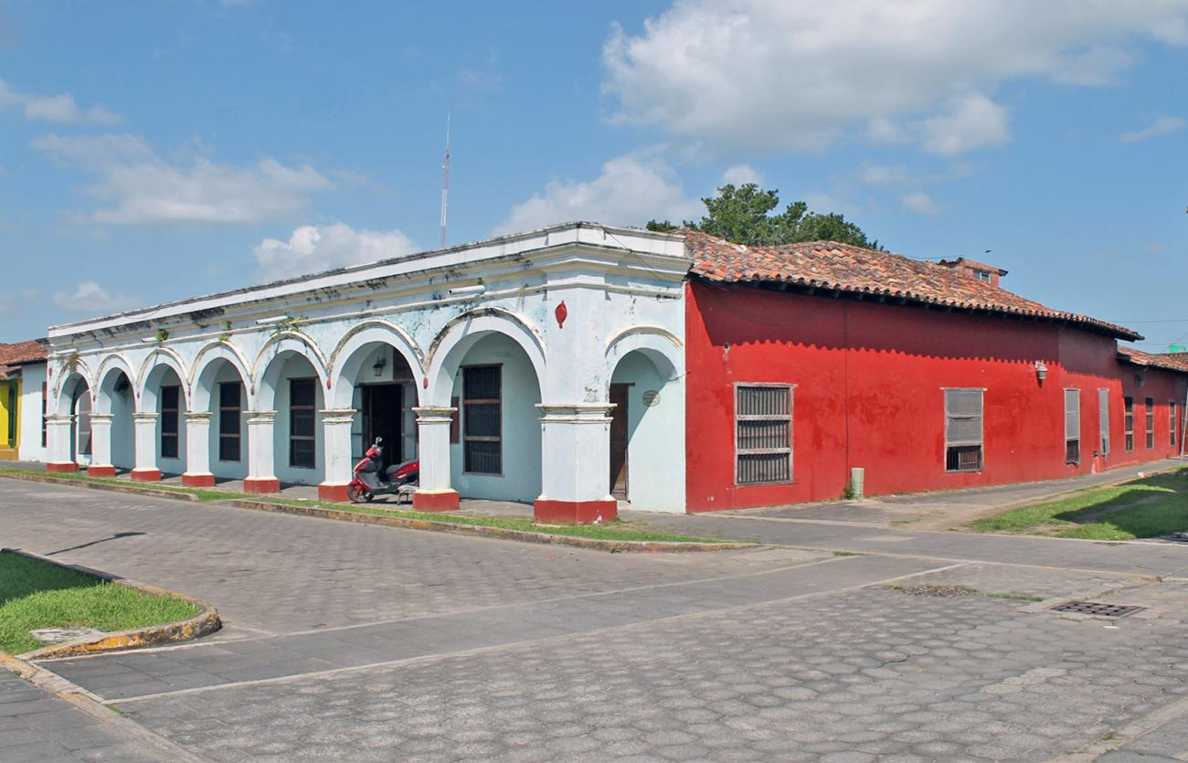
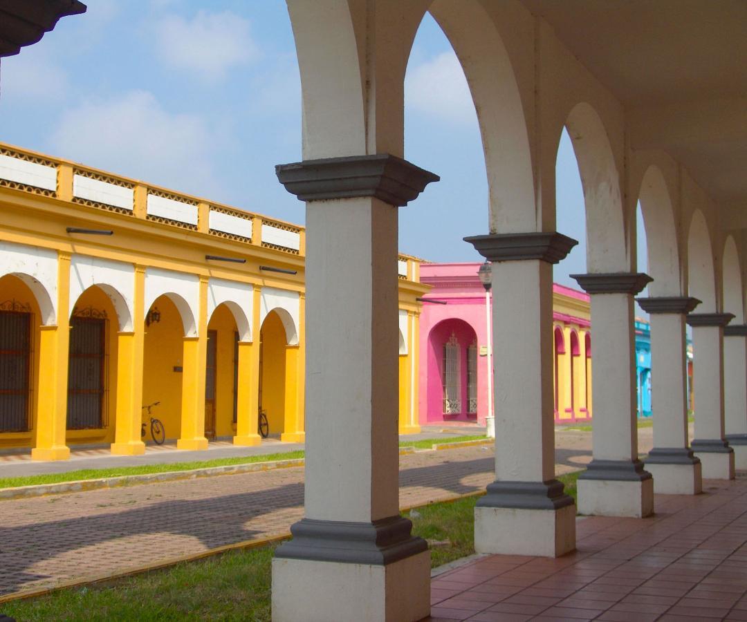
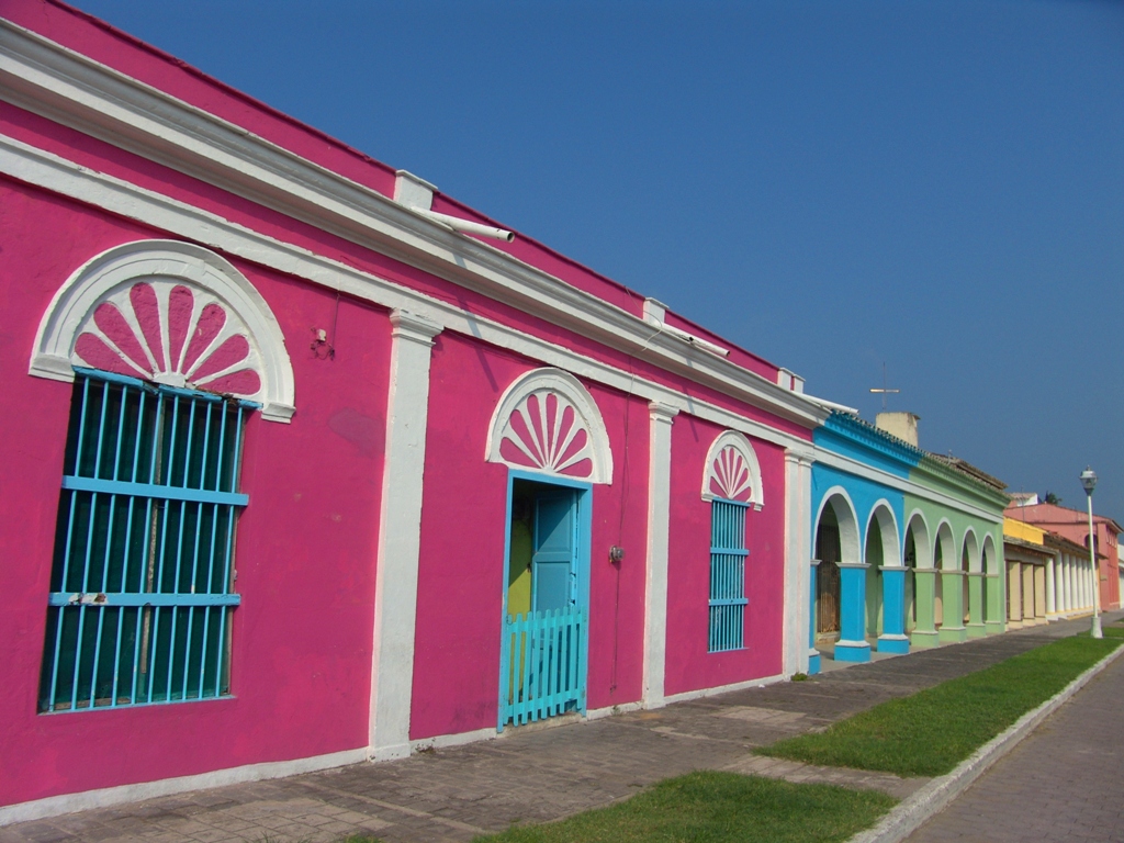
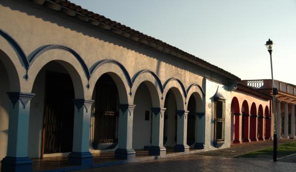
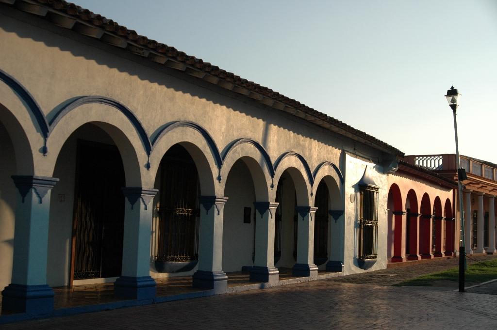
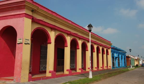
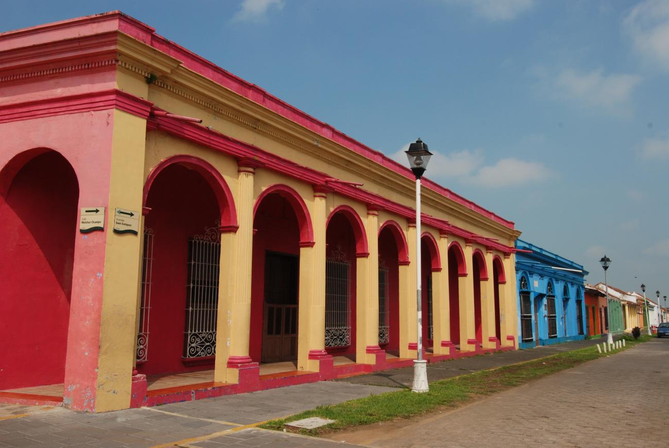
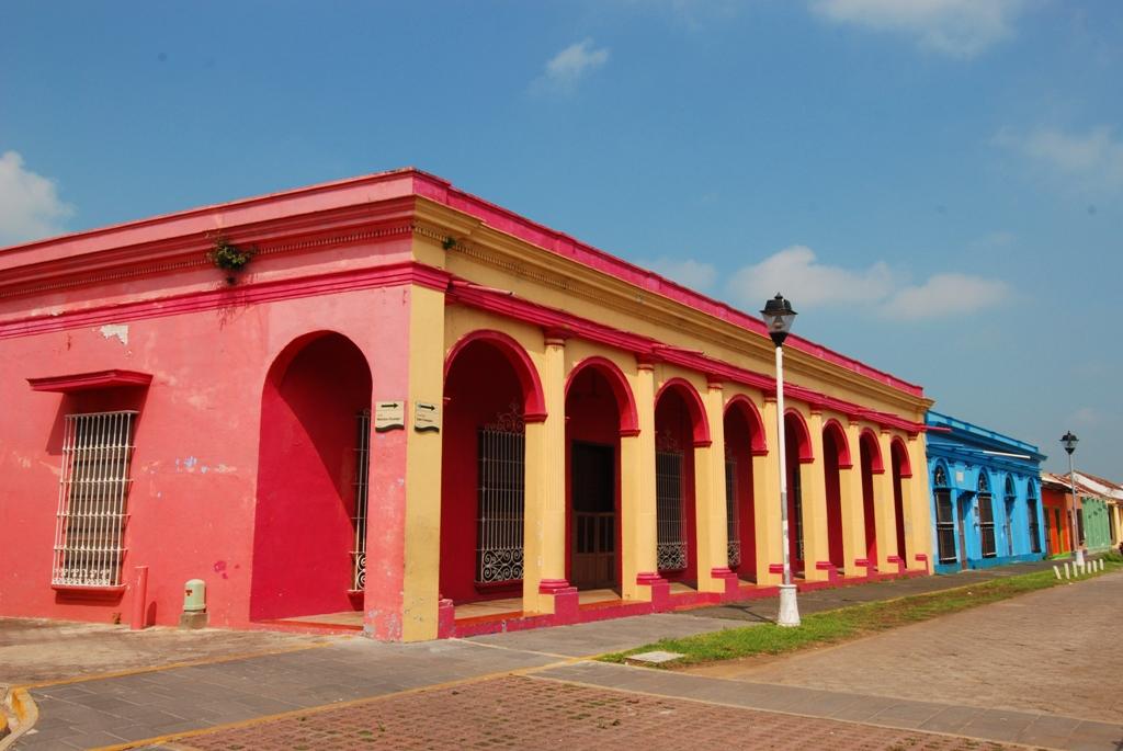
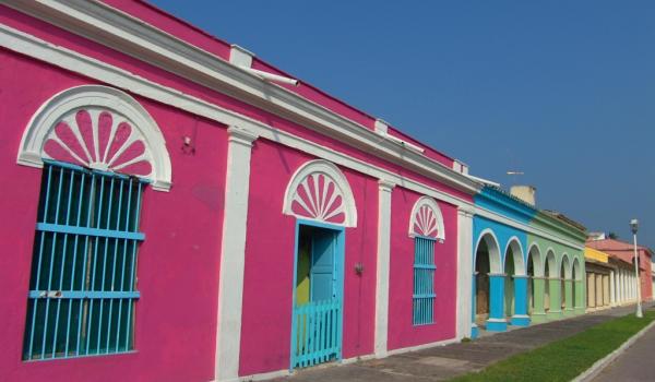
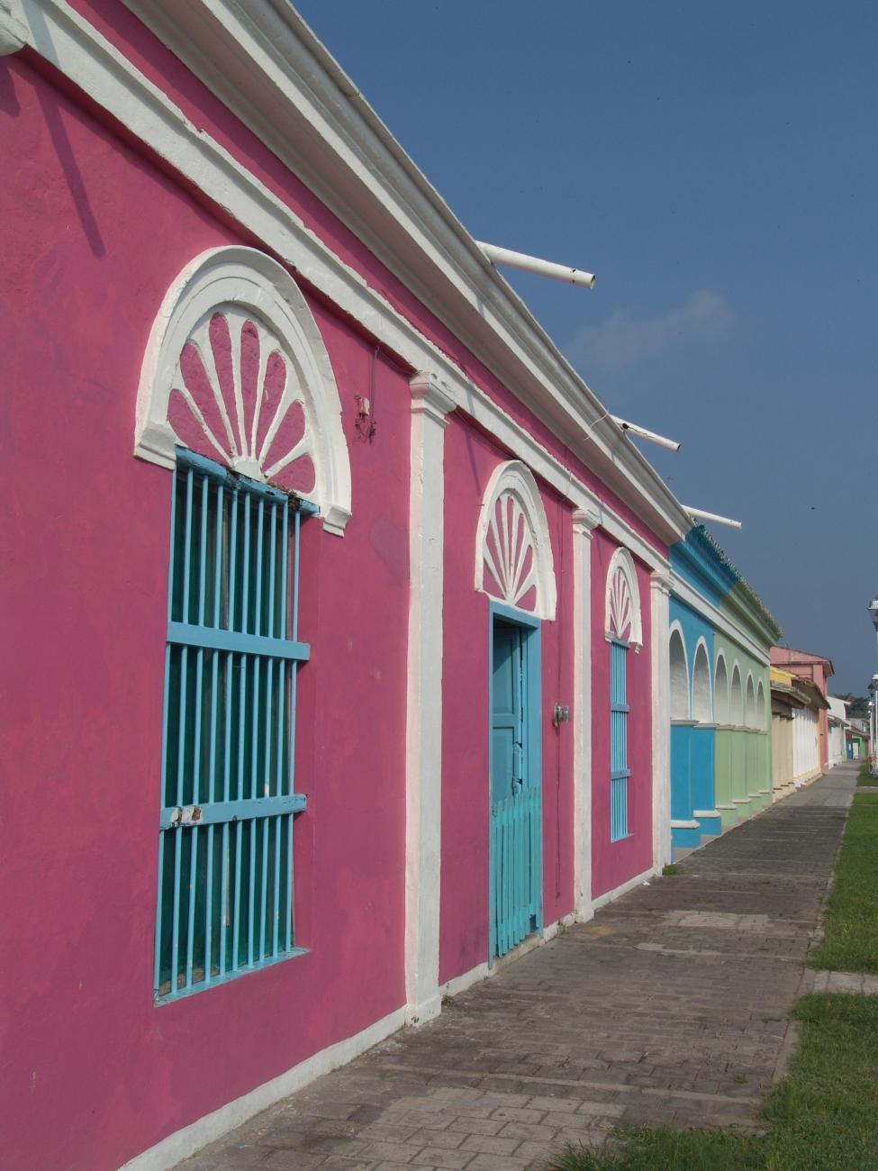
The town of Tlacotalpan developed along the banks of the Papaloapan river. During the vice-regal epoch and into the 19th century, trade with other cities in Mexico as well as abroad helped it to prosper. Today, the town is noted for the attractive and colorful façades of its buildings, its colonnades and its pitched clay-tiled roofs, together with its wealth of traditions.
35_EN_638_ZMH_Veracruz_Tlacotalpan.wav
In the pre-Hispanic period, Tlacotalpan was a Totonaco settlement until the 12th century. In the 13th and 14th century it was occupied by the Toltecas, and subsequently fell under the sway of the Mexicas, who gave it the name Tlaxcotaliapan. This Nahuatl word means “land between water” in reference to its location, since Tlacotalpan stands on the banks of the river Papaloapan, in the heart of the state of Veracruz.
In 1518, the Spaniards entered the region and, after the Conquista, the town was granted as an encomienda to the Spanish soldier Alonso Romero, who arrived with the expedition led by Hernán Cortés. In 1541 a corregimiento was established, which was soon became an Alcaldía mayor.
In the 17th century, Tlacotalpan was defined by the establishment of two haciendas: La Estanzuela and San Juan Zapotal; at the same time the Spanish population increased and a boat construction yard was opened. Reports suggest the town also suffered attacks from English freebooters that caused fires.
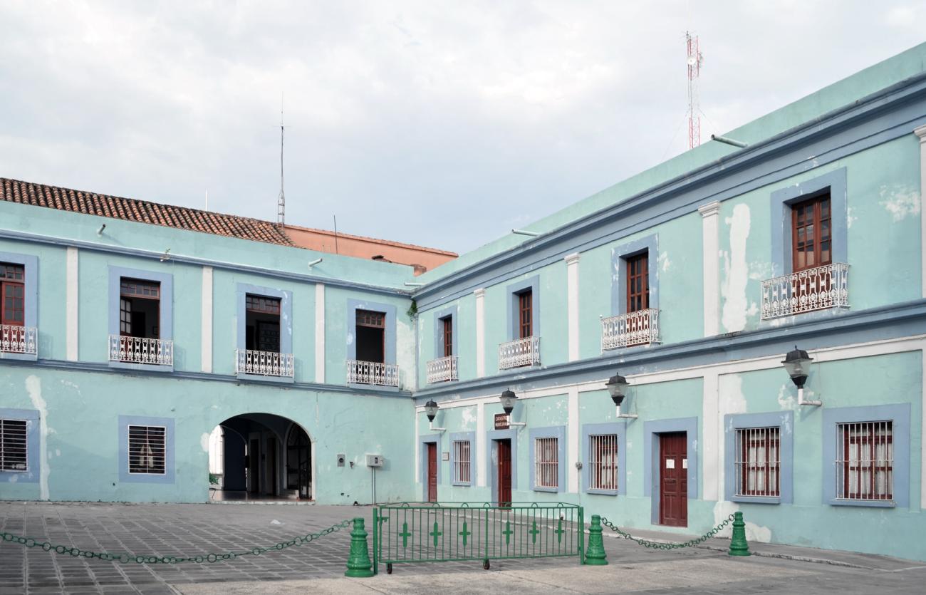
The current urban layout dates from the end of the 18th century when, following the devastating fires of 1788 and 1790, all new houses were obliged to be built in stone and placed at regular distances to prevent the spread of fire. From this time on the Neoclassical style was adopted for buildings, though in a manner adapted to local preferences with up to five different colors added to bring luminosity and liveliness to the city. Today, this chromatic diversity distinguishes Tlacotalpan, together with the homogenous character of its buildings, many of which are houses with arched façades and pitched roofs with curved clay tiles.
In 1847 it acquired the status of villa and in 1865 that of city, in recognition of its citizens’ efforts to repel the French Intervention and the provisional establishment here of the Veracruz state capital. From this moment on, Tlacotalpan underwent rapid economic, political, social and cultural growth, and it strengthened its commercial ties with Puebla, Veracruz, Orizaba and Campeche in Mexico, with the foreign cities of Havana, Caracas, Guinea, Marseille and with a number of ports in United States. However, over the 20th century, the importance of cargo transport by river declined, with the establishment of the Trans-isthmus Railroad.
In 1896, from this city, Porfirio Díaz organized his uprising against the reelection of president Sebastián Lerdo de Tejada. As a result of this action it was renamed Tlacotalpan de Porfirio Díaz, although this was dropped following the Mexican Revolution.
Tlacotalpan has also been the birthplace of notable figures in the history and culture of Mexico, including the general Juan de la Luz Enríquez, who fought at the battle of Puebla of 5 May 1862 against the French Intervention and was governor of the State of Veracruz; the poet Josefa Murillo, the historian and anthropologist Gonzalo Aguirre Beltrán, modernist painter Alberto Fuster and famous composer Agustín Lara.
Among the traditional festivities celebrated in the town the most important of all is that of the Virgen de la Candelaria, held between 31 January and 9 February. It is noted for its horse riding displays, the parade of the Virging across the Papaloapan river, the release of the bulls (similar to the Pamplonada of Spain), the jarana music evenings and the traditional fandango. A common feature of these festivities is the La Mojiganga parade. Other typical celebrations are: La Rama, beginning on 16 December, during which a group of young people tour the streets of the city singing jóvenes recorren las calles de la ciudad entonando cantos decembrinos e improvisando versos; el carnaval, que se realiza en la primera quincena de mayo, y las fiestas de San Miguelito, que tienen lugar del 26 al 29 de septiembre.
Los visitantes pueden disfrutar, además de estas fiestas, atractivos de la ciudad como los paseos en lancha a lo largo del río Papaloapan y la gastronomía local, cuya especialidad es la comida ribereña, platillos como el caldo de mariscos y de pescado, el arroz a la tumbada y el mondongo.
La traza de la ciudad está adaptada al terreno plano y a la conformación del río Papaloapan; las calles principales corren paralelas al río y las transversales convergen hacia él, formando una red. La mayor parte de las calles están orientadas en dirección este-oeste, siguiendo la curvatura del río; los callejones generalmente se encuentran orientados de norte a sur.
Asimismo, Tlacotalpan está divida en cuatro zonas. La primera, conocida como el Barrio de Arriba, corresponde al antiguo asentamiento español y su traza se caracteriza por ser regular. La segunda, conocida como Barrio Abajo, corresponde al antiguo asentamiento indígena y sus calles son menos regulares. La tercera zona ocupa el territorio donde, hasta mediados del siglo XVIII, se encontraba el arroyo Regado; esta condición determinó la irregularidad de su traza. Finalmente, la cuarta zona, de origen relativamente moderno, está constituida por un área ganada al río.
Complementan la traza y la forma de la ciudad sus plazas: central, Hidalgo, del Templo de San Miguel, Doña Marta, del Atracadero, Nicolás Bravo y Zaragoza, que se distingue por sus hermosas banquetas de mármol. La Plaza doña Marta es sede del encuentro anual de decimeros y jaraneros que se celebra del 31 de enero al 2 de febrero, durante las fiestas de La Candelaria.
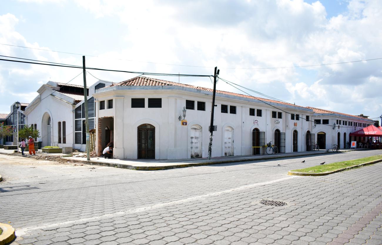
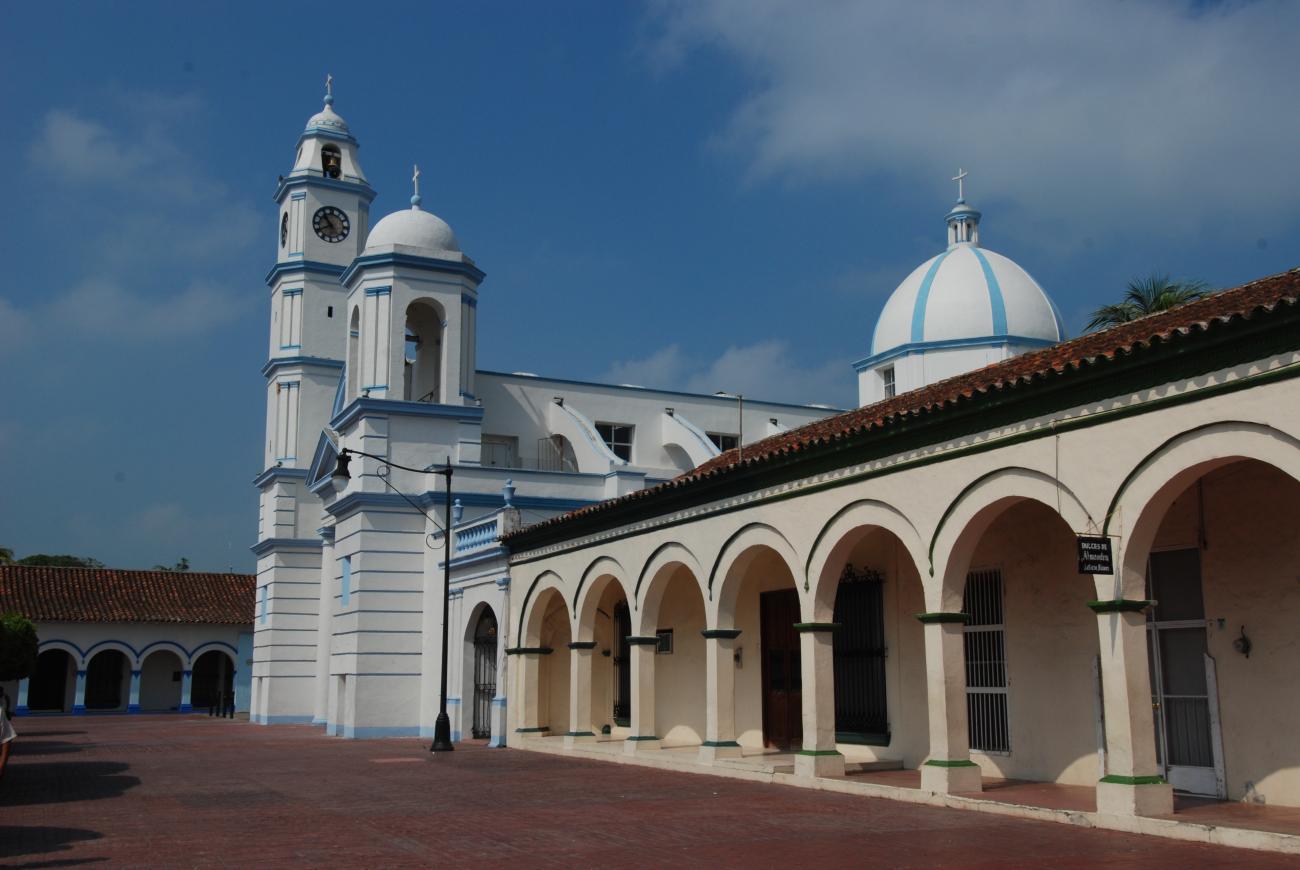
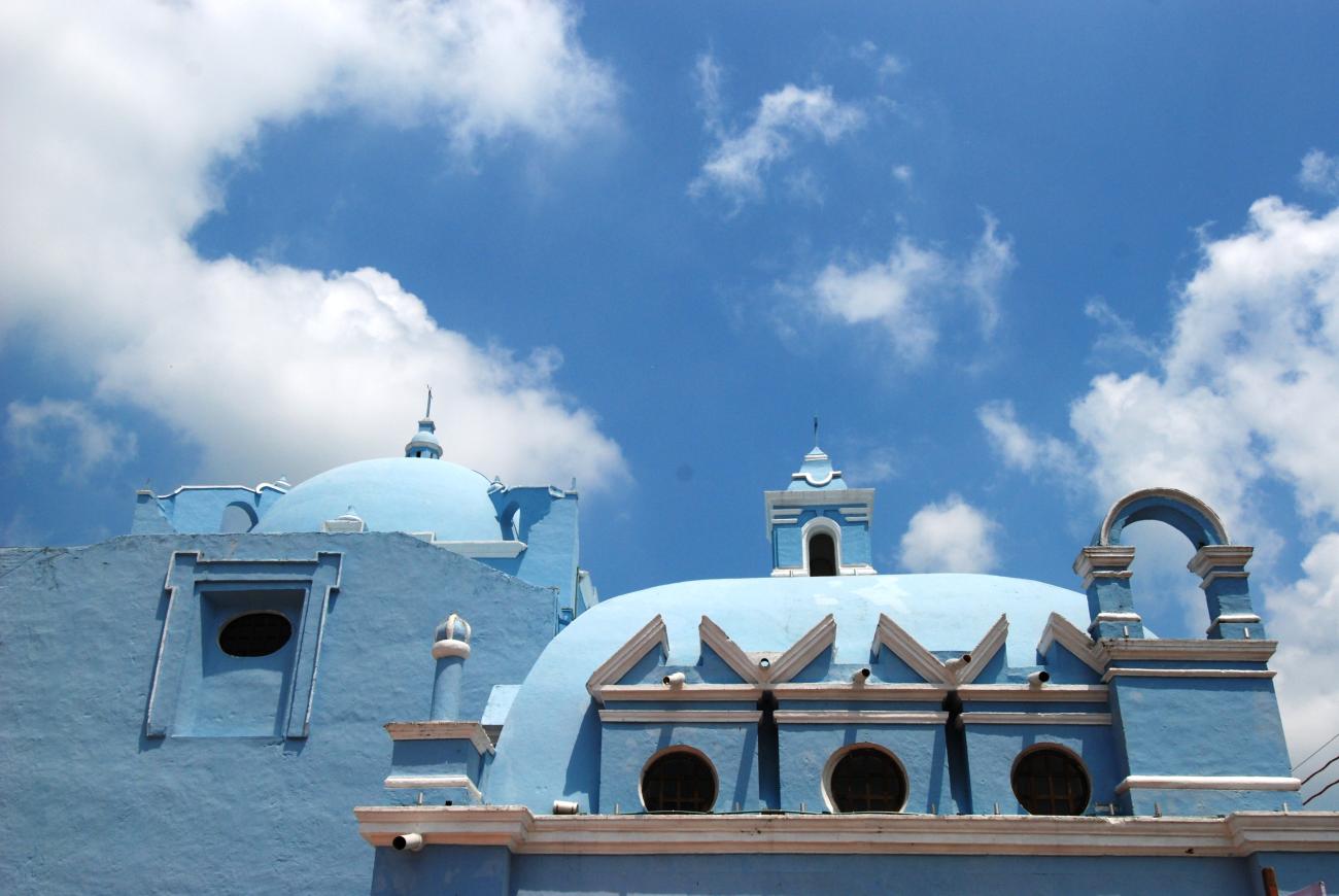
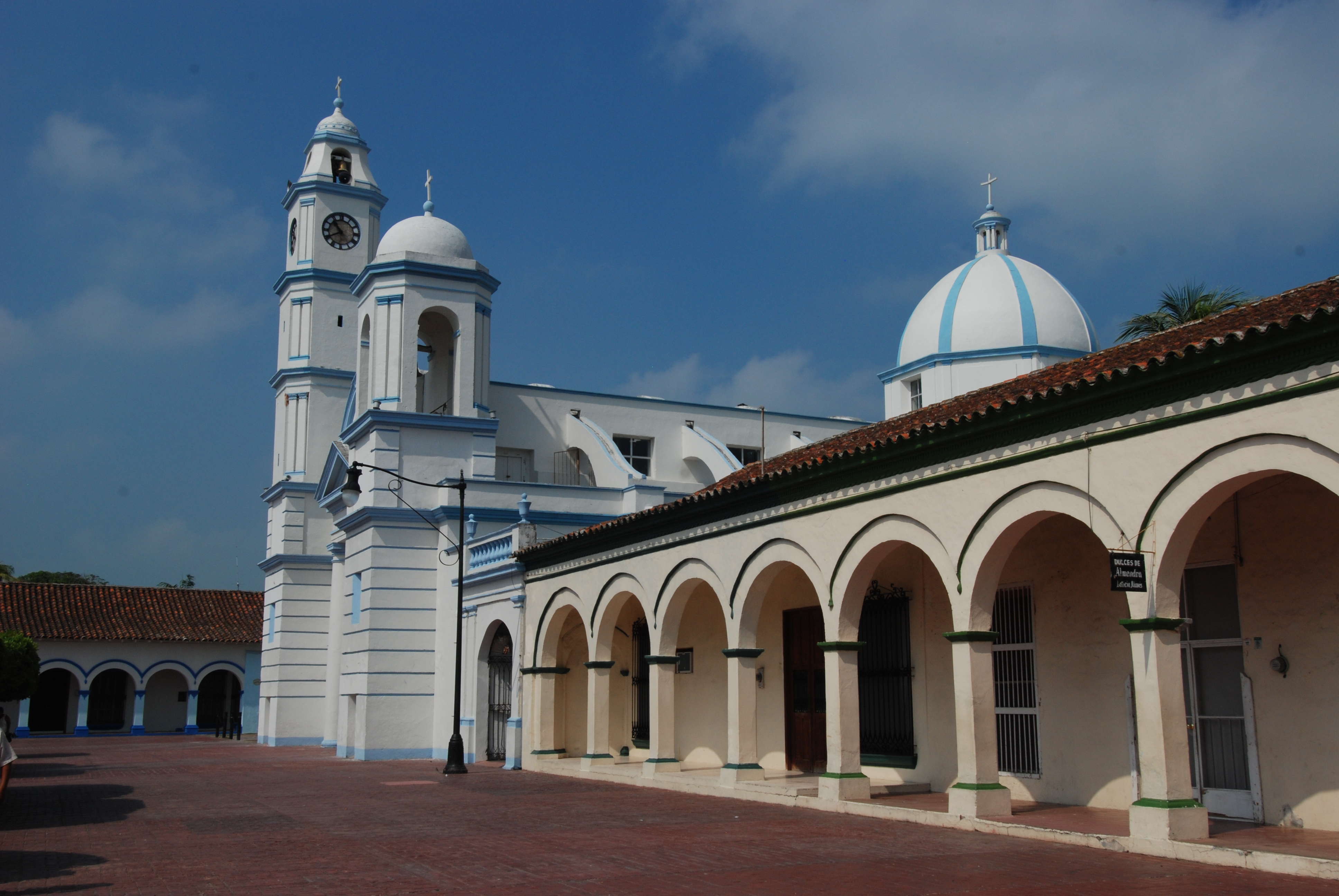
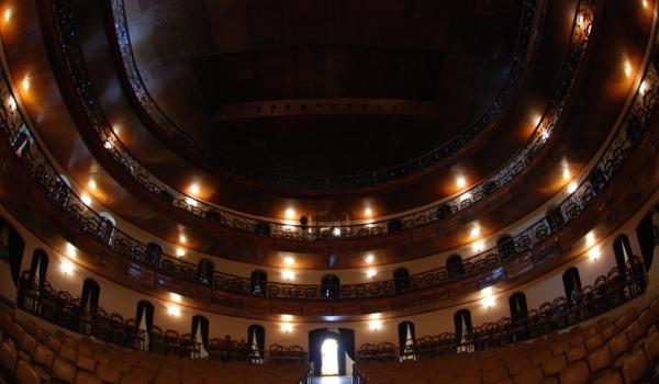
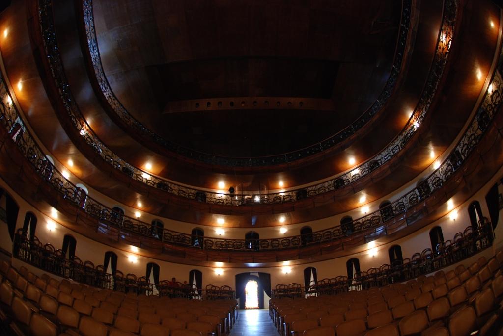
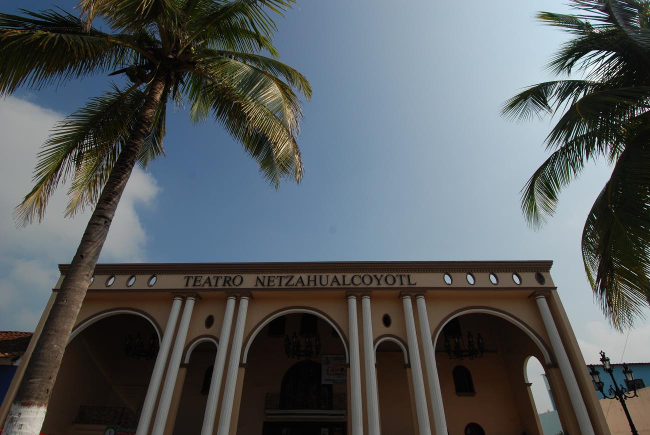
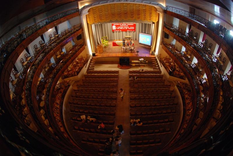
The Zone of Historical Monuments covers an area of 0.75 km2 and comprises 153 city blocks with buildings of great historical value built between the 17th and 19th centuries. Of note are the churches of Nuestra Señora de Guadalupe, La Candelaria, con su bóveda y cúpula de coral, y el de San Miguel Arcángel. Otros edificios notables son el Teatro Nezahualcóyotl y la Casa de la Cultura y Artes “Agustín Lara”.
The city was declared a Zone of Historical Monuments on 10 December 1986 and inscribed on the list of UNESCO World Heritage Sites on 2 December 1998.

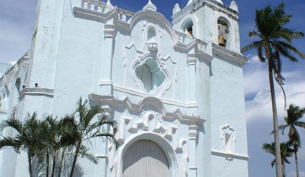
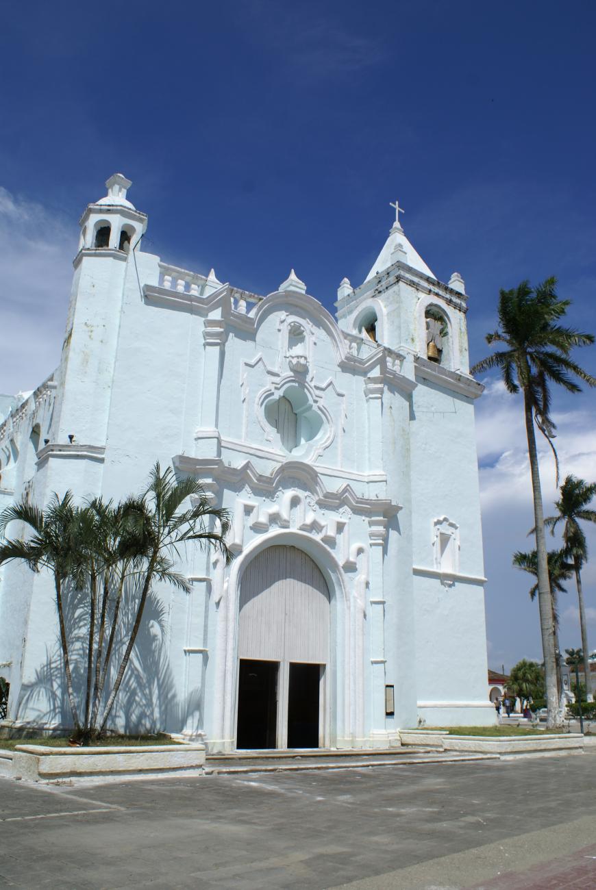
Templo de La Candelaria
This temple was designed by Juan Medina and built in 1779 in the Spanish Moorish style.
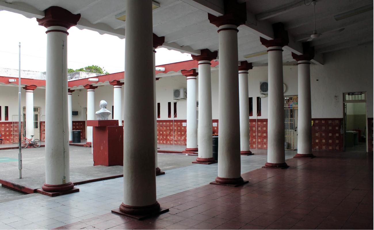
Casa-habitación
The first two bays connect to the dining room and a central courtyard. It has a tile roof on a wooden structure, and its floors are made of Marseille tiles and marble with borders.
Casa-habitación
Inside the first bay, alterations can be seen, such as the construction of arches and some contemporary additions that are used as rooms.


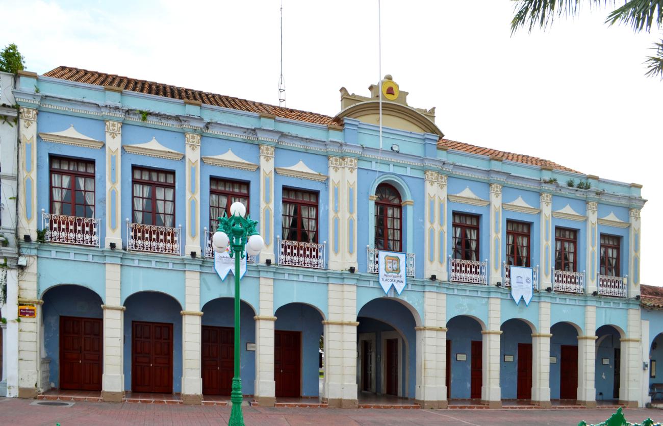
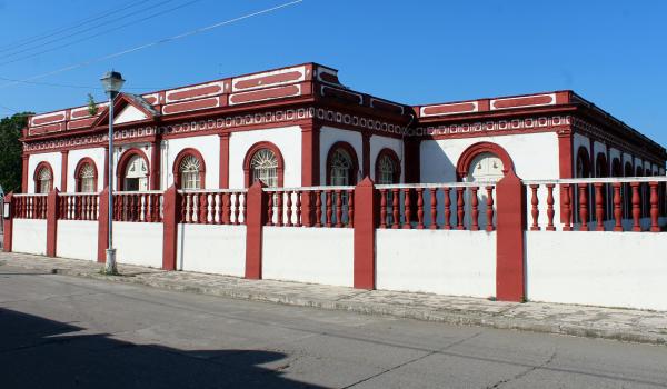
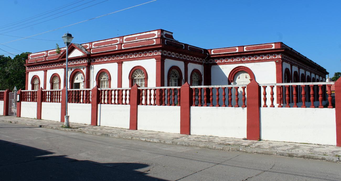
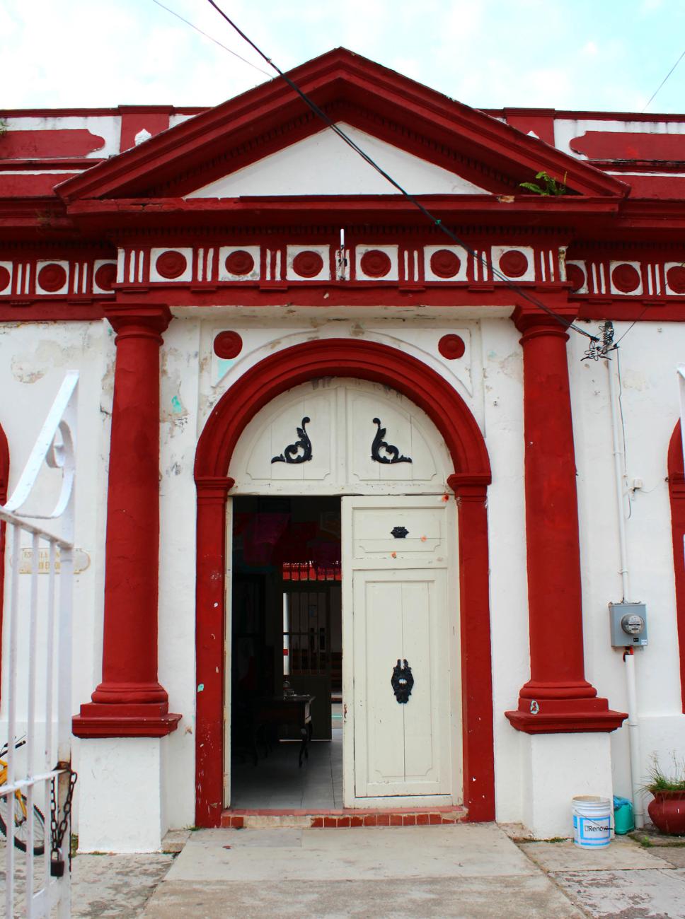
Palacio Municipal
This building was constructed in 1849, lost its original façade, and had its upper part modified.