


Tlalpujahua de Rayón
Historical Monuments Zone
Abstract
A town with pre-Hispanic roots that is notable as the birthplace of the López Rayón brothers, who played a leading role in the struggle for independence. Its mining roots link it with the most important industry of the colonial period, while its buildings and street plan make it a classic example of the architecture of western Mexico.
The name of the town comes from the Nahuatl words “tlalli” (earth) and “poxohuac” meaning something fluffy or spongy, which is why it is interpreted as “in fluffy or spongy lands.” The name “de Rayón” was added later when Tlalpujahua became known as the birthplace of the López Rayón brothers, heroes of Mexican independence.
This site was on the border between the Purépecha and Mazahua peoples, which led to frequent conflicts between these groups. Research shows that the first to settle in this place, in approximately the year 1460, were the Purépecha, and later the Mexica, commanded by their emperor Axayácatl.
In the year 1522, after the dissolution of the Tarascan kingdom, the encomiendas were created. Tlalpujahua formed part of the Tarimeo encomienda. In 1560 it received an influx of Spaniards as a result of the discovery of gold and silver mines, which earned it the title of Real de Minas de Tlapujahua. Ten years later, the Real de Minas was declared an Alcaldía Mayor and reported directly to the viceroy. Mining was the foundation of its development from then until the beginning of the 20th century and was a major economic influence throughout the region.
During the founding process of the bishoprics of Michoacán and Mexico, various conflicts arose in determining the assignation of Tlalpujahua. As a result of the efforts of Don Vasco de Quiroga, it was definitively allocated to the bishopric of Michoacán. In 1575, the parish was founded by Don Antonio de Morales, immediate successor of Vasco de Quiroga.
In the year 1593, by instruction of the viceroy, the then mayor of the Tlalpujahua mines, Gaspar de Solís, was placed in charge of the first congregation of indigenous people and of drawing up the first street plan and construction of houses for the new town. Sources indicate that on July 4, 1603 the congregation of the Real de Minas de Tlalpujahua was established. At that time it was home to 14 mines.
According to the reports of Dr. Felipe de Valleza, by 1765, the Tlalpujahua parish served the towns of San Miguel Tlacotepec, San Juan Tlalpujahuilla, Santa María, Nuestra Señora de los Remedios and San Pedro Tarimangacho. At the beginning of the 18th century, a fire destroyed part of Tlalpujahua, reducing important buildings and documents to ashes.
Tlalpujahua was the birthplace of the brothers Ignacio, José María, Francisco and Rafael López Rayón, prominent insurgents recognized in Mexican history for their efforts fighting a number of battles, under the command of General Ignacio López Rayón. One of these battles was against the royalist forces and took place in the Cerro del Gallo, located in the vicinity of the town. General Ignacio López Rayón was secretary to the independence leader Don Miguel Hidalgo y Costilla, with whom he participated in the momentous battles in Guanajuato and in the Cerro de las Cruces. He earned fame in the struggle for the independence of Mexico and is also recognized as a pillar of the political and social organization of independent Mexico as Secretary of State, Mayor of San Luis Potosí, and Deputy. By the year 1820, Tlalpujahua was devastated by the War of Independence and most of its mines were abandoned.
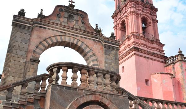
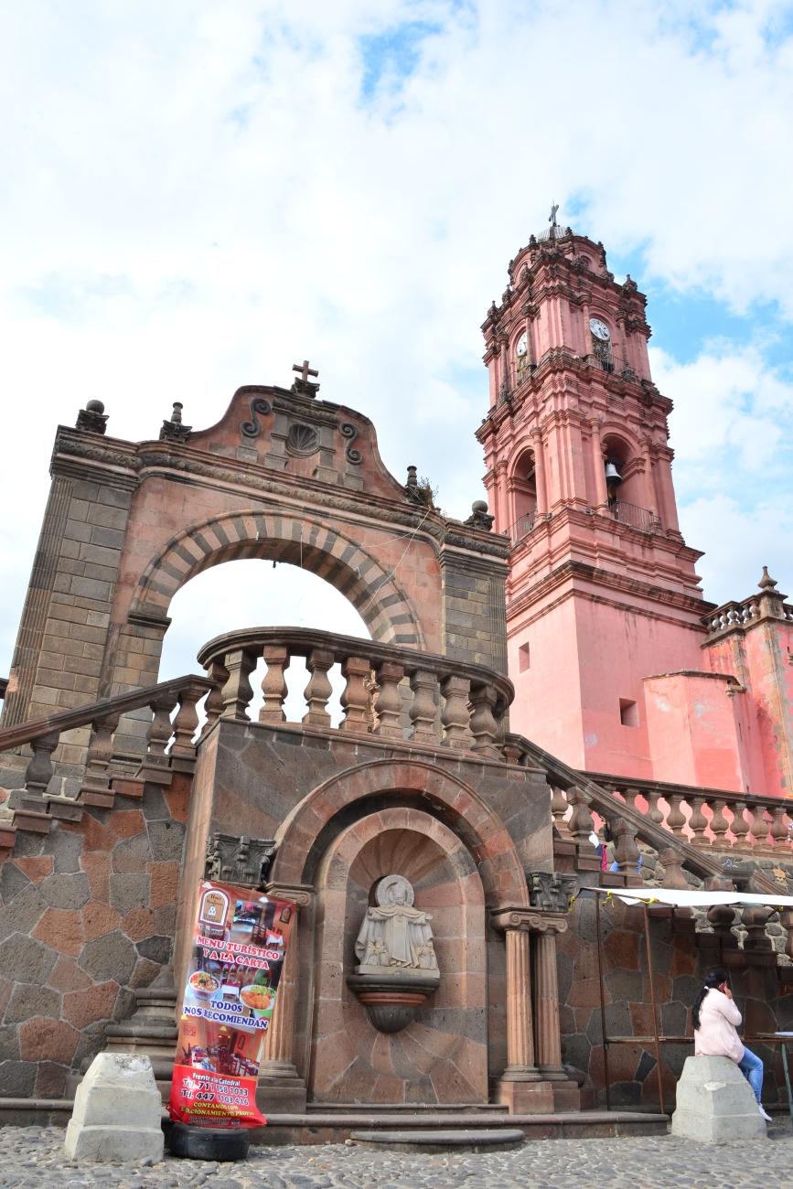
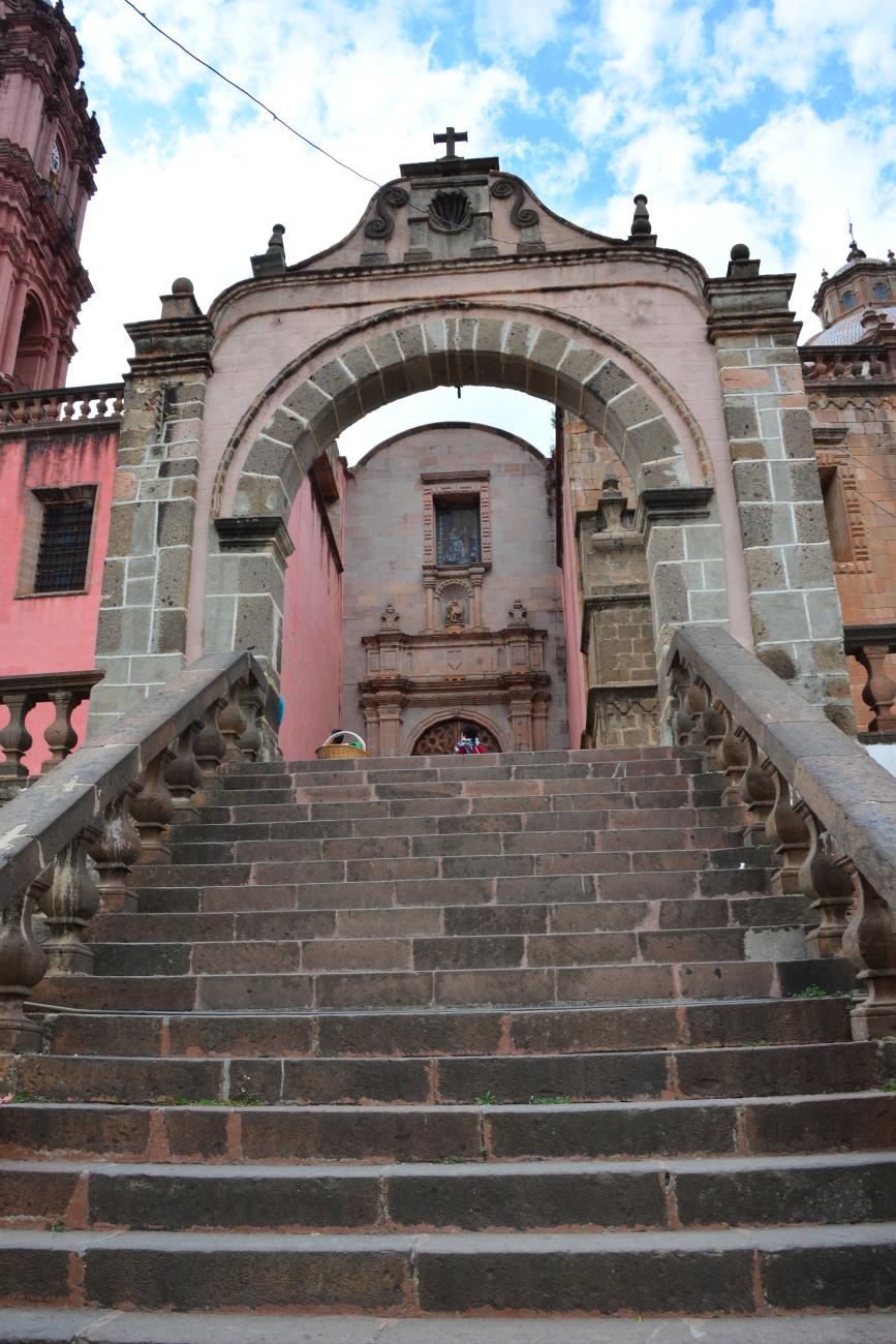
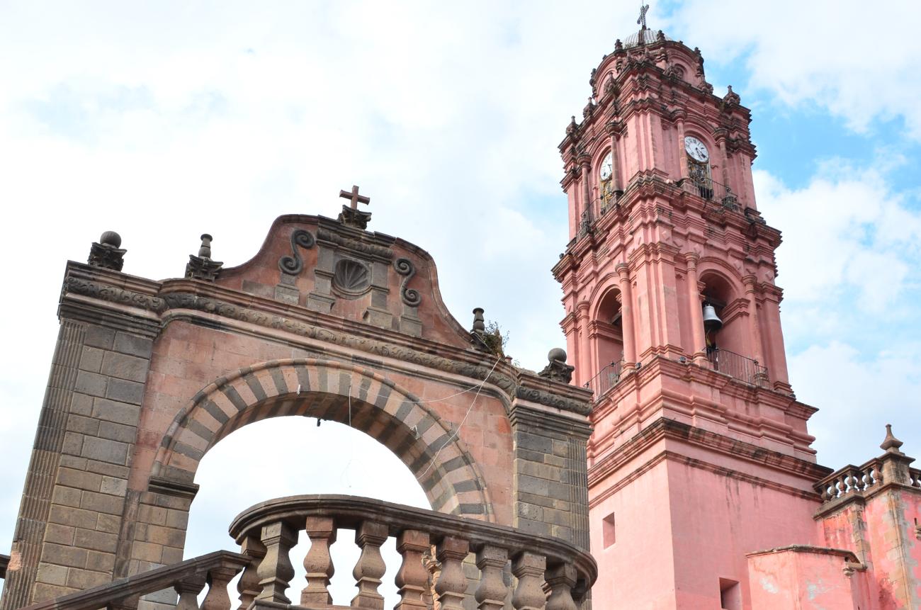
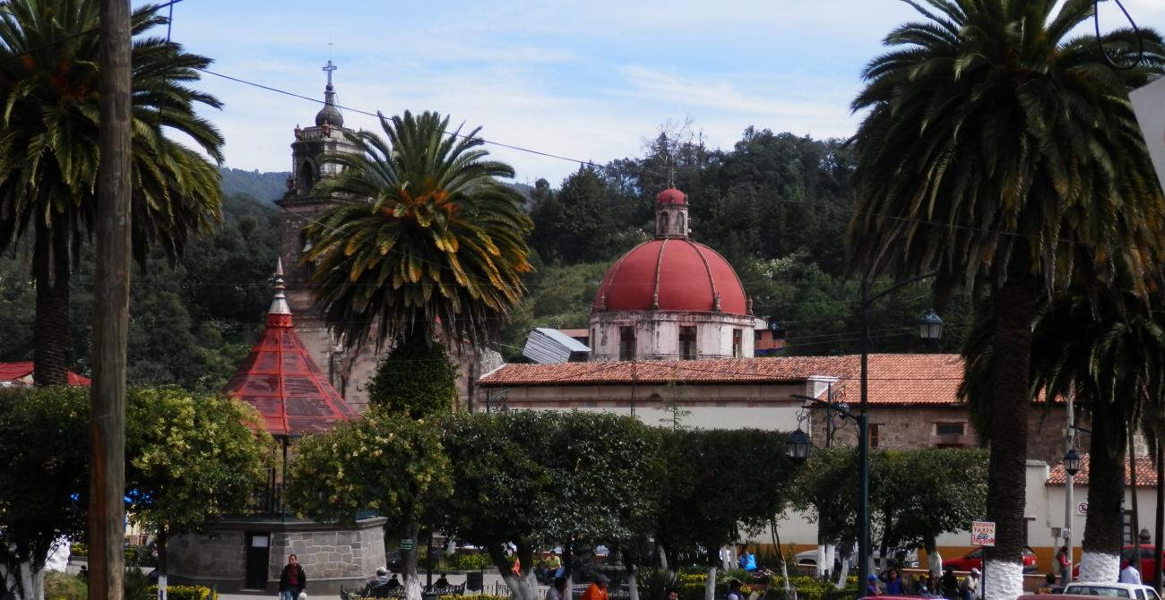
In 1822, the first town hall was constituted on December 10, 1831, it was recognized as a municipality and became the district head of the Departamento de Oriente. On May 21, 1859, the town was granted the title of Mineral de Rayón, in memory of the López Rayón brothers. Later, in 1861 its status was raised to principal town in the administrative district along with Angangueo and Contepec. The inhabitants of this place also enjoy historical recognition for their participation in the Reform War alongside the Liberals. The historical records also indicate that when this town was lost to the Conservative forces, General Rafael Cuellar spared no effort to recover it. In 1937, a flood destroyed the Dos Estrellas mines and the central neighborhoods of the town, which led to significant economic deterioration and the emigration of the population to other parts of the state and to neighboring states. As a result of these events, together with its location, urban layout and the specific character of its buildings, the government declared it a Zone of Historical Monuments. The zone covers an area of 0.35 km2 and is made up of 42 blocks containing buildings constructed between the 16th and 19th centuries that stand testimony to the architecture of each successive era.
Some of these buildings were destined for religious worship, such as the former Franciscan monastery, the Diocesan Sanctuary dedicated to Nuestra Señora del Carmen, the Church of the Brotherhood, and the chapel of the Santiago Puxtla neighborhood; others are public buildings such as the Municipal Presidency and the Teatro Obrero. The remaining buildings are of a civil nature in which their architecture and formal elements are significant not only individually but as a whole, due to the harmony of this Zone of Monuments in its wooded surroundings, whose conservation as an integral whole is in the national interest.
In the vicinity of the town the Señor de Zapateros chapel can also be visited, which takes its name from the shoemaking trades practiced by its inhabitants. Also, just three kilometers away is the Las Dos Estrellas Mining Technology Museum, which tells the story of one of the most successful gold and silver mines in the region. It was discovered in 1899 by the French engineer Francisco J. Founier and was considered one of the most advanced of its time, making use of French and British equipment and technology. In 1938, a mining cooperative was formed that continued production there until its definitive closure in 1959.
Due to the local topography, the buildings are aligned to the streets and adapted to the slope of the land. The houses have a central or lateral courtyard and the construction system employs stone and adobe walls and plinths. The wooden structure of the sloping roofs is covered with metal sheeting or clay tiles. The architecture is a combination of elements from the Spanish tradition with the local spirit, which added to the climatic and geographical conditions of the region, and the economic development generated by mining, make for a unique urban landscape, made up of winding streets that create varied and remarkable views.
To protect the historical legacy of this urban area, without altering or damaging its harmonious character, it was granted protection under Mexican law by incorporating it into the regime set out by the Federal Law on Monuments and Archaeological, Artistic and Historical Zones.

Categoria
Tlalpujahua de Rayón Croquis_portada
Adscripción
Créditos
INAH-Mediateca
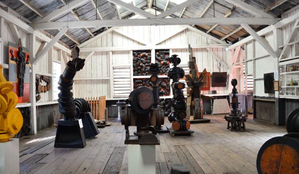
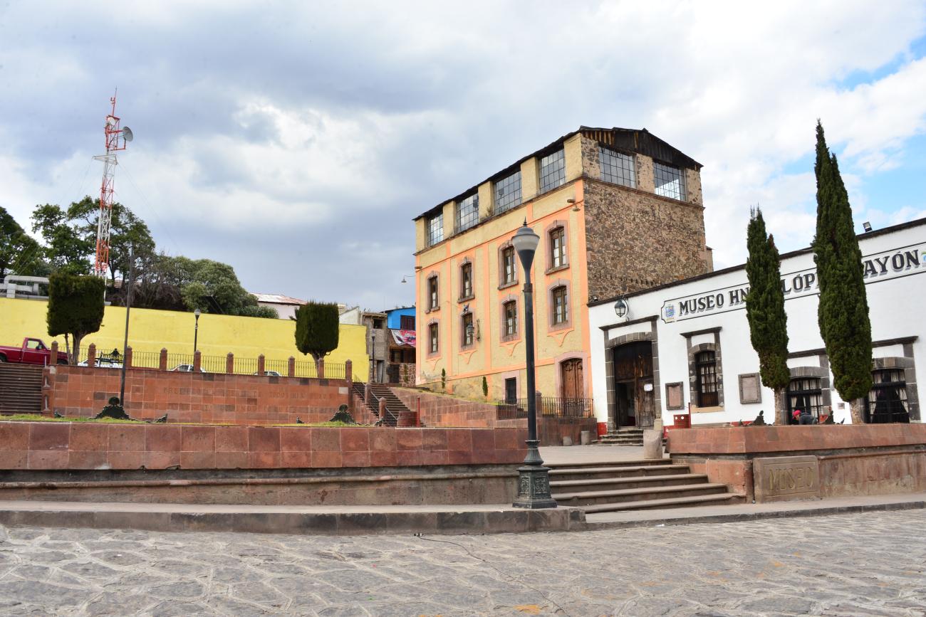
Museo Tecnológico minero del siglo XIX
The building is also known as the Las Dos Estrellas Mine Museum. This mine was discovered by French engineer Francisco J. Fournier, who began excavating the main tunnel on December 27, 1899. It was the first modern mine in the country to use electrical technology, cyanidation, and dynamite.
Museo Tecnológico minero del siglo XIX
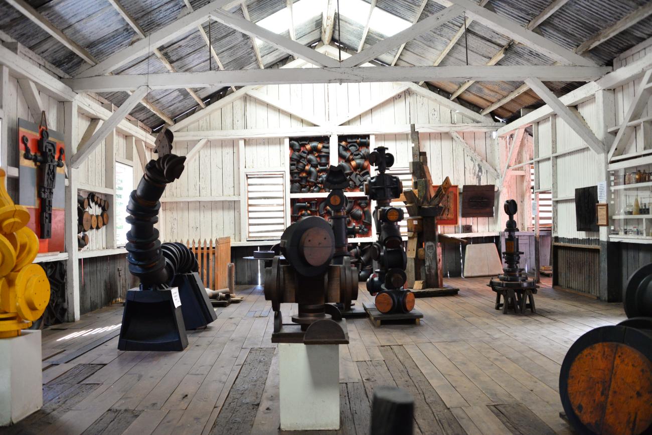
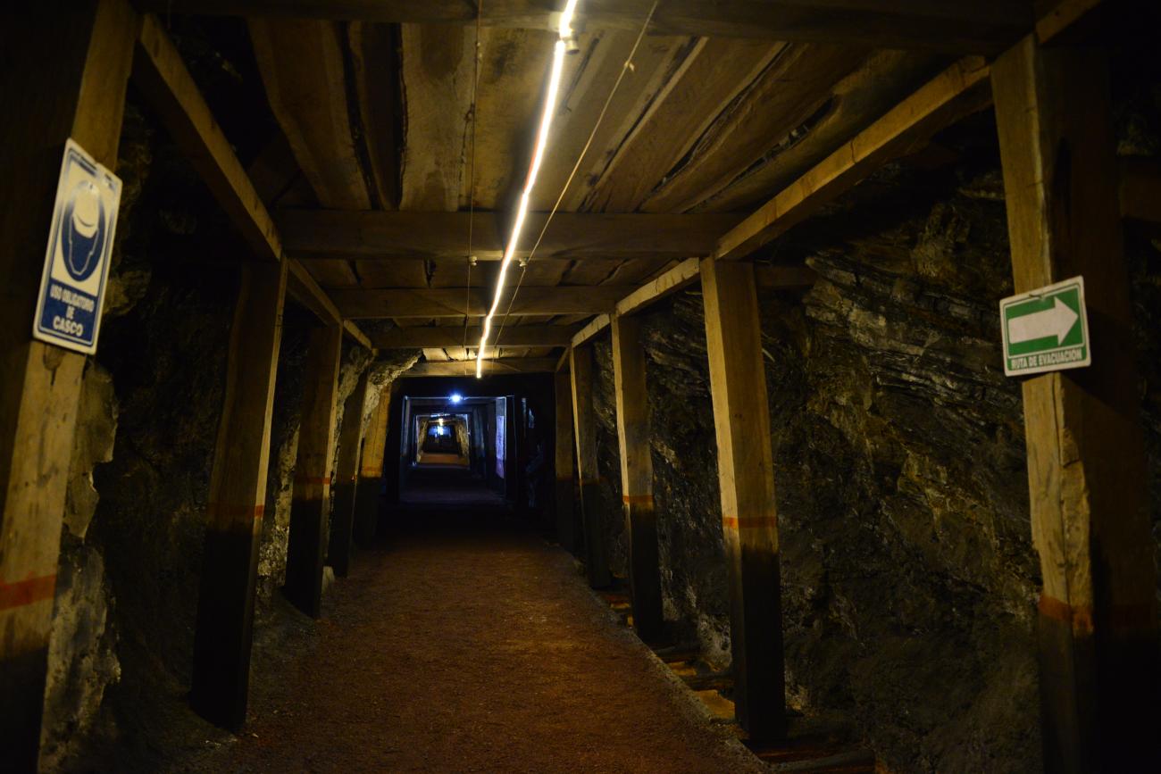
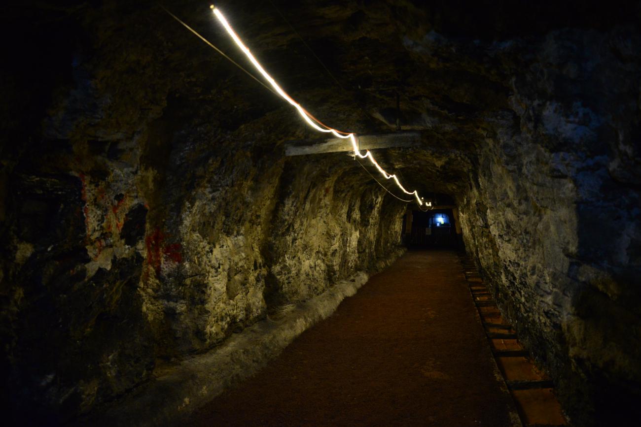
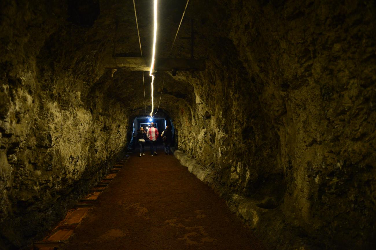
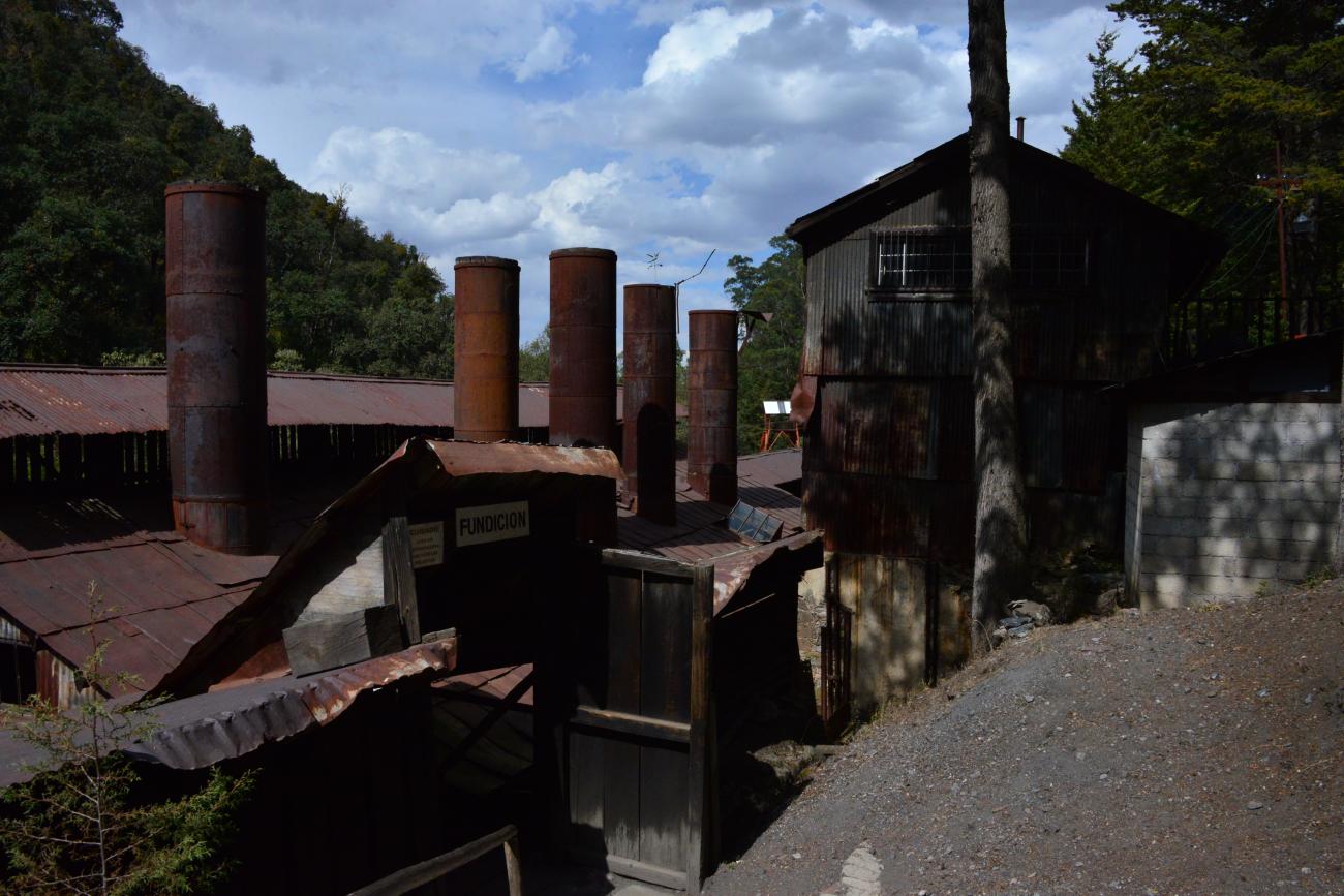
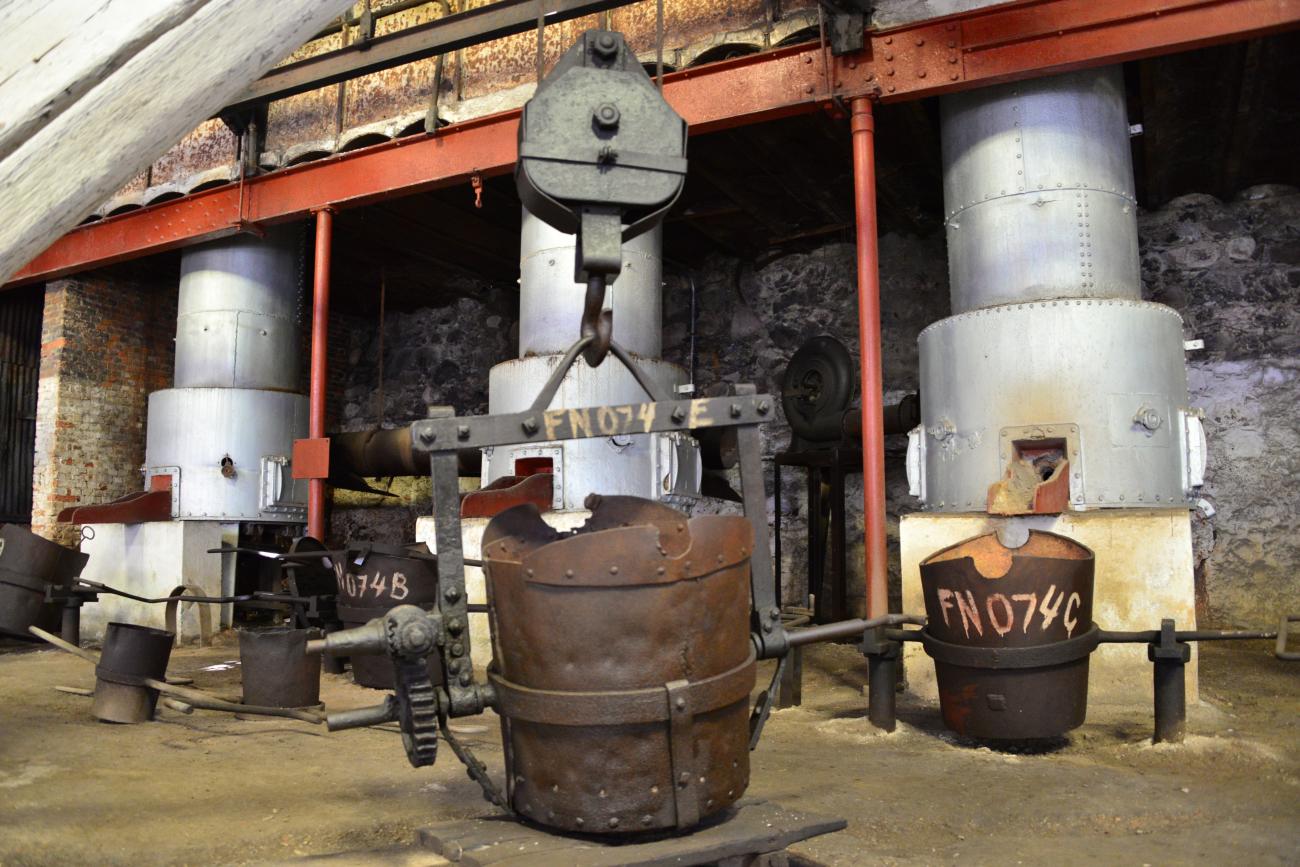
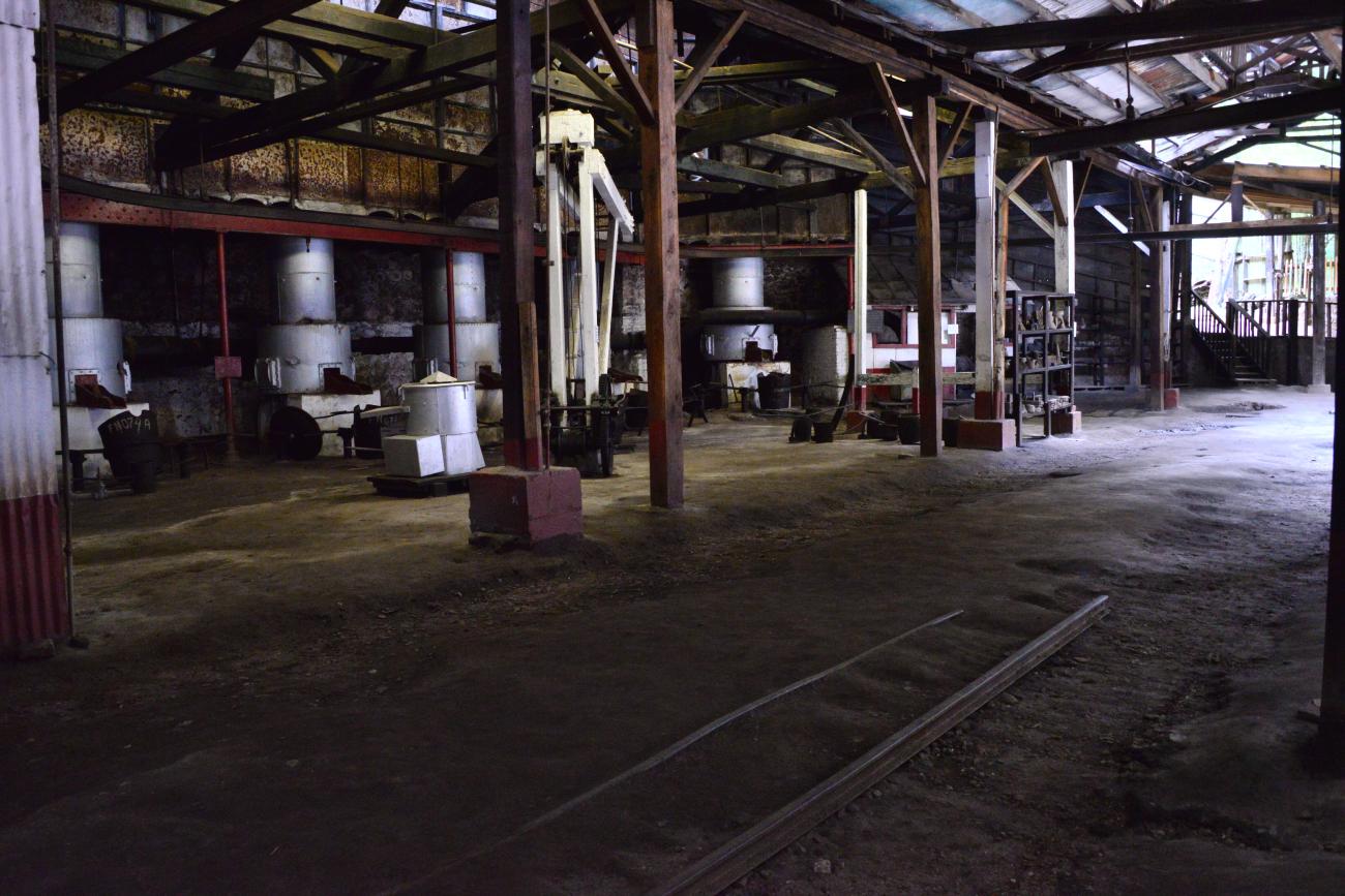
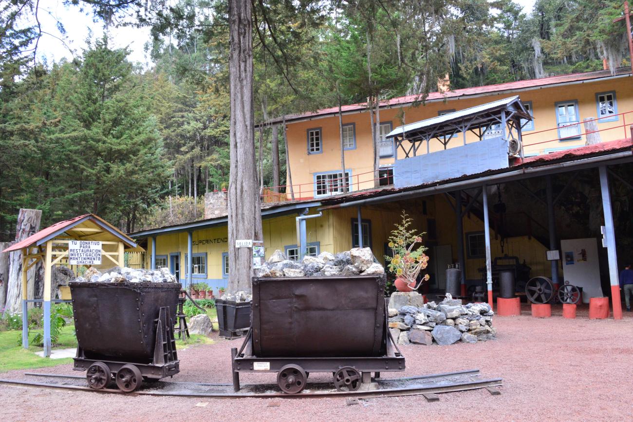
The building is also known as the Las Dos Estrellas Mine Museum. This mine was discovered by French engineer Francisco J. Fournier, who began excavating the main tunnel on December 27, 1899. It was the first modern mine in the country to use electrical technology, cyanidation, and dynamite. Its heyday was between 1905 and 1913, when approximately 45,000 kg of gold and 400,000 kg of silver were produced by an average of 5,000 workers. In 1938, the foreign owners sold the mine due to low production, low metal prices, and financial saturation in Europe. In 1938, the mining cooperative was founded as the property of the miners and remained so until 1959, when it was liquidated due to changing conditions in the country and the world.
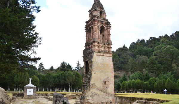
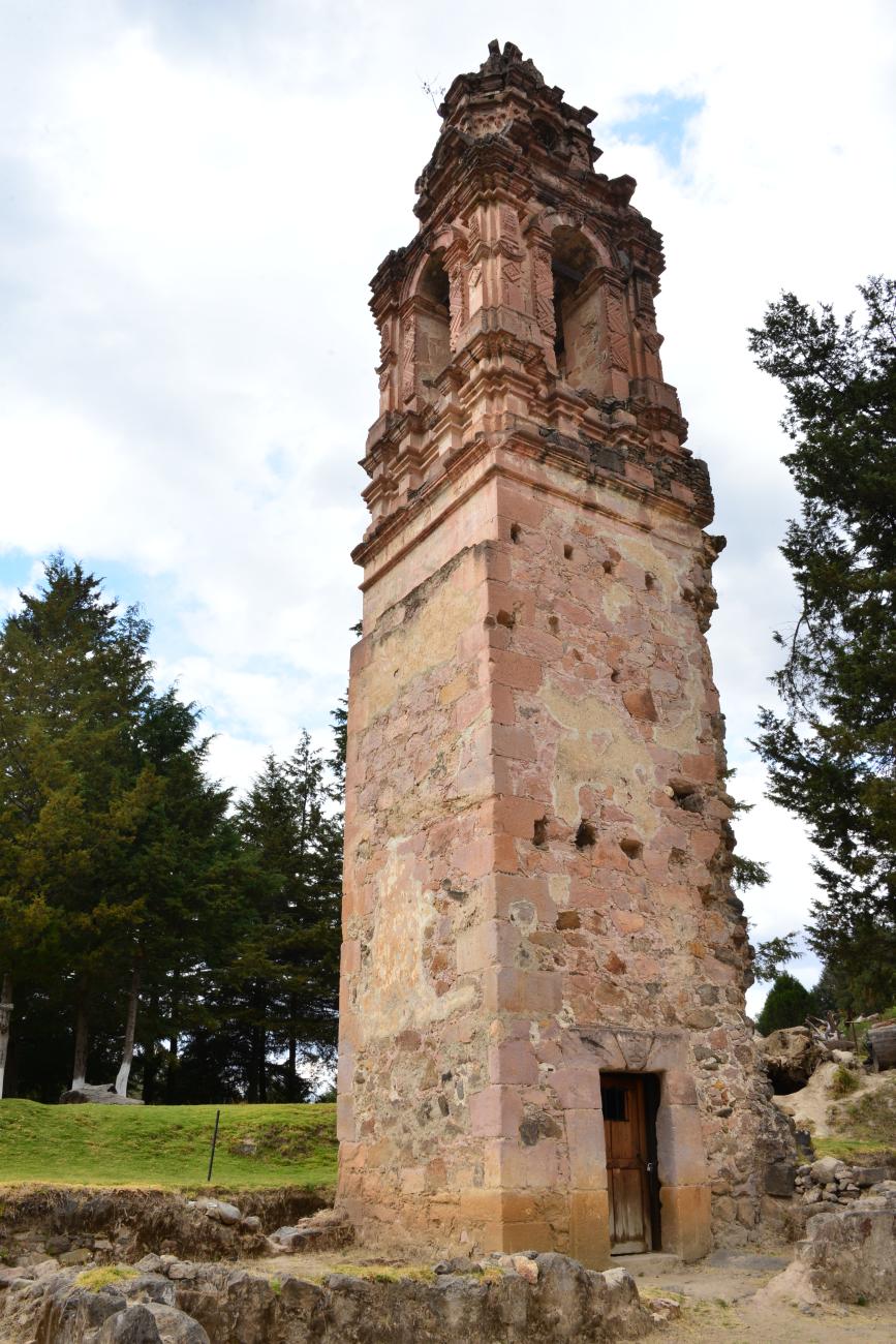
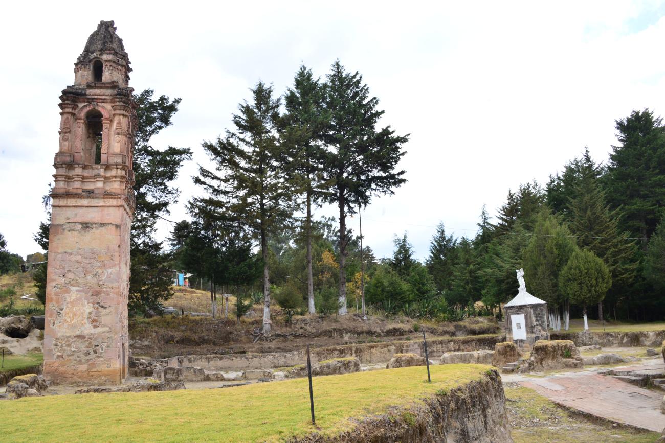
Torre de la antigua capilla del Carmen
Adobe chapel in 1623 and hacienda chapel until 1937. The chapel was partially destroyed on May 27, 1937, by a flood.

Plaza Hermanos López Rayón
To the north of the square is a platform with a flagpole and a plaque with text by Rafaela López A. de Rayón. The quarry stone paving to the south forms steps flanked by planters.

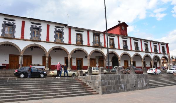
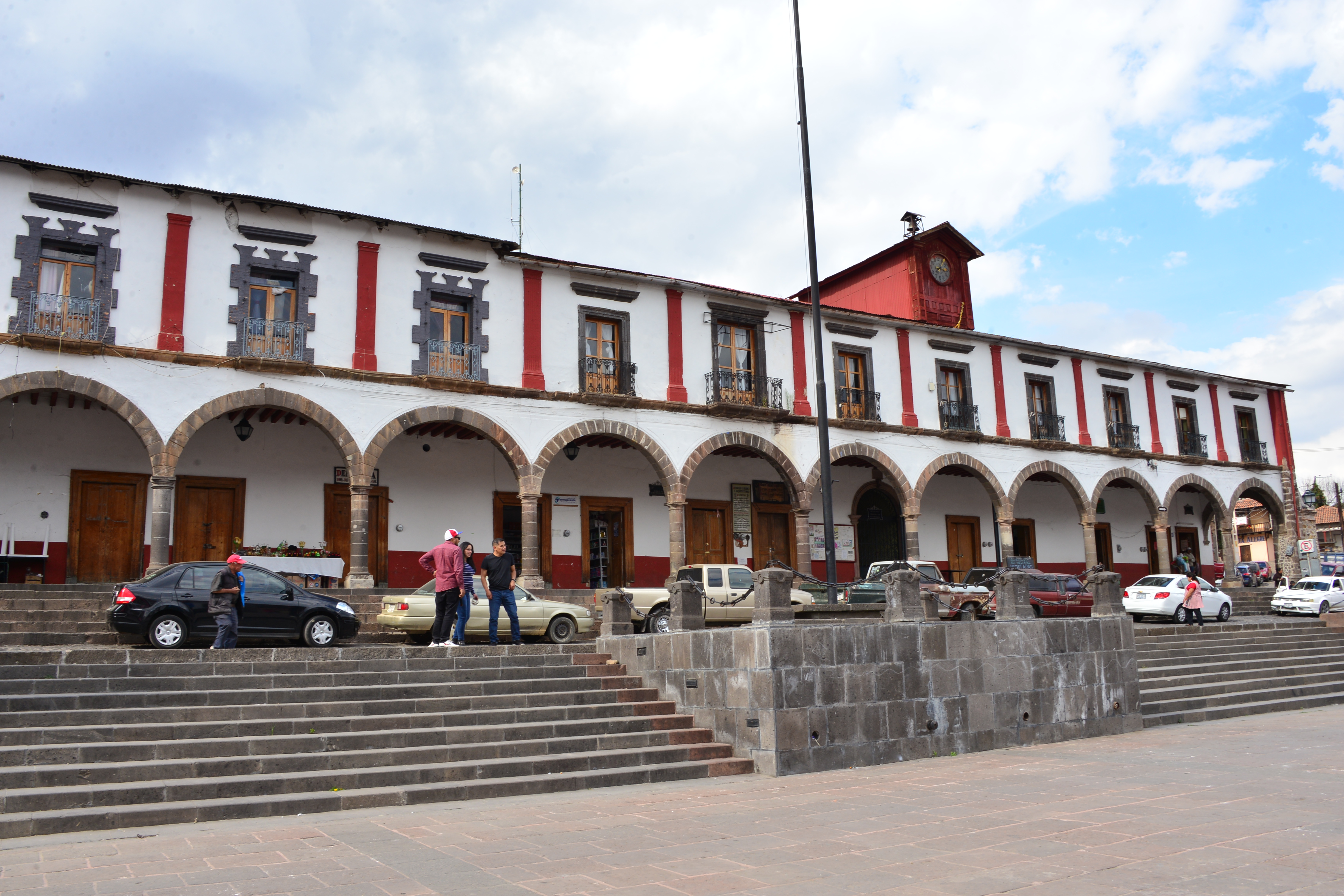
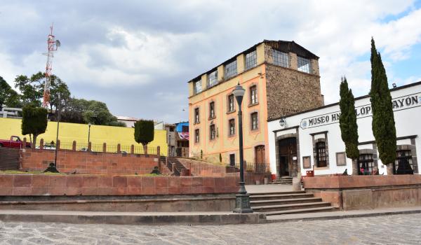
Presidencia Municipal de Tlalapujahua
On May 5, 1882, this municipal building was inaugurated, featuring balconies and a spacious and beautiful corridor inside.