


Cuautla
An iconic site in the history of the Independence of Mexico where José María Morelos y Pavón defeated the Spanish royalist troops with the support of the inhabitants of the city. Its hydraulic infrastructure and sugar estates are a reminder of the economic importance of the region.
Its name derives from Nahuatl cuauhtlan, which means “forest.” In 1837, in honor of the battle of the site of Cuautla in which José María Morelos y Pavón was victorious, it was named Ciudad de Morelos. In 1869, when the State of Morelos was created, it became Cuautla de Morelos.
In pre-Hispanic times, the current territory of the city of Cuautla was a settlement of Tlahuicas that belonged to the lordship of Huaxtepec which, in turn, was a tributary of the Mexica. It was the urban center of the Amilpas region, meaning irrigated lands. This area was notable for the cotton crop that was sent as a tribute to Tenochtitlan.
In 1521 the lordship of Huaxtepec was conquered by Captain Gonzalo de Sandoval and later became part of the Marquesado of the Valley of Oaxaca, granted to Hernán Cortés. Thanks to the fertility of the land, Cortés introduced the cultivation of sugar cane, which became the main plantation crop in the area. Sugar farms were established that took advantage of irrigation from the Cuautla-Chinameca river, and irrigation canals and aqueducts were built.
Cuautla was important during the colonial era due to its geographical location, which connected Mexico City with the Pacific coasts and with the central valleys of Oaxaca, as well as because of the wealth of the sugar economy. Likewise, its fertile land, benign climate and abundant water resources were valued.
In order to establish Spanish rule over the region and obtain labor, the evangelization of the indigenous peoples was carried out by monks. In 1580 the Dominicans built their monastery dedicated to Santo Domingo in Cuautla and in 1640 the Dieguinos built one of their own. However, the decline in the indigenous population as a result of epidemics meant that black slaves were brought to Mexico to work on the sugar estates, while indigenous people from other regions were also brought to work in the fields.
The city was also home to so-called casas reales, which functioned as customs offices, where the gold and silver shipments that left for the port of Veracruz were registered and then sent to Spain. The location of Cuautla made it an important trade hub, as it linked together different routes from the towns of the Chalco region and the Cuernavaca Valley as well as reaching Mexico and Puebla. Due to its importance to trade, it was split off from the administration of Huaxtepec and the Marquesado del Valle de Oaxaca in 1609, and the region was designated the Alcaldía Mayor of Cuautla de Amilpas.
The urban plan of the city dates from the 16th century and was laid out by a Dieguino friar by the name of Montesinos. It took as a point of reference the most important church, that of Santo Domingo, and the city was divided into four neighborhoods: Tejalpa, San Martín, Jerusalem and Xochicalco, the first with a Spanish population and the rest with indigenous people. With the passage of time, it developed an urban fabric with a civil and religious character defined by houses of the mayor and members of the city council, as well as by the former monasteries of the orders of Santo Domingo and San Diego. Meanwhile, sugar mills and sugar cane plantations were established in the surrounding region. Was one of the most densely populated places in the region during the colonial period, and its population continued to grow during the 19th century due in large part to the migration of people to work on the sugar estates.
The city of Cuautla was key to the struggle for Independence. Between 1810 and 1812, in the face of the advance of the forces of Morelos, a number of owners of sugar estates in Cuautla, Cuernavaca and Yautepec armed their workers to maintain the resistance. In November 1811, Morelos won the support of more than 200 residents of the community. On December 26, Morelos arrived in Cuautla and ordered the fortification of the city. The siege of February 1812 took place in its streets. The assault by the royalist general Félix María Calleja on February 19, 1812 began with a bombardment that lasted 18 hours and was followed by an attack by infantry and cavalry. The general planned to besiege Cuautla to weaken it and finish off Morelos, but his plans did not succeed, and after 72 days of siege, on May 2 the insurgent forces triumphed.
This allowed Morelos to reorganize his army to achieve a greater expansion of the area under his control, and the ideological culmination of his national project in the Congress of Chilpancingo. It was for this reason that in 2012 Cuautla received the title of “Heroic City of Morelos, Historic Capital of Morelos.”
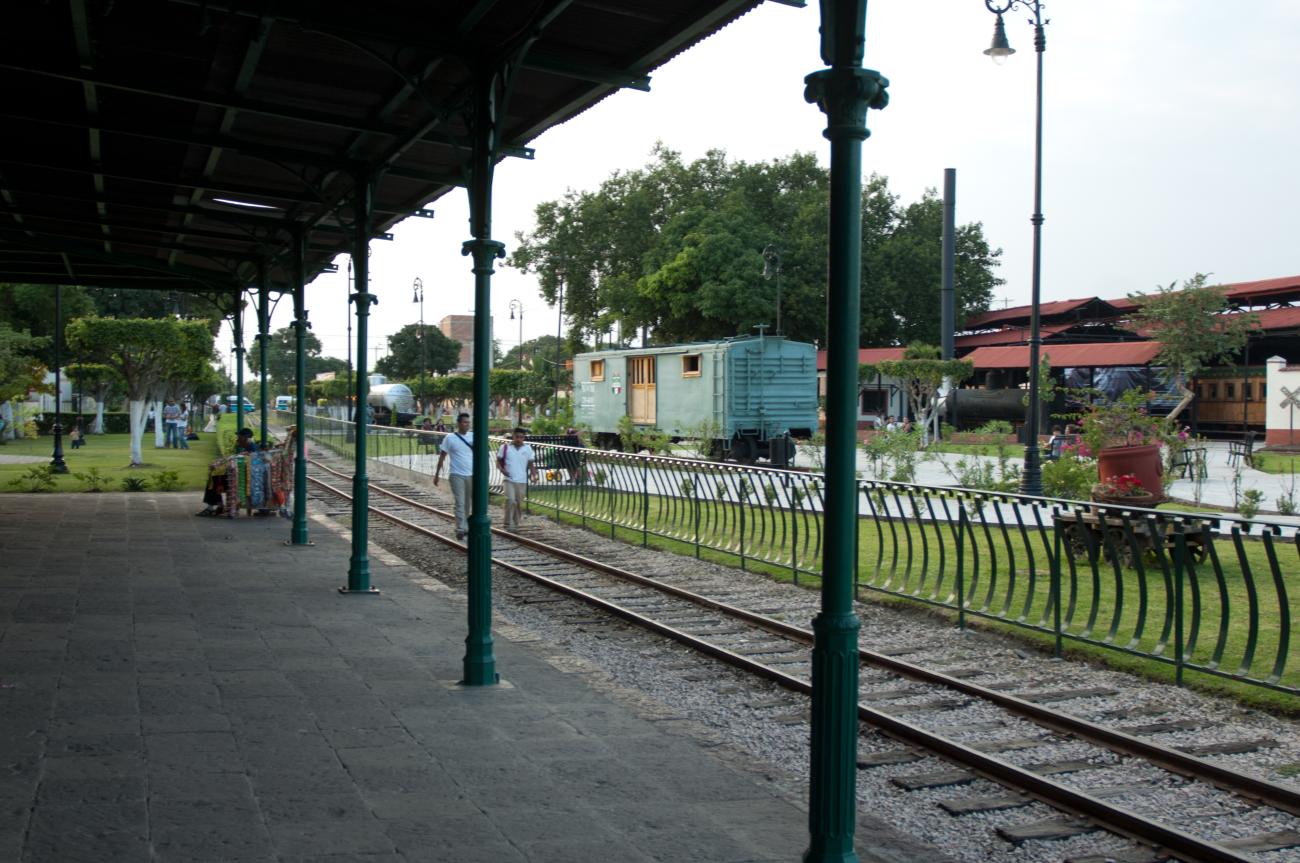
During the Porfiriato period, Cuautla was transformed by the construction of the railroad, which began in 1879 and ended in 1881. The railroad connected Cuautla with Mexico City, which allowed technological advancement by bringing machinery for the haciendas and also increased the volume and speed of trade. The new dynamic generated by the railroad and the policies of Porfirio Díaz led to the expansion of areas under sugar cane into lands that were rented by the peasant farmers, which caused unrest among local communities as they lost land while the sugar estates gained.
This social inequality between landowners and peasant farmers led the city of Cuautla to play an active role in the Mexican Revolution. Its residents joined the movement in the hope of regaining their rights to the lands and waters that were taken from them by the landowners during the Porfiriato.
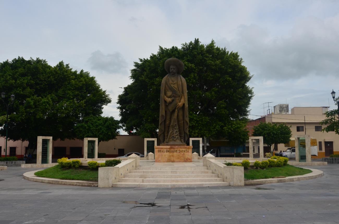
The first armed uprisings in Morelos took place in late 1910. The most important group was that of Villa de Ayala, Morelos, with Pablo Torres and Emiliano Zapata at the fore. This group joined the Francisco I. Madero movement in 1911 and occupied a number of towns in Morelos. The liberating army of the South, led by Zapata, besieged Cuautla from May 11 to 18. In 1919, when Zapata was assassinated on the Chinameca estate, his body was transferred to Cuautla, where it was buried in the municipal cemetery. Today his remains lie in the Plaza de la Revolución del Sur.
With the Revolution the sugar industry disappeared and the roads were neglected. In agriculture there was a boom in corn production and rice planting, a product that over the years would restore Cuautla’s importance in the agricultural sector. With regard to land, the new collective land tenure arrangements known as ejidos meant that the lands belonging to the large estates were distributed among the community.
In the 1950s, tourism began to develop in the state of Morelos and in the city of Cuautla, an activity promoted by the presence of springs and spas, which led to the opening of restaurants, shops and other businesses to meet the needs of tourists. Tourism is the main economic activity in the city today.
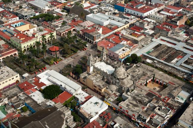
Cuautla was declared a Zone of Historical Monuments in 2012, the area covers 0.755 km2 with 52 blocks that include historical constructions built between the 16th and 19th centuries. Some of these were destined for religious worship, public service and others for fortresses and defensive ramparts when the city was besieged by Calleja; these constructions notably include the system of springs and canals or apantle, important elements in resisting the siege to which the city was subjected.
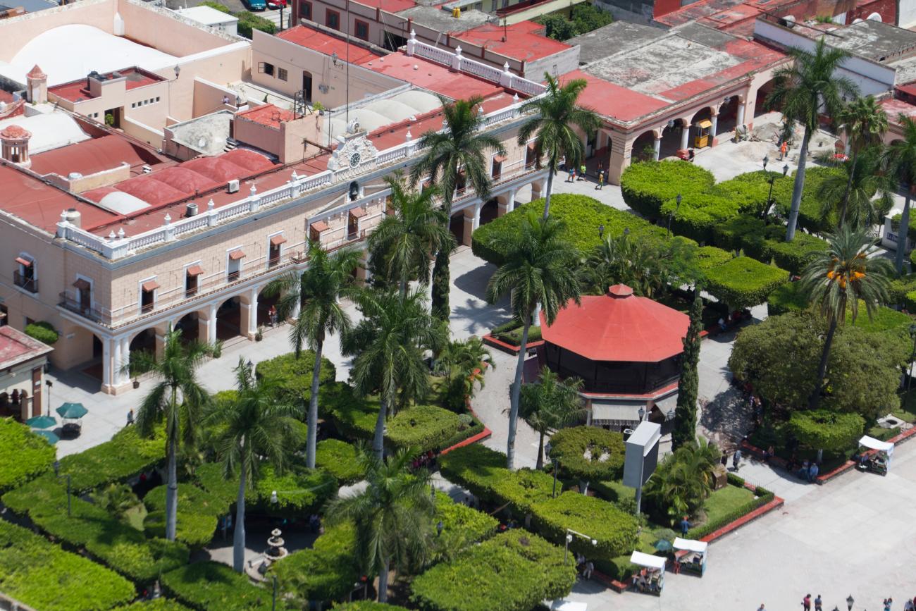
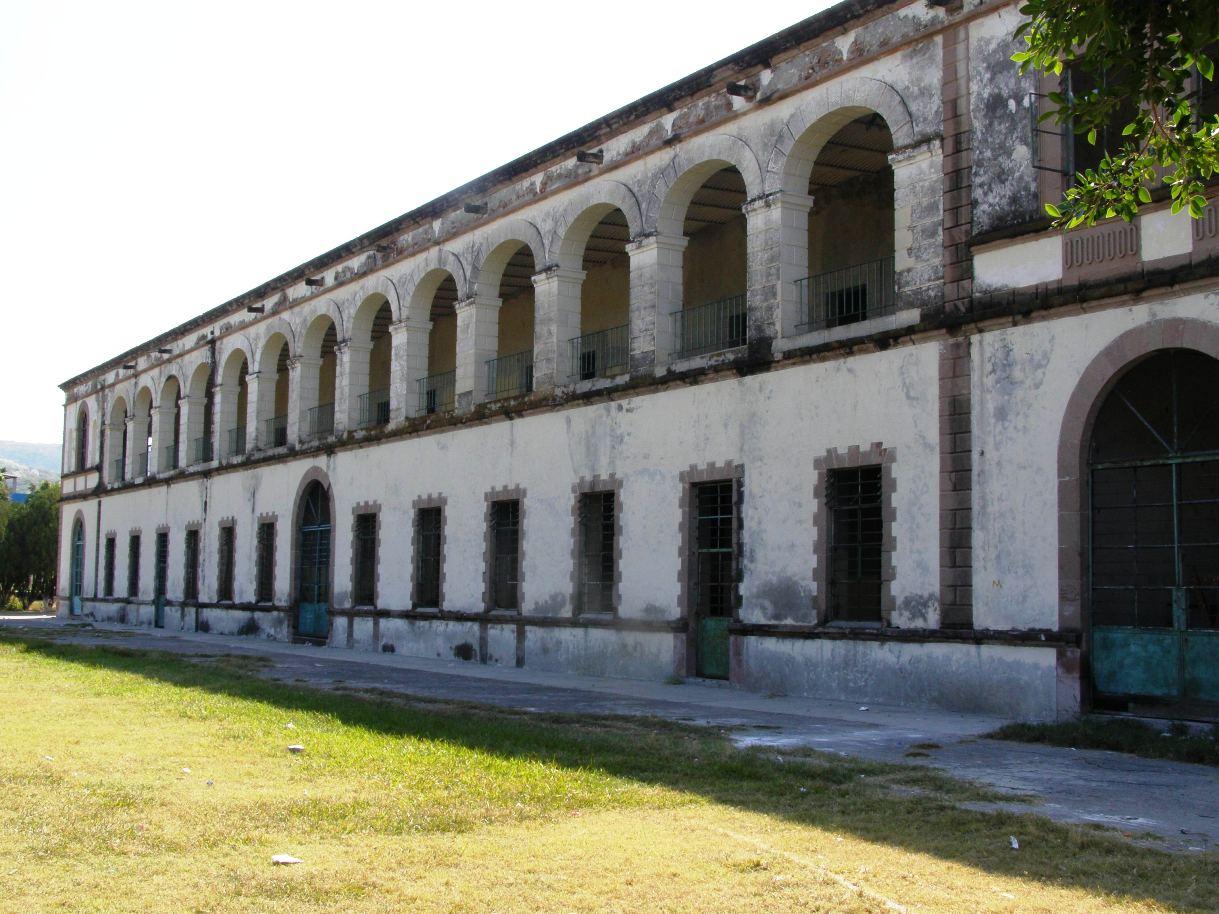
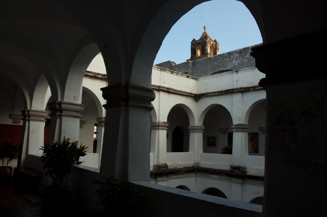
The city presents a street plan dating from the 16th century. Notable public spaces include: Plaza Morelos, Plaza Fuerte de Galeana, Plaza Revolución del Sur, Old Plaza of Gualupita, and the Municipal Pantheon; the Church of the Lord of the People, the Chapel of Gualupita; the Municipal Presidency, the Morelos Gate; the Historical Museum of the Oriente de Morelos “Casa de Morelos,” and the sites that served as bastions during the siege of the city: Former Hacienda de San José Buenavista, the Matamoros Fort and its Aqueduct, the Former Hacienda of El Tequipano or the Church and Former Monastery of Santo Domingo; the Church and Former Monastery of San Diego, the Fort of Galeana and the Interoceanic Station.
The nomenclature of the streets recalls the historical event of the siege of Cuautla, with names such as: Retirada de Calleja, Del Abrigo, Cañoncito Niño, Defensa del Agua, to mention only a few. The names are based on the records that were requested from the chronicler and guerrilla fighter Felipe Montero in 1829, who was present at this historical event and set down the street on which each episode took place. The nomenclature was altered after the Mexican Revolution, with some streets taking the name of the events that occurred during Zapata’s presence in Cuautla.


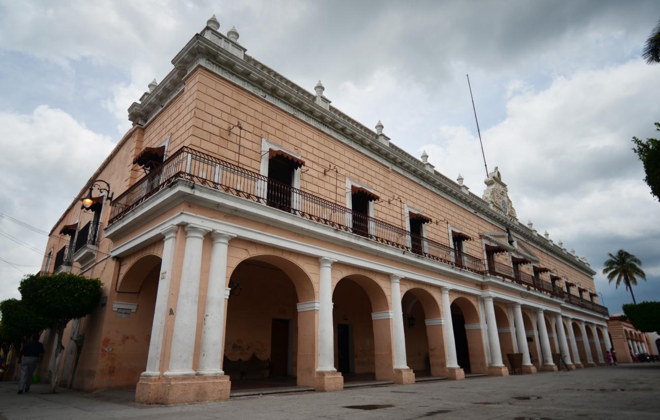
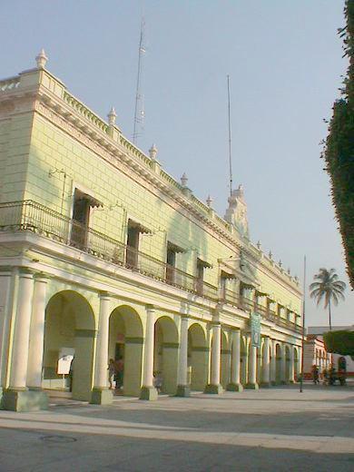
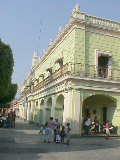
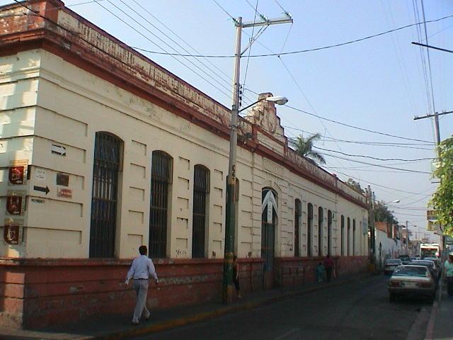
Palacio Municipal
The ground floor was built before the Siege of 1812. It is the Royal Prison of Cuautla de Amilpas, from where Juan Nepomuceno Alamonte took his fellow “Emulantes” prisoners. The second floor was built around 1865 and the façade in 1898. It was set on fire by Zapatista forces in May 1911.
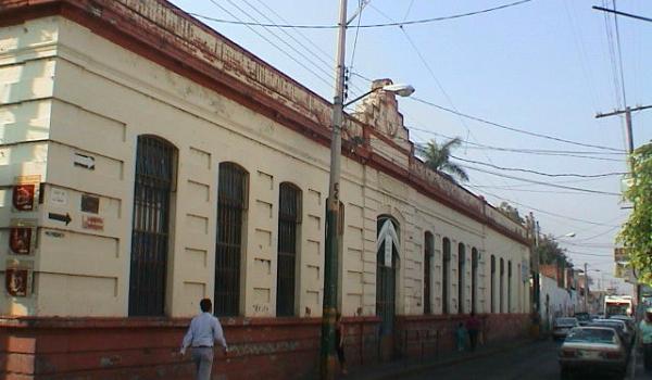
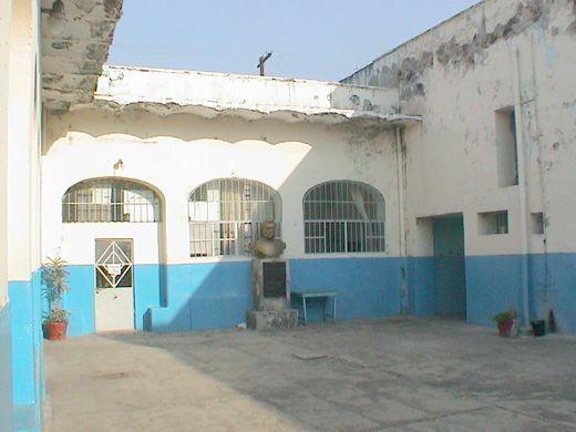
Escuela Secundaria Gabino Barreda
It opened on April 13, 1905, as a girls' school; it was the first official school in the eastern part of the state.
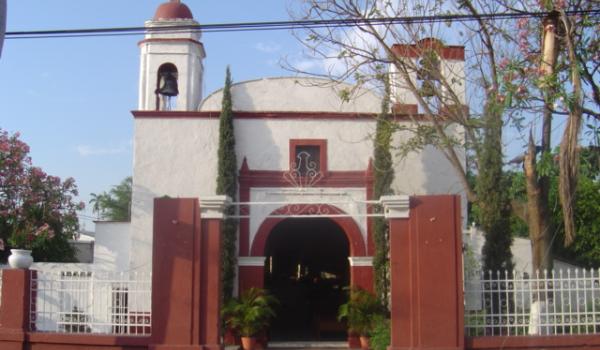
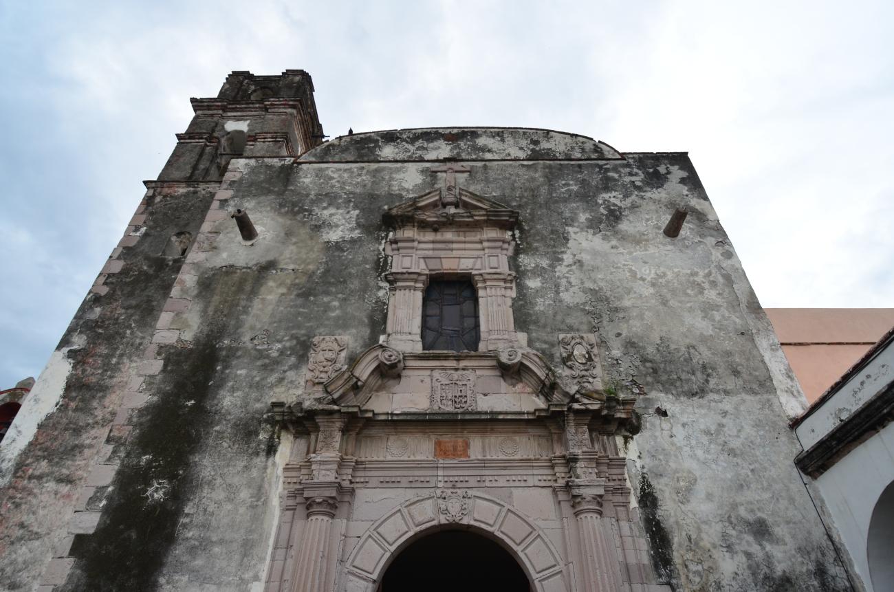
Capilla de Gualupita
Religious building constructed starting on July 5, 1603, in the indigenous neighborhood of Xochitengo, by order of Viceroy Gaspar Zuñiga y Acevedo.
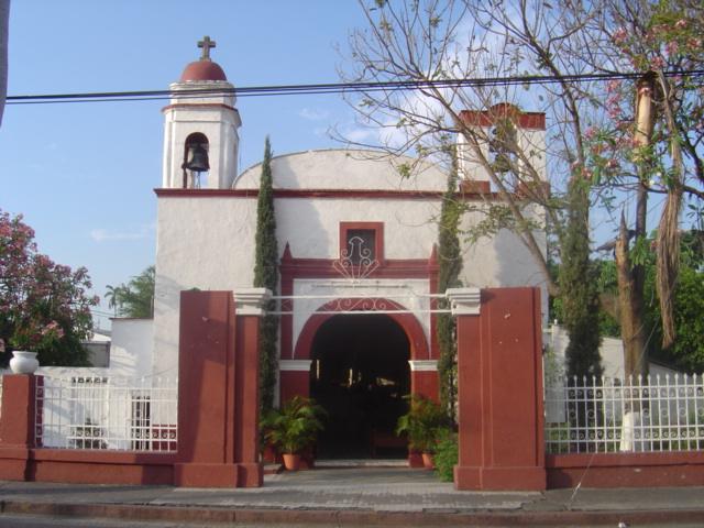
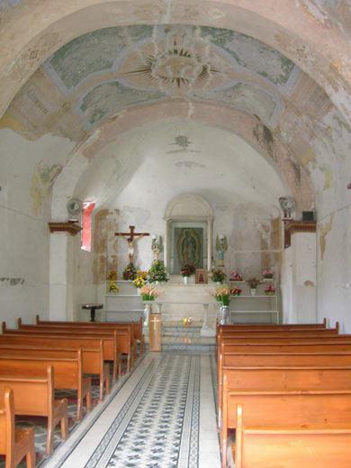
Religious building constructed starting on July 5, 1603, in the indigenous neighborhood of Xochitengo, by order of Viceroy Gaspar Zuñiga y Acevedo. Originally, the Crucified Christ or Lord of the People of Xochitengo was venerated here, but his image was moved in 1830 to the Chapel of Santa Bárbara. It currently houses a painting of the Virgin of Guadalupe.