


Azcapotzalco
At the edge of Mexico City, the ancient capital of the Tepanecas is distinguished from the rest of the city by its social cohesion and by its enduring traditional neighborhoods.
The name Azcapotzalco derives from Nahuatl and means “in the anthill.” During pre-Hispanic times it was distinguished by its natural wealth and the importance of its water resources, since this territory was on the shore of a lake. Due to its fertile land, it was an excellent place for agriculture and for obtaining fish and salt.
Villages were first founded in this territory, now located in the west of Mexico City, in the Preclassic period, around 1500 BC. Later, in the Postclassic period, the Tepanecs arrived and established the capital of their dominion in Azcapotzalco, becoming the most powerful political and military entity in the Mexican Basin until it was subjugated to the rule of the Mexica in 1428.
After the Spanish conquest, Azcapotzalco was entrusted to Francisco de Montejo, conqueror of Yucatán, who brought several Tepanecs to the peninsula. In 1529 the first Dominican religious missionaries settled in Azcapotzalco and the first churches were built using the stones from pre-Hispanic constructions.
The parish churches and chapels continued to be administered by the Dominicans until the first half of the 19th century. Their presence throughout the colonial period and the first decades of independent Mexico contributed to the continuity of the traditional order, to social cohesion and to the unity of its territory which since pre-Hispanic times has comprised 27 neighborhoods.
During the colonial era, the population of Azcapotzalco was mainly indigenous, although some Spaniards, criollos and mestizos settled in the area. These people generally held an administrative or government position. In 1709 the layout of the neighborhoods was rearranged, favoring some Spanish landowners who saw the possibility of buying land or appropriating it. However, the situation of Azcapotzalco did not change significantly during the 18th century and, when Mexico began life as an independent country, it was still a rural and indigenous area.
In the second half of the 19th century, several events took place that transformed Azcapotzalco: the Dominican monastery was abandoned due to the Ecclesiastical Property Confiscation Law; two of its neighborhoods were annexed to the State of Mexico; while other territories were placed under its jurisdiction. The latter change led to a considerable increase in its population.
By the end of the 19th century, modern means of transportation and communication arrived in Azcapotzalco. In 1874 the Popotla tram reached the town; four years later the telegraph service was installed and in 1885 a branch railroad line was inaugurated that went to Tlanepantla. However, the process of integration of Azcapotzalco into the country’s capital was a slow one.
In 1898 it became one of the prefectures of the Federal District, receiving the name of Villa Azcapotzalco de Porfirio Díaz. During the Porfiriato period, Azcapotzalco had the reputation of being a pleasant area to take a Sunday walk or to spend the summer. Porfirio Díaz visited the area a few times a year. This promoted the creation of residential districts for the Porfirian elite. In 1904 the “El Imparcial” neighborhood was founded along the Azcapotzalco road, where houses were built in a chalet style with large gardens. Part of that neighborhood still remains today, although it is now part of the Clavería neighborhood.
By the beginning of the 20th century, most of the population of Azcapotzalco was no longer native to the area and was mainly concentrated in its old center and in the newly founded neighborhoods such as Legaria, San Álvaro and Ángel Zimbrón. Later, it became one of the boroughs that constituted the Department of the Federal District. However, the urban area had not yet expanded to incorporate Azcapotzalco, meaning most of its territory remained cultivated fields with rivers and streams flowing in places such as what is now Camarones Avenue.
Azcapotzalco began to urbanize at a rapid pace starting in 1929, when a number of entrepreneurs chose to establish factories in the Vallejo area, attracting a large number of people. Subsequently, the 18 de Marzo Refinery and the Pantaco Railroad Loading Center were founded. The most spectacular rise in population took place after Vallejo was declared an industrial zone in 1944.
The proportion of rural area dropped significantly between 1940 and 1970. In those years the neighborhoods of 18 de Marzo, La Preciosa, Petrolera, Ampliación Petrolera and Los Electristas were built under the union influence of oil workers and electricians.
The population continued to increase, however, the economic crisis of the last quarter of the 20th century led to the closure of many factories in Vallejo, which was reflected in a decrease in the population at the beginning of the 21st century.
Today, Azcapotzalco maintains strong community ties, especially among the residents of its neighborhoods, expressed mainly in the organization of its patron saint festivals.
It was declared a Zone of Artistic and Historical Monuments in 1986. This zone covers an area of 990 m2 with approximately 65 blocks made up of buildings built between the 16th and 19th centuries, some dedicated to religious worship, such as the church of the Holy Apostles Felipe and Santiago, the cathedral of the diocese of Azcapotzalco, the Chapel of the Conception, and the chapels of the Rosary, of the Lord of Life, San Salvador Nextengo, of the Kings, San Simón and San Lucas. In addition, there are other significant buildings such as the Clavería, the Renacimiento and the Rosario estates.
The area preserves part of the original 16th-century road layout, which was based around the Azcapotzalco highway that ran to Tenochtitlán. Since then, architectural development, although influenced by a number of styles, has been characterized by the creation of different types of civil and religious buildings that have been adapted to the everyday needs of its inhabitants.

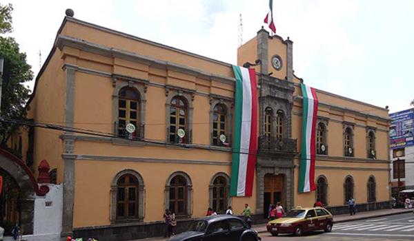
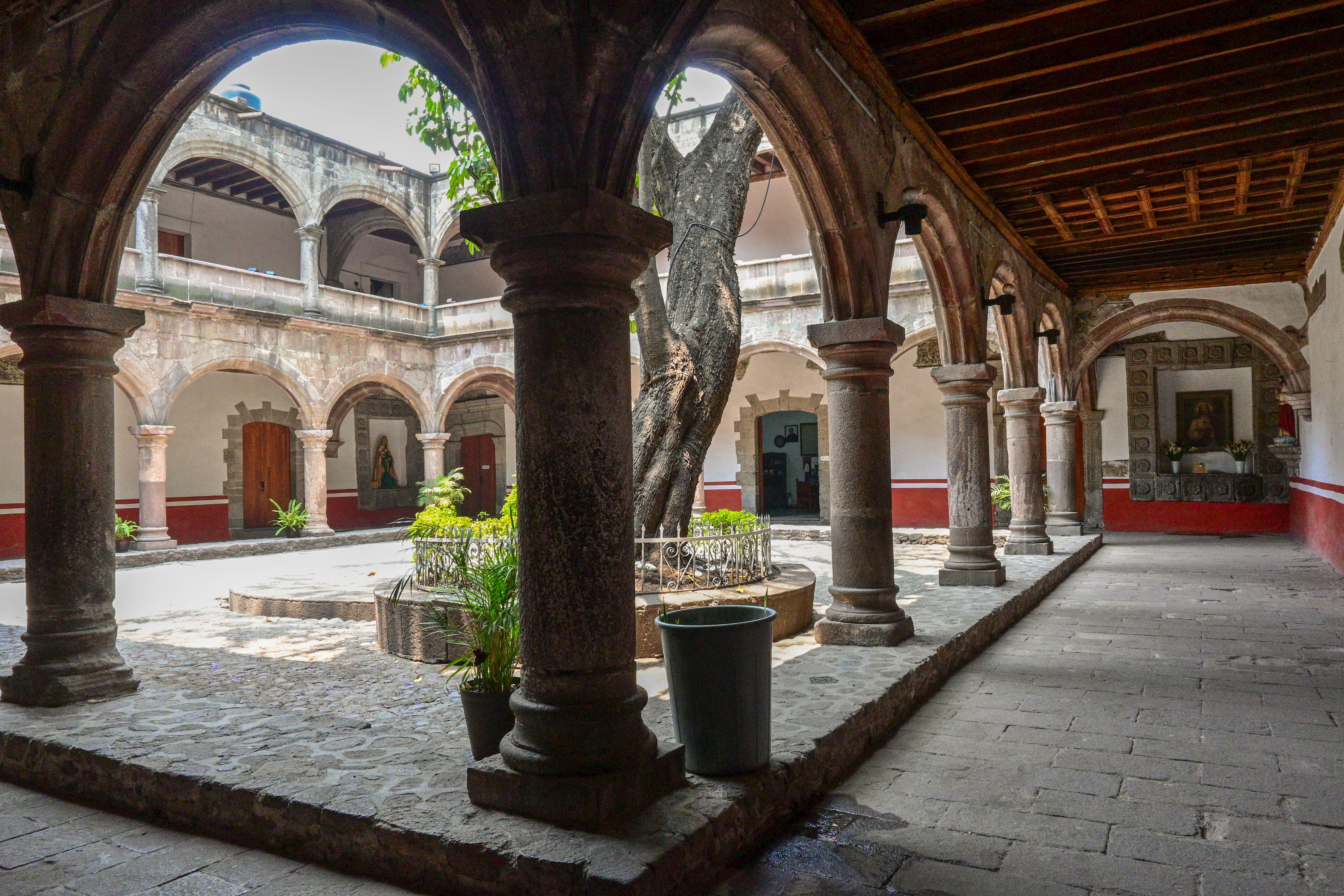
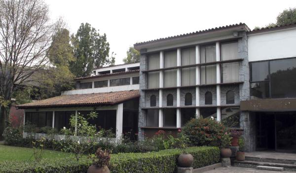
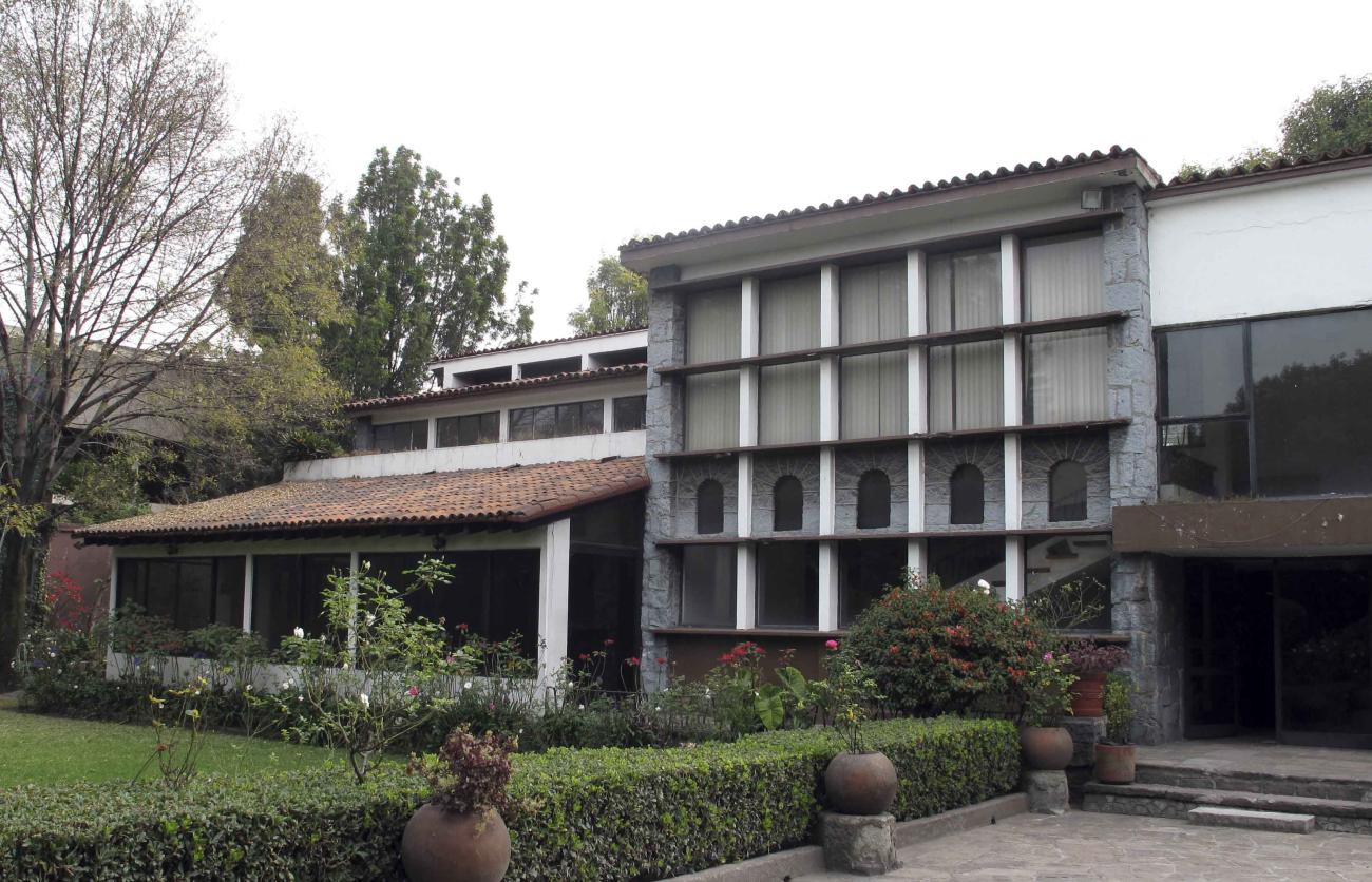
Casa de Cultura
This building was constructed by order of President Porfirio Díaz in 1881 to house the Political Prefecture of the Municipality of Azcapotzalco.
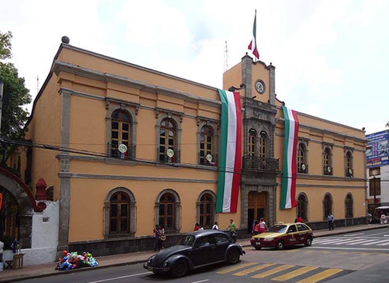
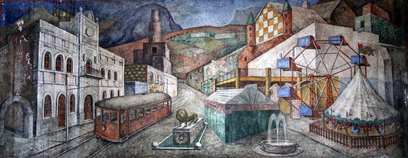
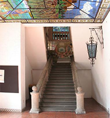
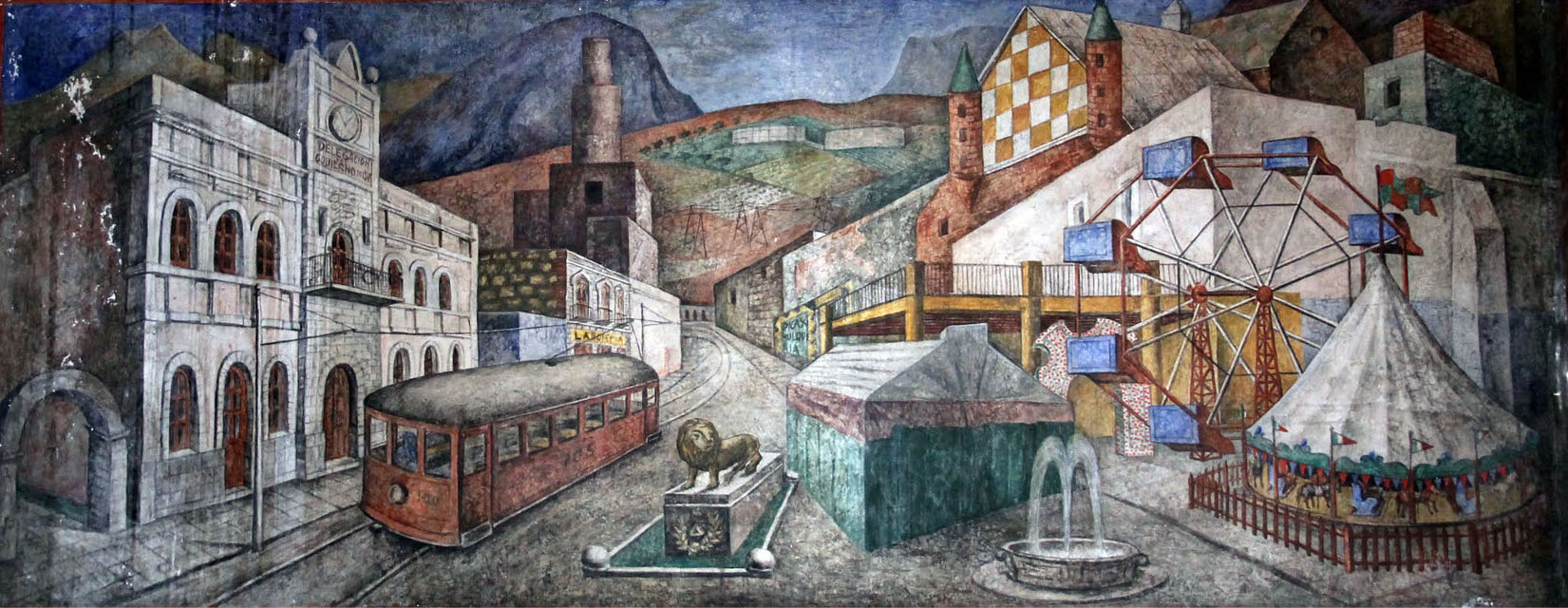
This building was constructed by order of President Porfirio Díaz in 1881 to house the Political Prefecture of the Municipality of Azcapotzalco. Over the years, it has had different uses: mayor's office, police station, tax collection and treasury, civil registry, police, and traffic and road safety. The garden belonged to the Tram Company. In 1926, muralist and architect Juan O'Gorman, together with Julio Castellanos, created the mural in the Fray Bartolomé de las Casas Library, known as “Allegory of Azcapotzalco.” Since November 18, 1991, the building has housed the Azcapotzalco House of Culture.
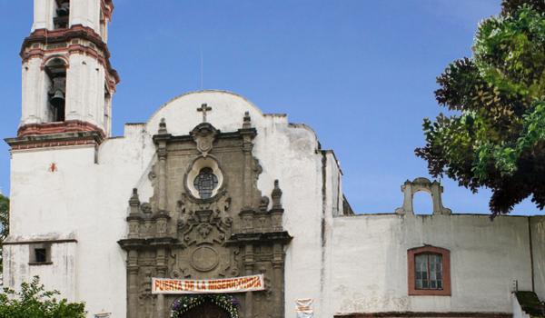
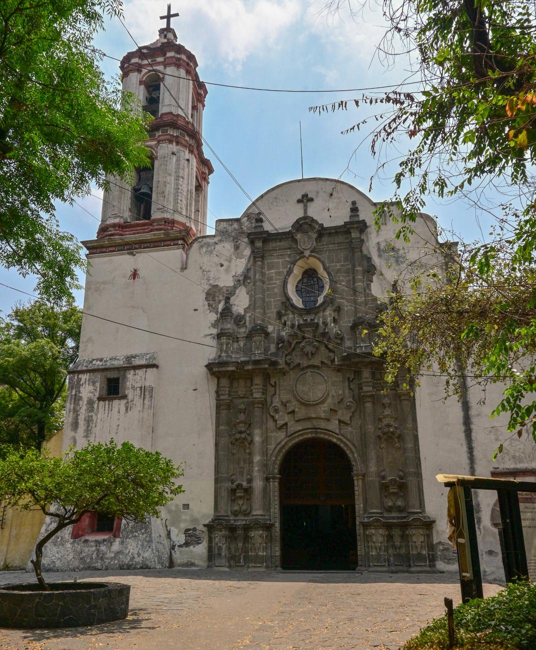
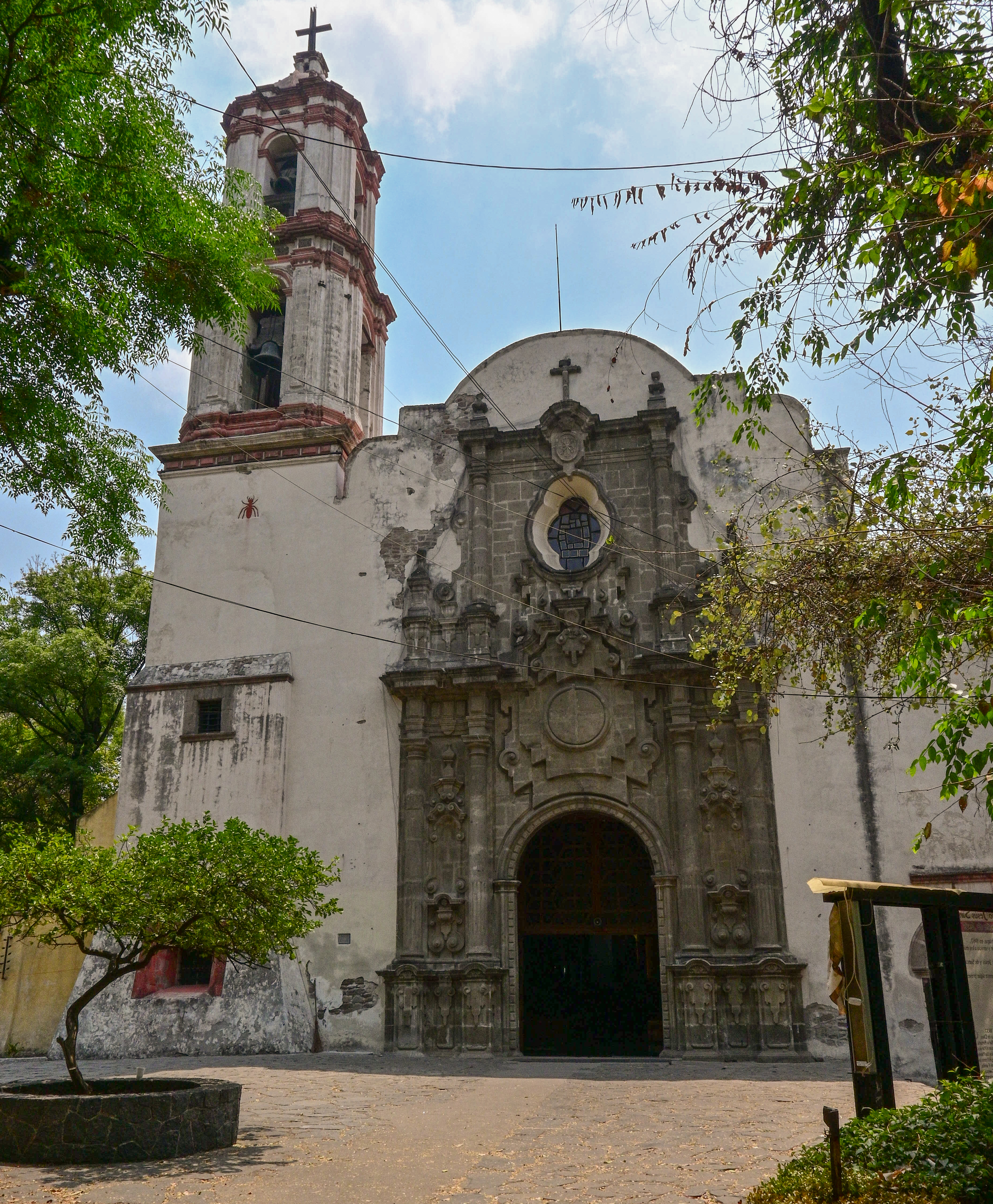
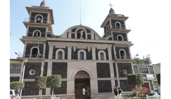
Catedral de los Santos Apóstoles Felipe y Santiago
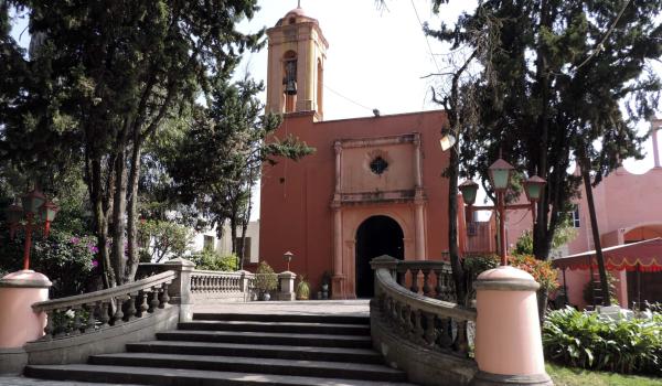
This building was constructed on top of a pre-Hispanic ceremonial site, using stones from the main pyramid for its walls. It is one of the first Dominican parishes, and construction of the rectory was completed in 1565.
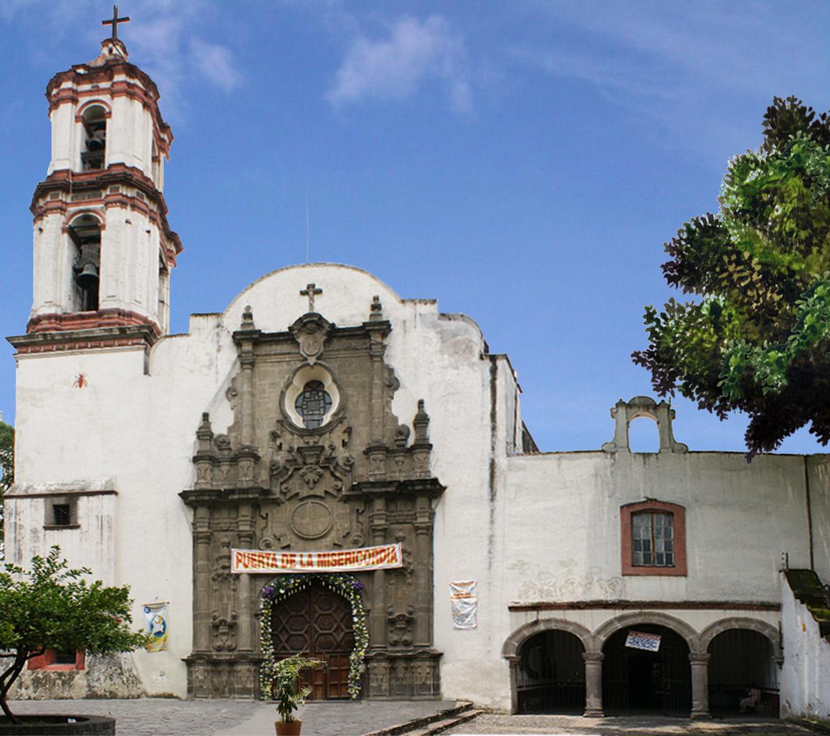
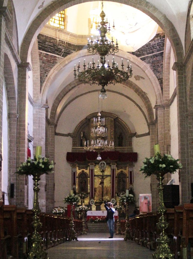
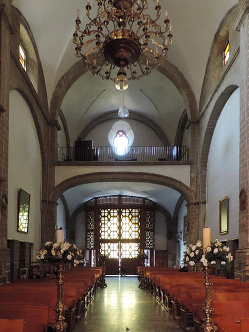
This building was constructed on top of a pre-Hispanic ceremonial site, using stones from the main pyramid for its walls. It is one of the first Dominican parishes, and construction of the rectory was completed in 1565. A strong earthquake in 1653 destroyed half of the church, which was rebuilt and reopened on October 8, 1702. The last battle for national independence was fought in its courtyard on August 19, 1821.
Antiguo Rancho El Renacimiento
This 19th-century building was owned by the bullfighter Rodolfo Gaona.
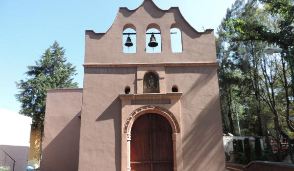
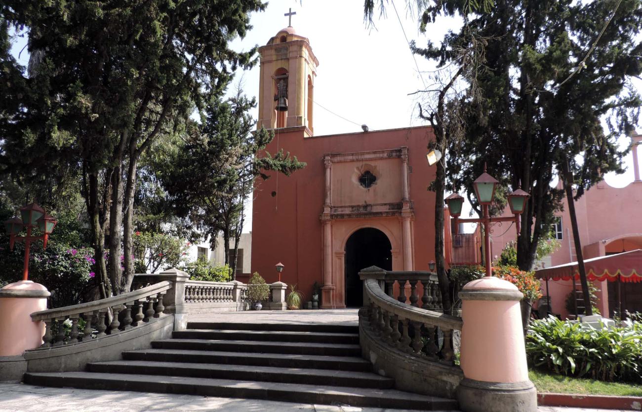
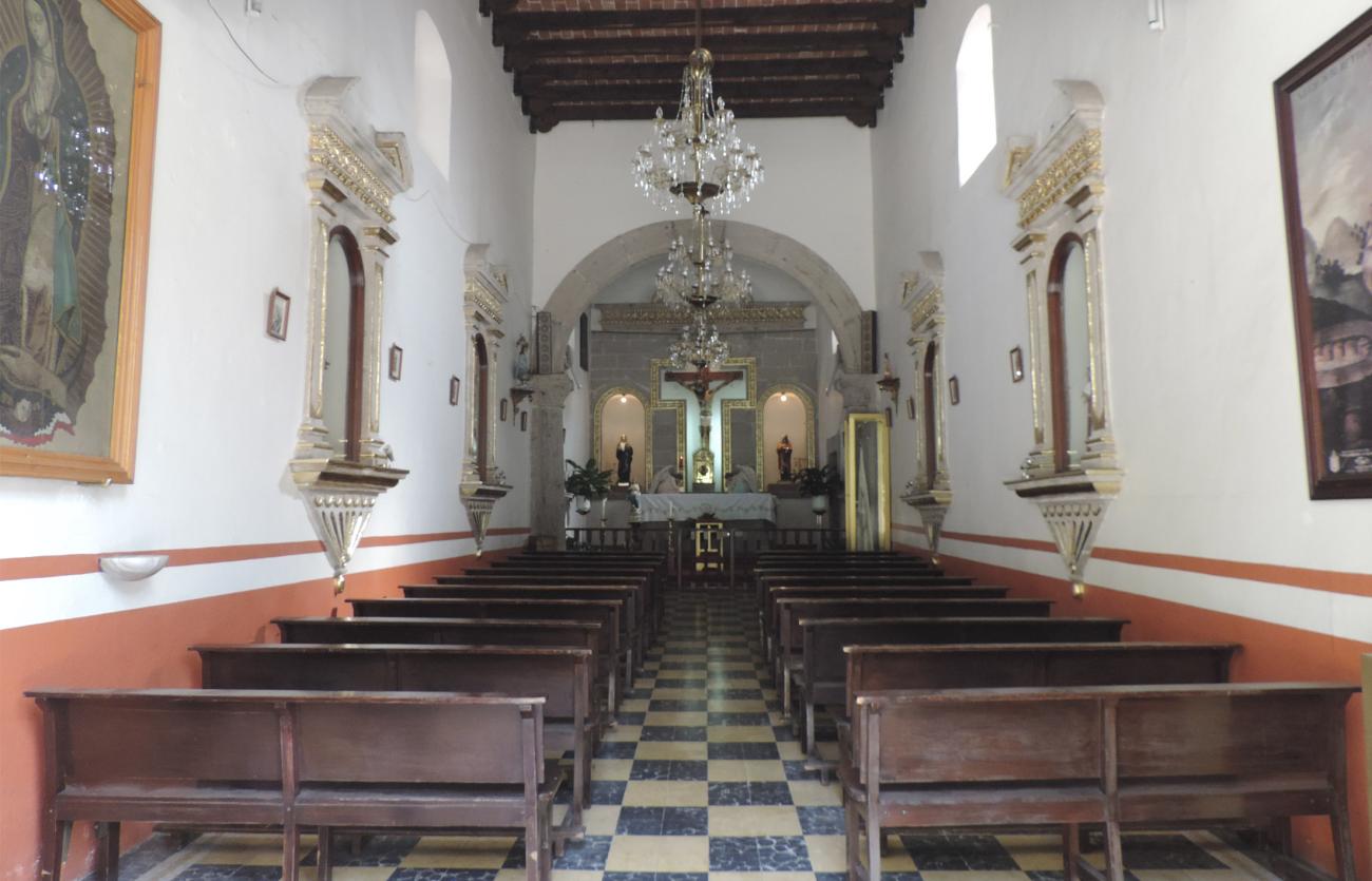
Capilla de San Juan Evangelista Huacalco
A religious building dating back to the 17th century, it was elevated to parish status on December 10, 1966. In 1976, the parish priest obtained approval to build a new church and renovate the old one; this work was completed in 1982.

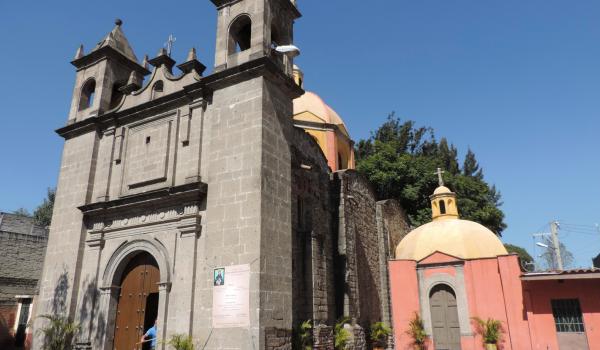
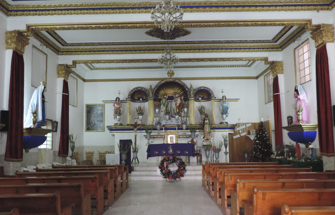
Parroquia de Jesús Nazareno
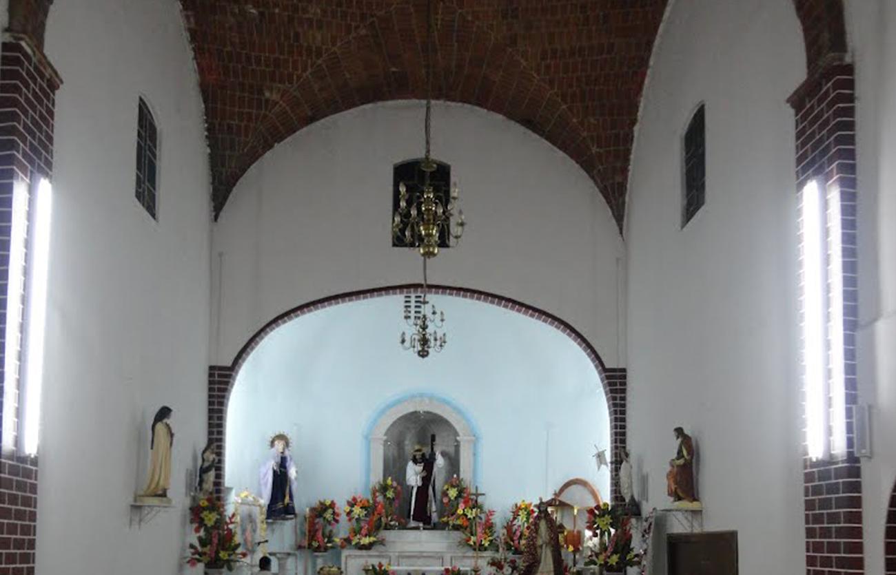
An 18th-century building, it preserves vaults and remains of original tepetate and adobe walls, while the rest of the construction is modern.
Parroquia de San Miguel Arcángel Amantla
A 17th-century building, it was completed in 1637 on the territory of a sacred city of the Tepanec Empire.
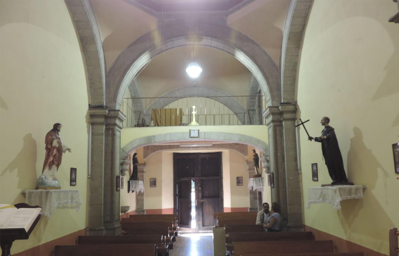
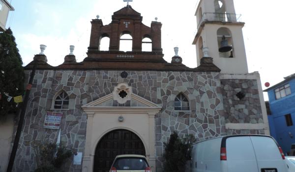
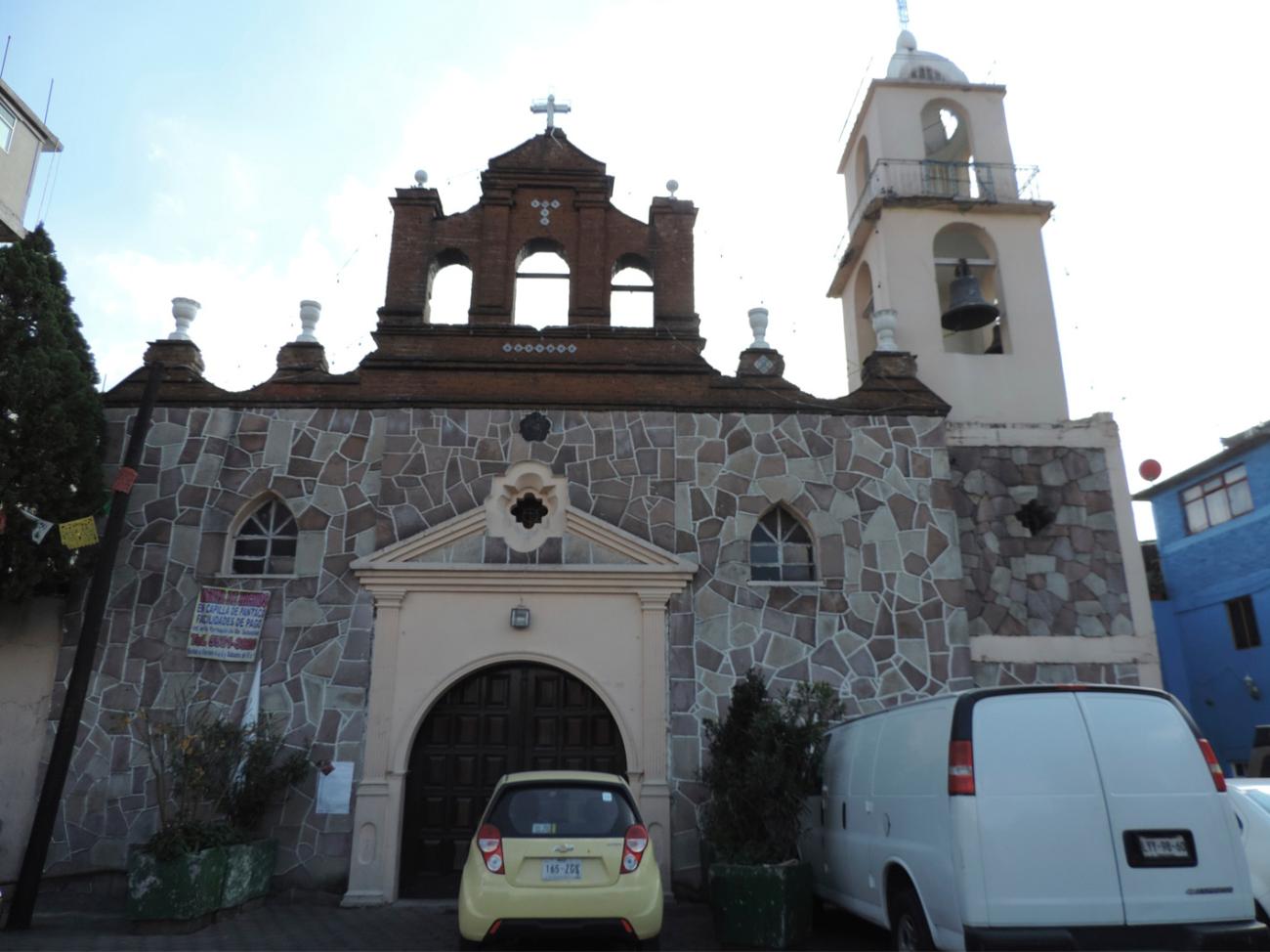
Parroquia de San Sebastián Atenco
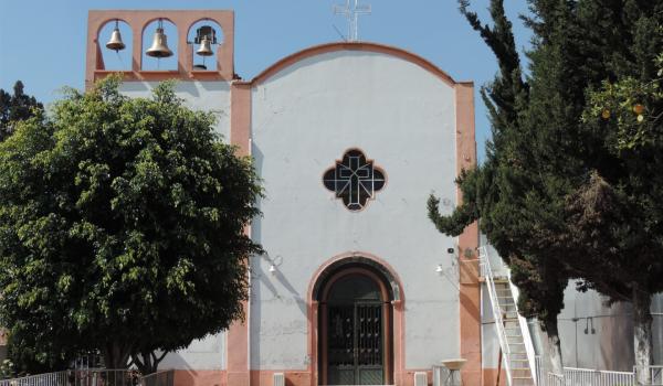
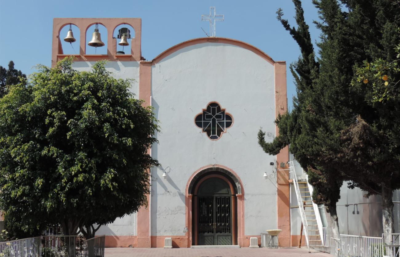
Late 19th-century building. In 1961, a request was made to repair the temple, and in 1978, to build a structure adjacent to the chapel.

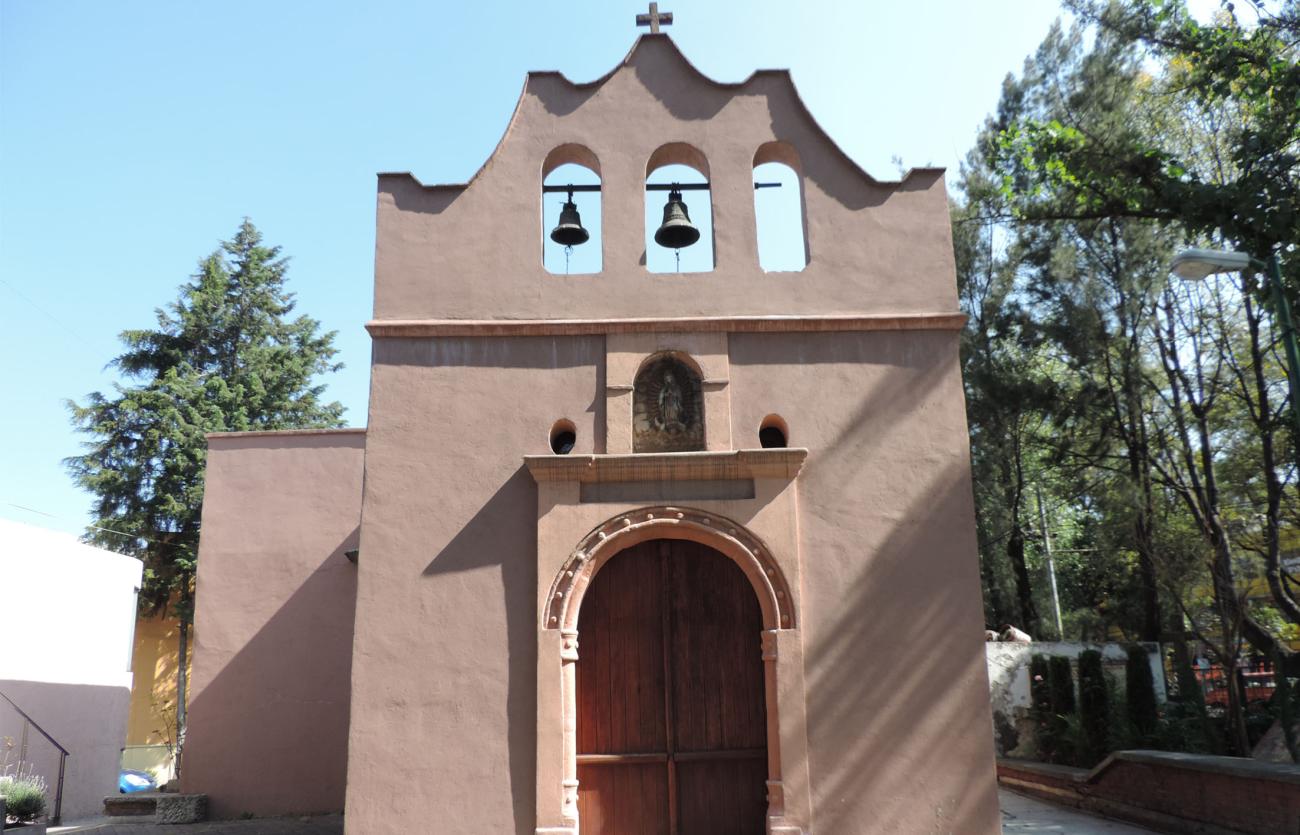
Capilla de Santo Domingo Huexotitla
An 18th-century building where the last descendants of Cuauhtémoc were buried.

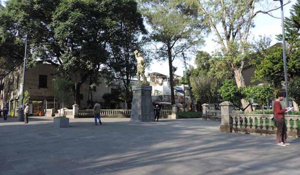
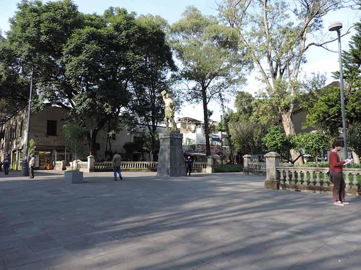
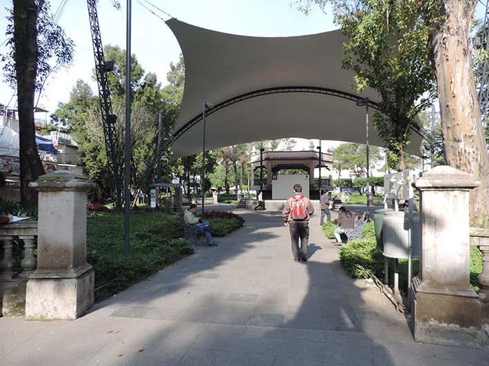
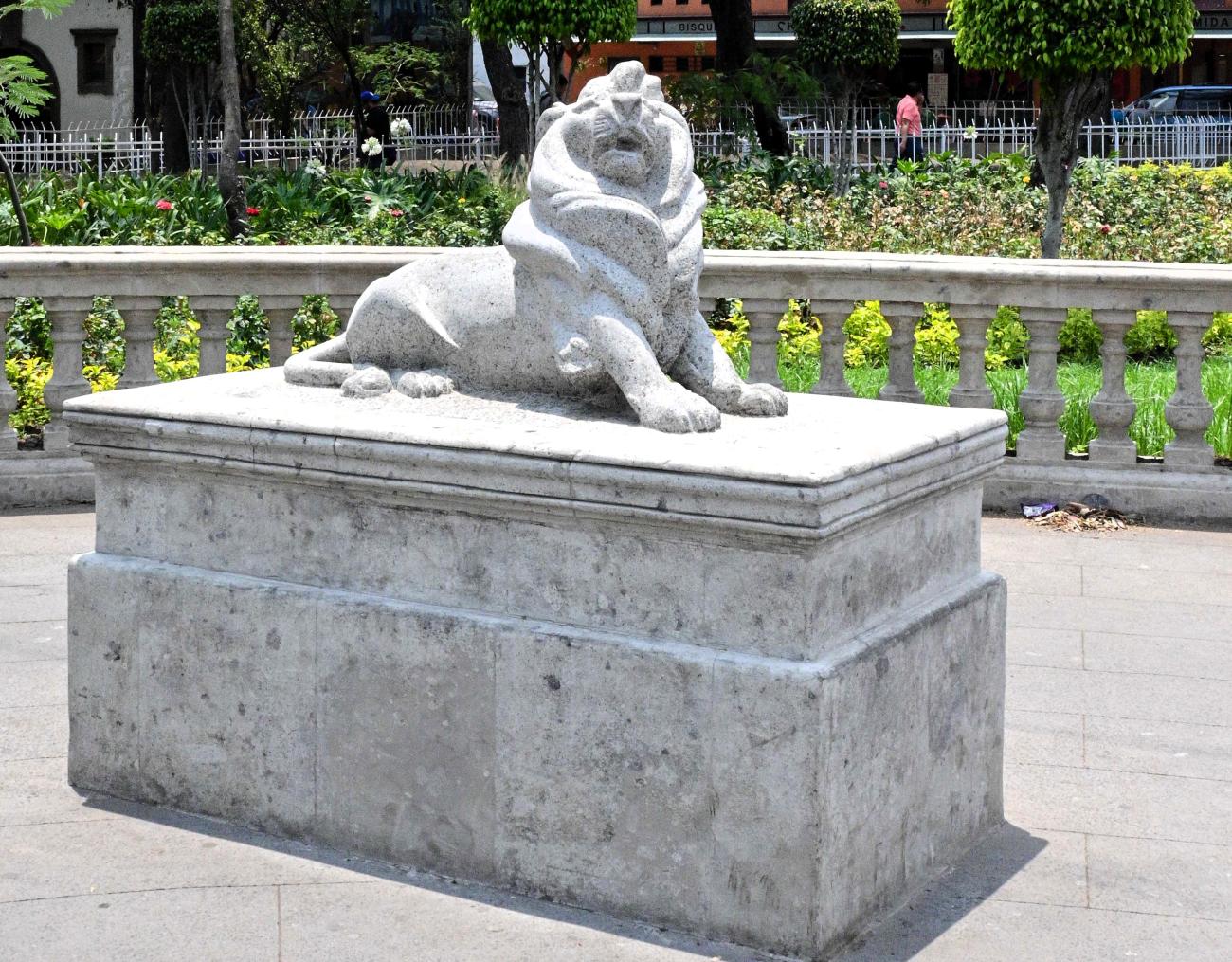
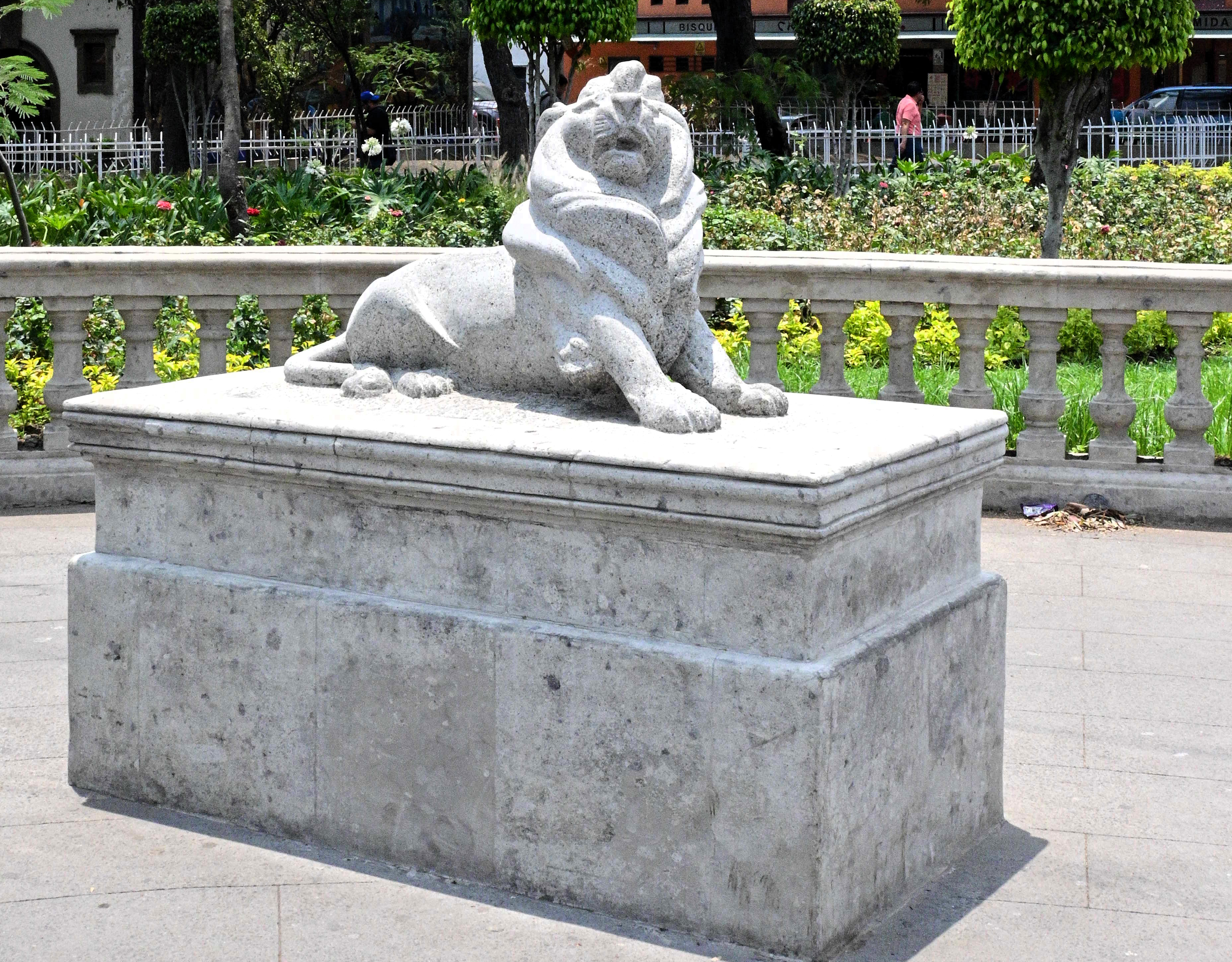
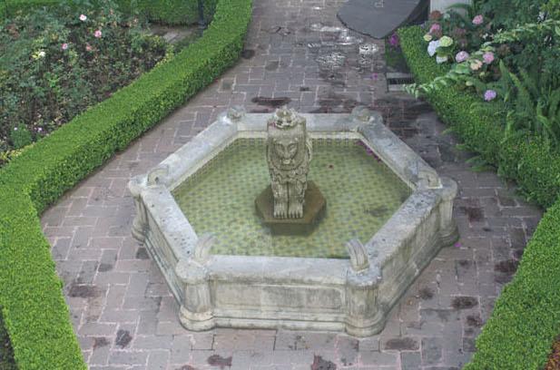
Jardín Hidalgo
An 18th-century space, by 1981 it had a fountain in the center, with a small kiosk to one side, surrounded by leafy trees. The kiosk was replaced during the Porfiriato. This garden was depicted by Juan O'Gorman in the current library of the Casa de Cultura de Azcapotzalco.