


San Pablo Apetatitlán
Historical Monuments Zone
Abstract
San Pablo Apetatitlán is an area of agricultural lands and pasture for livestock grazing. Its most representative buildings include the parish church of San Pablo, built in a specific local variety of Baroque known as pulular. Apetatitlán is a term that comes from Nahuatl and means “on a sphere of water.”
The first traces of occupation of this site date from 1800 B.C., when the Tlatempa culture developed; then, the construction of permanent housing began, and the manufacture of pottery became widespread, agriculture with irrigation canals, domestication of animals, astronomical observation and the construction of altars for religious worship.
During the Colonial period, the Apetatitlán district, which depended on the lordship of Tizatlán until 1545, grew to become a town in its own right. A rectangular checkerboard street layout was adopted by the Franciscans in the 18th century, and the 1791 census shows that it had well-planned streets and plazas. Traces can still be found of the former farming and livestock haciendas, which included Apatzingo, La Aguanaja and Gavillero.
Due to its strategic geographic location, Apetatitlán was part of the Mexico-Veracruz and Tlaxcala-Huamantla Royal Roads and the old trade route, which led to the construction of buildings to provide lodging, food and transport. It also became a trade emporium and the distributing center for the state of Tlaxcala, supplying other towns; the products sold came from Puebla, the capital and the Tierra Caliente region, and included panela cheese, sugar, rice, coffee and aguardiente, brought via Tlaxco and traded for manta, soap, salt, flour and other merchandise.
This town was the site of several battles between Liberals and Conservatives: including that of June 10, 1858 between General Manuel Escobar, who occupied the Plaza of Apetatitlán, and Commander Cirilo León. During the Reform Wars, Antonio Carvajal defended liberalism, the Constitution and the government of Juárez, leading his army known as the “Redshirts”; on October 10 the Constitucionalists fought to reoccupy the town, and on November 20 the battle took place between General Alatriste and the conservative Amador. In the 20th century, on May 26, 1910, Juan Cuamatzi, Marcos Hernández Xoloxotzi and Antonio Hidalgo, among other figures from the town, rebelled against Porfirio Díaz, although they were defeated overnight.
Meanwhile, On April 30, 1879, when Miguel Lira y Ortega was governor, Decree number 5 granted the town of Apetatitlán the title of “Villa del Progreso,” reflecting the importance of its location, trade and industry. On May 4, 1971, Decree number 133 granted the municipality of Apetatitlán the name “Municipio Antonio Carvajal,” in recognition of the liberal leader born in the town who fought during the Reform Wars and the French Intervention. The same decree preserved the name of the town as Villa de Apetatitlán.
A number of constructions stand out from the Porfiriato period: the construction of the railroads, such as the 8 km spur from Apizaco to Puebla that passed through San Pablo Apetatitlán on its way between Tlaxcala and Chiautempan; the Nativitas agricultural railroad, the remodeling of the Calle Nacional, the construction of a bandstand in the Galeana Plazuela, the primary school and the municipal agency; as well as the building of the La Carolina aguardiente factory, three wheat flour mills, the canal bridge from Apetatitlán to El Riachuelo and the installation of electric lighting.
The layout of the city is focused around the Plaza Principal, with an irregular pattern; the urban profile of the zone is characterized by the variety of civil and religious buildings, which have been adapted to the way of life of the inhabitants, taking into account the physical and geographic conditions of the terrain and the use of local materials, which, together with the culture of the populace, gives rise to unique architectural expressions.
On April 4, 1986, the town of San Pablo Apetatitlán was declared a Zone of Historical Monuments, covers an extension of 0.284 km2 formed by 16 blocks with 51 buildings and plazas of historical and architectural value; some of these were used for religious purposes, including the Padre de Jesús church and the San Pablo Apetatitlán parish church.
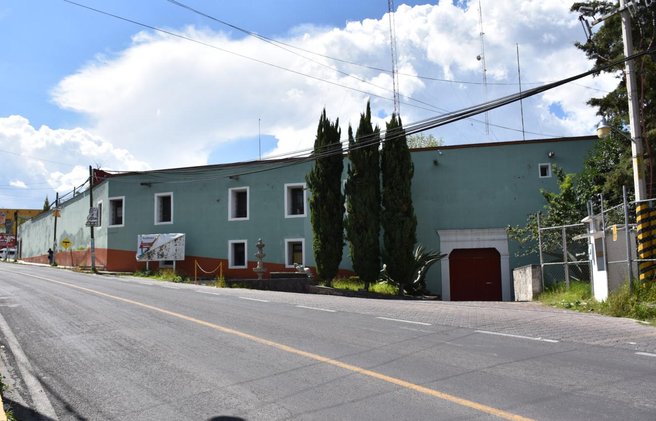
Other buildings were intended for educational, public service and welfare purposes, as well as for the use of civil, ecclesiastical and military authorities, including the town hall. The remaining constructions are private civilian buildings whose architectural interest lies in their use of local materials and ornamental detailing that expresses a regional style.

Categoria
San Pablo Apetatitlán Croquis_portada
Adscripción
Créditos
INAH-Centro INAH Tlaxcala
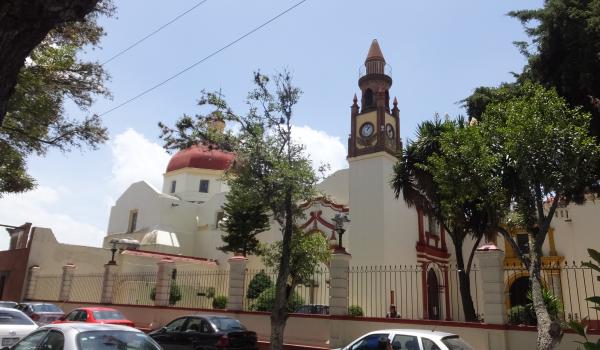
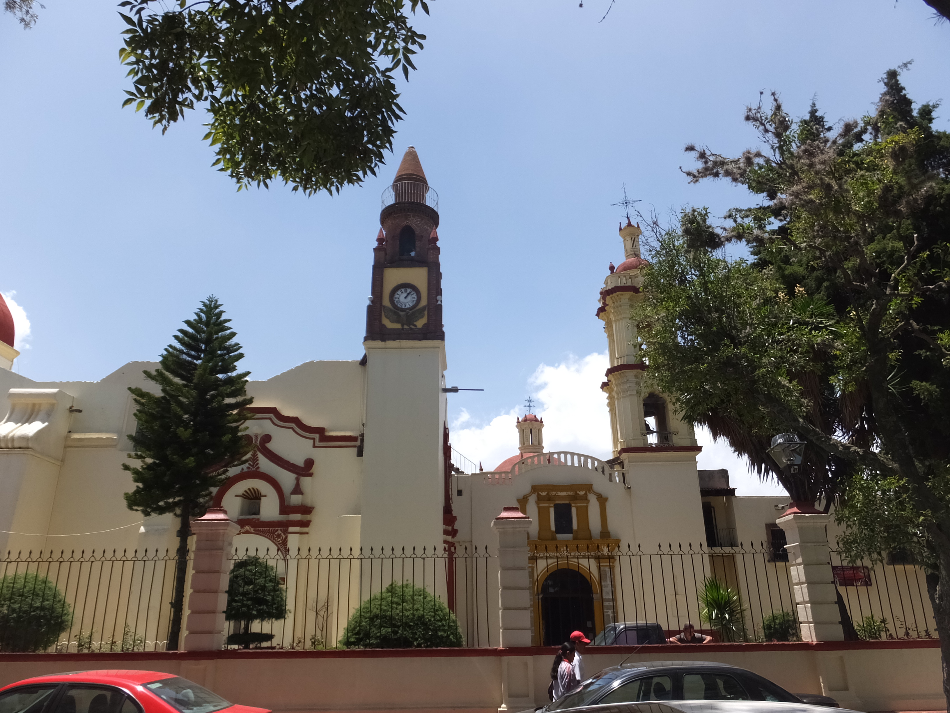
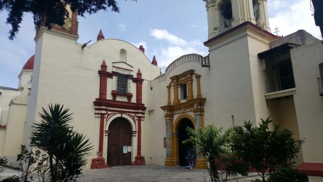
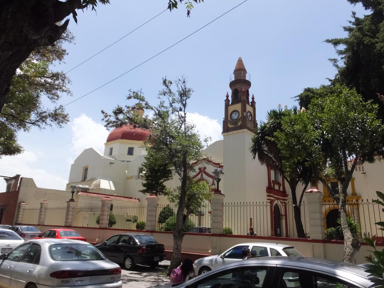
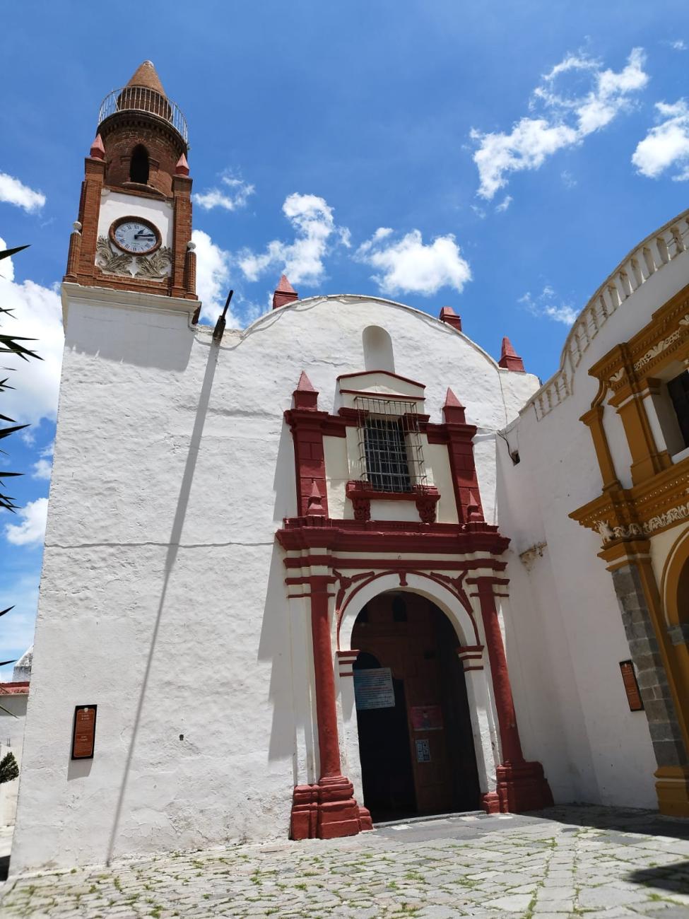
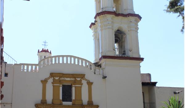
Templo del Padre Jesús
Building constructed in different stages, from the 17th to the 19th century, located next to the Parish of San Pablo. Its Neoclassical-style facade is smooth and features a Mudejar-style tower with two sections: a clock on the first level and a small pyramid-shaped lantern on the second.
Templo del Padre Jesús


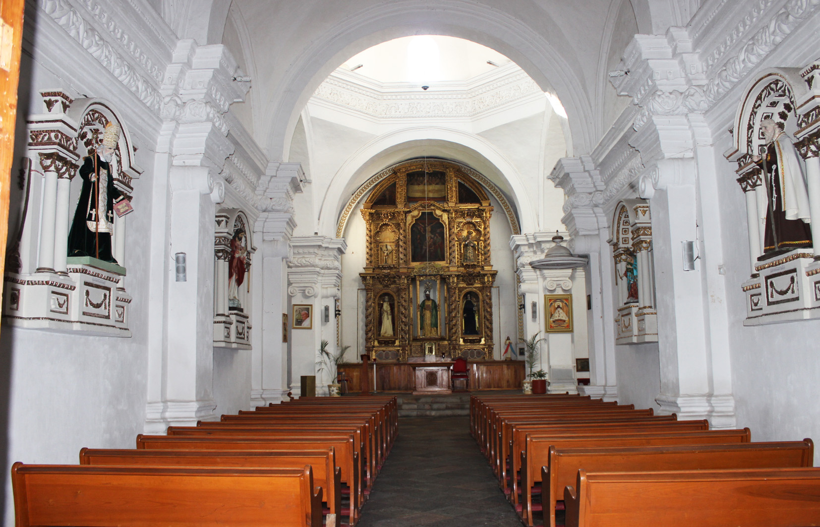
Parroquia de San Pablo Apóstol
18th-century building consisting of a parish and a temple connected by lateral walls. The decree establishing this parish was issued on February 4, 1767.


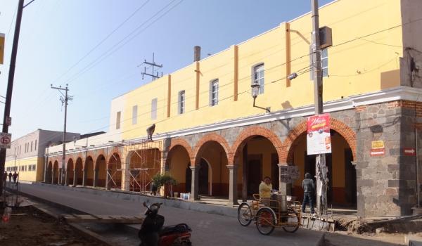
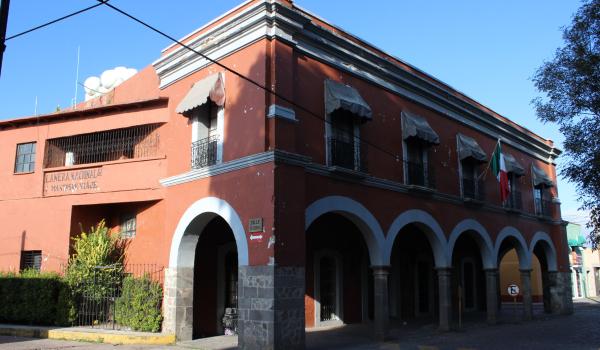
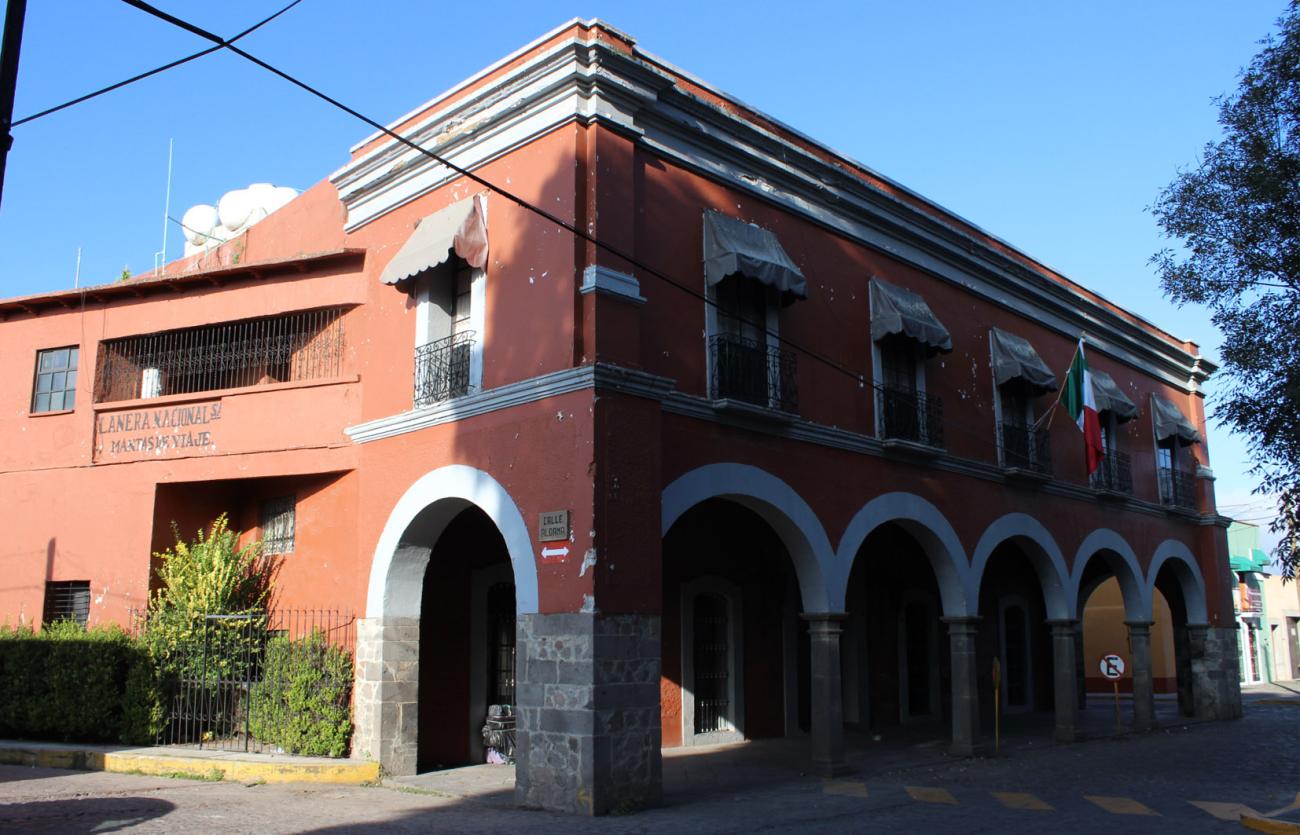
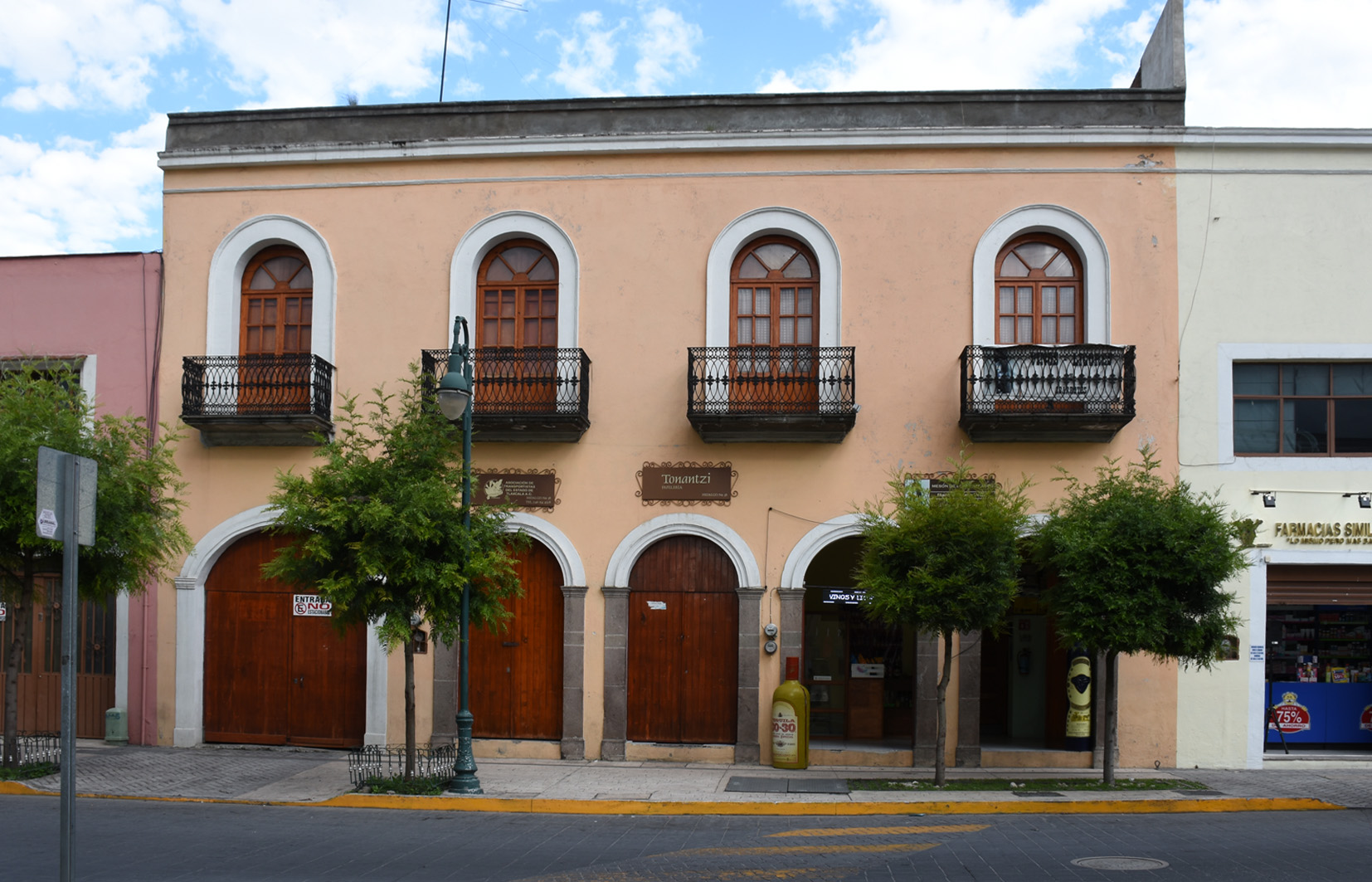
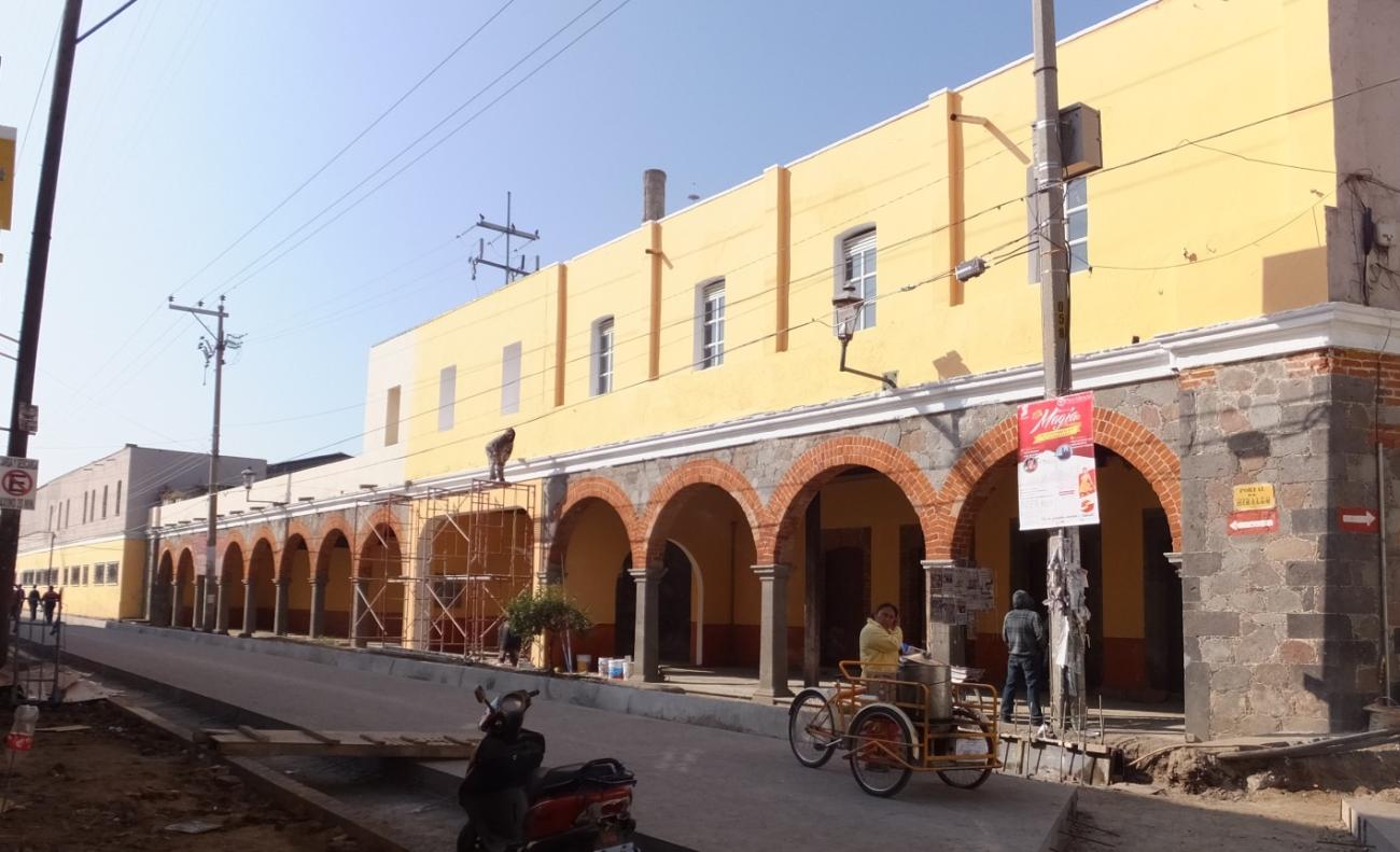
Portal de Hidalgo
In this 19th-century building, barter trade of the region was conducted, and it was a mandatory stop for travelers on the Mexico-Veracruz route.
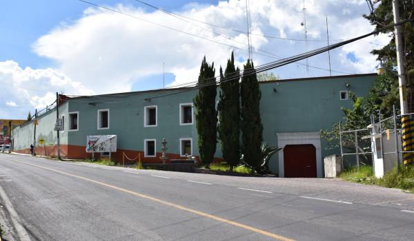

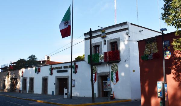
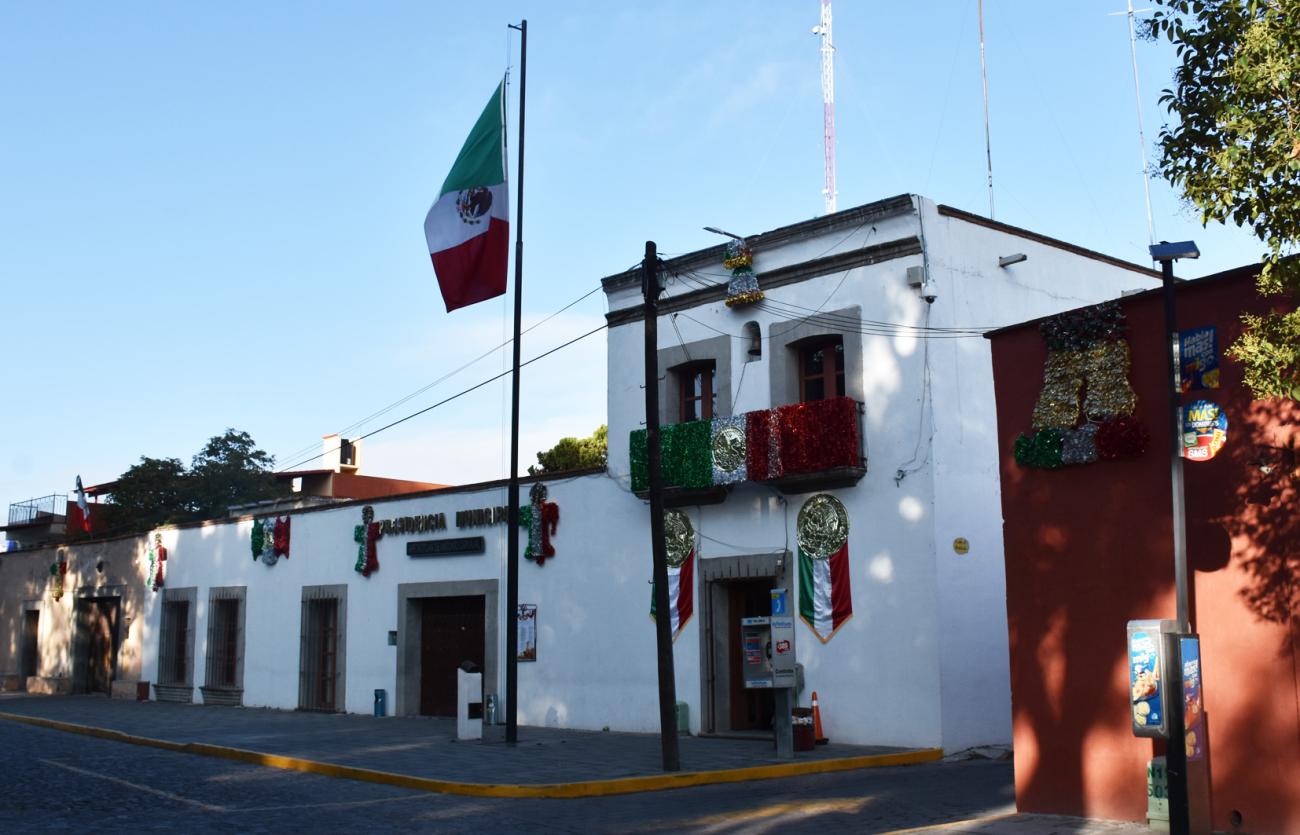
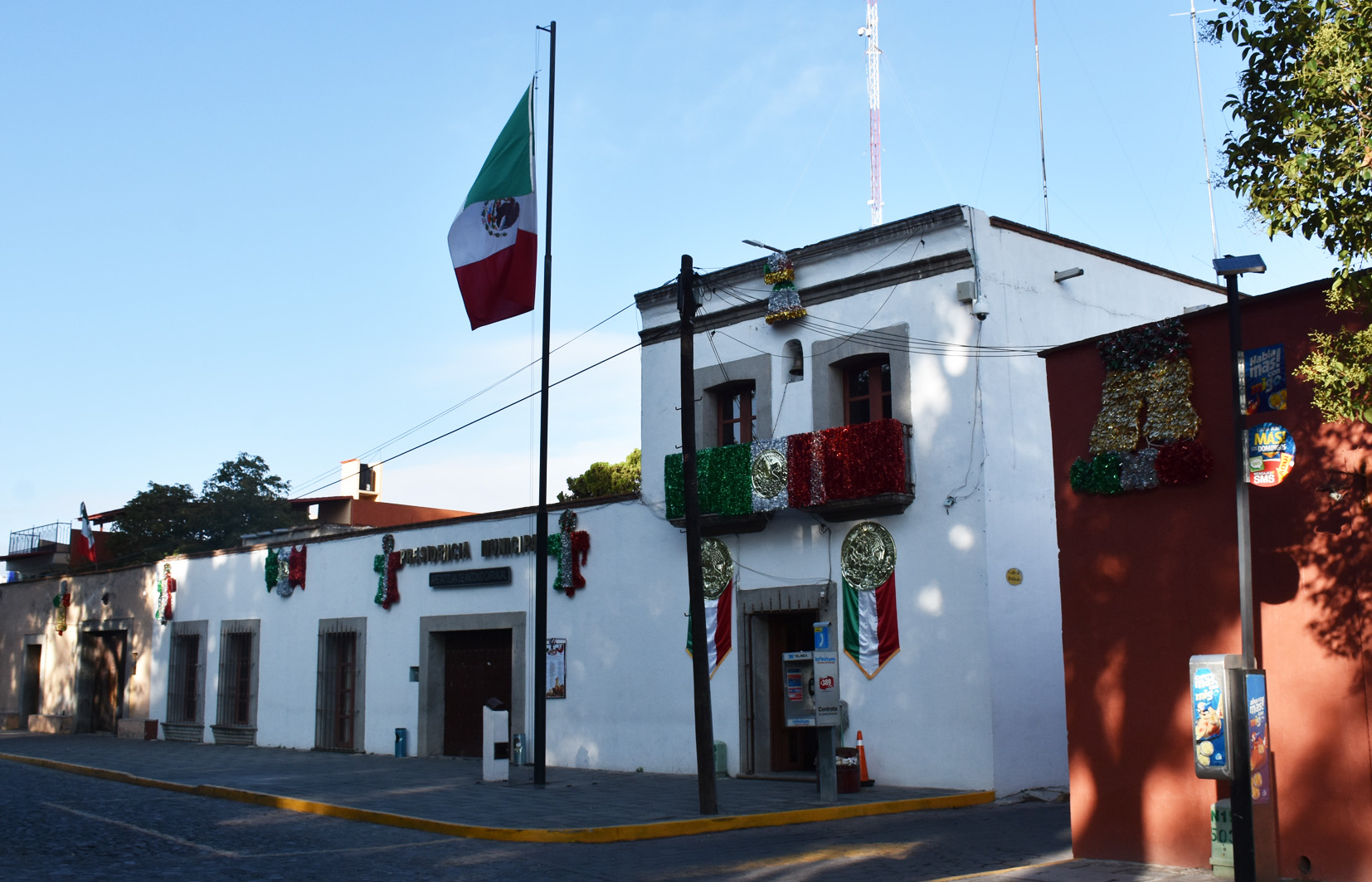
Palacio Municipal
19th-century building that originally served as a residence and later was used as a boarding house. Around 1943, it was acquired to be used as the Municipal Presidency.