


Coyoacán
A place of recreation and relaxation since colonial times, Coyoacán was the first capital of the viceroyalty, a bastion of defense against the Mexican-American War in the 19th century and today is the cultural heart of Mexico City. Its urban landscape is characterized by the beauty of its churches, chapels, squares and residences.
06_EN_607_ZMH_CiudadDeMexico_Coyoacan.wav
Its name derives from the Nahuatl word Coyohuacan and means “place of coyotes.” In 1332, in the current territory of Coyoacán, a group from Chalco settled. It later formed part of the Tepaneca lordship of Azcapotzalco before falling under the sway of the Triple Alliance of Tenochtitlan, Texcoco and Tlacopan.
During the conquest of Tenochtitlan, Coyoacán allied with the Spanish, like other tributary towns of the Mexica. Once the city was taken, Hernán Cortés and his troops settled in Coyoacán, where they founded the first Ayuntamiento of the Valley of Mexico. Coyoacán was the capital of the viceroyalty until 1524, and five years later Cortés chose it as chief town of the Marquesado del Valle de Oaxaca.
In the early years of the viceroyalty, the chief of Coyoacán, baptized with the name Juan Guzmán Ixtolinque, donated the land where the convent of San Juan Bautista was founded to promote the evangelization of the natives.
During the viceregal period, Coyoacán was characterized as a very fertile place, full of orchards, churches and convents. It became a place of recreation where wealthy families from Mexico City built their summer homes.
Most of its inhabitants were dedicated to agriculture and livestock but, starting in the seventeenth century, entrepreneurs began to arrive who established small manufacturing, textile and weaving workshops. In 1824, once Mexico was an independent country, the Federal District was created and by 1855 Coyoacán formed a part of the Third Prefecture.
During the Mexican-American War it was the scene of major battles such as that of Churubusco which took place on August 20, 1847 in the grounds of the former monastery of the same name. In this confrontation, Generals Pedro María Anaya and Manuel Rincón fought against the Americans, together with the Saint Patrick’s Battalion, made up of Irish soldiers who deserted the enemy ranks.
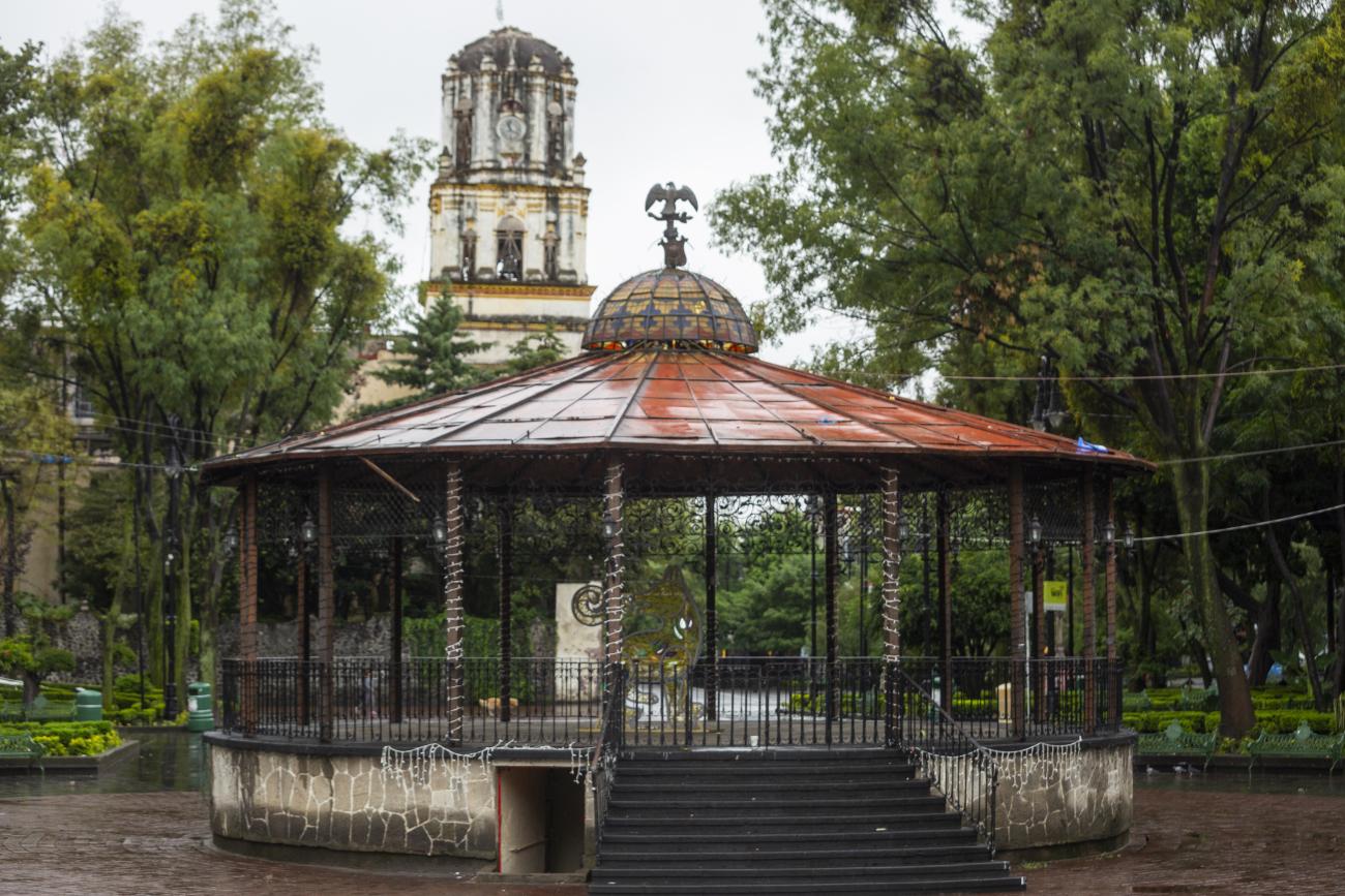
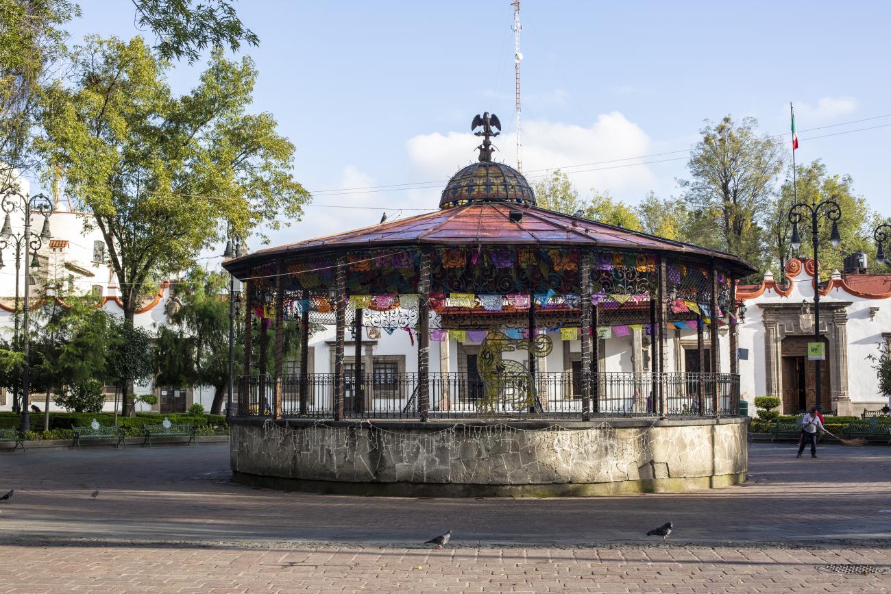
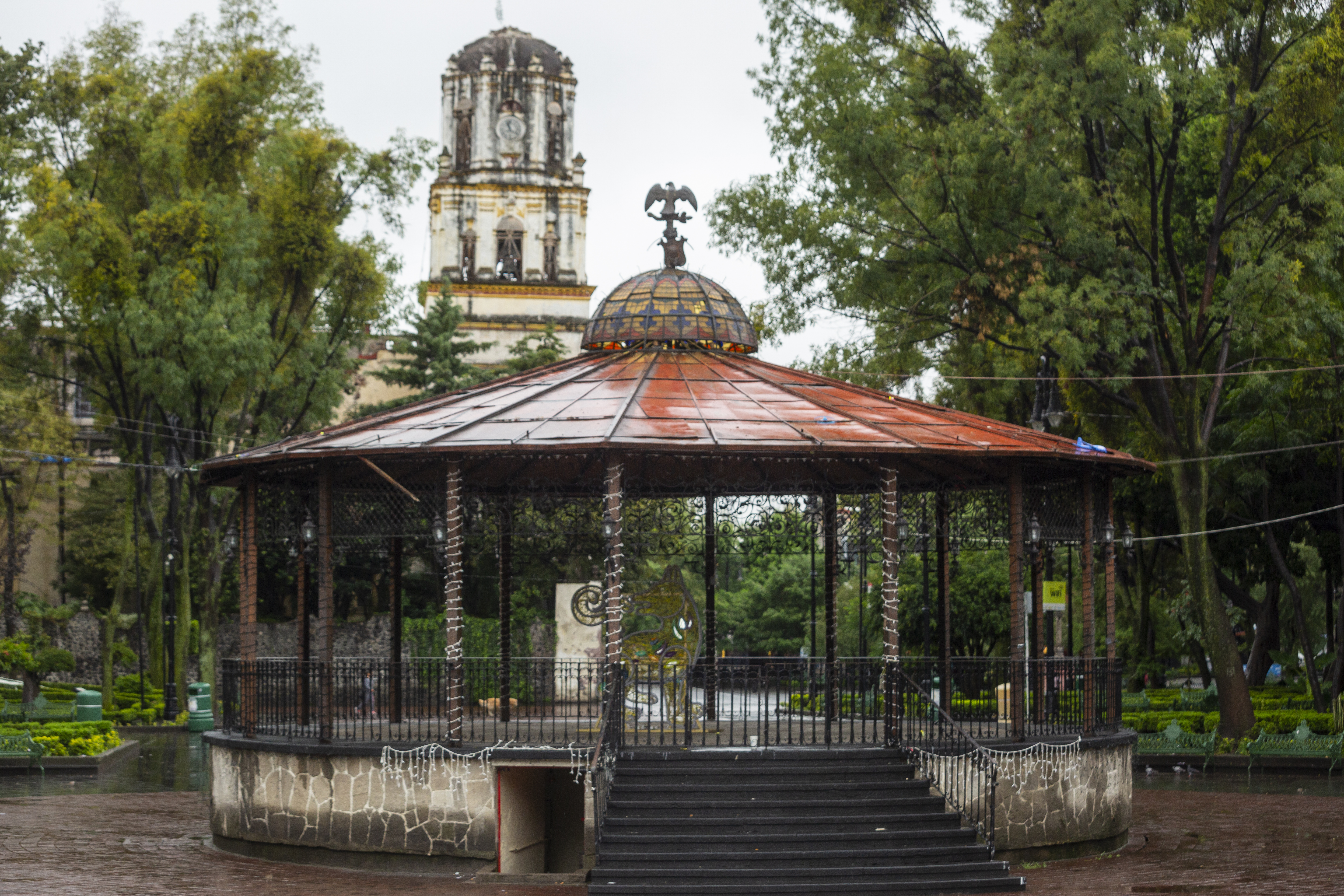
In 1890 Porfirio Díaz established the “Del Carmen” neighborhood on the lands that formed part of the Hacienda de San Pedro. It was named in honor of his wife Carmen Romero Rubio and became a symbol of modernity. Also during the Porfiriato, in 1910, the bandstand was built in the Main Square.
After the turbulent times of the Revolution, the urbanization process of Coyoacán accelerated. The Mexico-Coyoacán road was inaugurated, the Hidalgo avenue was paved and a bus route was established that led from the center of Coyoacán to the town of Los Reyes, passing through the town of La Conchita. As a result of this process, the agricultural character of the region changed and the inhabitants of the villages and neighborhoods began to join the ranks of the factory workers. The growth of Mexico City led to the establishment of new neighborhoods and subdivisions in the surrounding towns.
By 1929 Coyoacán stopped being a municipality and become a borough of the Federal District and, by 1940, the process of urbanization was imminent. The residential areas of Xotepingo and Ciudad Jardín and Miguel Ángel de Quevedo and Pacífico avenues were created.
Coyoacán has been the residence of outstanding Mexicans in the cultural sphere: the poet José Juan Tablada; the historians Francisco Sosa, Manuel Toussaint and José Goroztiza; painters Diego Rivera, Frida Kahlo, Salvador Novo, José Chávez Morado and Rufino Tamayo, as well as the engineer Miguel Angel de Quevedo. Historical events that occurred in Coyoacán during the 20th century include the arrival of King Carol of Romania, and the assassination of Leon Trotsky, a key figure in the Russian Revolution.
Today Coyoacán has an extensive cultural infrastructure that reflects its artistic and cultural traditions.
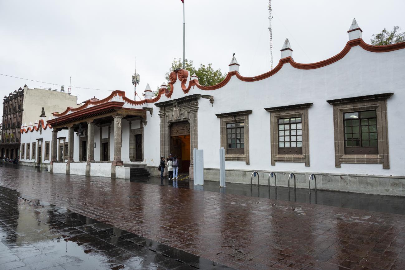
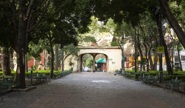
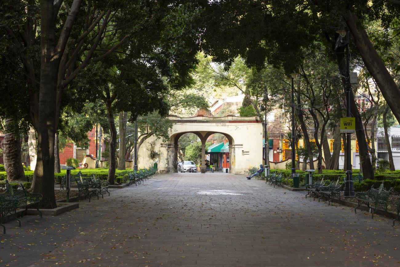
The Zone of Historical Monuments covers an area of 1.64 square kilometers and comprises 86 blocks that contain 50 buildings with historical value, built between the 16th and 19th centuries. It preserves part of the original 16th-century layout that was partially drawn up around the road that connected the town with San Ángel, forming a checkerboard pattern in the center and presenting a more irregular layout elsewhere.
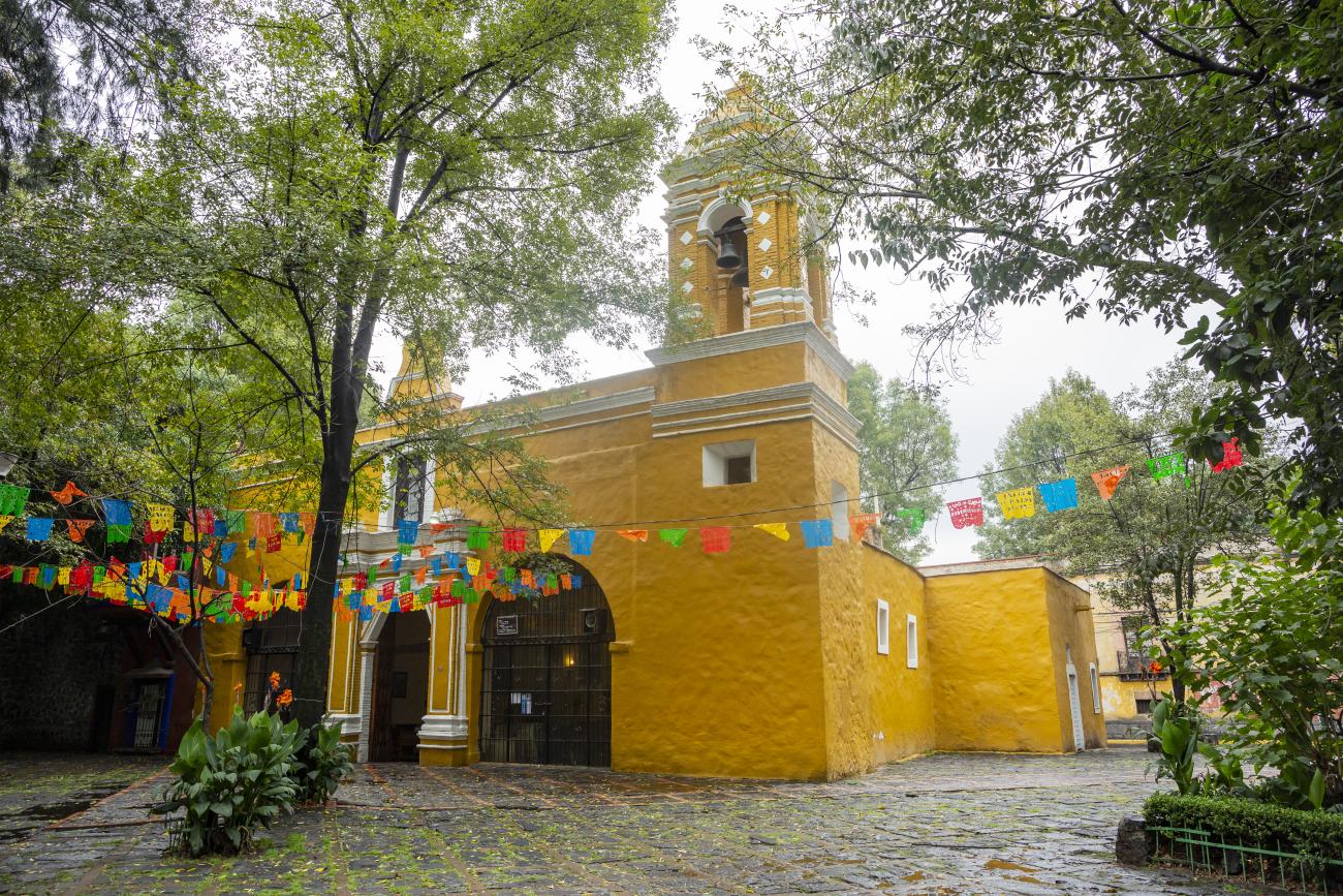
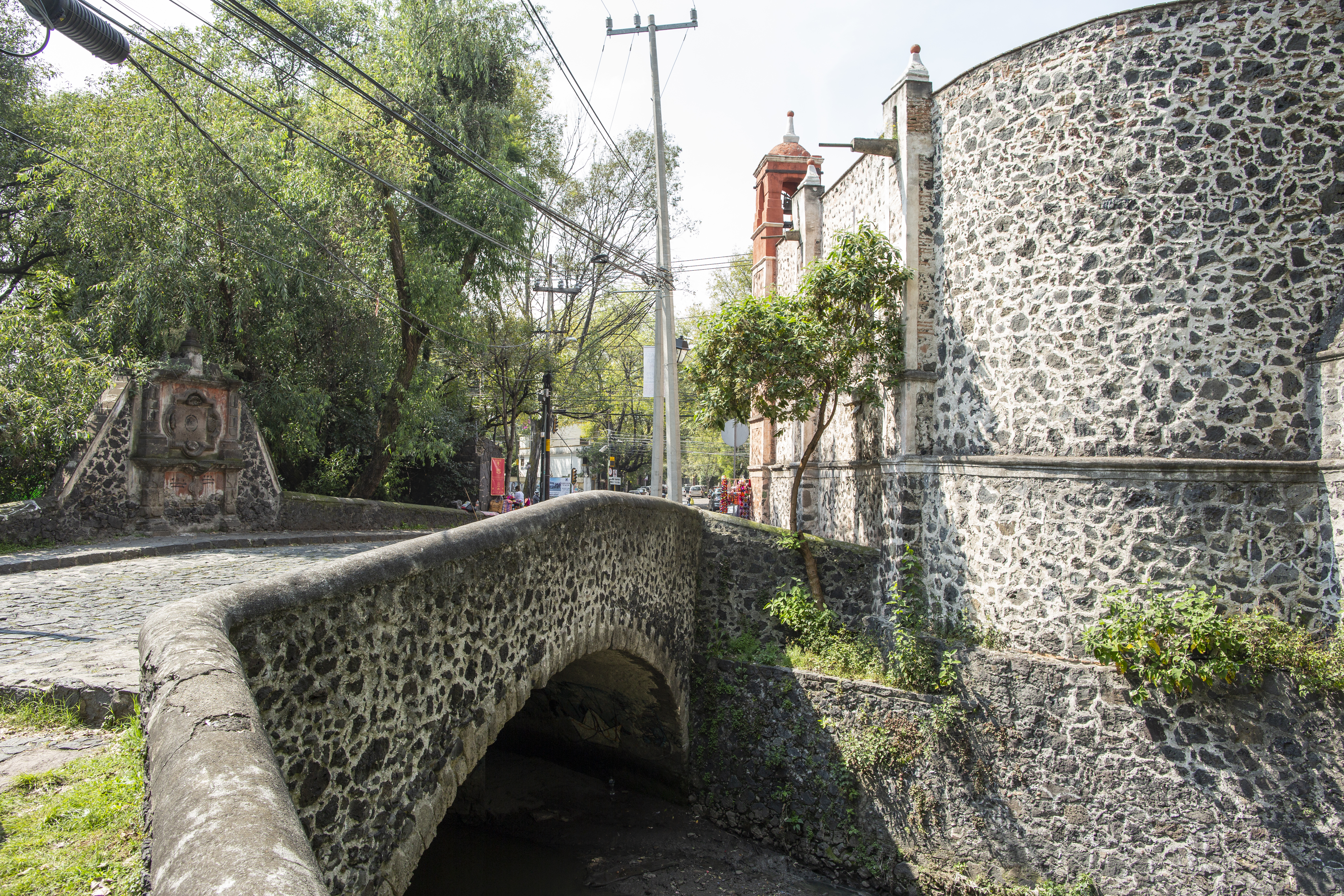
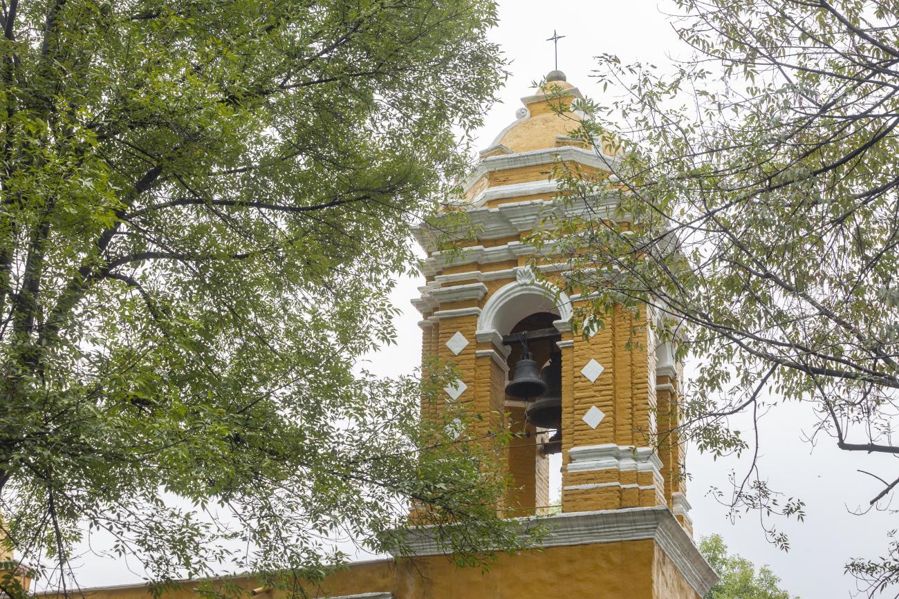
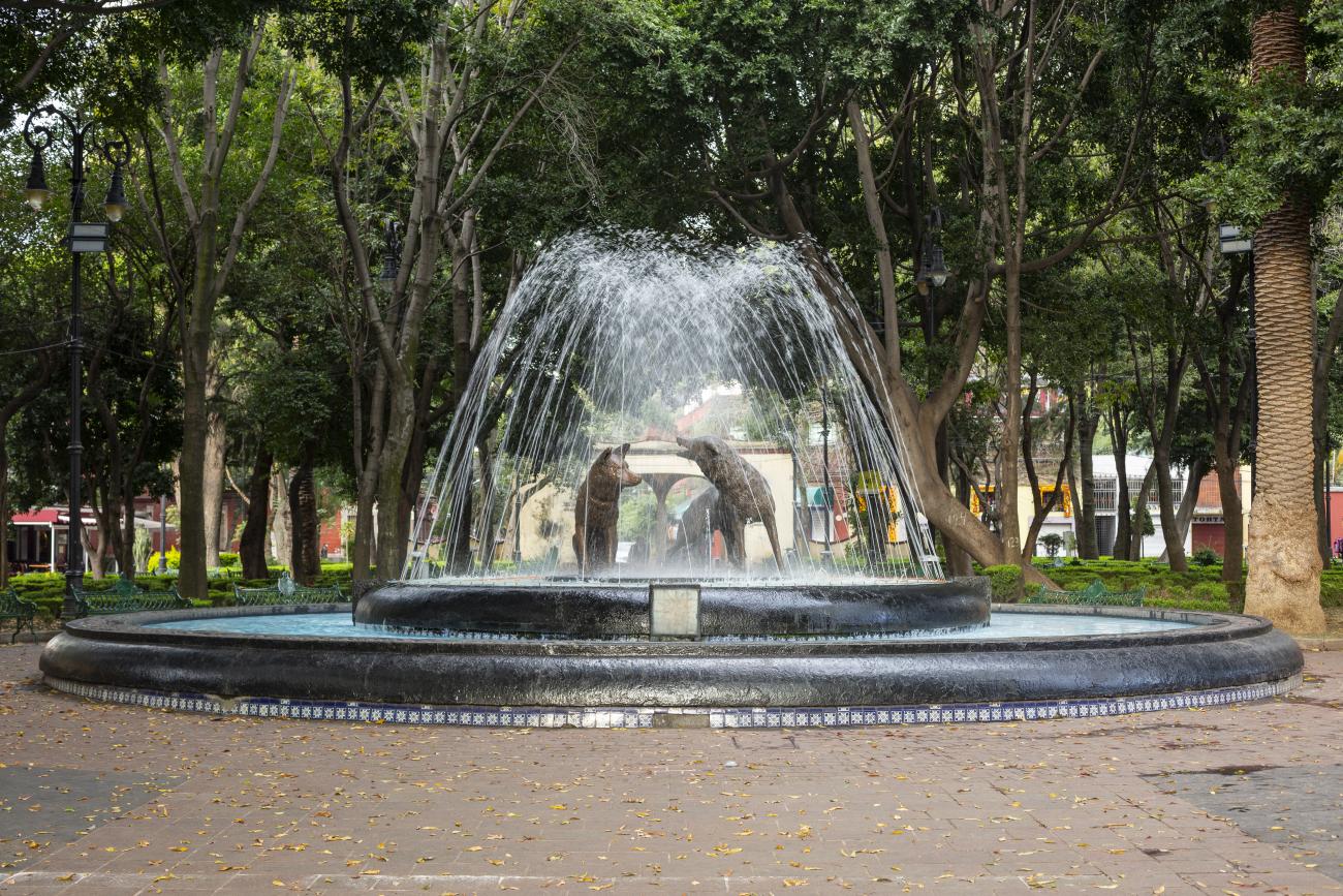
Its religious buildings include the Church and Former Monastery of San Juan Bautista, the Former Camillian Monastery, the churches of Santa Catarina and the Immaculate Conception and the San Antonio Panzacola Chapel. Among the civil buildings, it is worth mentioning the house of Hernán Cortés, the San Antonio Panzacola bridge and the bandstand. The area is also characterized by its open spaces, including the Hidalgo, Conchita and Panzacola plazas, as well as the Centenario and Santa Catarina gardens.
On October 5, 1934 Coyoacán was declared a “Typical and Picturesque Zone” of the Federal District due to its outstanding urban and architectural characteristics and it became a Zone of Historical Monuments on December 19, 1990.

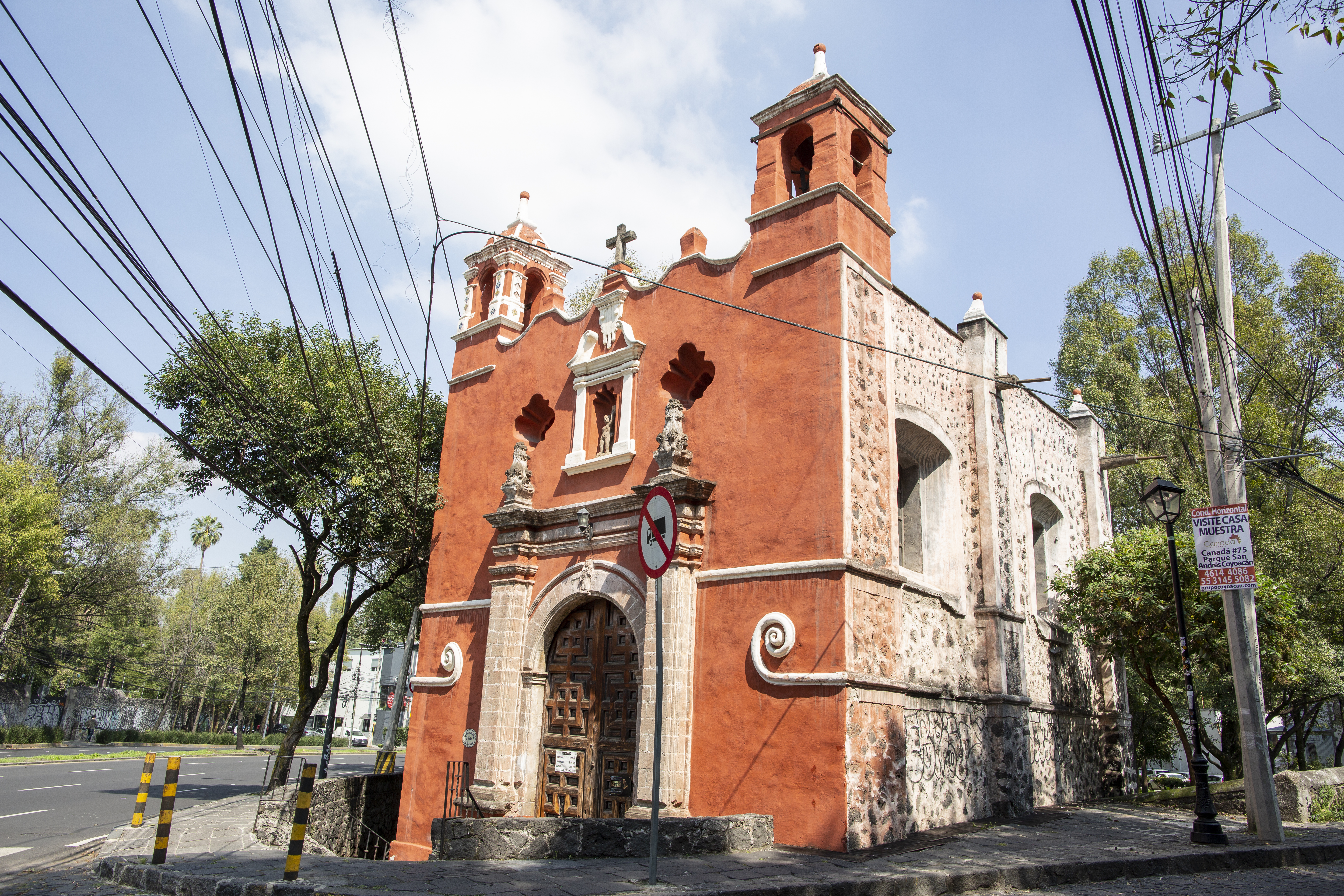
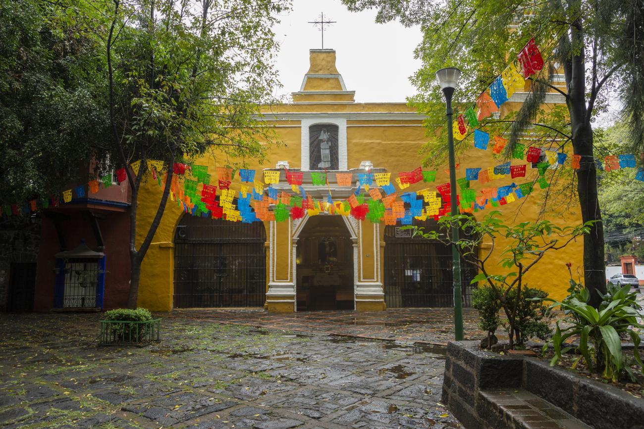
Templo de San Antonio Panzacola
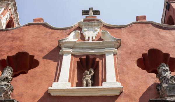
Located on the corner of Avenida Universidad and Francisco Sosa, this single-nave temple has a sober Baroque façade, decorated with a relief of Saint Anthony of Padua and topped with merlons, battlements, and a stone cross.
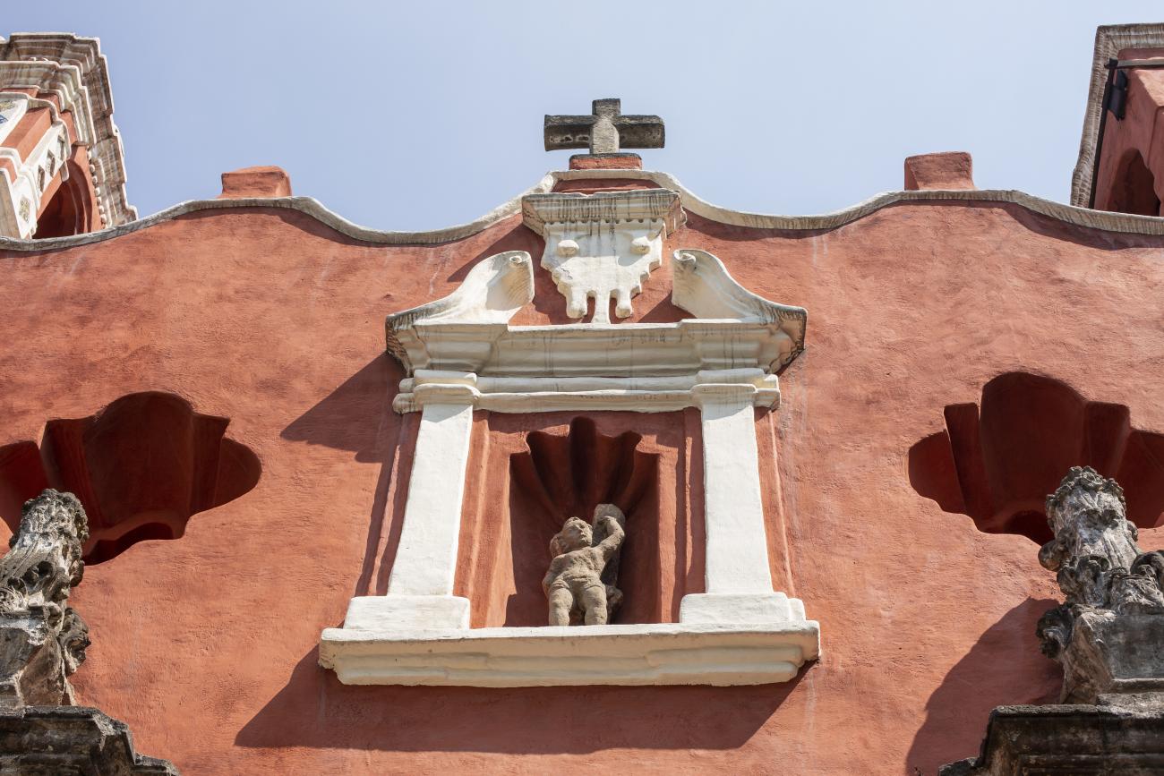


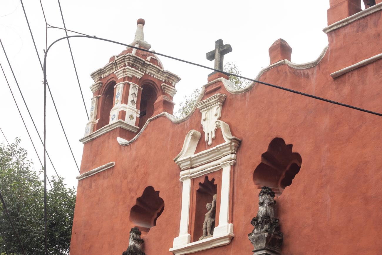
Located on the corner of Avenida Universidad and Francisco Sosa, this single-nave temple has a sober Baroque façade, decorated with a relief of Saint Anthony of Padua and topped with merlons, battlements, and a stone cross.
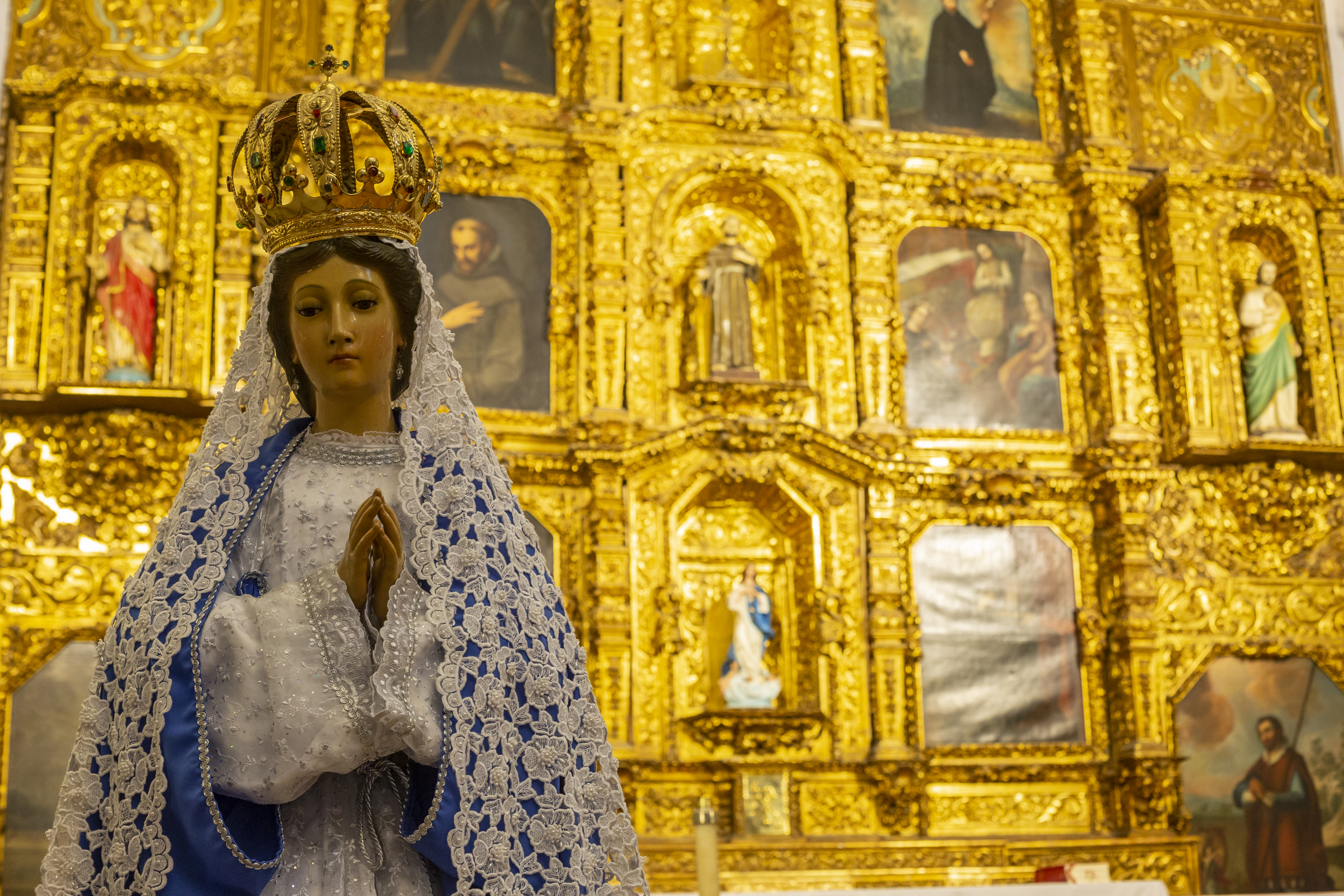
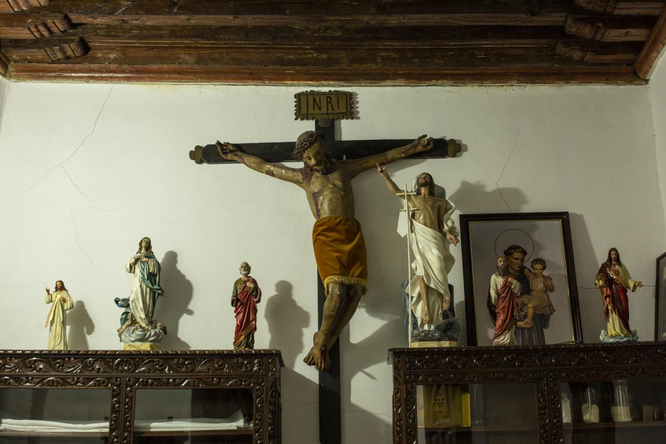
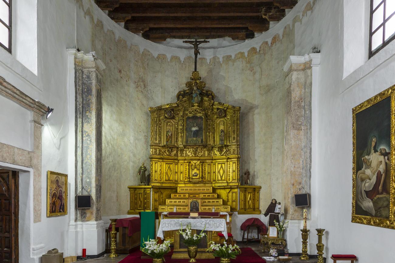
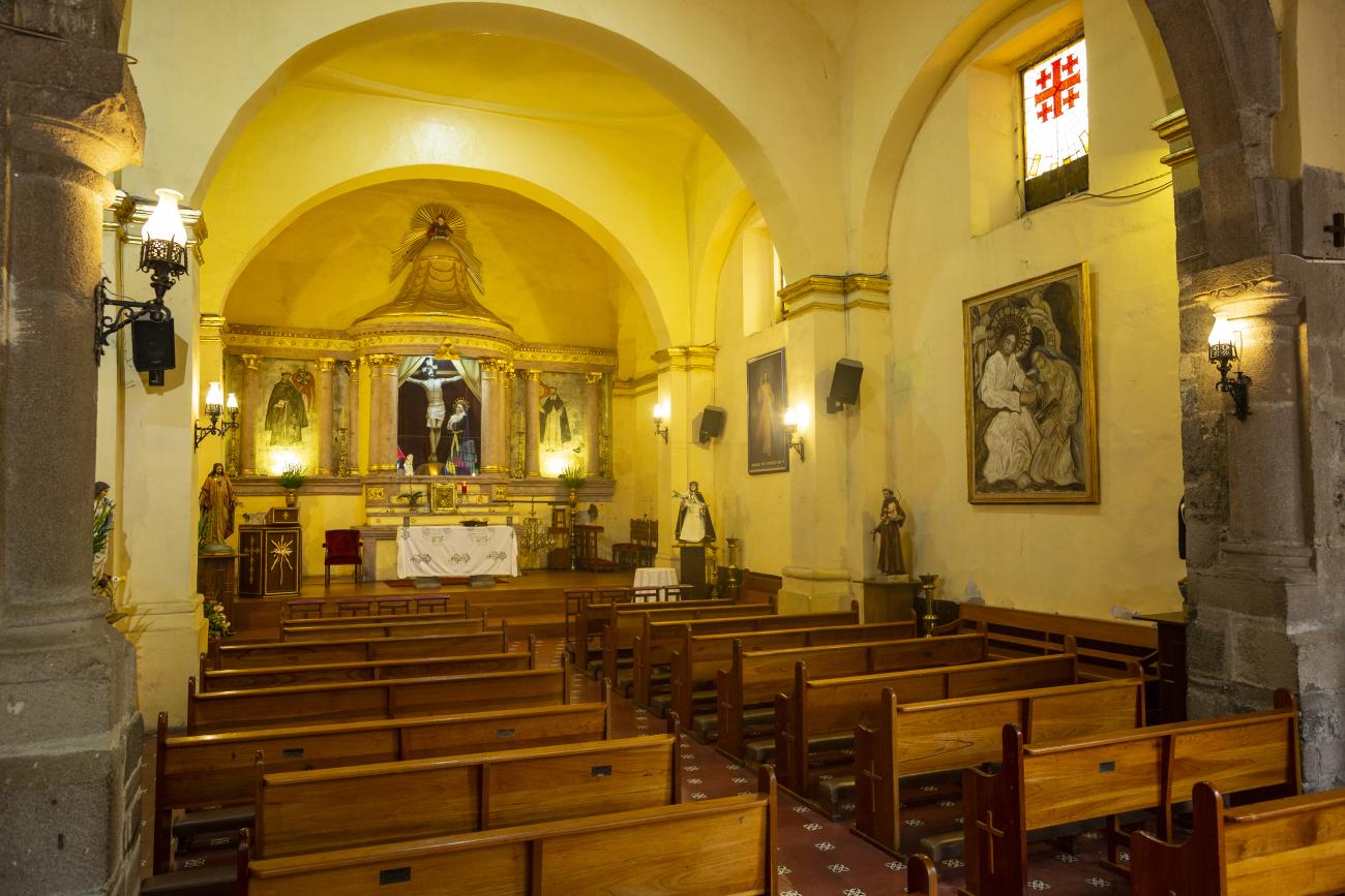
Inside, there is a Baroque-style altarpiece with easel paintings and sculptures of Christ, the Virgin Mary, and Saint Anthony of Padua.
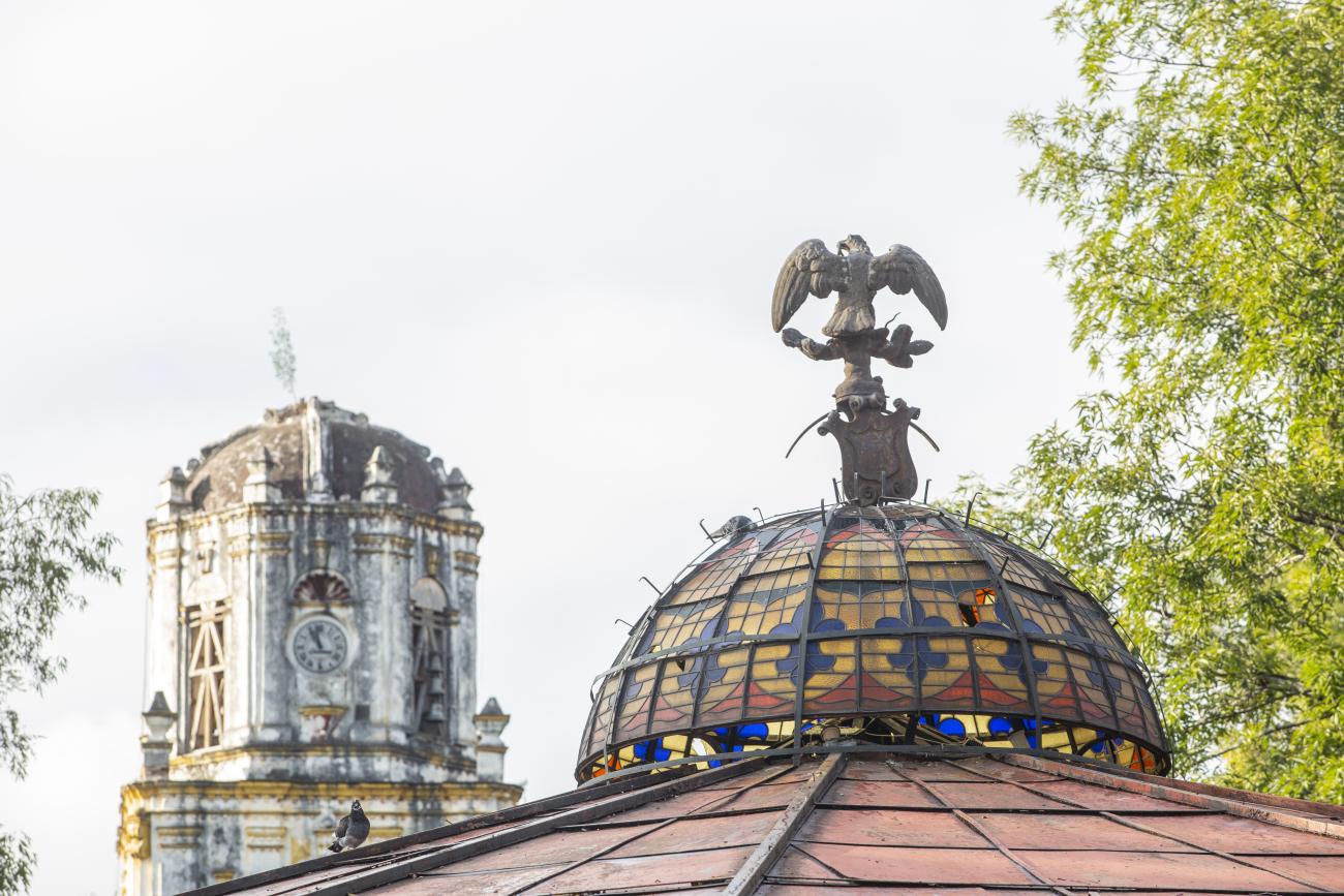
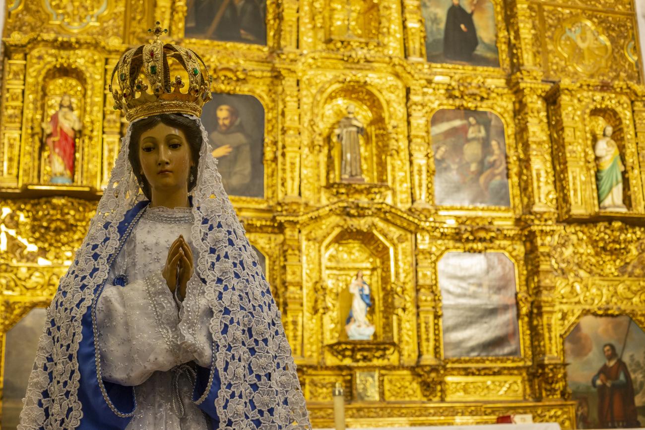
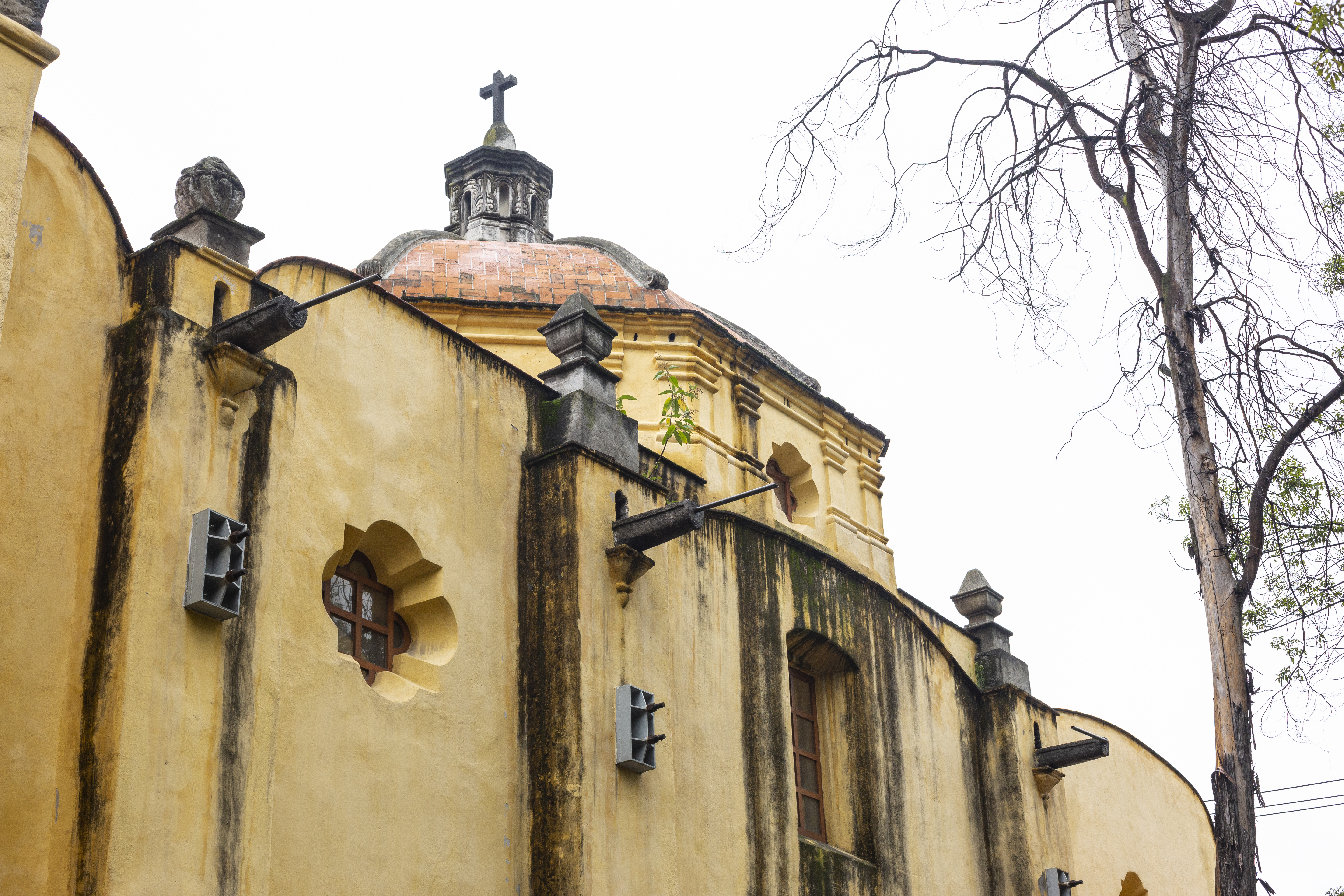
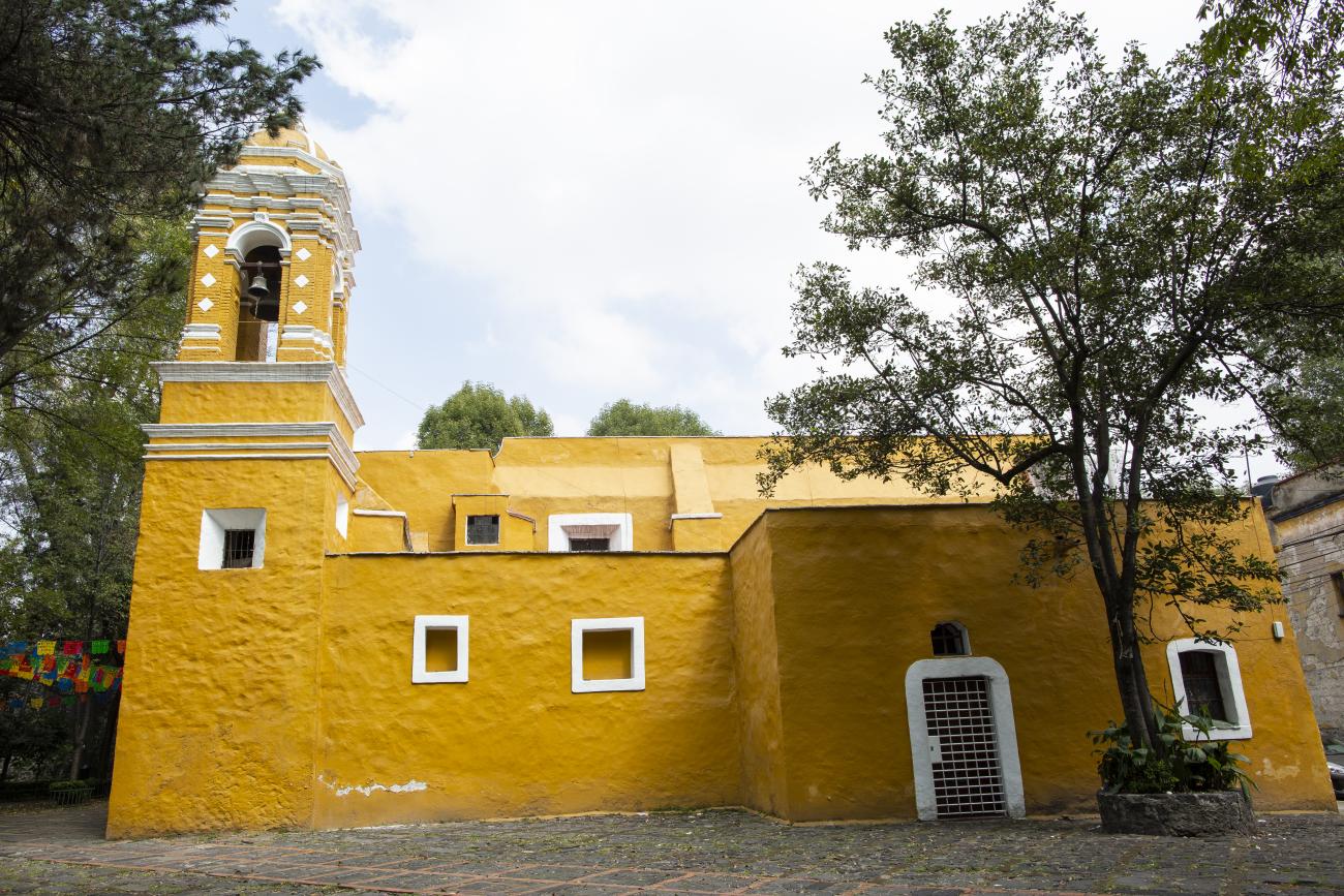
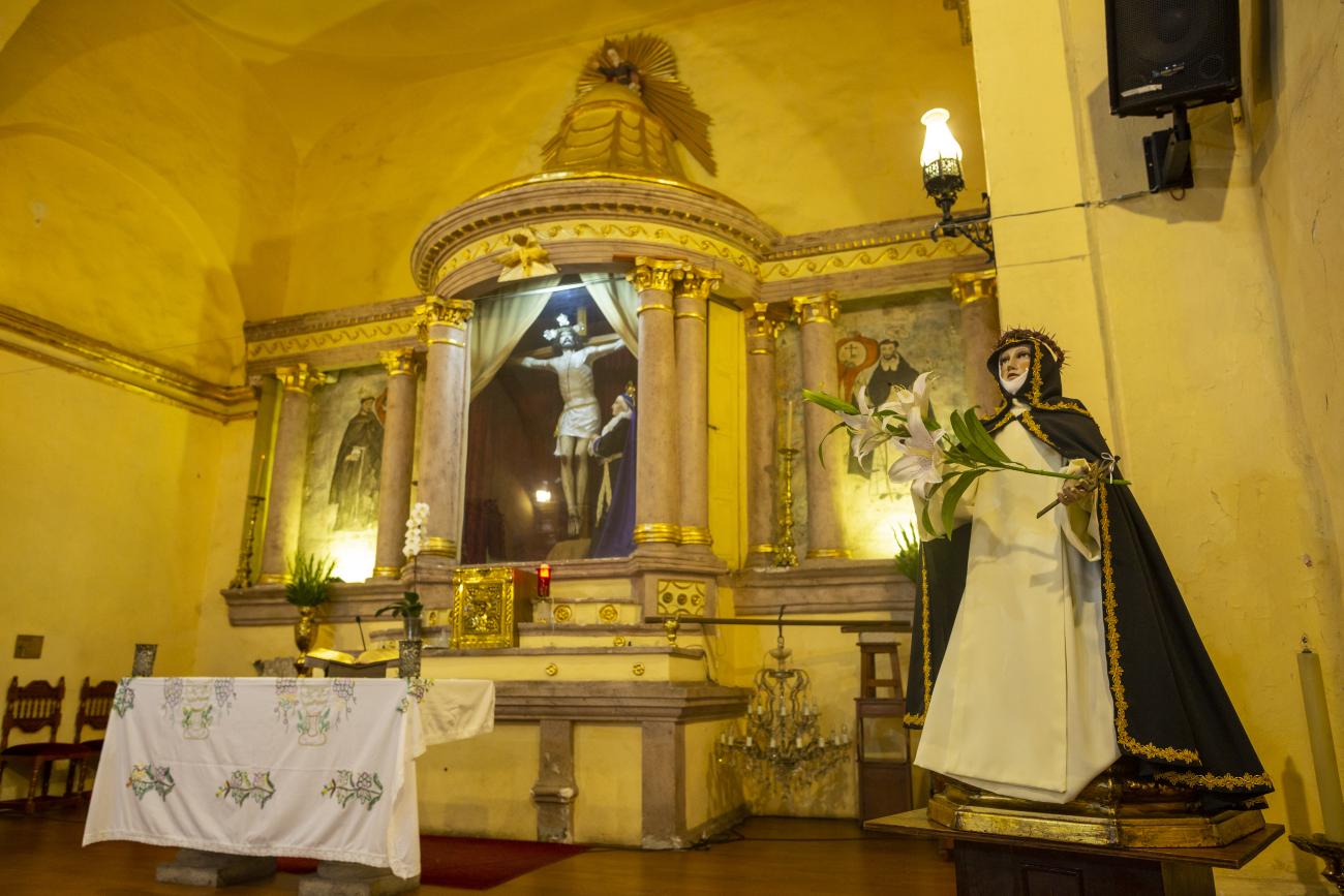
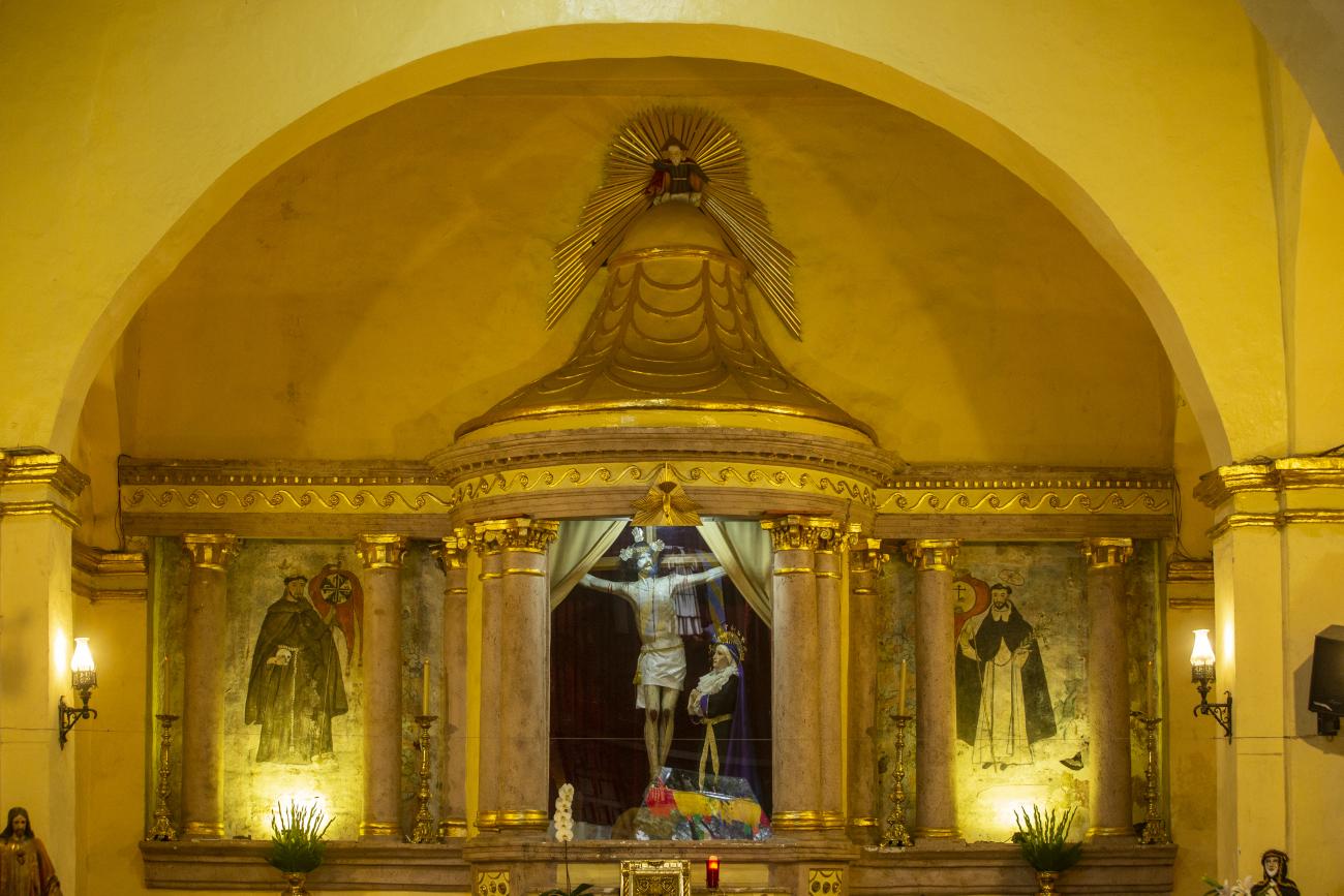
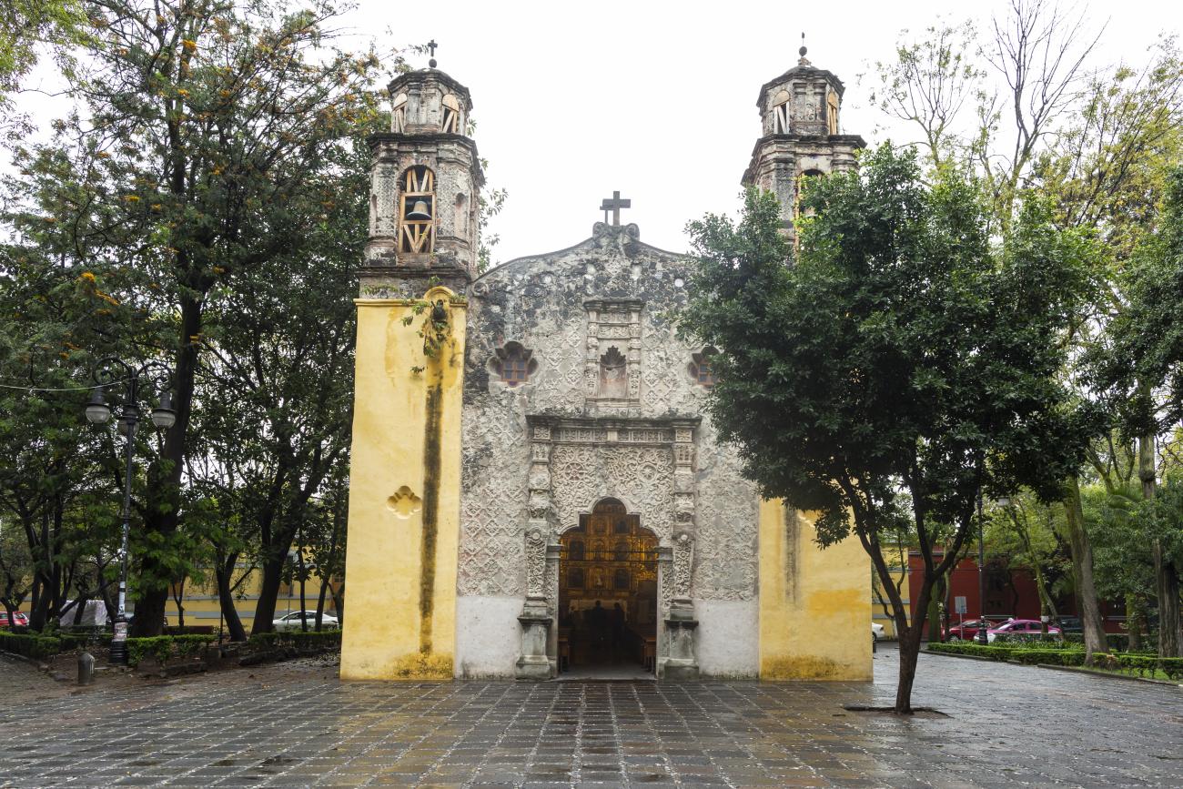
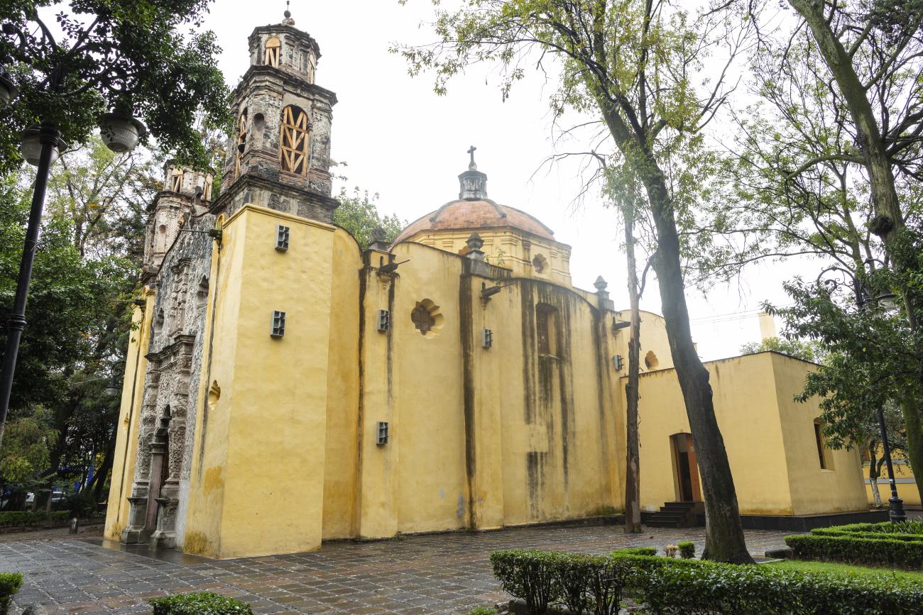
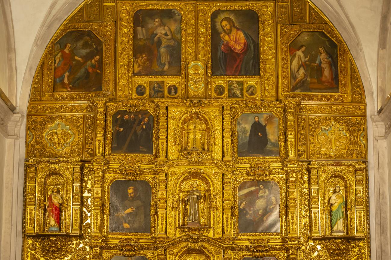
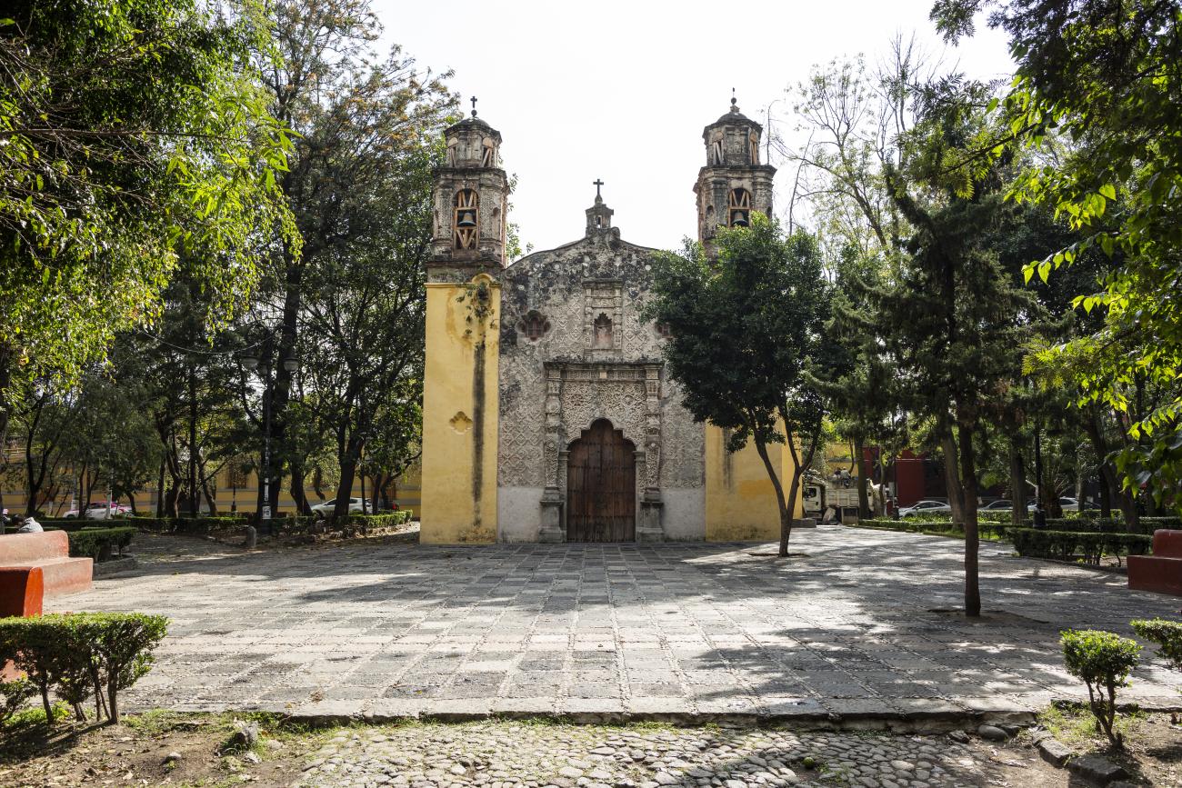
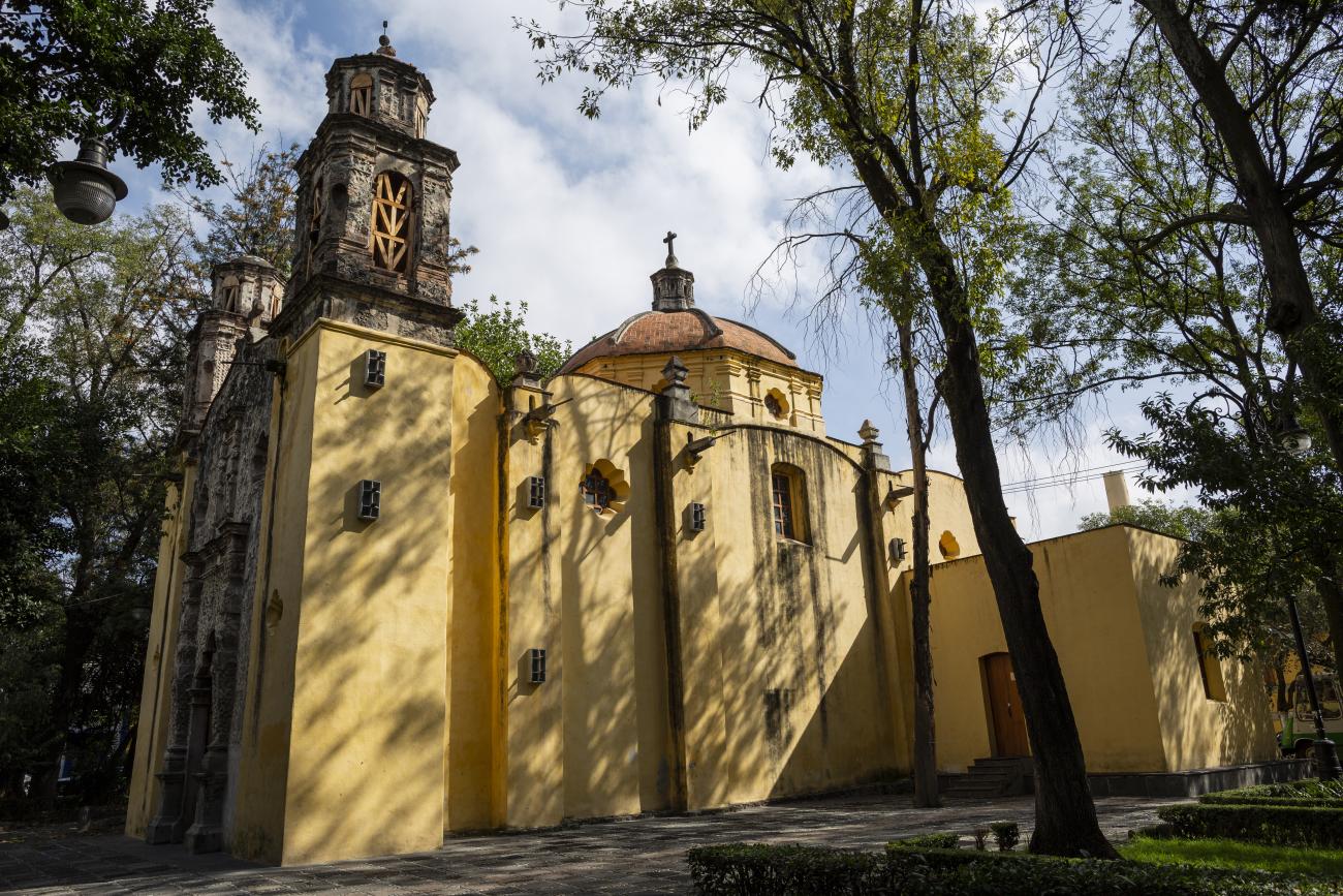
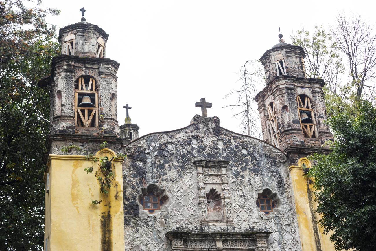
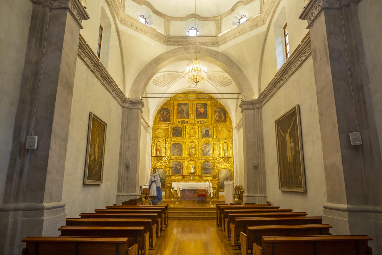
Templo de San Juan Bautista
This 16th-century chapel is part of the Monastery of San Juan. In subsequent centuries, it underwent various alterations; the three naves were reduced to a single one, and the cedar beam ceiling was replaced with a modern roof.
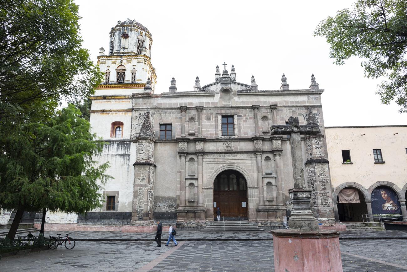
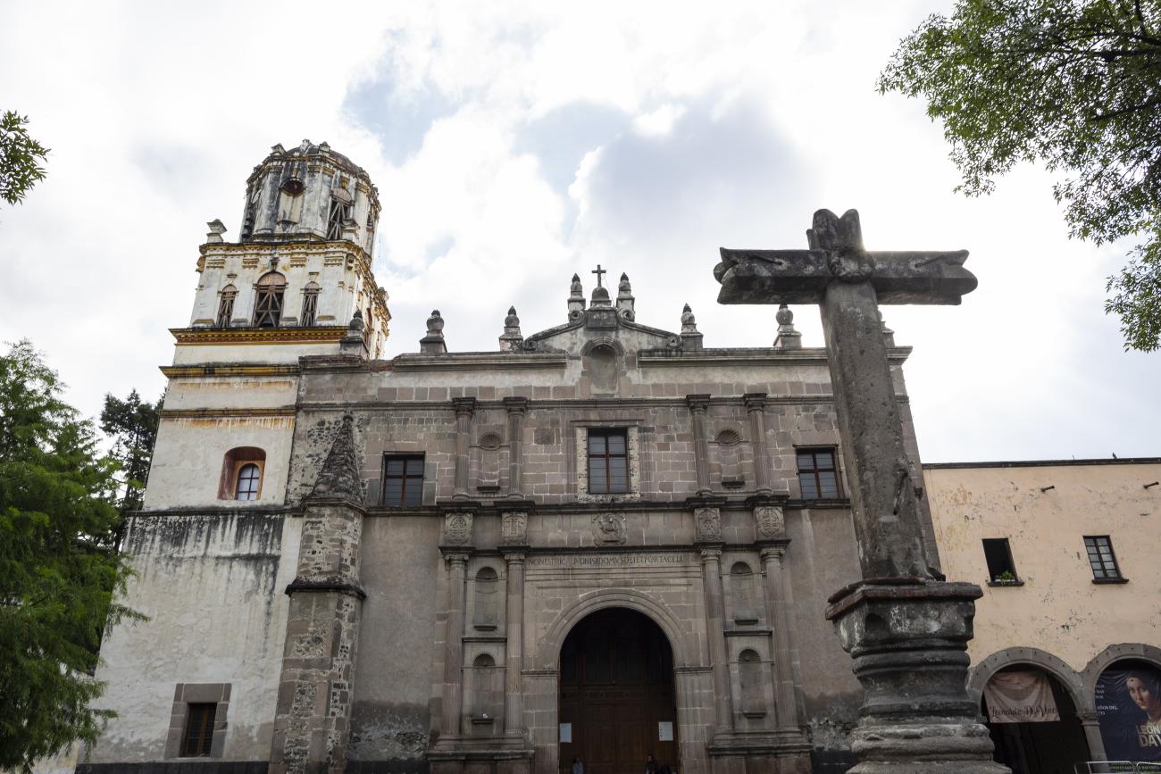
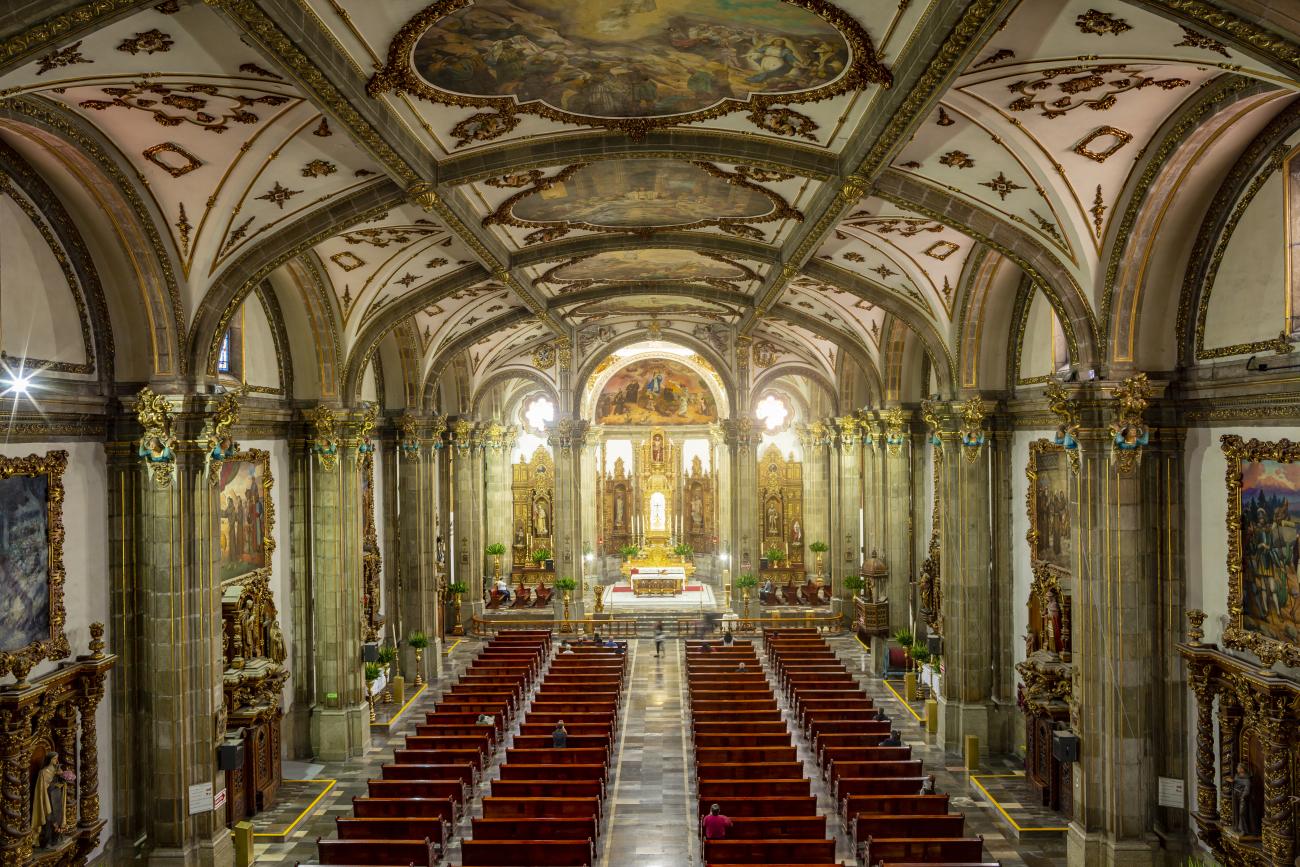
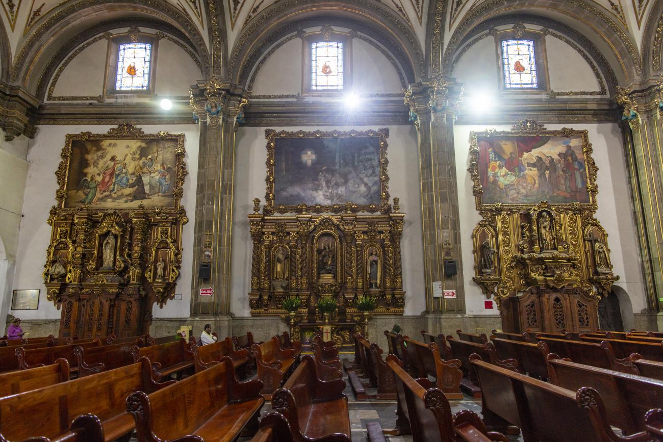
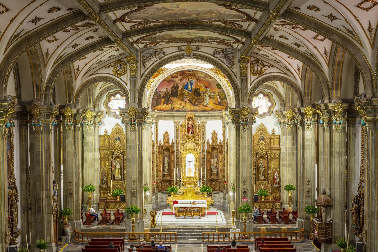
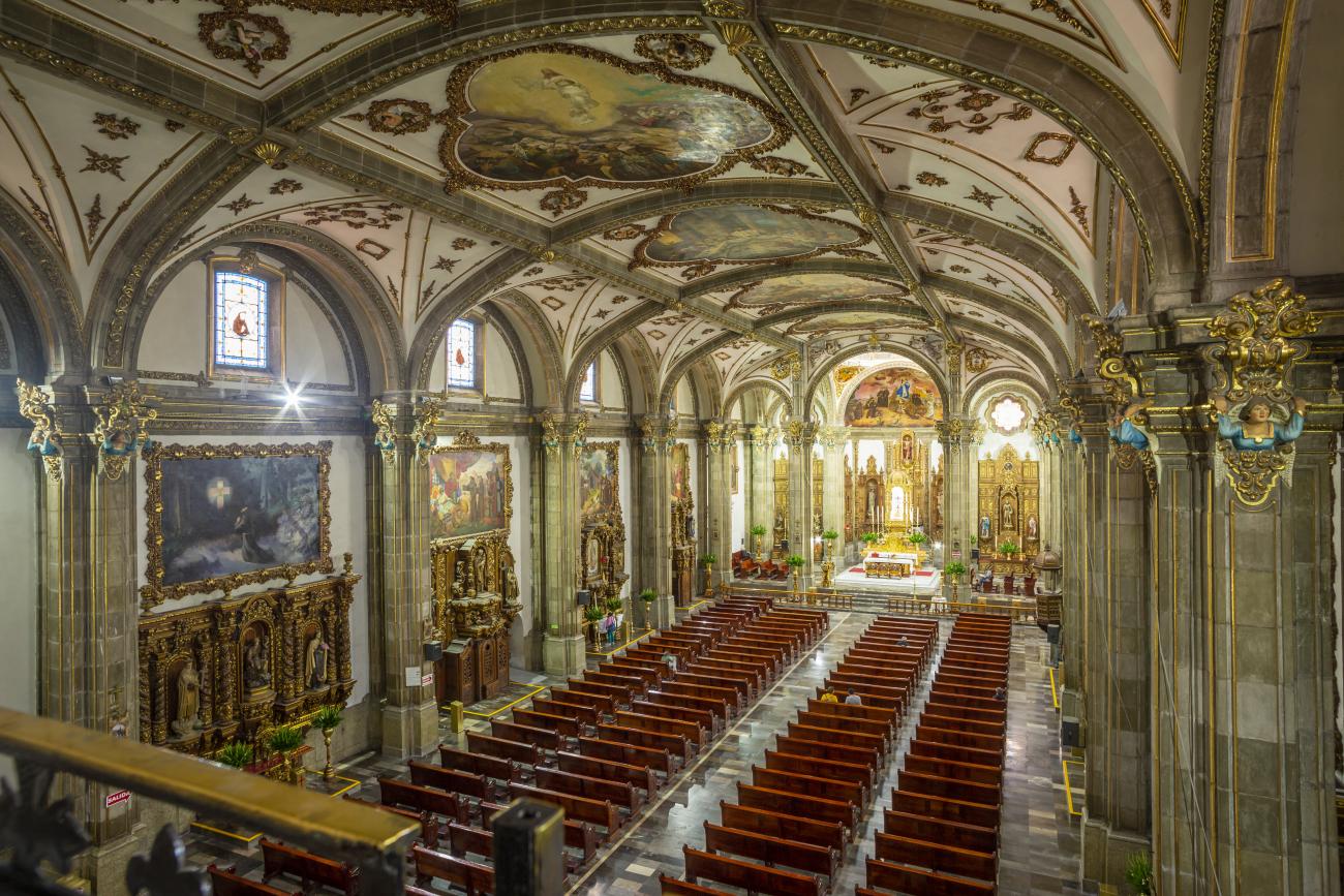
This 16th-century chapel is part of the Monastery of San Juan. In subsequent centuries, it underwent various alterations; the three naves were reduced to a single one, and the cedar beam ceiling was replaced with a modern roof.
It has a pilgrims' portal, corner altars, doorways, lintels, a stone basin, and a roof that tells the story of the Dominican order, as well as various paintings, which were restored by the painter Mario Velázquez in 1970.
Its Herrerian-style façade has two columns with fluted shafts and Ionic capitals on each side supporting an entablature, a frieze with Dominican coats of arms, a relief referring to the Lamb of God, and anagrams of Jesus Christ and the Virgin Mary.
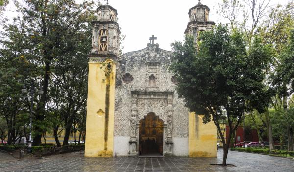
Templo de Santa Catarina
Religious building constructed in the 16th century as an open chapel until the 17th century, when the population increased. In 1963 and 1972, the façade and tower were restored and repaired.
Religious building constructed in the 16th century as an open chapel until the 17th century, when the population increased. In 1963 and 1972, the façade and tower were restored and repaired.
Its façade preserves traces of the arches of the original open chapel, and the interior shows remains of mural paintings.
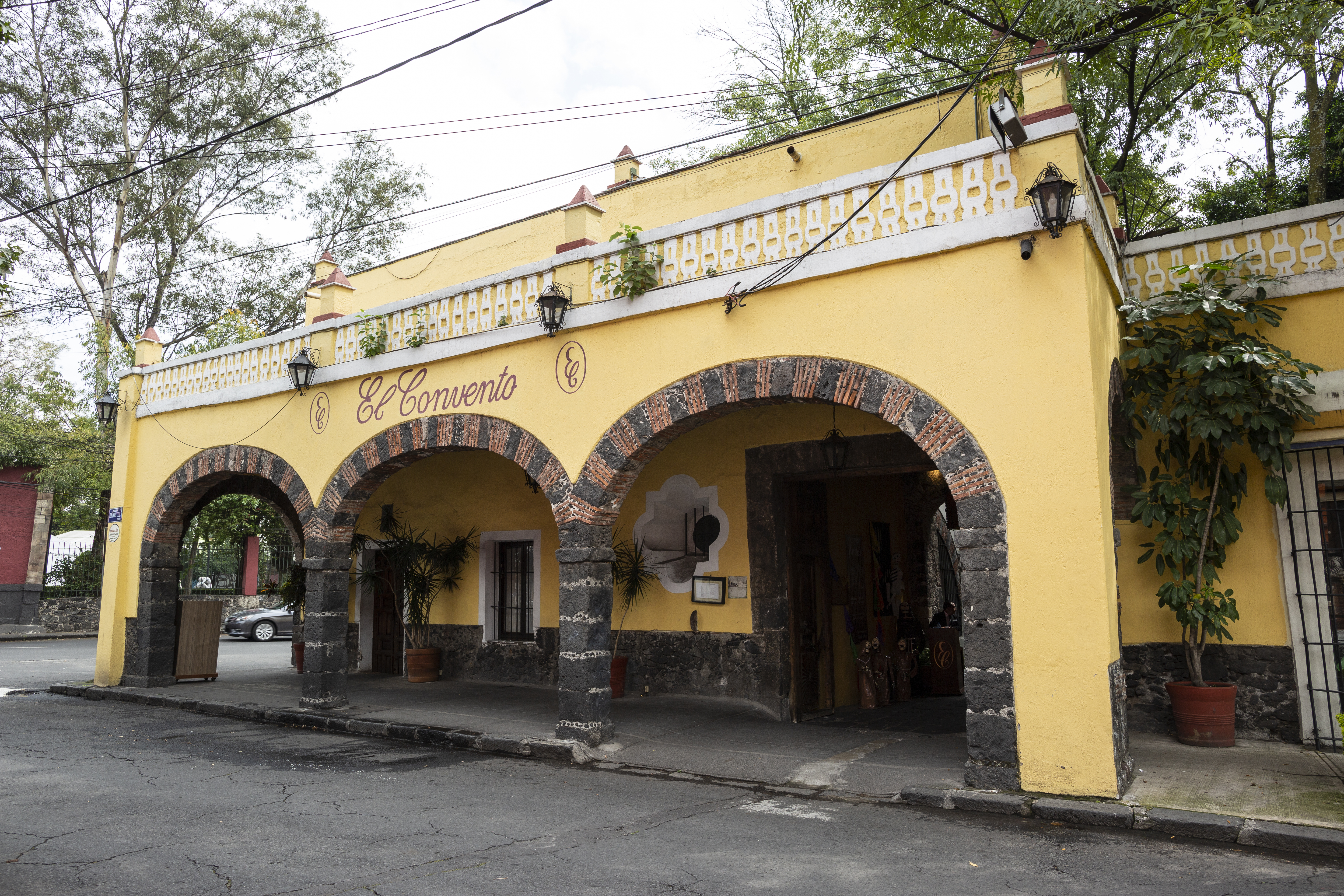
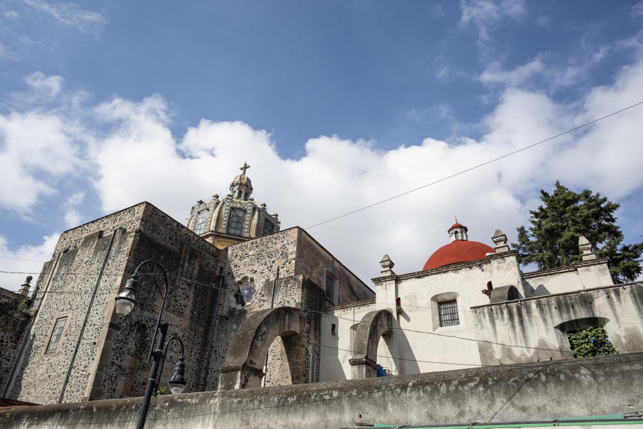
Casa de los Camilos
This two-story building was constructed in the 18th century by the Camillians, who used it as a retreat; it was also known as El Rosedal (The Rose Garden), as the Camillian fathers grew roses in its gardens.

This two-story building was constructed in the 18th century by the Camillians, who used it as a retreat; it was also known as El Rosedal (The Rose Garden), as the Camillian fathers grew roses in its gardens. After the Camillians were secularized, the building was acquired by the Department of Corrections of the former Tecpan de Santiago. In April 1880, an agricultural colony and a juvenile correctional facility were established there. In the 1920s, it became the property of Guadalupe Toriello de Villada, who repaired both the interior and exterior of the house. Since then, it has had different uses: theater, cinema, cafeteria, residence, and offices. It has a sober façade with a balcony and a portal with three pointed arches and wooden and brick beams.
Arcos de acceso al atrio del Templo de San Juan Bautista
The atrium of the Temple of San Juan Bautista had three Plateresque-style entrance arches with symmetrical proportions; the only one that remains in its original location is the one on the west side.
The atrium of the Temple of San Juan Bautista had three Plateresque-style entrance arches with symmetrical proportions; the only one that remains in its original location is the one on the west side. The archway is supported by a column with a fluted shaft and Corinthian capital, decorated on the sides with angels carrying a crown of flowers carved in bas-relief. In the center of the masonry cornice is a Franciscan coat of arms surrounded by fleurs-de-lis and a stone cross.
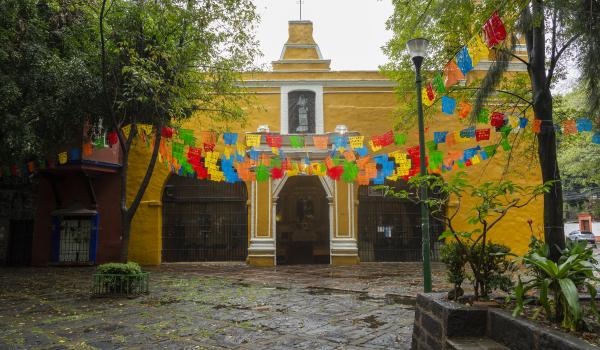
Conjunto de la Conchita
The Chapel of the Conception, originally Franciscan, is located in the center of the plaza. It was built because Cortés wished to be buried there, as expressed in his will.

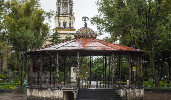
Plaza Hidalgo
This architectural complex consists of the monument to Miguel Hidalgo and the bandstand.
During pre-Hispanic times, this site served as a Tepanec ceremonial center, and after the Conquest, it became the property of Hernán Cortés.