


Peralta
One of the largest sites in the Bajío region (330-750 AD), there is still a mystery about the ethnic origin of the people who inhabited it. The magnificent architecture is monumental, suggesting a ceremonial center.
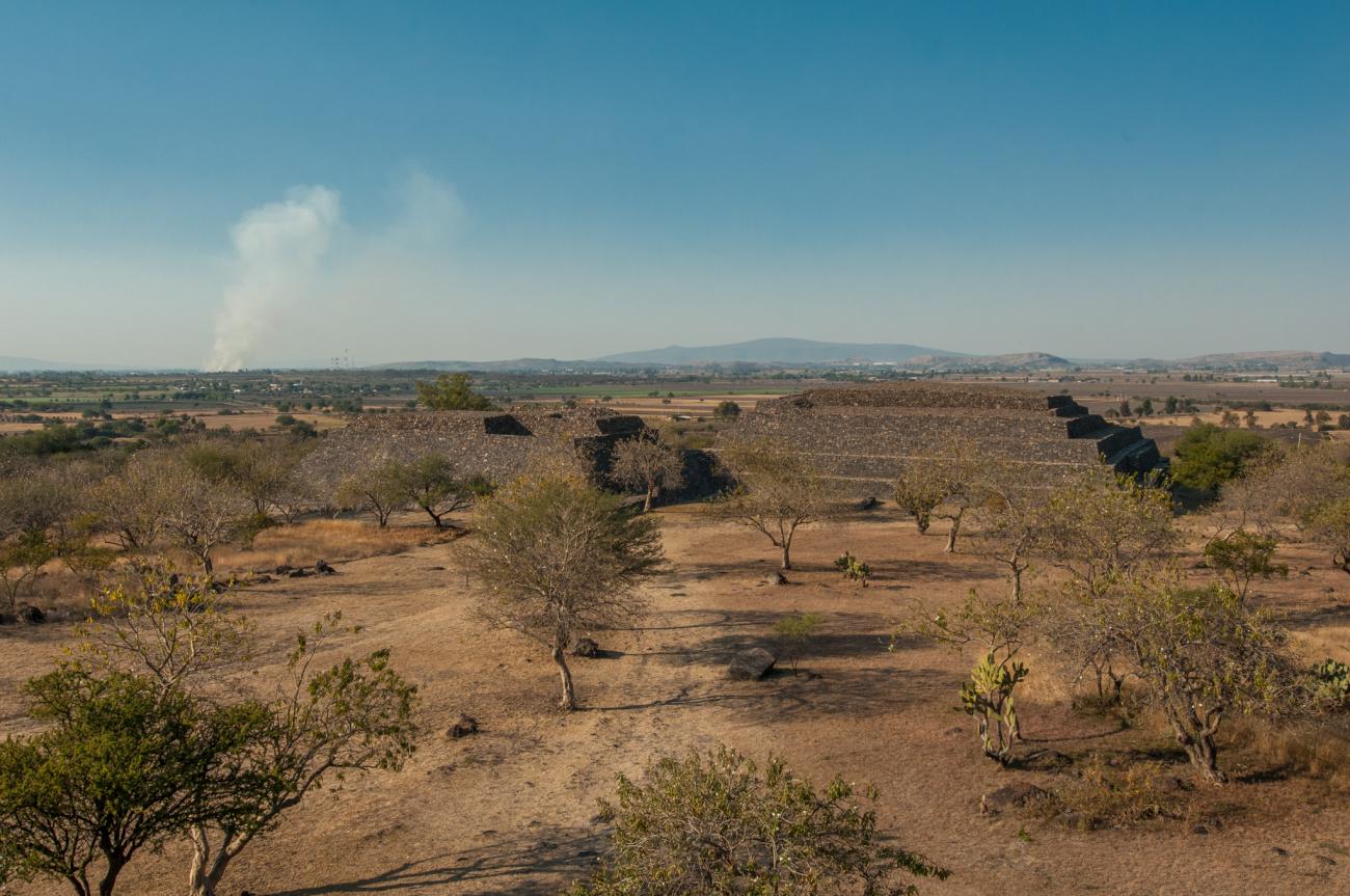
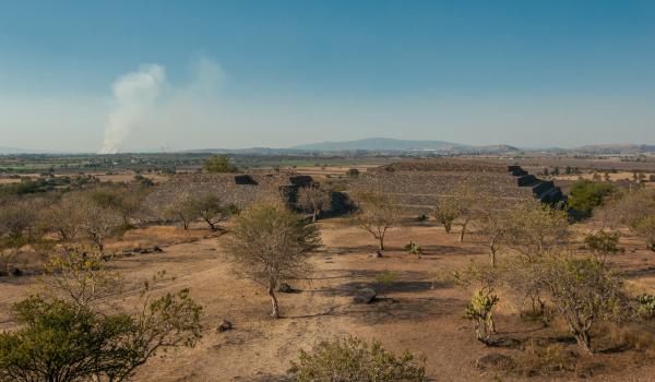
This site, which is dispersed across the foothills of the Peralta mountain and the banks of the Lerma River, stood out in the pre-Hispanic era due to its agriculture. The land around the site and the traces of hundreds of terraces on the northern hillside of the mountain which gives the site its name are manifestations of this activity. Furthermore, its proximity to the Lerma suggests that a large amount of lake resources would have been available, supplementing the diet of the former inhabitants. Deposits of obsidian and rhyolite in the nearby mountains of Pénjamo and Abasolo are also thought to have contributed to the development of these groups. The area reached its peak between the years 300 and 650 AD.
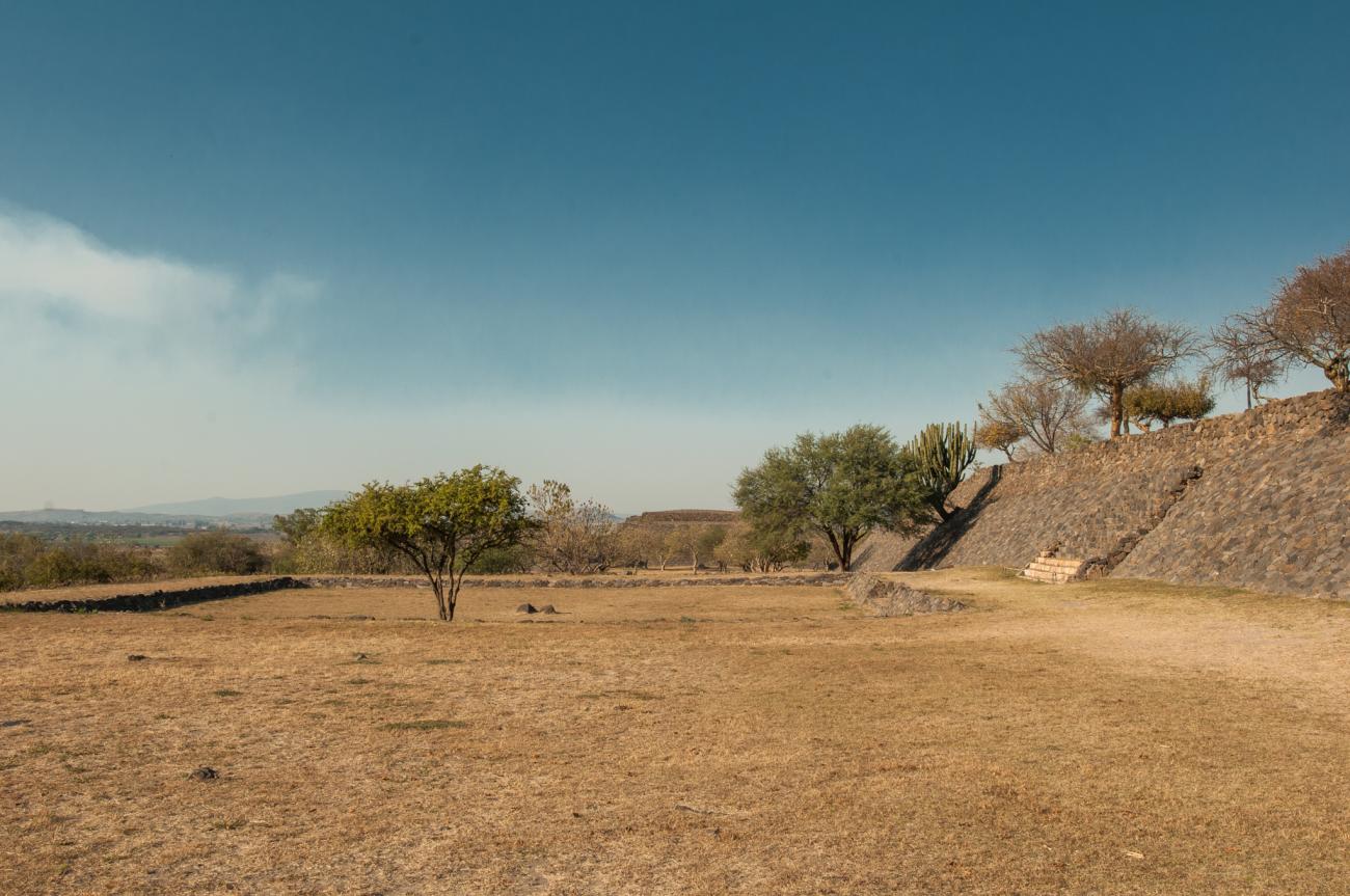
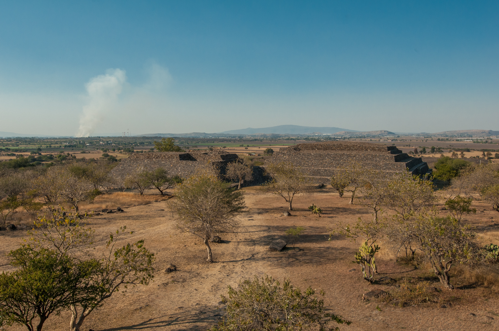
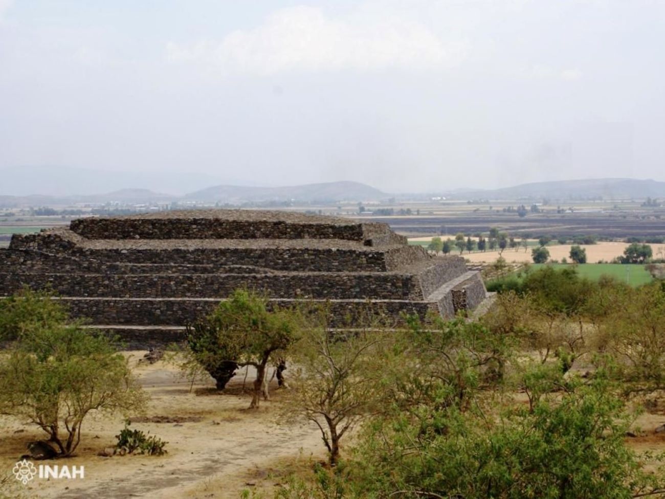
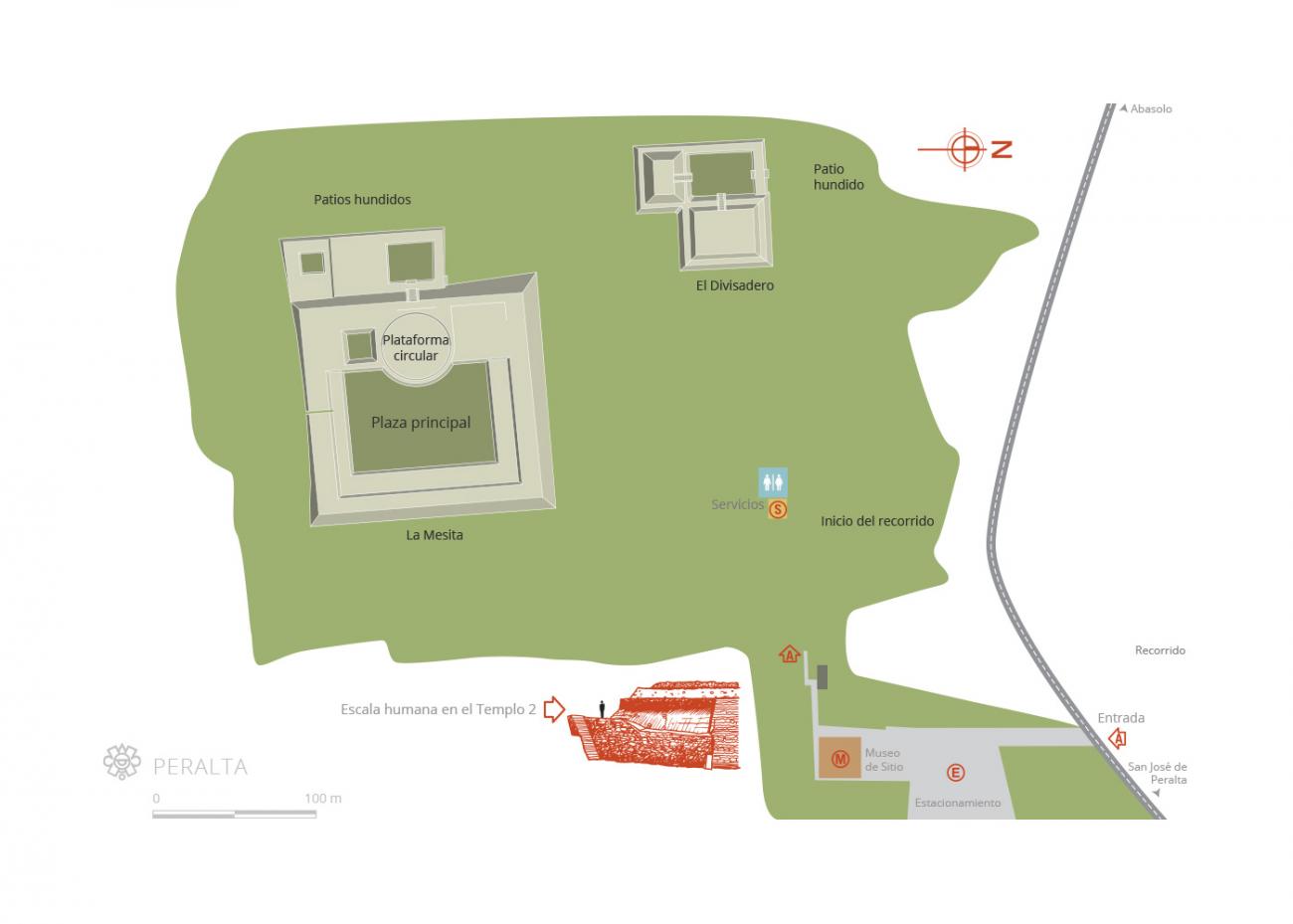
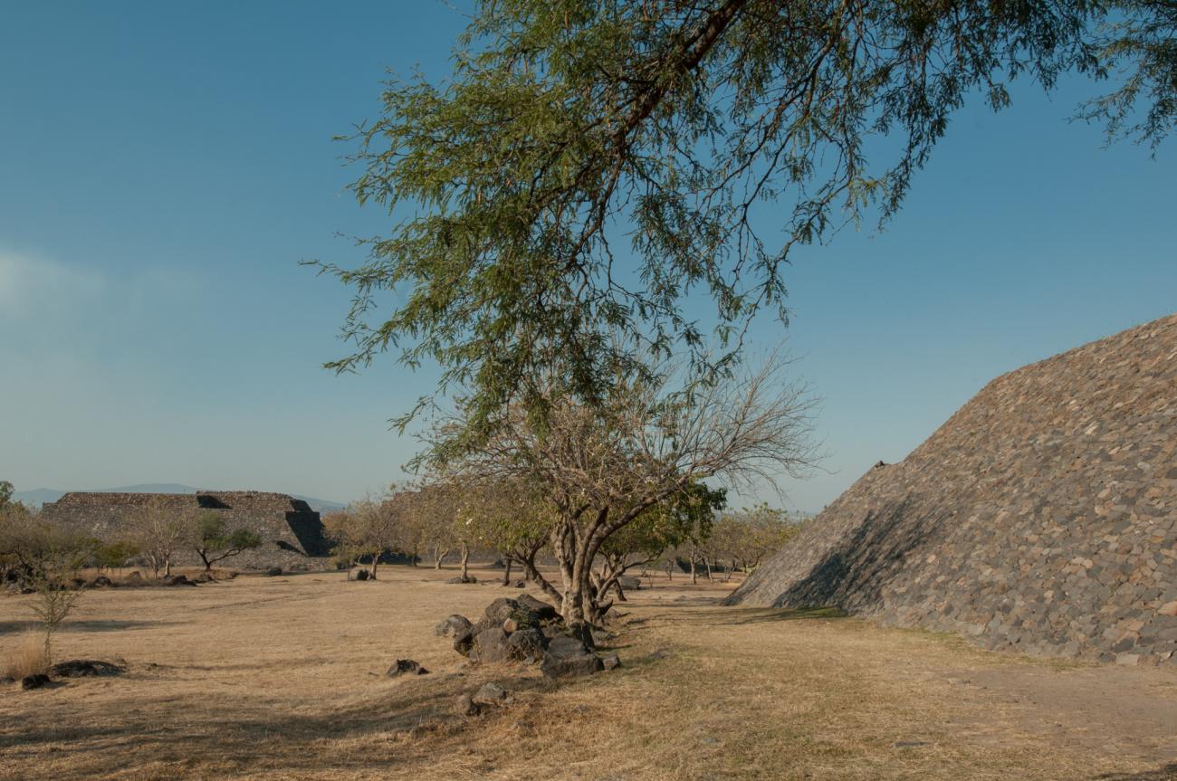
Peralta has more than 20 groups of structures. However, in the central area, El Divisadero (“The Lookout Point”) and La Mesita (“The Little Table”) stand out; both have been fully excavated. El Divisadero comprises a plaza which is marked out by two temples and a pathway leading to rooms. Remains of adobe walls can be seen above the foundations, whilst the closed square created an enclosed setting for ceremonial and ritual activities.
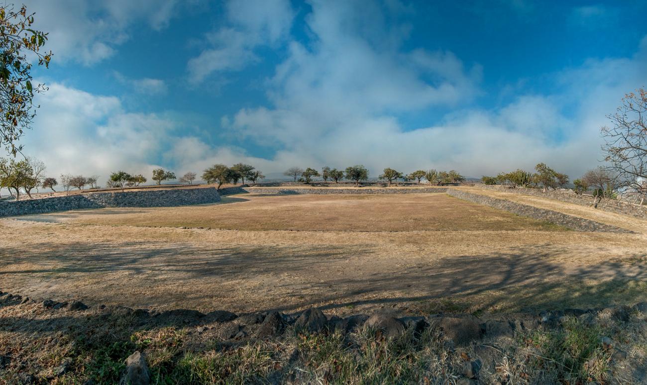
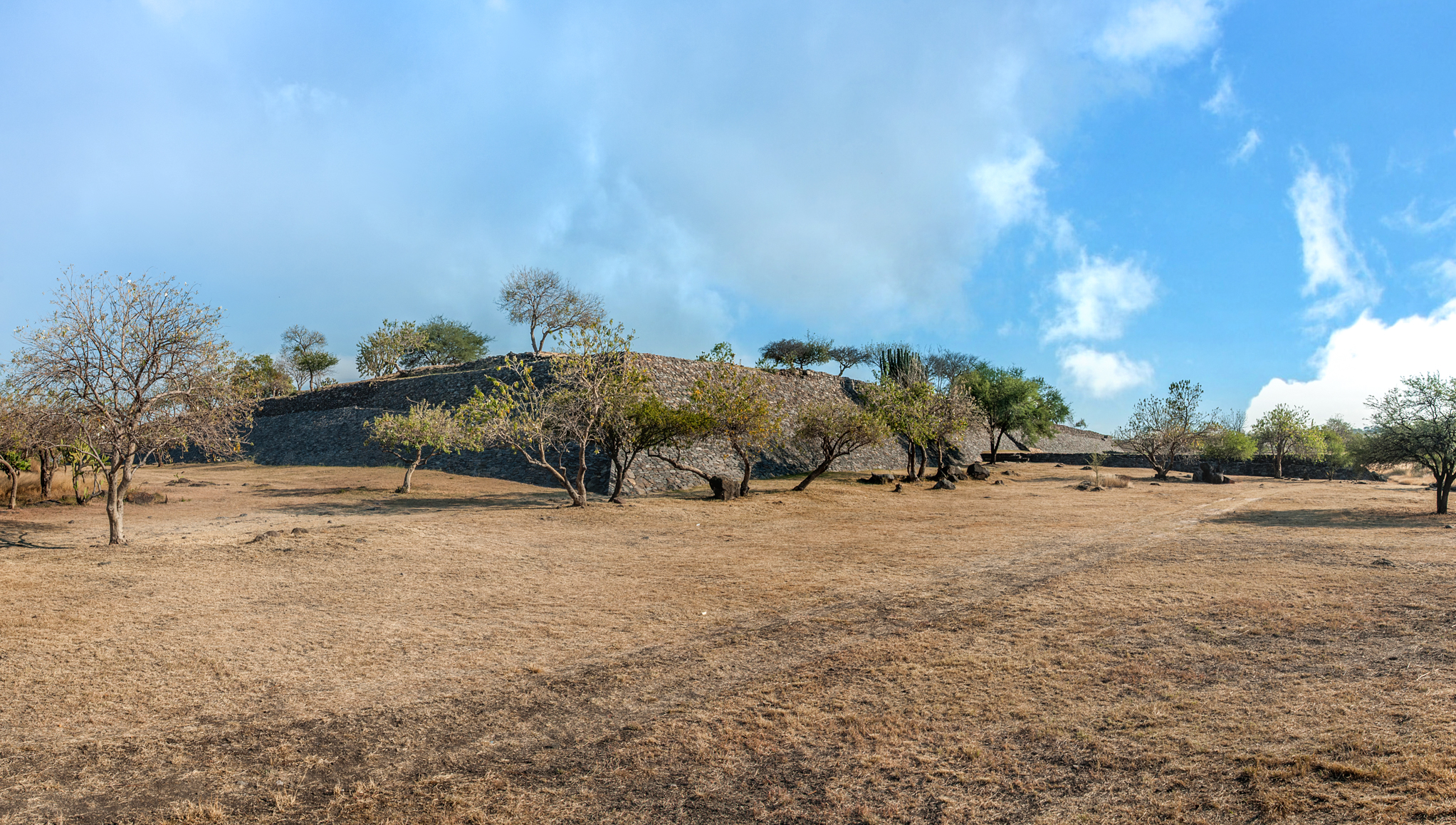
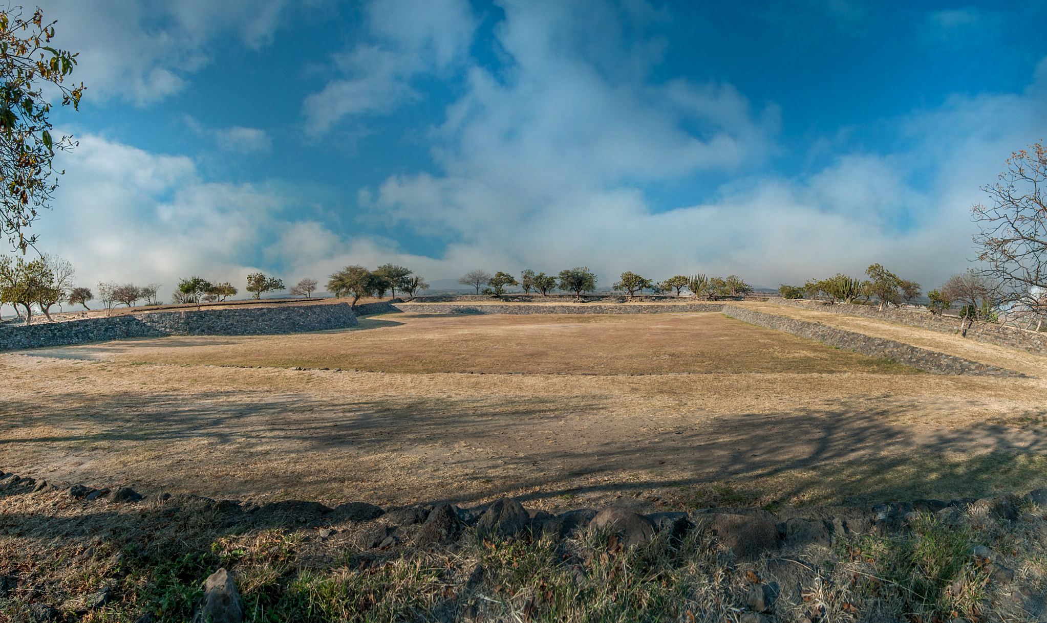
La Mesita, whose foundations measure almost 500 feet on each side, contains various architectural elements inside. The central courtyard is one example, where hundreds of people could come together, as well as a structure with a circular base, a tradition from outside the Bajío region. Interestingly, this feature is more closely linked to sites in the present-day state of Jalisco. Another architectural element worth mentioning is the rooms along the interior pathways on the northern and eastern sides of the structure, which functioned as residences for elite groups and, possibly, as storage areas.
The Cerrito de Celestino and Yóstiro archeological remains are also part of the site, but they are now embedded within the modern urban area and are not open to visitors. The domestic area is situated on the Peralta mountain, however, and is where daily work practices were carried out. These ruined complexes all stand on smaller plinths and have been given names such as La Joyita (“The Little Gem”), La Crucita (“The Little Cross”), El Fraile (“The Friar”), Los Nogales (“The Walnuts”), Los Corrales (“The Stockyards”), and La Tinaja (“The Clay Pot”).
In 2002, the INAH entrusted the archeological work in Peralta to Efraín Cárdenas García, who took on responsibility for extensively excavating and restoring the two main sites and opening them to the public in 2008. His investigation also intended to analyse Peralta’s location in relation to its neighbouring sites, both on a small scale and larger regional scale. He further sought to study the construction system, building use, the definition of the settlement pattern and record of the local variants within a regional context. He also studied the site’s flora and fauna.
In the archeological site’s museum it is possible to view objects which mark out Peralta as a society which actively participated in the exchange of goods with other groups from both near and far.
- Dirección del Centro INAHGuillermo González Leónguillermo_gonzalezleon@inah.gob.mx+52 (473) 733 0857
Zona arqueológica Peralta
Scattered from the top of the Peralta hill to the lowlands, occasionally flooded by the Lerma River, there are 20 architectural complexes, two of which are open to the public. The ethnic affiliation of its inhabitants remains an enigma.


Scattered from the top of the Peralta hill to the lowlands, occasionally flooded by the Lerma River, there are 20 architectural complexes, two of which are open to the public. The ethnic affiliation of its inhabitants remains an enigma.
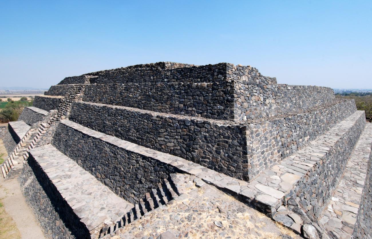
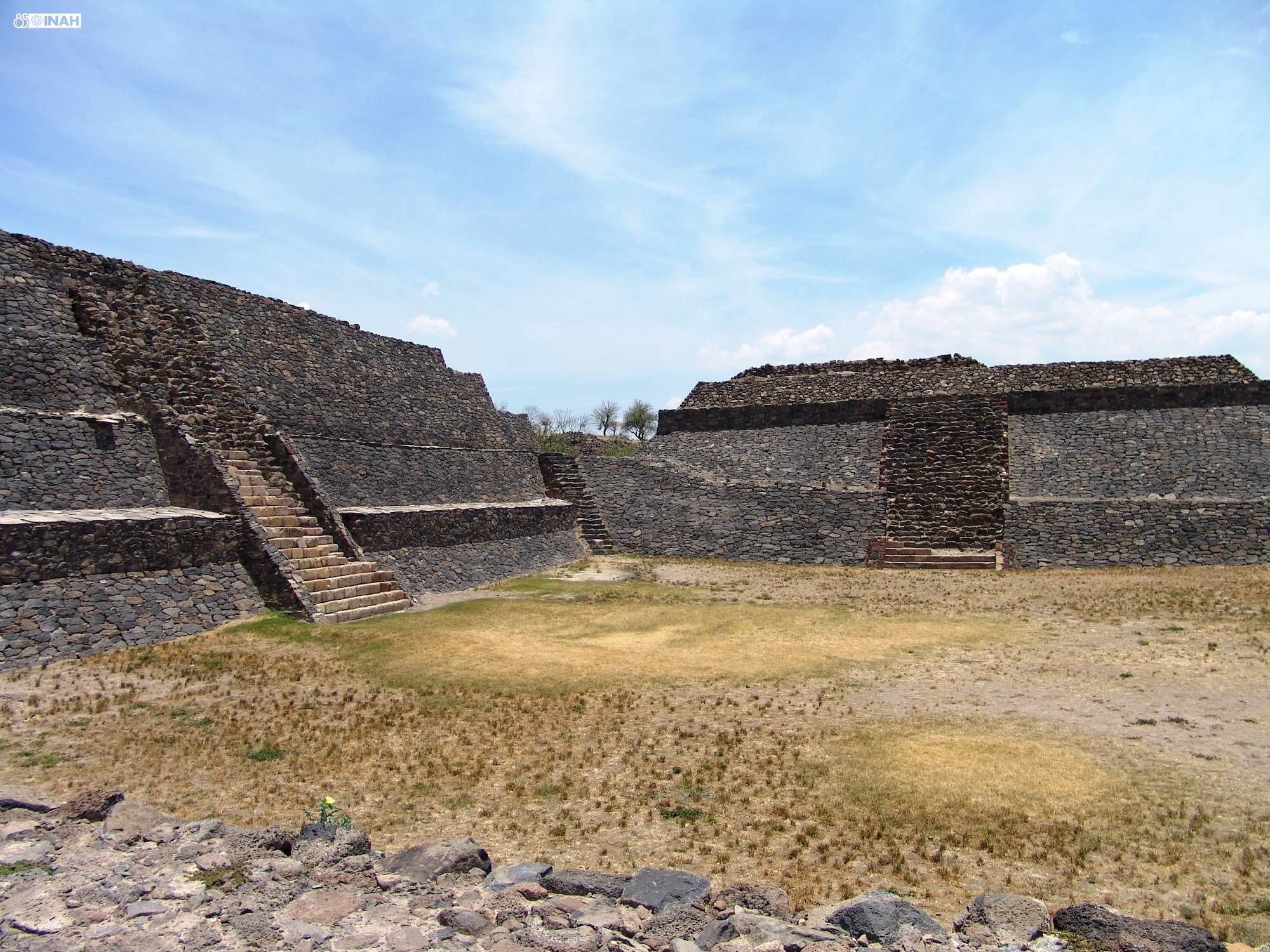
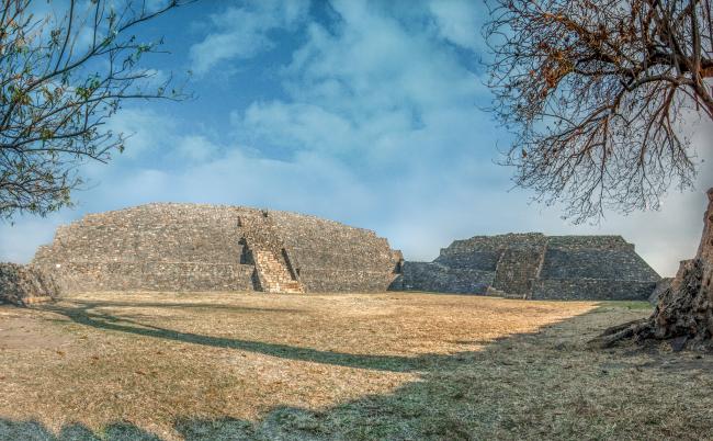
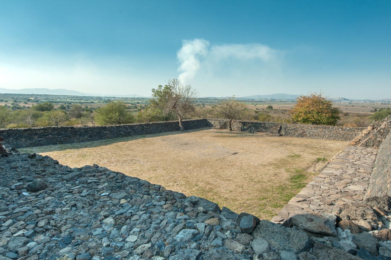
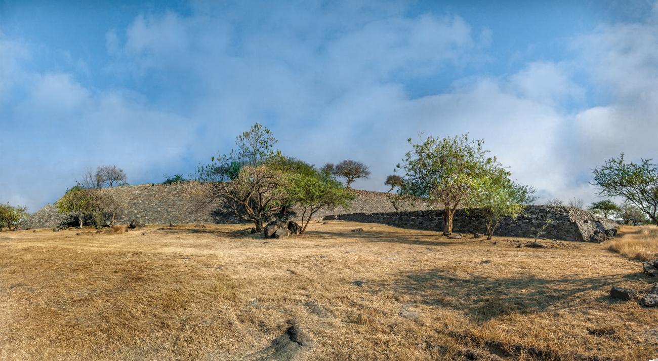
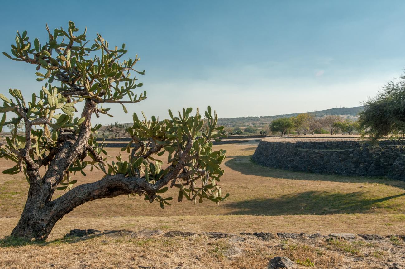
El Divisadero: It is located to the northwest of La Mesita and, with its double temple and sunken patio, is the most important ceremonial building of Peralta. It has a platform 85 m long by 79 m wide and was erected on a rocky outcrop, of which large fragments can still be seen in some parts of the building. The construction shows an interior plaza closed on the east and south sides by two pyramidal bases with an approximate height of 10 m each, and a long body traced at right angles on the remaining sides. In some parts it is evident that the building was enlarged at least once; in the center of the plaza the remains of a quadrangular altar were found.
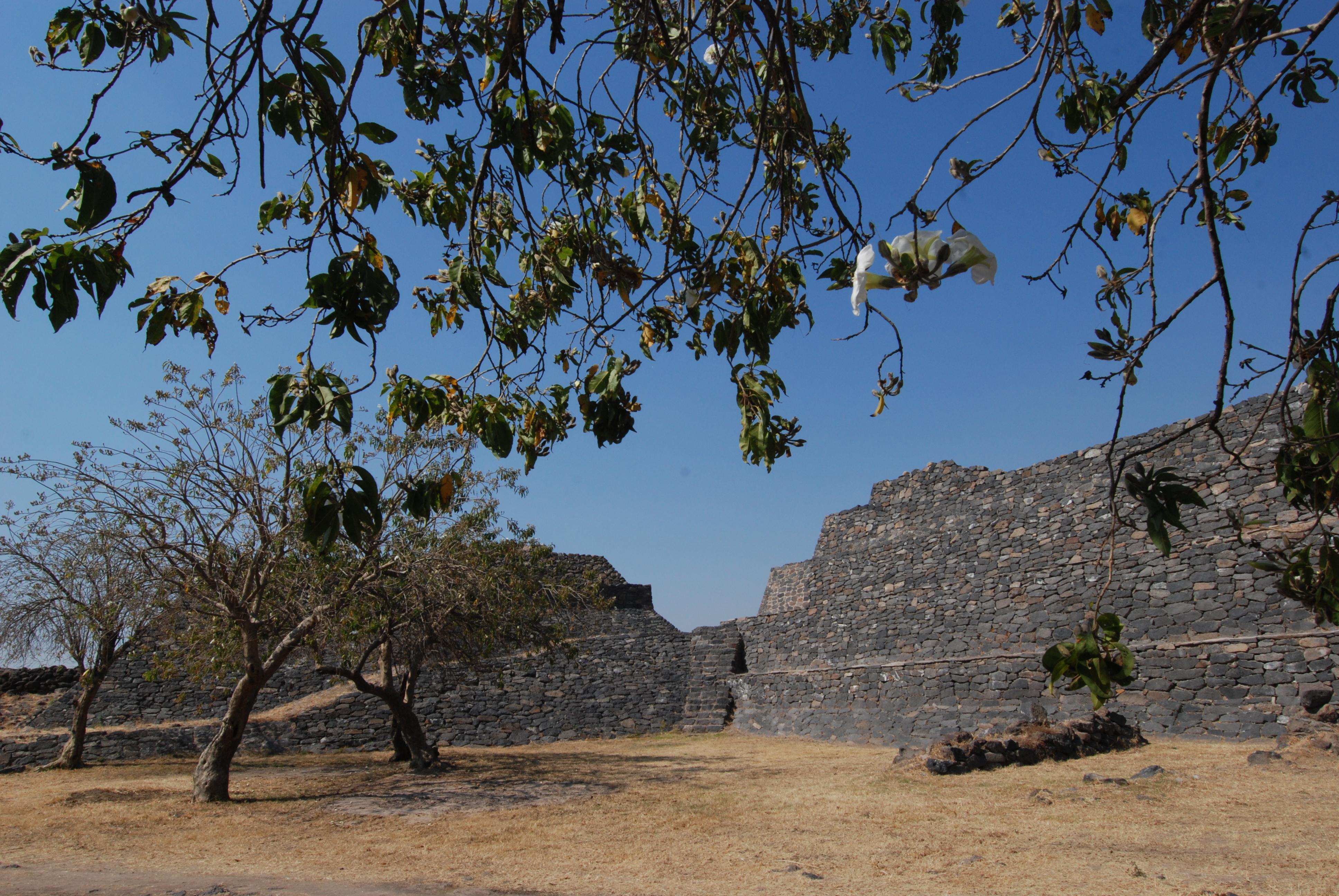
El Divisadero is entered by a simple stairway located on the north façade, which goes up and down on the perimeter body that closes the plaza. In the southeast corner, between the two foundations, there is another stairway without alfardas, made with rough basalt blocks, which breaks the symmetry of the building.
Courtyard: Sunken courtyard in the dividing wall.
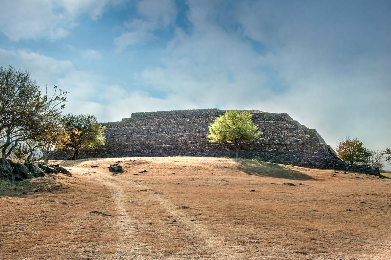
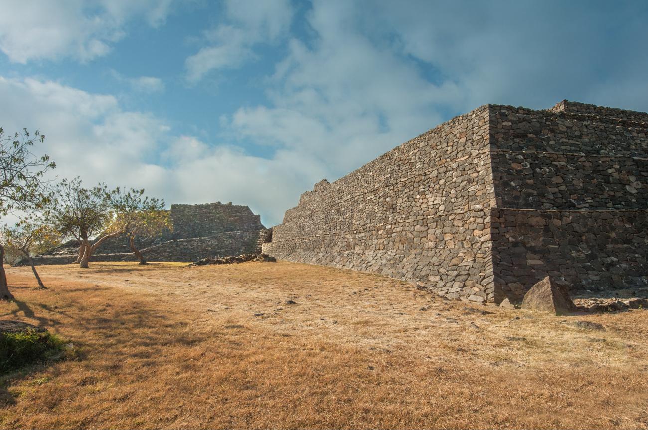
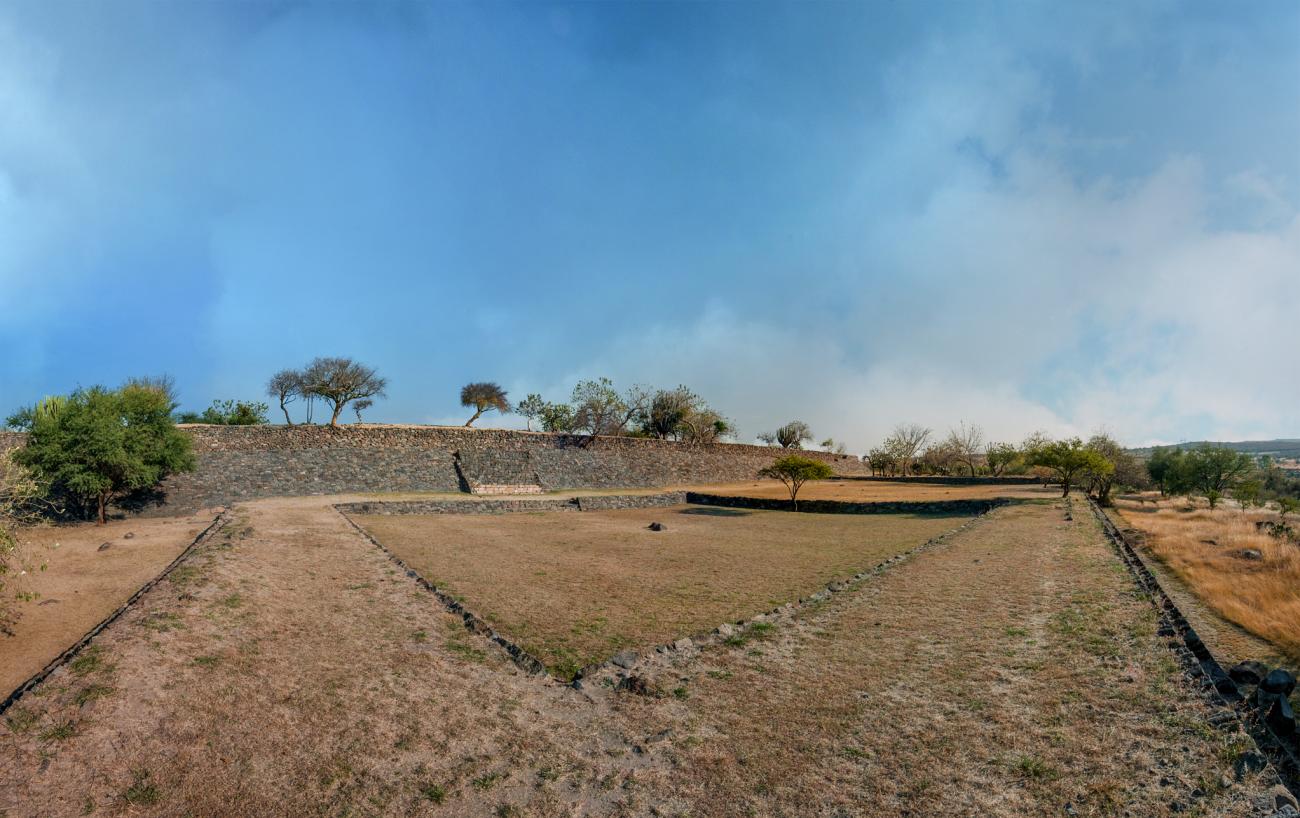
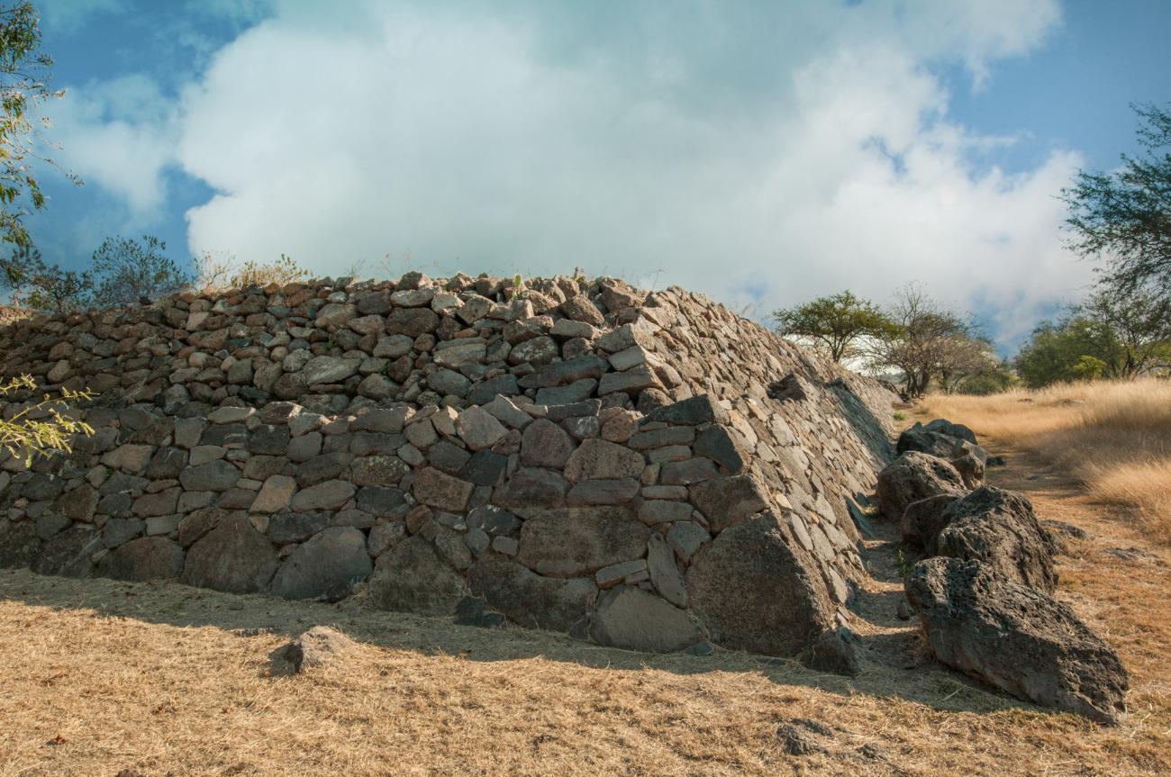
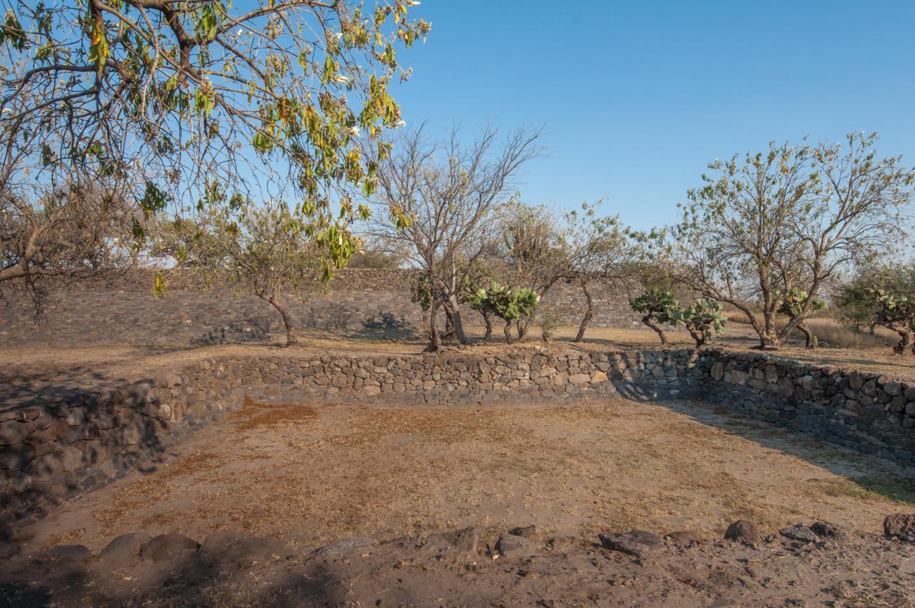
South Basement: Also known as the Enclosure of the Rulers, it is one of the most outstanding complexes of Peralta due to its large dimensions. It is a rectangular platform 147 m long by 130 m wide and 12 m high, with an immense interior plaza. In the upper body, adobe walls and traces of earthen floors were found, which suggests that they were interconnected rooms dedicated to administrative functions, while the lower body must have been a long corridor. It is thought that the life of the community was governed from this palatial building.
La Mesita has two entrances: a staircase composed of yellow quarry blocks -contrasting with the dark basalt of the alfarda- in the center of the west façade, and a discreet corridor in the center of the south façade.
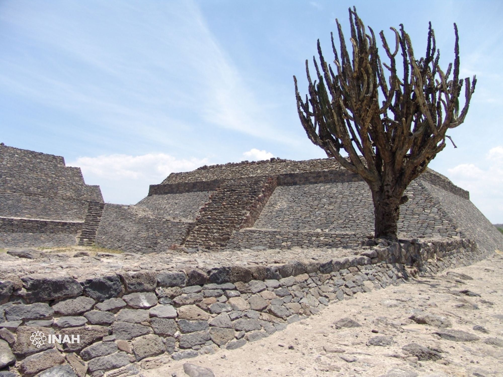
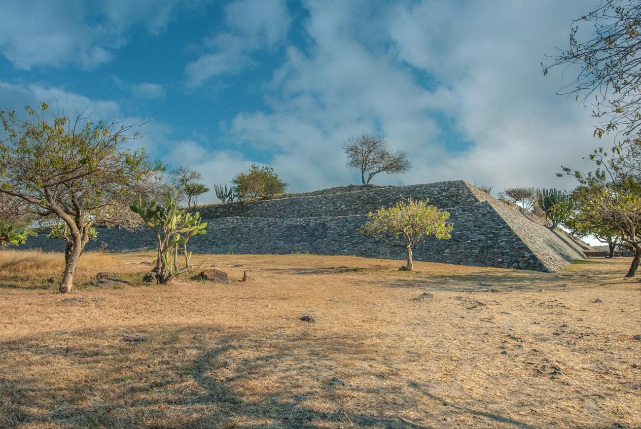
South and east basements: East and south basements taken from the courtyard of the divisadero.
South and east basements: Northwest corner of La Mesita, start of La Plaza is observed.
Northwest corner of La Mesita: Corner of the Plaza to the west of La Mesita.
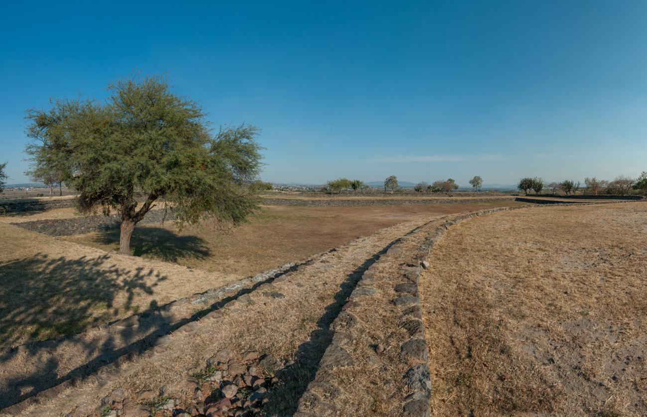
La Mesita: Plaza inside La Mesita, taken from the north. To the right circular structure.
Plaza: Plaza with circular structure taken from the north.
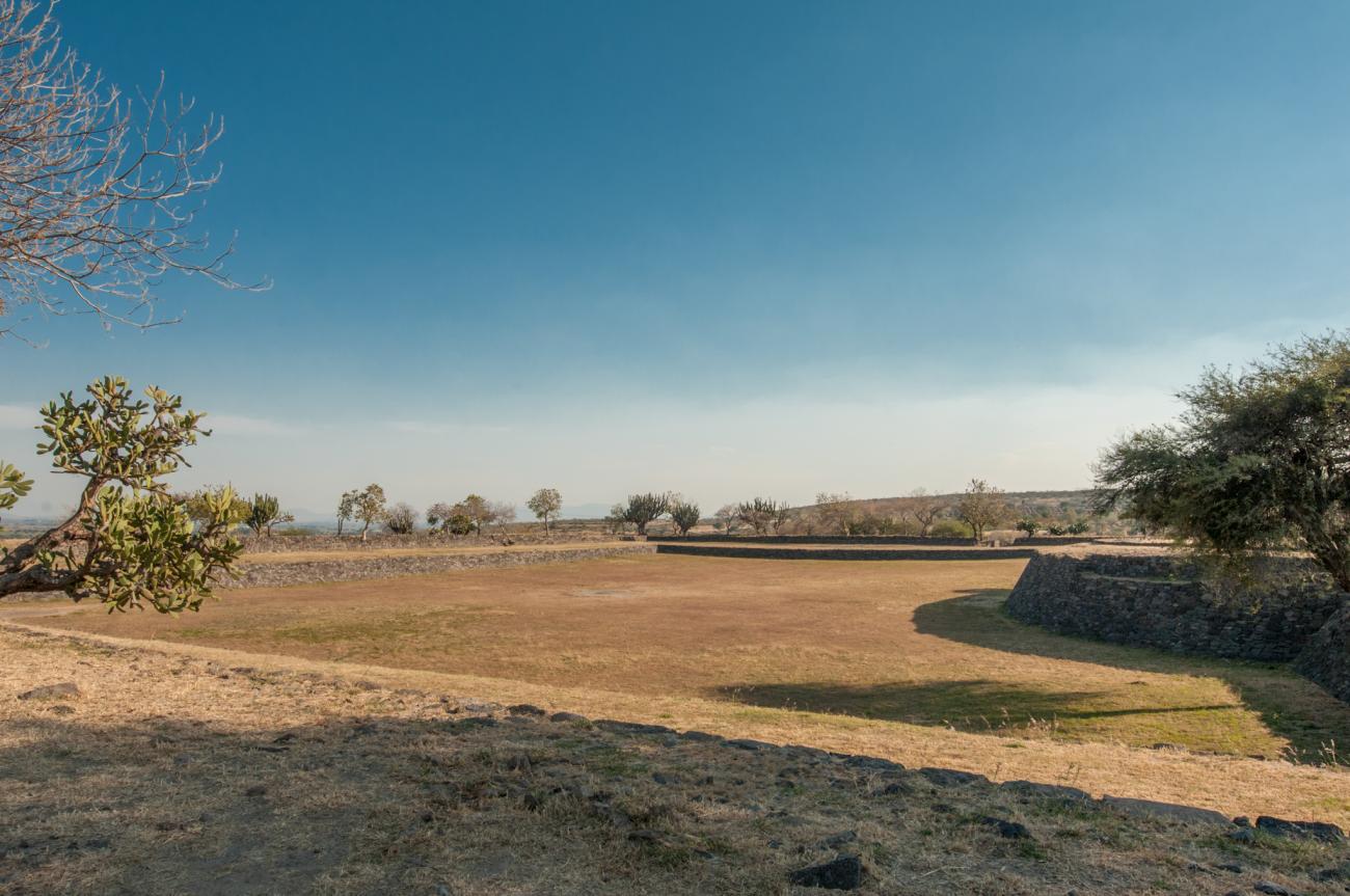
La Mesita: Plaza exterior to the west of the plateau.
Plaza exterior: Plaza exterior to the west of the plateau.