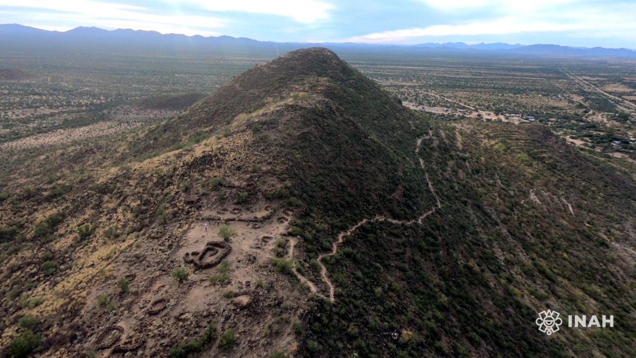
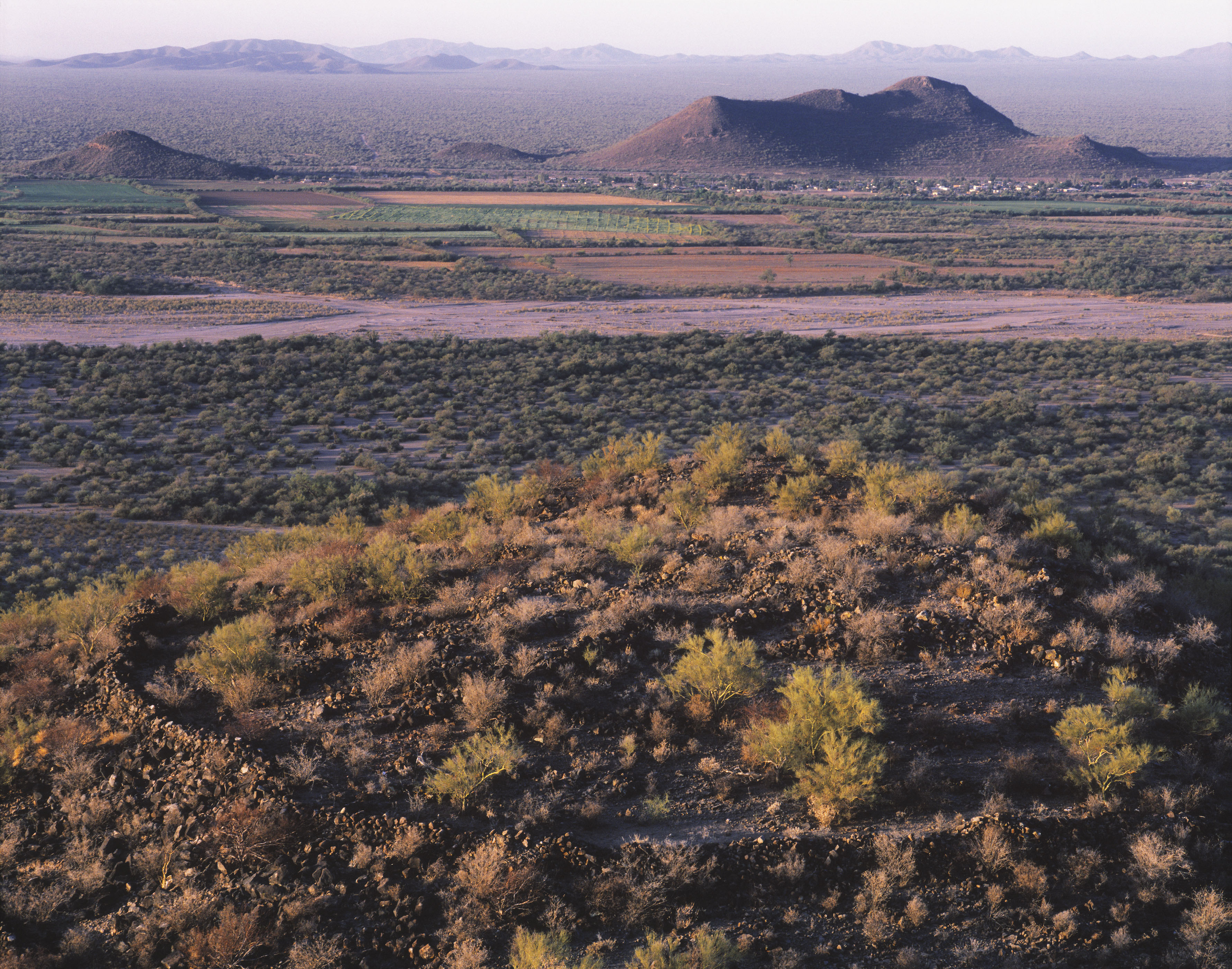


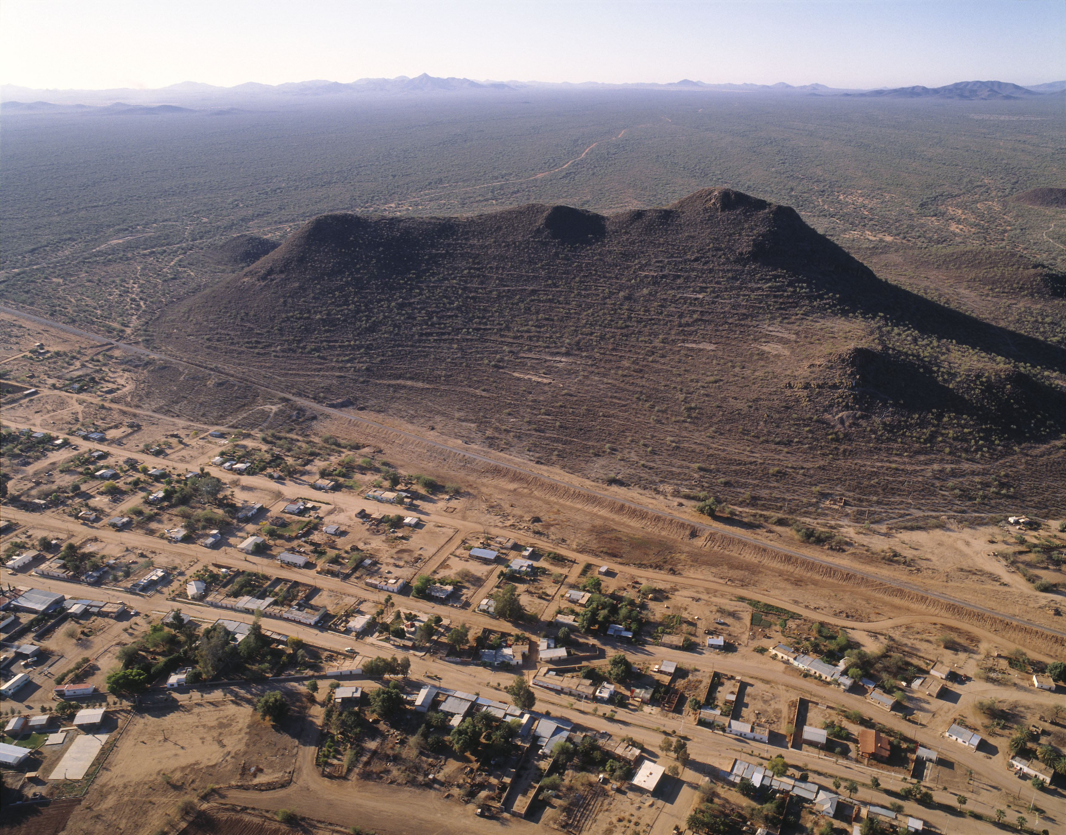


Cerro de Trincheras
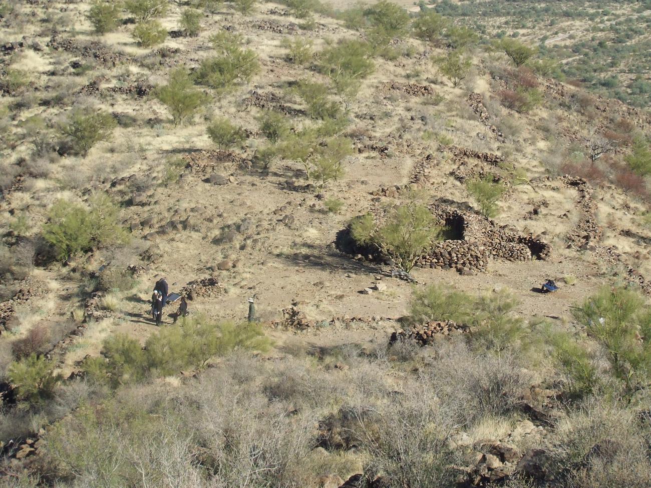
Twelve centuries ago, a mountain enabled a thousand farmers, craftsmen and leaders to establish a city in the Sonora desert. They levelled out more than 900 hillside terraces, raised walls of river stones, built a plaza on the peak and marked out a shell form. Its traces still remain.
The American continent’s first settlers arrived to the modern-day territory of Sonora 13,000 years ago. When the Sonora desert formed 10,000 years ago, these hunters and gatherers adapted to its conditions and enriched their diet with the desert plants. The region’s natural richness allowed this archaic way of life to endure for several millennia.
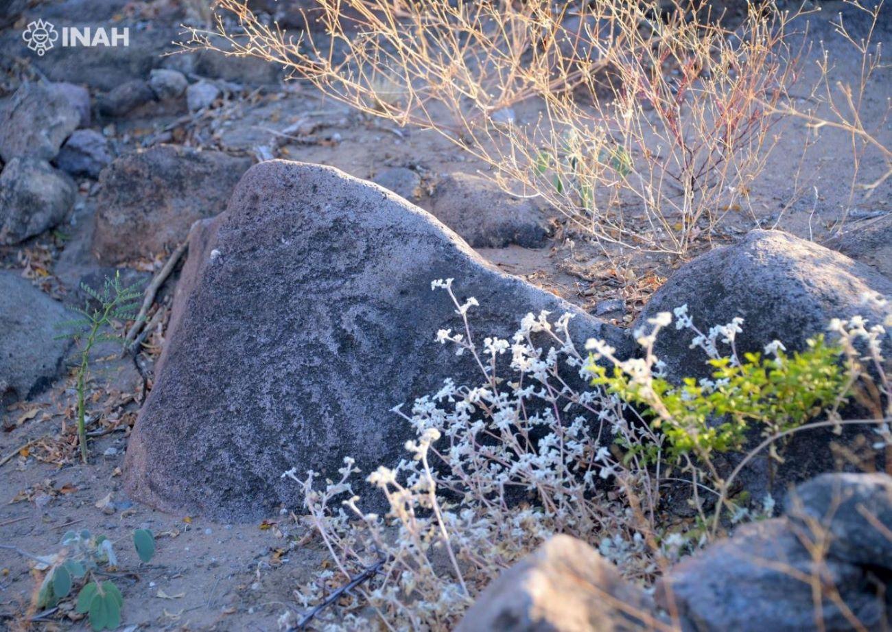
Approximately 3,500 years ago, the settlers learned how to cultivate maize and used canals for irrigation. The care required for farming led to the emergence of the first permanent settlements or villages. These had common cultural characteristics such as the production of purple-on-red pottery, the construction of walls or “pens” on the peak of some hills and building terraces or “trenches” on the hillsides. As a result, these villages are known as belonging to the “Trenchiras” tradition.
Seven hundred years ago, the site became the governing center of the farming villages scattered around the valleys of the Magdalena, Altar and Concepción rivers. It was home to a population of more than 1,000 inhabitants from 1300 to 1450. When controlling the valleys from this town became impossible, the communities went back to living in isolated villages.
In this pre-Hispanic settlement, stone-walled terraces were built. They were used to build houses and shelters by the ancient inhabitants, where they carried out all of their daily activities. They also had areas dedicated to certain activities. Some were used for public or communal ceremonies and others for private rituals, exclusively for certain groups or the head family.
- Dirección del Centro INAHZenón Humberto Tiburcio Robleszenon_tiburcio@inah.gob.mx+52 (662) 212 6364Jefe de la Zona ArqueológicaSergio Adrián López Dávilasergio_lopezdv@inah.gob.mx+52 (641) 325 6018Administración del Centro INAHAnabell Hernández Bedollaanabell_hernandezb@inah.gob.mx+52 (662) 212 6364
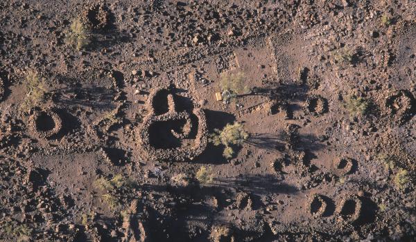
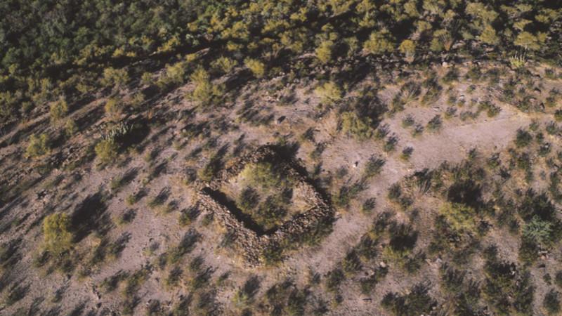
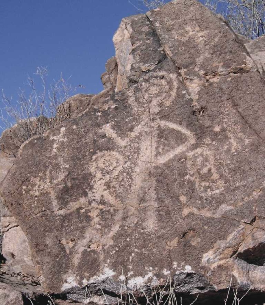
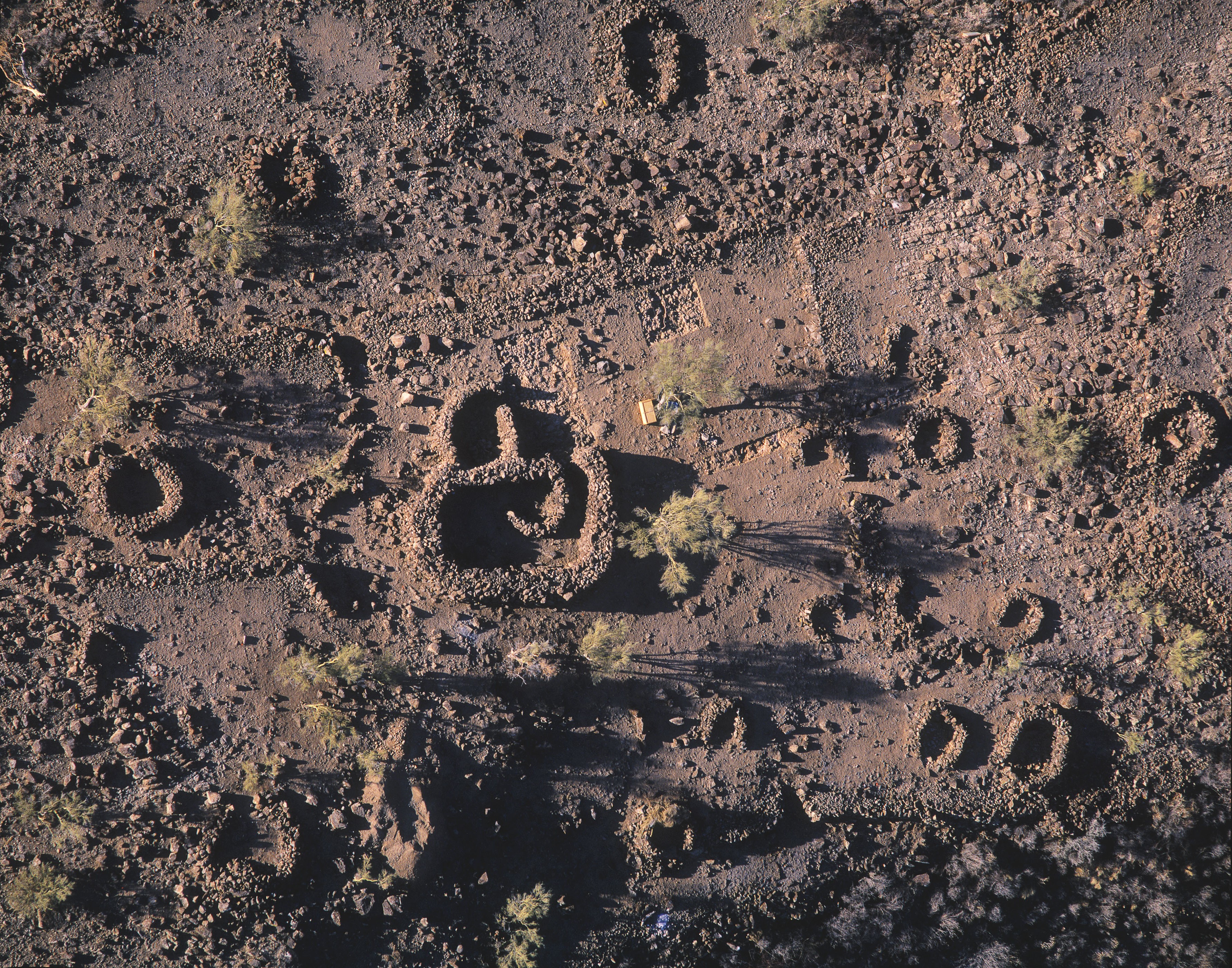
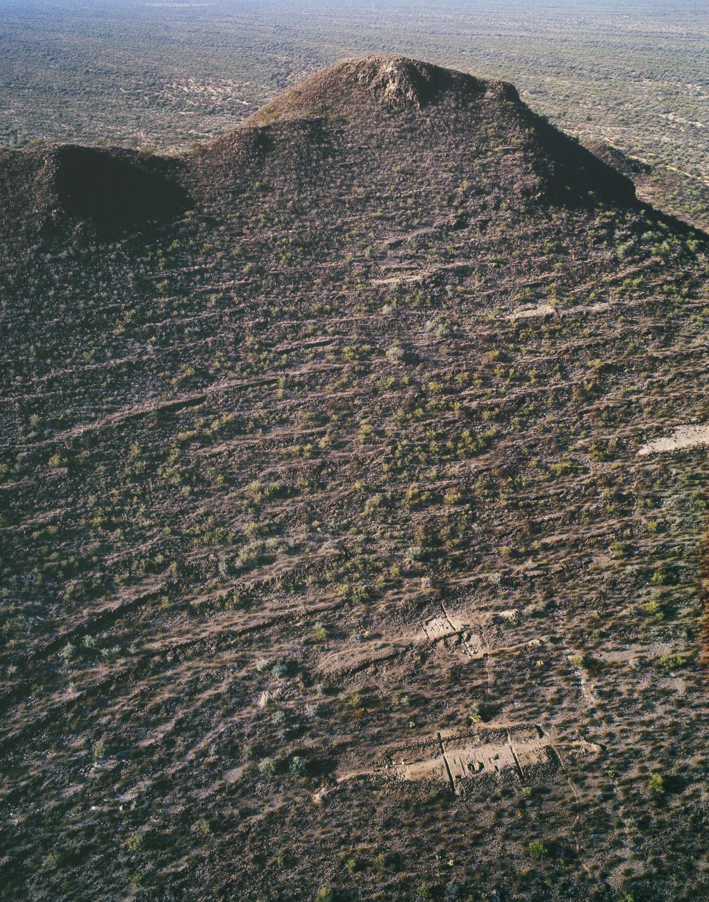
Plaza de El Caracol
It owes its name to the central architectural structure that stands out among the other twenty circular elements found on the summit. The restricted access and its location indicate that the activities developed there did not involve the entire community of Cerro de Trincheras.
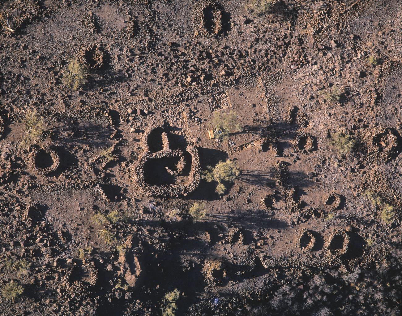

It owes its name to the central architectural structure that stands out among the other twenty circular elements found on the summit. The restricted access and its location indicate that the activities developed there did not involve the entire community of Cerro de Trincheras. At the top of the peaks, to the west, archaeologists located two “V” shaped structures that point to the sunrise on the summer and winter solstices, important markers for the farming communities of northern Mexico.
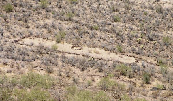
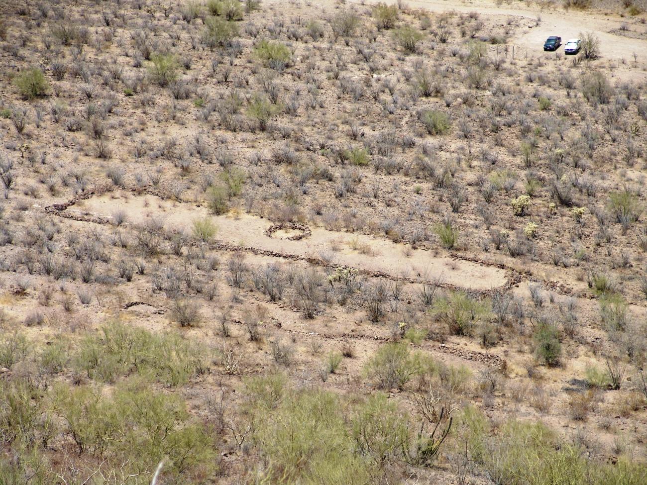
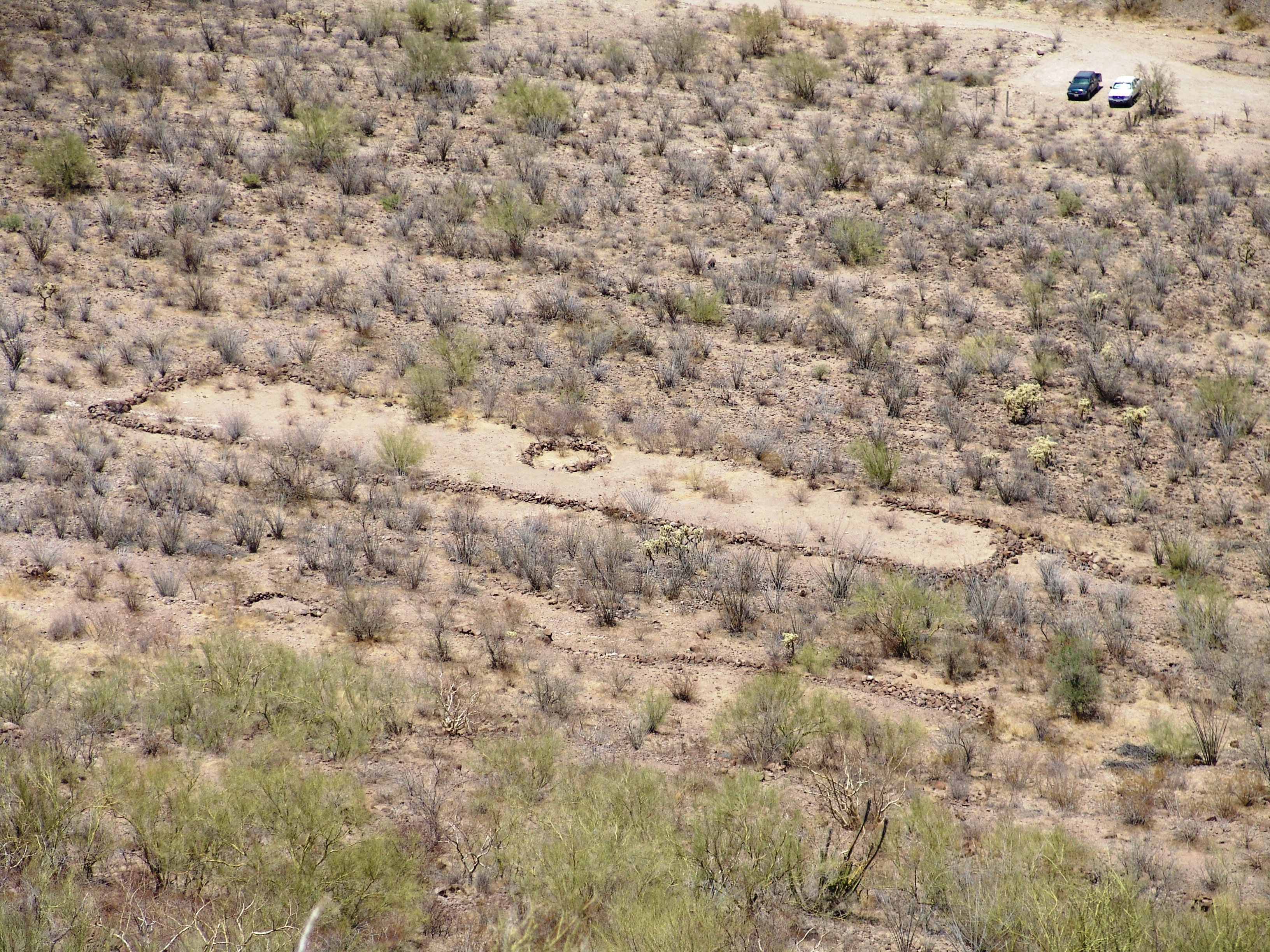
La Cancha
“La Cancha” is the current name given to the ceremonial community space of the ancient inhabitants of Cerro de Trincheras. It occupies a predominant location on the northern slope of the settlement.


“La Cancha” is the current name given to the ceremonial community space of the ancient inhabitants of Cerro de Trincheras. It occupies a predominant location on the northern slope of the settlement. It could have been used for dances and in the circular structure could have been placed the musicians or singers, as it happens in the current ceremonies carried out by the indigenous groups of the north of Mexico. This structure was never roofed.