


San Felipe de los Alzati
An important control point for protection of the Purépecha territory at the border with the Mexicas, populated by the Otomies, their allies, situated on top of the Zirahuatohill and adjoining mountains. Elegant remains of their constructions in the midst of a natural green area.
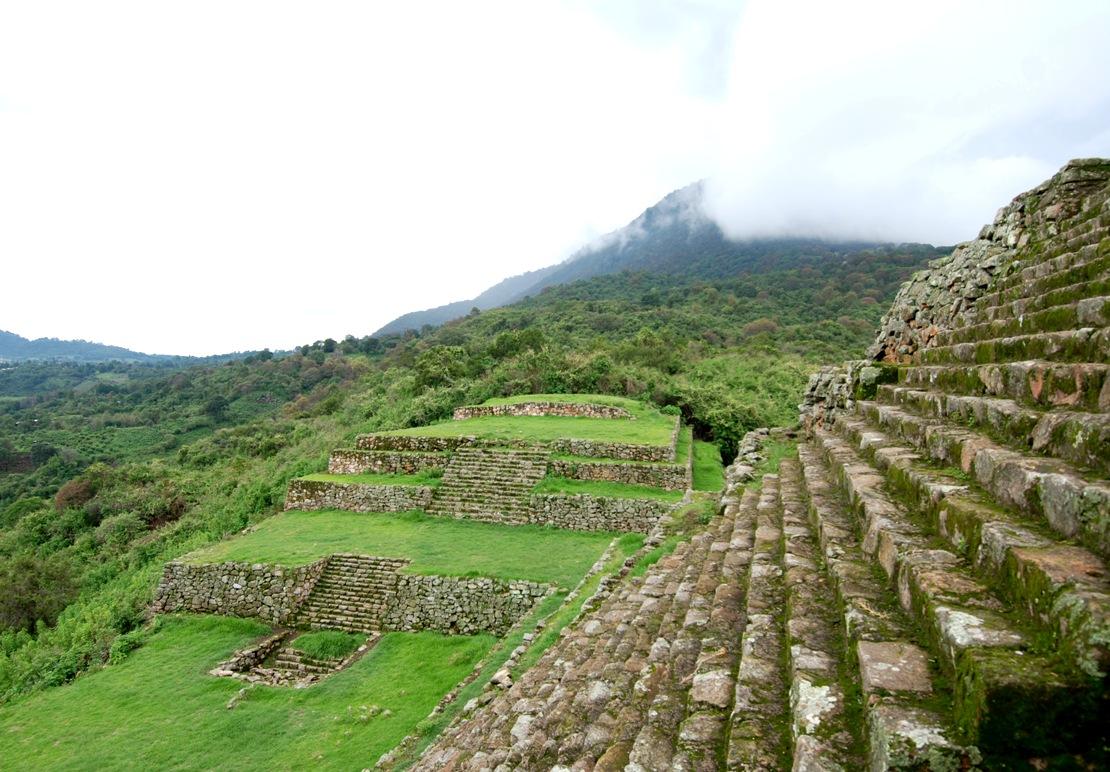
Flourished from the eighth to fifteenth centuries of the current era and formed part of the same culture that settled in the Valley of Toluca, that of the Matlatzinca. Historical sources, including the Historia Antigua de México (Ancient History of Mexico) by the Jesuit Francisco Javier Clavijero, mention that this region was occupied by the aforementioned group, and the field of archeology has confirmed this. For this reason, the site does not display the architectural features typical of the Tarascan area seen in places such as Tzintzuntzan or Ihuatzio. Here, there is a lack of mixed-plan structures, and there are pyramids built in superimposed sections which have stairways in the middle leading to plazas at different levels.
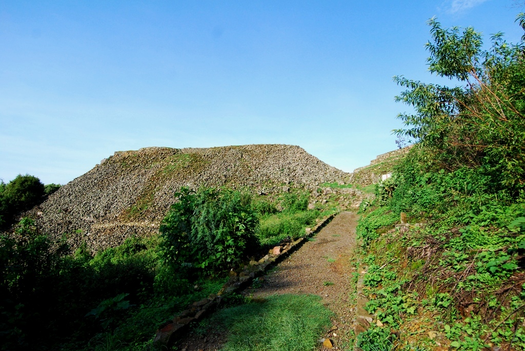
At the height of its splendor, this archeological zone occupied a surface area of 128 acres that extended beyond the area now open to visitors, which makes it the most important zone in the east of the state of Michoacán found to date, besides being the only National Institute of Anthropology and History (INAH) site open to the public in this area. Its geographic location was significant at the time in pre-Hispanic Mesoamerica.
The site has two names, as the land it lies on belongs to two communities. One is Zirahuato, which means “cold hill” in Tarascan, and the other is San Felipe Calvario. However, it became popular to add the surnames of certain local heroes to indigenous or colonial names at the end of the nineteenth century. Therefore, the first is known as Zirahuato de los Bernal (after Félix and Arturo Bernal) and San Felipe lost Calvario to become San Felipe de los Alzati in honor of José María, Marcos and Darío Alzati, figures who fought heroically for the Republican cause during the time of Maximilian’s empire. The Alzati were from the district of Zitácuaro. Colonel José María Alzati was General Vicente Riva Palacio’s right-hand man and fought alongside his brothers for the Republic until winning victory.
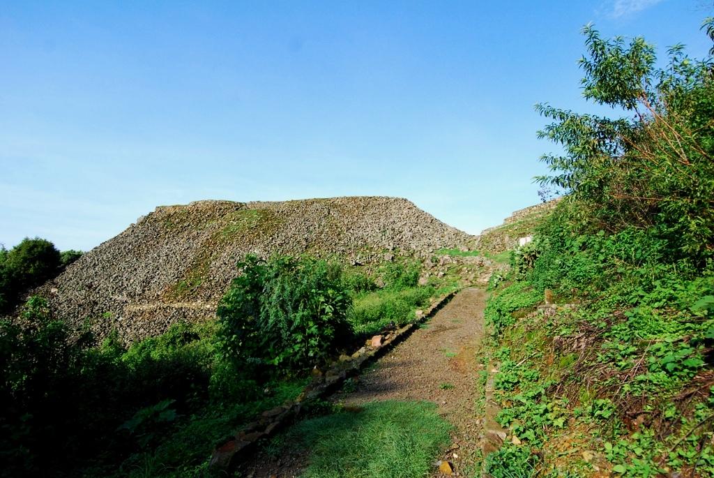
The mounds that have not yet been explored suggest the existence of a ballcourt, as well as buildings such as palaces and residential areas. A first archeological exploration of the site occurred in 1963, when Román Piña Chan responded to a report of looting at the top of the north face. Formal exploration began in 1973 under the guidance of archeologists Otto Schöndube Baumbach, Ramón Carrasco and Estela Peña Delgado. Archeological and ethnohistoric research has enabled us to locate four architectural complexes to date, of which two have been exposed: the Great Pyramid and the residential area.
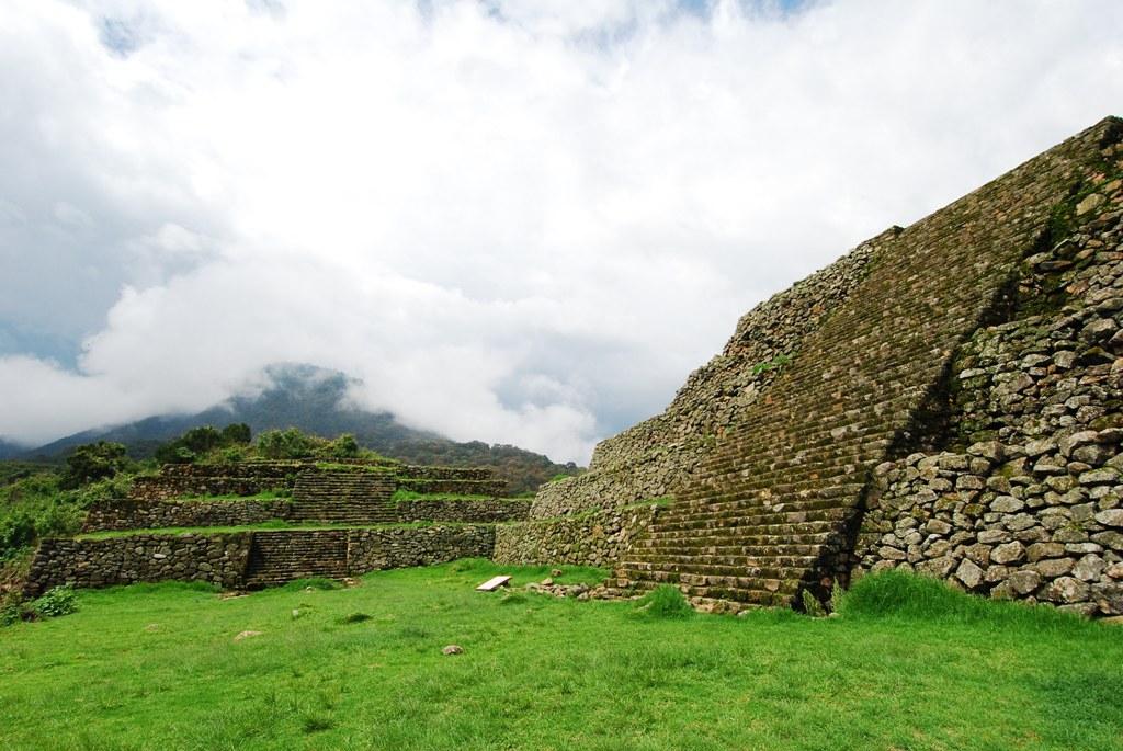
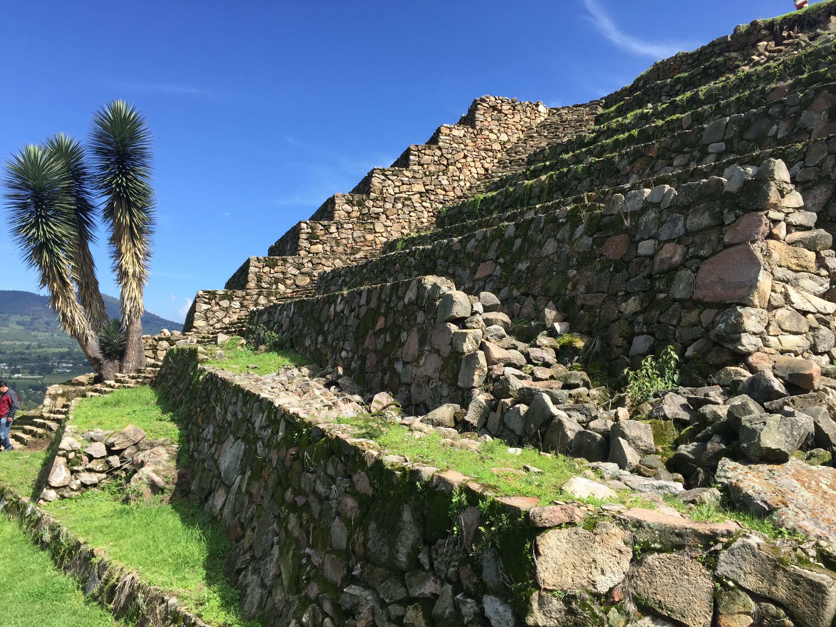
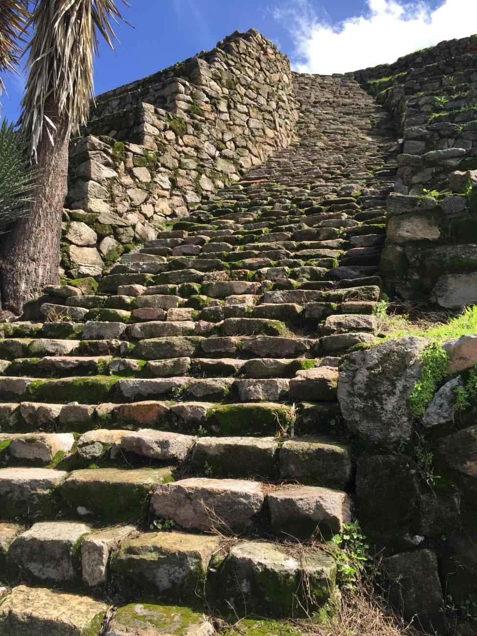
The ceremonial center lies at the foot of the Zirahuato volcano. The lowest part of the hill is 6,332 feet and the highest is 6,889 feet above sea level. Advantage was taken of the terrain’s topographical features when building the site, as its structures stand upon a natural elevation artificially modified through retaining walls. The material used was volcanic stone. Flat stones were placed on the outside, and carved rocks were used for the stairs and some corners.
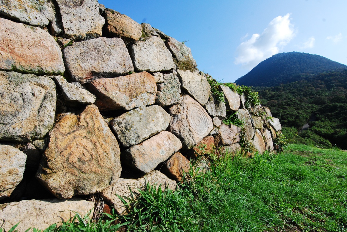
Petroglyphs can be seen throughout the archeological site. A recurring shape in these is the spiral, which can also be observed on some faces of the main pyramid. It is believed to symbolize observation of the sun’s movement. There is also a hieroglyphic symbol which represents Tezcatlipoca, the great lord of sky and earth, a significant deity in Mexica society.
- Dirección del Centro INAHMarco Antonio Rodríguez Espinosamarcoa_rodriguez@inah.gob.mx+52 (443) 313 2650
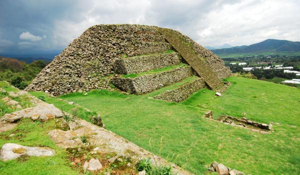
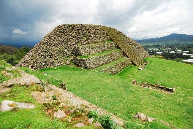
Pirámide Mayor
It is so far the tallest structure found in the current state of Michoacán.
North face: It stands on a large base of staggered bodies with four faces. Archaeological evidence suggests that in its upper part there was a temple built with perishable materials.


It is so far the tallest structure found in the current state of Michoacán.
North face: It stands on a large base of staggered bodies with four faces. Archaeological evidence suggests that in its upper part there was a temple built with perishable materials.
South face: It is also constituted by staggered bodies; a collapse in the southeast left exposed a stairway that corresponds to a substructure. Recent explorations have allowed its partial restoration.
East face: It is the least prominent face, by virtue of the fact that it adapts to the natural shape of the terrain on which it slumps.
West face: It is the best preserved face of the structure. It has six superimposed bodies and a stairway. Attached to this face is a plaza and to the north of it is located another base of smaller dimensions, known as Pyramid Minor, which has three bodies and a staircase. In its upper part there must have also been a temple of perishable materials.