

Ruta Puuc
It was a Late Classic Maya regional system adapted to an environment lacking surface water, where the development of technologies such as chultunes made it possible to sustain complex societies with what was likely a decentralized organization. Its architecture, characterized by elaborate mosaics and the presence of the god Chaac, reflects a worldview linked to water, fertility, and power, while elements such as the sacbeob demonstrate networks of economic and ritual integration.
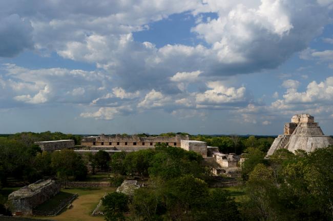
It constitutes one of the most complex and revealing cultural landscapes of the pre-Hispanic Mayan world. It is located in the southern part of the modern-day state of Yucatán, within a distinct ecological region characterized by low hills and the almost complete absence of surface water sources. This environment profoundly shaped the social, economic, symbolic, and technological organization of the societies that inhabited cities such as Uxmal, Kabah, Sayil, Xlapak, and Labná.
From an anthropological perspective, the Puuc region cannot be understood solely as a collection of archaeological sites, but rather as a cohesive regional system that reached its peak during the Late Classic period (ca. 600–900 CE), in parallel with other major Mesoamerican centers such as Chichén Itzá. However, unlike these better-known centers, the Puuc cities appear to have operated under a less centralized political logic, possibly organized into multiple interdependent entities that shared architectural styles, trade networks, and ritual practices, without necessarily constituting a unified empire.
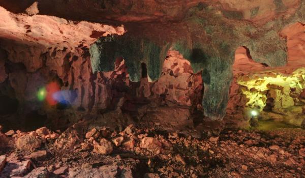
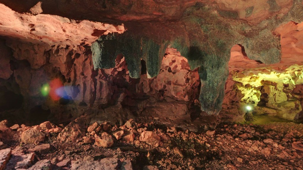
One of the most significant aspects for anthropology is the way in which the environment shaped culture. The absence of visible cenotes forced the inhabitants to develop sophisticated hydraulic systems, such as chultunes—cisterns carved into the limestone to collect and store rainwater. This not only implies advanced technical knowledge but also a social organization capable of planning, building, and maintaining community infrastructure. Control over water was likely linked to political and religious power, making it a strategic resource both materially and symbolically.
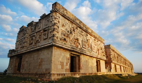
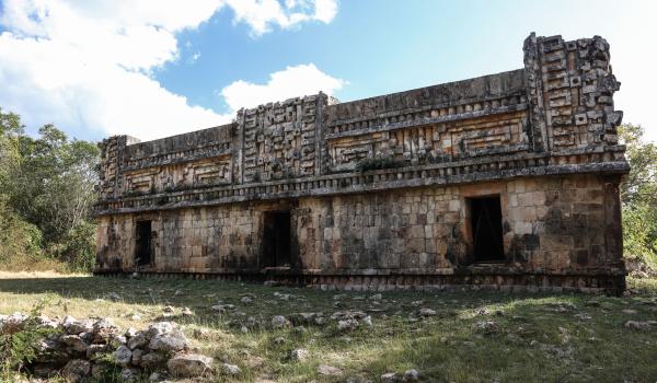
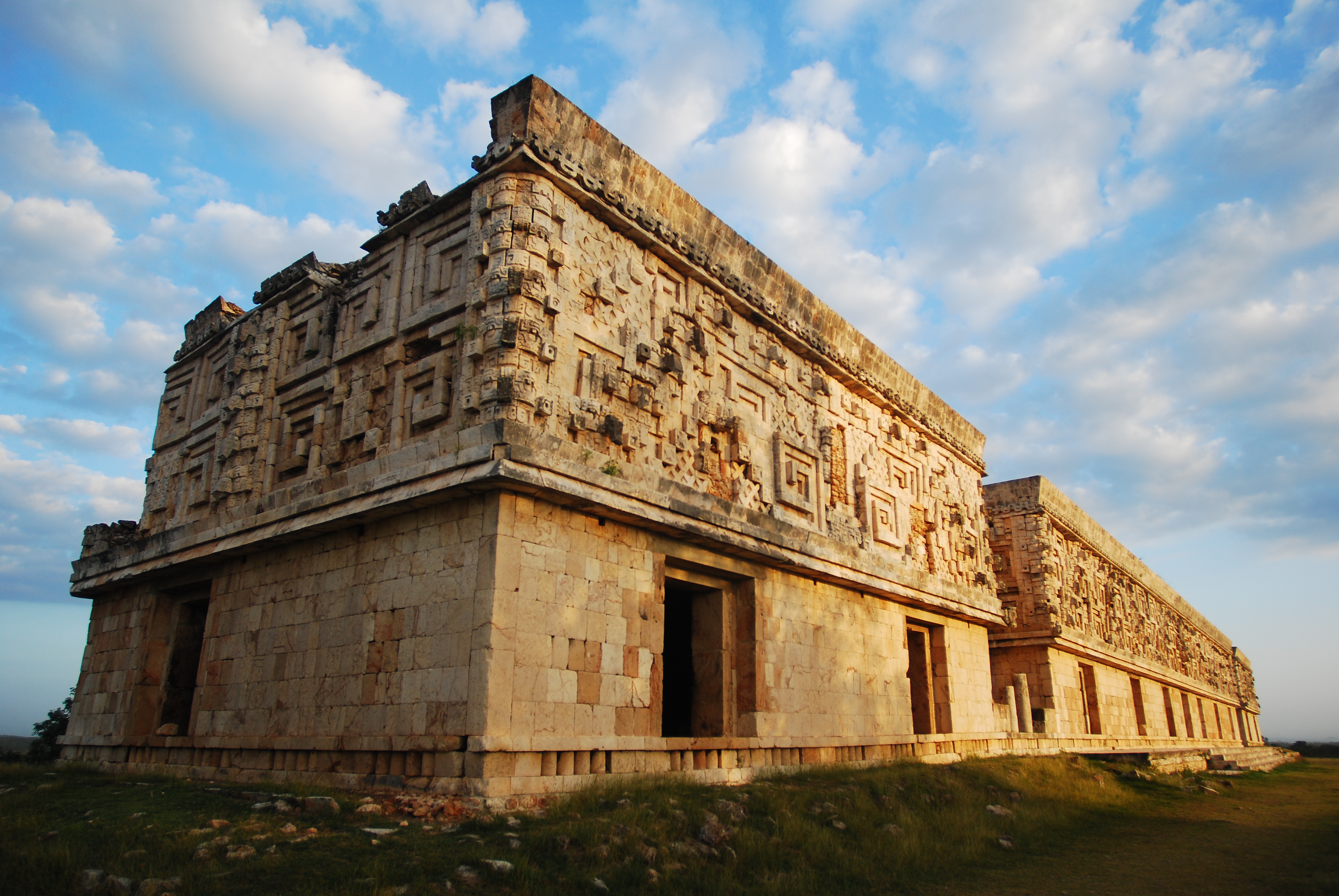
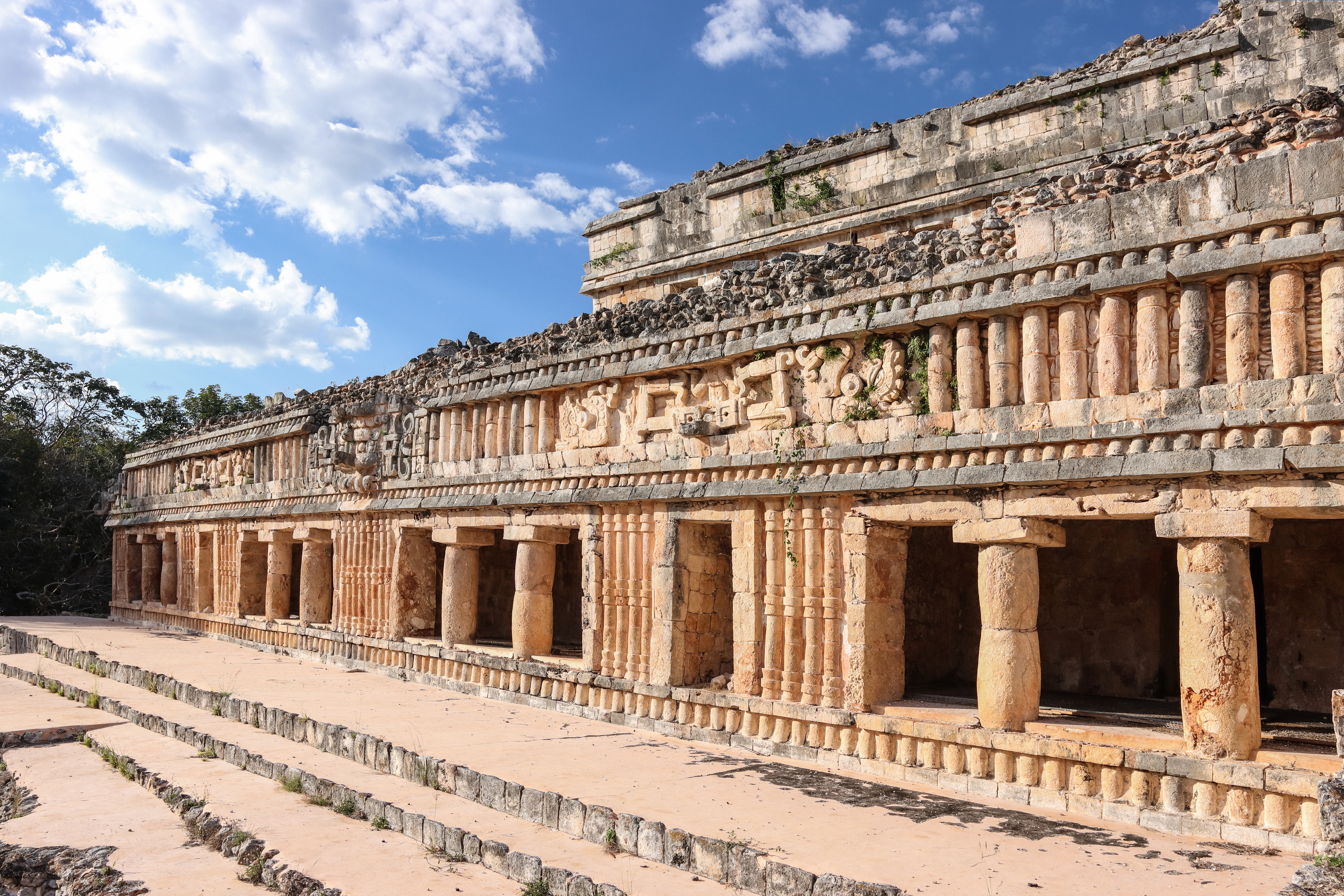
In this context, Puuc architecture takes on a significance that goes beyond the aesthetic. The richly decorated facades, especially at the top of the buildings, feature complex stone mosaics with geometric patterns and repeated depictions of the god Chaac, a deity associated with rain. These images were not merely ornamental: they functioned as visible expressions of a worldview in which fertility, the agricultural cycle, and divine intervention were deeply intertwined. The recurrence of Chaac can be interpreted as a manifestation of environmental anxiety in the face of water scarcity, as well as a form of legitimizing power through the symbolic control of natural elements.
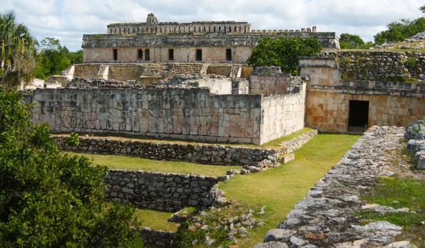
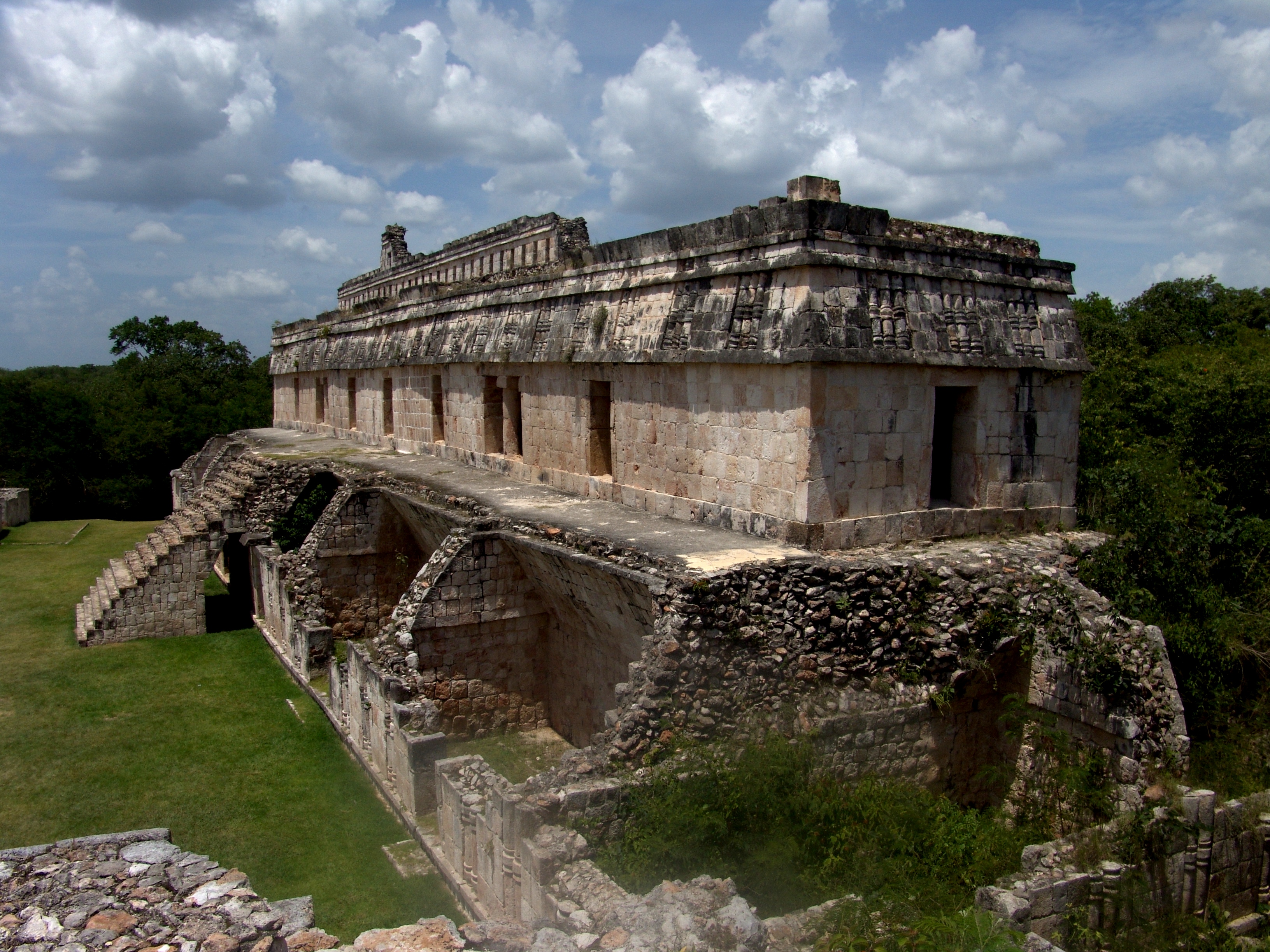
The cities along the Puuc Route also reflect a clear social divide. Structures such as the Nun’s Quadrangle in Uxmal or the Great Palace of Sayil suggest the existence of ruling elites who concentrated political, religious, and economic power. These elites inhabited elevated, ornate architectural complexes, while the common people likely resided in simpler structures, which are less visible in the archaeological record today. This pattern indicates a stratified society, with well-defined hierarchies and mechanisms of ideological control based on ritual, architecture, and access to key resources.
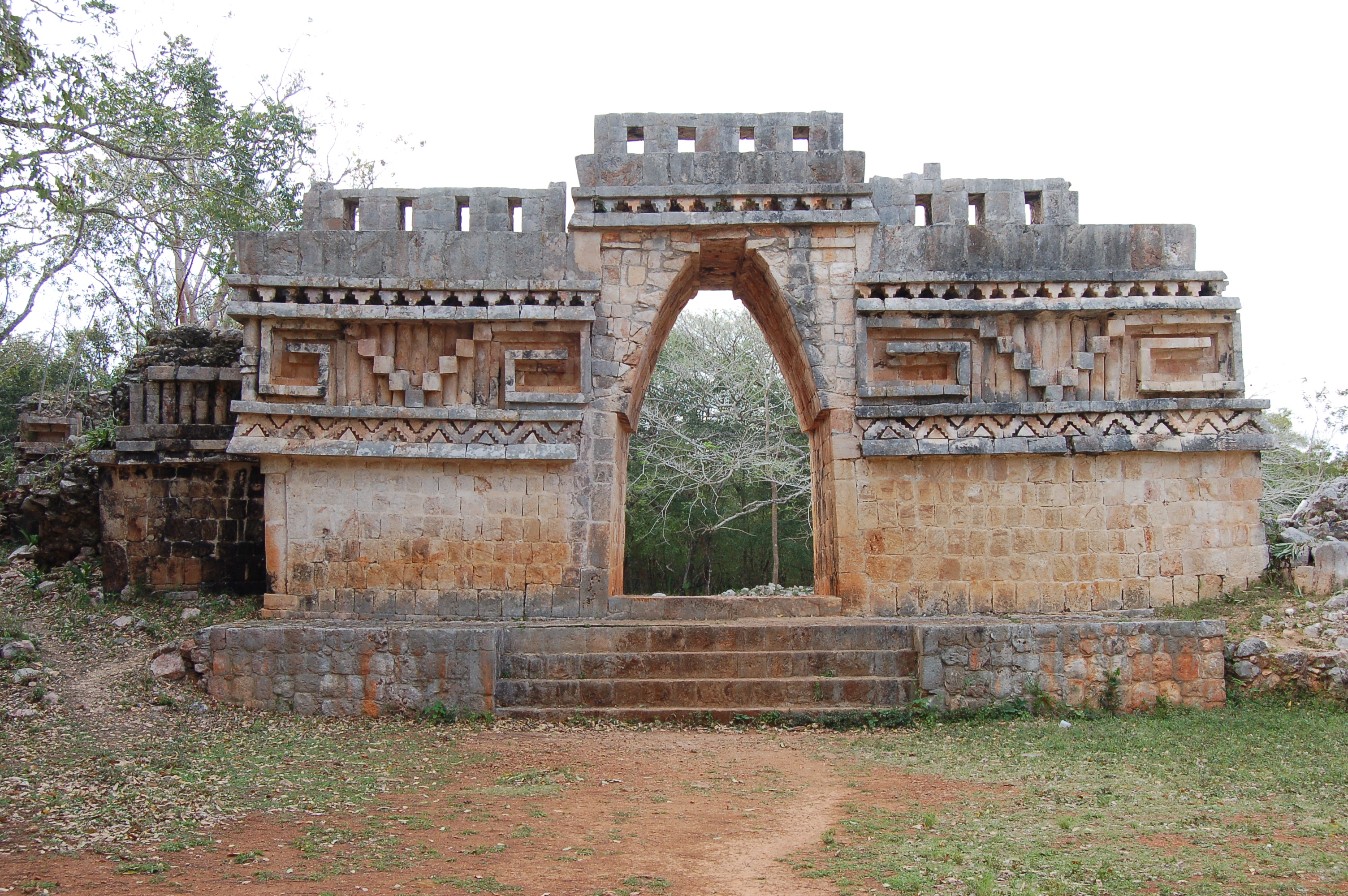
Another fundamental element is the network of roads or sacbeob (plural of sacbé), which connected different cities, such as the road between Uxmal and Kabah. These routes not only facilitated the exchange of goods—such as obsidian, ceramics, or agricultural products—but also fostered political and ceremonial relationships. From an anthropological perspective, the sacbeob can be understood as axes of regional integration that contributed to the cultural cohesion of the Puuc region.
The analysis of the collapse of these cities around the 9th century has also been a central theme in Mesoamerican anthropology. Various hypotheses suggest that factors such as climate change (especially prolonged droughts), overexploitation of the environment, internal conflicts, or shifts in trade networks may have contributed to the region’s gradual abandonment. Rather than an abrupt collapse, many researchers propose a gradual process of social reconfiguration and migration to other areas in the northern part of the peninsula.
The Puuc Route represents much more than a tourist circuit: it is a historical laboratory that allows us to understand how a complex civilization managed to adapt to adverse environmental conditions through technological innovation, sophisticated social organization, and a worldview deeply integrated with its surroundings. Its study offers fundamental insights for anthropology, not only in terms of Mesoamerican history but also for reflecting on the relationship between society, the environment, and sustainability in contemporary contexts.