


Puente de Ojuelos
During the 16th century, the intense traffic of mule trains, wagon caravans, and indigenous carriers traveling daily along the Royal Inland Road between the presidios of El Portezuelo and Ojuelos made it necessary to implement permanent infrastructure that would allow for vehicle passage throughout the year.
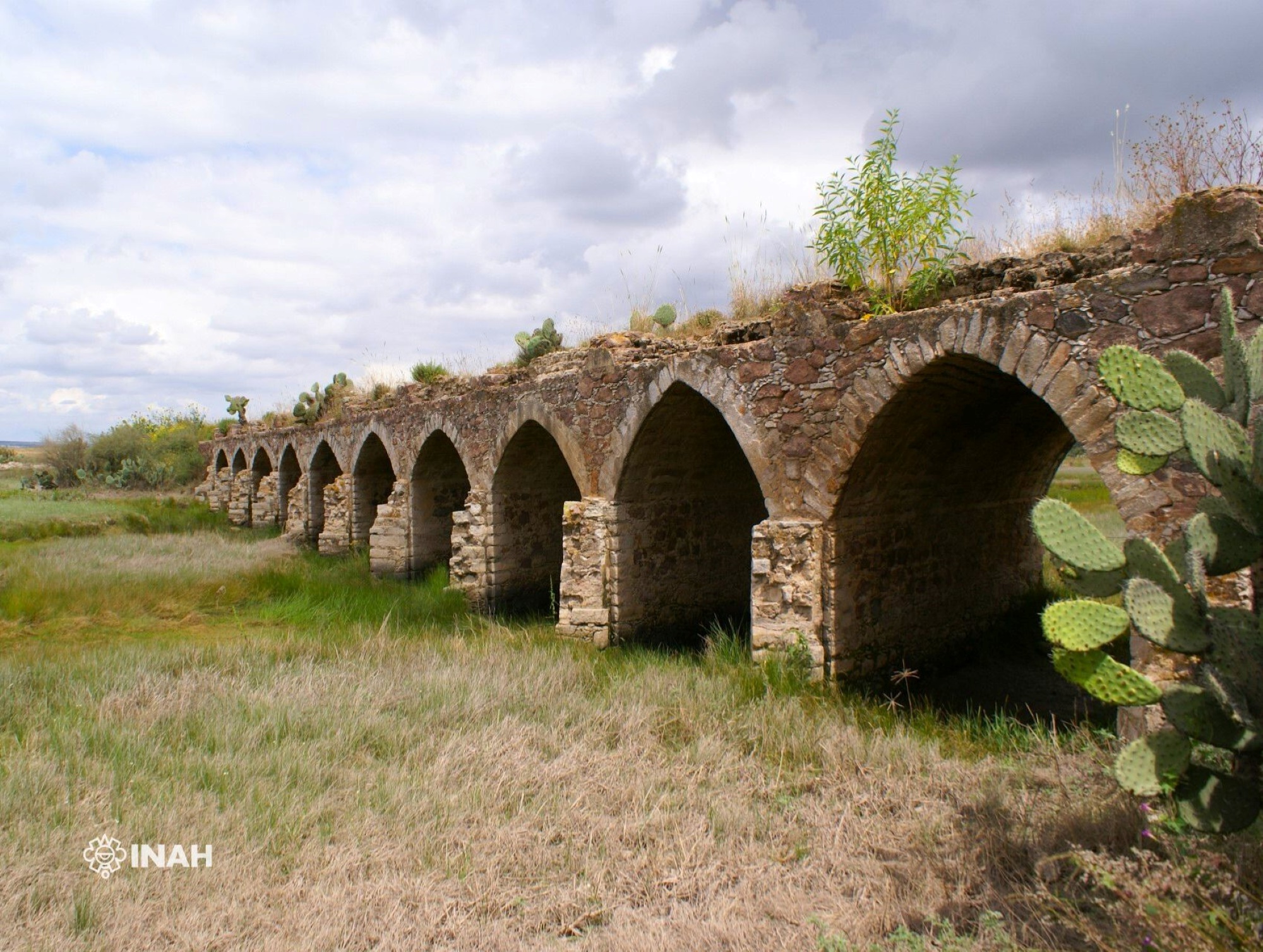
For this reason, a modest bridge was constructed to safeguard against the constant flow of a nearby river, facilitating access to the town of Ojuelos from the settlement of San Felipe Torres Mochas, and on toward the mines of Zacatecas.
Although there are no documented records of the bridge’s construction, it is likely that its building began in the 17th century as part of the Silver Route, which was in use from the 16th century until the first half of the 20th century.
The Ojuelos Bridge is an example of the infrastructure works carried out by the Spanish crown to establish a permanent communication route to the north of New Spain, at its boundaries with the Kingdom of Nueva Galicia.
The location where this bridge is situated is currently a site that has well-preserved the original characteristics of a considerable stretch of the old Royal Inland Road. It allows one to recreate the atmosphere of isolation and desolation that extended from this area towards the northern reaches of New Spain.
Today, the unused Royal Inland Road runs parallel to the paved road. The bridge is oriented southeast, spanning a stream. It consists of two abutments and ten masonry piers that rise above the terrain to reach the height of the supporting arches. The long bridge is supported by eleven irregular stone arches, forming semi-pointed vaults, with finely carved stone voussoirs at each end.

