


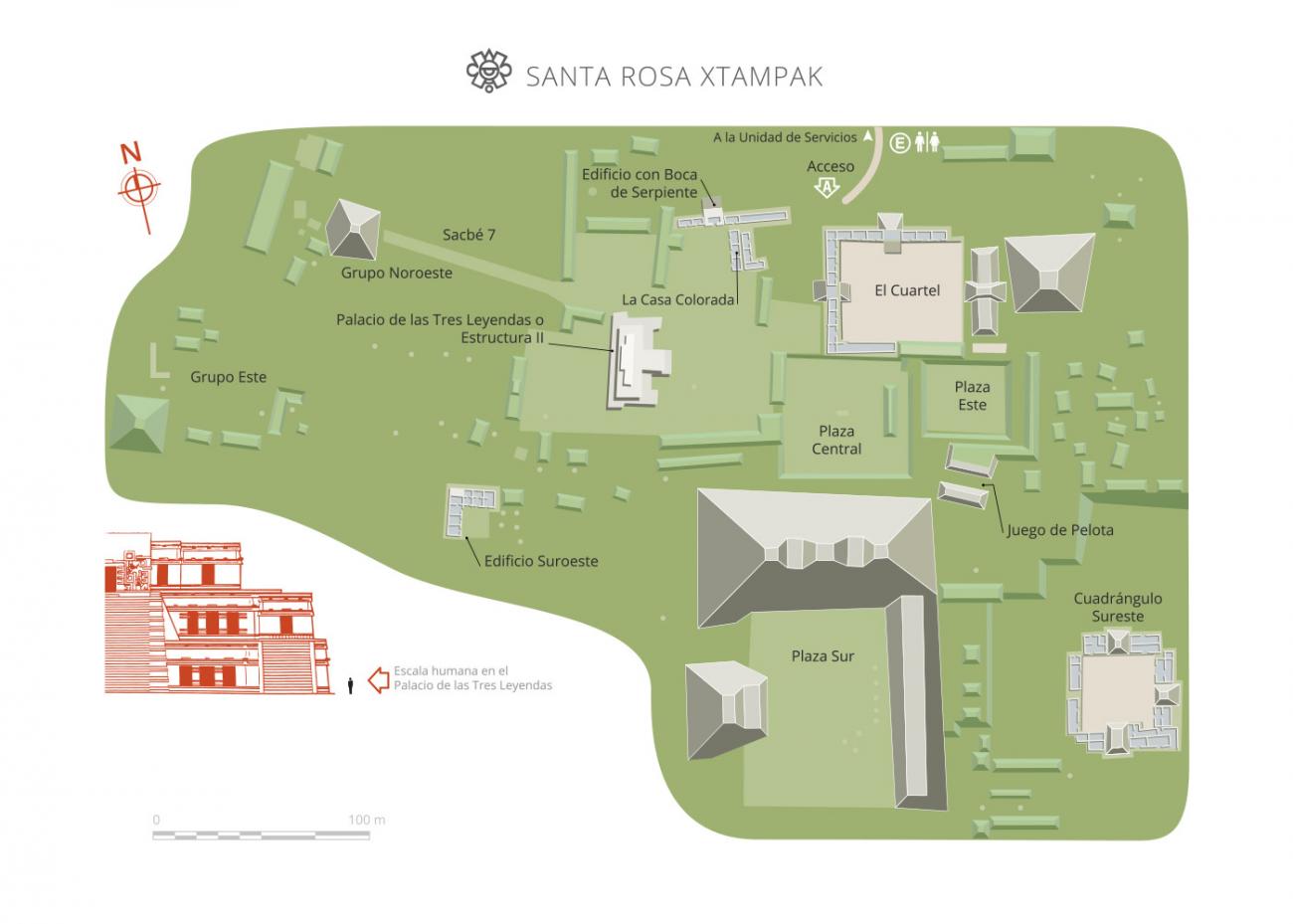
Xtampak
A preeminent Maya city, the capital of the Chenes for 850 years, it began to decline a millennium ago. Its monumental architecture, sculpture and pottery are incomparable in the region. Jade, obsidian and salt were brought here from Guatemala, central Mexico and the Yucatan peninsula.
Santa Rosa Xtampak is one of the most important Mayan cities in northeastern Campeche. The labor required to build and maintain its pyramids, palaces and temples points to the existence of a solid political structure that controlled a wide region. The rulers also ordered the creation of official inscriptions on the stelae and paintings found on various chambers; they established long-distance trade links and played an important role in the area, especially during the Late Classic (600-900 AD). The eight stelae registered at the site to date bear dates ranging from 646 to 911 AD.
The name of the archeological site combines two words: Santa Rosa, the name of a nineteenth-century hacienda, where pre-Hispanic remains or “xlabpak” (old walls in Yucatec Mayan) were found. The placename was used throughout the nineteenth century (when it was known as Xlabpak de Santa Rosa), and in the following century it was modified to Santa Rosa Xtampak (“opposite the wall,” “exposed wall”), in reference to the walls conserved on one of the main buildings.
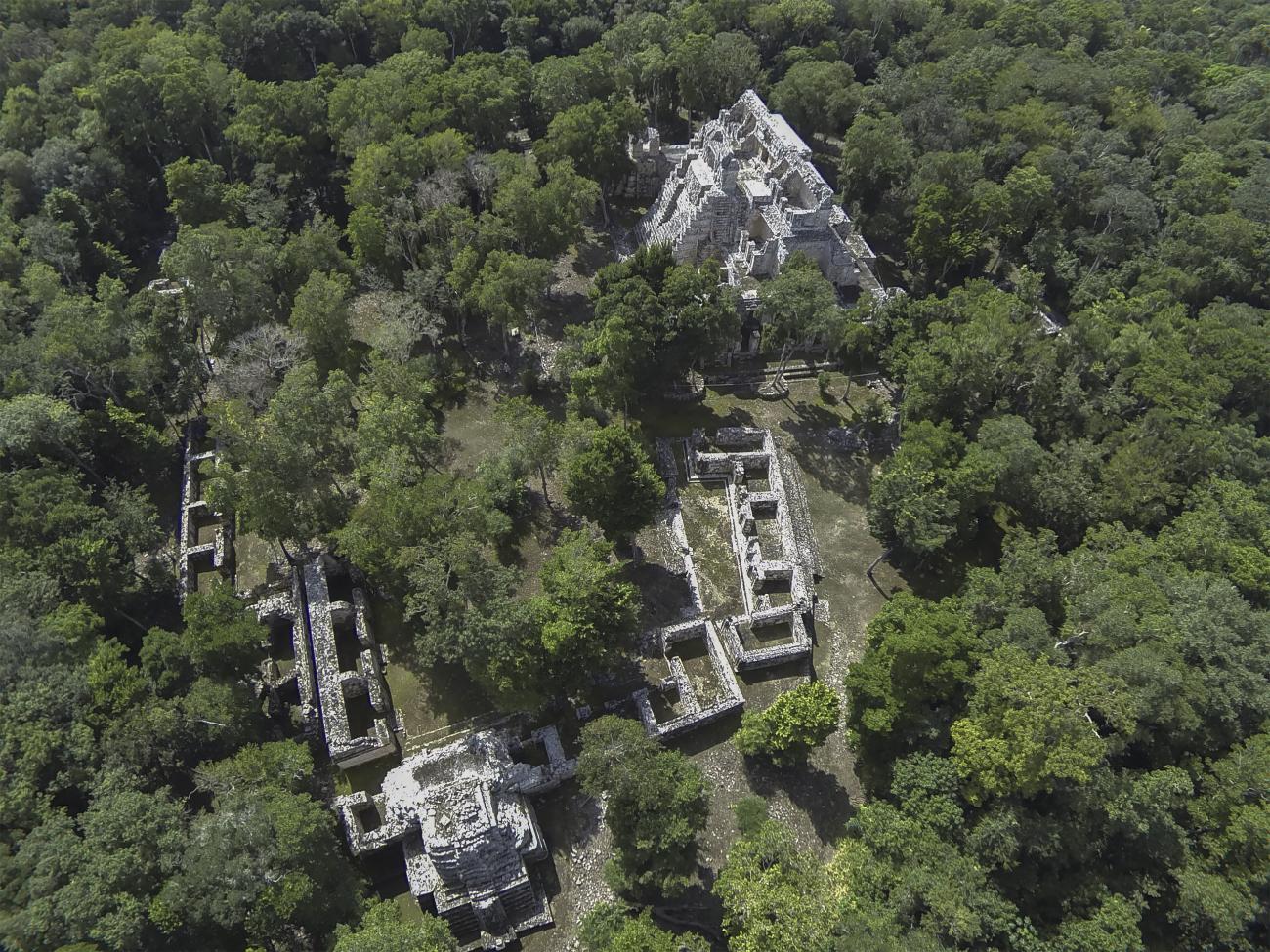
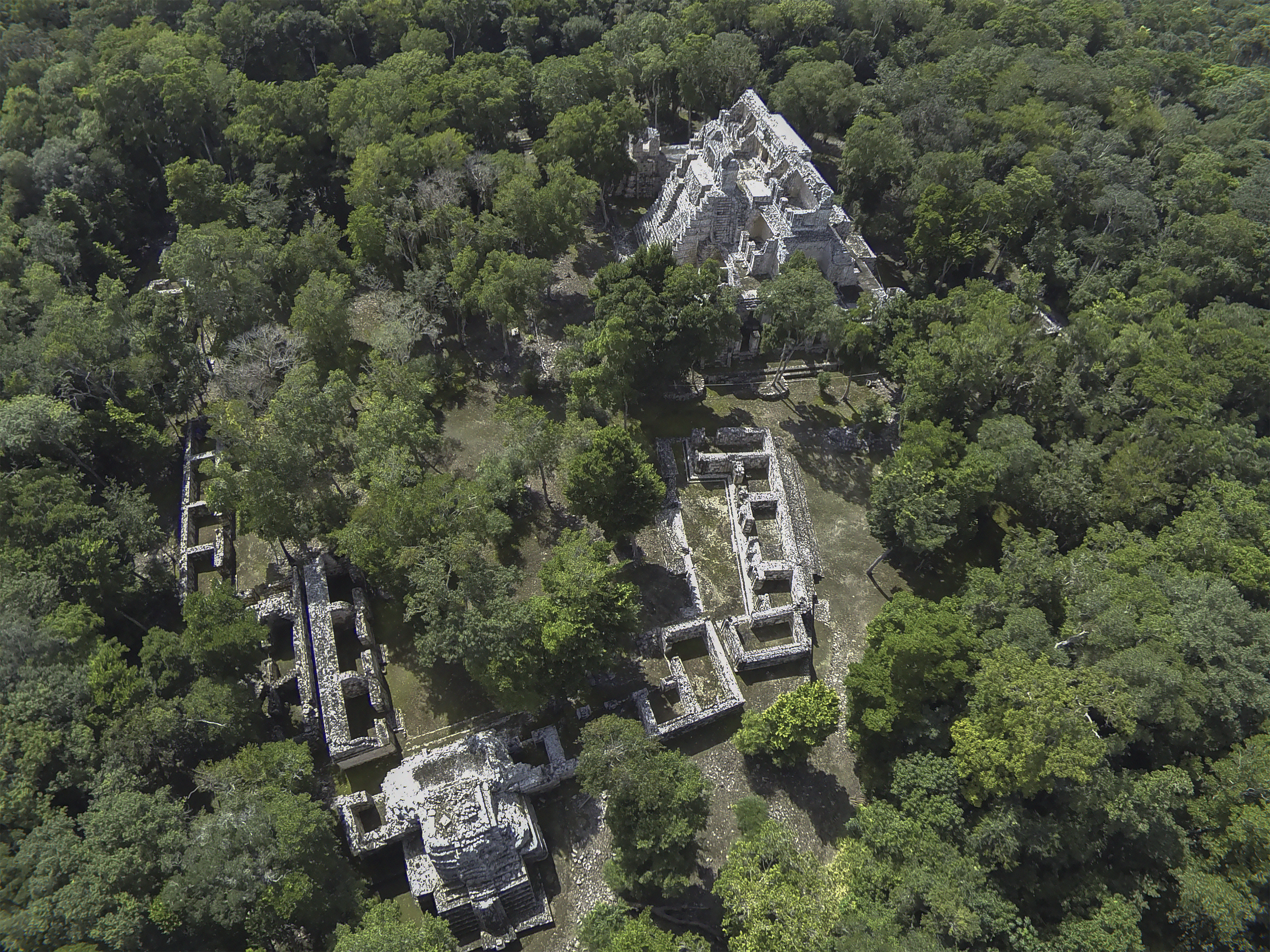
The remains of this Mayan city are located at the top of a hill, which was leveled in various parts and given terraced slopes in order to enable the construction of around a hundred masonry buildings, many on a monumental scale, and these created several regularly distributed square patios and plazas.
Eight stelae have been found at Santa Rosa Xtampak, as well as an altar and several painted vault covers containing invaluable information in their images and hieroglyphic inscriptions. Therefore we know that the earliest date yet recorded is 646 AD (Stela 5), although preliminary analyses of the pottery indicate that the settlement existed several centuries before the Common Era. The most recent date—948 AD—was discovered by specialists on the cover of a vault in the Palace building. The pottery artefacts also point to a diminished occupation by the Post Classic (1000-1500 AD), before the site was completely abandoned before the Europeans landed on the peninsula.
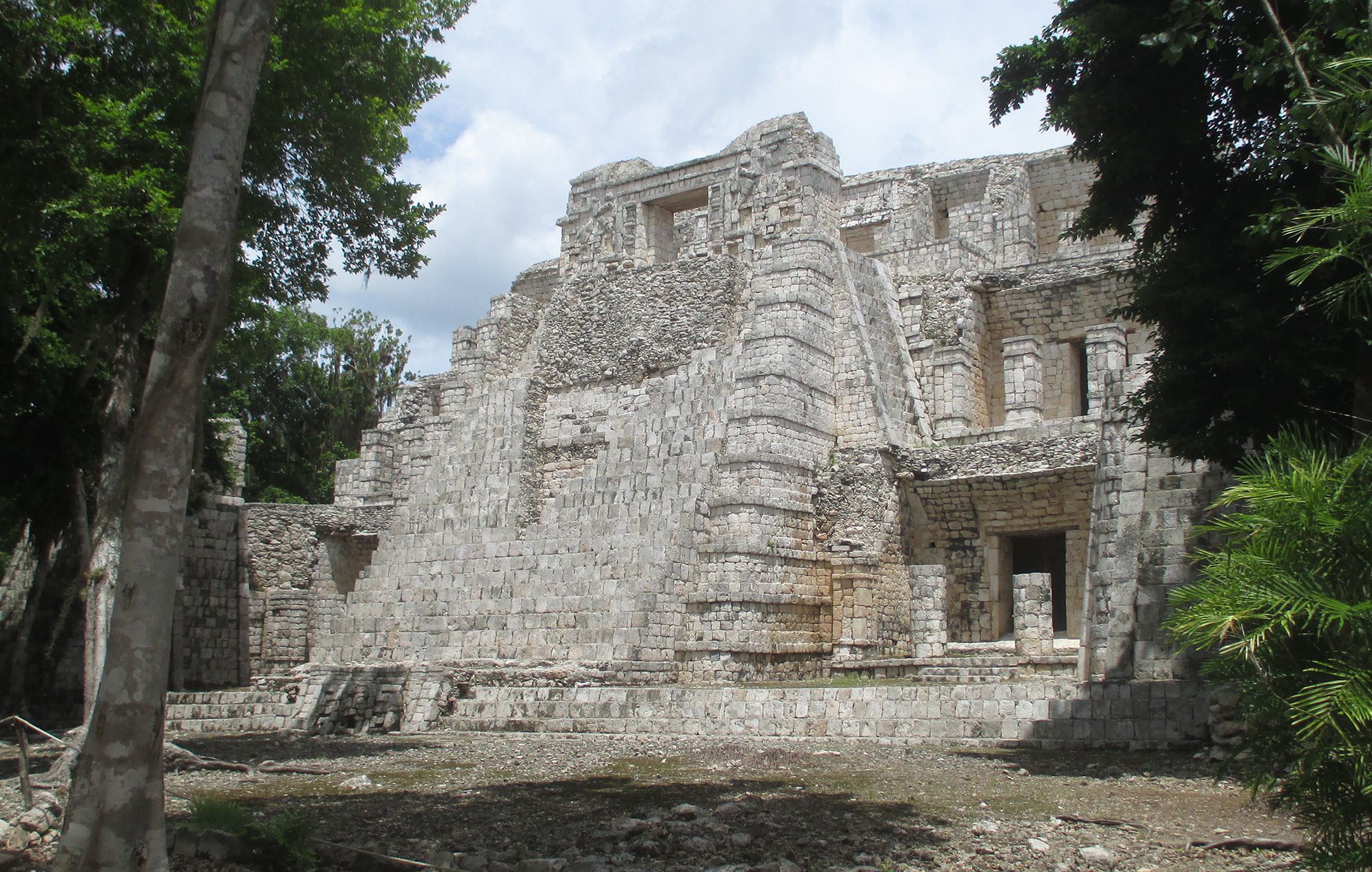
Chenes is the predominant architectural style in Santa Rosa Xtampak, where the constructions are noted for their large mask decorations that partially or completely cover the main facades. The motifs were created using specially cut stone mosaics that were then coated in stucco and painted in various colors, above all red. Many of the buildings combine smooth wall surfaces with columns set into the walls or corners. The many entrances are usually formed by masonry columns or pillars. The arch vaults generally begin directly from the vertical wall supporting them, almost without leaving even the slightest set back or soffit. The internal setbacks over the lintels are also common features.
Water was supplied using an extensive system of chultuns or underground cisterns for rainwater collection. Evan DeBloois studied 67 chultuns and by calculating the maximum rainwater collection capacity, conservative estimates suggest that the city could have supported an average population of 10,000 inhabitants.
The site was first brought to the world’s attention by the explorers Frederick Catherwood and John L. Stephens, who visited it in the mid-nineteenth century. Soon before the end of that century, Teobert Maler conducted a more detailed survey of the remains. In the 1930s and 40s, various researchers from the Carnegie Institution, led by Harry Pollock, carried out archeological work at Santa Rosa. In the late 1960s, Richard Stamps and Evan DeBloois, of the Brigham Young University in Utah, recorded and analyzed the site’s architecture, ceramics and chultuns. More specialists arrived in the 1980s: George Andrews (University of Oregon) and Paul Gendrop (UNAM) carried out architectural studies, while William Folan and Abel Morales (Autonomous University of Campeche) came to draw up plans of the settlement’s layout. In the 1990s, Nicholas Hellmuth produced a highly detailed photographic record of the buildings still standing; Hasso Hohmann and Erwin Heine made a photogrammetric study of the Palace and carried out some initial architectural restoration works under the supervision of Antonio Benavides C. In the beginning of the twenty-first century, Renée Zapata coordinated a maintenance program for some of the main constructions.
- Dirección del Centro INAHAdriana Velázquez Morletadriana_velazquezm@inah.gob.mx+52 (981) 816 9111Operación de Zonas Arqueológicas del Centro INAHCandelaria del Carmen Duarte Patzarqueologicas.camp@inah.gob.mx+52 (981) 816 9111, ext.138016
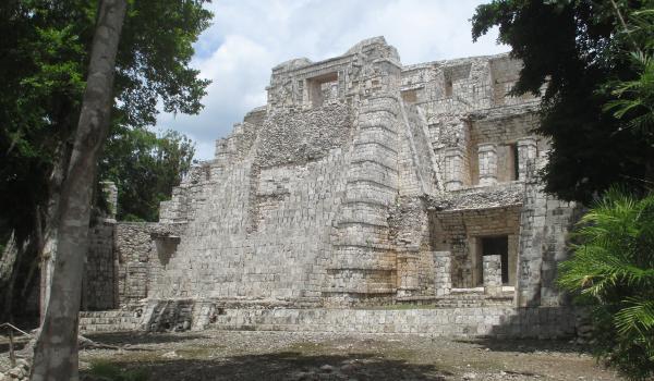
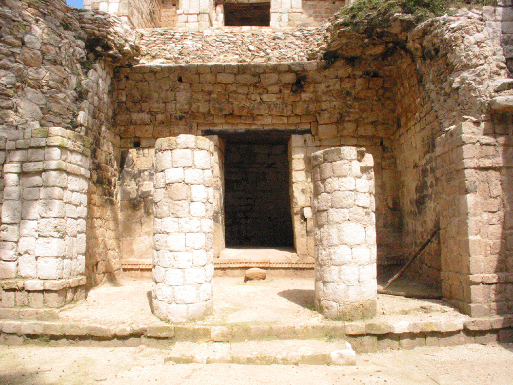
Palacio
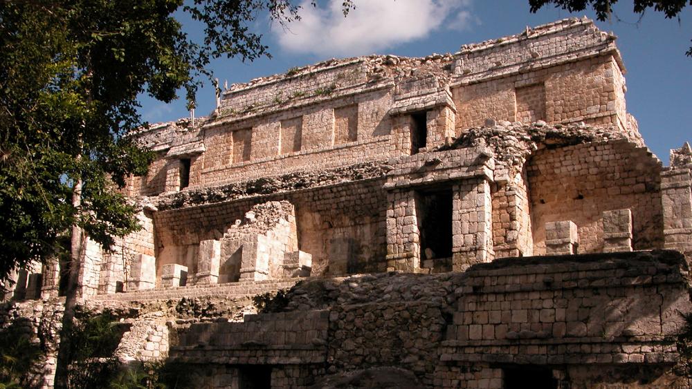
It has 42 rooms arranged on three levels. On average it is 50 m long by 30 m wide and 30 m high. It has a wide staircase on its eastern façade, but it also has complementary accesses on its western side and, in addition, two interior stairways that facilitate circulation between the rooms.
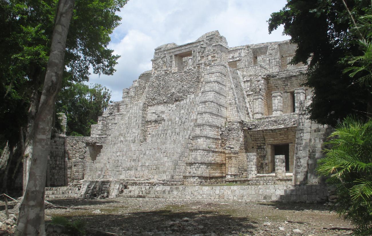
It has 42 rooms arranged on three levels. On average it is 50 m long by 30 m wide and 30 m high. It has a wide staircase on its eastern façade, but it also has complementary accesses on its western side and, in addition, two interior stairways that facilitate circulation between the rooms. These elements of internal communication are unusual in Mayan architecture and the technical solution of its vaulted arches, which rotate in oblique planes, has received the attention of several specialists. The amplitude of the chambers, their interior fittings and distribution have led to suggest that most of them were used for living purposes by the rulers and associated courtiers. The smaller chambers, located on levels 1 and 3, could have been used to store the various accessories used by the elite (large headdresses, ceremonial costumes, censers, staffs, parasols, etc.).
Because of its dimensions and complexity, the Palace of Santa Rosa Xtampak is unique, although comparable to other monumental constructions of elite residential character, such as the palaces of Sayil, Xkipché and Labná, or the west side of the Building of the Five Floors in Edzná.
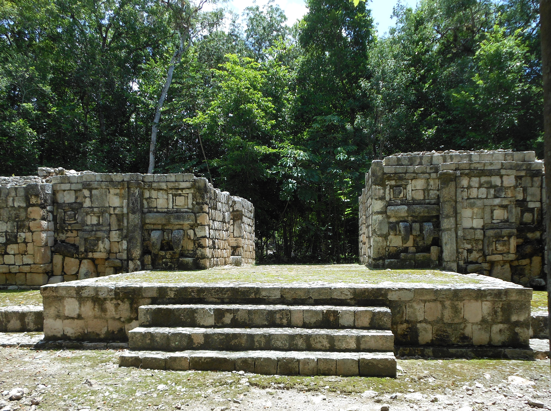
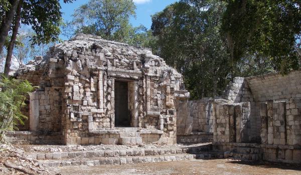
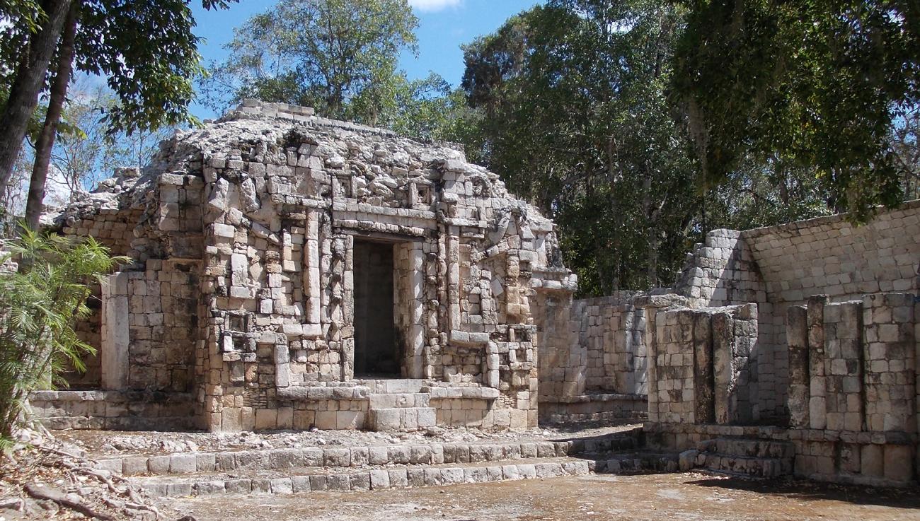
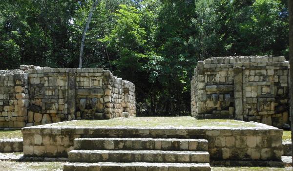
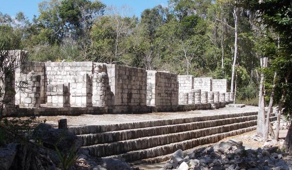
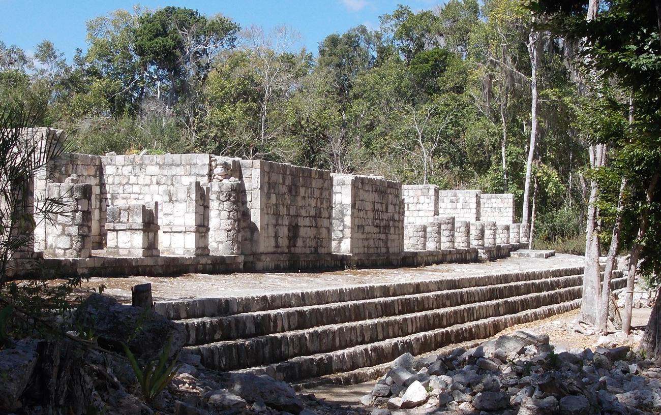
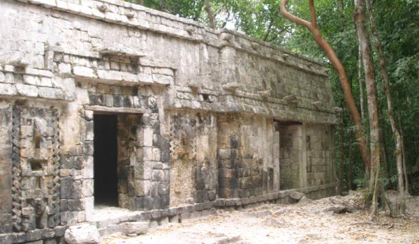
Edificio con Boca de Serpiente
Named after Teobert Maler, it shows the typical Chenes façade, with a large fantastic mask that covers the entire façade. On both sides it has auxiliary rooms of which little has been preserved.
Named after Teobert Maler, it shows the typical Chenes façade, with a large fantastic mask that covers the entire façade. On both sides it has auxiliary rooms of which little has been preserved. Perhaps the most striking is its back, where the Mayan builders gave the building the image of a scolopendra or centipede, cutting and assembling the ashlars in a specific way to denote the body, legs and head with eyes, jaws and fangs. These arthropods (chapat, in Yucatec Maya), which have a pair of poisonous nails, were considered inhabitants of the underworld and were associated with the deities of that place.
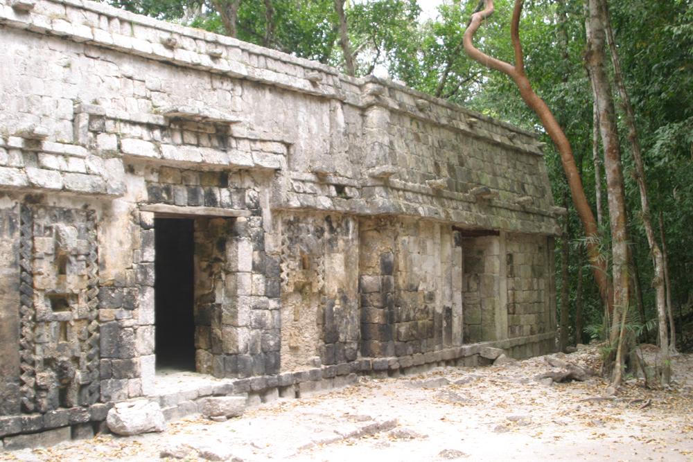
Edificio Boca de Serpiente, Lado Sur
Next to the previous building is La Casa Colorada, a three-room building of which only the side walls of the rooms, the lower part of the facades and the rear wall shared by them are complete.
Next to the previous building is La Casa Colorada, a three-room building of which only the side walls of the rooms, the lower part of the facades and the rear wall shared by them are complete. It was so named by Teobert Maler, in allusion to the vestiges of red paint that in the 19th century it still conserved in some sectors.
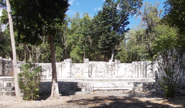
Casa de las Grecas Escalonadas
It is located between the Snake Mouth Building and the Palace. It is another elite housing complex, but with only one floor. It has spacious rooms that had false arches as ceilings and a rhythmic pattern of slender columns as part of the walls.
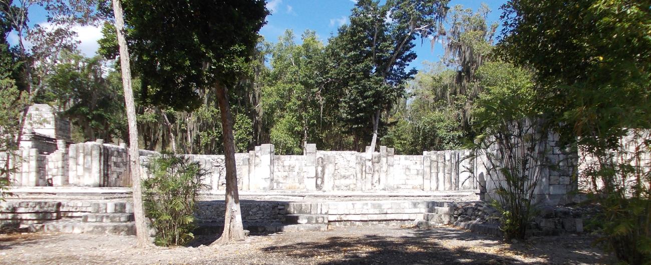
It is located between the Snake Mouth Building and the Palace. It is another elite housing complex, but with only one floor. It has spacious rooms that had false arches as ceilings and a rhythmic pattern of slender columns as part of the walls. The plinth was decorated with the motif that gives the building its name: the stepped fretwork, a symbol frequently used in Chenes and Puuc architecture, but also widely documented in many Mesoamerican regions. Its meaning is a subject of debate, with ideas such as the stylization of the rattlesnake, the cyclical movement of the stars, the opposition of opposites, the change of seasons, etc., having been proposed. In central Mexico it was called xicalcoliuhqui (xicalli = jicara; coliuhqui = twisted or lying thing).
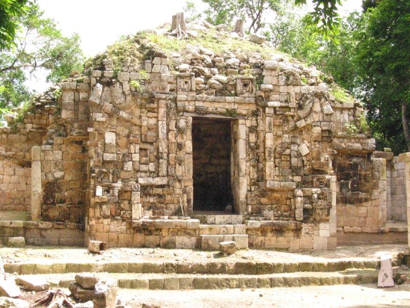
Casa de Itzamná
It is located a short distance from the Palace. The central part of the building is clearly marked by a wide corridor that runs from east to west at both entrances, and on either side of the access opening that was once vaulted.

It is located a short distance from the Palace. The central part of the building is clearly marked by a wide corridor that runs from east to west at both entrances, and on either side of the access opening that was once vaulted. The image of the Monster of the Earth stands out, made with ashlars cut specifically to form a stone mosaic. The entrance was, precisely, its large mouth. This mythical entity symbolized Itzamná, the creator deity, sometimes represented as an iguana, sometimes as a crocodile, and sometimes as a very old anthropomorphic being. The image achieved in this building is another variant of the deity that decorates the highest wall of the Palace (above and in the center of the east façade). Both wings of the Casa de Itzamná have an equal number of rooms, which had vaulted ceilings and some have banquettes.
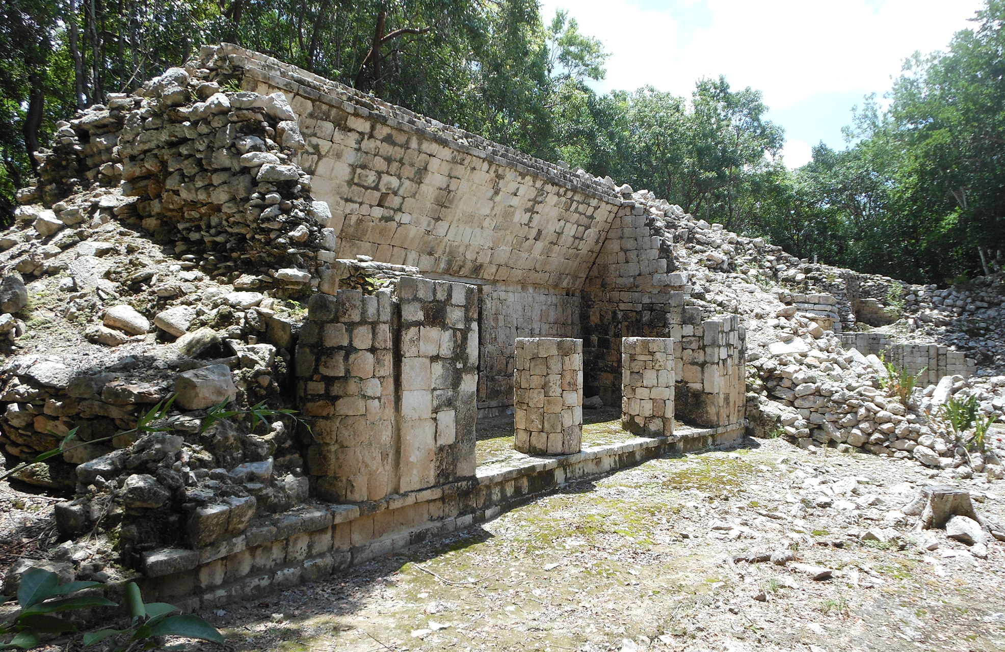
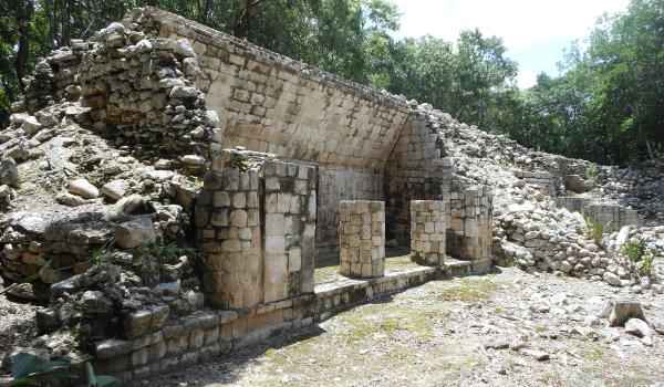
Edificio Sur
It delimits the south side of the main square associated with the Palace. It has a wide staircase that provides access to 14 rooms that were once roofed with a false arch. There is also a complementary staircase on the west side of the building.
It delimits the south side of the main square associated with the Palace. It has a wide staircase that provides access to 14 rooms that were once roofed with a false arch. There is also a complementary staircase on the west side of the building. All the rooms are distributed in pairs, with access only from the south side. The central room has a single entrance, but the three on each side have triple entrances formed by masonry columns. This type of columns, covered with well-cut ashlars, is one of the typical elements of Chenes architecture. The same can be said of the pair of embedded columns that decorate the west side of the building. Some rooms have wide masonry benches that were used to rest or to spend the night. In the interior walls, close to the entrance, it is common to find small holes or “curtain rails” that were used to tie cords to hang elements (fabrics, skins, mats) that attenuated the passage of light. Evidently, these were living spaces for high-ranking individuals.
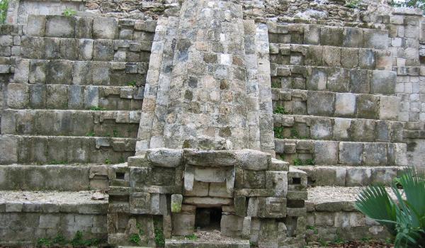
El Cuartel
A large quadrangular patio on the north side of which a building with several standing rooms is preserved. At the center of the building are the remains of a staircase and on each side of it we find three rooms.
A large quadrangular patio on the north side of which a building with several standing rooms is preserved. At the center of the building are the remains of a staircase and on each side of it we find three rooms. The central room is flanked by cascades of stylized masks and the frieze of the middle molding has two folds that evoke the “broken moldings” typical of an early phase of Puuc architecture. In fact, several other buildings at Santa Rosa Xtampak combine Chenes and Puuc features. Another series of rooms (south side of the courtyard) shows a wide staircase that provides access to the rooms. It calls the attention, between the steps, the existence of the mouth of a chultún or subway deposit for rainwater. It is worth mentioning that the function of the architectural complex had nothing to do with military matters; the popular imagination baptized it as such since the middle of the 19th century, when it was reported by John Stephens.
Cuadrángulo del Sureste
Partially explored, some of its constructions conserve the vaulted ceilings and several rooms have benches. Like other buildings of the site, in the Southwest Quadrangle we found an excellent carving in the construction ashlars, denoting a strong organization of collective work.

Partially explored, some of its constructions conserve the vaulted ceilings and several rooms have benches. Like other buildings of the site, in the Southwest Quadrangle we found an excellent carving in the construction ashlars, denoting a strong organization of collective work. The Maya social pyramid had a large labor force for the benefit of a small group of rulers and associated specialists. In contrast, the bulk of the population lived in humble houses made of perishable materials.
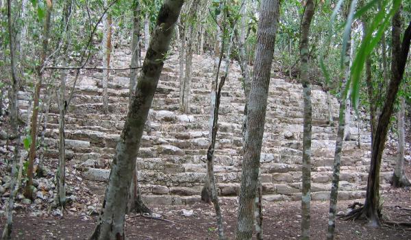
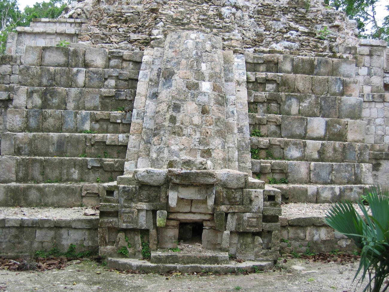
Cerro de la Estrella
The great southern patio of Santa Rosa Xtampak, to the southeast of the Palace, is delimited on its northern side by an enormous pyramidal base, today called Cerro de la Estrella, at whose base several of the megalithic steps that facilitated its access are still visible.
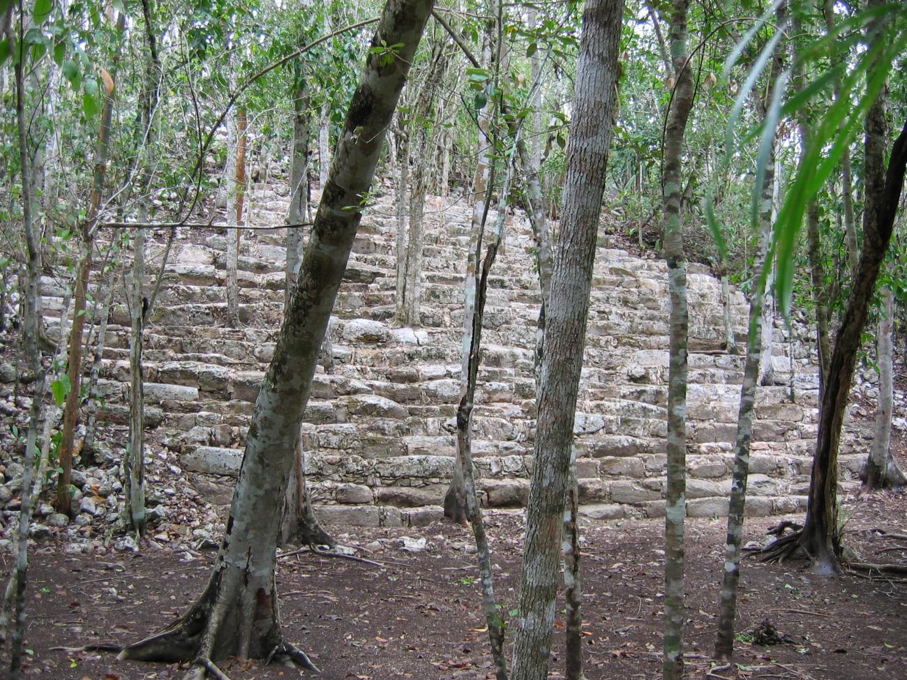
The great southern patio of Santa Rosa Xtampak, to the southeast of the Palace, is delimited on its northern side by an enormous pyramidal base, today called Cerro de la Estrella, at whose base several of the megalithic steps that facilitated its access are still visible. Those elements correspond to the first times of the settlement, in a similar way to the stairways of great blocks of the Petén architecture that have been registered in other regional capitals of the peninsula, like Edzná, Dzehkabtún, Izamal and Cobá. The summit of Cerro de la Estrella is the highest point in the heart of Santa Rosa Xtampak, but archaeological explorations have not yet been carried out in that sector and it is covered by vegetation.