


La Campana
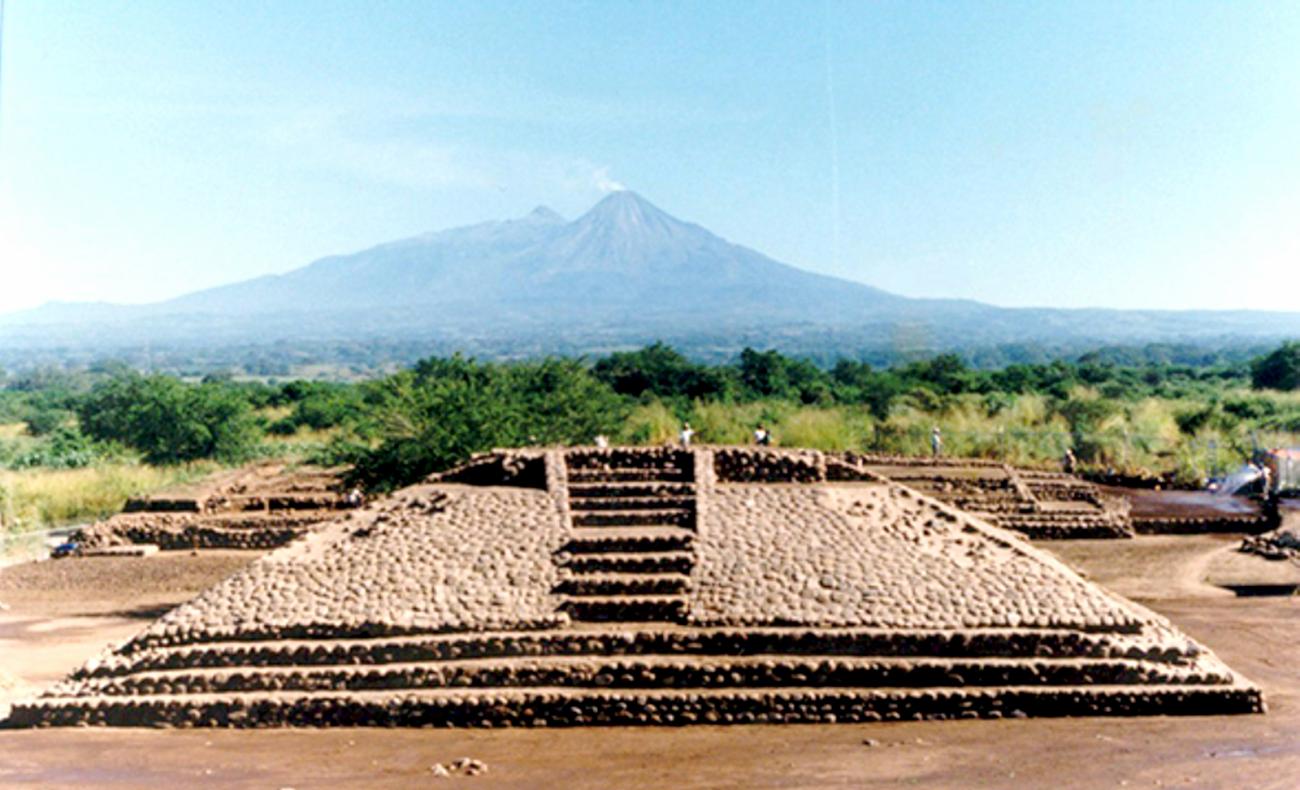
With the Colima volcano in the background, this site is striking because of the design of its streets and buildings, as well as the numerous stone carvings found in its squares and courtyards. An example of the first urban settlements in Mesoamerica, it developed in parallel to Teotihuacan and Monte Albán.
The La Campana (“The Bell”) archeological site is situated in Colima state, in the town of Villa de Álvarez, which is part of the greater urban area of Colima. The structures found in the old pasture of La Campana are remains of the old city of Almoloyan, which in the Nahuatl language means “place among running water.” It was the most important city in the Colima territory and Western Mesoamerica during the Classic and Postclassic periods. The remnants of this settlement are delineated by the left bank of the Pereyra stream and the right bank of the Colima river.
Nowadays, the site forms part of the urban landscape and is now amazingly close to the current Colima population, who are happy to share essential aspects of their pre-Hispanic past with visitors, such as their cosmogony and cosmology beliefs.
La Campana awoke the interest of intellectuals in the region at the start of the twentieth century, such as the engineer José María Gutiérrez Santa Cruz and Dr. Miguel Galindo, who sought to protect and safeguard it. They emphasized the significance of the monuments and helped disseminate their importance and meaning. In 1994, the INAH began the archeological research project in La Campana, enabling a significant portion of the history of the societies who used to live in this city to be reconstructed.
The first settlers appeared during the Capacha ceramic period (1870-1720 BC), when simple circular structures were built in the north-west section and buildings were erected upon them using perishable materials. At the start of the Ortices period, the site’s dignitaries redesigned the city’s layout, in order to convert this small village into a metropolis. This was possibly a result of influence from the Teotihuacan culture, with which the leaders of La Campana had formed trading relationships.
They decided to build a city dedicated to the god of fire, following a layout oriented towards the Volcán de Fuego (“The Volcano of Fire”) (16º north-east). Using a four-part plan, based around two intersecting avenues (one running east-west and the other north-south), the new settlement emerged in response to the mythical and religious traditions and the political and economic interests of the group in power.
To this we may add the orientation of the main buildings in the ceremonial center, which is similar to that of the Pyramid of the Sun and the Avenue of the Dead in Teotihuacan. This may represent a western imitation of a pattern established in the Central Mexican Plateau. The structures are associated with the four regions situated between the four cardinal points, according to the daily movement of the sun from east to west and the annual transit of the sun from north to south. All of this reveals knowledge of astronomical events which were defined by astronomer-priests, as well as consideration of the Volcán de Fuego’s location when establishing the orientation of the city and its key buildings, which may have significant connotations within the Mesoamerican farming calendar.
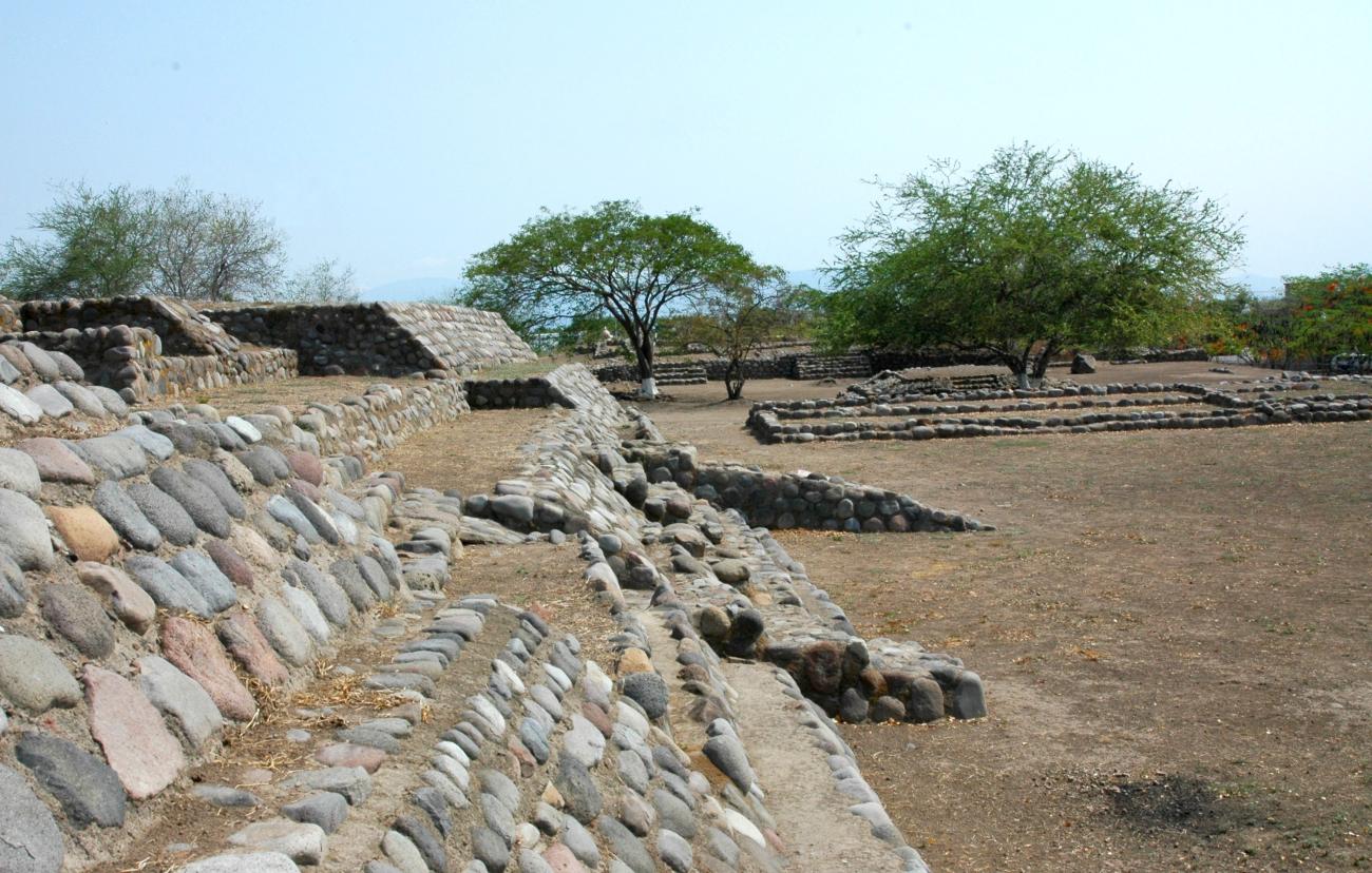
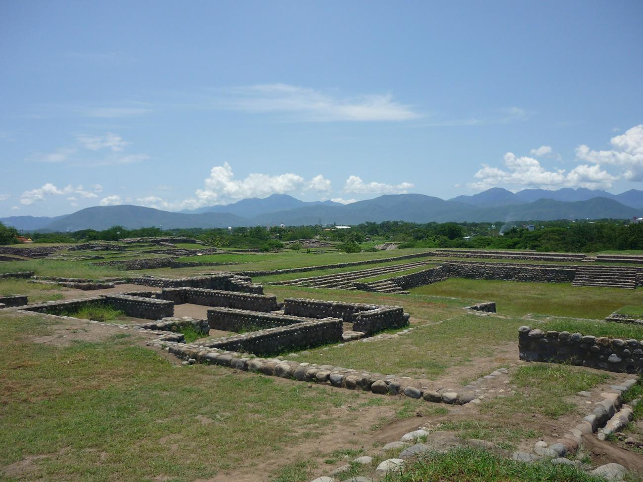
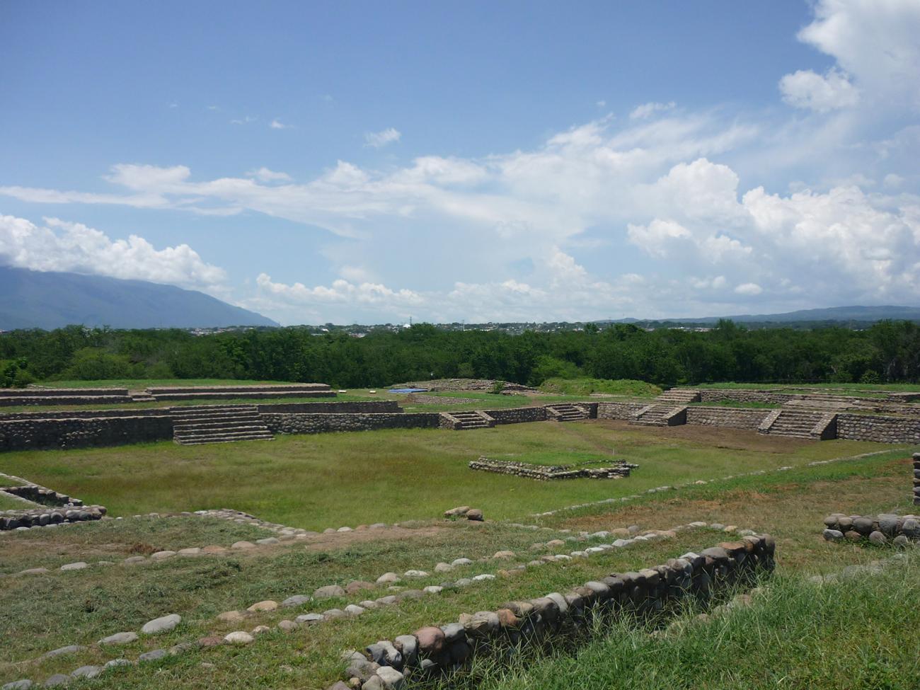
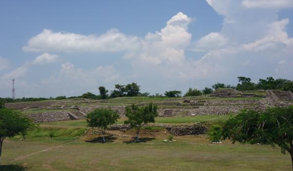
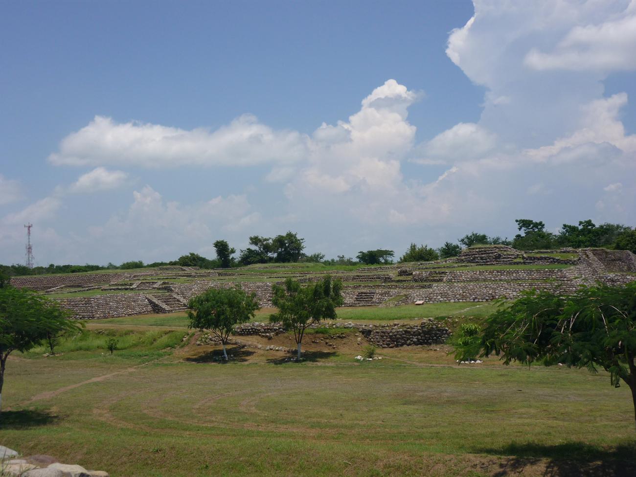
The group who planned the settlement had the abilities to design a ceremonial-administrative center in the central area of the city. At its peak, it was characterized by a nucleus defined by monumental architecture and distinctive surrounding areas which were used for both residential purposes and for trade, craft and farming activities.
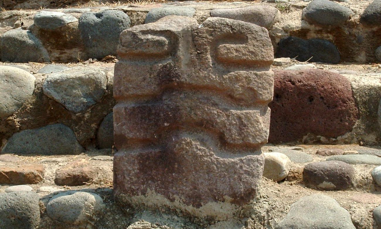
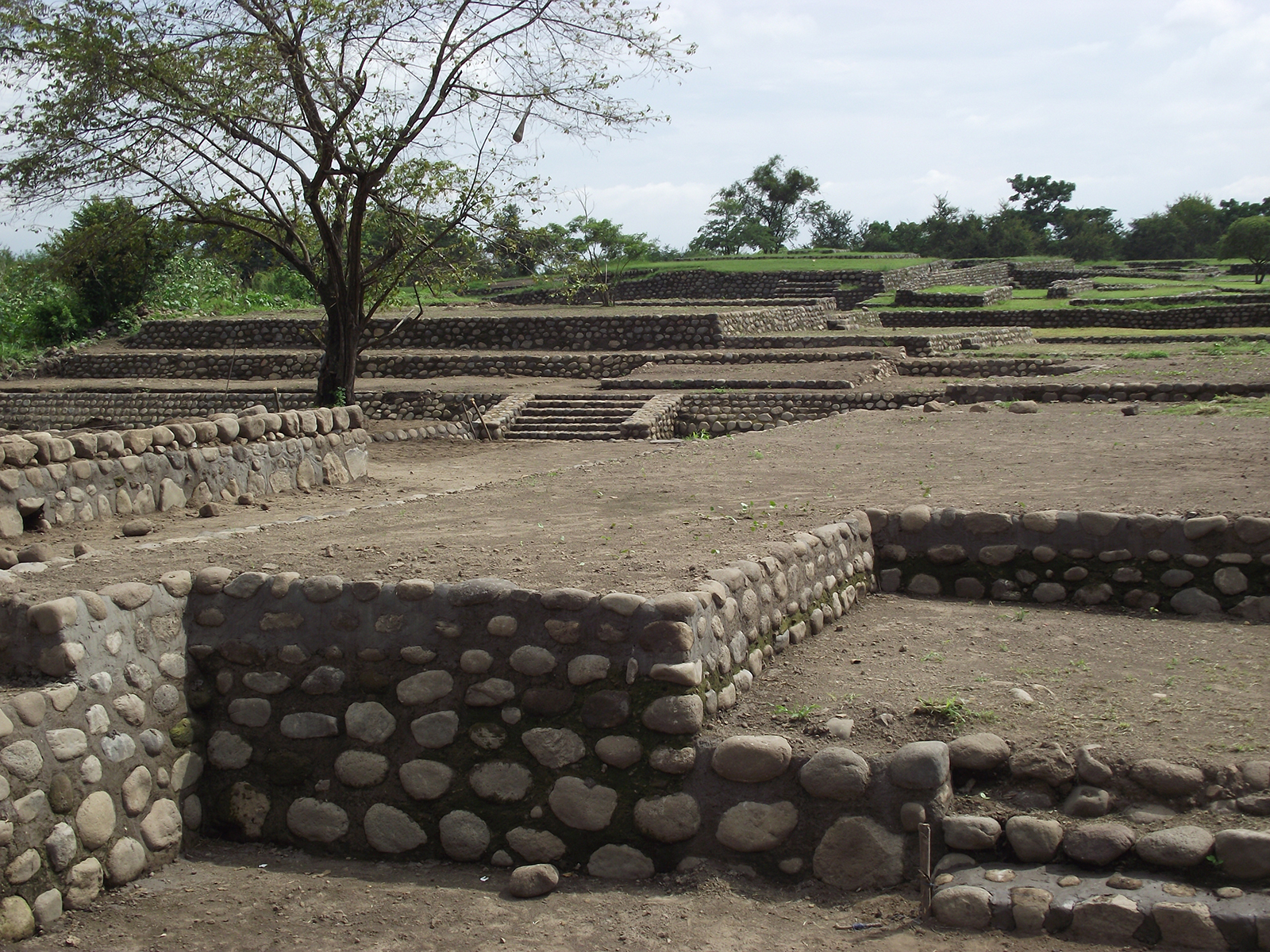
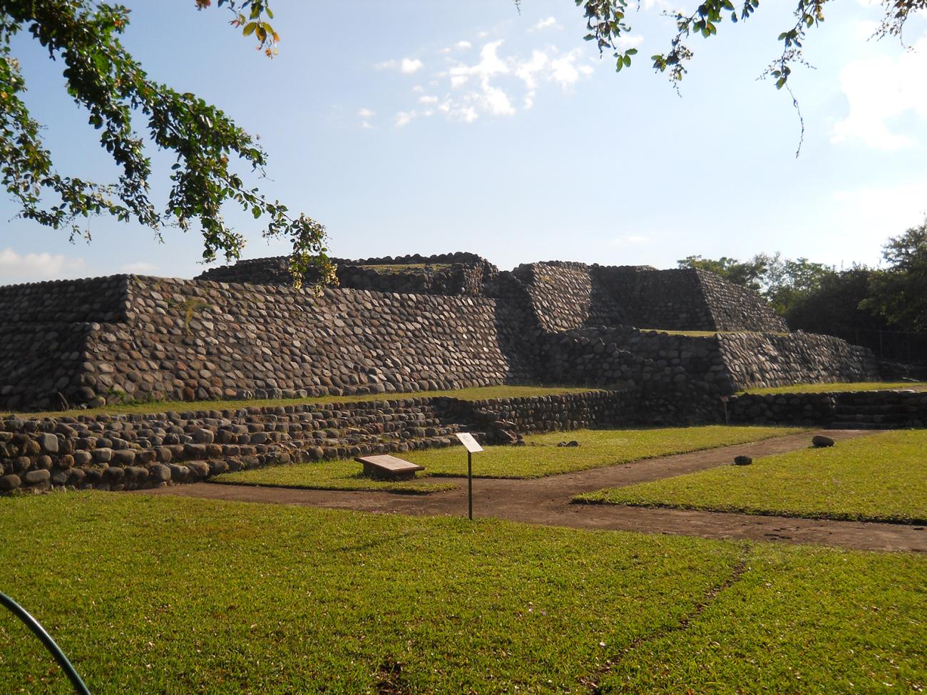
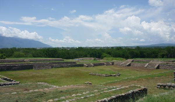
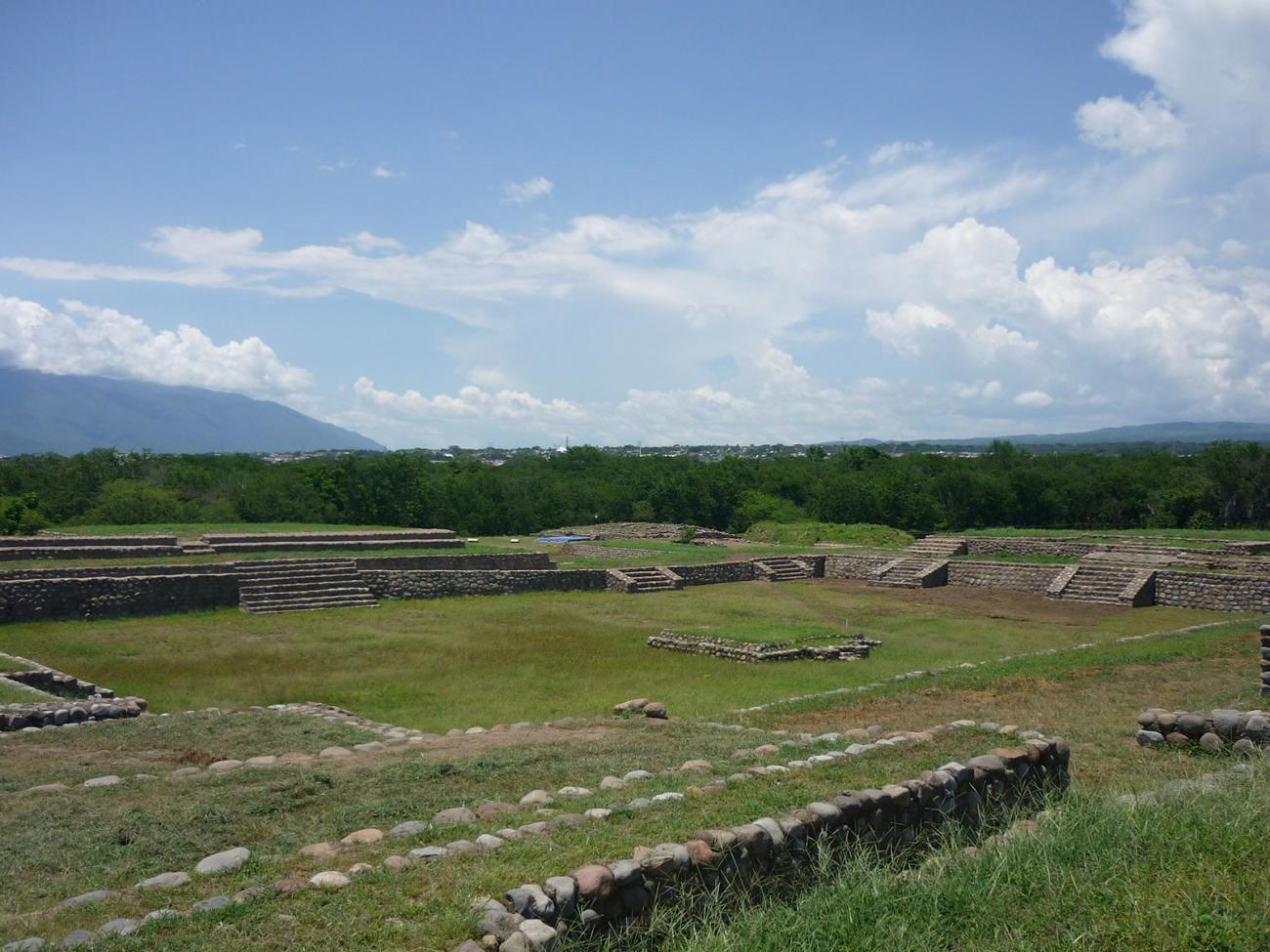
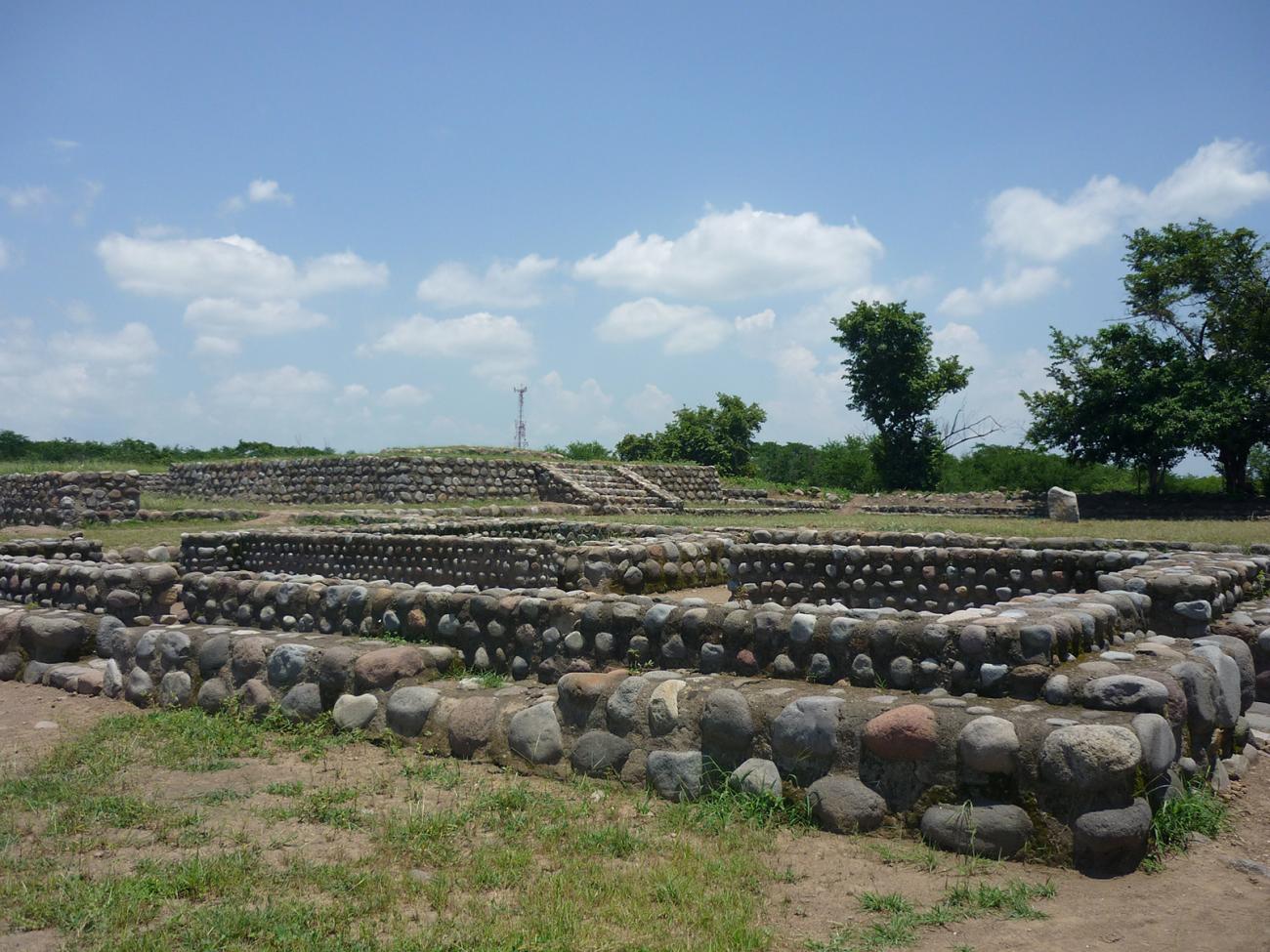
In the ceremonial center, we can see structures which have a mix of regional and Teotihuacan-style characteristics. This is a highly developed architecture with groups of different volumes represented by religious buildings and others which probably had administrative uses. In the northern section, there are residential, trade and communication areas, among others. In the ceremonial-administrative center there are also other types of structures such as large platform-like constructions, superimposed one above the other in stepped form. In the highest area there were sacred enclosures intended for members of the bureaucratic system or even as the residences of the elite, whose wanted to separate themselves from the rest of the population. In other words, they wanted to mark the social hierarchy to legitimize the governing rank and uphold the reproduction of the state through religious ideology.
The complexes are defined by four monumental platforms with ceremonial buildings constructed on top of them. Generally speaking, these sites, especially Enclosure 1A, recall the most important religious enclosure in Teotihuacan, known as La Ciudadela (“The Citadel”), as well as others with the same rectangular floor plan located in the central part of such sites. These identify settlements which have an affiliation with Teotihuacan, such as San Nicolás El Grande, Tlaxcala and Chingú, near Tula, Hidalgo.
It is important to note the alterations which were made to the most important structures in the ceremonial center, since these sought to erase the Teotihuacan-style symmetrical characteristics following the collapse of the ancient city of the Central Mexican Plateau. Another important characteristic is the presence of an underground drainage system which allows rainwater to drain from around the buildings and carries it to the rivers which delimit the settlement.
- Dirección del Centro INAHAlex Ochoa Lozanoalex_ochoa@inah.gob.mx+52 (312) 313 4946Administración del Centro INAHJuan Enrique Cortés Brizuelajcortes.col@inah.gob.mx+52 (312) 313 4945, ext. 15800
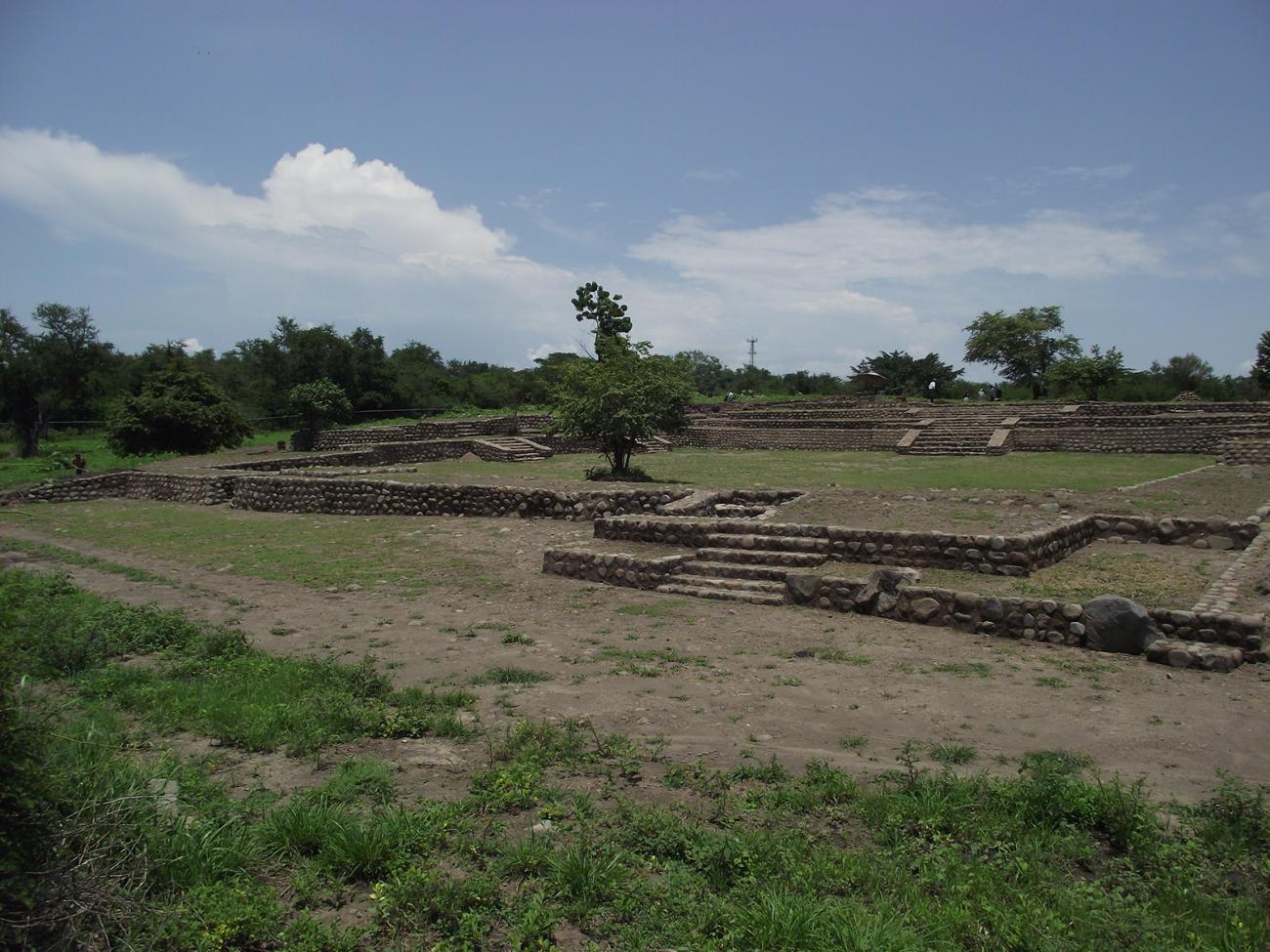
Recinto 1
This type of settlement can be defined as ancient cities resulting from systematic urban planning.

This type of settlement can be defined as ancient cities resulting from systematic urban planning. It is made up of different architectural complexes with religious-administrative functions; these were built in such a way as to isolate their residents from the rest of the population, which helped to maintain the distance between the different social strata and favored the legitimization of the ruling stratum. Architecture was, therefore, an important support for the reproduction of religious and state ideology.
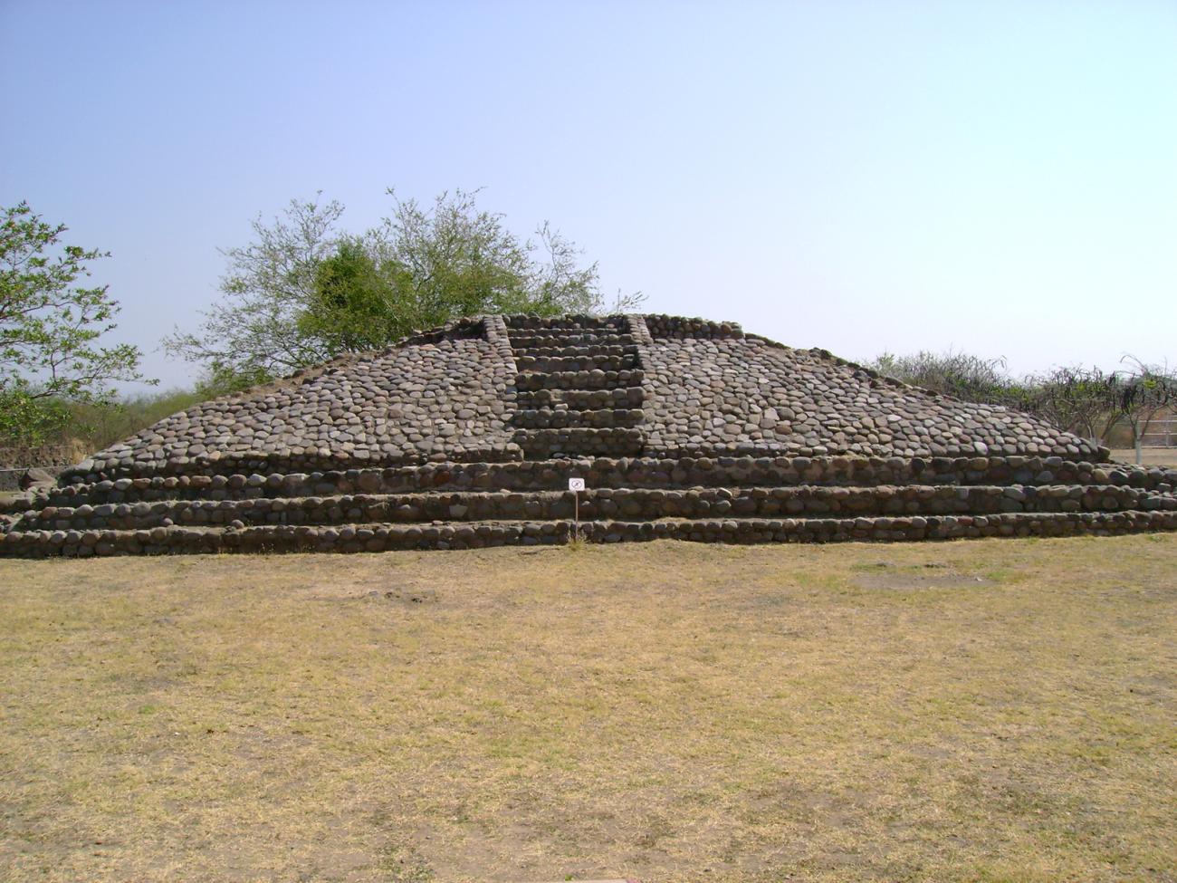
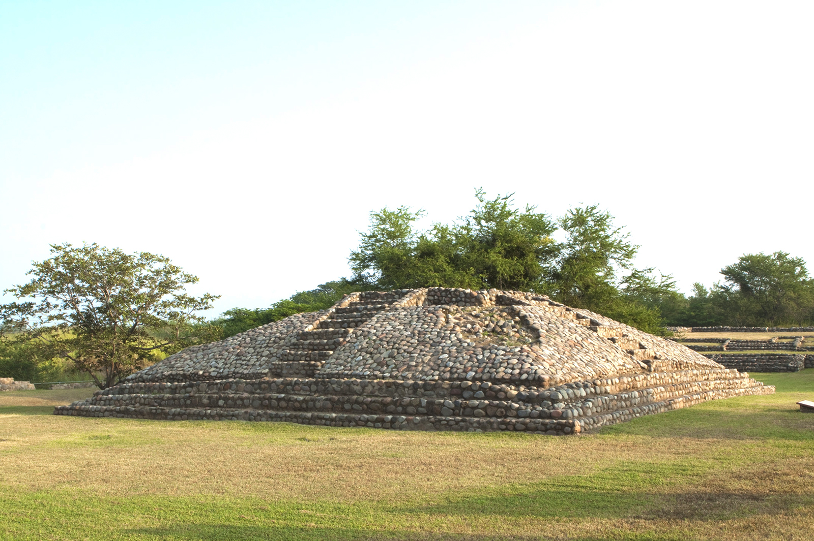
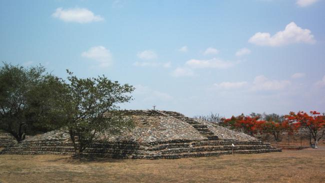
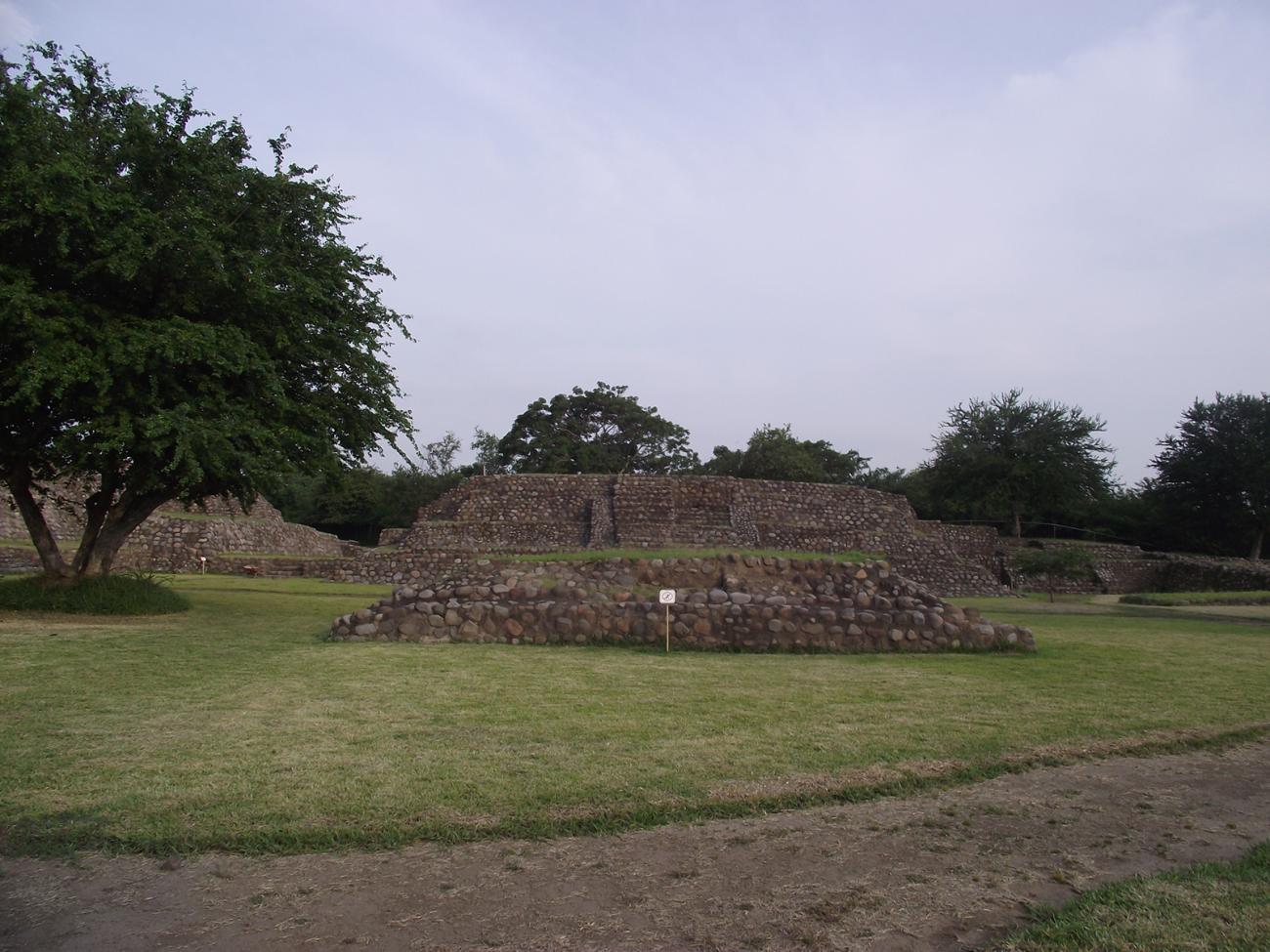
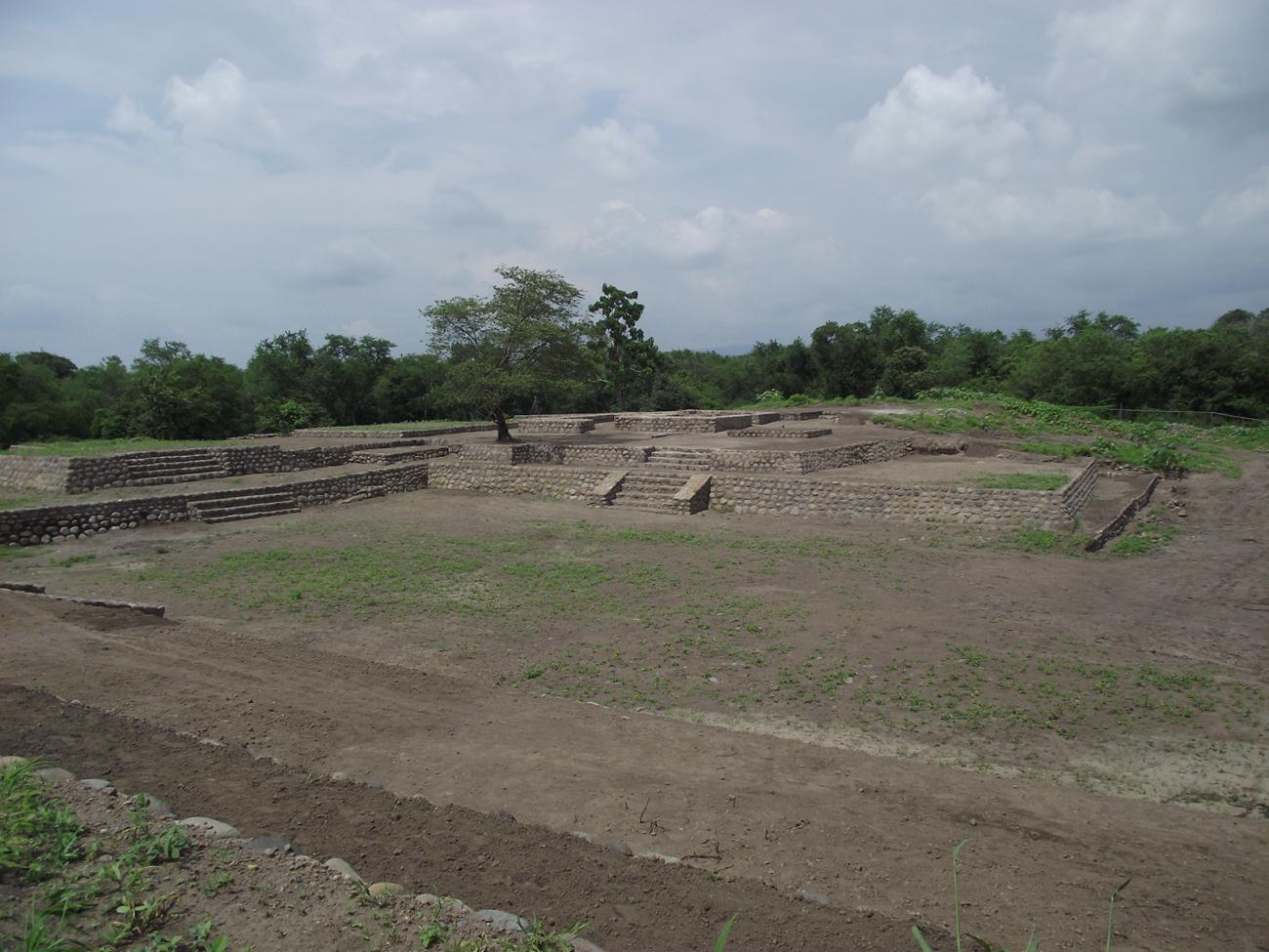
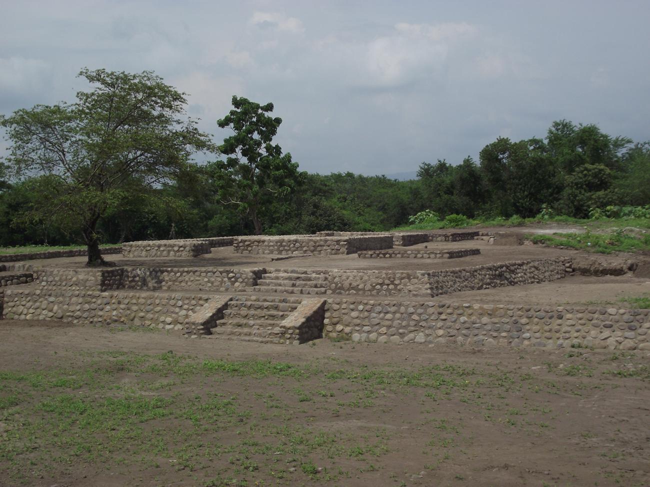
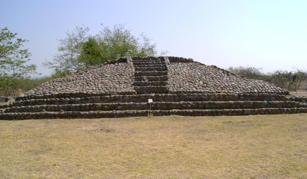
Structure 5-A: Pyramidal stepped building, dedicated to Quetzalcoatl in his evening invocation of Tlahuizcalpantecuhtli, which represents the planet Venus, the morning star.
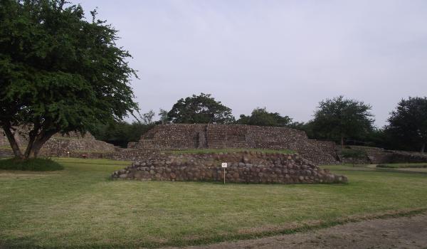
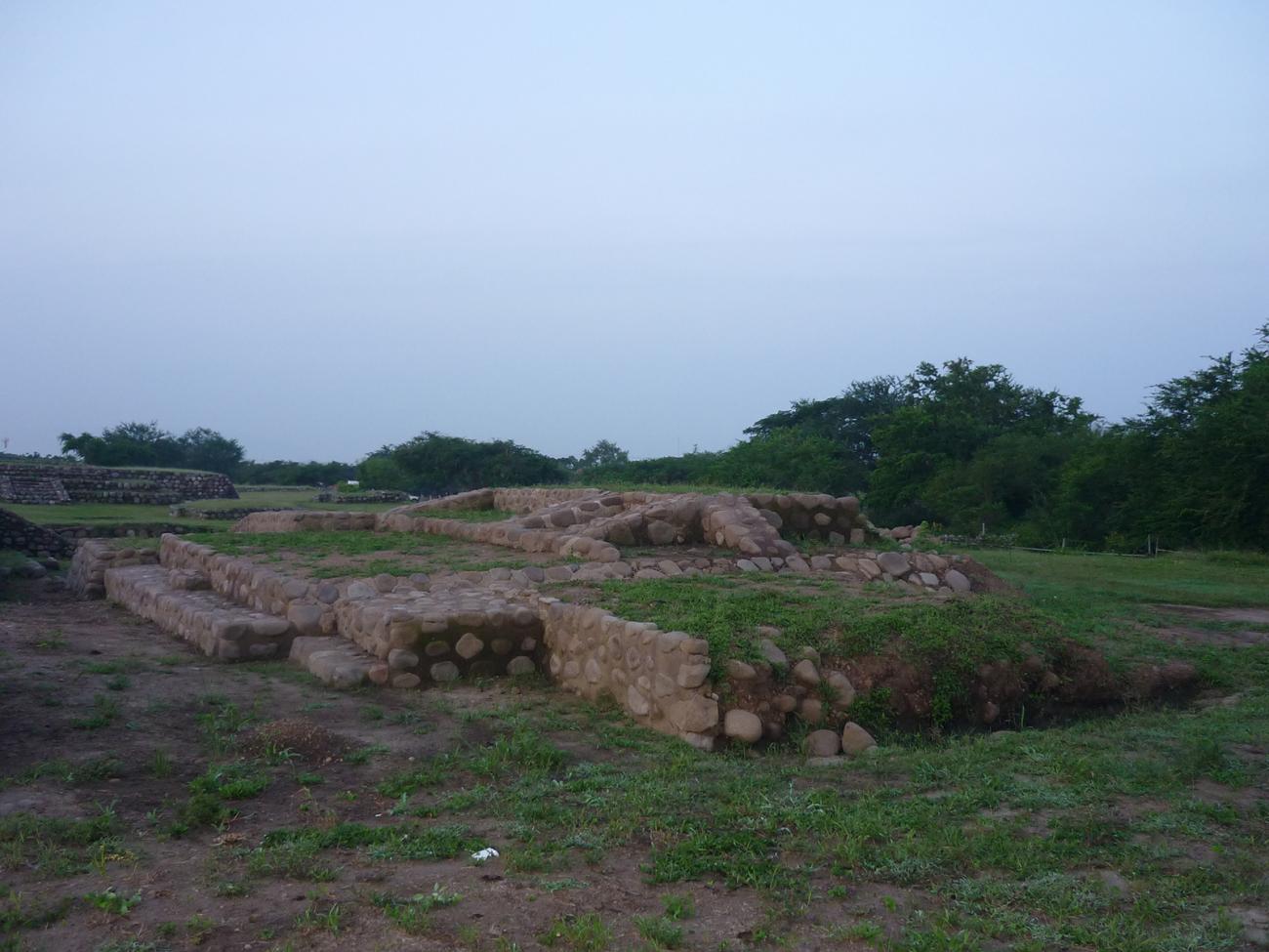
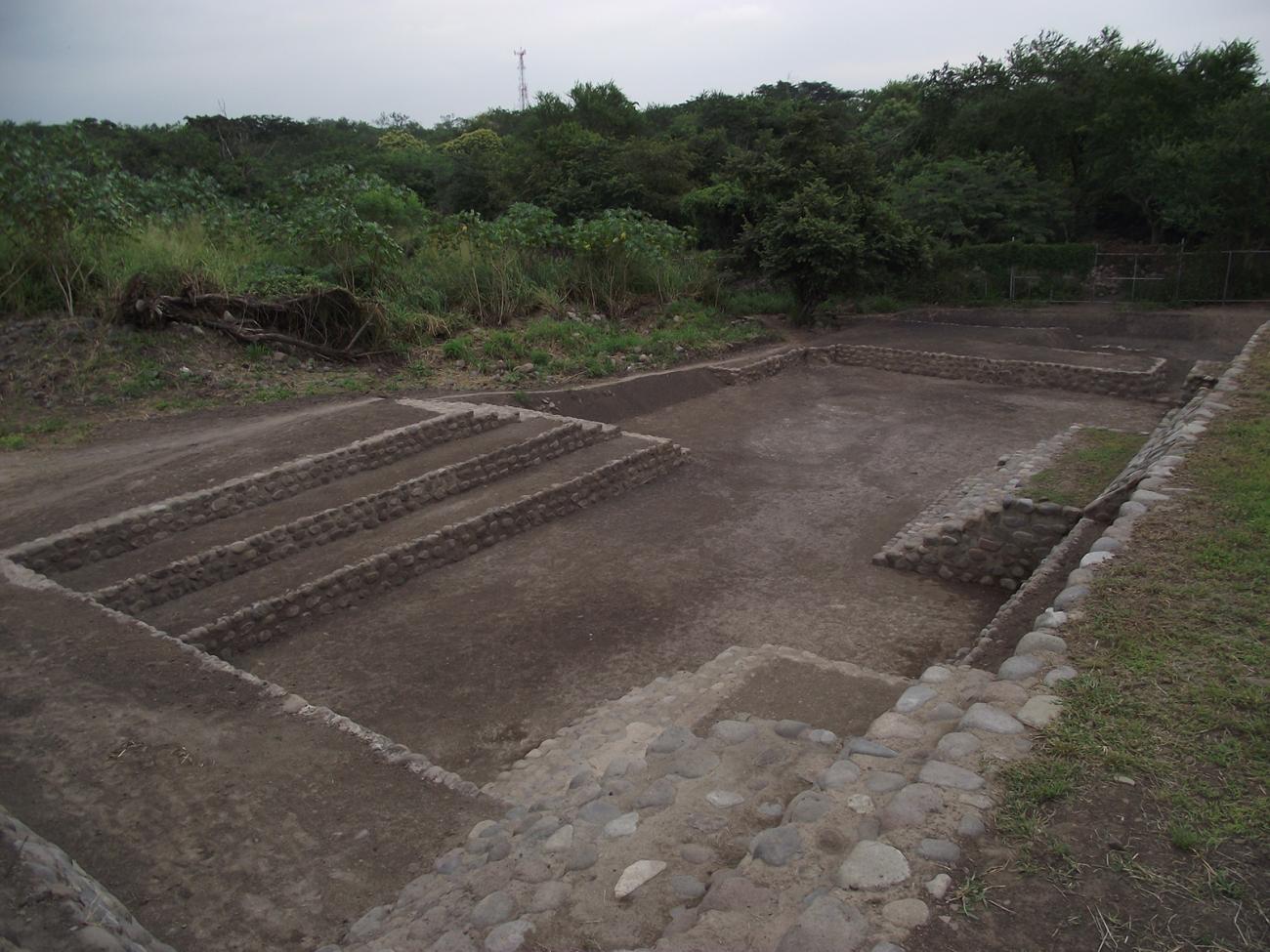
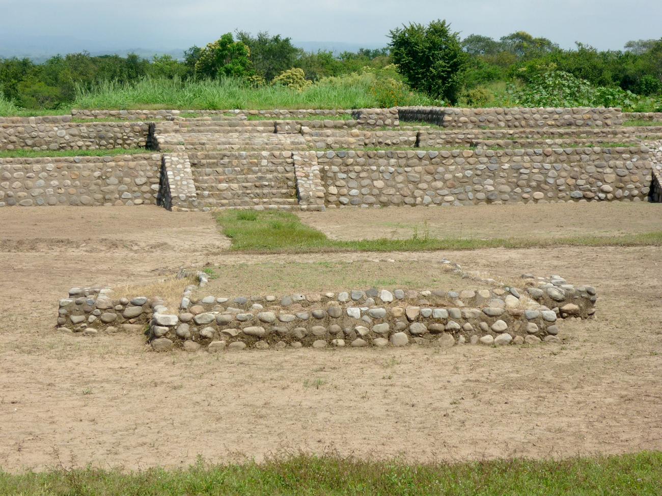
Architectural complex E-6: In the upper part of the South Platform of this complex, housing complexes and materials of its occupational sequence were defined.
Ball Court 1: It is located between Structures E-5 and E-6. In it, the ritual of the ball game was practiced, whose cosmogonic symbolism reflects the movement of the stars in the sky.
Structure E-10
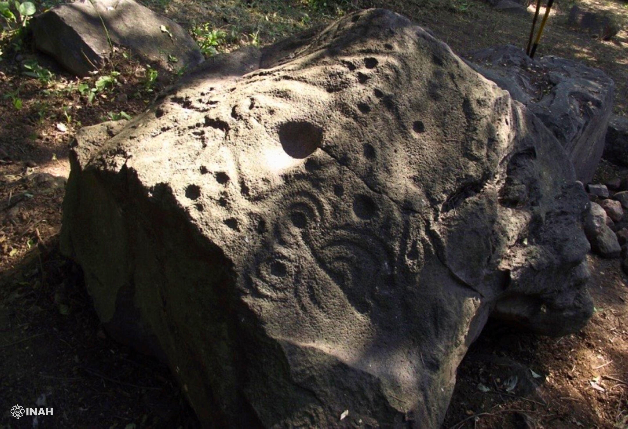
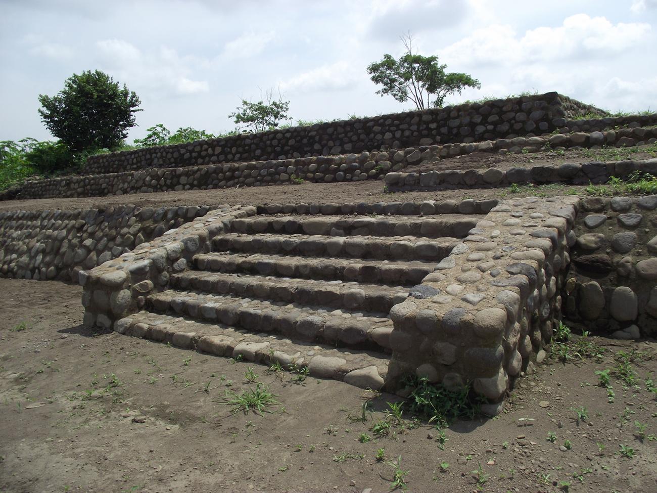
Structure E-12: In the stepped access of this structure, burials of human skeleton fragments were found.
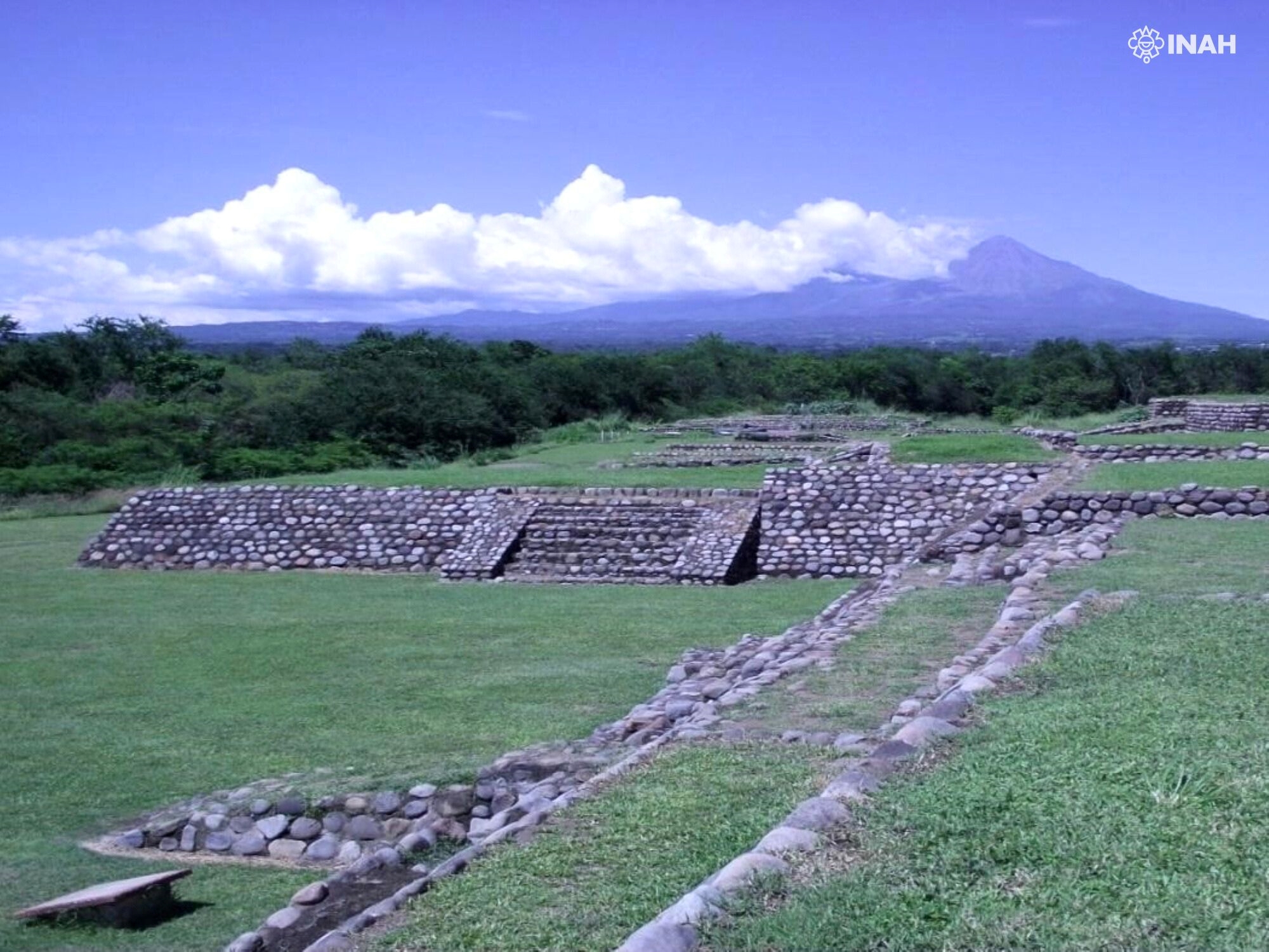
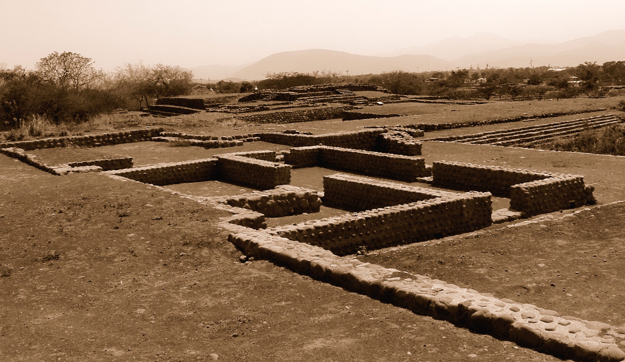
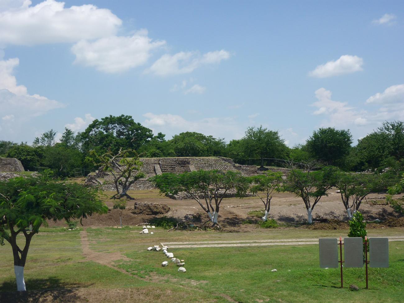
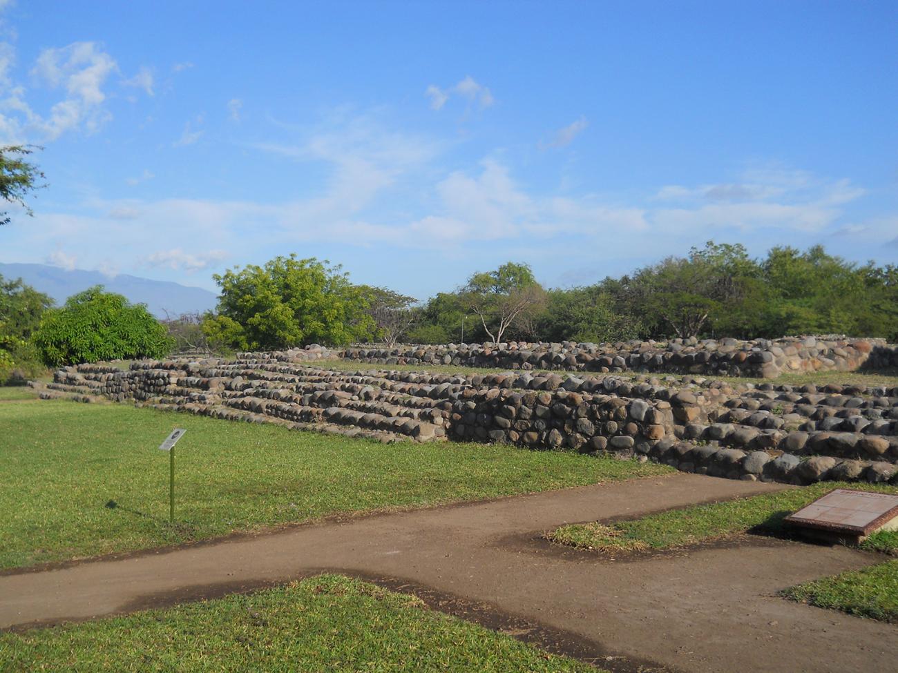
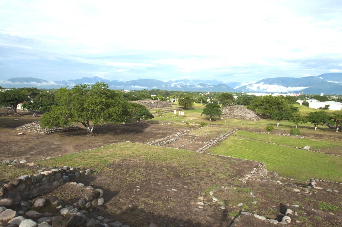
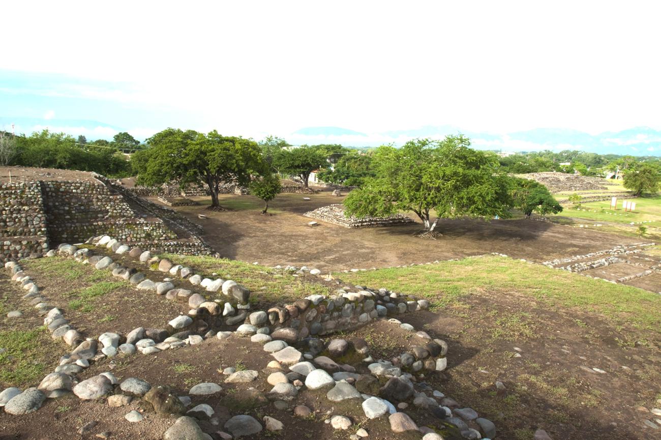
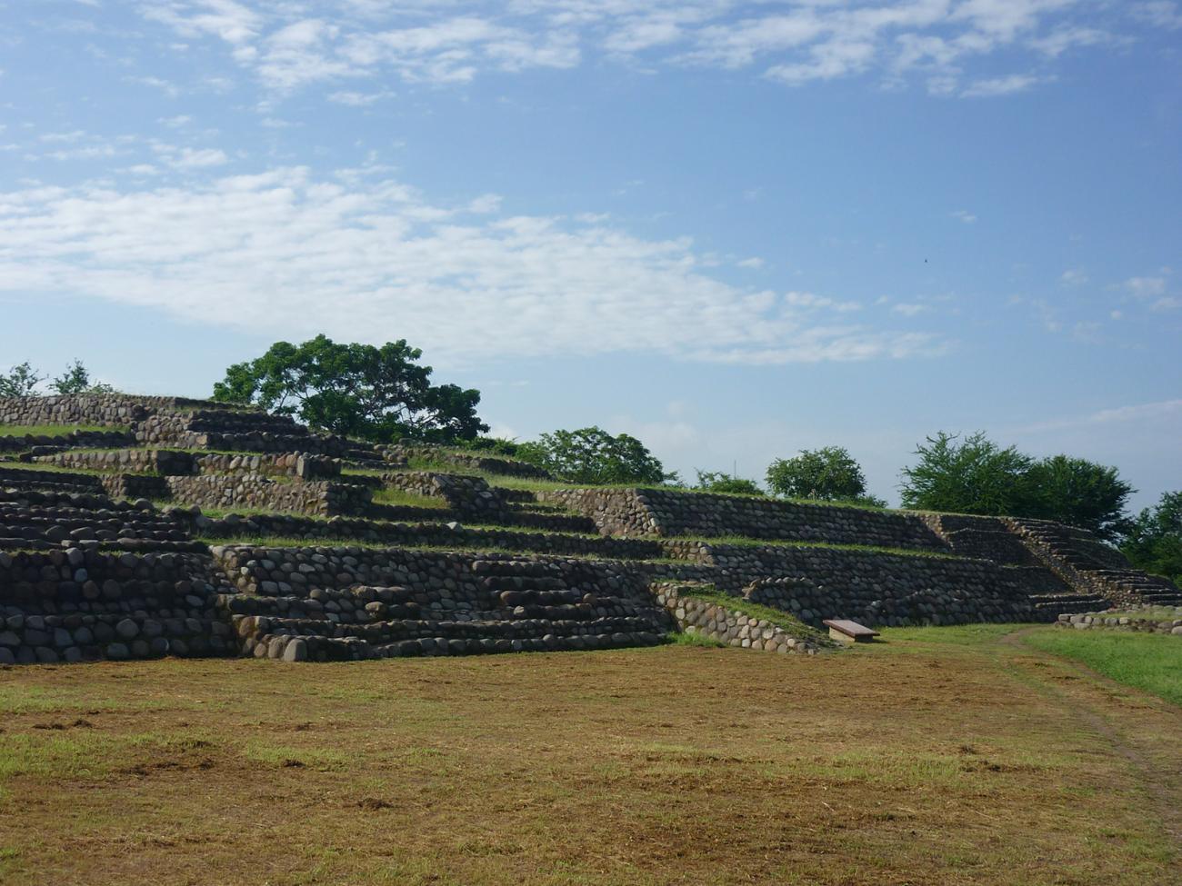
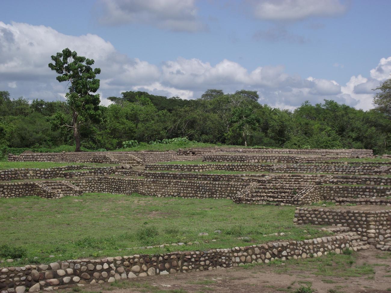
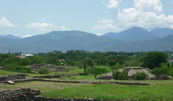
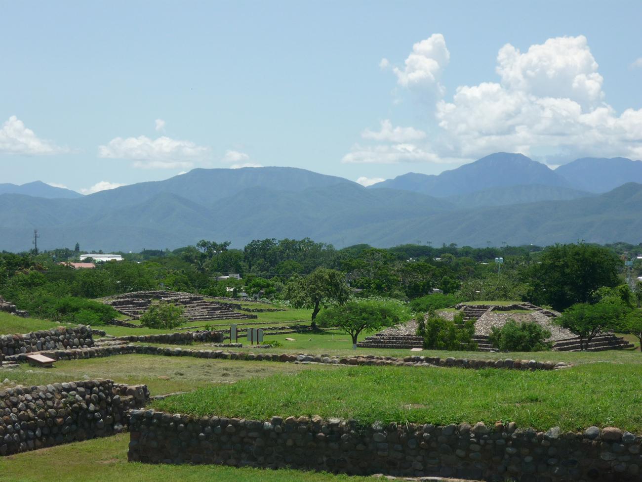
West section of the ceremonial center: General view of the west section of the ceremonial center.
View of the southeast end of the ceremonial center: Structures and plazas on the southeast side of the ceremonial center.
Recinto 1-A
The complexes are defined by four monumental platforms on which ceremonial buildings were built.
The complexes are defined by four monumental platforms on which ceremonial buildings were built. In general, these groups, especially Precinct 1-A, recall the most important religious precinct of Teotihuacan, known as La Ciudadela, as well as others of Teotihuacan affiliation, such as San Nicolas El Grande, Tlaxcala and Chingú, near Tula, Hidalgo.
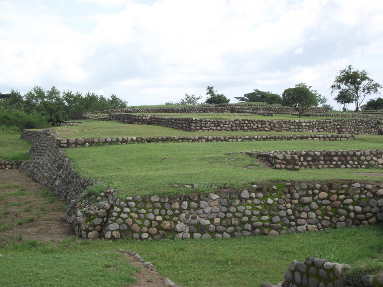
Plaza and north side of the North Platform: General view of the North Plaza located in the North Platform, where fragmentary sculptures of lumens and parts of ceremonial objects were recovered.
East Platform and Structure E-North: Living spaces for important priests and for the storage of ritual materials. The North Structure is dedicated to the Numen of Fire.
Inner Plaza and East Platform: View of the most important architectural complex of the ceremonial center. Residence of the important priests and place where rituals were performed at sunrise and the activity of the Volcano of Fire.
Inner Plaza, West and North Platform: Partial view of the interior of Precinct 1-A, whose architecture is influenced by central Mexico, as it has similarities with the Citadel of Teotihuacan and the Great Temple of Mexico-Tenochtitlan.
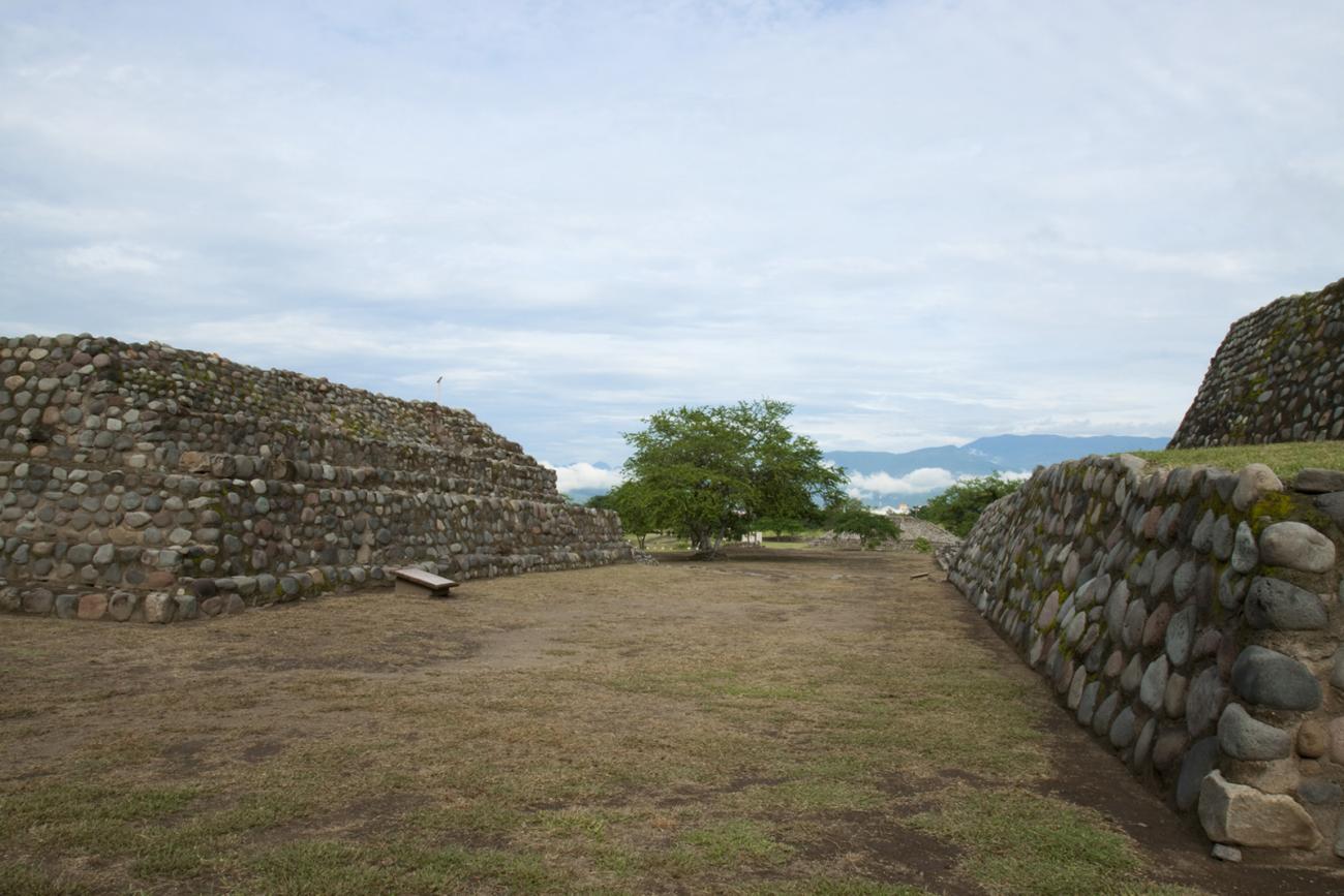
West Platform and central altar section: Partial view of the West Platform and central altar.
West main access to the upper section of E-6: The west stepped access allows ascending to the upper section of the E-6 complex, integrated to the south section of Precinct 1-A.
Recinto 2
Architectural complex of rectangular plan, dedicated to the cult of the Volcano of Fire and the sun. It is characterized by its sets of rectangular enclosures designed for religious and administrative functions, oriented from east to west according to the daily transit of the sun.

Architectural complex of rectangular plan, dedicated to the cult of the Volcano of Fire and the sun. It is characterized by its sets of rectangular enclosures designed for religious and administrative functions, oriented from east to west according to the daily transit of the sun. In addition to emulating the annual movement of the sun, it manifested the knowledge of the movements of the star, as well as the management of a solar calendar of agricultural character.
West view: View from west to east of Precinct 2 of the ceremonial center.
West Platform of Precinct 2: Detail of the West Platform of Precinct 2, where ceremonies to the sun took place.
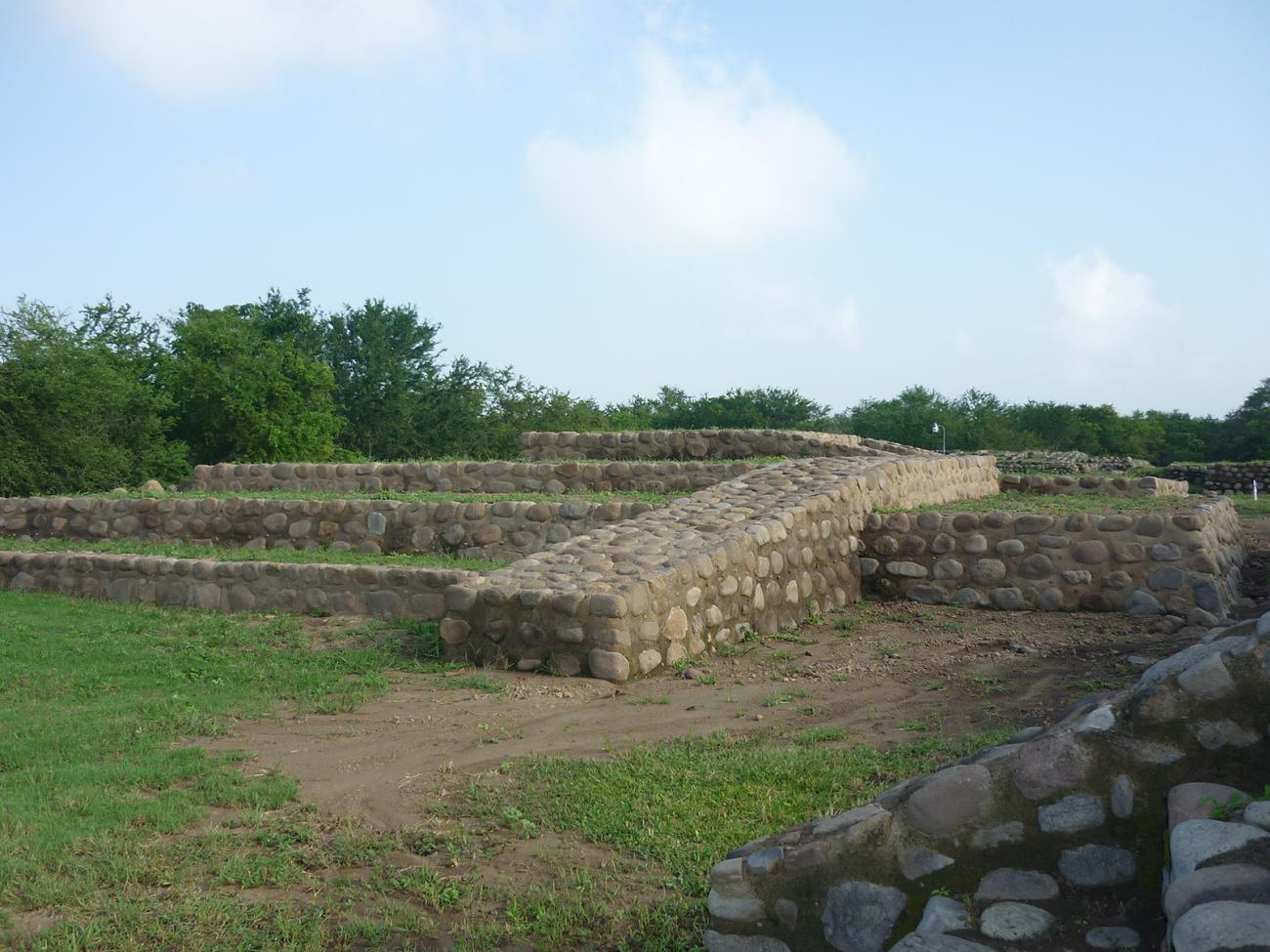
South plaza and west side of structure E-43: View of the stairway on the southwest side of Platform E-43.
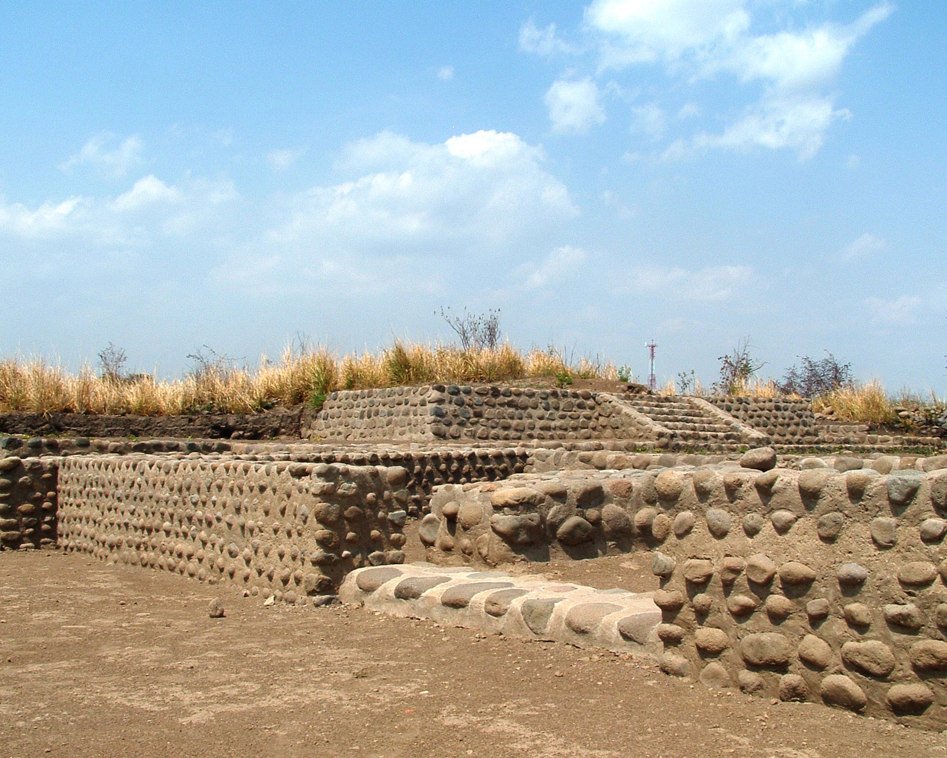
Southwest side of the South and North Platforms: Details of the stone walls characteristic of the platforms and building structures.
Walls and architectural details of E-43 and E-44: The architecture is characterized by superimposed stepped platforms defined by stone walls.
South side of Platform E-43: Detail of the architectural complexity of the upper south section of the east end of E-43.
North side of Structure E-44: Stepped access to access the top of the north side of E-44.
Estructuras E-1 y E-2
West section of the ceremonial center, with Structures E-1 and E-2. The first consists of an upper enclosure built on superimposed stepped platforms, with a residential function for important people.
Adoratorio Piramidal Edificio E-2
It is oriented to the Volcano of Fire of Colima, and the design of its plant resembles that of the same volcano. Fragments of human skeletons were found around it.