


Guiengola
It is believed to have been a fortress for defense against hostile groups, and at the time of the Conquest it was a Mixtec administrative center.
Guiengola is situated on a hill of the same name. The course of the Tehuantepec River runs to the west of this limestone hill with many caves, making its way to the Gulf of Tehuantepec.
According to seventeenth-century sources, the Zapotecs of this settlement were allied with the Mixtecs to defend the isthmus territory against the advance of the imperialist Mexica in their push to the Soconusco region of Chiapas. The isthmus was controlled by the Zapotecs from the Central Valleys, who made use of its varied natural resources. The Mexica were defeated and had to agree a marriage alliance.
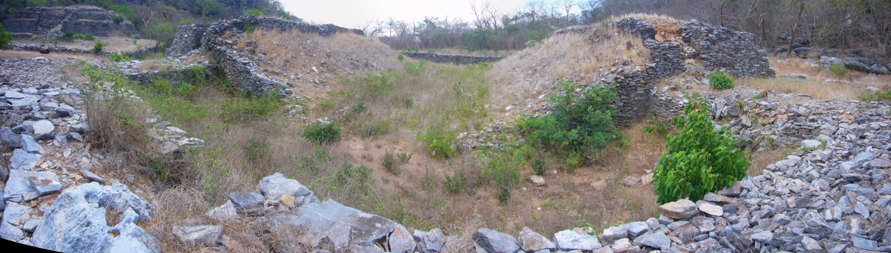
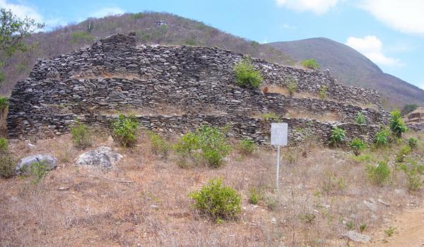
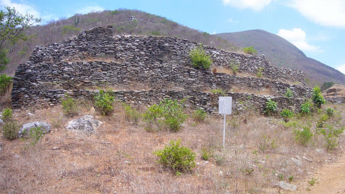
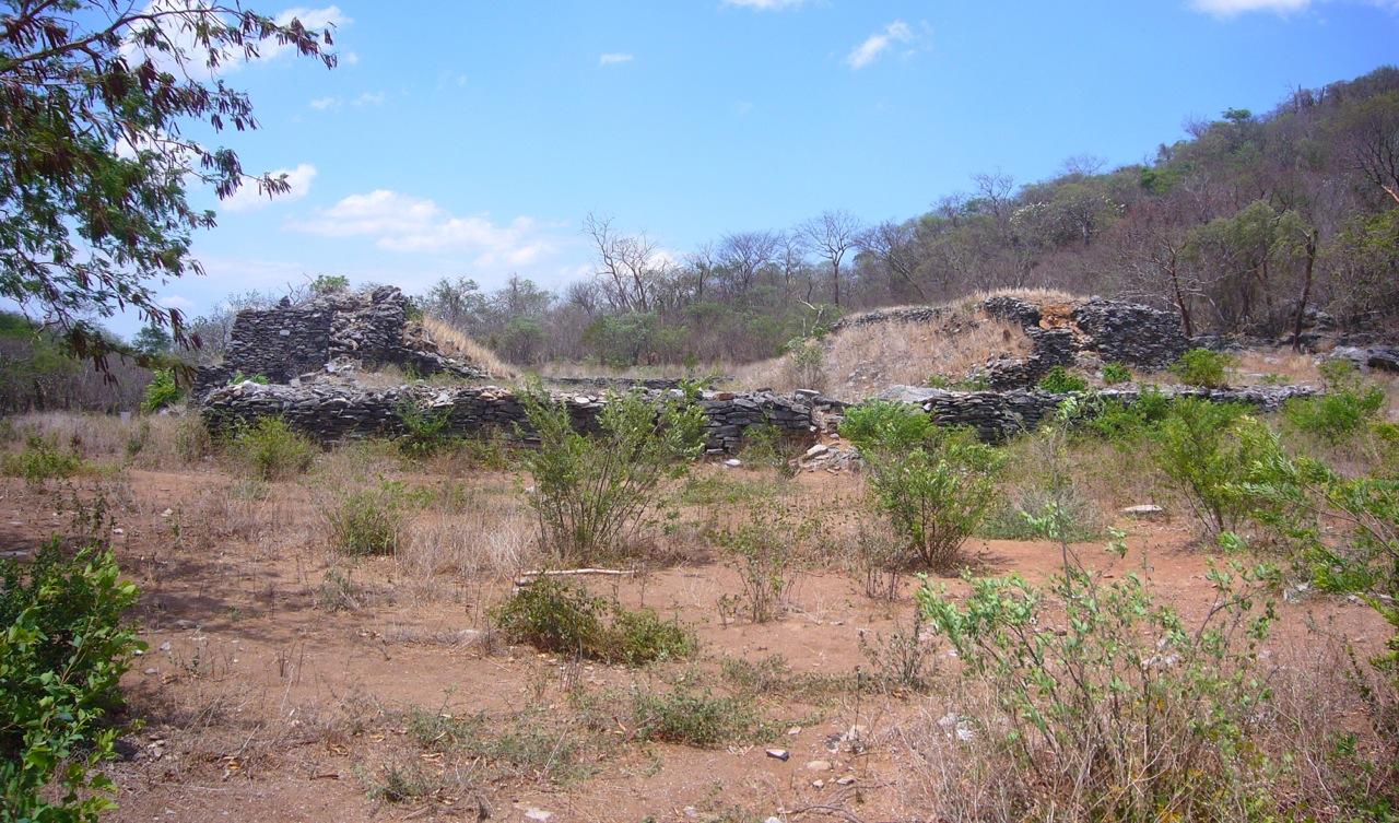
It is said that this site was built purposely as a fortress and its location certainly made it unassailable. It was an impregnable fortress with well-planned construction and the topography was carefully exploited. In short, it was a fortified place with seven-foot-wide defensive walls with a height of 10 to 16 feet, depending on the position on the hill. River stones were placed at regular intervals along the enormous defensive wall surrounding a part of the hill. Examples of military infrastructure include probable stores for foodstuff, the remains of a few controlled tight access points as well as surveillance posts.
This fortified civic-ceremonial center of the Postclassic period was described by Fray Francisco de Burgoa in his geographical work. Among the first to visit the site were Guillaume Dupaix, Charles Brasseur de Bourbourg, Teobert Maler and Eduard Seler.
The formal archeological investigation of the site began in the 1950s. In 1955 James Forster obtained collections of ceramics and figurines from Guiengola and from the nearby sites of Juchitán, Tlacotepec and Mixtequilla. He made a contribution to understanding the styles of these artifacts and finds from other regions of Mesoamerica. The archeologist David Peterson published the first piece in a series of works on the site in 1972. He wrote his most important work with Thomas MacDougall in 1974, the result of several mapping exercises, which were the basis for the plans drawn of the principal structures. In this work Paterson records relatively unknown structures and mentions building techniques and the looting they had suffered, among other matters.
Martín Cendrero published his bachelor’s degree thesis on the site, the only one to date (ENAH, 1986). The author did no excavation, but he did record the site’s in situ materials and explored the whole mountain. A decade later, in 1997, Roberto Zárate made a similar survey for a study focused on the rock art, reporting that many of the overhangs contain paintings of this kind, but he also noted the damage to some of these works.
- Dirección del Centro INAHJosé Manuel Bañuelos Ledesmajosemanuel_banuelos@inah.gob.mx+52 (951) 513 0389Protección y Resguardo de Bienes CulturalesManuel Rufino Aguilar Martínezmanuel_aguilar@inah.gob.mx+52 (951) 513 3346, exts. 2880
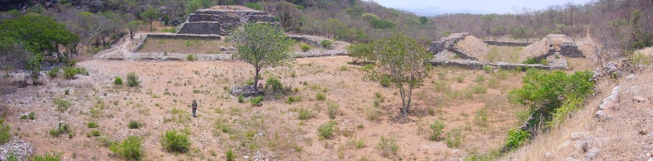
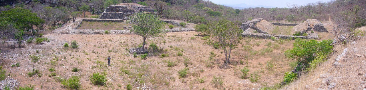
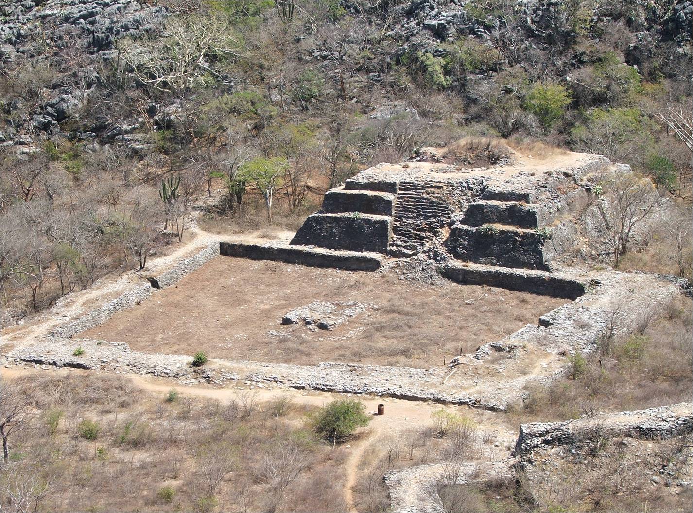
Área monumental
It consists of a ball game, two squares with their respective buildings on a northeast-southeast axis and possible water containers excavated at the site; in pre-Hispanic times, the latter were supplied by natural springs.
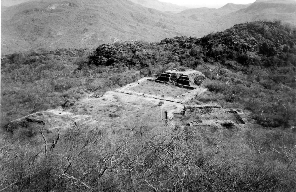
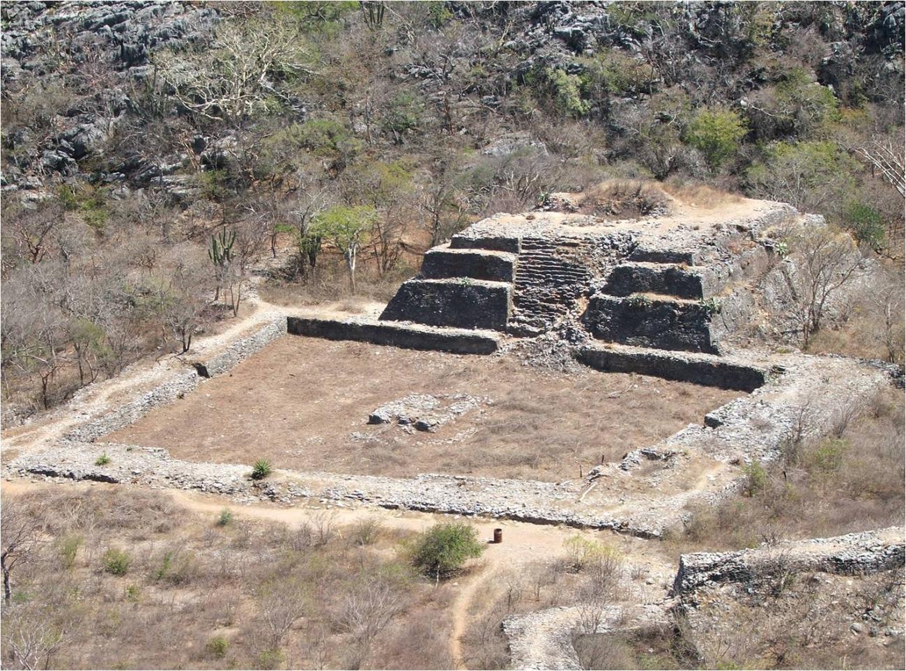
It consists of a ball game, two squares with their respective buildings on a northeast-southeast axis and possible water containers excavated at the site; in pre-Hispanic times, the latter were supplied by natural springs. From the architectural point of view, the defensive infrastructure stands out, whose planning and construction required seismic and engineering knowledge. The length of these walls and their heights in some sections are surprising. The viewpoints at points with good visibility are equally remarkable.
Ball Court
Structure with courtyard and altar
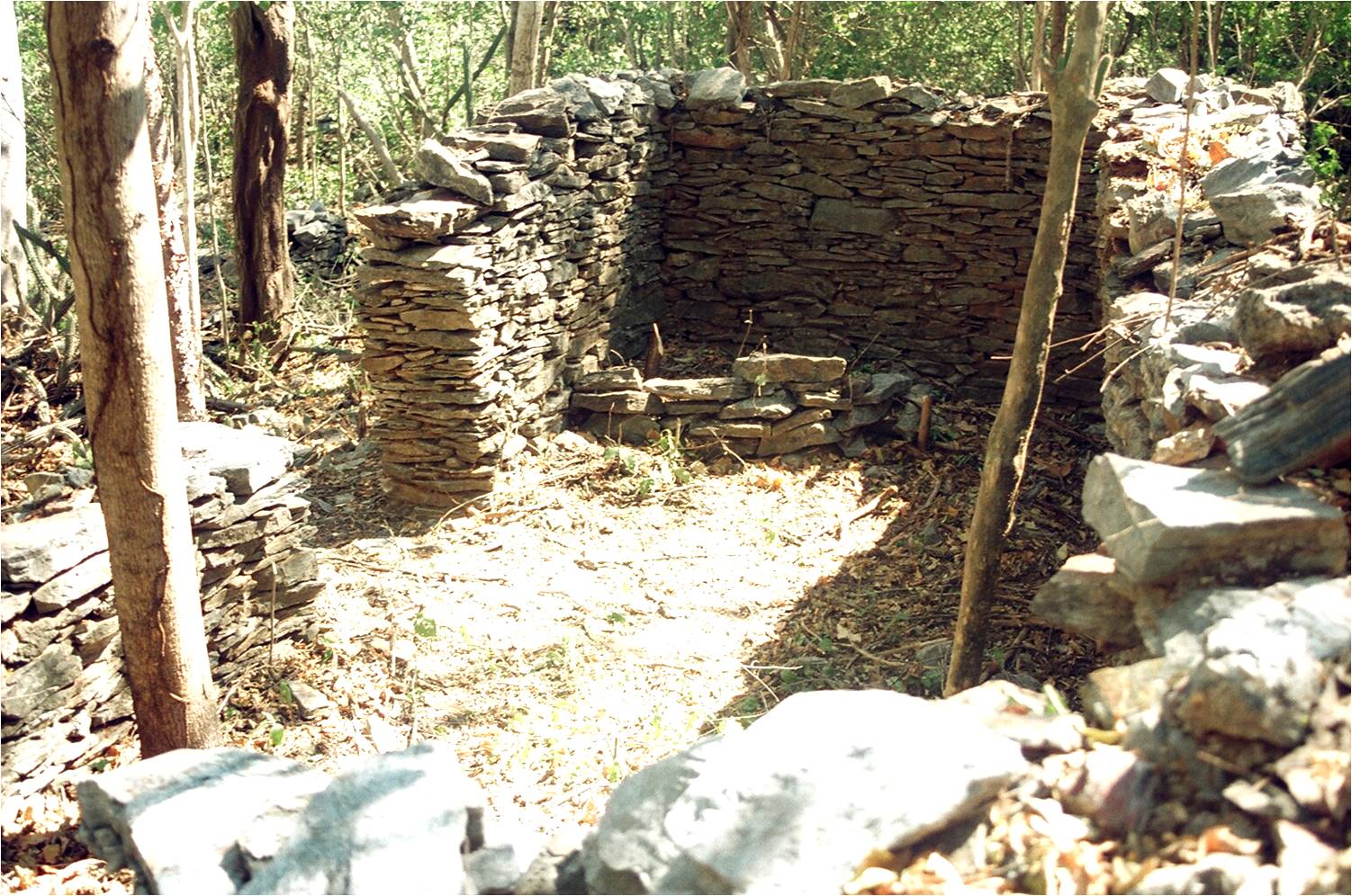
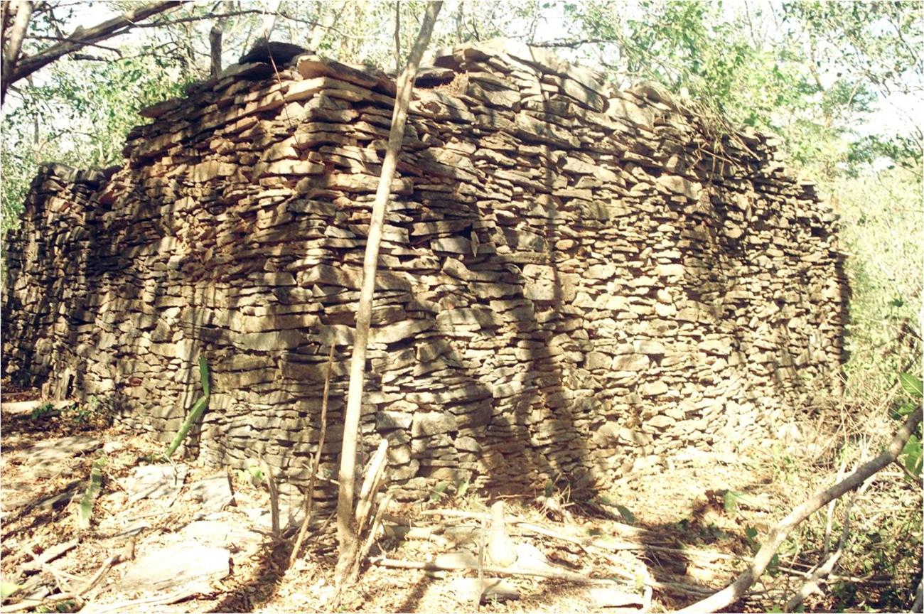
Section of wall: Guiengola is characterized by the stacking of slabs to build the walls that protected the main area. These were 2 m wide, 3 to 5 m high and 2,400 m long in a southeast, east and north direction.
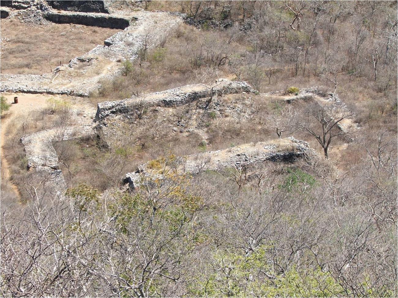
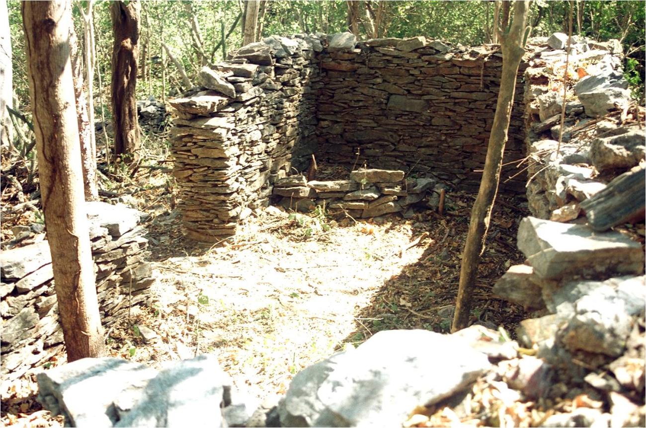
Quarry: It also highlights the construction of housing units established in the different slopes of the land, which were also erected with stone slabs obtained on site. Due to their spatial location and the characteristics of the construction spaces, the quartarias denote different statuses within the population.
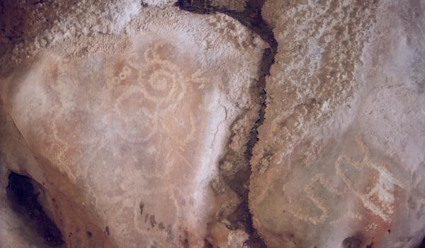
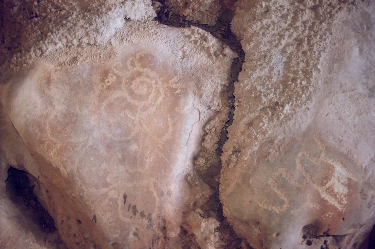
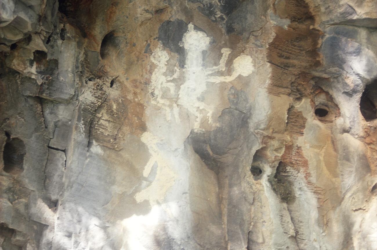
Cuevas
Within the archaeological zone there are caves and rock shelters with petroglyphs and cave paintings. Anthropomorphic, geometric and zoomorphic motifs stand out.