


Cobá
Important ancient Maya city in an area of lakes, from here the great sacbe’ob (long roads) were built, which helped it survive over many others until it was defeated by Chichen Itza. The round observatory, the great Pyramid of Nohoch Mul and the stunning inscriptions make it unique.
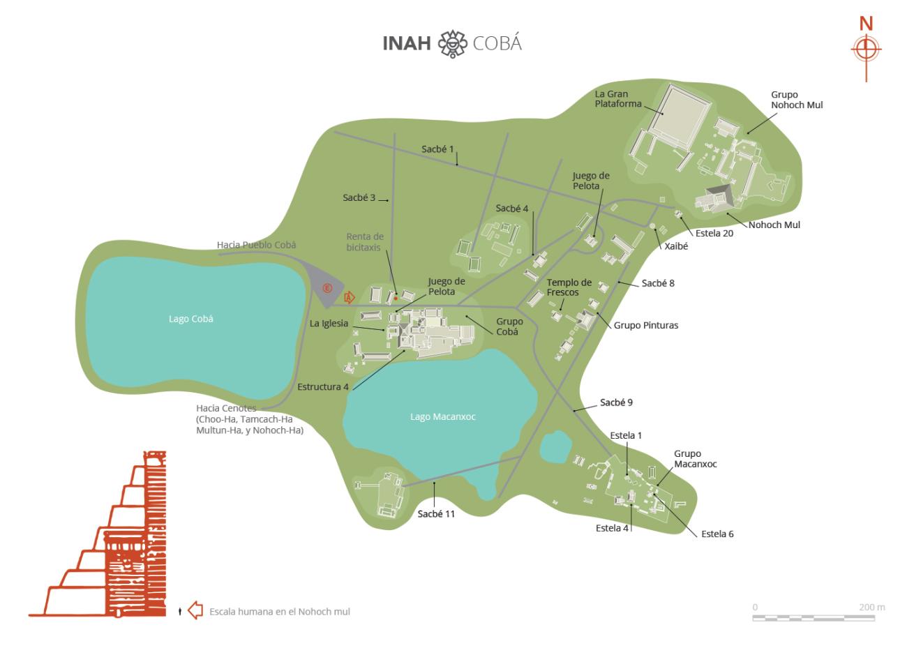
Coba, the city surrounded by five lakes, was one of the most important cities of the northern Maya lowlands. It dominated an extensive territory, and its 50 raised roads, known in Maya as sacbes (white roads), served ceremonial, administrative and residential centers. As well as creating alliances, trading and opportunities for interchange, the roads enabled Coba to exercise control over other groups. Two of the roads connected more distant places, such as Ixil, 12.5 miles away and Yaxuná, 62 miles away.
The city of Coba is one of the few pre-Hispanic settlements to keep its original name, as testified by the inscriptions carved on the monuments. Like many Mesoamerican settlements, in its early days, which was from the first century BC to the second AD, it consisted of small villages which lived by farming and hunting. Afterwards, its economy grew and its political organization improved, with power becoming more centralized; marking the start of a long process of consolidation as a city.
Coba grew and expanded between the fifth and tenth centuries. Roads were built and stelae and panels were sculpted. The road network kept expanding, and political and trading relationships began with other Mayan towns to the west and south of the peninsula, in the Guatemalan Peten as well as the Gulf and central Mexico. Between 900 and 1000 it rivaled Chichen Itza, and was ultimately defeated by it, but Coba managed to preserve its status as a religious and commercial center despite being confined to the second tier politically. It even managed to survive longer than its victorious rival. Its architecture has signs of influence from the Peten, but with a strongly local flavor, an indication that its political elite managed to establish political relations far afield.
Coba was completely abandoned by the time the Spanish conquistadors took over the Yucatan peninsula, and it remained that way until the explorer John Lloyd Stephens reported its existence in 1842, yet without ever actually seeing it. Only the odd chicle tapper, in search of the valuable sap of the sapote tree, ever went deep into the forest. Juan Peón Contreras and D. Elizalde arrived at Coba in 1886, sketching just one of the temples. The next to arrive was Teobert Maler in 1891. He provided us with the first photograph of a temple at Coba.
In 1926, the Carnegie Institute in Washington began a series of expeditions sending notable archeologists and epigraphists, who produced valuable work first published in 1932. Other researchers followed until 1972 when the INAH undertook the tasks of excavating, mapping, consolidation and rescue, which culminated in the opening of the site to the public.
Highlights include reliefs and stelae of prisoners and calendar inscriptions of notable events, and there are two particularly important buildings in terms of their size and height. One is the Nohoch Mul, in a group of the same name, and the other is known as “La Iglesia” (The Church), in the Coba Group. The Mayan architects and the mass of laborers—the stone-cutters, water and stone carriers, as well as the lime stucco makers—have left us majestic buildings in beautiful harmony with the luxuriant natural setting.
- Dirección del Centro INAHMargarito Molina Rendónmargarito_molina@inah.gob.mx+52 (983) 837 2411
Grupo Cobá
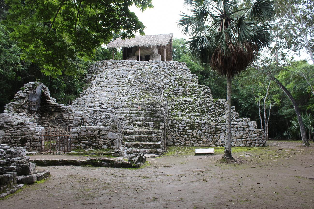
Located on the shore of two lagoons, it is the most important and oldest of the site. It has more than fifty buildings, several patios, vaulted rooms, shrines, a large plaza, a ball game and the second tallest building of the site, known as the Church.

Located on the shore of two lagoons, it is the most important and oldest of the site. It has more than fifty buildings, several patios, vaulted rooms, shrines, a large plaza, a ball game and the second tallest building of the site, known as the Church. In this group we find seven sculpted stelae. From here there are six sacbeob that end in groups of buildings of diverse dimensions and importance.
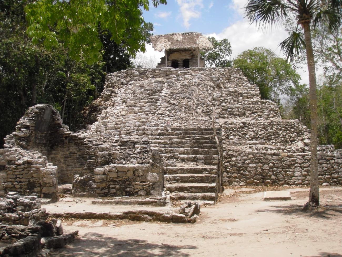
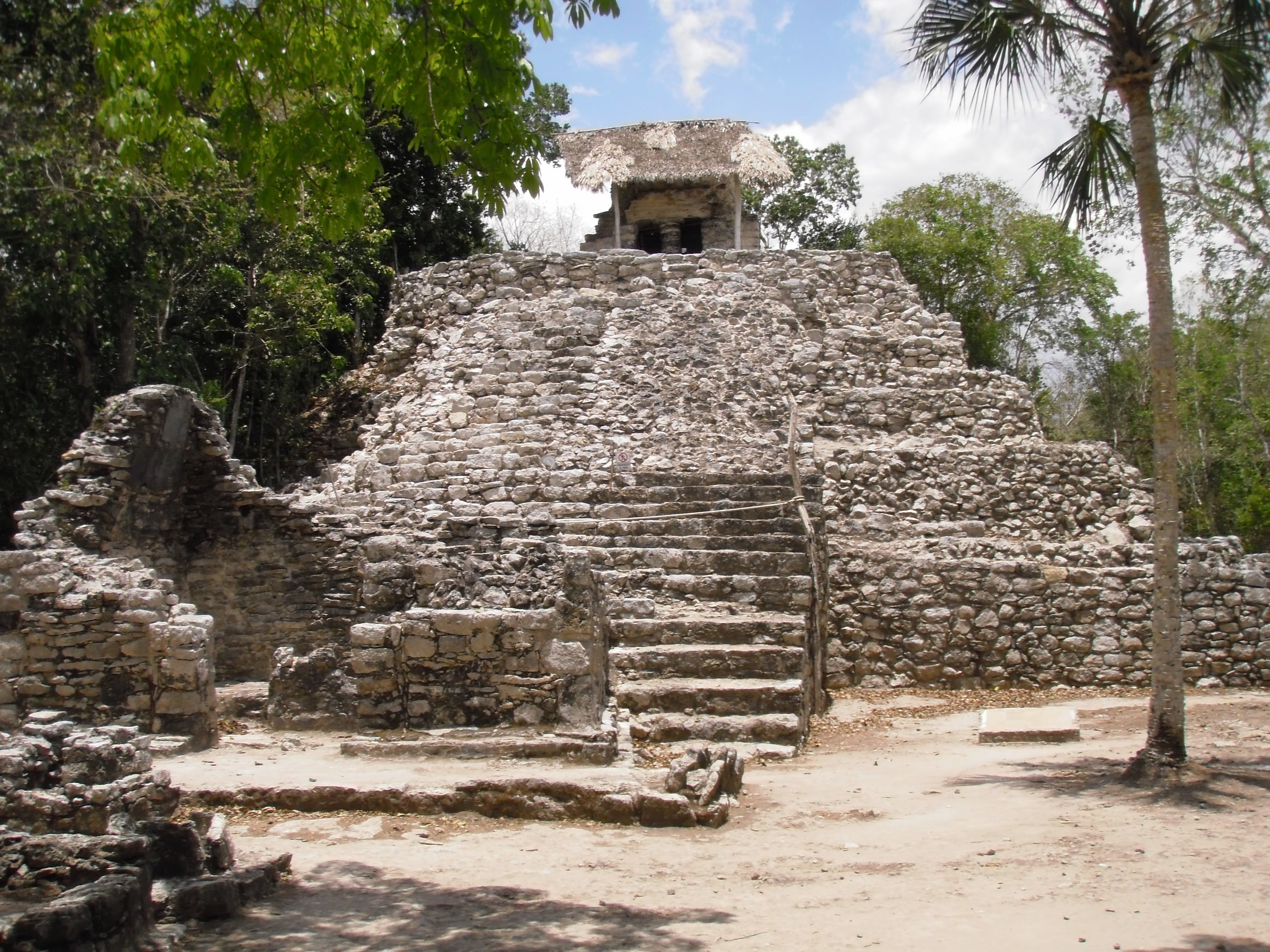
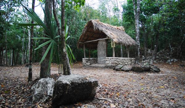
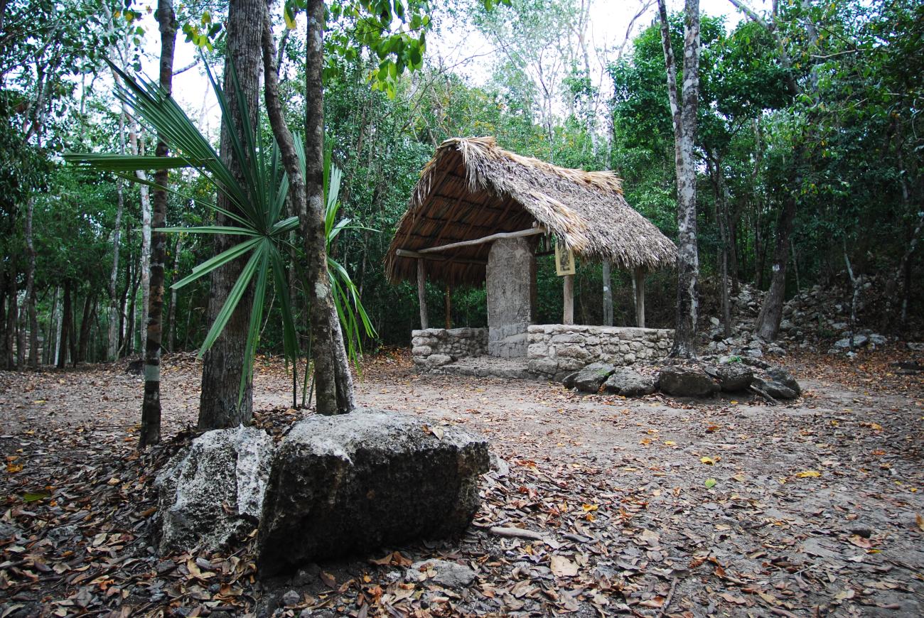
The Church: It is one of the most important structures of the site: Stela 11 was erected at its feet.
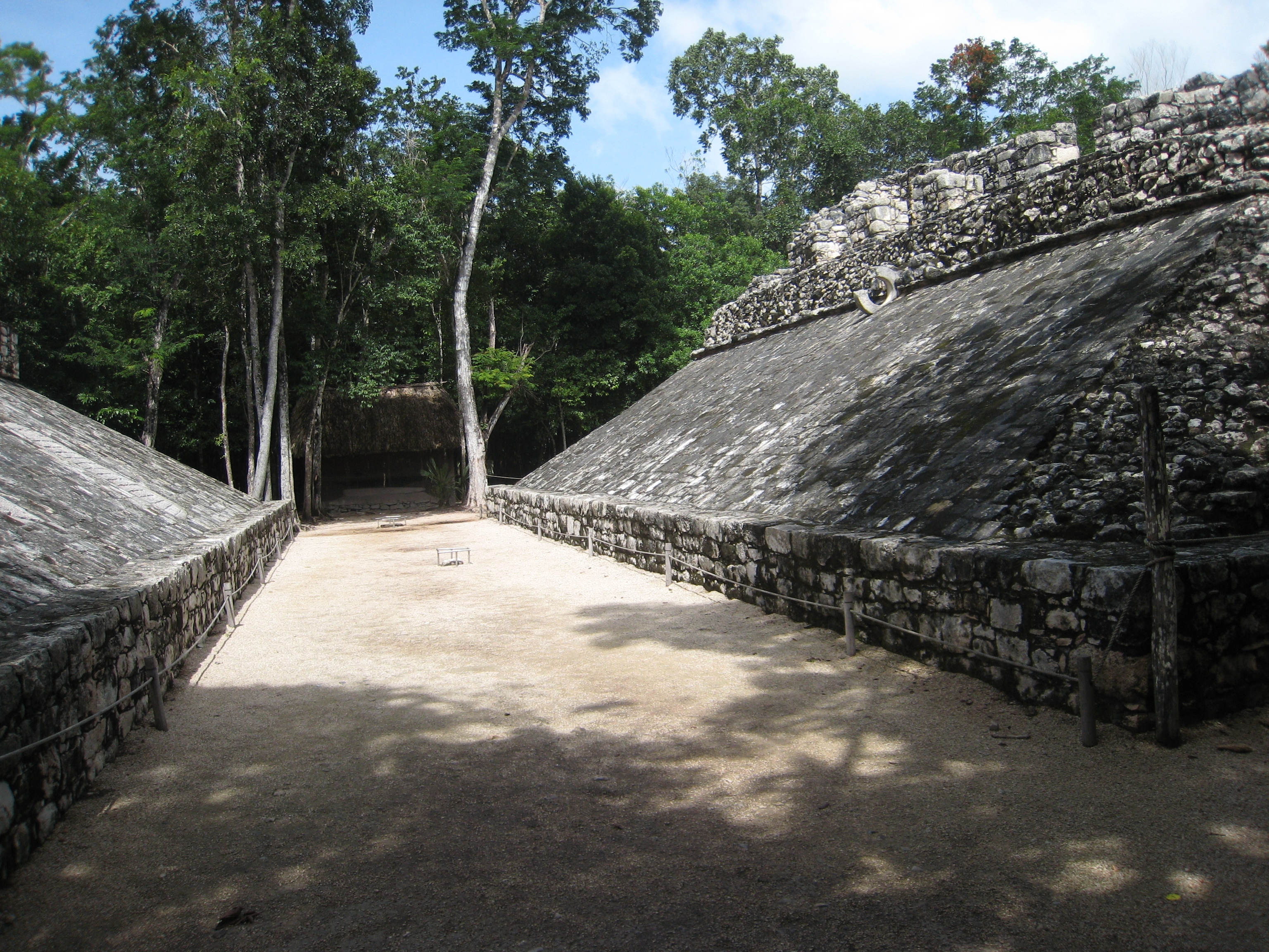
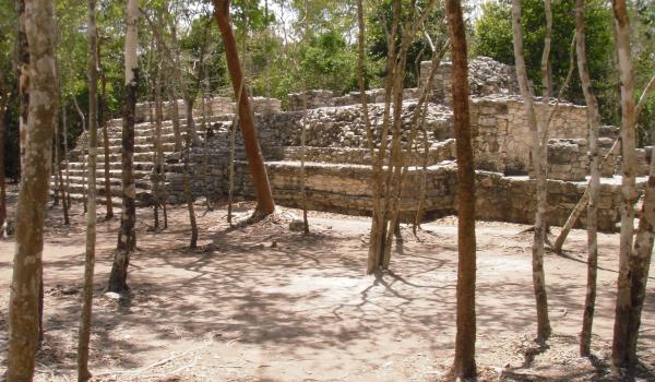
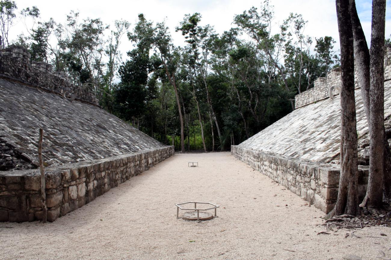
Ball Court: This Ball Court belongs to Group B. It shows the Kan stairway in the background, as well as panels with representations of captives embedded in each of the slopes.
Grupo D
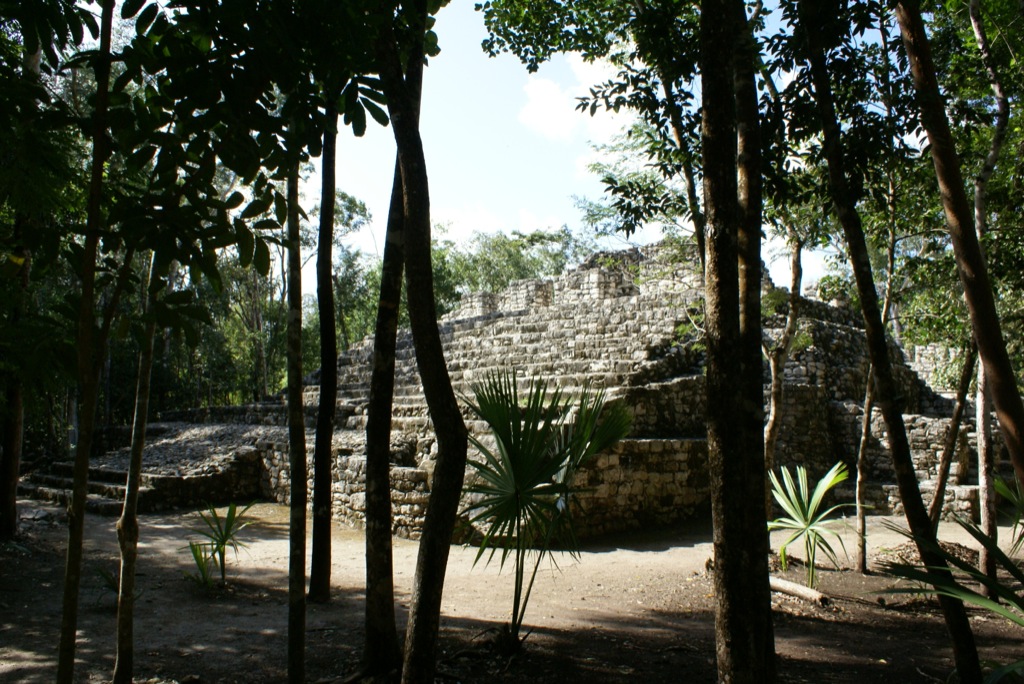
This group is formed by numerous structures. It is located in the space formed between sacbeoob 4 and 8, bordered to the north by the Nohoch Mul group, to the south by the Cobá group and the Mancaxoc lagoon.

This group is formed by numerous structures. It is located in the space formed between sacbeoob 4 and 8, bordered to the north by the Nohoch Mul group, to the south by the Cobá group and the Mancaxoc lagoon. It is characterized by a greater dispersion in the distribution of its structures and has a series of buildings arranged in squares and a ball game.
Paintings Complex: So called because of the remains of mural painting in the upper temple of the main building, which corresponds to the last period of occupation of the ancient city. Here it is possible to clearly observe the combination of two occupational periods in Cobá, the Classic and Postclassic, where earlier buildings were reused to superimpose constructions of later periods.
Ball Court: Ball Court of Group D that, in addition to the panels of captives embedded in the slope of the bodies, has markers in the court, one in the center and another at one end.
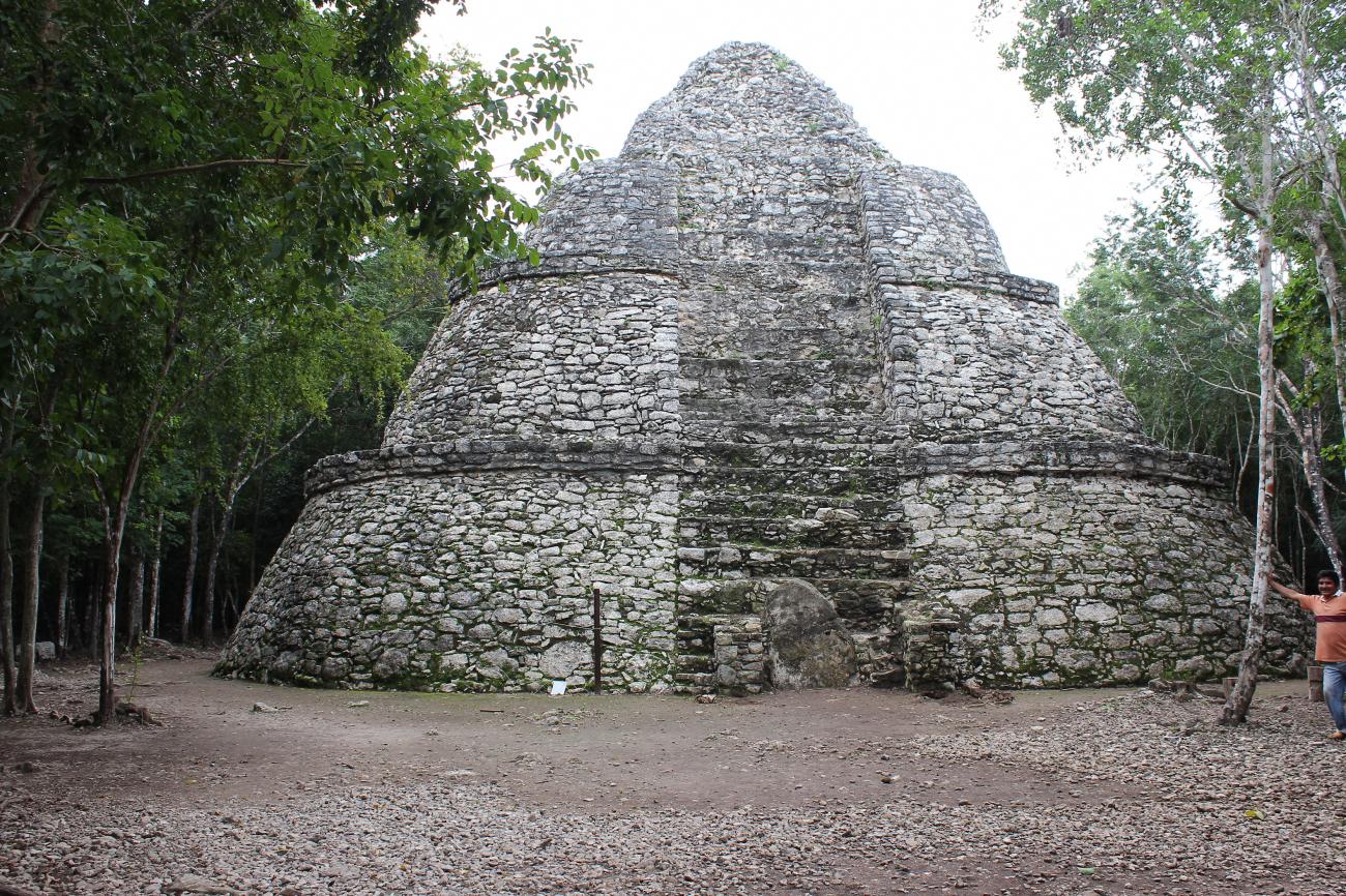
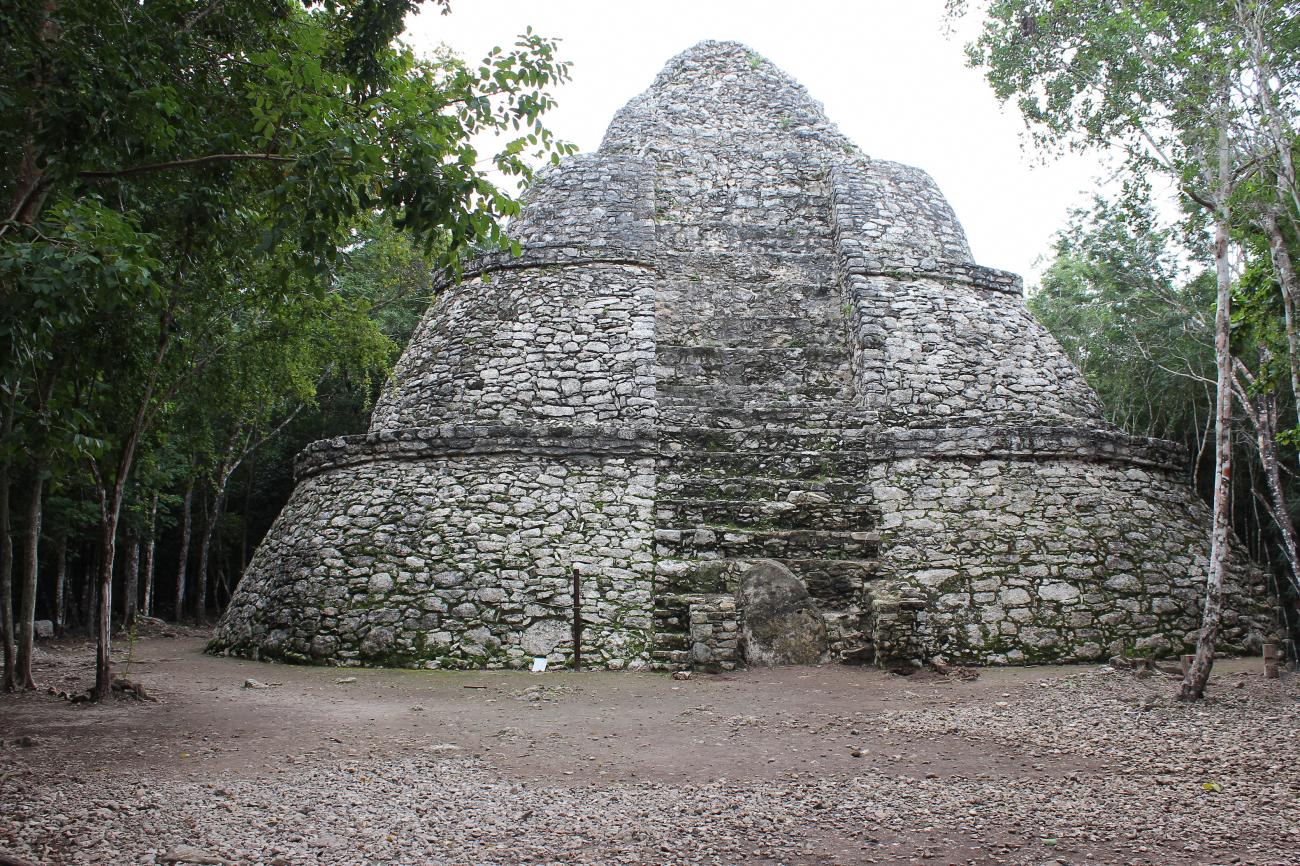
Xaibé: This unusual building, whose real function we do not know, is in the vicinity of the terms or beginnings of some sacbeoob.

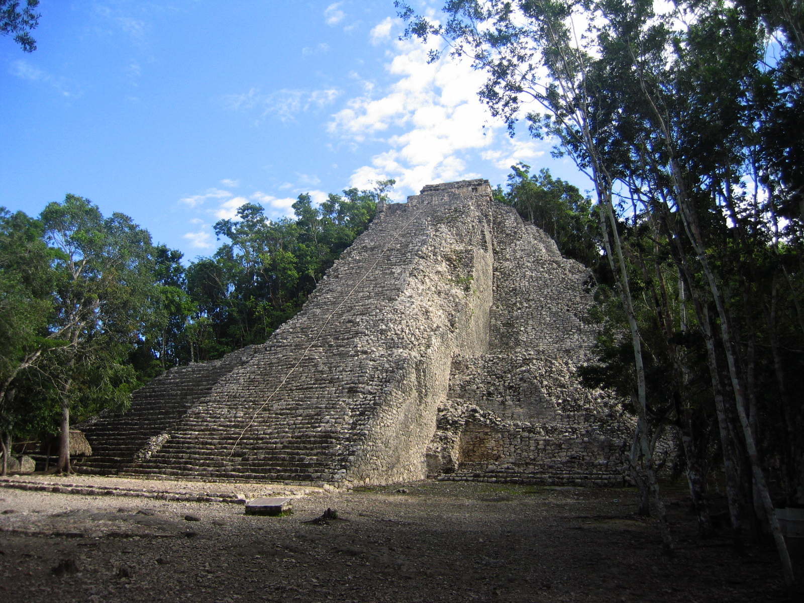
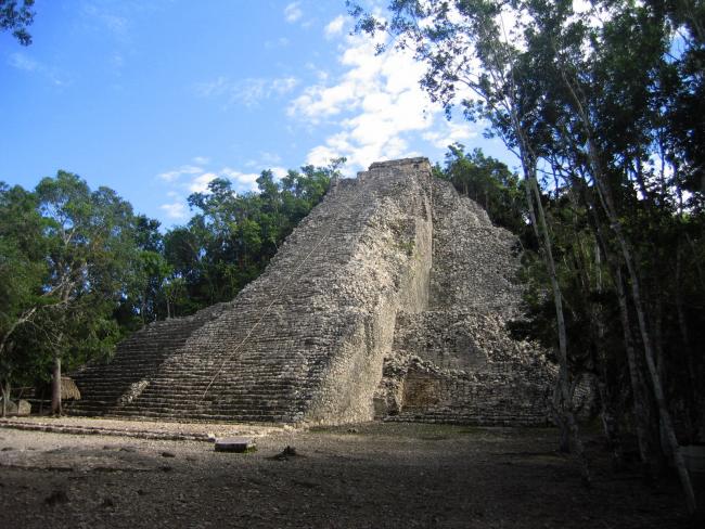
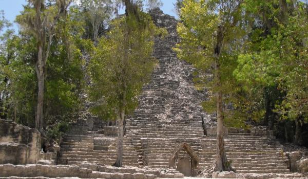
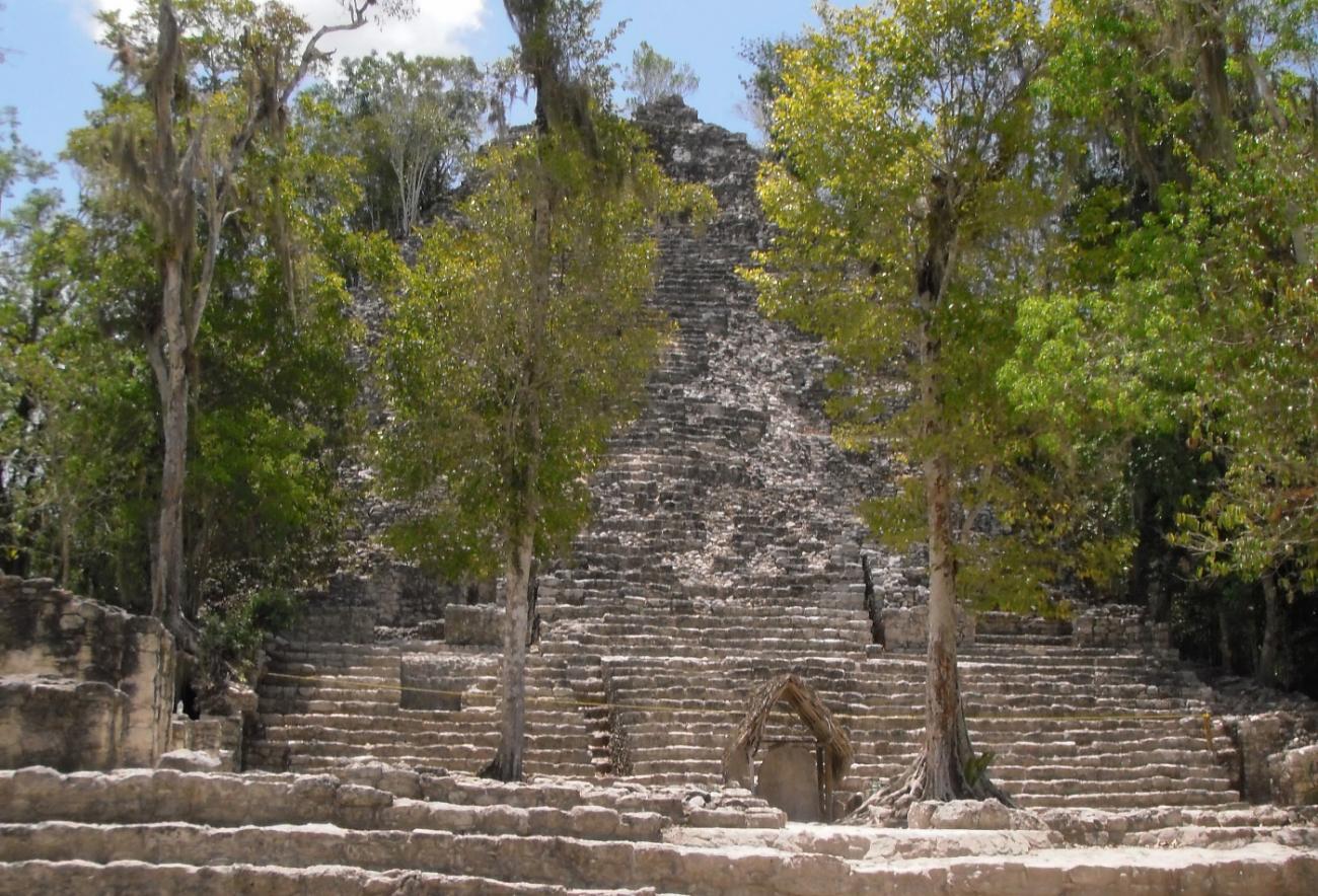
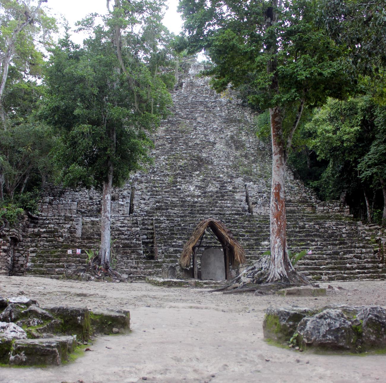
Grupo Nohoch Mul
Although it does not have a large number of buildings, they are the largest in volume of the entire site. Only three have been explored and can be visited.
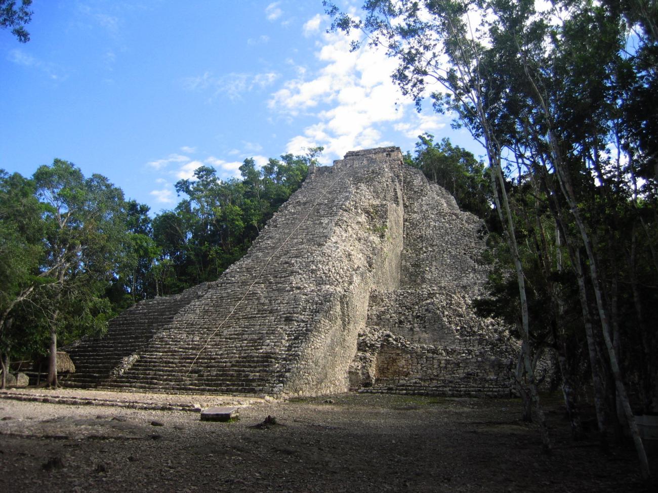
Although it does not have a large number of buildings, they are the largest in volume of the entire site. Only three have been explored and can be visited. The words “nohoch mul”, in Mayan, mean “great mound”, a name given in modern times and that is directly related to the main and highest structure of all Coba. It has two stairways on its front, one that reaches the top and another parallel one that reaches a vaulted room one level lower. The construction is composed of a base of seven bodies of rounded corners, with an upper temple whose architectural characteristics are the latest in the region, and whose features it shares with sites of the eastern coast of the peninsula. In the great square of this group is the best preserved stele of all those found so far, dated in the year 780 of our era.
Grupo Macanxoc
One arrives walking for a sacbé of the city, the widest of all, in whose trajectory we found a stela and several altars. The buildings sit on a great leveling of the land that raises between 1 and 4 meters.
One arrives walking for a sacbé of the city, the widest of all, in whose trajectory we found a stela and several altars. The buildings sit on a great leveling of the land that raises between 1 and 4 meters. It has three buildings of considerable height not yet explored and others of different dimensions.
The eight carved stelae are mostly highly eroded by the passage of time and weathering, so it is difficult to distinguish the representations depicted on them. In spite of it, it is possible to appreciate that they share the same thematic: a richly dressed personage, who sustains a great ceremonial bar on his chest and captives accompany him under his feet and/or to the sides. Several glyphs frame the scene. The dates on these monuments correspond to the 7th century AD.

The city of Coba came about as a result of the physical, intellectual, technical and artistic endeavors of thousands of people over hundreds of years.