


Chinkultic
The great city of the lakes of the ancient Maya, near the Guatemala border, with buildings cleverly adapted to the irregular shape of the hills. It has a very large ballcourt and the Plataforma de las Lajas (Platform of the Stone Slabs) was built from the largest cut stones in the whole of Mesoamerica.
This Mayan city in the state of Chiapas reached its peak between 750 and 900. It is close to the border with Guatemala, in a mountainous region dotted with lakes and cenotes, very close to the Montebello lakes and the town of La Trinitaria. Its name in Maya could mean “the cave with descending steps,” or the “stepped cenote.” The site was first settled around 50 BC and it was abandoned by 1200 AD. The pottery found at the site indicates that it was a very important trading center. The sun and Chaac, the rain god, were worshiped most extensively.
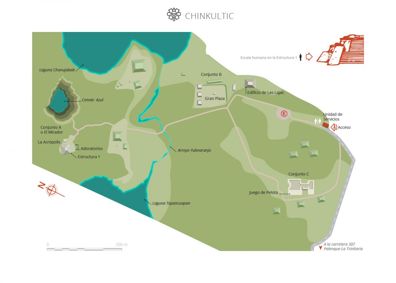
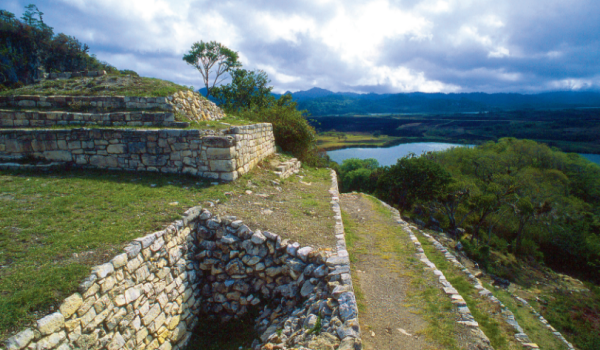
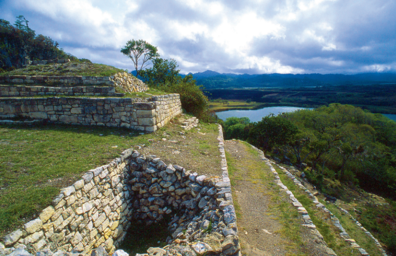
The site’s monuments are divided into four complexes: El Mirador ("The Lookout") with its Acropolis; Complex B with the Plaza Hundida ("The Sunken Plaza"), Complex C with its ballcourt and Great Platform and Complex D with its great Pyramid and the Plataforma de las Lajas ("Platform of the Slabs"), made from great slabs of stone measuring 16 inches by eight feet 6 inches, the largest in Mesoamerica. The whole site can be viewed from different perspectives from either El Mirador or the Plaza Hundida.
The German Eduard Georg Seler explored the site in the final years of the nineteenth century. In 1923, Frans Blom and Oliver La Farge cleared the way to the ballcourt and recorded its figures and glyphs for the first time. Enrique Juan Palacios provided a general description of the site three years later. In 1928 Frans Blom calculated that Chinkultic was built between 591 and 897. Sixteen years later Sylvanus Morley and Eric S. Thompson visited the site and discovered Stela 10, which also had a figure and glyphs. In 1958, Gareth W. Love visited the site with the support of the New World International Foundation. A new archeological project started in 1966 under the direction of Stephan F. de Borhegyi, sponsored by Milwaukee Public Museum in Wisconsin, and the following year Guillermo Bonfil of the INAH began the systematic excavation of Chinkultic.
- Dirección del Centro INAHLeobardo Daniel Pacheco Ariasleobardo_pacheco@inah.gob.mx+52 (961) 612 2824EncargadoGabriel Lalo Jacintogabriel_lalo@inah.gob.mx+52 (961) 612 2824
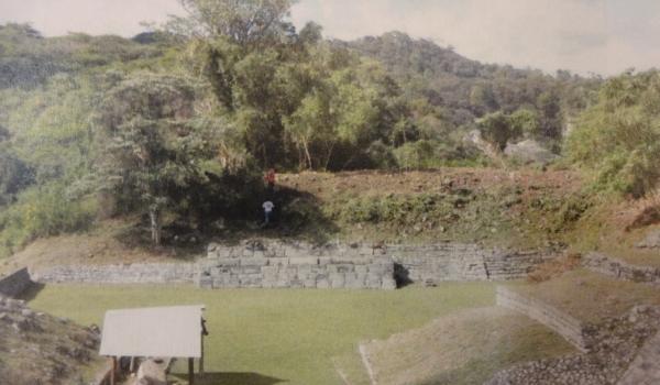
Juego de Pelota
It is part of the so-called Group C. Large ball court with a huge adjacent platform on the top of a hill. In its west side and from the platform that delimits this structure there is a series of staggered terraces that finish in the superior part with three temples and a small square.
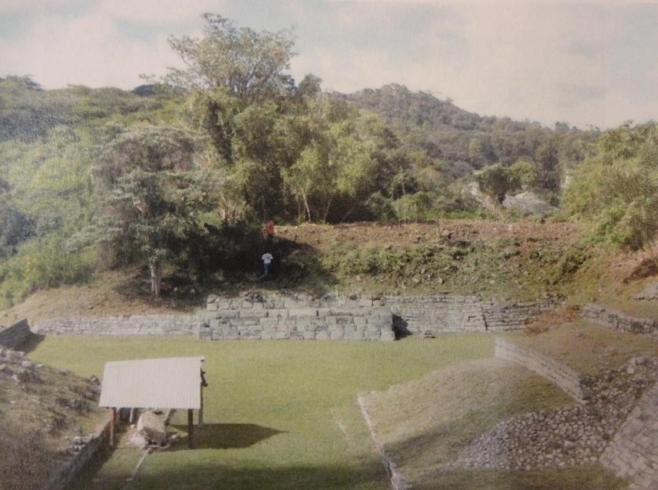
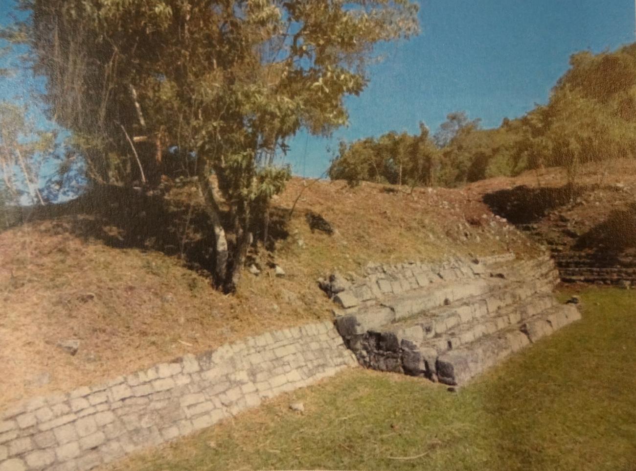
It is part of the so-called Group C. Large ball court with a huge adjacent platform on the top of a hill. In its west side and from the platform that delimits this structure there is a series of staggered terraces that finish in the superior part with three temples and a small square. The east side conserved without any modification its natural landscape of elevation in which the rock outcrops and the vegetation covers it.
Acrópolis
Integrated by six buildings distributed around a square in which there is also a stela.
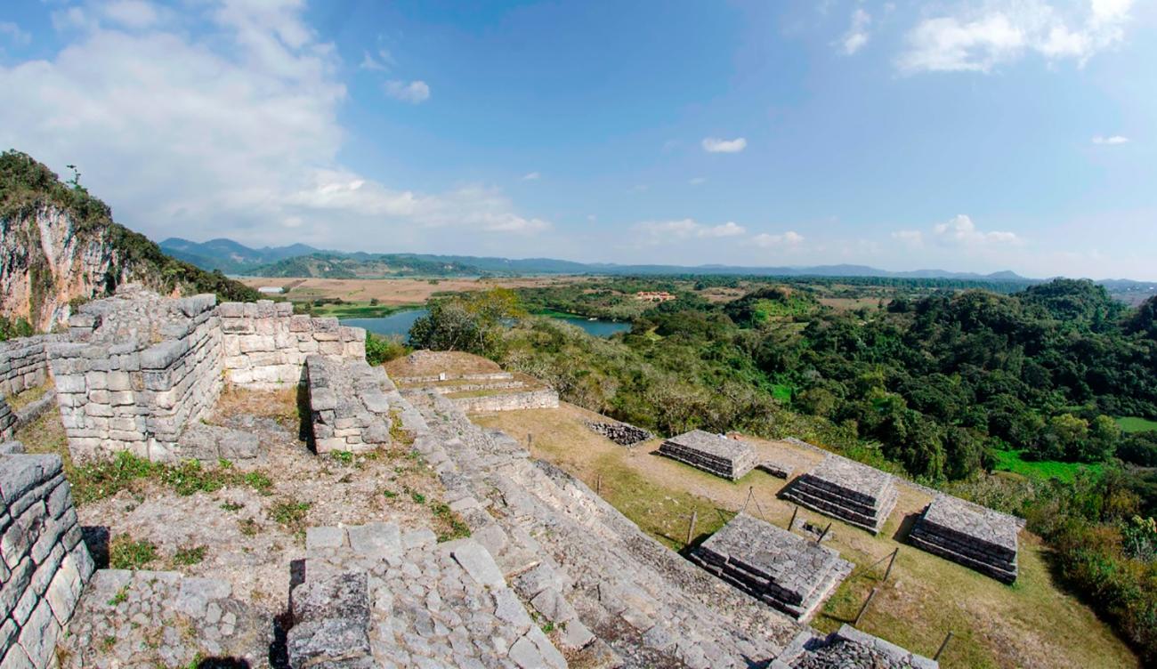
Integrated by six buildings distributed around a square in which there is also a stela. Two of the buildings are pyramids and one of them is the main one, with the facade oriented to the south and it looks directly towards the monumental stairway; the other pyramid is located at the east end of the square, delimiting it. The remaining buildings are four altars.
