


Yaxchilán
In the Lacandon forest, on the banks of the Usumacinta River, lies this imposing city with beautiful architecture and sculptures. There are 124 remarkable inscriptions on stelae, altars and lintels, recording the acts of its governors, ceremonies, battles, rituals and daily life.
Yaxchilán is one of the most important Mayan archeological sites of the Late Classic period, from 600 to 800 AD. It is especially notable for the richness of more than 130 monuments with inscribed stelae, lintels, altars and steps which tell the story of a dynasty which lasted from the fourth to the ninth centuries. These artistic expressions portray the lives of the governors and scenes of conquest, battle and self-sacrifice.
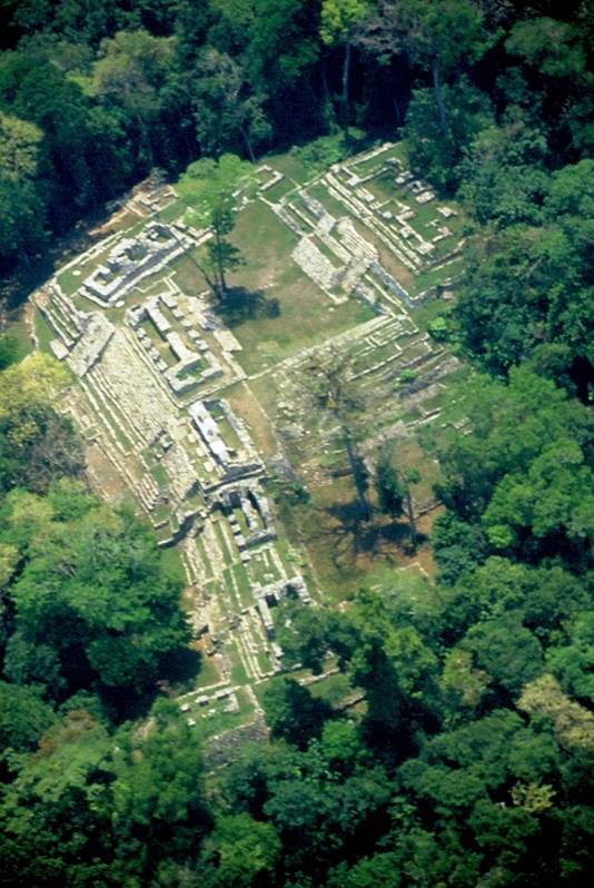
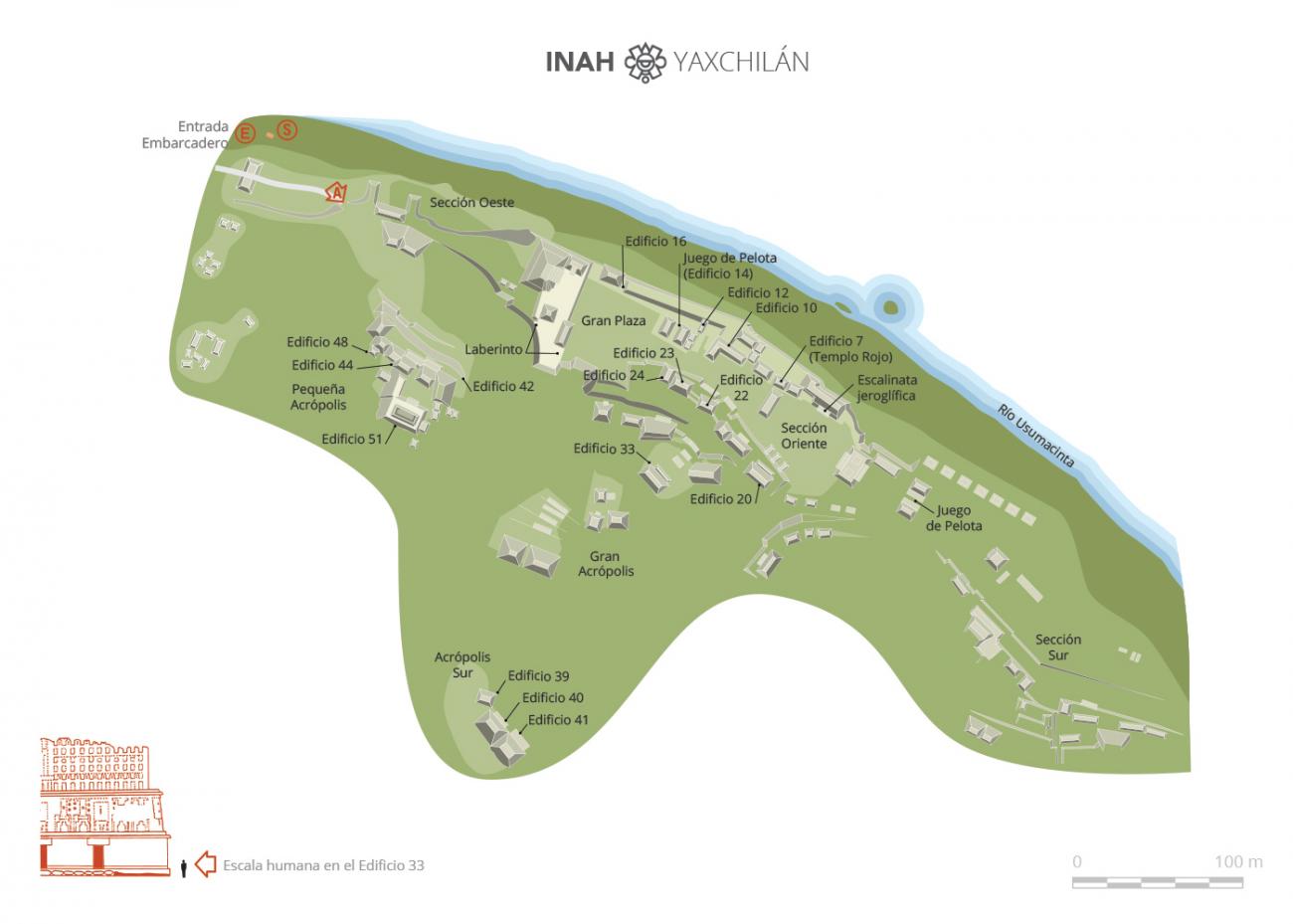
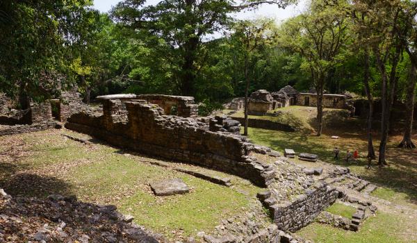
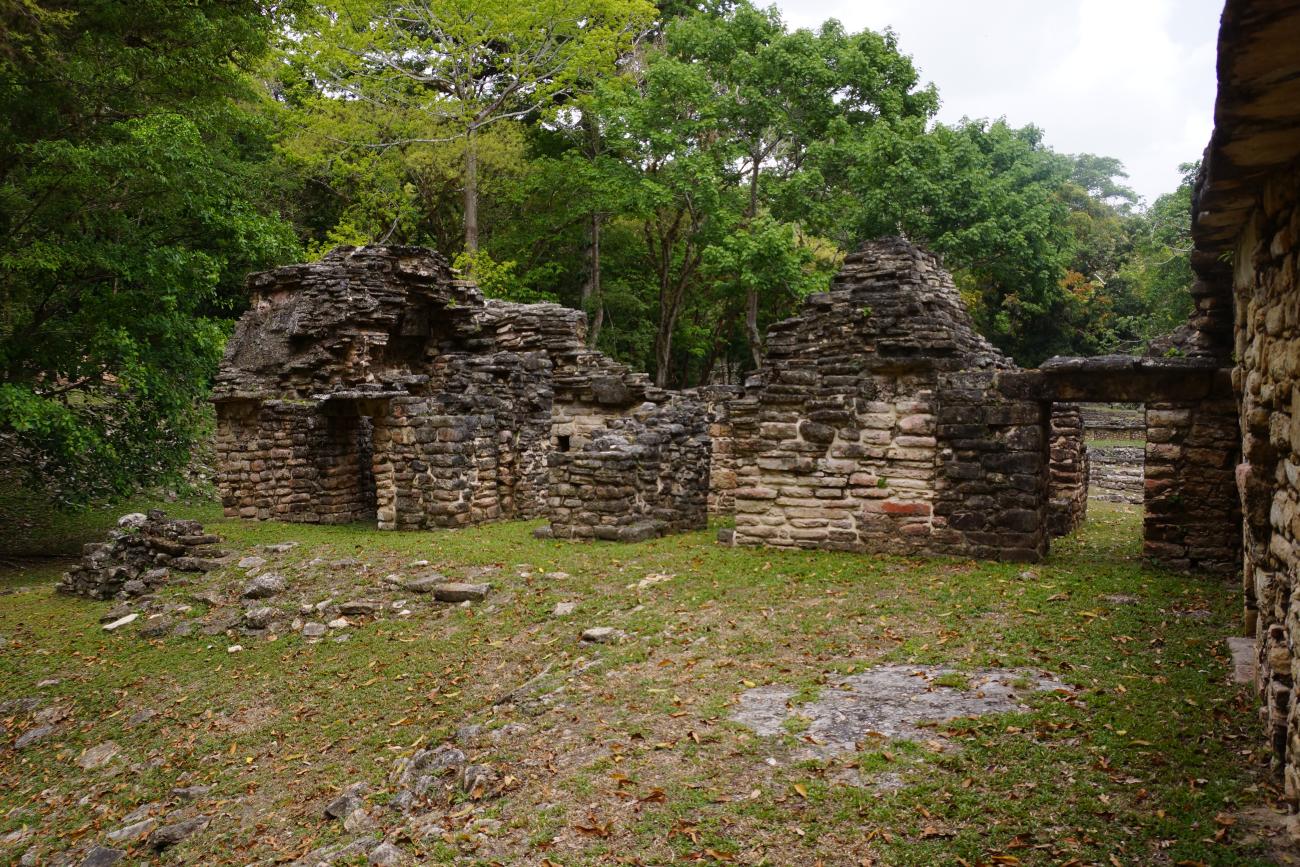
The site is clearly shaped in response to the river which borders it. The concentration of buildings and civic-religious areas extends from the west to the east on a broad terrace with two important plazas. The people of Yaxchilán made use of the natural contours of the land to build the great majority of the architectural groups, most notably the Great Acropolis, the South Acropolis and the West Acropolis.
The Great Acropolis is located in the center of the site and it includes numerous buildings around two plazas. The western limit is marked by the architectural group consisting of Building 19, also known as the Labyrinth, and buildings 18, 77, 78 and 75, linked by the West Platform. The first section includes a ballcourt and temazcal. The second has another group made up of five structures, one of which could be considered a palace. The third section includes four buildings, two of which contain the earliest substructures of the site. The South Platform of the Great Plaza has six structures, and a great stairway which leads to buildings 25, 26 and 33.
The South Acropolis is located on the hill to the extreme south of the site and is comprised of three buildings (39, 40 and 41), while the West Acropolis, also known as the Small Acropolis, has two plazas and 13 structures and it is situated to the far west of the site, on a natural hill 165 feet above the level of the Great Acropolis plaza.
There may be references to Yaxchilán dating from the eighteenth century, but it was not until 1882 when Alfred P. Maudslay and Désiré Charnay arrived at the site that it came to the attention of the western world. Teobert Maler made three journeys to the archeological site in 1895, 1897 and 1900 and he established the names for the buildings and monuments which are still used today; he also gave the site the name we know it by today.
Sylvanus G. Morley made several expeditions and excavations between the years 1914 and 1931. In 1931 Morley carried out research with Karl Ruppert and John S. Bolles, members of the Carnegie Institution of Washington expedition. Bolles’ topographical map is still in use today. The INAH Yaxchilán project began in 1973 under the direction of archeologist Roberto García Moll and by 1985 30 buildings around the Great Acropolis had been excavated and consolidated, with three more in the South Acropolis. The Small (West) Acropolis was excavated between 1989 and 1991 and 13 buildings and their bases were consolidated.
A study analyzing the inscriptions was also carried out. According to this research, the story began in the fourth century when the first records linked to the dynastic sequence of governors appear. The monuments which record the first ten governors of the city were built during the time of Bird Jaguar IV and the possibility must be considered that it was an "official" or fabricated history for the purposes of legitimation.
There was a pause in the dedication of monuments at Yaxchilán and other Mayan sites between 537 and 669. The earliest real historical date on the site: the year 514, appears on stela 27, and it refers to the eleventh governor, Bird Jaguar III. He was succeeded by Shield Jaguar I, Bird Jaguar IV, Shield Jaguar II and Mah k’ina Skull III, whose lives and military exploits were recorded in stone.
One further aspect of note at Yaxchilán is the particularly harmonious combination of cultural heritage and the tropical forest environment. Indeed Yaxchilán is one of the few archeological sites to achieve recognition for both its natural and cultural heritage.
- Dirección del Centro INAHLeobardo Daniel Pacheco Ariasleobardo_pacheco@inah.gob.mx+52 (961) 612 2824Administración del Centro INAHJulissa Camacho Ramírezjulissa_camacho@inah.gob.mx+52 (961) 612 2824, ext. 16800
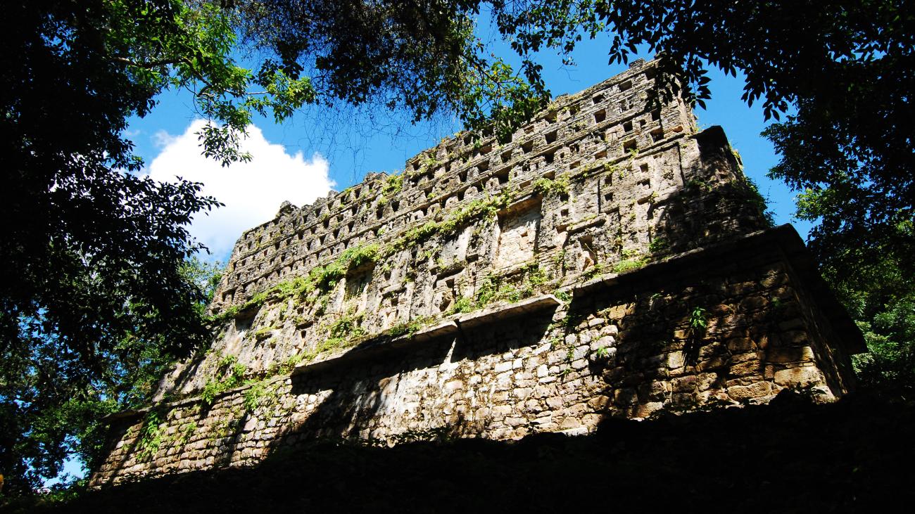
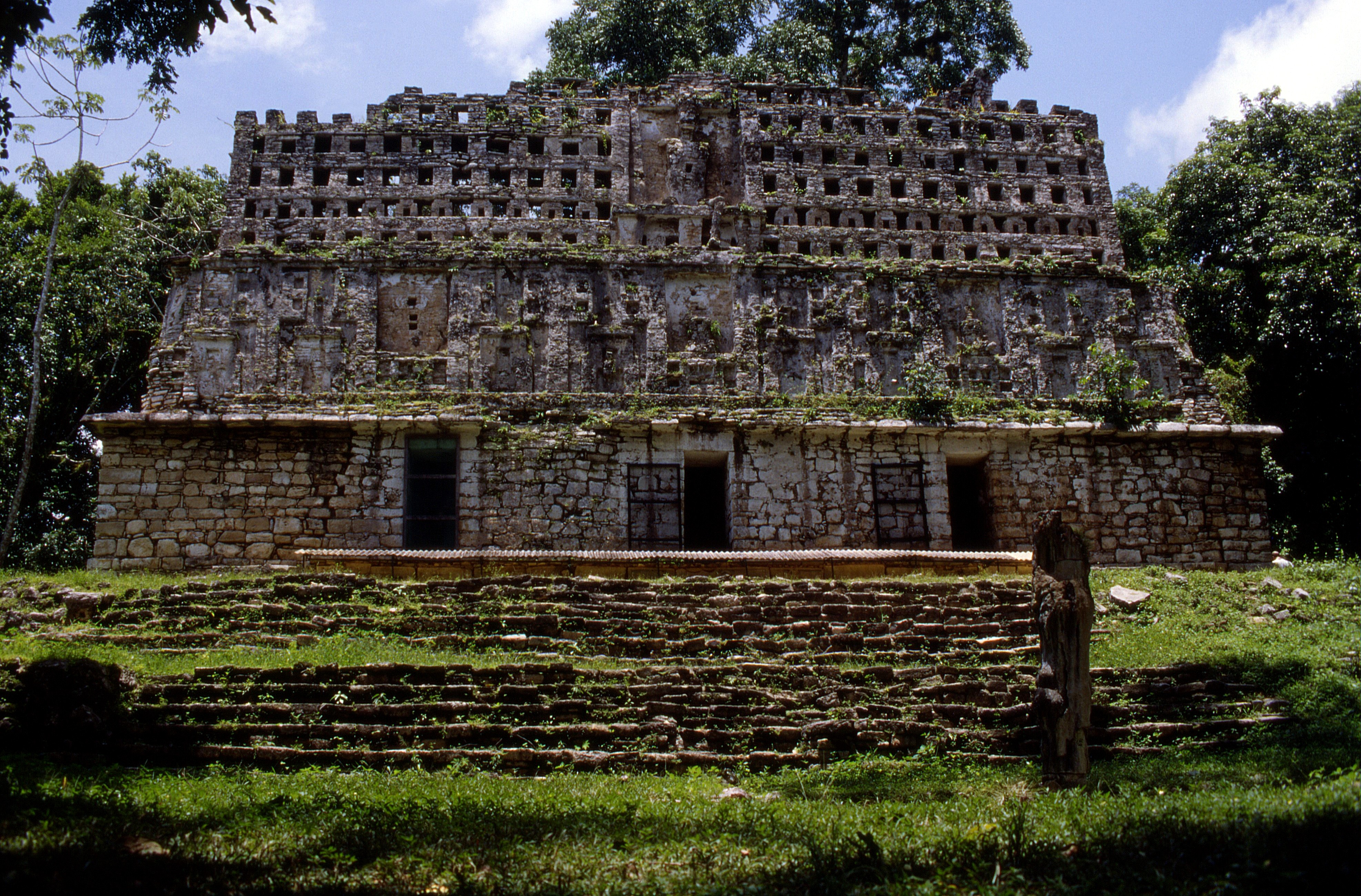
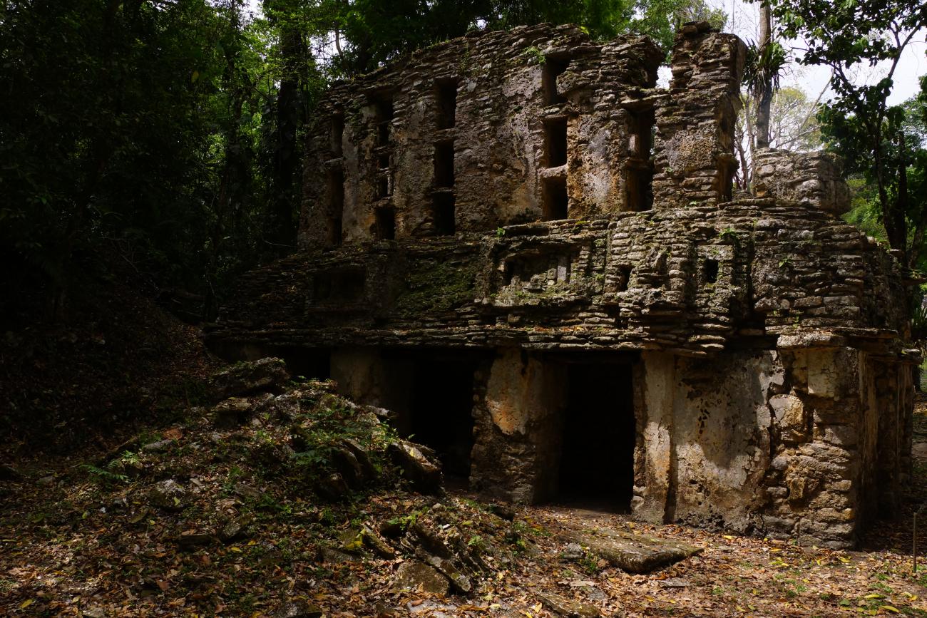
Pequeña Acrópolis o Acrópolis Oeste
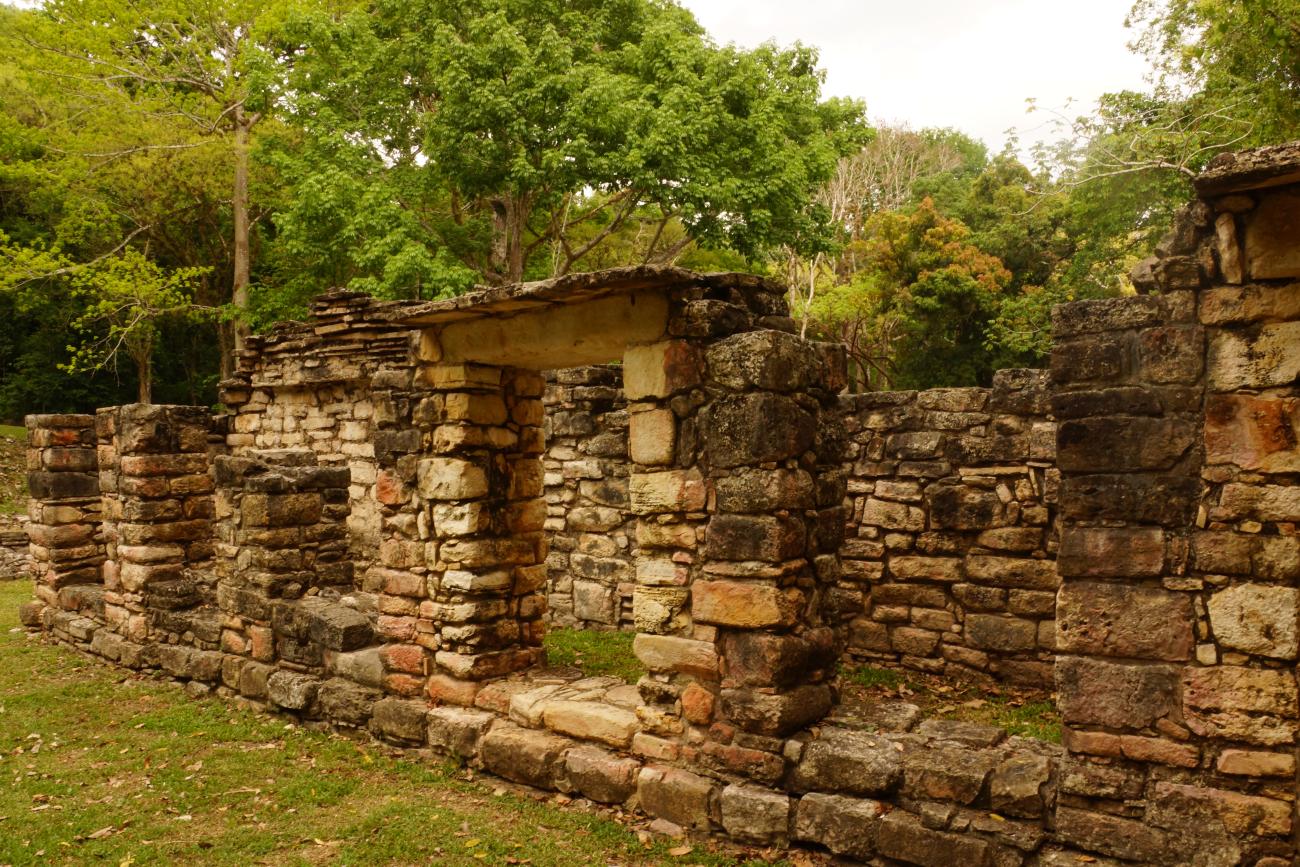
This group of 15 buildings is on a natural elevation more than 60 m above river level, between the North Group and the West Platform of the Great Plaza. It is currently reached through a sidewalk that starts next to buildings 80, 31 and 32.
This group of 15 buildings is on a natural elevation more than 60 m above river level, between the North Group and the West Platform of the Great Plaza. It is currently reached through a sidewalk that starts next to buildings 80, 31 and 32.
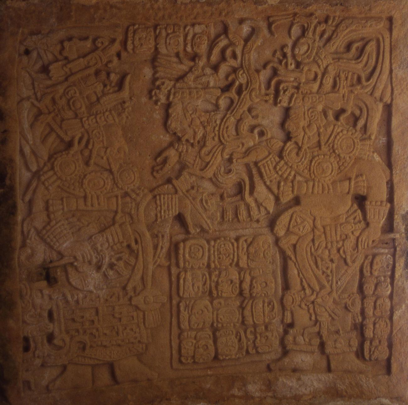
Building 42: Its façade faces Building 33; it only conserves the central lintel where Pájaro-Jaguar IV is observed, with its center, dialoguing with one of its warriors. Regarding the other lintels, one was stolen by Maudslay in 1882 and the other is in the National Museum of Anthropology.
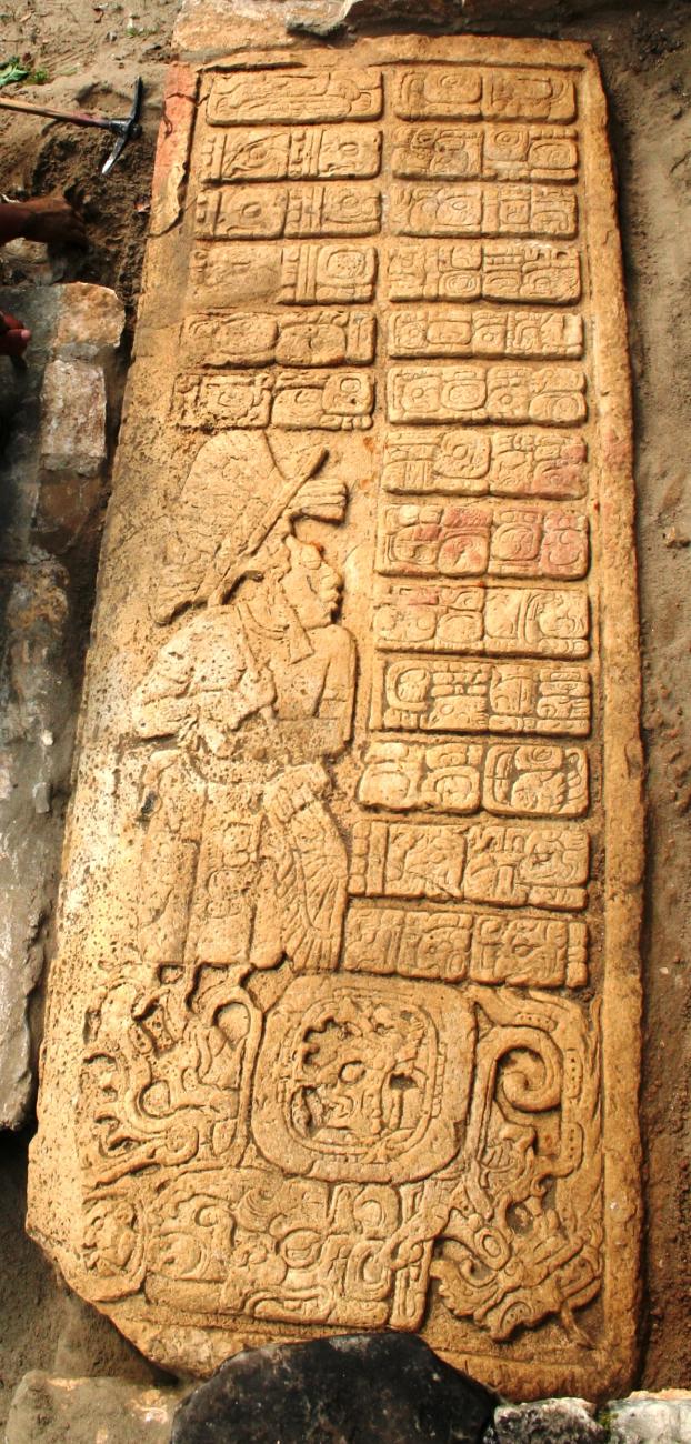
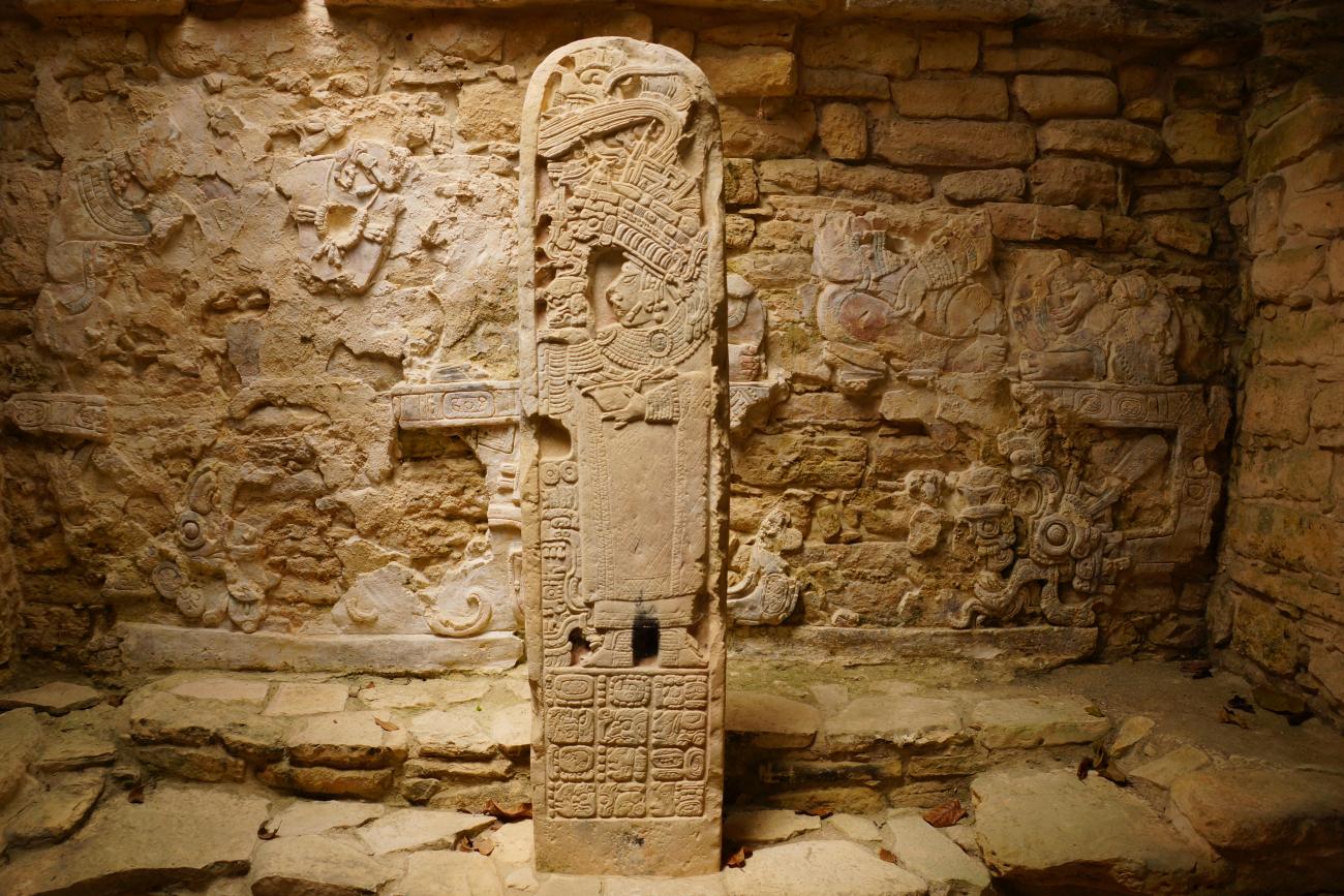
Hieroglyphic step of Building 44: Buildings 43, 44, 45 and 46 limit this complex to the north, and their facades face the river. The importance of Structure 44 is highlighted by the presence of stelae 14, 17, 21, 22, 23 and 29, located in front of this building. It is calculated that the construction of this building occurred during the period of Escudo Jaguar I. There is a hieroglyphic step located at the central entrance of this building, although it is currently protected with a stone box.
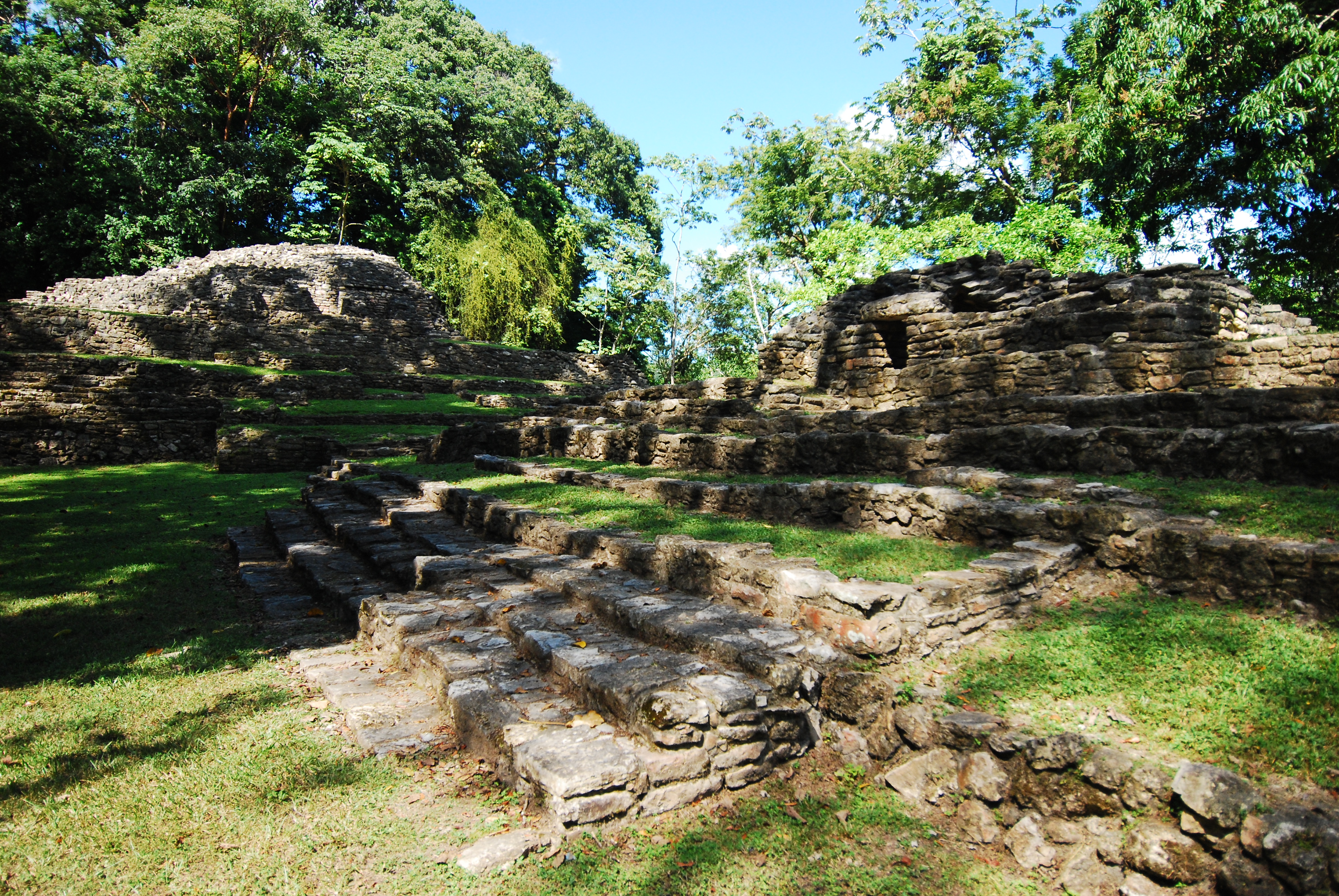
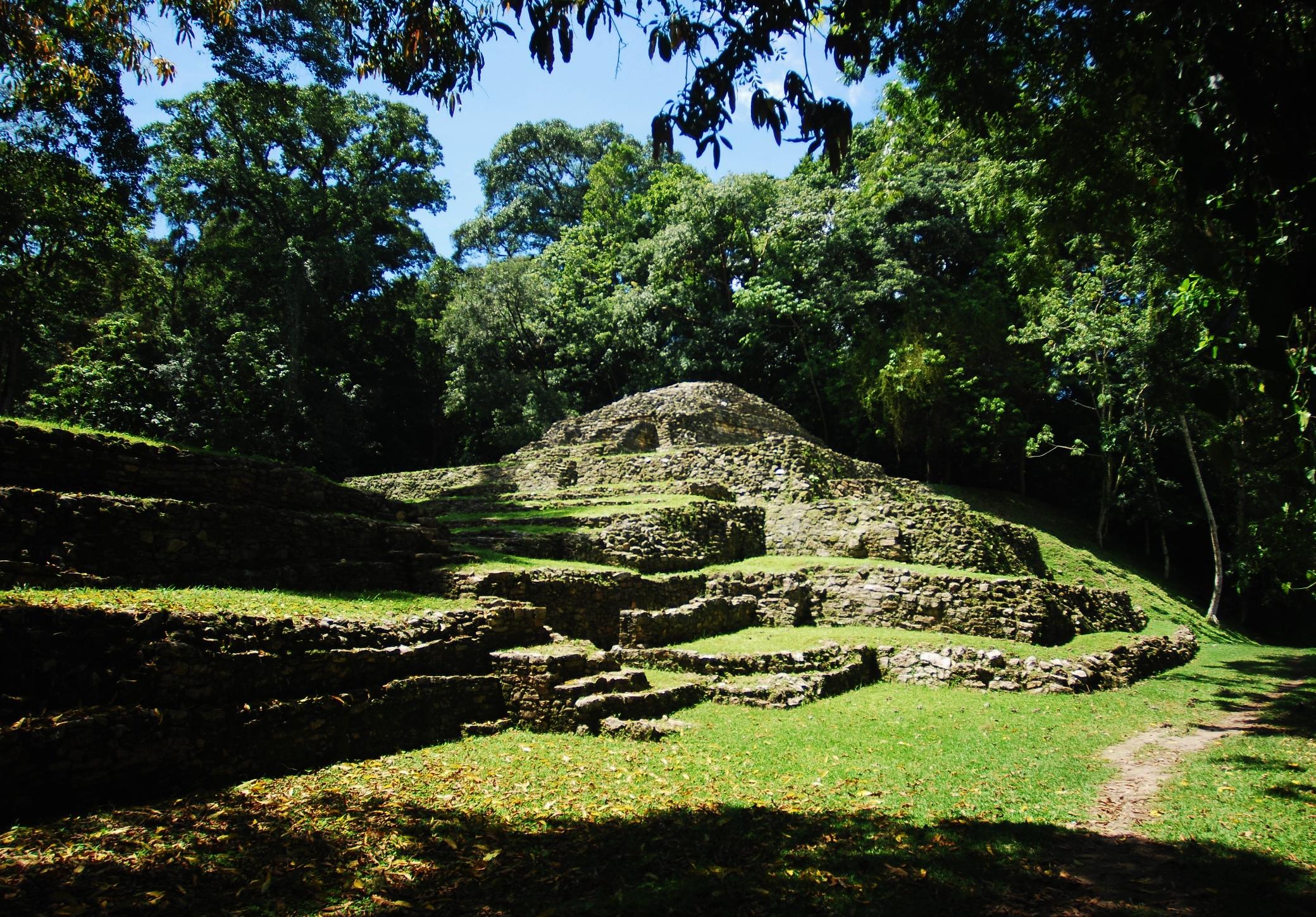
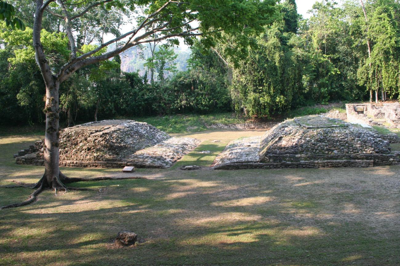
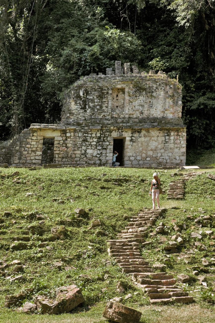
Acrópolis Sur
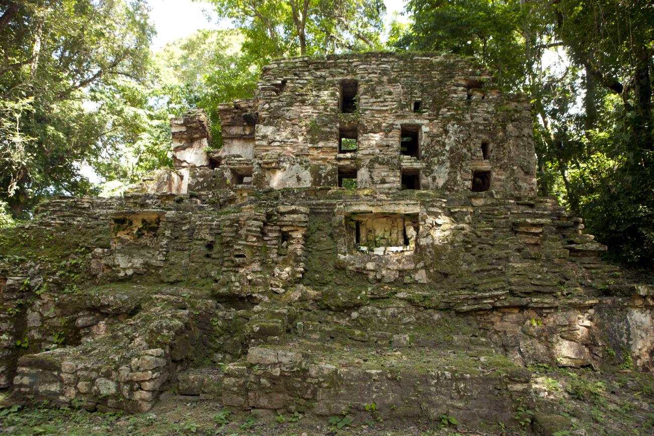
This architectural group is part of the so-called Great Acropolis and is located at the southeast end of the monumental core of the city, at a height of 90 m above the level of the Great Plaza.
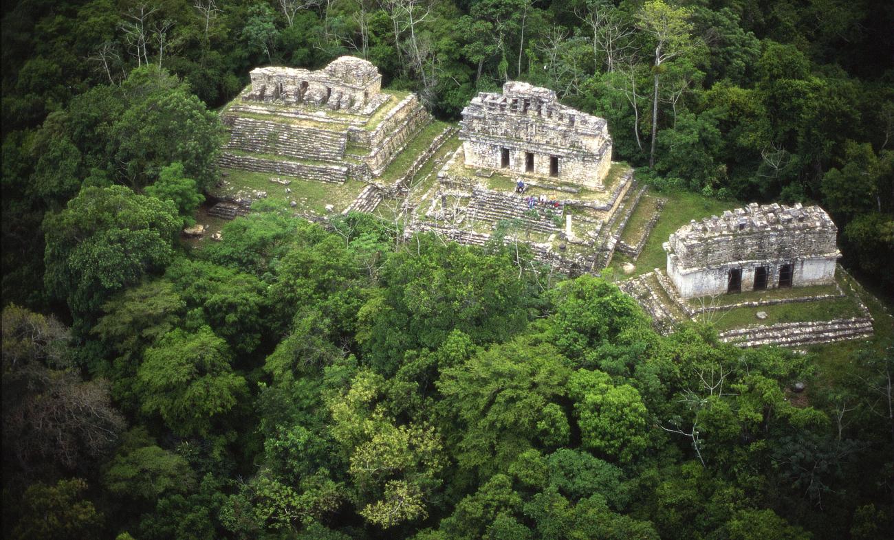

This architectural group is part of the so-called Great Acropolis and is located at the southeast end of the monumental core of the city, at a height of 90 m above the level of the Great Plaza. Associated with these three buildings several stelae, altars and steps with hieroglyphic inscriptions were located, among which Stela 10 and Altar 4 stand out, which by dates are associated with the beginning of the period of Pájaro Jaguar IV.
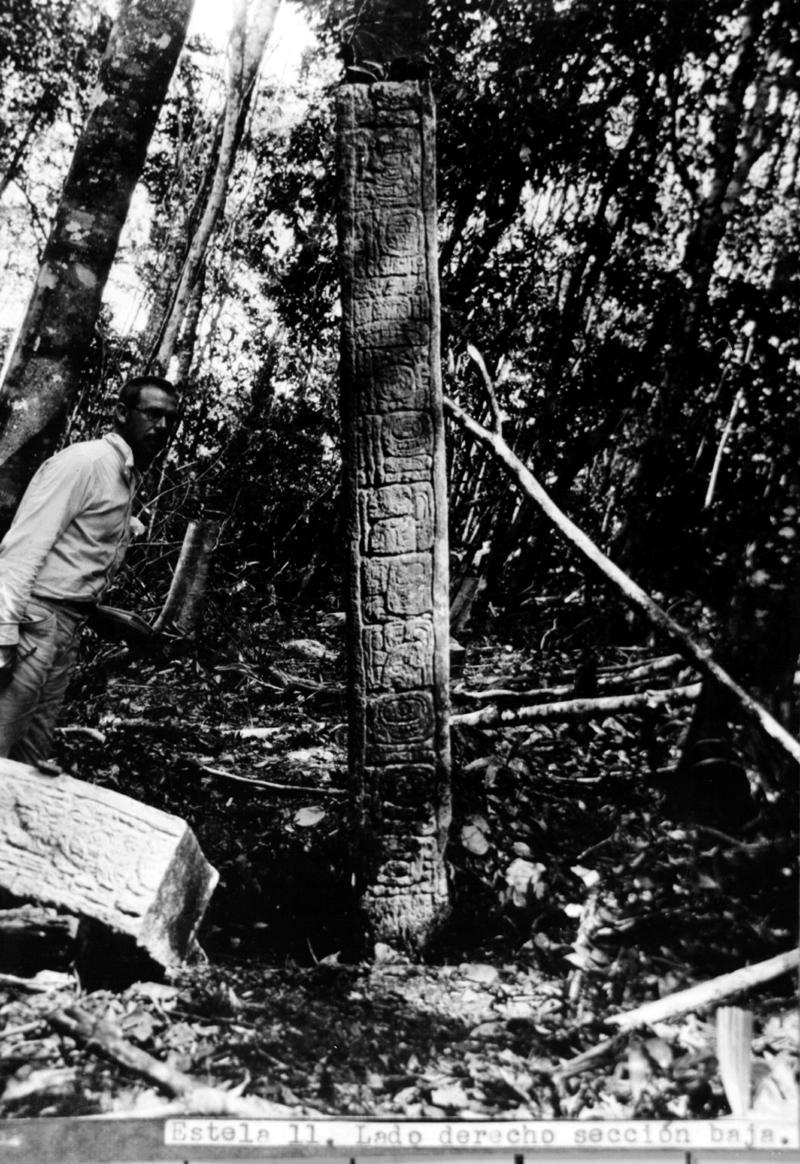
Building 40: All the monuments of Building 40 are linked to Pájaro Jaguar IV, among them Stela 11 stands out. In the interior of this building there are remains of mural painting and some figures modeled in stucco, which have been identified with the “Bolom Ticú” or “Nine Lords of the Night”. Building 41 has three steps with inscriptions and five stelae, mainly associated with Escudo Jaguar, 681 to 742. The best preserved, 18, is now in the National Museum of Anthropology.
Stela 11: Buildings 39 and 41 belong approximately to the years 650 to 700, along with others of the same style, such as 25, 26 and 30. Temple 40 is from the period when Pájaro Jaguar IV ruled. While buildings 39 and 40 have been maintained in an excellent state of preservation, building 41 presents stability problems since ancient times, which could be one of the reasons why there are numerous modifications in its structure, as well as an important deterioration in its central elements.
Buildings 39 and 41: Buildings 39 and 41 belong approximately to the years 650 to 700, along with others of the same style, such as 25, 26 and 30. Temple 40 is from the period when Pájaro Jaguar IV ruled. While buildings 39 and 40 have been maintained in an excellent state of preservation, building 41 presents stability problems since ancient times, which could be one of the reasons why there are numerous modifications in its structure, as well as an important deterioration in its central elements.
La Gran Plaza
Two elements are determinant in the form of Yaxchilán as a city: the Usumacinta River and the limestone hills; from them the site adapted and developed.
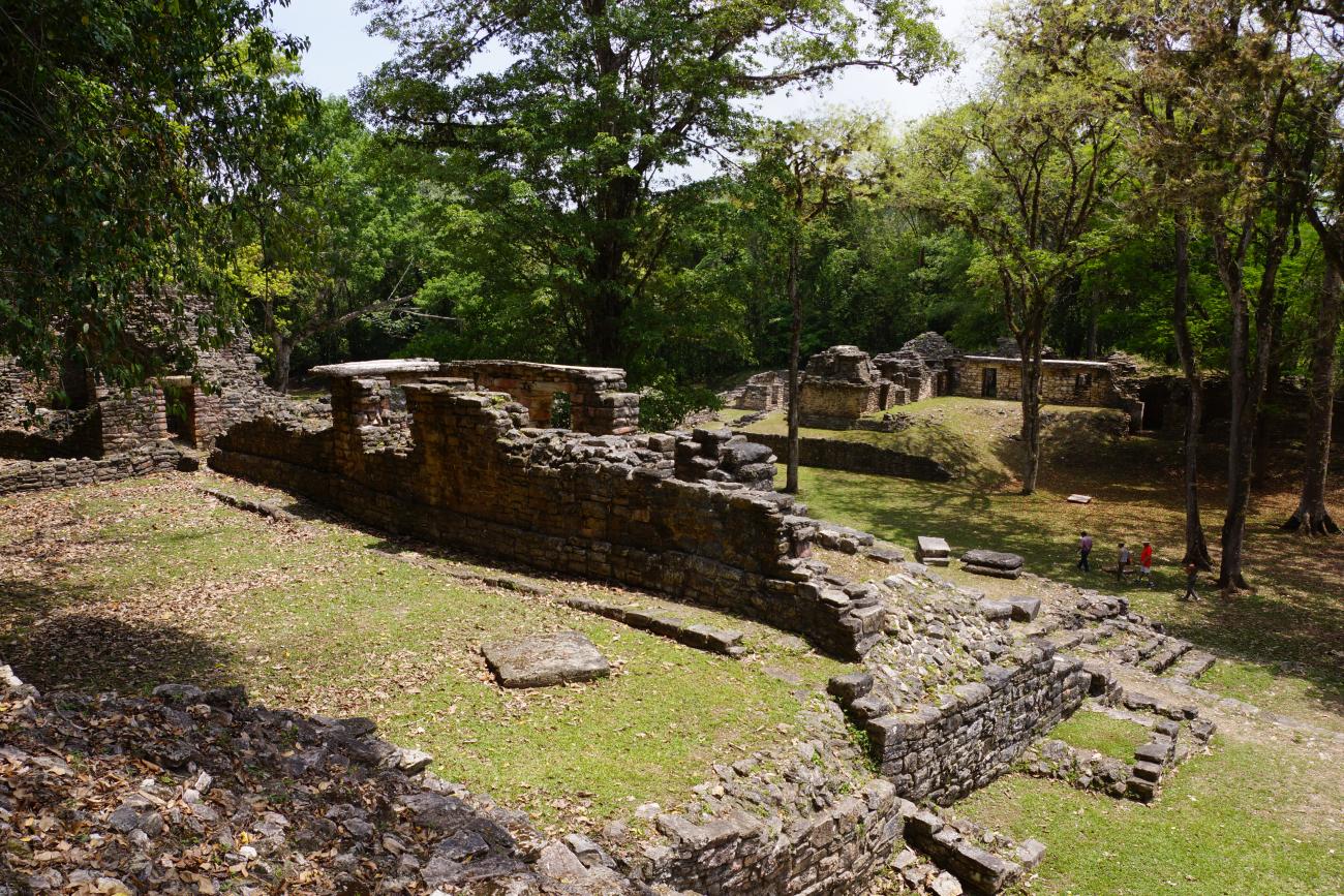

Two elements are determinant in the form of Yaxchilán as a city: the Usumacinta River and the limestone hills; from them the site adapted and developed. On the terrace of fluvial origin it was transformed and built through time, the Great Plaza, oriented from west to east, where the greatest number of buildings is grouped. Other groups were built on the limestone hills located south of the Great Plaza, with two main groups that Teobert Maler baptized as Great Acropolis and Small Acropolis.
Building 6: It is also called the Red Temple of the Bank because of the colorful stuccoes. This building still conserves the first body of its openwork cresting. In this building, as in the 33rd and 25th, a great quantity of Lacandon ceramics and prayer tables were found. In fact, centuries after the abandonment of Yaxchilan, several groups of Lacandon people used to visit the site to perform propitiatory ceremonies in honor of their gods.
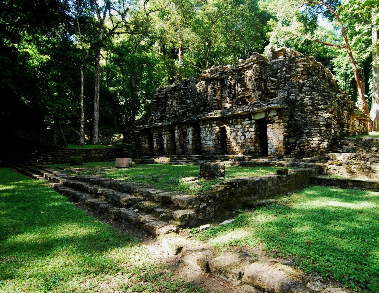
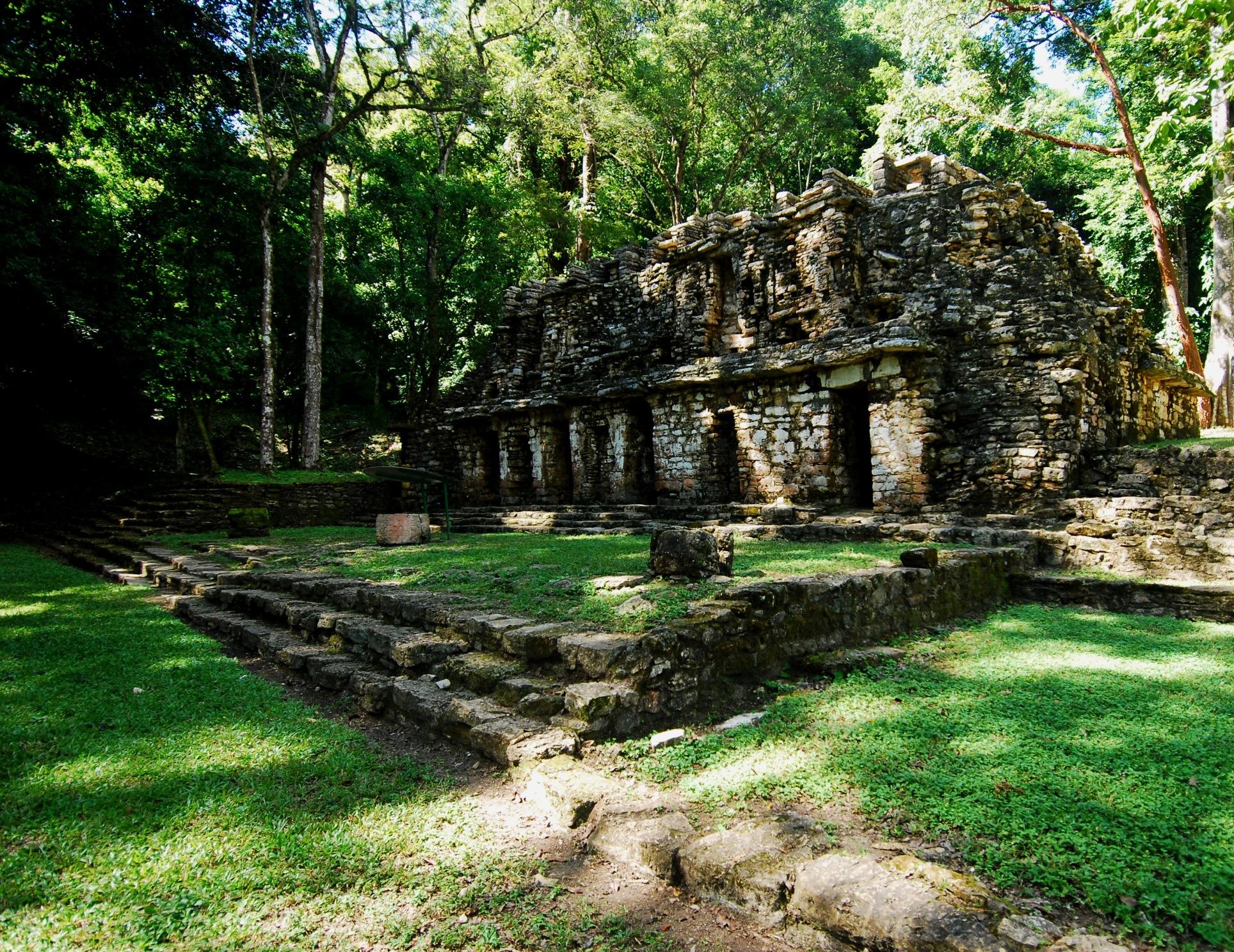
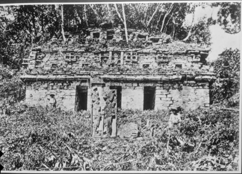
Building 12: Building 12 is one of the simplest architectural structures built in the city. Its interior is formed by two parallel bays that were covered with the typical Mayan vault. Its interior is accessed through nine openings, seven on the main façade and two on both lateral façades. The important thing about this building is the presence of eight lintels, carved on its lower face with hieroglyphic text, of which three are in situ, two in the National Museum of Anthropology and another one in the British Museum. Apparently it is an old list of rulers; the first ten defined the destiny of Yaxchilán during the first half of the VI century. Over the years, this building underwent a series of modifications, ranging from subdividing its interior spaces to blinding the access openings, except for the central one. Finally, along with the rest of the city, it was totally abandoned around the year 900.
Building 13: It is located in the second section of the Great Plaza forming the nucleus that limits it on the northwest and northwest ends. The northwest side runs parallel to the Usumacinta River. Through time, Building 13 underwent some modifications, such as the substitution of the wooden lintels for ones carved in stone that came from another building. The central access mentions Escudo Jaguar (700), the northwest access refers to Pájaro Jaguar IV (747) and the one at the southwest end was dedicated to Lord Mahnk'ina Cráneo III (800).
Building 14, Ballgame: Apparently, upon the death of Shield Jaguar I, one of his wives assumes power for a brief period, known as interregnum (742 to 752), during which she prepares the ascension to power of her son, Bird Jaguar IV, also called the Great. In that brief period two structures were built in the Great Plaza, Building 19 or The Labyrinth and number 14, which corresponds to one of the two existing ball games in the city. The axis of the Ballgame Building 14 runs almost north-south; and between it and Structure 12 there is a series of small rooms that, in the opinion of García Moll, must have served as steam baths.
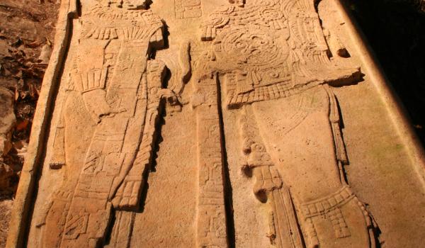
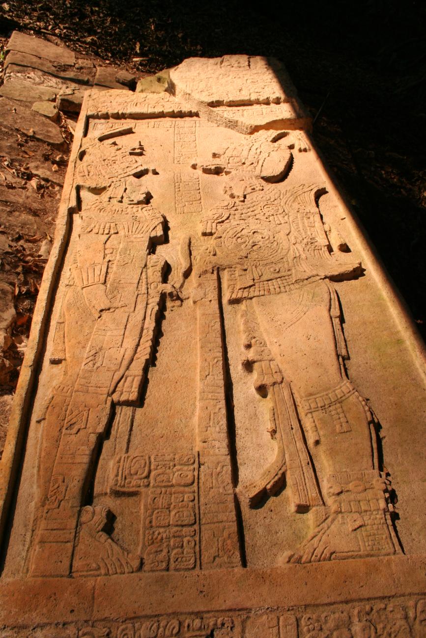
Building 16: It is a quadrangular building with two parallel bays in its interior, which were covered under a vault. Originally it had only three access openings, but in a later modification two small rooms were added at the north end. On the first three openings there are three lintels, carved on its front face, where the protagonists are Pájaros Jaguar IV and two women, the three in the rite of “the vision of the serpent”, linked to the self-sacrifice.
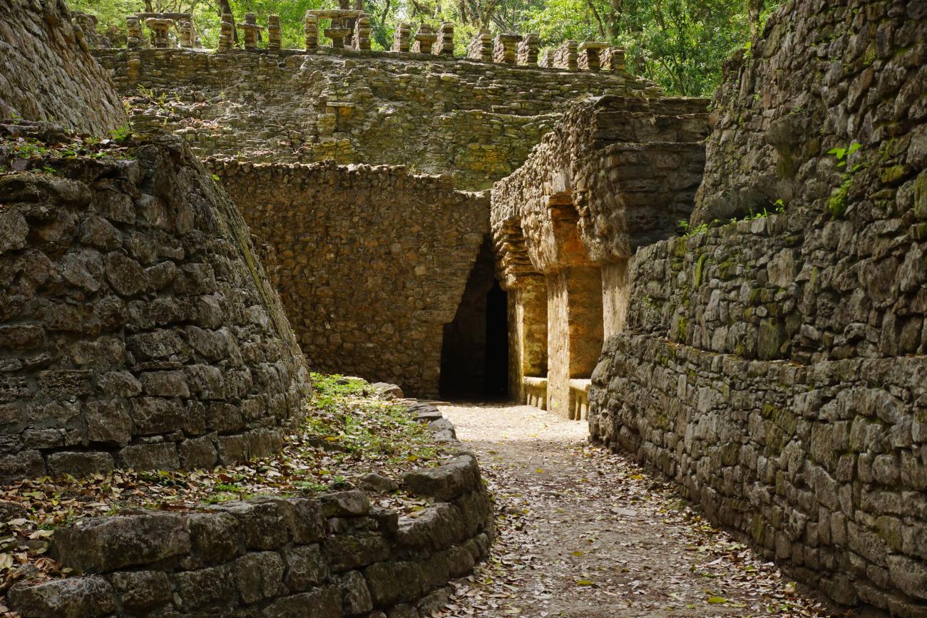
The Labyrinth or Building 19: This Building 19, also called Labyrinth, is undoubtedly the most complex structure of the entire site. Its construction can be placed between the years 742 and 752. It is directly linked to the entire platform that closes the Great Plaza in the northwest end. In the upper portion, it has inside a wide passageway, three smaller chambers and two staircases that descend to a series of passages and lower passageways with benches, all covered by the typical Mayan vault. In front of its main façade is located Altar 1, the only sculptural monument associated with this building.
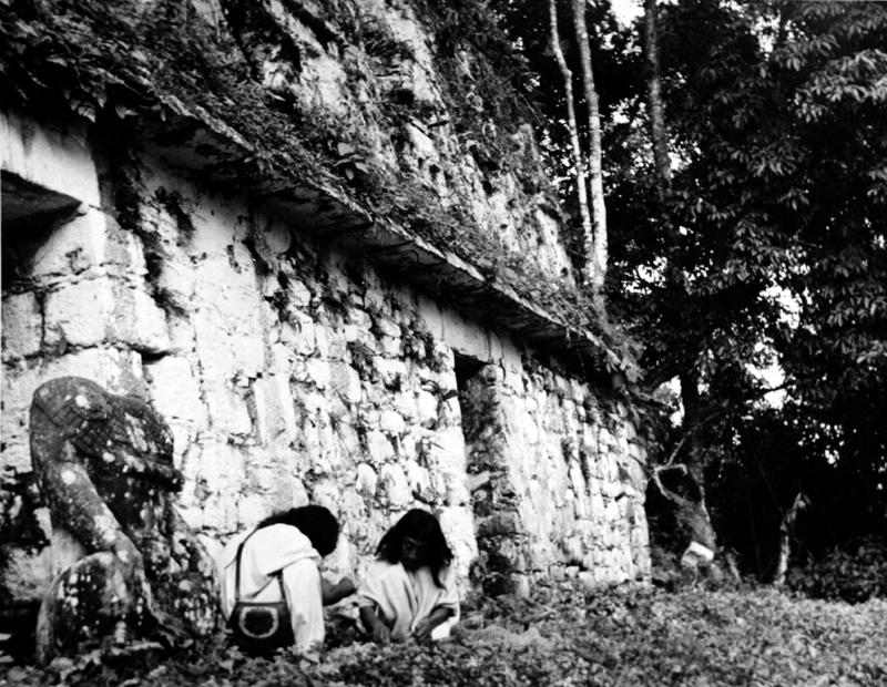
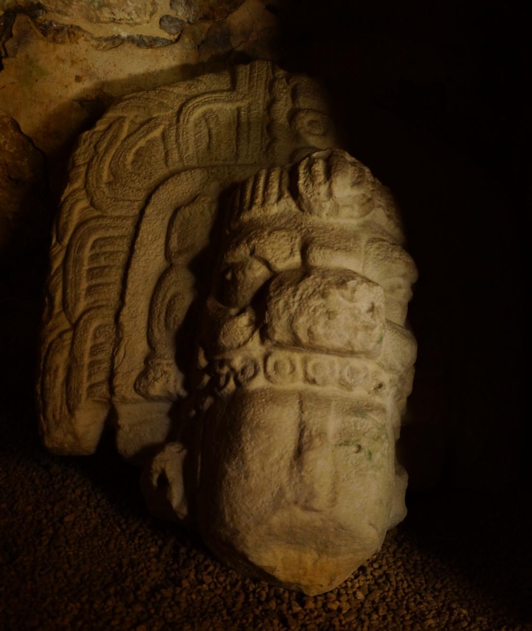
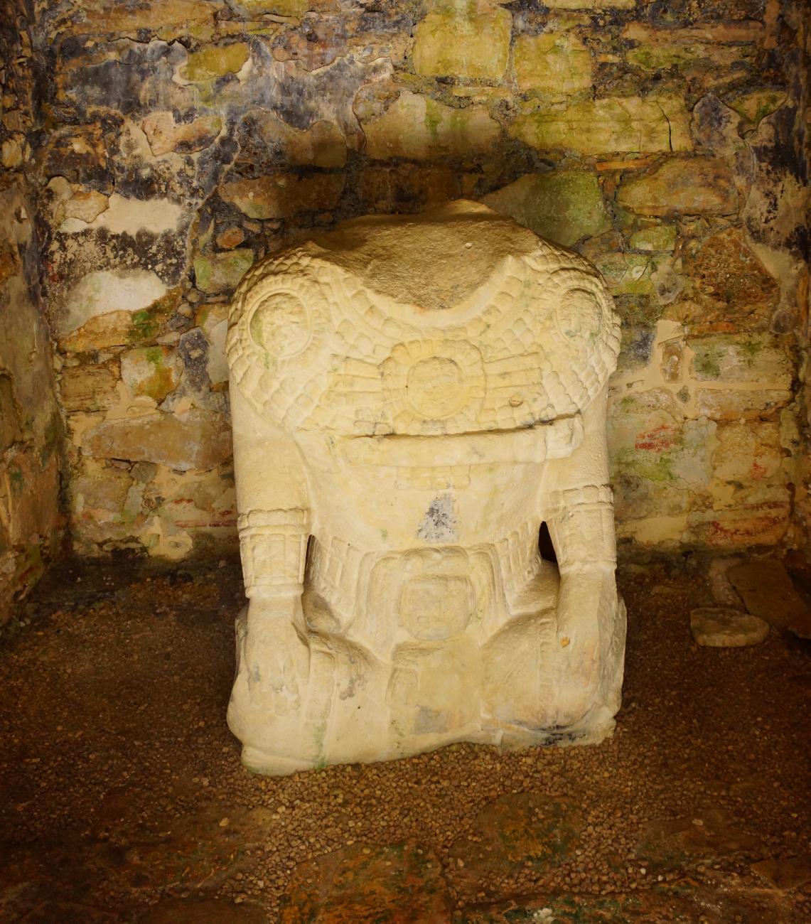
Building 21, Stela 35: Towards the southern limit of the Great Plaza begins a succession of platforms that house diverse groups of buildings; building 21 stands out for its stela and stucco decoration. In the stuccos, four women and a man appear seated on a stool finished off on their sides by great serpent heads, from whose jaws emerges the figure of a Chaac or Tláloc. Perhaps it is the Lady Ik-Craneo, who occupies the central place and is also represented on the stela. It commemorates an important rite of bloodshed, which was performed by rulers and priests by piercing their tongues, in the case of women, and their penises, in the case of men.
Building 30: At a height of 20 m above the level of the plaza and as part of the Great Acropolis, a wide terrace was built where buildings 27, 28, 29 and 30 are located, each with its own base and its own access from the plaza. Building 30 is composed of a base of two bodies with staircases and a rectangular temple; its interior is composed of two interconnected bays with vault. In the north façade there are three openings that give access to the interior of the building; they have monolithic lintels of limestone rock, carved without decoration. Below the cornices of the east and west facades are two small windows that probably served for ventilation. The cornice rests on a molding, from which the panels with modeled and polychrome stucco decoration begin. Of the decorative elements on these panels, only some small niches and the remains of a stucco mask, which serves as a frame for two other vents, are partially preserved.
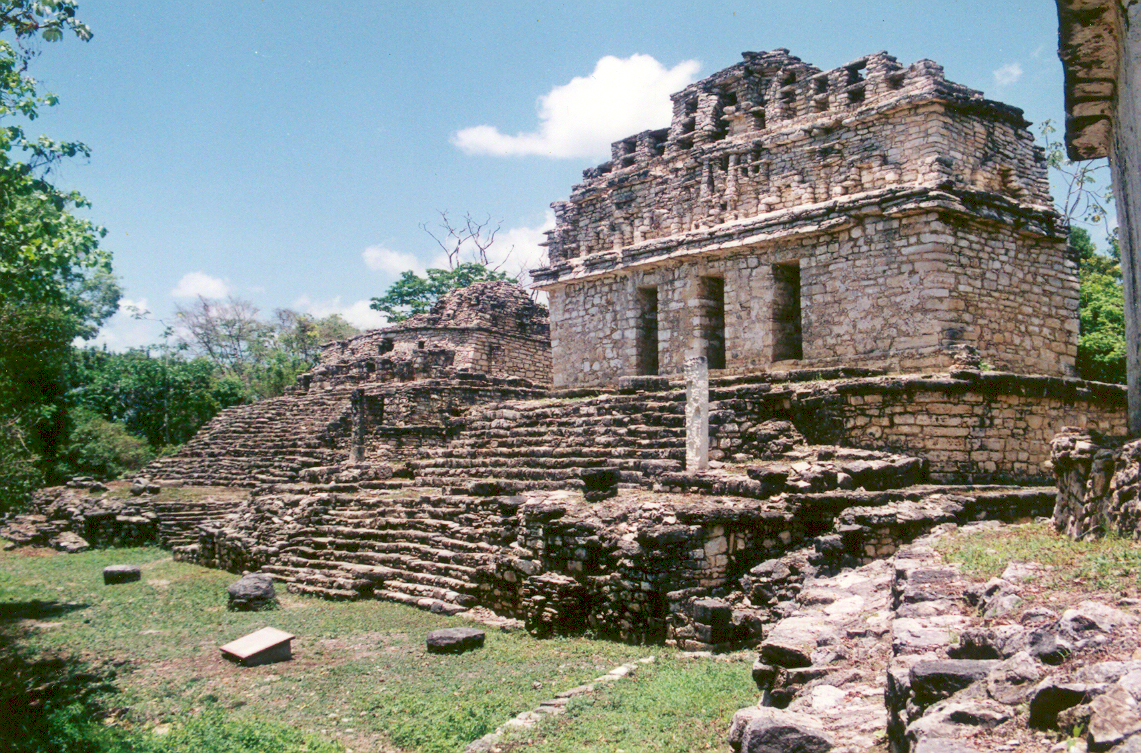
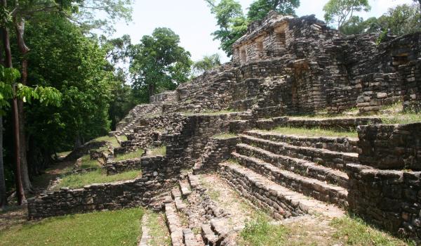
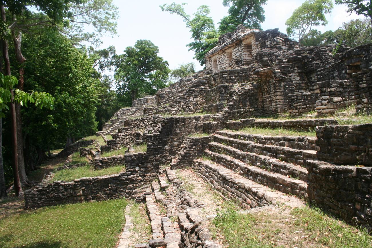
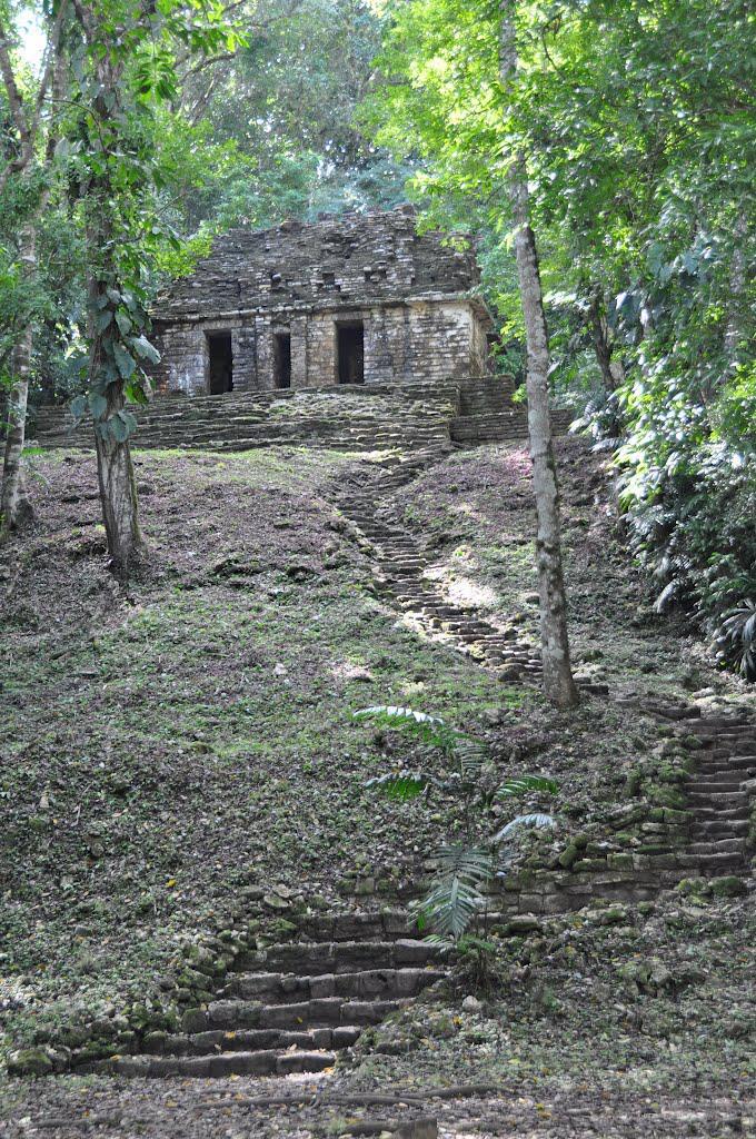
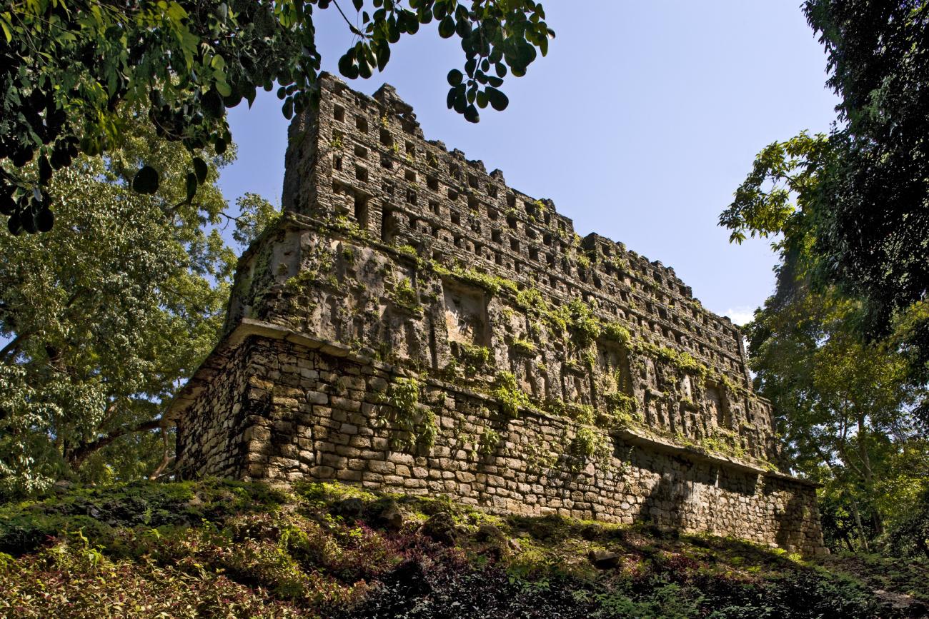
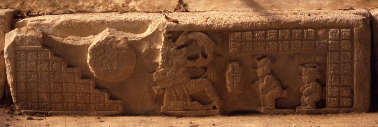
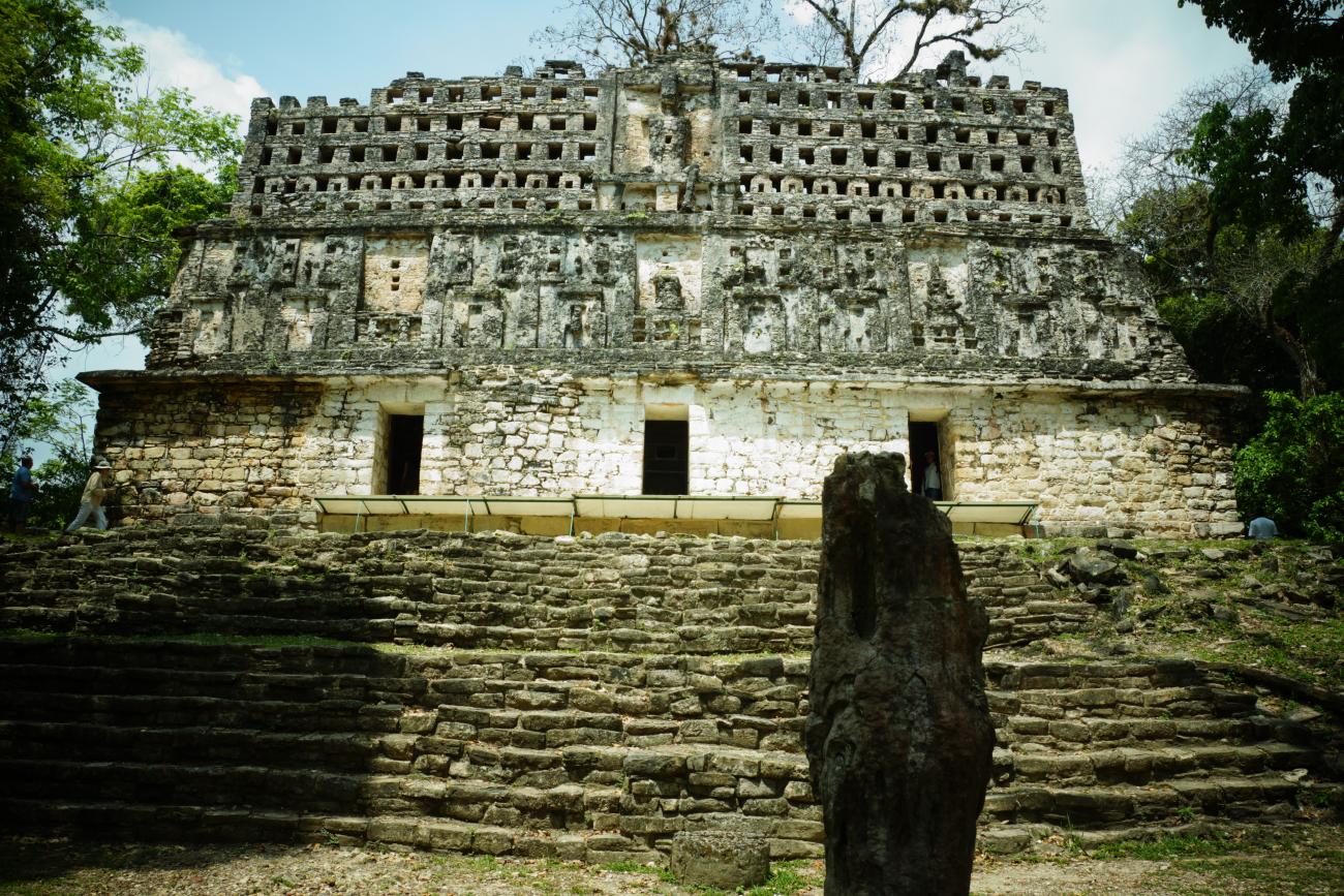
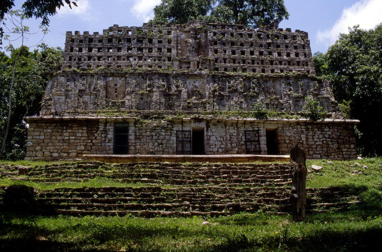
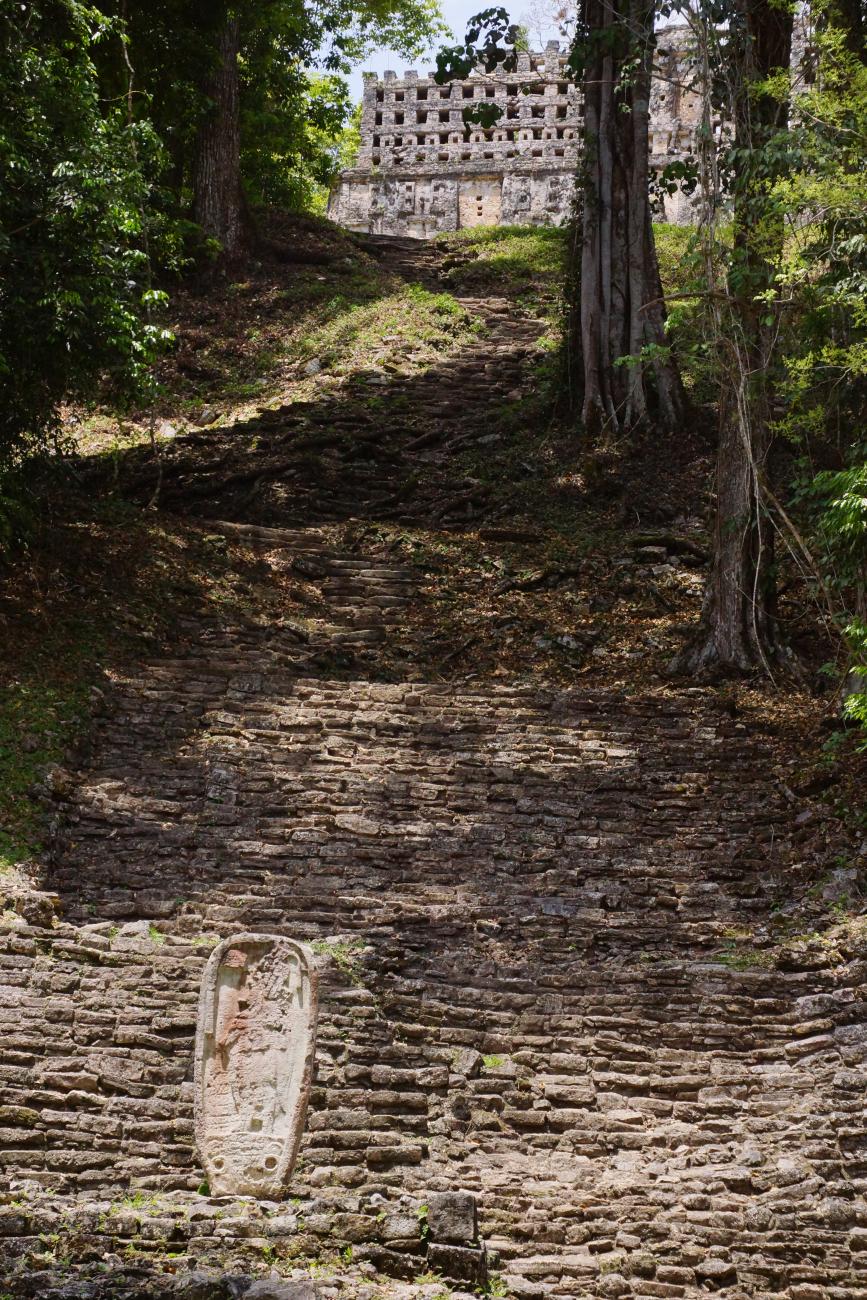
Building 33: This structure, composed of a basement and a temple, rises on a hill 40 m above the level of the Great Plaza. It is the most important work carried out by Pájaro Jaguar IV (752 to 772) and it is also the best preserved in its architectural and decorative elements. From the square it is acceded by a monumental stairway in front of the Stela 1, that begins with a section of six steps built with base in big carved blocks, which finish in a small esplanade where an adoratory is located with the Stela 2 (with the date 537) flanked by two altars. Three lintels (1, 2 and 3), a carved stalactite (Stela 31), an anthropomorphic sculpture and Hieroglyphic Stairway 2 are directly associated with this building. Both in the lintels and in the Hieroglyphic Stairway, the central character is Pájaro Jaguar IV. During his government the conquest over other territories was consolidated and the city reached its maximum splendor. The most common events narrated in these monuments are the self-sacrifice “the vision of the serpent” and the Ball Game”.

A singular encounter with the past and the natural world