


Toluquilla
Situated south of the Sierra Gorda, this city was inhabited from 400 AD until shortly before the Conquest. Miners and mineral workers, influenced by different cultures, left impressive constructions in the area.
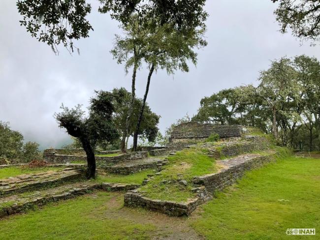
Toluquilla sits on a hill almost completely surrounded by ravines, which endows it with a strategic position to control the movement of people. This site’s importance is also largely owed to the mineral resources which are found nearby.
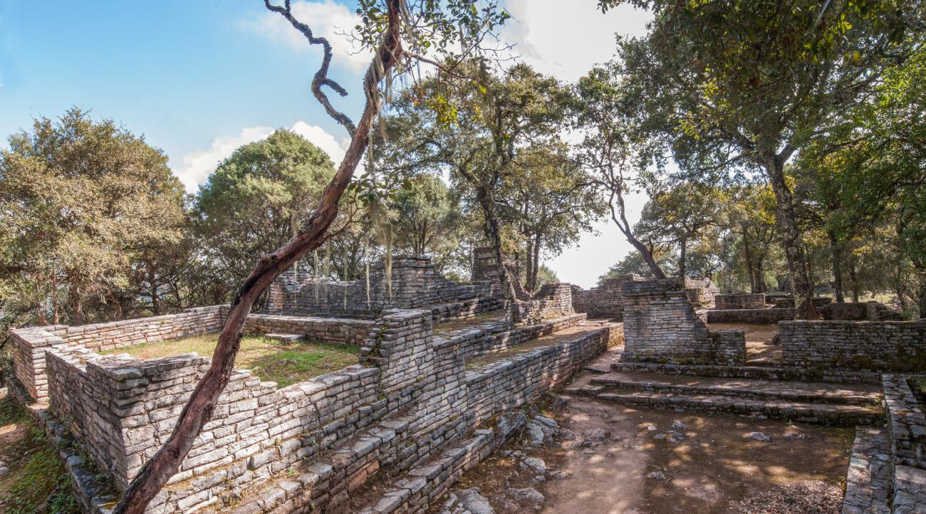
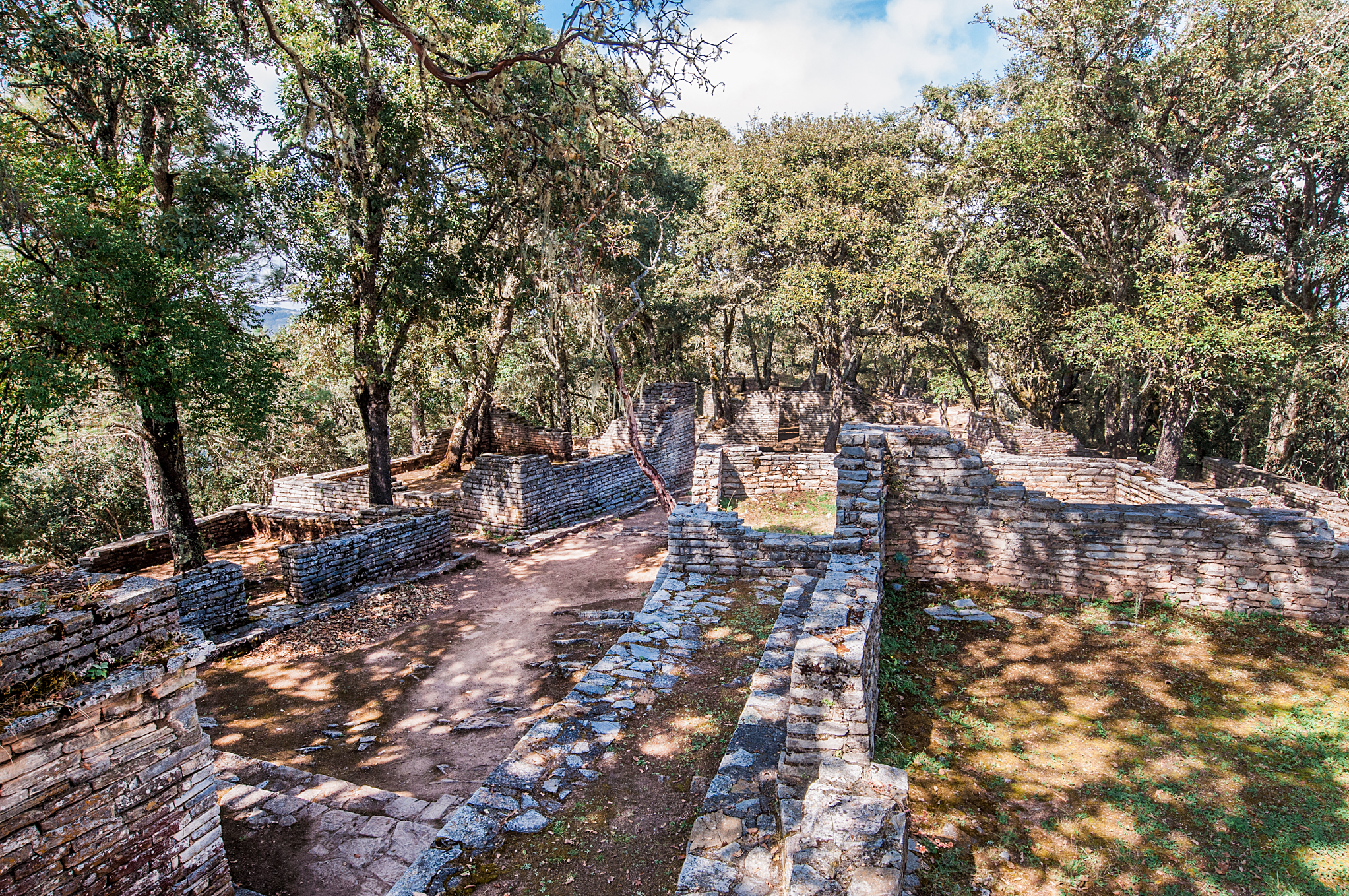
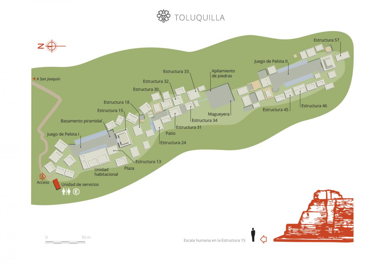
The upper section was shaped by excavating and infill to form flat areas at different levels. A medium-sized town was built on these terraces, with the buildings followed the north-south axis of the hill. Most of them were located on the summit: rooms, squares and temples distributed around four ballcourts. Terraces were formed to the south and the west of the hill, for the construction of houses.
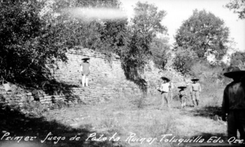
The first reference to the site is found in an 1838 issue of the newspaper "El Sol de México." However, it was between 1870 and 1880 that painters, travelers and, above all, mining engineers reported its existence more extensively. The majority of visitors marveled at what they saw and, given that they were not specialists, they compared the structures with those of Ancient Greece or Rome. They even spoke of walled fortresses, small forts and watchtowers.
The emergence of the discipline of archeology in the twentieth century led to a visit to Toluquilla. In 1931, the first archeologist arrived, Eduardo Noguera, who soon showed the military character attributed by former engineers to be false. He concluded that the site was related to Teotihuacan and Tula, and was also an intermediate point between the Gulf cultures and those from the center of Mexico.
As part of the newly created INAH Center in Querétaro, the archeologist Margarita Velasco worked in Toluquilla over two periods: first, for four months from 1987 and 1988, and later, in 2010. This specialist is responsible for the interpretation of the word Toluquilla, a hybrid term from the Náhuatl ‘toloa’, a verb which describes the the action of crouching and the Spanish suffix ‘illa’ (to make something small or endeared). Furthermore, according to the archeologist, Las Ranas is the largest site in the region, while Toluquilla is a secondary and incomplete site.
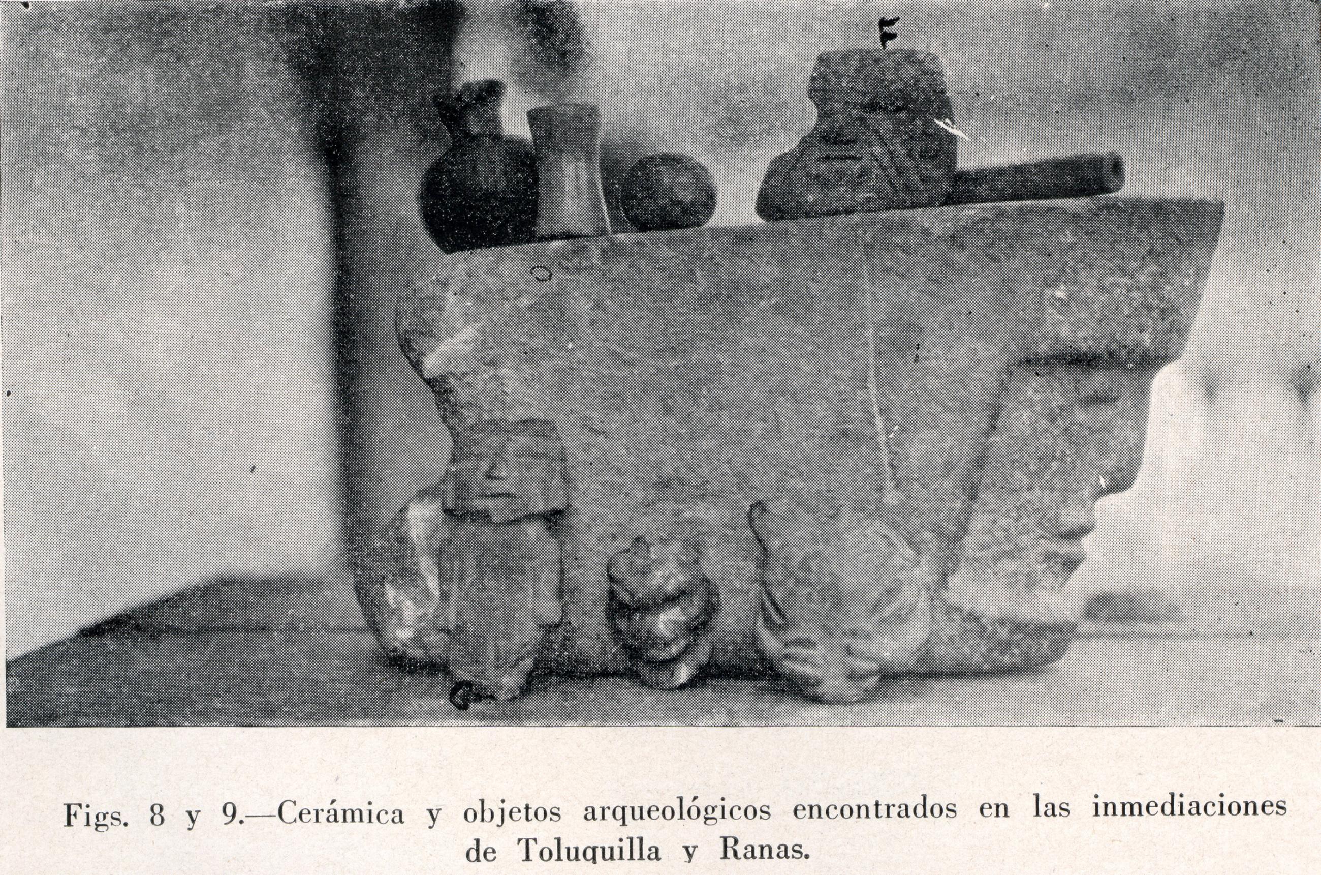
From 1996 until the present day, the INAH has maintained an ongoing research project at Toluquilla, under the responsibility of the archeologist Elizabeth Mejía Perez Campos. This has made it possible not only to obtain a large quantity of materials, but also to carry out radio carbon dating and DNA analysis. Today it is known that this town of 200 monuments (the largest in the state of Querétaro) specialized in the knowledge of, search for and exploitation of minerals. The settlers began by digging small holes and, over the years, excavated underground mines with winding tunnels that followed the mineral veins, as well as underground passages and some vertical shafts. Two red pigment minerals stand out: red ochre (iron oxide) and, above all, cinnabar (mercury sulphide). The latter was used extensively by the Olmecs, the Maya and the Teotihuacanos to cover the bodies of leaders in preparation for burial. It has been confirmed that cinnabar combined with oxygen was also used to paint the outer walls and murals inside living quarters, as well as to cover pots and other objects placed with the dead.
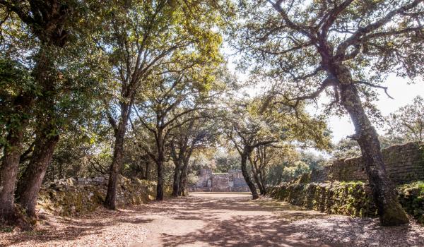
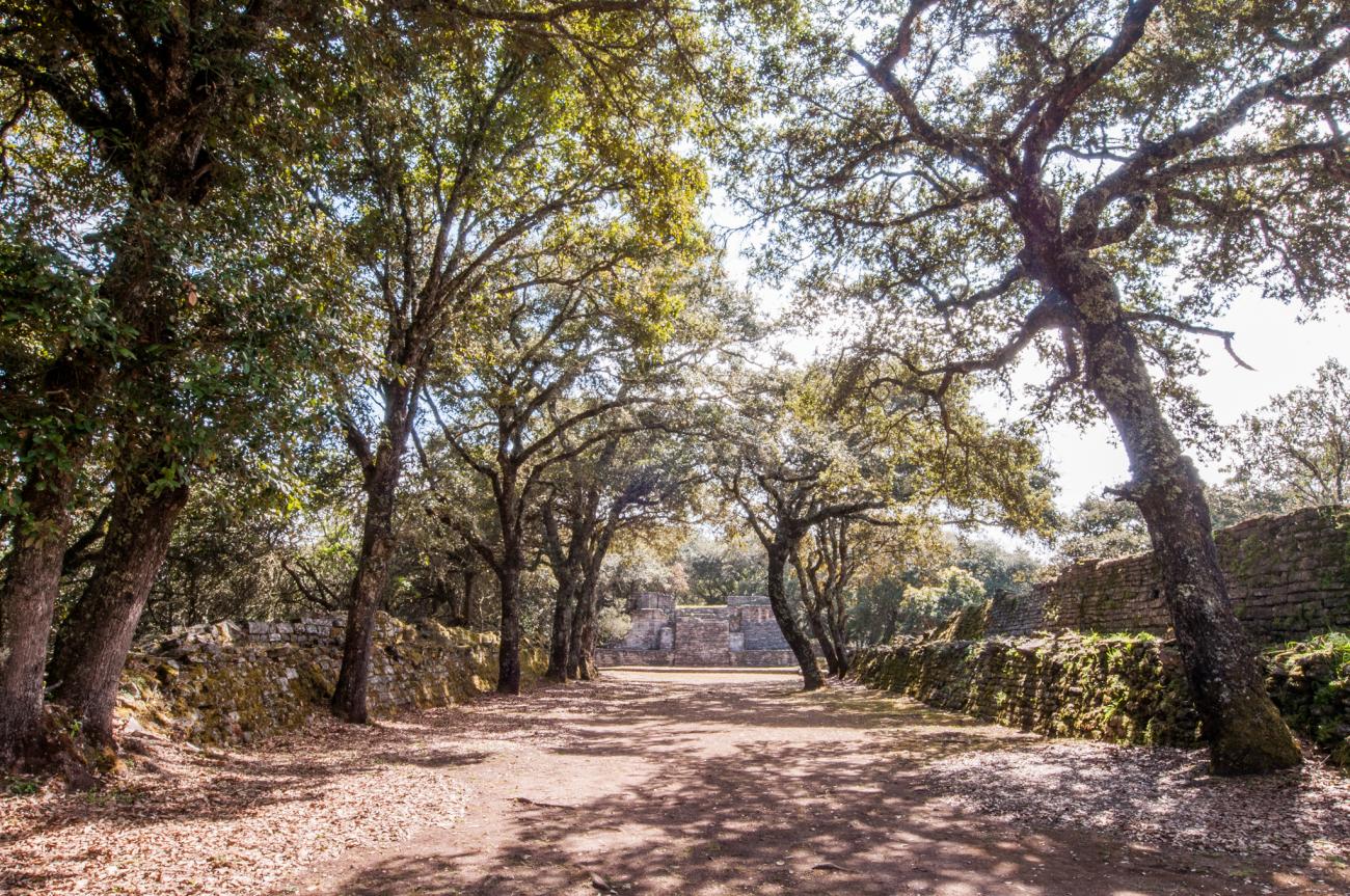
Toluquilla is very well preserved. Even before the archeological excavations, it was possible to explore its streets and alleys and pass through its doorways. The visit currently covers the entrance plaza, the first ballgame court, a residential complex, the Magueyera area and the second ballgame court. After this point, the site is overgrown and covered by five centuries’ worth of collapse. Altogether, around 40 percent of the ancient town has been explored.
- Dirección del Centro INAHRosa María Estela Reyes Garcíarosaestela_reyes@inah.gob.mx+52 (442) 245 5205Administración de la Zona Arqueológico y Museo de SitioArmando Bahena Quintanaabahena.qro@inah.gob.mx+52 (442) 212 2036, ext. 30801
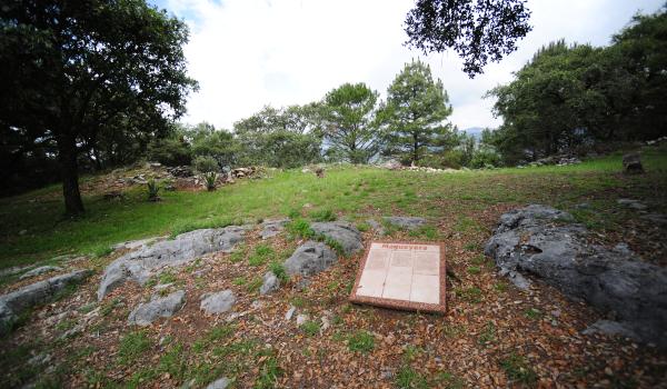
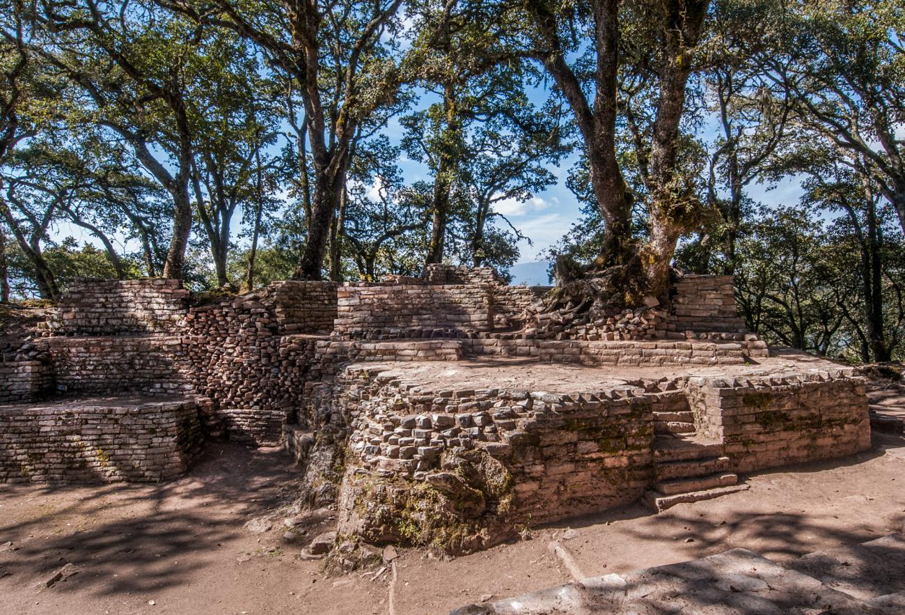
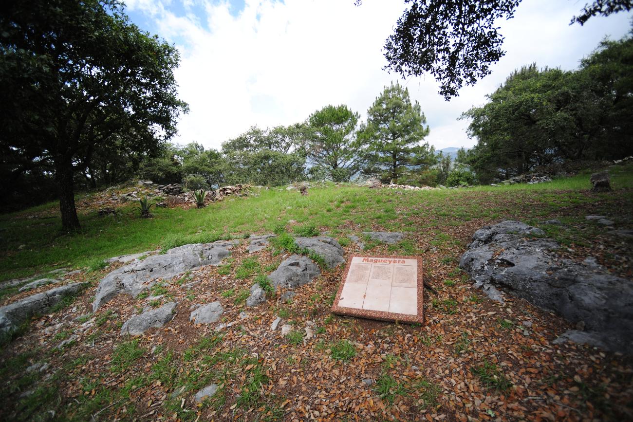
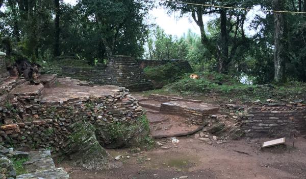
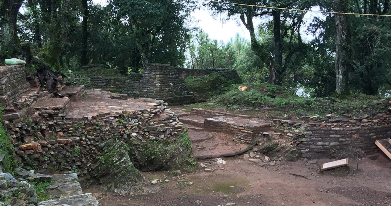
Magueyera
The name of this area, now very clean, is due to the fact that the rooms built there were dismantled to plant magueys for the production of pulque. Thanks to the fact that the urban layout of the town was continuous, it is still possible to observe the remains of such rooms.
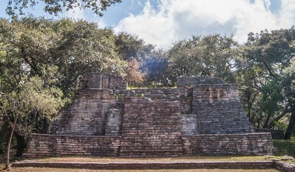
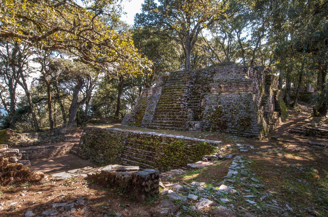
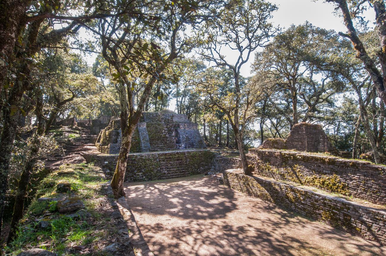
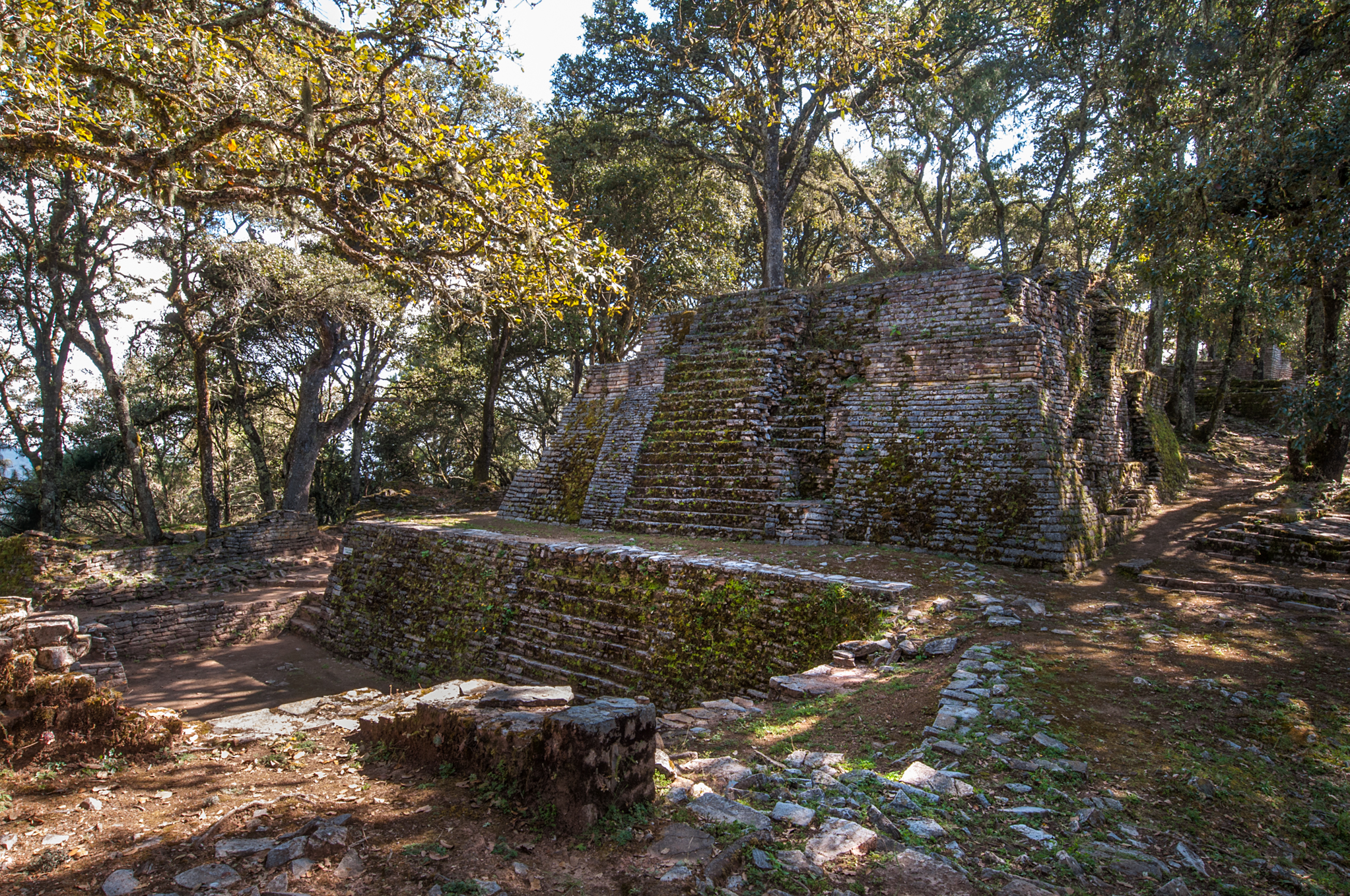
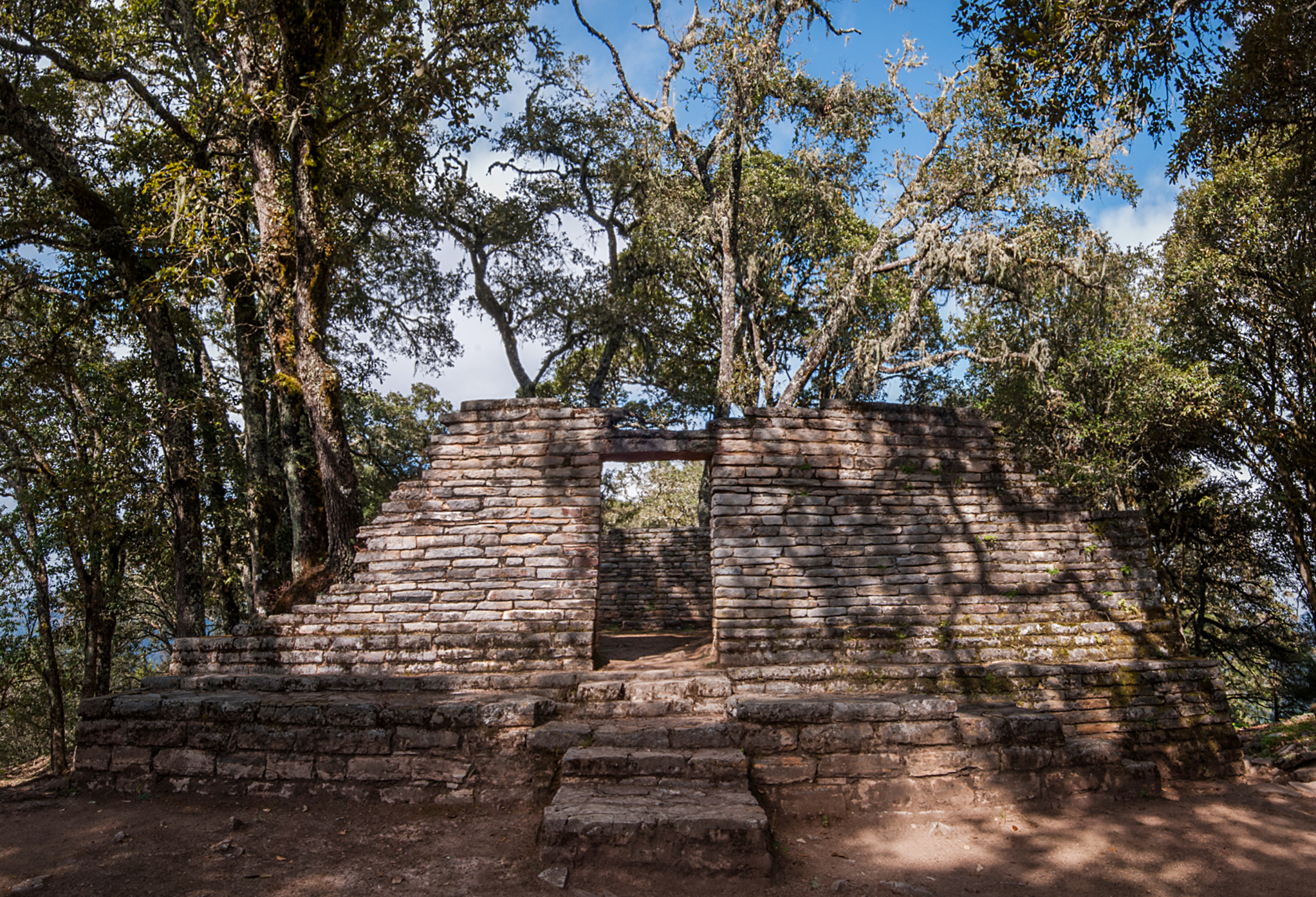
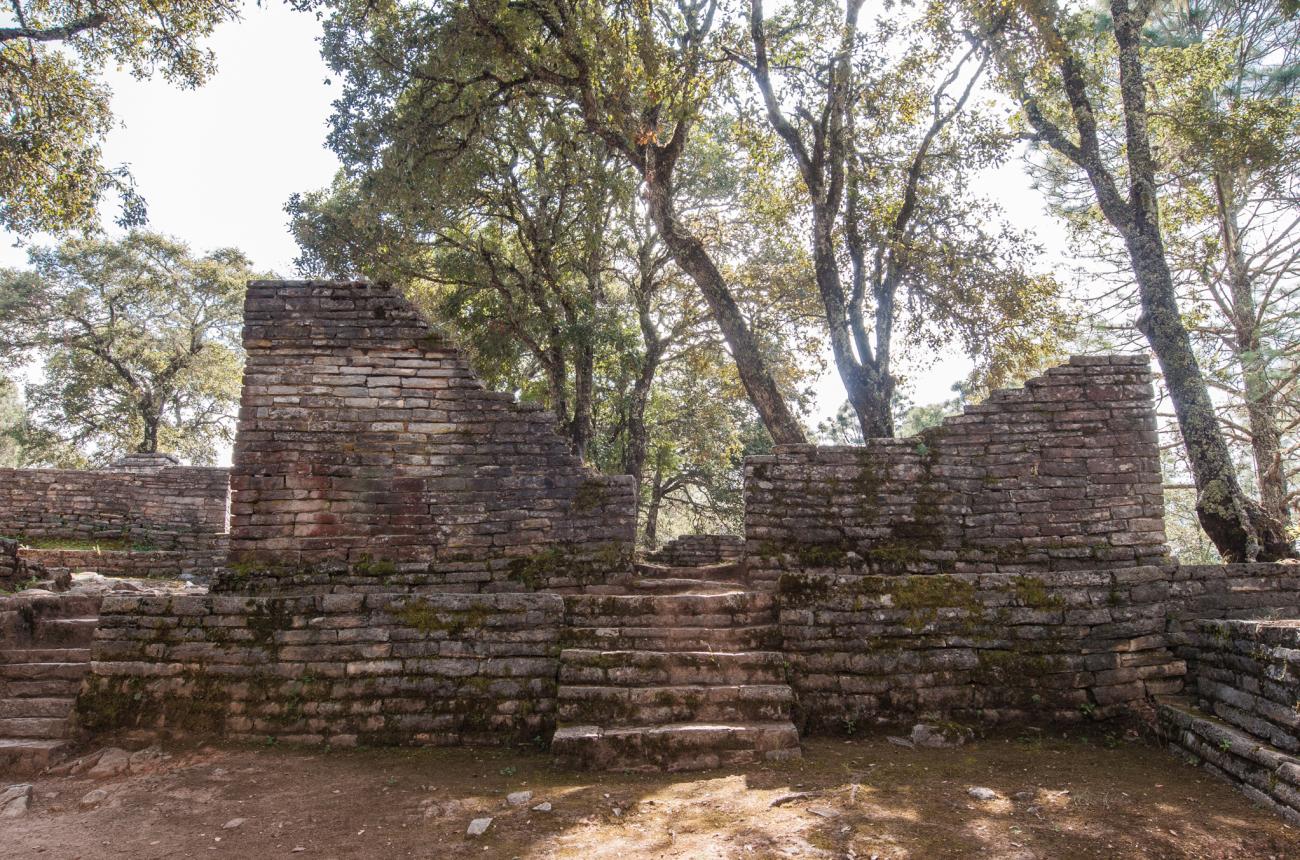
Templo o Edificio 57
Rectangular in plan, it is composed of two bodies. The first is a low banquette that surrounds it with a simple staircase in front and a corridor linked at the back, which provides continuity through a platform that contained several very low rooms.
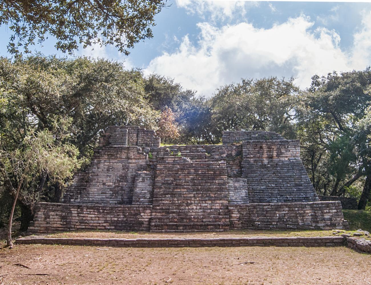

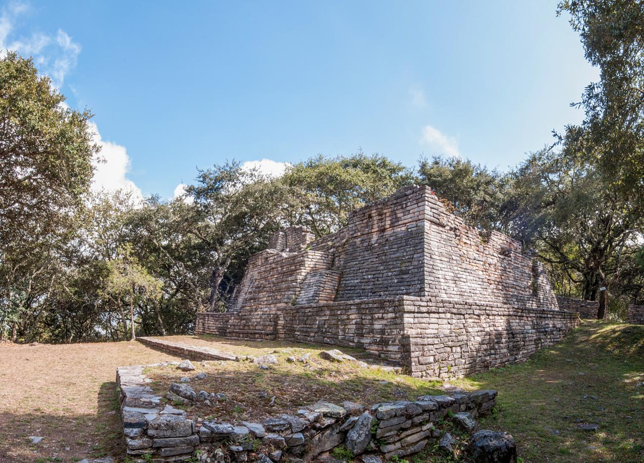
Rectangular in plan, it is composed of two bodies. The first is a low banquette that surrounds it with a simple staircase in front and a corridor linked at the back, which provides continuity through a platform that contained several very low rooms. The second body has a projecting cornice; its staircases had lateral alfardas.
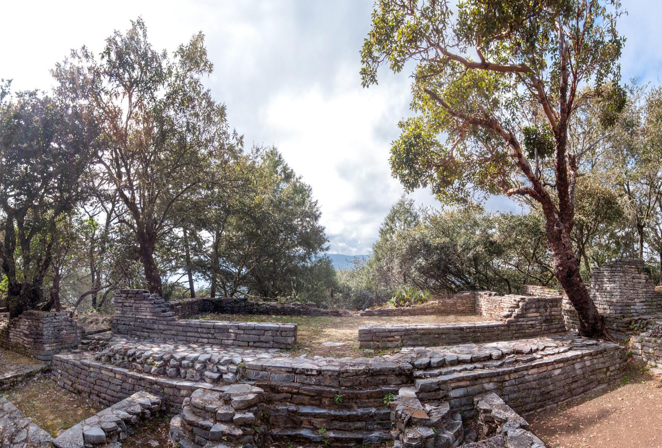
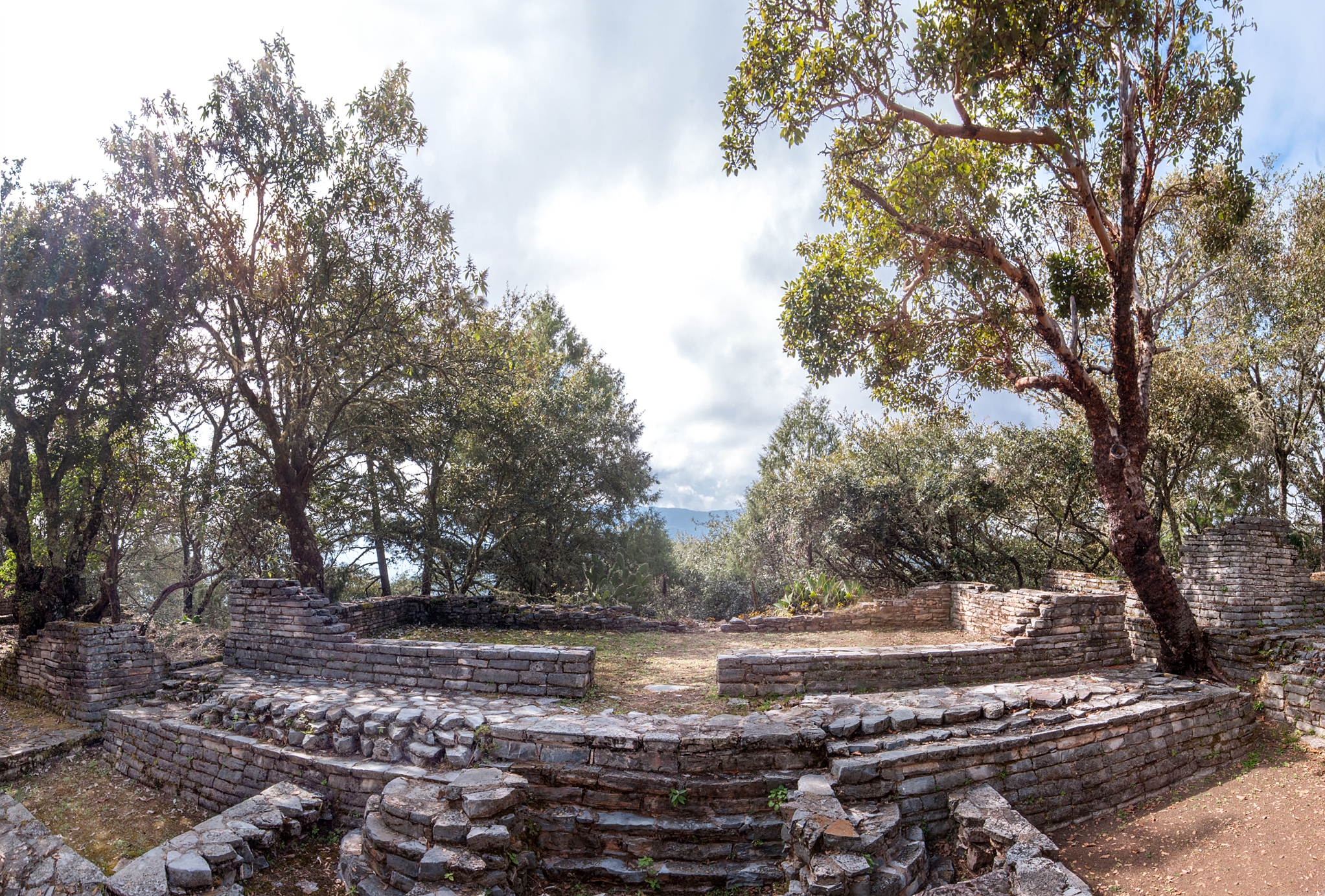
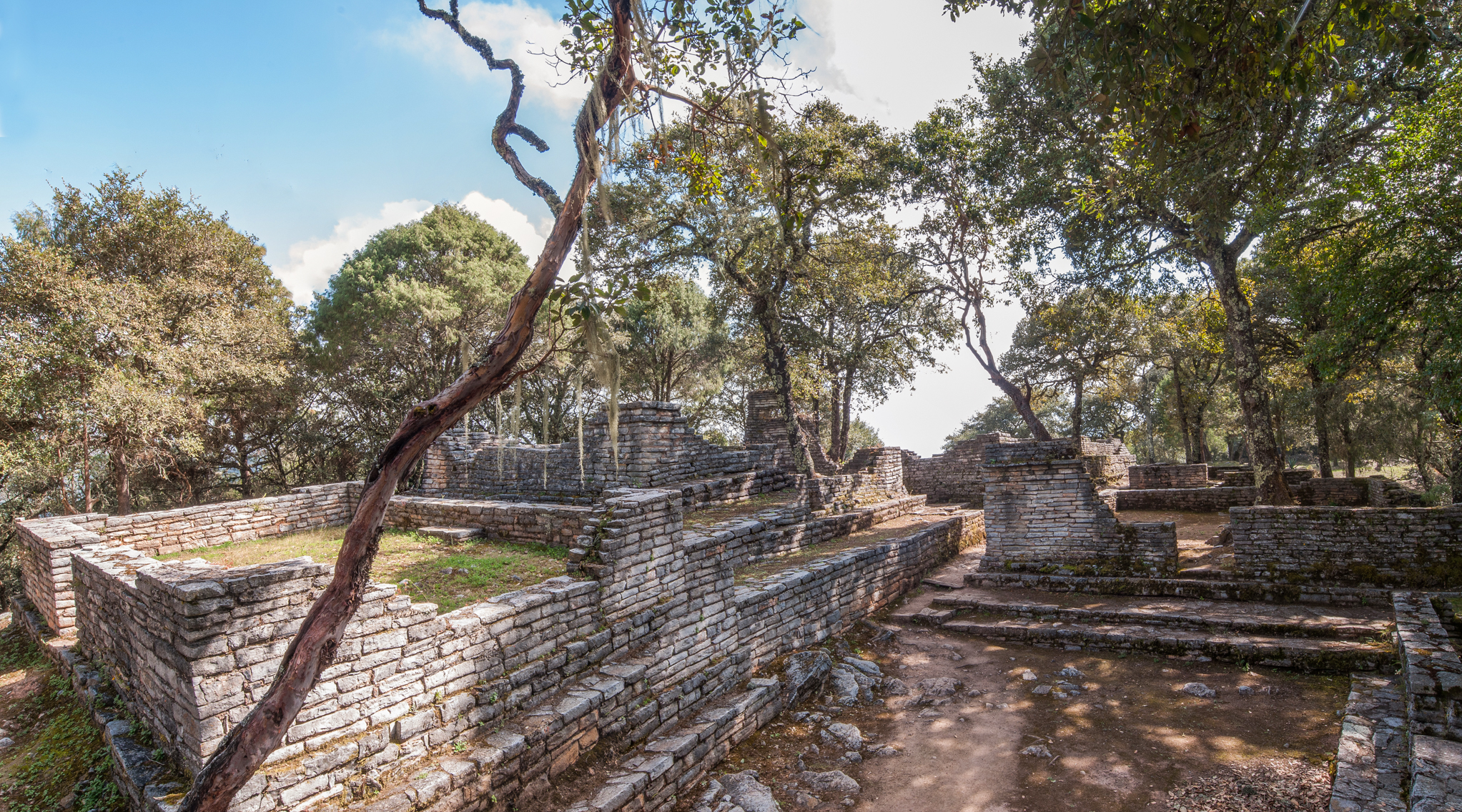
Conjunto habitacional
To the south of the vestibule is located this area, which begins with a plaza where there is a street that leads to different rooms, several with small altars that possibly functioned for religious worship.


To the south of the vestibule is located this area, which begins with a plaza where there is a street that leads to different rooms, several with small altars that possibly functioned for religious worship.
Building 18: During its exploration, the doorway was discovered and restored.
Building 31: In the northeast corner there is a 2.30 m high wall, with a narrow slab that protrudes; this architectural detail has been called ixtapaltete, a fashion imitated from Teotihuacan.
Building 33: Two construction periods can be observed here. The oldest, near the door, maintained a straight stairway, and in its sides two more were added in semicircle, characteristic element of the constructions of the Sierra Gorda. The second stage, built on top of the previous one, is differentiated by the straight stairways.
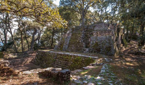
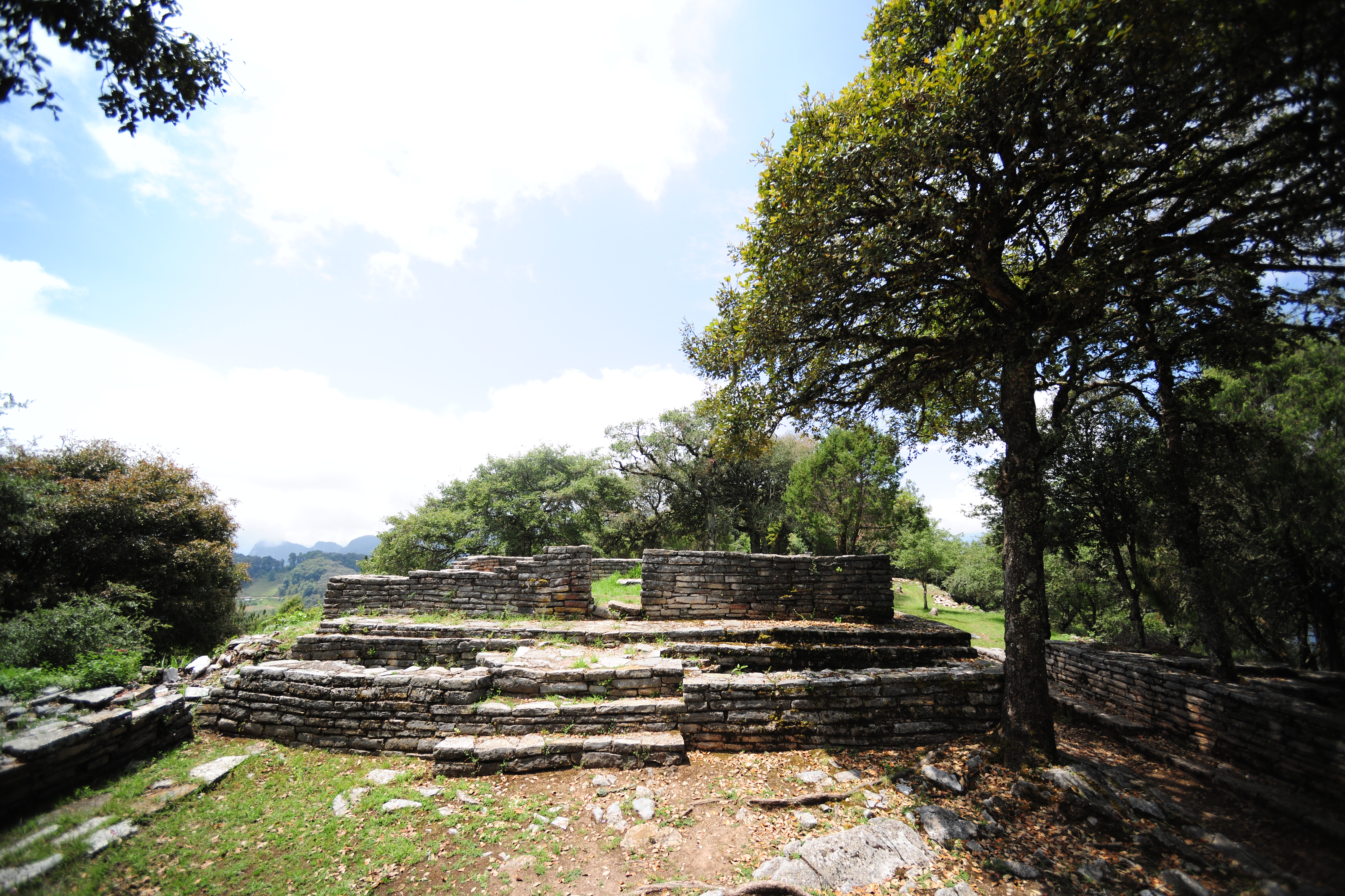
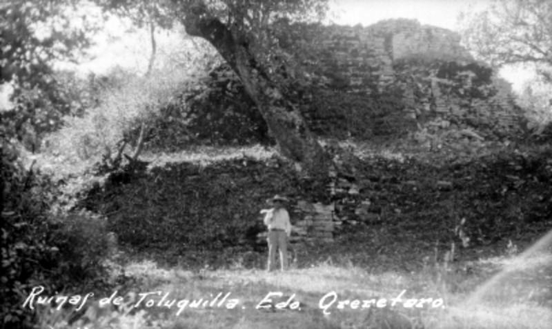
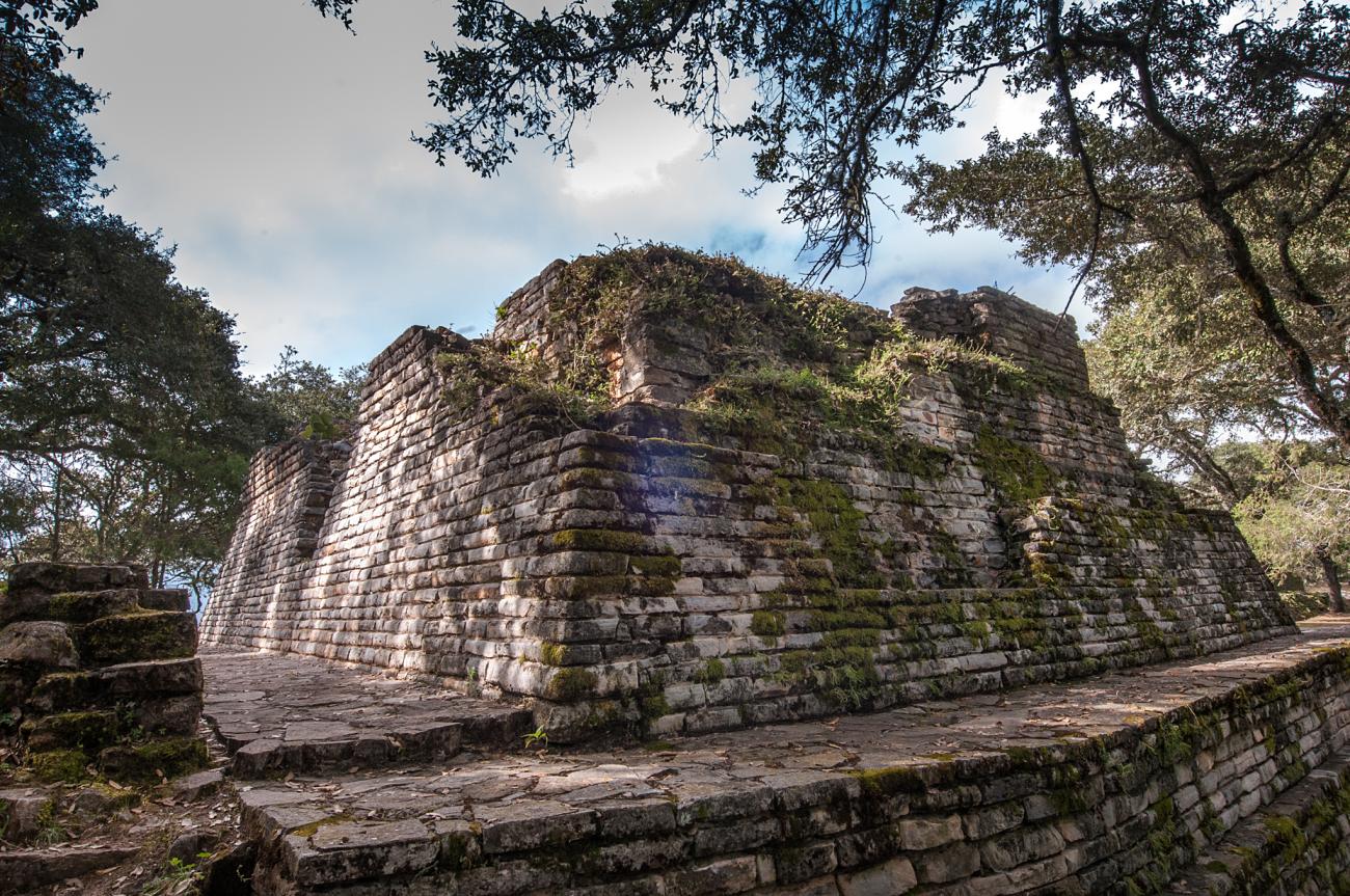
Edificio 15
It is rectangular in plan and has three bodies. The stairways have a very narrow footprint, as they were more ornamental than functional. Only in the second section does the use of alfardas stand out.

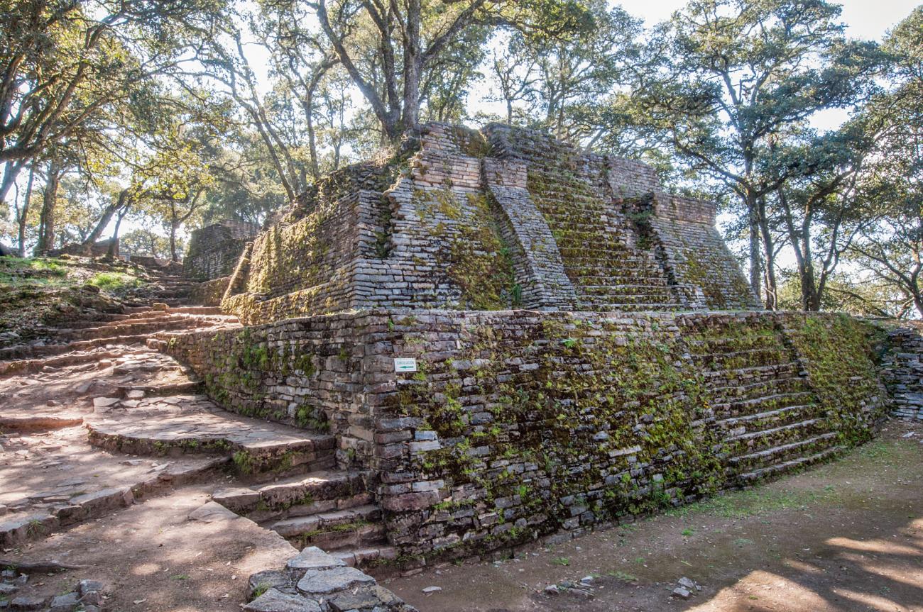
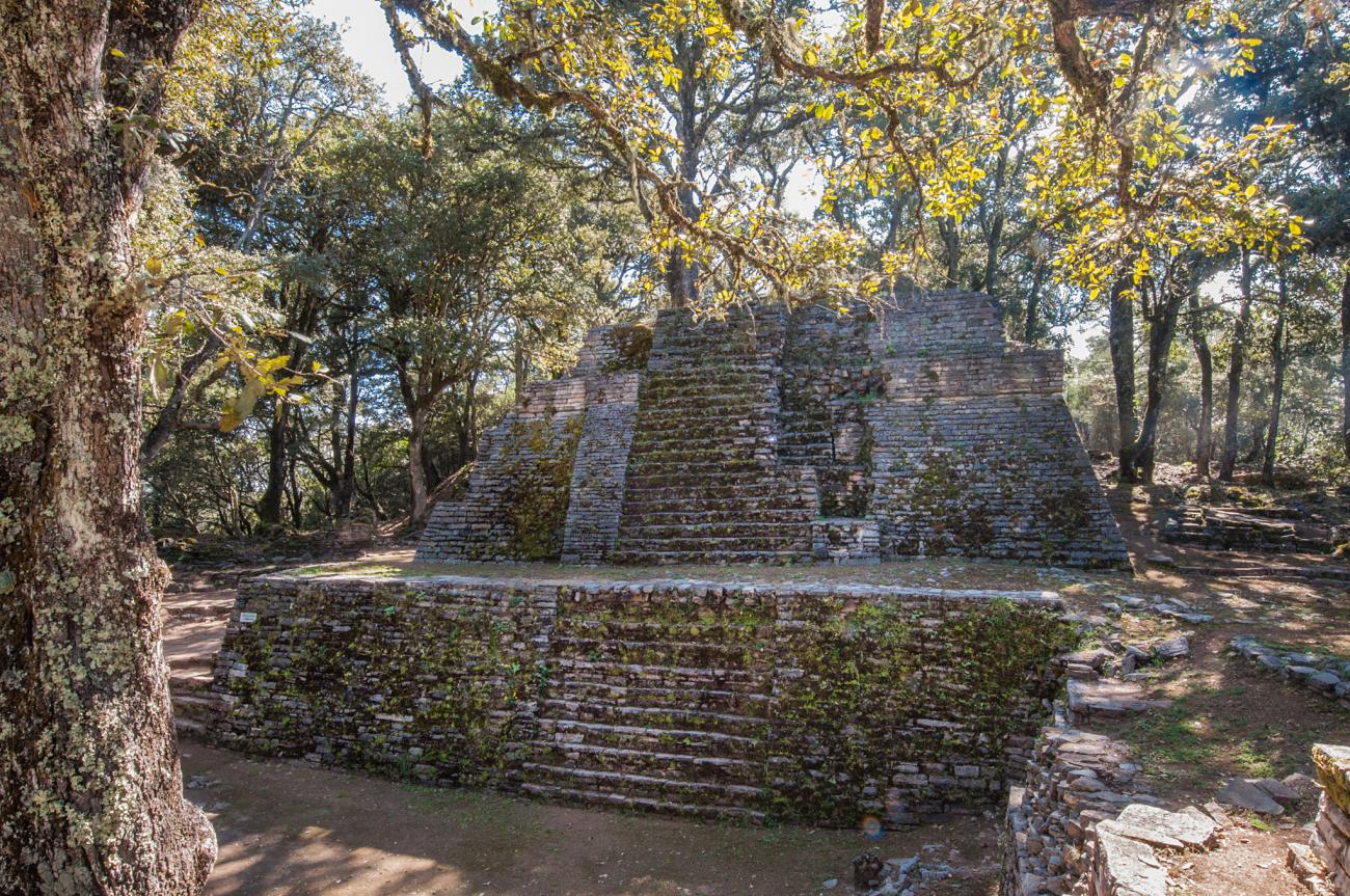

It is rectangular in plan and has three bodies. The stairways have a very narrow footprint, as they were more ornamental than functional. Only in the second section does the use of alfardas stand out. In this space, the base has a ledge cornice, a feature that has been identified as coming from the coast of the Gulf of Mexico. On the east side, the six stages of occupation can be observed.
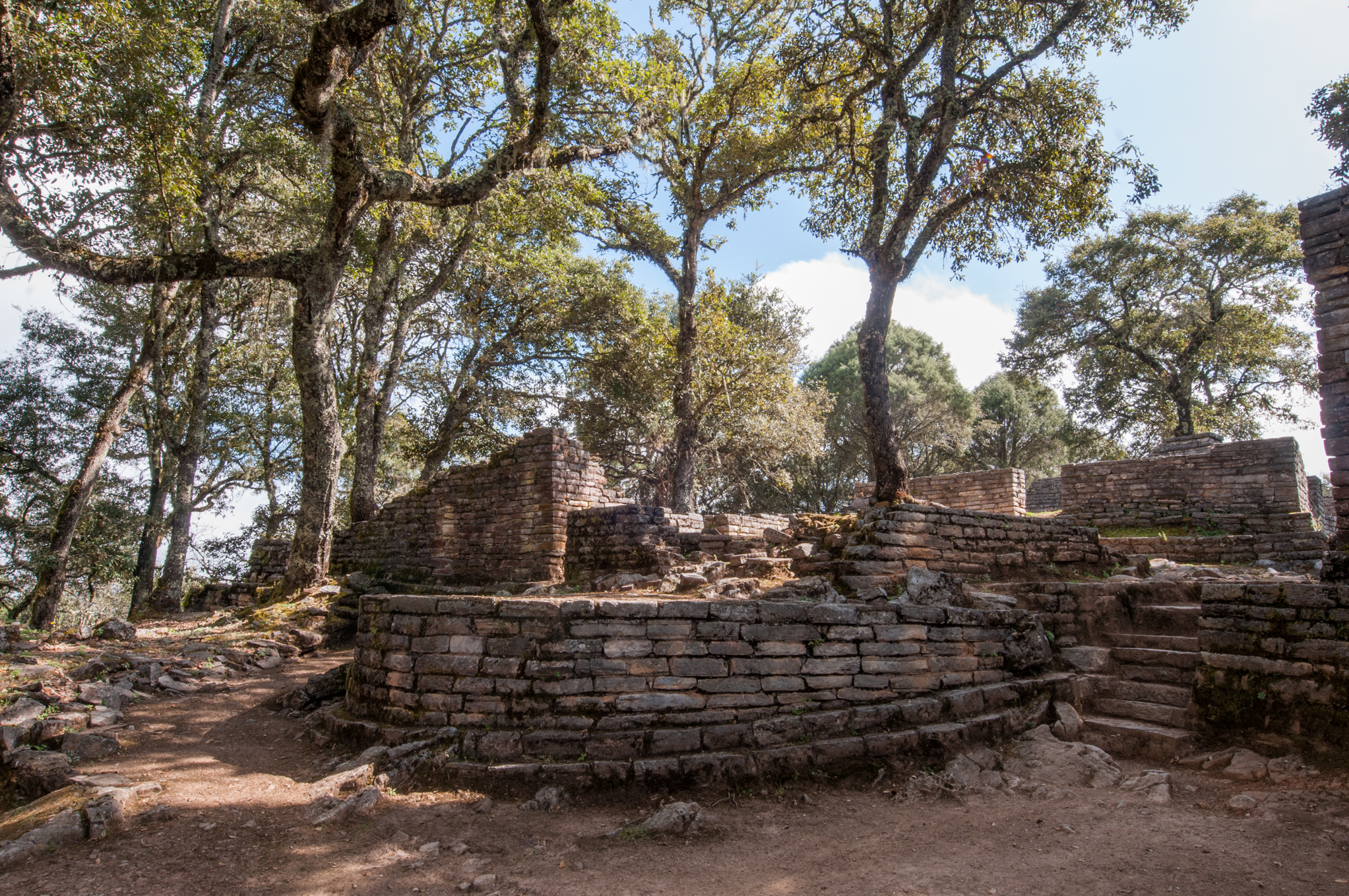
Vestíbulo
Ascending the slope to the guard house, the visitor first enters this space for registration and rest. Then he arrives at a small square surrounded by six rooms.
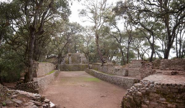
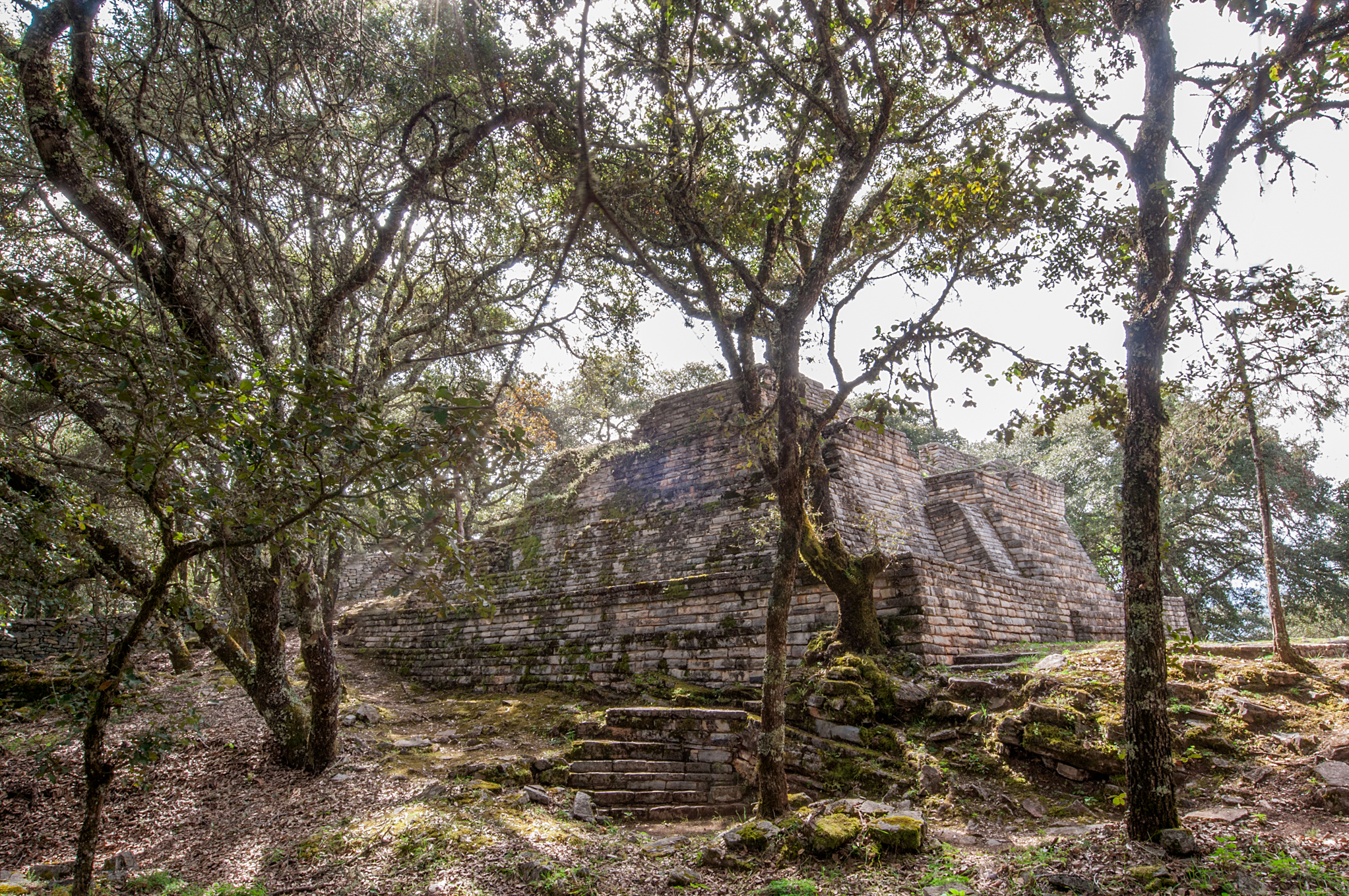
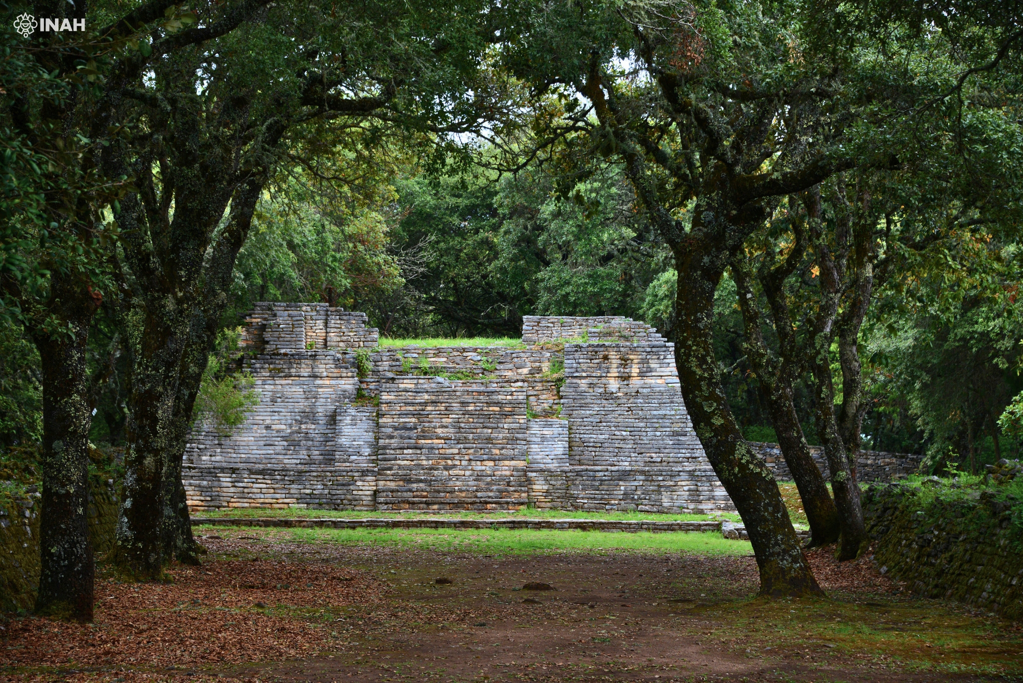
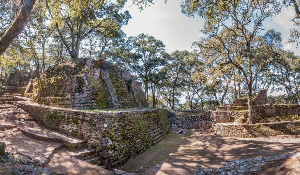
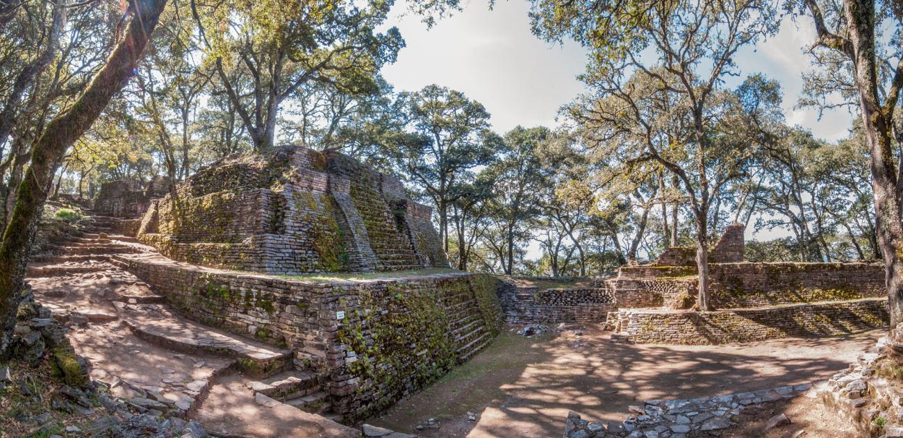
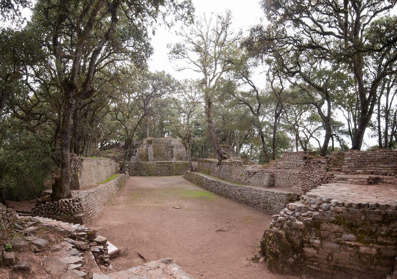
Juego de Pelota 1
This “I” shaped space consists of the court bounded on its longitudinal axis by long constructions and, at the back, by Building 15, which tops it. The lateral walls, where the absence of markers is noticeable, stand out.
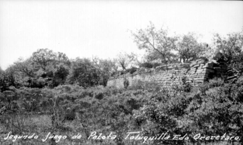
Juego de Pelota 2
Located to the south, it consists of a court surrounded by two long constructions of almost vertical profile, not as well preserved as in the first court.
Located to the south, it consists of a court surrounded by two long constructions of almost vertical profile, not as well preserved as in the first court. To the south, a temple tops the space, while to the west there are two temazcales, one at each end of the court, as well as a lateral corridor. In recent explorations the markers were located on the floor, not embedded in the wall, as in other ball courts. They were on the longitudinal axis and divided the profane space from the sacred. The sacred rituals surrounding the game are under investigation.

Different construction phases