


Museo de Arqueología Maya, Fuerte de San Miguel
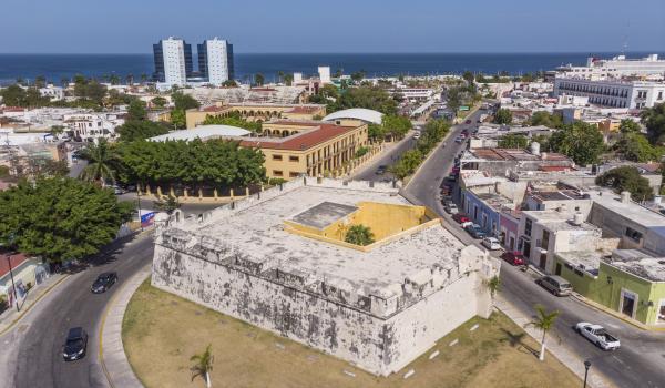
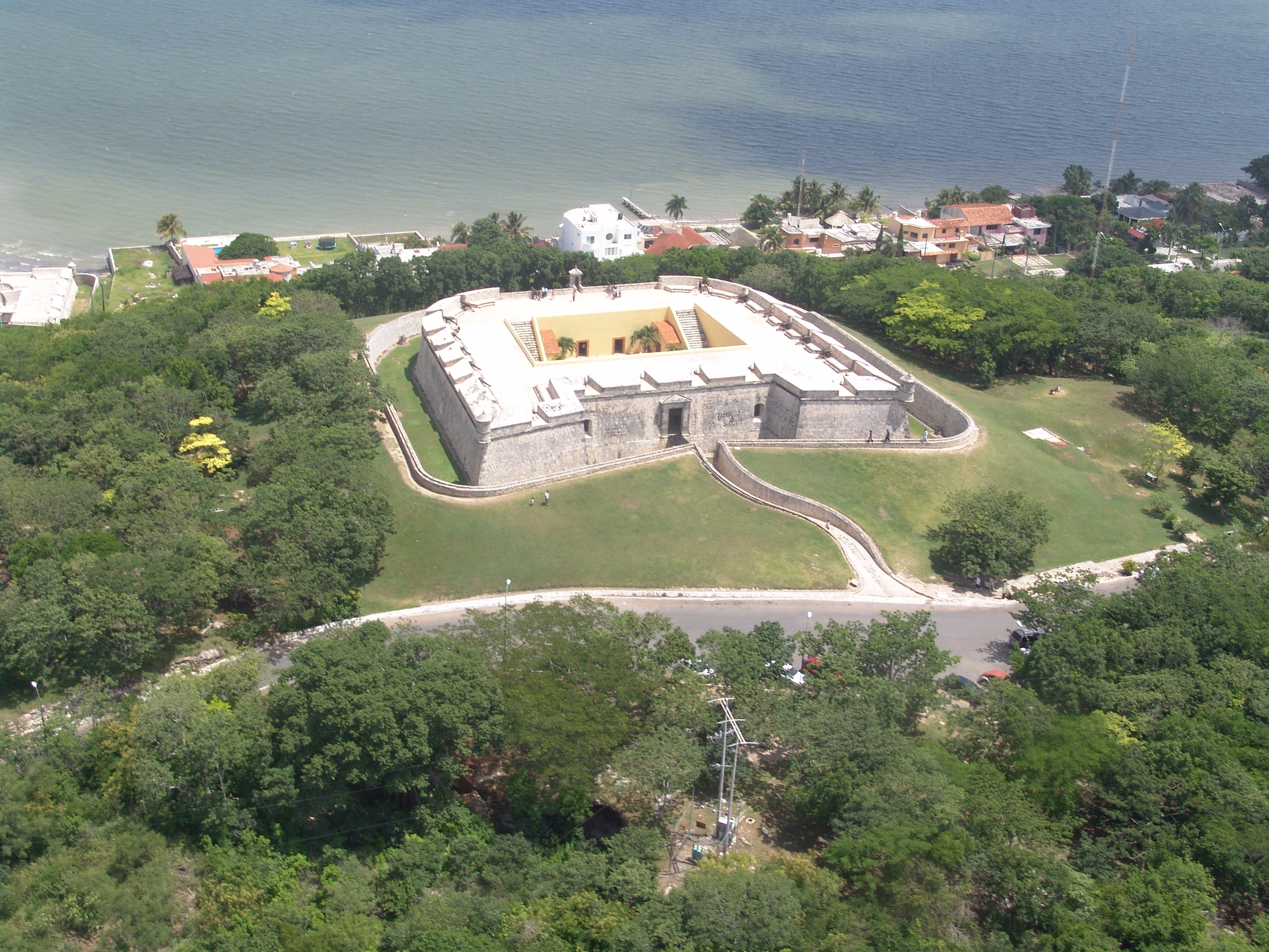
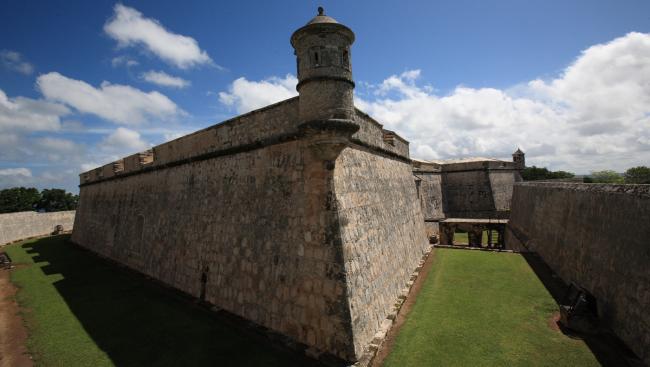
In one of the mightiest forts of the vice-royal period, dating from the late eighteenth century, this museum is now home to two unique collections: the funerary jade masks of Calakmul, and the funerary ceramic figures of Jaina. In addition, there are some remarkable Mayan stone sculptures. The architecture and splendid collections of the Fuerte de San Miguel were among the main reasons why the city of Campeche was listed by the UNESCO as a World Heritage Site in 1999.
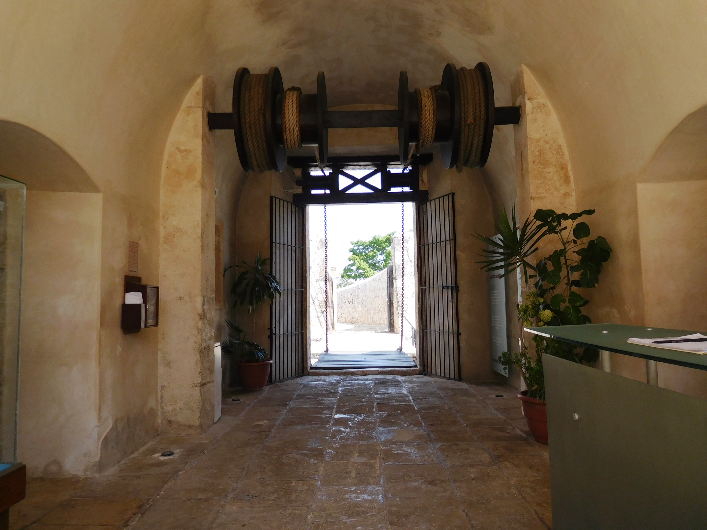
The Maya Archeological Museum on the site of the Fuerte de San Miguel is a seventeenth-century building, forming part of [Campeche’s] defense system that consisted of two hilltop forts and four batteries on the coast. This construction was specified as a reason for the city becoming a UNESCO World Heritage Site as a “Fortified Historic City” in 1999.
In 1963, the building was restored to become a museum of weaponry and seamanship; in 1978 its collection was replaced by the displays of the Museum of Mayan Archeology. A refurbishment in 1999 renewed the exhibition design and the collection was expanded to include objects from various archeological sites across the state.
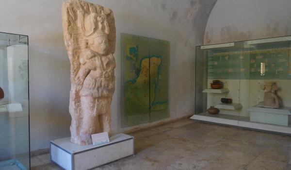
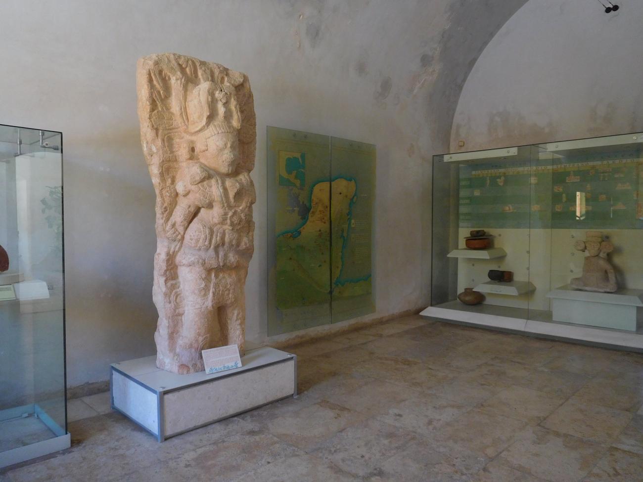
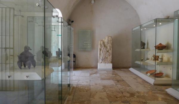
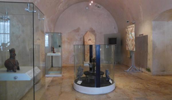
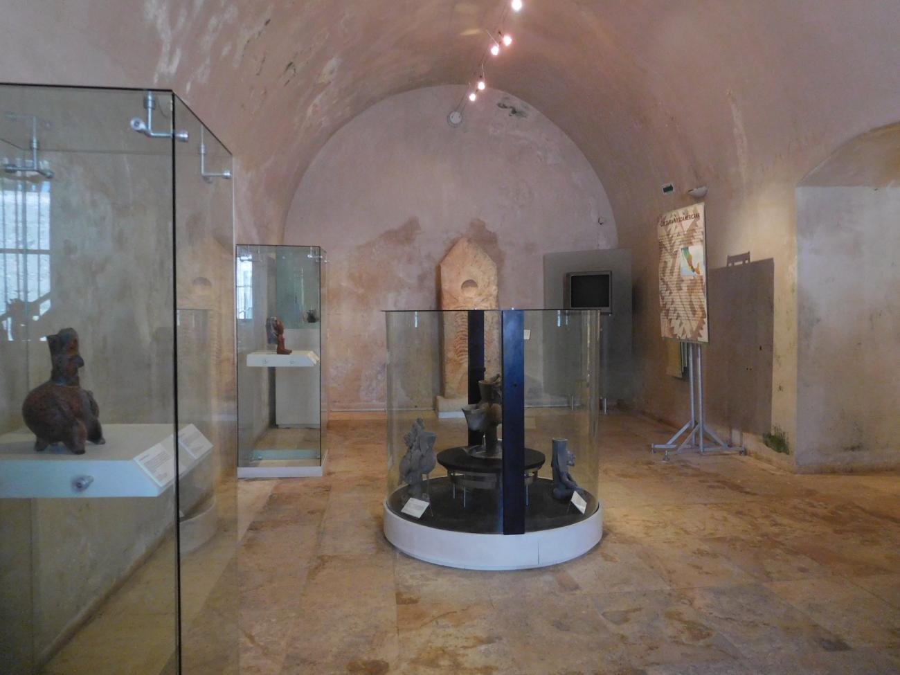
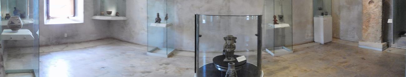
There are two collections: one consists of jade funerary masks from the tombs of the Rulers of Calakmul, the other is a display of funerary figurines from the island of Jaina. Other important items include a pot with an iguana-shaped lid, hinting at a rich history of religious ideas expressed iconographically, and an earthenware pot with a lid in the form of a black panther’s head or a night sun, both discovered at the Becán archeological site. The stone drum sculpture, featuring the image of a queen, comes from the site of Edzná or “House of the Itzaes”.
The fortification of New Spain’s coastlines have a long history. The Bourbon kings of France, Spain and Naples with Sicily (the southern half of the Italian peninsula) sealed a series of “family pacts” in the eighteenth century which led them to engage in, or stir up, onerous wars, including the Seven Years’ War (1756-1763), which led to the Spanish Empire losing Florida and being forced to recognize the British right to establishing an outpost in modern-day Belize.
As a result, the Yucatán Peninsula—which, like Florida, “closed off” the Gulf of Mexico to trade—found itself in a precarious position; by the mid-eighteenth century the port of Campeche had already been attacked by English pirates, and the Spanish galleons that carried New Spain’s silver and Peruvian gold, along with many other goods—including products from Asia that had come via Acapulco—were regularly plundered by English and Dutch pirates. The Spanish government then decided to equip the coasts of New Spain with a series of forts, as part of a plan drawn up by the infantry brigadier Agustín Crame, and this system included the Fuerte de San Miguel in Campeche on a hill called La Eminencia, to the southwest of the city. This fort was eventually completed in 1779, together with the coastal batteries of San Luis and San Fernando, boasting artillery that made it very difficult for enemy invaders to disembark. The works were supervised by the king’s deputy, Don Leandro Poblaciones.
Later abandoned, following Mexico’s Independence from Spain the Ministry of War took over responsibility for the fort, and its restoration under the INAH’s supervision began in 1963. Two years later it opened as a museum, and in 1999 it received additions to its collections from various parts of the state of Campeche.
The Maya World
This gallery presents the geographical location of the cities from which the museum’s collection originates, along with a historical overview of the development of Maya culture and some objects that reflect the physical features of the Maya people of the Yucatán Peninsula.


The Natural Environment
Covering nearly 138,000 km², the geography of the Yucatán Peninsula is characterized by flat landscapes made of soft limestone, except along the coasts and in the southern part. A series of small elevations, known as the Puuc hills, crosses the region.

Covering nearly 138,000 km², the geography of the Yucatán Peninsula is characterized by flat landscapes made of soft limestone, except along the coasts and in the southern part. A series of small elevations, known as the Puuc hills, crosses the region. Rainwater does not remain on the surface but instead carves paths underground; upon reaching the water table, it forms subterranean rivers, caves, caverns, and the sacred "cenotes". The flatlands, covered with vegetation, gradually become dense jungle as one moves southeast.
The Maya's deep knowledge of their environment enabled them to use their resources rationally—for food, medicine, construction materials, and raw materials for crafting everyday, luxury, and ritual goods. Due to their extraordinary characteristics, certain birds, reptiles, and felines were considered representatives of the three levels of the cosmos: the celestial, the earthly, and the underworld.
They built spectacular cities whose monumental architecture mirrored the cosmos. The Maya conceived time as cyclical and developed a complex writing system that records their history, that of their rulers, and their worldview. Archaeological remains reveal the work of specialists such as potters, lapidaries, painters, sculptors, architects, and merchants, among many others.
From Village to City
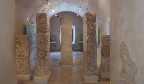
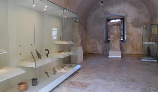
This gallery features pieces related to the development of Maya architecture during the Late Classic period (600–800 CE), taking as a reference the ancient city of Xcalumkin, located in the Puuc region, known for its exceptional carved stone sculpture.


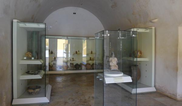
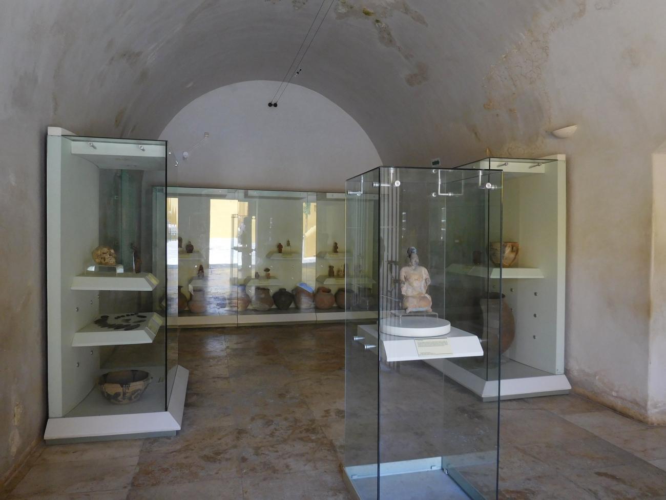
Jaina, the House on the Water
This gallery invites visitors to explore the ritual and funerary life of the Maya people through objects found in burial contexts on an artificial island built off the coast of Campeche.

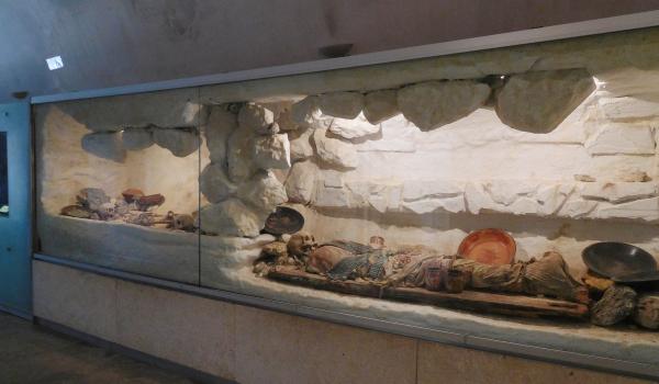
Calakmul: Transcending Death
This gallery features a representation of the tomb of the divine lord Fire Claw or Jaguar Claw, along with the original rich funerary offerings, which include a jadeite funerary mask, earspools, and necklaces made of the same material, as well as pearls and Pacific spondylus shells.
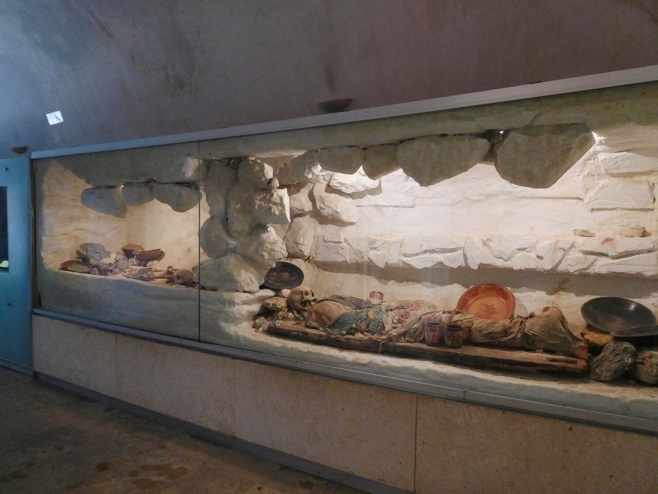

This gallery features a representation of the tomb of the divine lord Fire Claw or Jaguar Claw, along with the original rich funerary offerings, which include a jadeite funerary mask, earspools, and necklaces made of the same material, as well as pearls and Pacific spondylus shells. It also includes polychrome ceramics, whose epigraphic inscriptions reveal the name of this ruler.
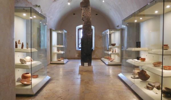
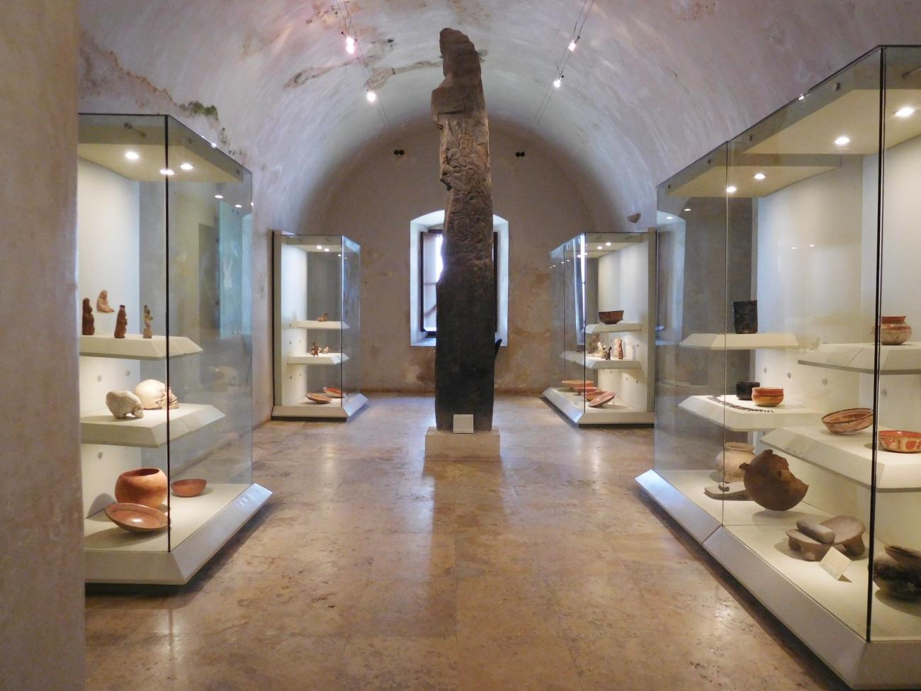
The Order of the Universe
This gallery exhibits black ceramics typical of Calakmul, with lids depicting animals and mythical figures such as the king vulture, the peccary, or the god Mam.
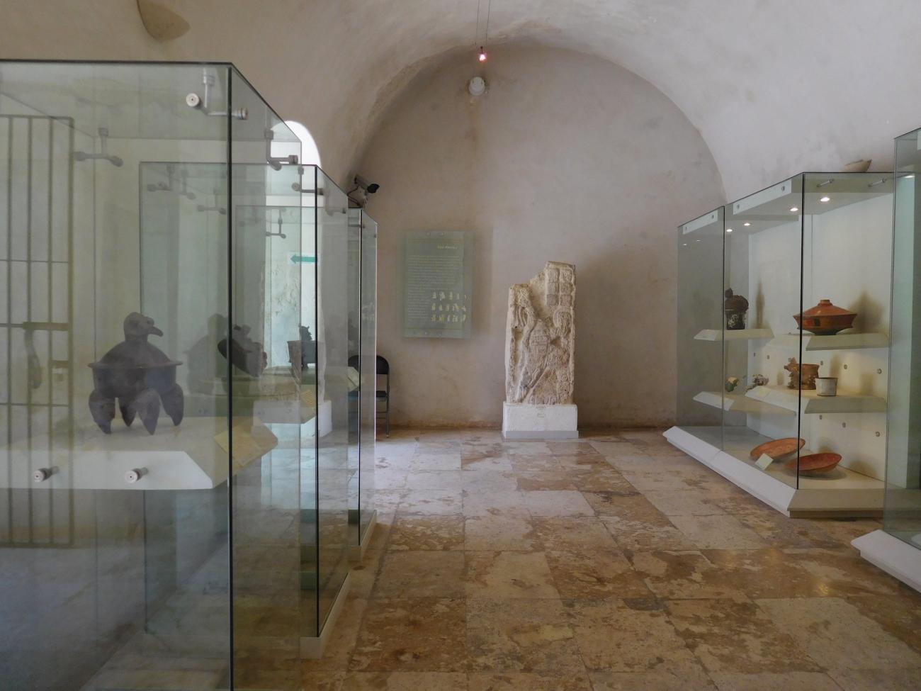

This gallery exhibits black ceramics typical of Calakmul, with lids depicting animals and mythical figures such as the king vulture, the peccary, or the god Mam. Also on display are stucco sculptures of the god Chaak and incense burners bearing the image of the Jaguar god, along with a collection of musical instruments including flutes and drums.
Scientific Knowledge
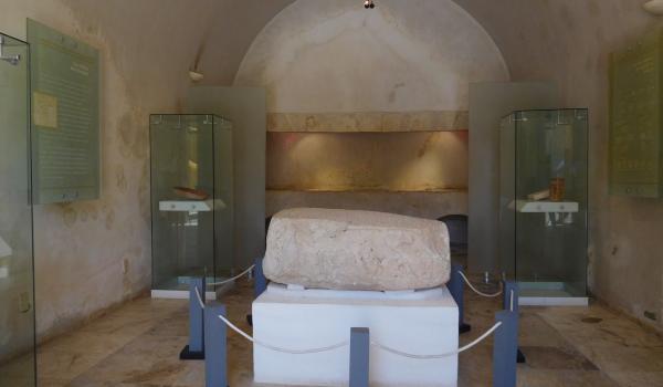
A basic explanation is offered about the Tzolk’in (ritual calendar) and the Haab’ (solar cycle), systems of time measurement that allowed for the development of the Long Count, whose beginning is marked by a mythical event and accounts for a calendar known as the 13 Baktuns.
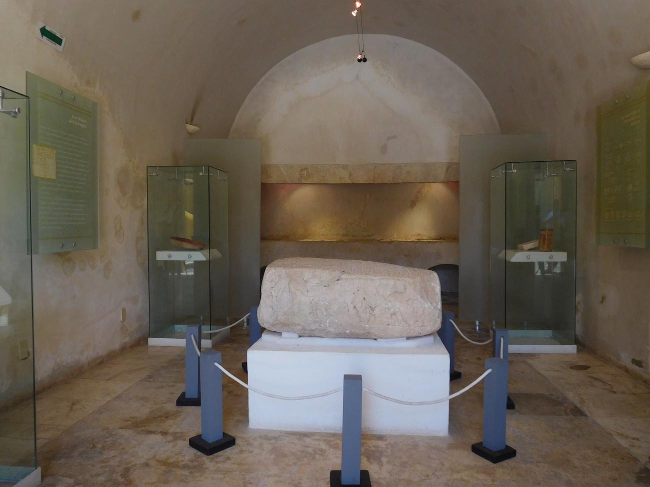
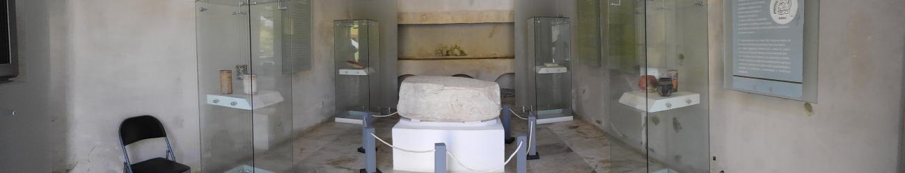
A basic explanation is offered about the Tzolk’in (ritual calendar) and the Haab’ (solar cycle), systems of time measurement that allowed for the development of the Long Count, whose beginning is marked by a mythical event and accounts for a calendar known as the 13 Baktuns. In this same gallery, visitors can see the altar from Uxul, originating from the Northern Petén region in the southern part of the state, whose epigraphic inscriptions are representative of Maya writing.
Social Structure
This gallery addresses the social stratification of Maya society and the warrior theocracy that fueled the development of Maya culture through the capture of prisoners, used both for the construction of large cities and for the sacrifice of noble captives as offerings to the gods.


This gallery addresses the social stratification of Maya society and the warrior theocracy that fueled the development of Maya culture through the capture of prisoners, used both for the construction of large cities and for the sacrifice of noble captives as offerings to the gods. Sculptural representations of these divine lords can be seen on stelae, along with ritual weapons that once belonged to them.
The Elite
Social hierarchy was closely tied to Maya cosmology. The highest lineages, linked to the gods, held the divine right to rule over commoners.

Social hierarchy was closely tied to Maya cosmology. The highest lineages, linked to the gods, held the divine right to rule over commoners. The governing institution included priests and wise men whose knowledge of the cosmos allowed them, through rituals and ceremonies, to ensure the continuity of society and maintain the balance of the universe. They were also responsible for managing and regulating economic activities such as agricultural cycles, craft production, and trade. Their observations of the celestial vault, calendars, and predictions allowed them to understand the periodicity of natural phenomena and to maximize environmental resources.
War and Territory
Warfare played a vital role among the Maya as a means to maintain territory and publicly legitimize political power. It also served as a tool for subjugating populations in order to control resources and demand tribute.
Warfare played a vital role among the Maya as a means to maintain territory and publicly legitimize political power. It also served as a tool for subjugating populations in order to control resources and demand tribute. In addition, it facilitated the capture of prisoners for construction work and the maintenance of monumental architecture in the city-states, for laboring on the rulers’ lands, for service, or even for imposing authorities on smaller settlements.
Warfare was a frequent theme in Maya art and iconography from early times and became a symbol of prestige. Scenes depicting captured and humiliated rulers before local dignitaries are common and appear in sculptures, reliefs, and murals in public spaces, serving to assert political authority.
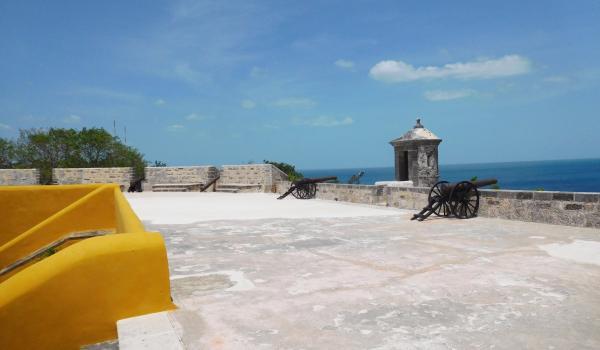
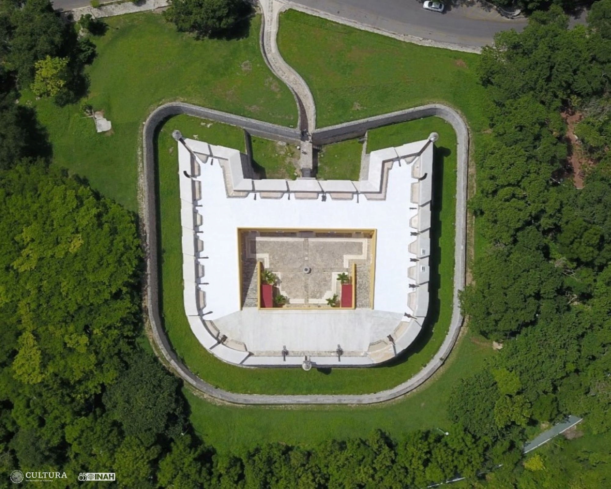
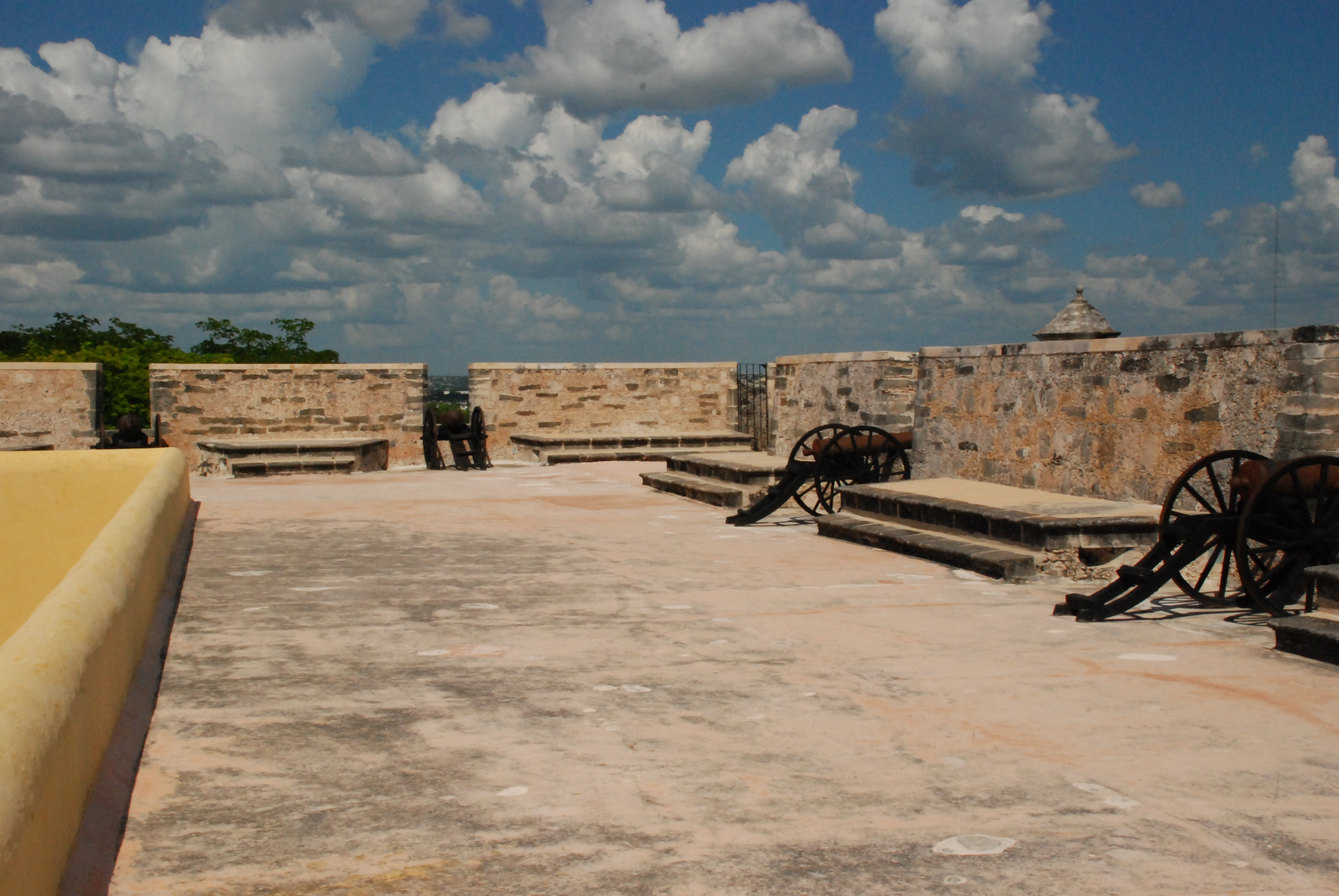
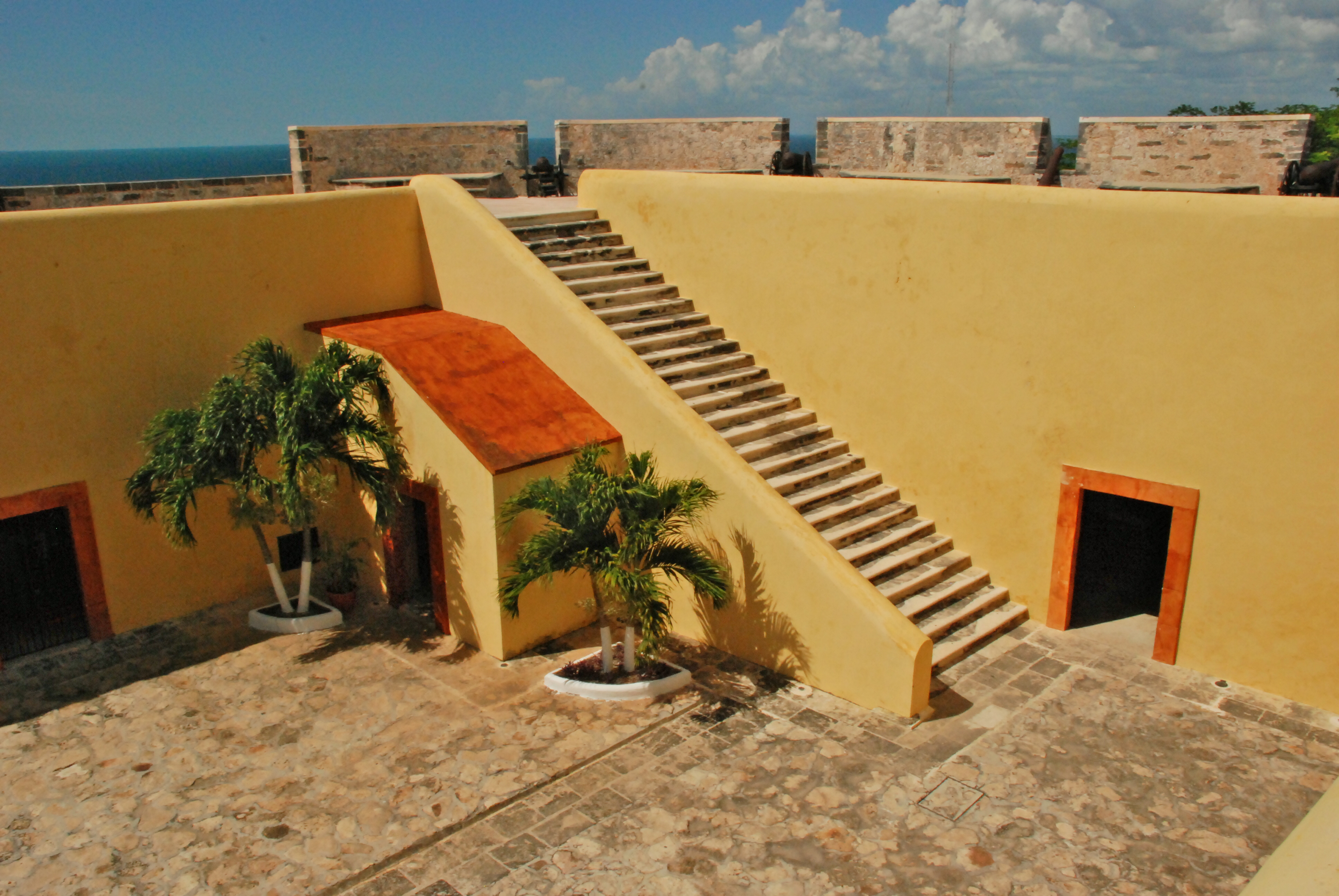
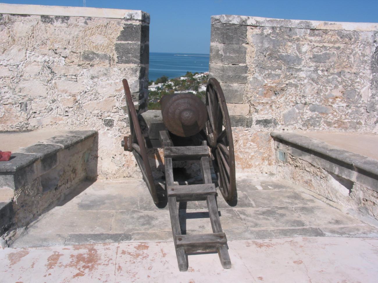
Parapet and Merlons
This wide rooftop space allowed for the movement of cannons and troops. It offers a panoramic view of the sea and part of the city. The merlons are the broad, reinforced battlements between which cannons could be positioned.


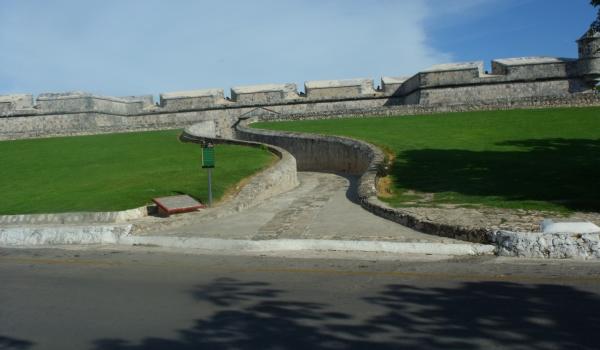
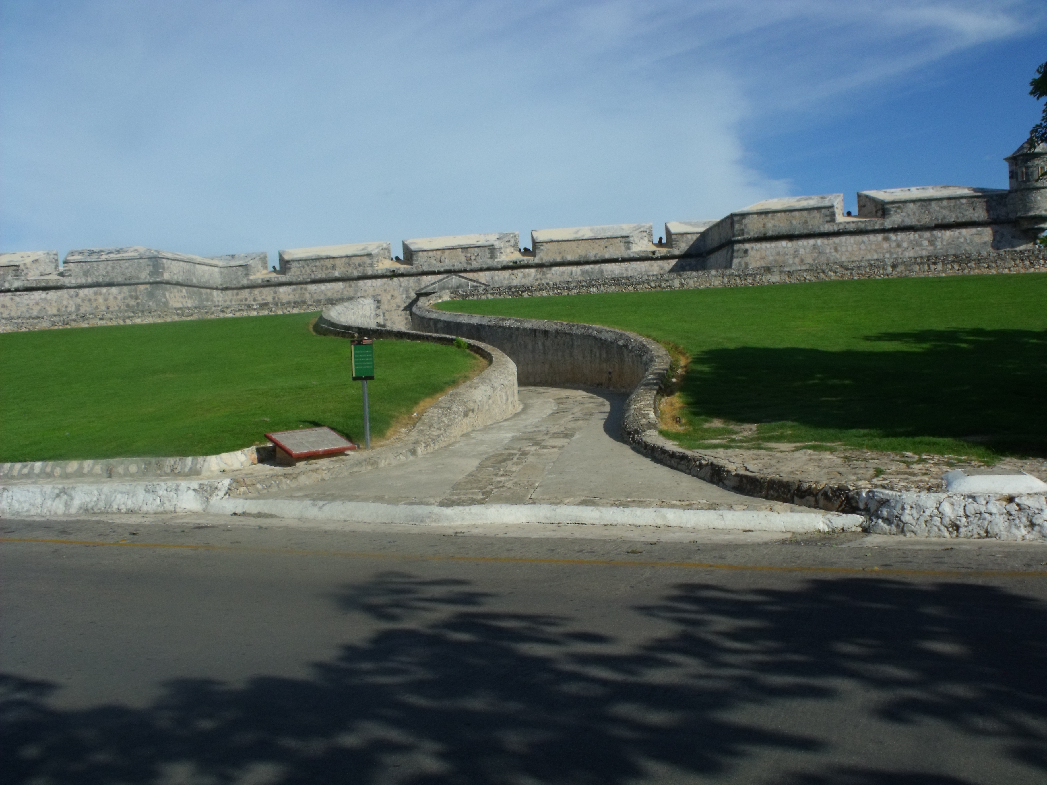
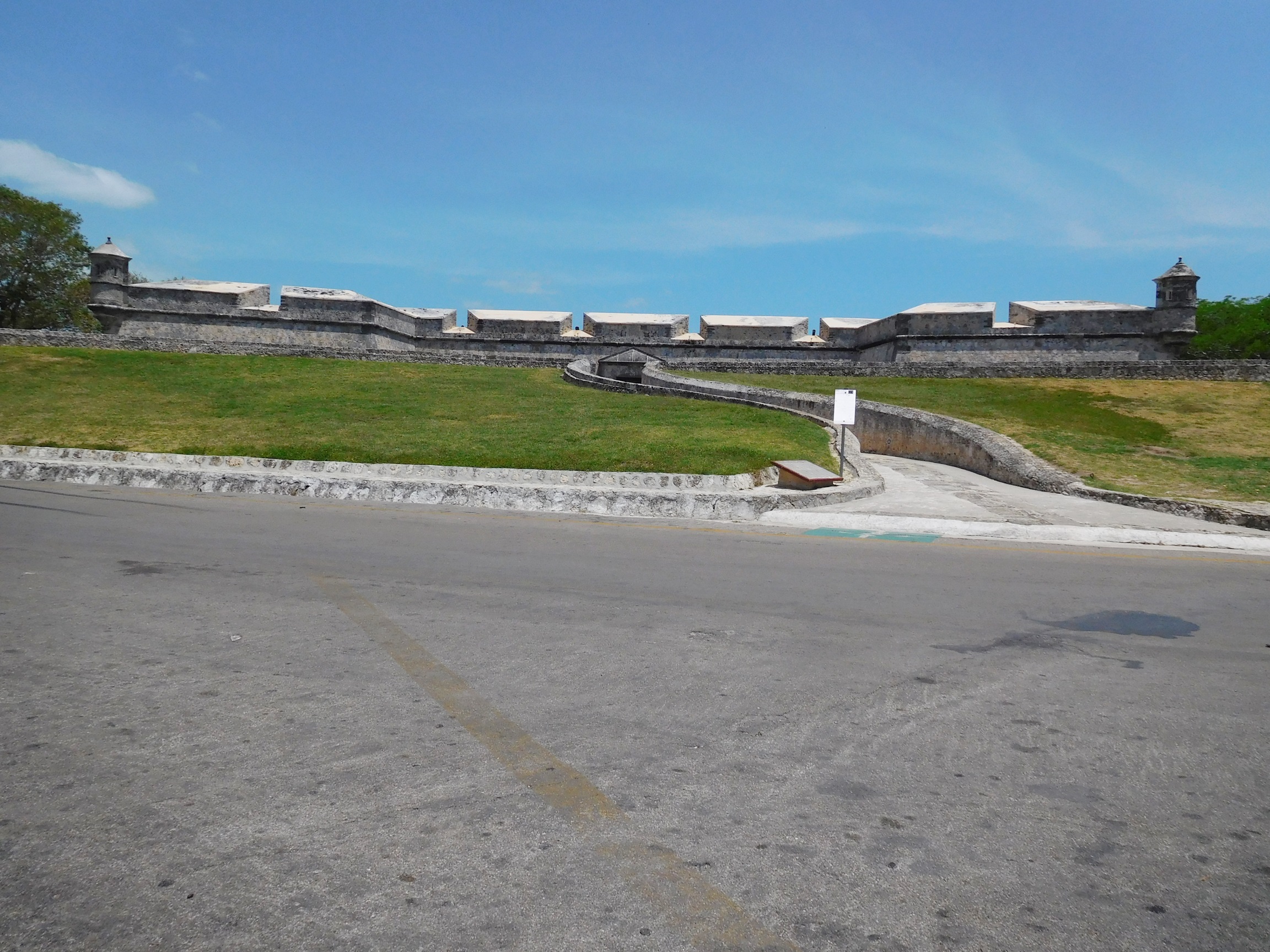
Winding Path and Glacis
Glacis are man-made ascending slopes that lead up to the outer walls of a fort. Their purpose was to expose potential attackers, making them easier targets. The winding path serves a similar defensive function, guiding movement toward the entrances while leaving invaders vulnerable.


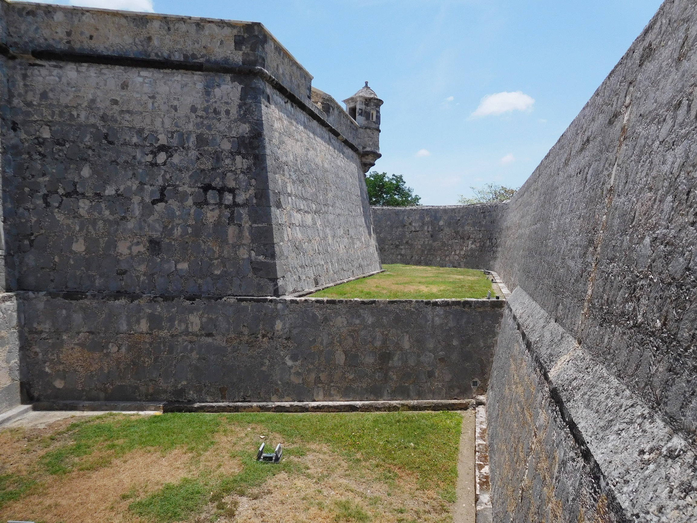
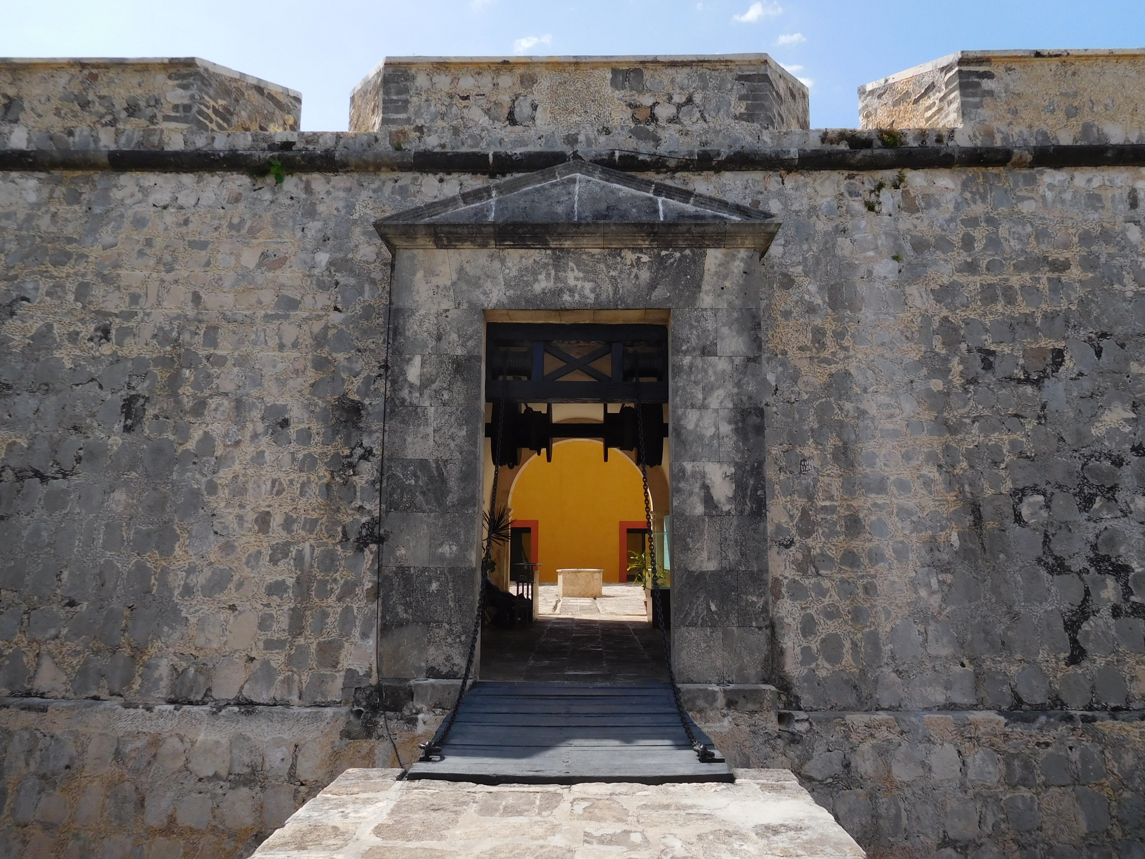
Moat
A deep trench surrounding a military fortress or castle, the moat served as the first line of defense. The side facing the interior of the fortress is called the escarp, while the outer wall facing the enemy is known as the counterscarp.


Watchtower (Garitón)
These small projecting towers located at the corners of the fortress walls were equipped with loopholes, allowing defenders to fire in multiple directions.

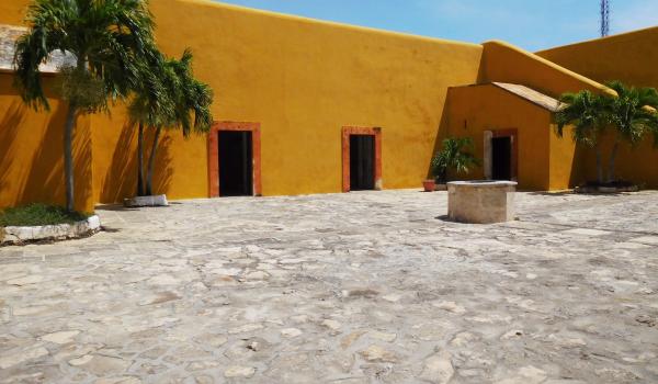
Courtyard with Cistern Well
The museum includes a square parade ground with a cistern well at its center. The well’s stone curb still collects rainwater to this day.


- EncargadoJonathan Miguel García Gonzálezmiguel_garciaglz@inah.gob.mx