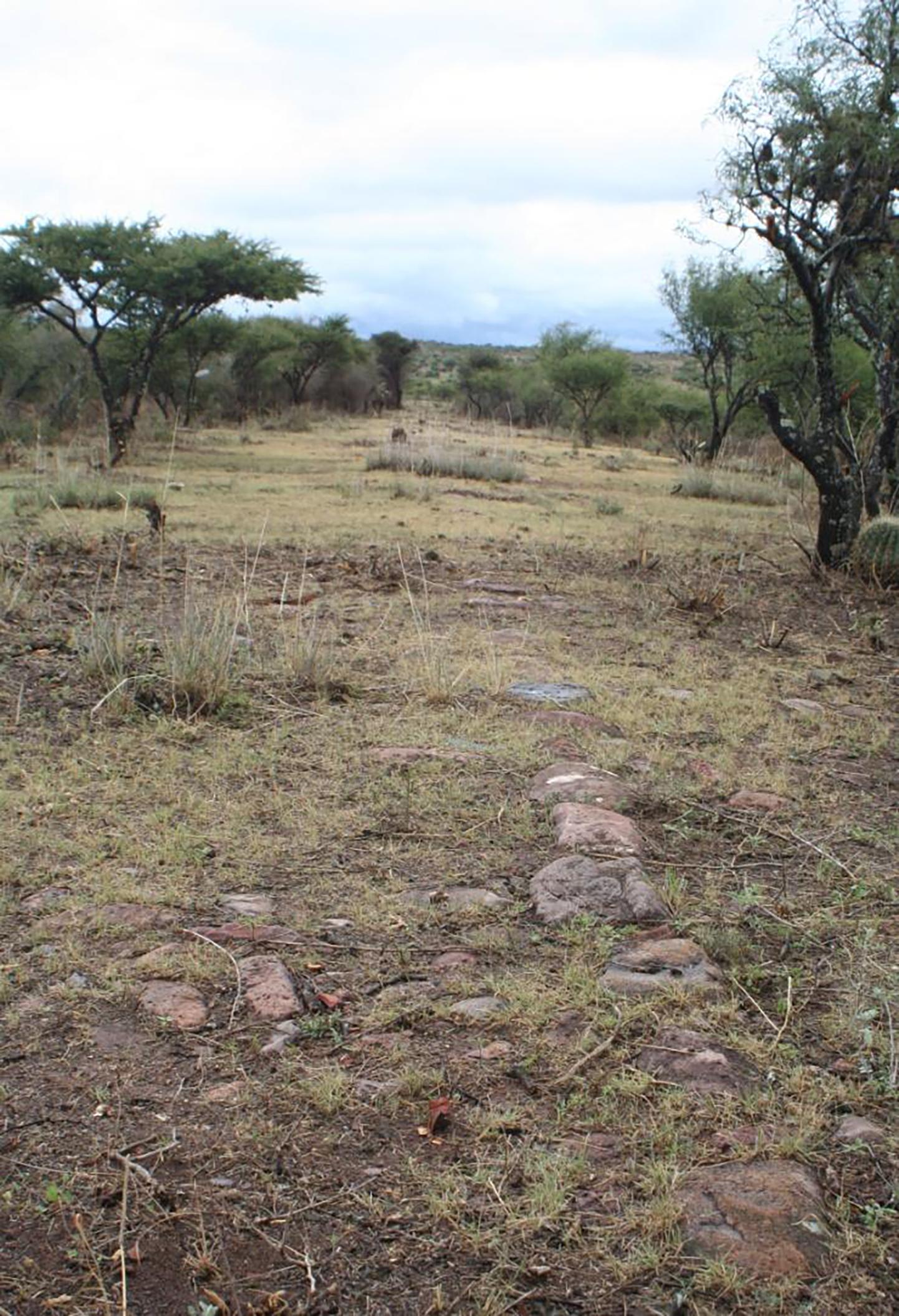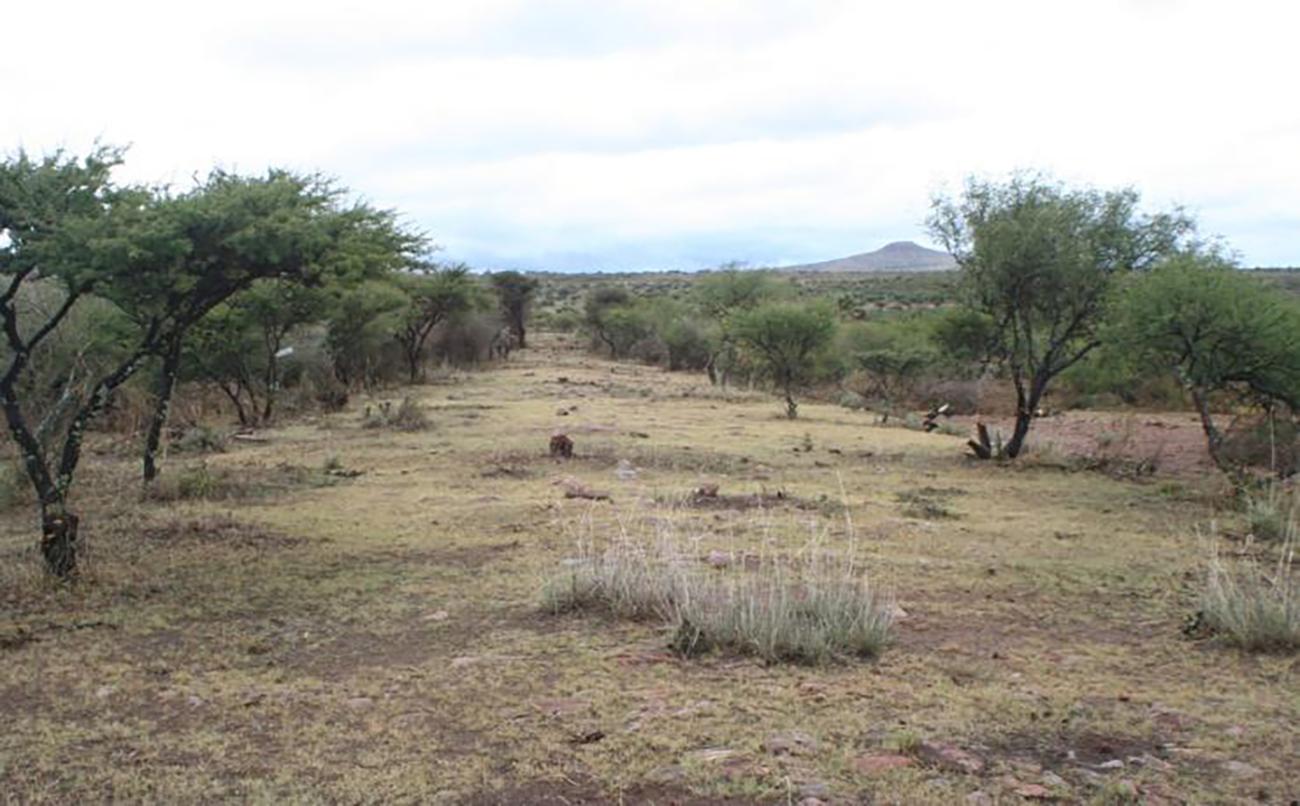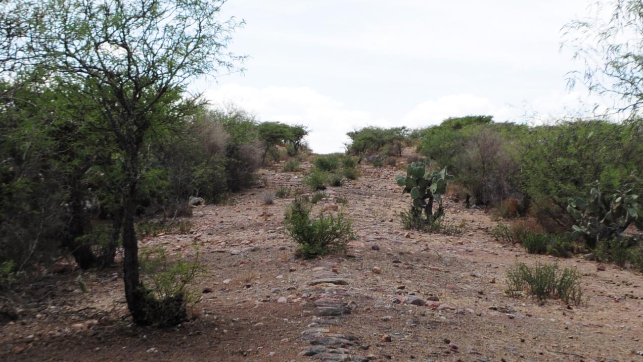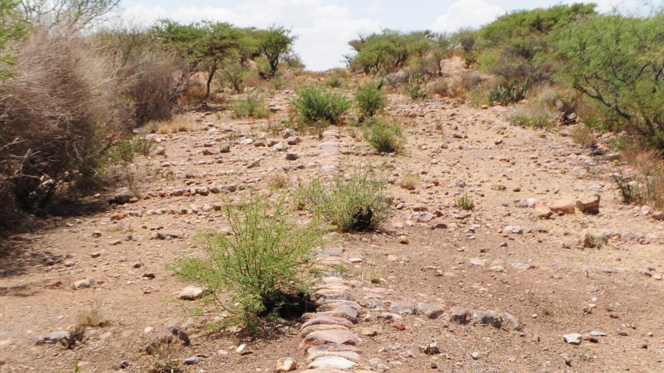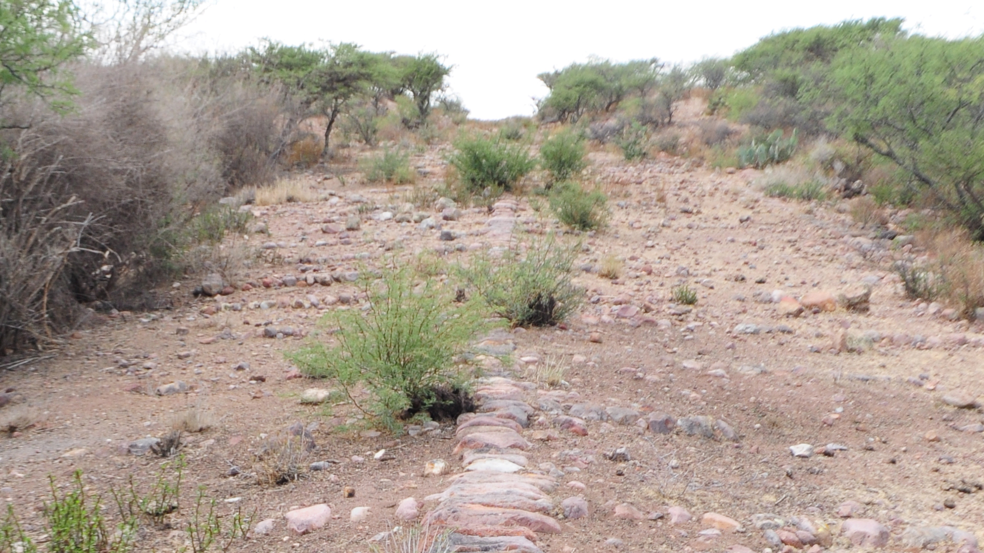
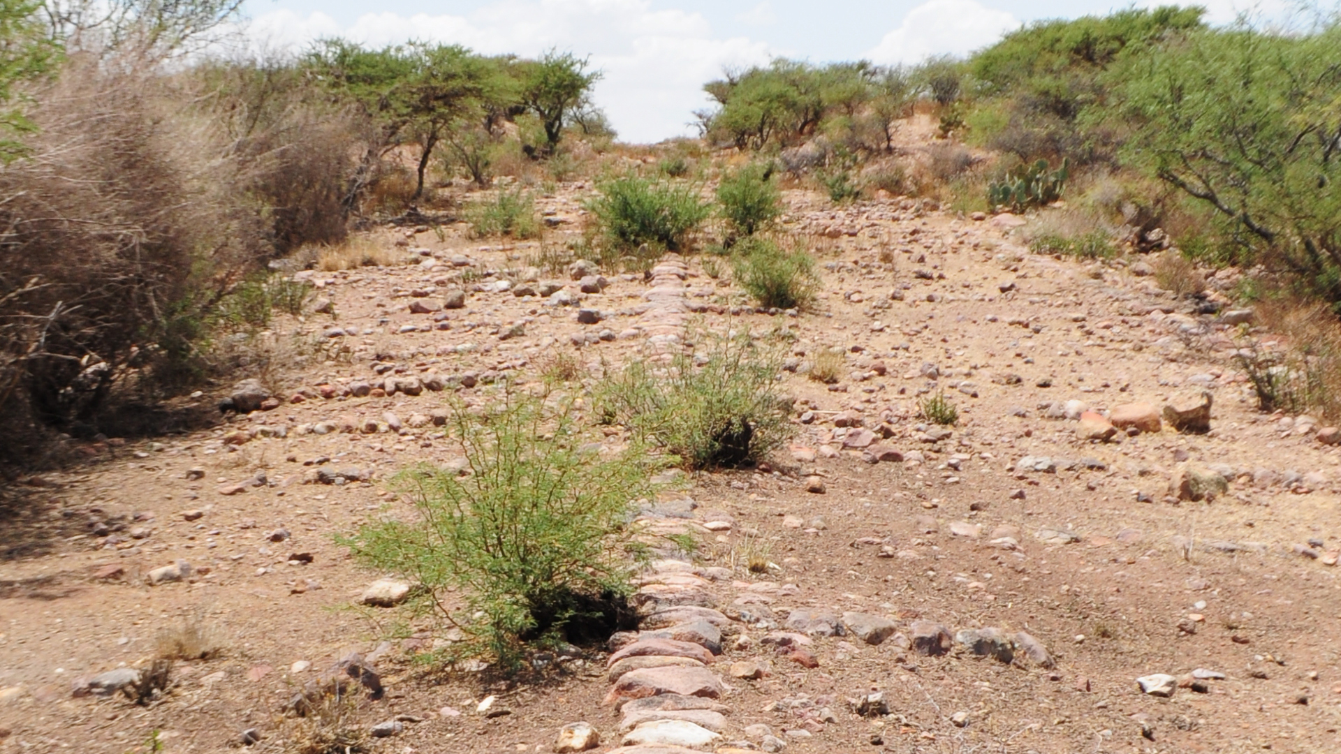


Tramo del Camino Real entre Ojocaliente y Zacatecas
The need to transport silver extracted from the mines of Zacatecas to the central part of the country, particularly to Mexico City, for smelting and minting influenced the emergence of the stretch of the Royal Inland Road between the city of Zacatecas and the town of Ojocaliente.
Similarly, this site served as an important point for providing a safe means of transportation for both goods and travelers heading toward the northern regions of New Spain.
The section of the Royal Inland Road between Ojocaliente and Zacatecas is a segment between the presidio of Palmillas and the Colegio de Propaganda Fide of Guadalupe. It is approximately one kilometer long with an average width of 6.50 meters. This part of the Royal Inland Road features cobblestone paving from the region, laid over a base of compacted earth.
This section of the road was part of a series of road constructions initiated in the mid-16th century in the lands of the Gran Chichimeca. It gained special significance for the Spanish Crown from 1554 due to the discovery of large silver deposits in Guanajuato, becoming the most important route of the viceroyalty toward the northern territories.
During the early years of the exploitation of the Zacatecas silver deposits, this route was used for transporting metal and supplying goods and inputs to the capital of the viceroyalty, the city of Guadalajara, and the port of Veracruz. To the south, the road passed through the presidio of Ojuelos, continued to Encinillas, and then to two locations in the present-day state of Aguascalientes: Las Bocas and Ciénaga Grande. It then proceeded to Cuicillo, where it joined the road coming from Guadalajara, and finally reached the presidio of Palmillas before arriving in the city of Zacatecas.