


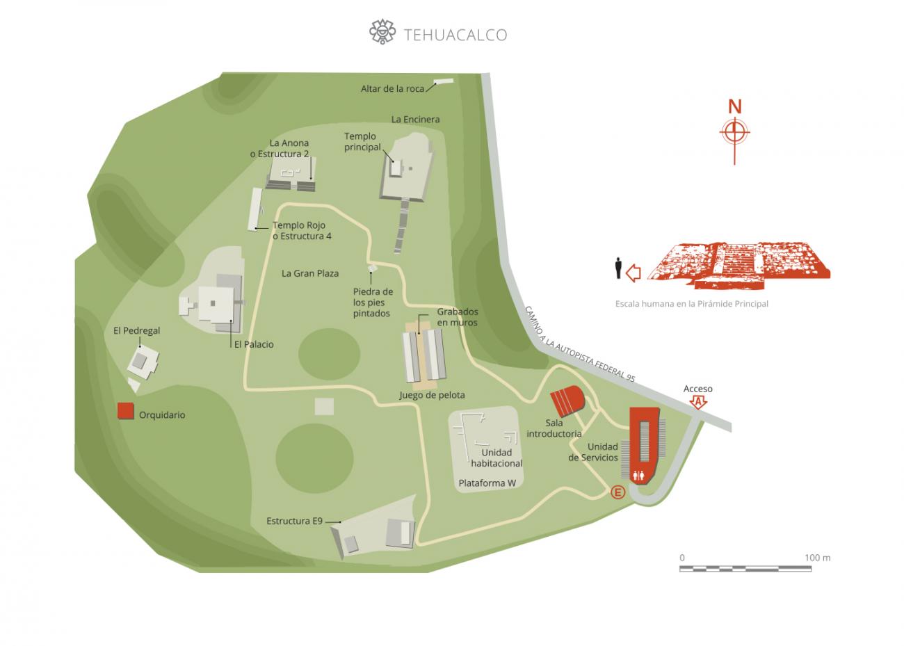
Tehuacalco
Pyramids and palaces surround the great central plaza of this stately location that was never dominated by the Mexicas. Surrounded by hills that coincide with the points of the compass, the site reproduces the scheme of the pre-Hispanic universe. Its deities were the gods of fertility, the sun, the hills and water.
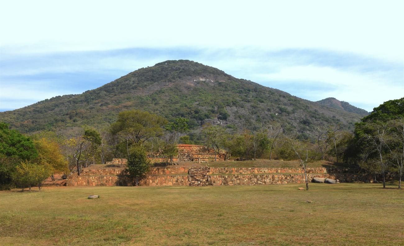
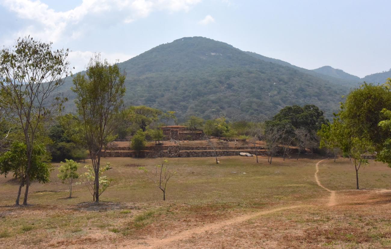
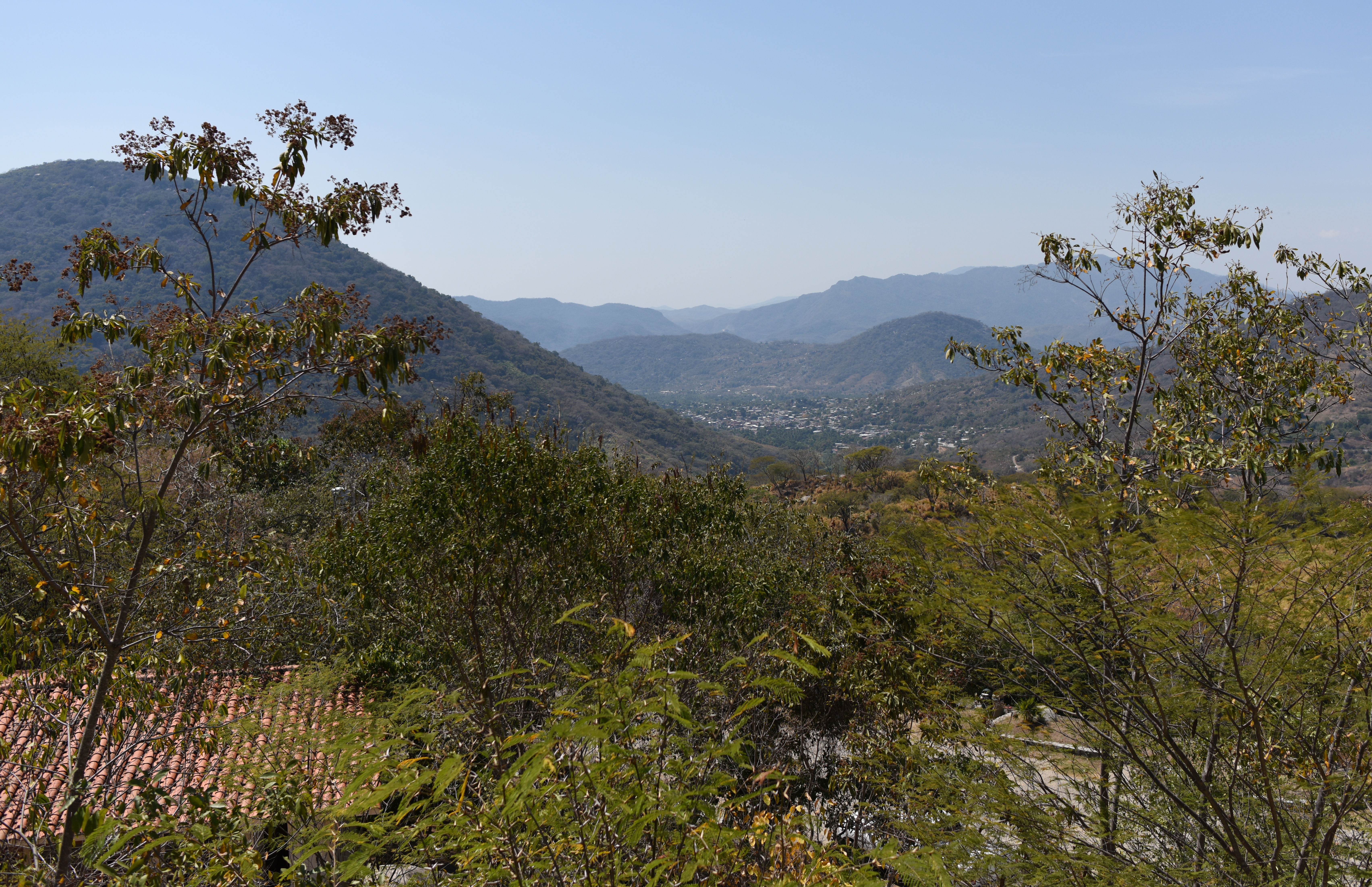
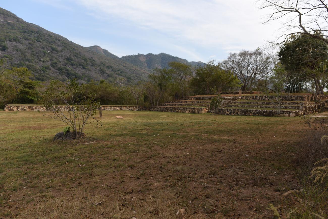
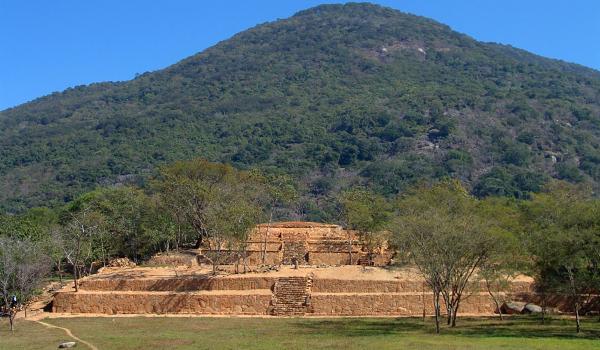
The Tehuacalco archeological site is located in the Sierra Madre del Sur mountain range, at one end of a long corridor which links the Central Plateau with the Pacific coast. Its strategic position in relation to this corridor conferred great importance and a favorable situation for its growth as a large population center, although in reality it was its immediate context that led it to become a great ceremonial center. It is set on a broad ridge surrounded by peaks which appear to encircle the urban center. Four of these hills coincide with the pre-Hispanic idea of the earthly plane being divided into four cardinal directions. As a result of Tehuacalco's position between these four peaks that “marked” these directions, rituals were held here and a sacred geography was established. That is to say, each mark and feature of the landscape bore strong divine significance, making it a center for religious rituals.
Tehuacalco was a pre-Hispanic settlement covering 200 acres, comprised of a civic-ceremonial center dedicated to the worship of water and the mountains, a surrounding population, and other temples, caves and petroglyphs in the outskirts of the urban nucleus. The name Tehuacalco must have been given by the Nahua groups who arrived after the Conquest to take the place of the local ethnic groups who had almost disappeared. The place name may be derived from the terms tetl/huacalli/co: place of the stone box, or Teoacalco, from teo/atl/calli/co: place of houses of holy water or place of water temples.
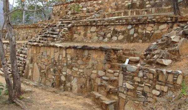
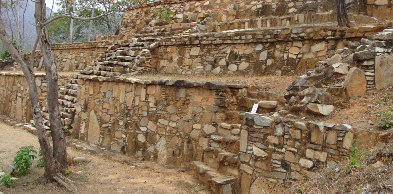
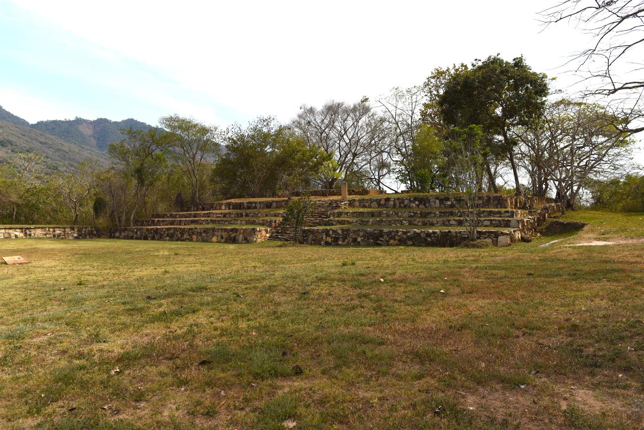
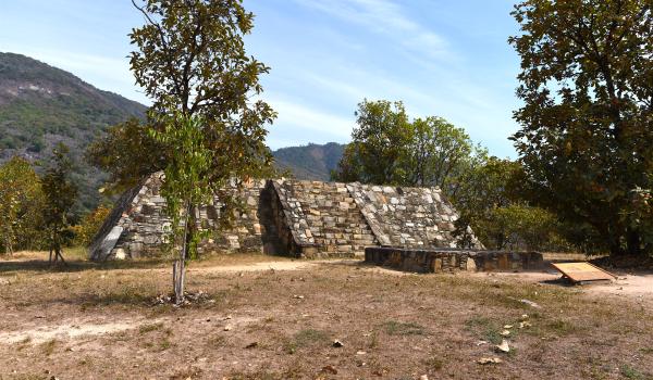
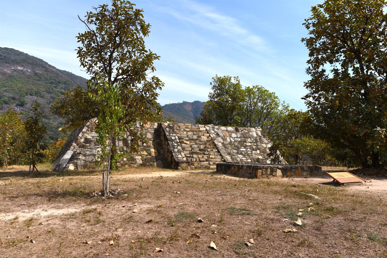
The site has eight principal archeological complexes, as well as ten smaller structures. The area with the larger structures covers 30 acres. As for the configuration of the civic and ceremonial center, the structures surround a large rectangular square and were oriented towards and aligned with the most prominent hills on the horizon. These hills establish clear visual lines that mark significant days in the solar year, such as the equinox or the solstices.
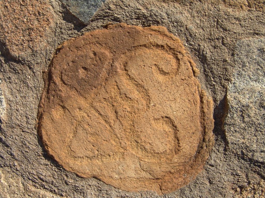
As a ceremonial center, Tehuacalco not only had civic, ceremonial, administrative and residential buildings; it also had an area full of ritual elements, from the landscape itself (like the sacred hills and caves) to petroglyphs and natural springs. All of these elements made it a ritual site and reflected its essence as a place of worship and veneration of the gods of agriculture and water. As well as the natural characteristics of the environment and the site’s own architecture, blocks of granite and sandstone were found attached to the walls of some plinths. They are engraved with motifs which are considered to be elements belonging to the urban iconography. These designs give character and identity to the monuments.
Most of the blocks discovered display aquatic elements such as spirals and raindrops, which confirm the idea that Tehuacalco was a center for the worship of water. Motifs related to celestial bodies, such as Venus, can also be observed, as well as the presence of gods of water and earth.
Occupation of the site dates back to just before the year 650, when its geographical location and surroundings helped it to become a major ceremonial center. Throughout the following centuries, the large pyramidal bases were built and it reached its peak in the year 1000. Following its decline, from 1350, when rivalries began between different ethnic groups in the region, people began to leave. However, some structures and caves continued to have ritual uses, and other sections of the site maintained a residential use until the site was finally almost completely abandoned. This left a smaller group of inhabitants in areas of the ceremonial center who continued with ritual activities.
- Dirección del Centro INAHHéctor Romeo Torres Calderónhector_torres@inah.gob.mx+52 (747) 471 7121
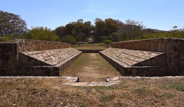
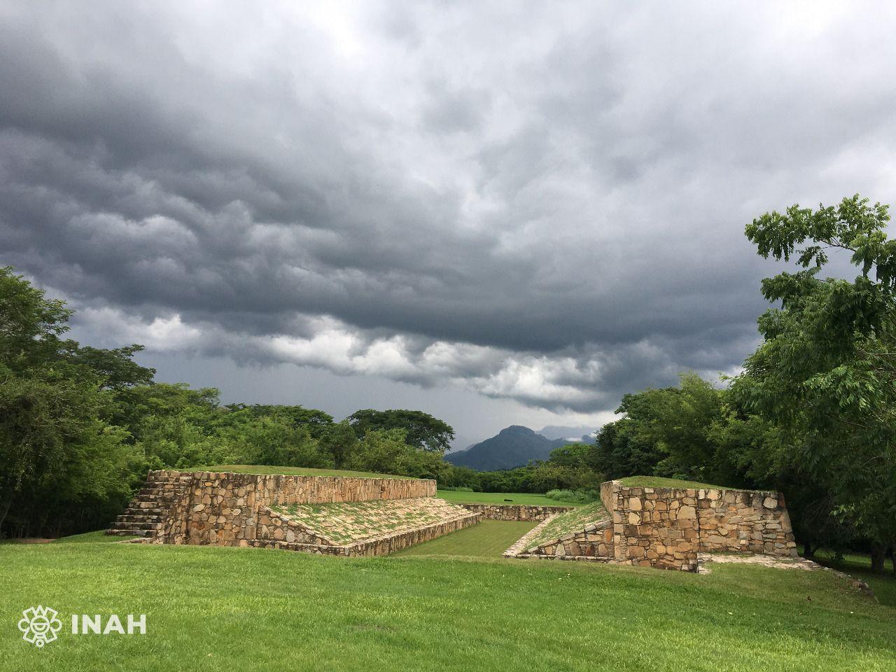
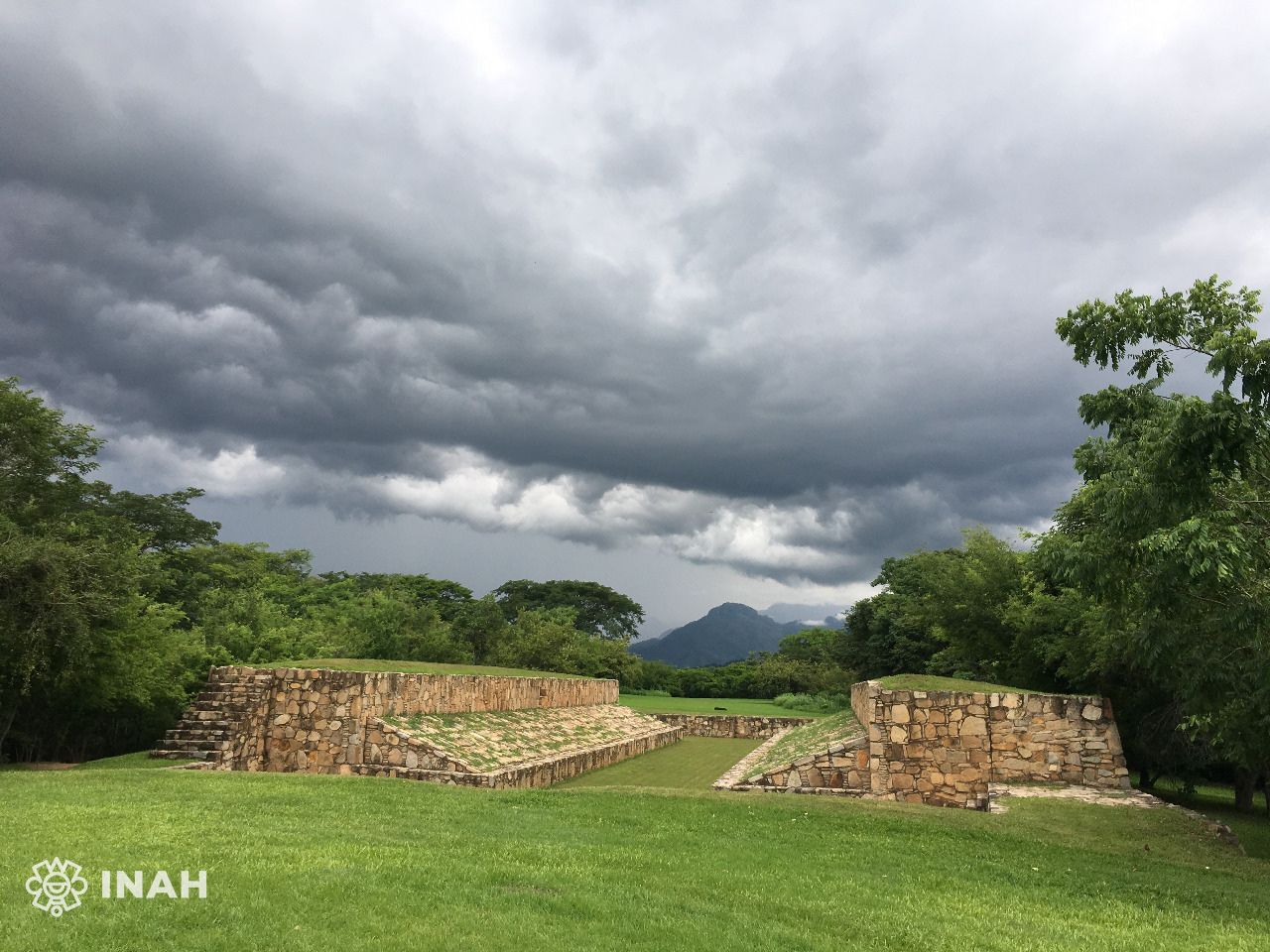
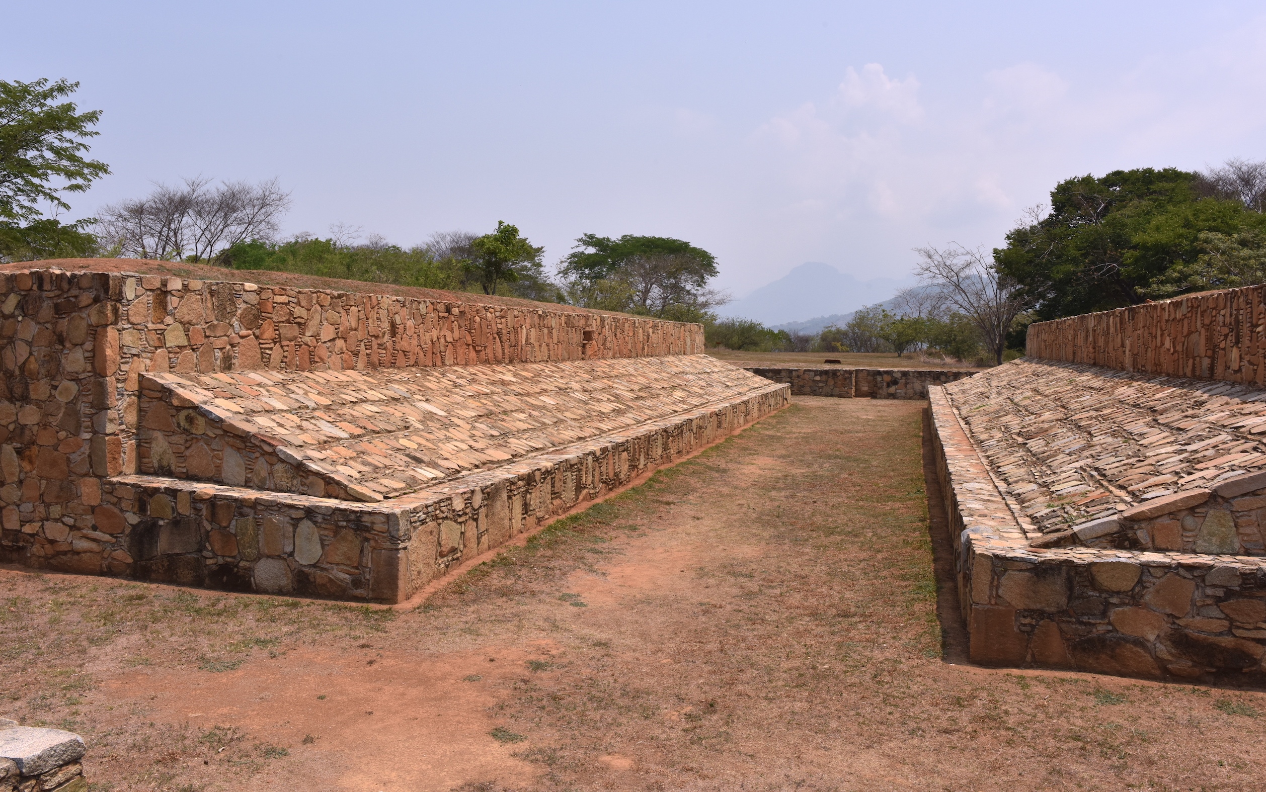
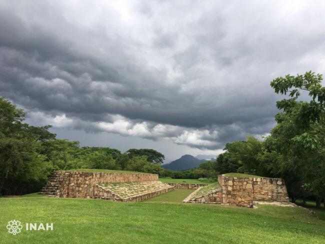
Juego de Pelota
The ball game was a ritual activity related to solar, war and agricultural aspects. It symbolized the struggle between the opposing forces of the universe, since through confrontation it was possible to achieve the union of light and darkness, heat and cold, fire and water.
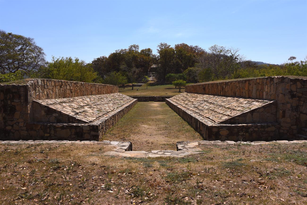

The ball game was a ritual activity related to solar, war and agricultural aspects. It symbolized the struggle between the opposing forces of the universe, since through confrontation it was possible to achieve the union of light and darkness, heat and cold, fire and water. The Tehuacalco court was mainly dedicated to the cult of water and fertility. It is aligned to the front in a north-south direction, towards the most sacred place of the site that corresponds to the Main Temple, sanctuary dedicated to rain; this differentiates it from other Mesoamerican courts that are oriented according to the transit of the Sun (east-west).
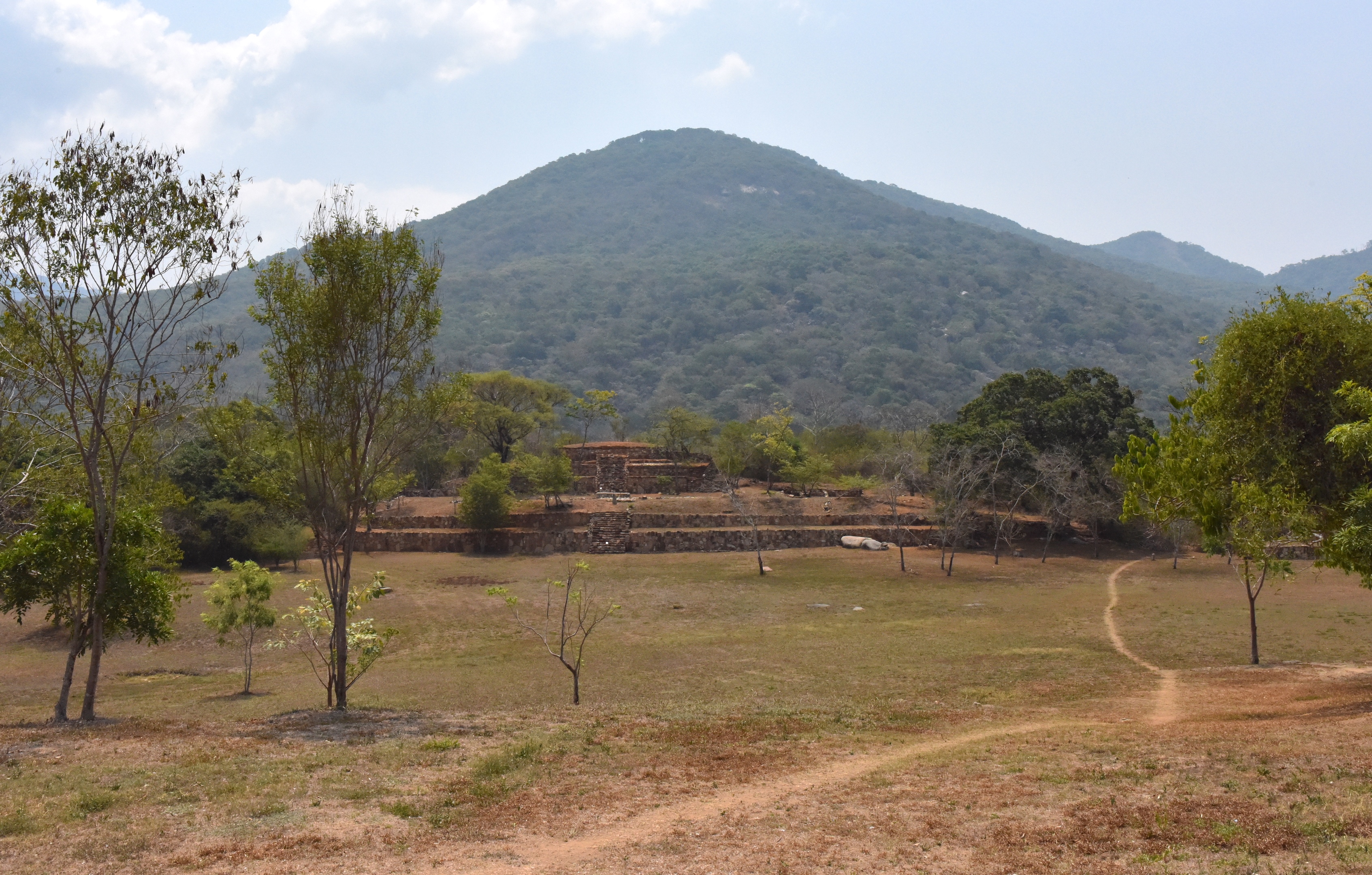
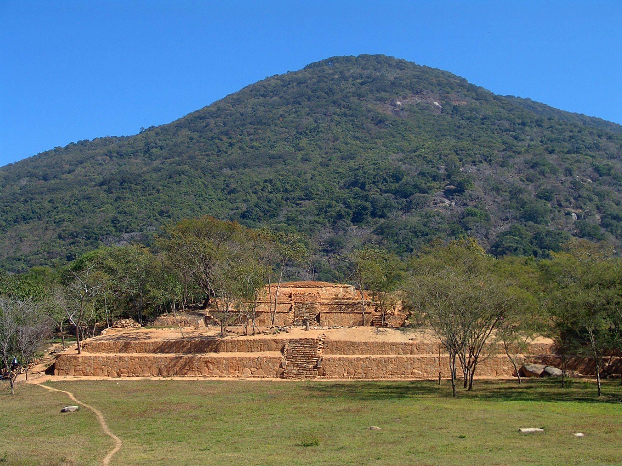
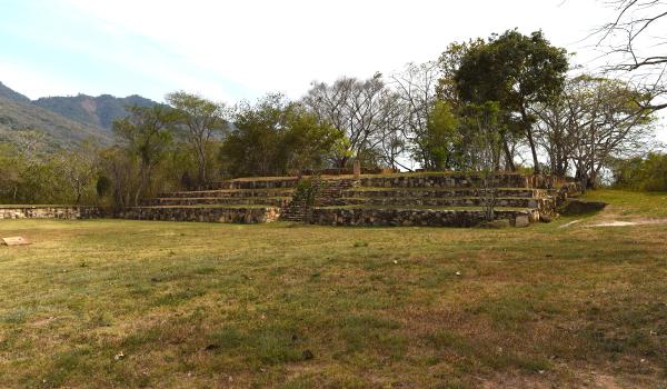
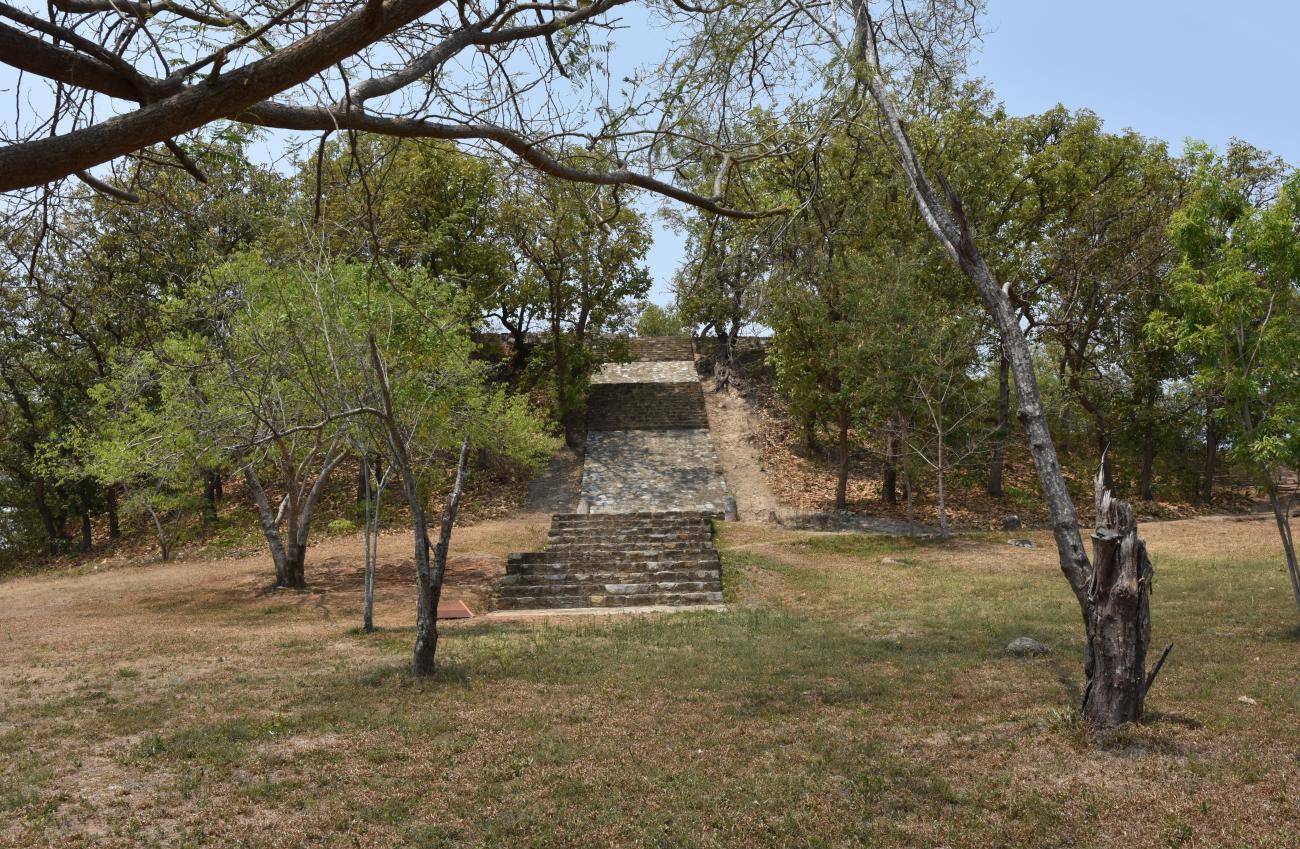
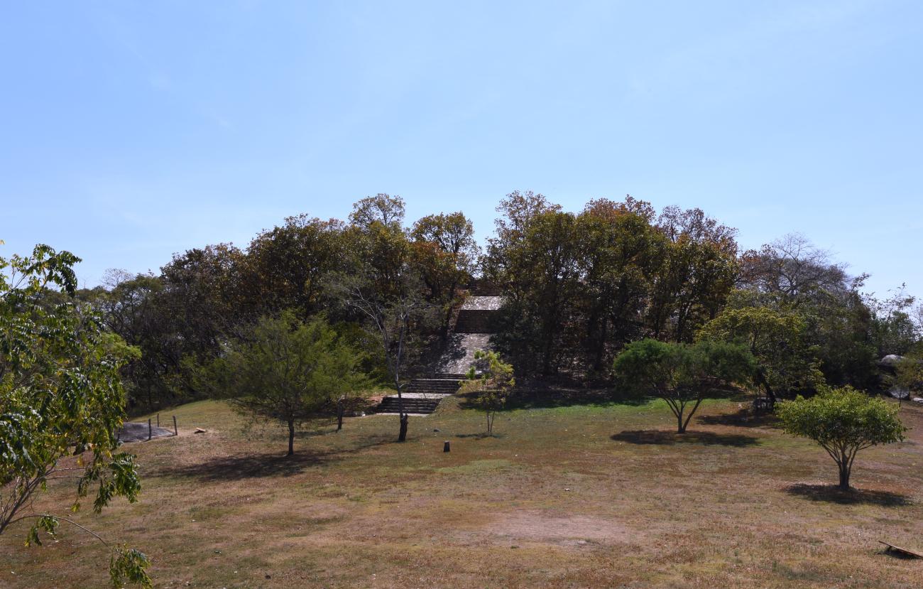
Templo Principal
It is the most sacred place in Tehuacalco. Of the temple only the base remains, on which thick adobe walls were erected to contain the divinity.
It is the most sacred place in Tehuacalco. Of the temple only the base remains, on which thick adobe walls were erected to contain the divinity. In front of this temple, great ceremonies dedicated to the rain gods were held, whose lavishness could be observed by the people gathered below and in the surrounding area. There were braziers on the altar and at the top of the stairs copal was burned, which was offered to the four directions with sahumadores. Conch shells, flutes and ocarinas were played while they danced using costumes and paper flags. It is probable that in this place human sacrifices were made, because in front of the stairs a possible stone of sacrifices was located.
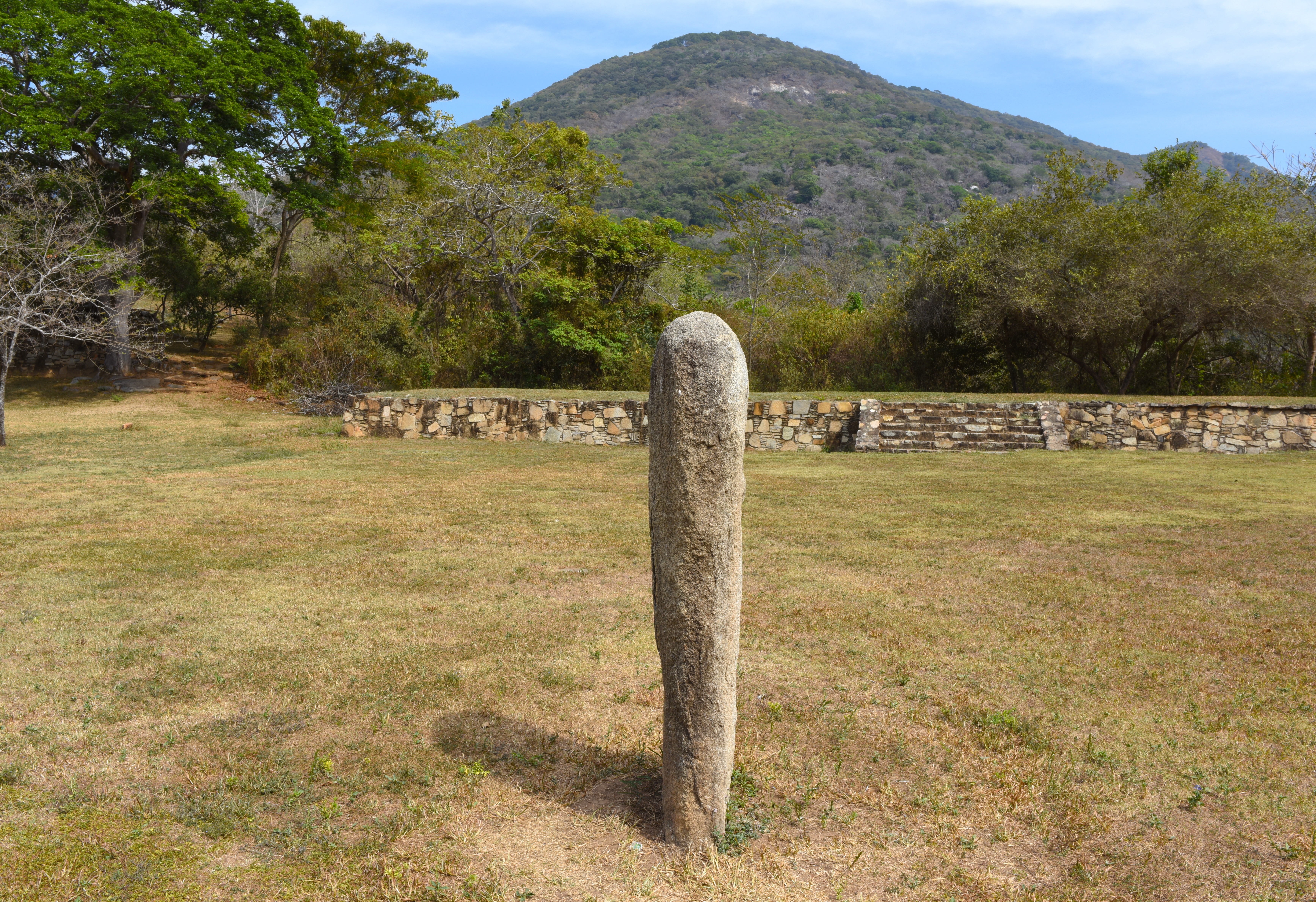
Conjunto Solar
Through constant observation of the movement of the stars, the inhabitants of Tehuacalco were able to calculate time.
Through constant observation of the movement of the stars, the inhabitants of Tehuacalco were able to calculate time. This allowed them to know the length of the year and its seasons with great precision in order to determine productive activities such as agriculture and the celebration of rituals. The importance of time measurement is evident in the arrangement of marks around the visual lines of solar displacement and in the construction of the temples, since the observation of the movement of the stars was done from fixed points. The smooth stele located in the center of this complex made it possible to align the gaze with respect to the hills in the background, in order to know and record the positions of the sun at dawn throughout the year. The two structures that limit this plaza were consecrated to fire.
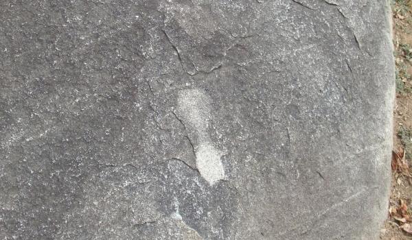
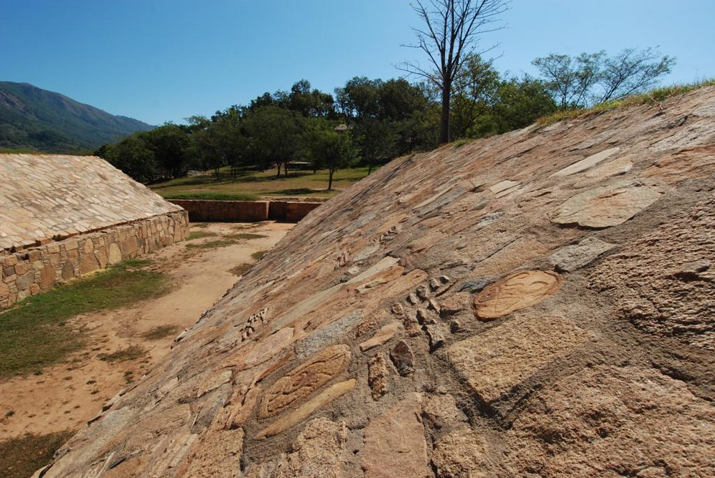
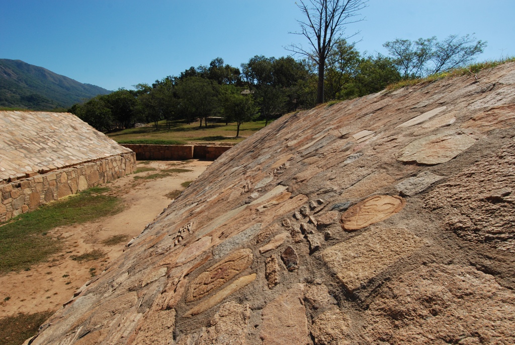
Piedra de los Pies Pintados
In this granite rock there are footprints of human feet carved by the ancient inhabitants to look like the marks left by a man walking, and thus show the direction of the ritual path from the Main Temple to the Palace.
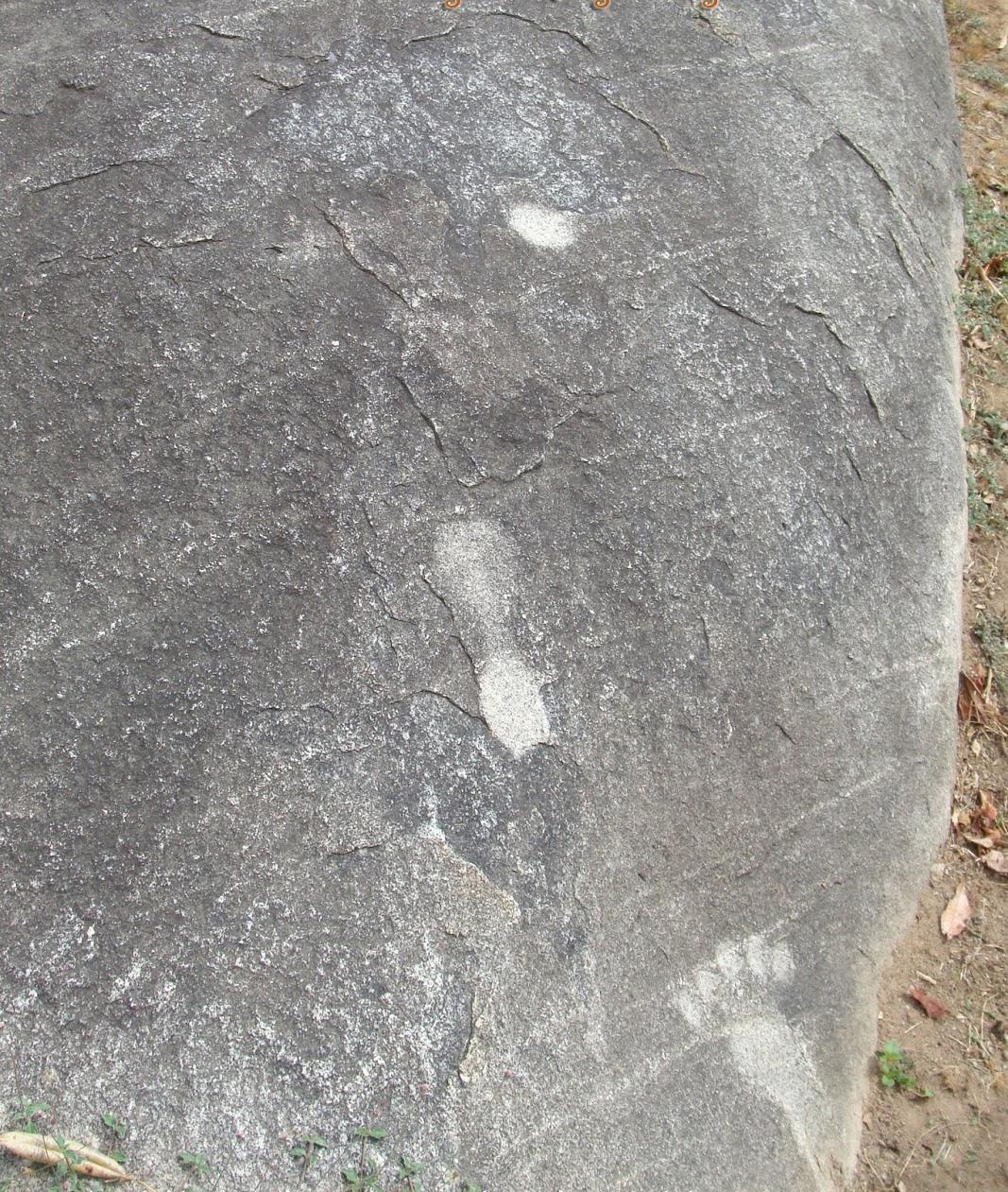
In this granite rock there are footprints of human feet carved by the ancient inhabitants to look like the marks left by a man walking, and thus show the direction of the ritual path from the Main Temple to the Palace. There is a local legend where it is narrated that a giant or a man of formidable strength, called Tehua, managed to move large blocks of stone to build Tehuacalco and, when finished, stamped his footprints on this place, which we now know as the Stone of the Carved Feet.
Calzada ritual
This elevation was sacred for the ancient inhabitants of Tehuacalco, because the hills were worshiped as great containers of water and storehouse of seeds for cultivation.
This elevation was sacred for the ancient inhabitants of Tehuacalco, because the hills were worshiped as great containers of water and storehouse of seeds for cultivation. The summit belonged to the divine world and, to highlight this sacred space, altars and temples were placed at the top to venerate the gods. Here was the main temple of this settlement, conceived as a sanctuary for rain. Two stone blocks were placed on the ritual roadway to delimit the earthly world and mark the beginning of the sacred space, which could only be accessed by priests and the ruling class.
Calzada de la lluvia
Ancient agricultural peoples attached great importance to rituals dedicated to water, as they depended on rain for their livelihood. On the steps of the causeway there are carved designs representing the deity of rain.
Ancient agricultural peoples attached great importance to rituals dedicated to water, as they depended on rain for their livelihood. On the steps of the causeway there are carved designs representing the deity of rain. In addition, the causeway connects the Palace with the Main Temple, to make evident the union between the seat of power and the most sacred space of Tehuacalco, through a ritual path.
Estructura 5 o Palacio
This structure has exactly the same silhouette as La Compuerta hill, which means that the Palace, the seat of power, was built to reflect the essence of the sacred hill and to show itself as its guardian.