


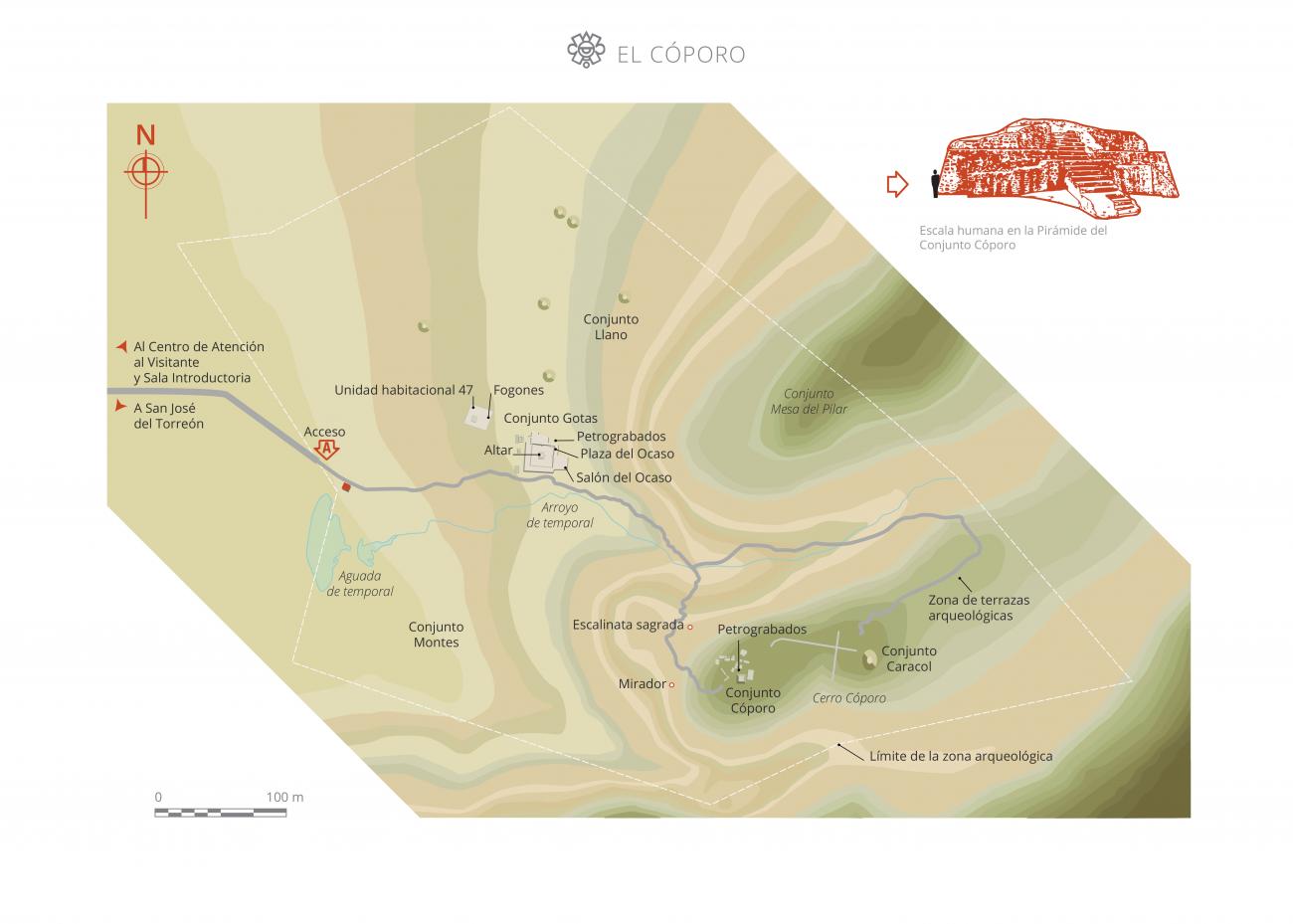
El Cóporo
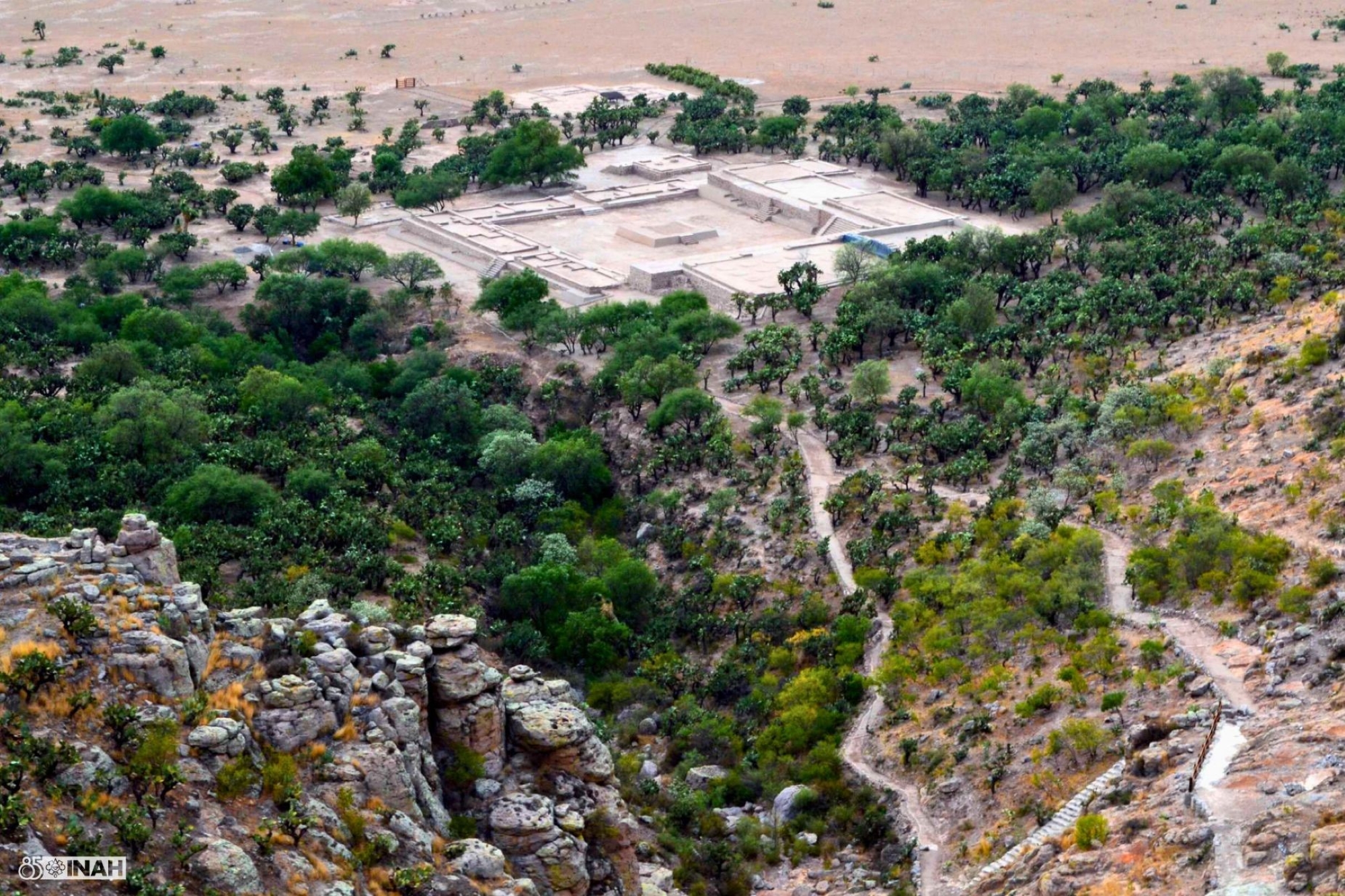
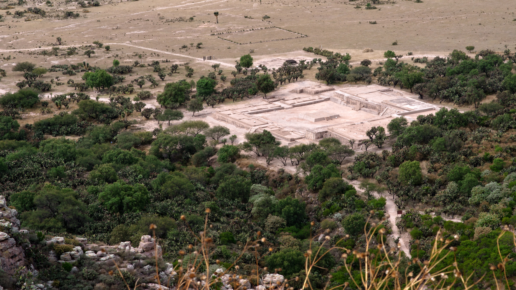
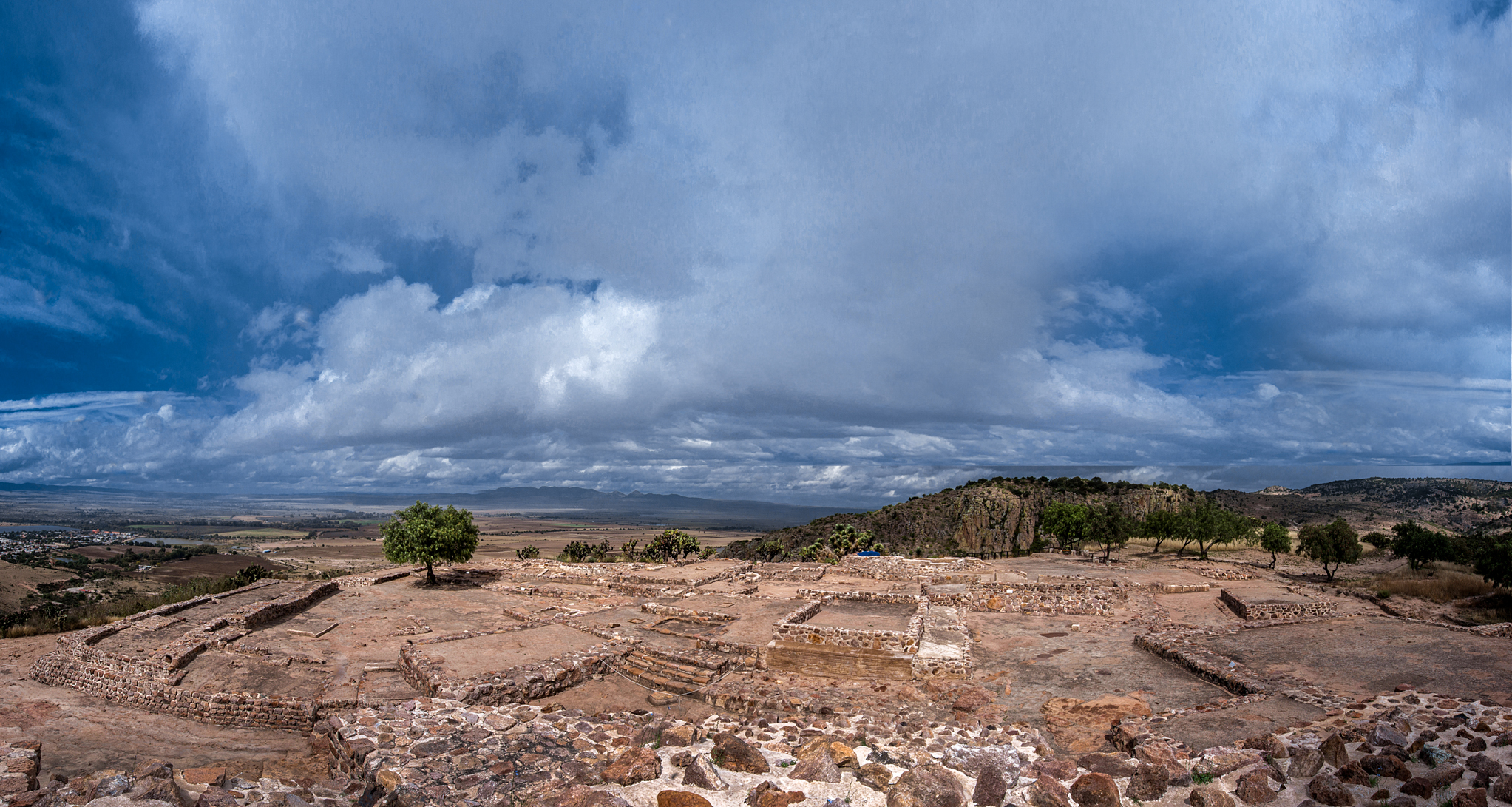
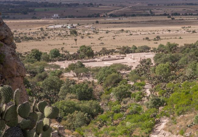
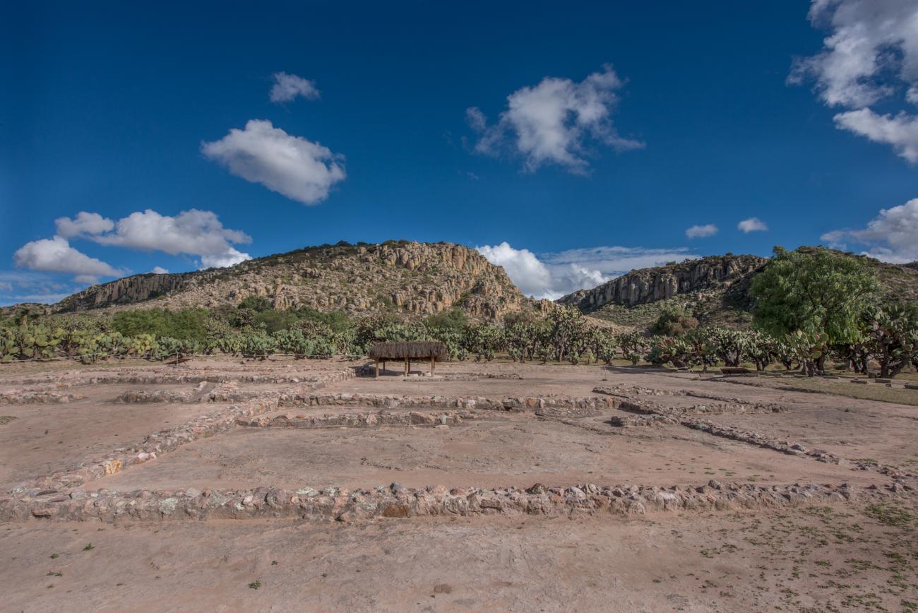
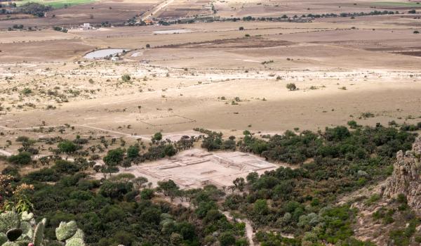
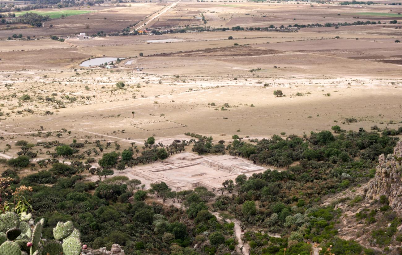
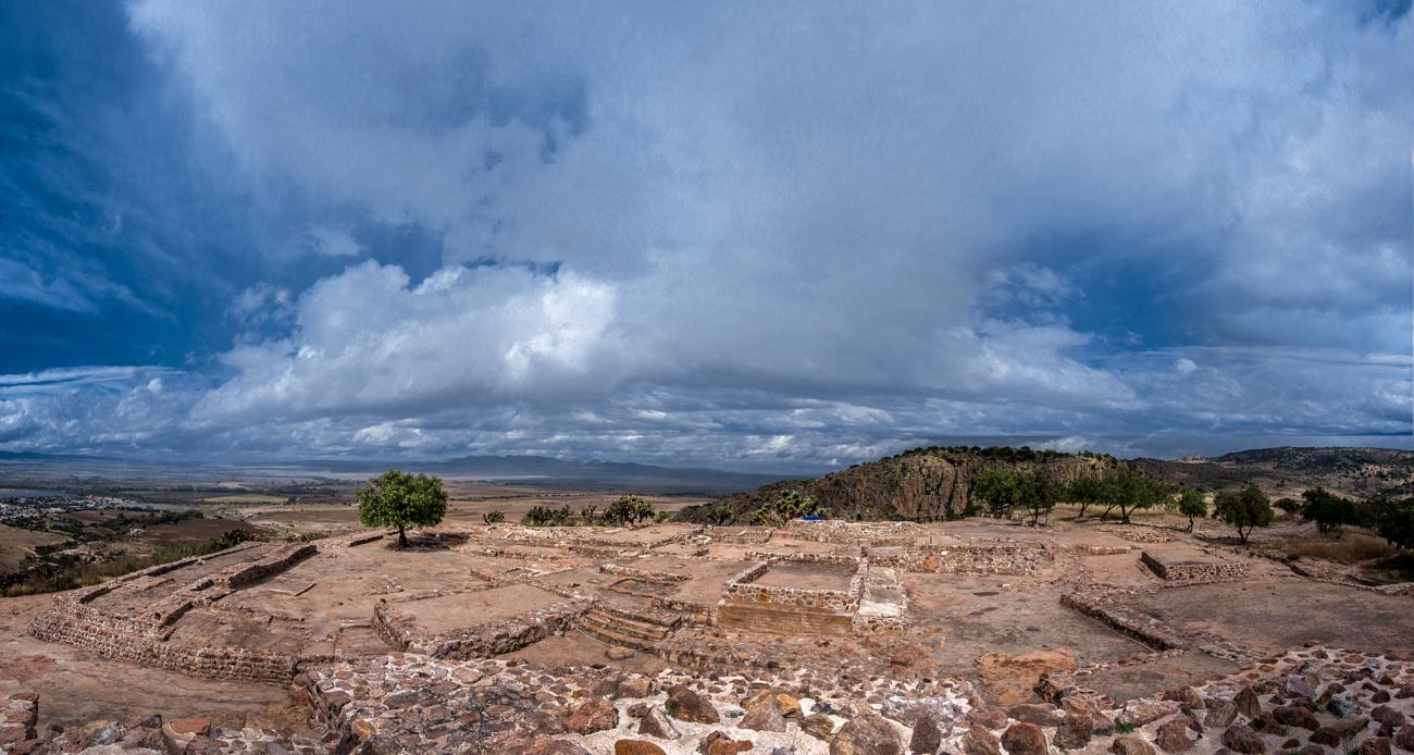
One of the most important sites in the state of Guanajuato, it developed around a hill of the same name. On the lower level, the architectural complexes were public buildings and houses, those on the hillsides were administrative and residential areas, and at the top there is a ceremonial zone.
El Cóporo's active period dates from between the years 1 and 1000 AD, reaching its peak between 400 to 600 and declining between 900 to 1000. It is located within the area of the Tunal Grande, delimited to the west by San Luis Potosí, the Jalisco Mountains, Zacatecas, Aguascalientes, and to the northeast by Guanajuato. In the sixteenth century, the Spanish named it El Cóporo (“the great road”) due to its abundance of prickly pear cacti.
The settlement’s location was decisive in its development. As well as being made up of grasslands and mountains, it is found between the Cóporo and Gotas rivers and protected by two canyons.
This archeological area, which is oriented towards the west, is distinguished by its earthen architecture such as its adobe walls, flat mud roofs and wattle and daub structures. The topography was exploited in building the structures, using rocky outcrops for the structures and staircases. The ground was leveled using a system of terraces in order to achieve the stability necessary for building.
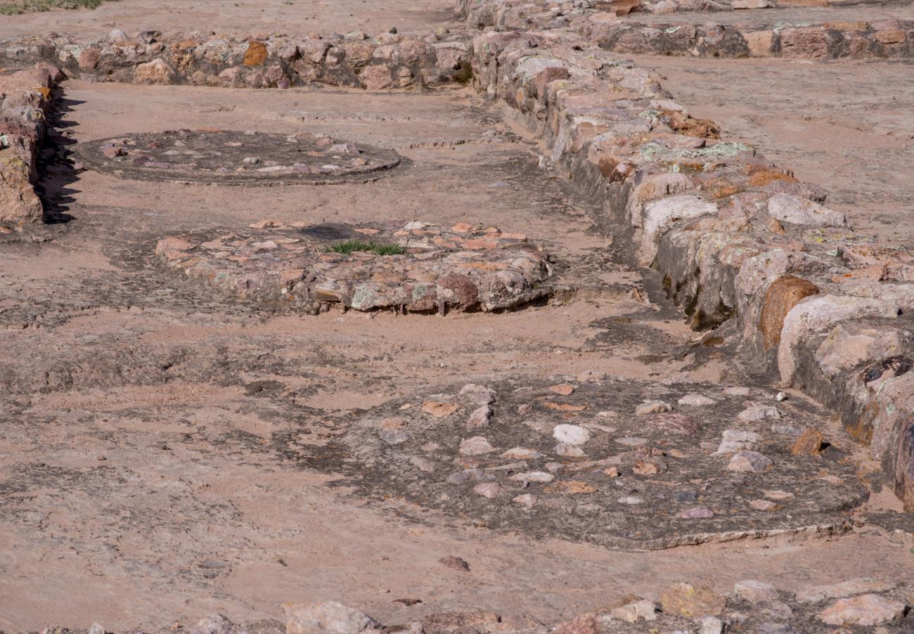
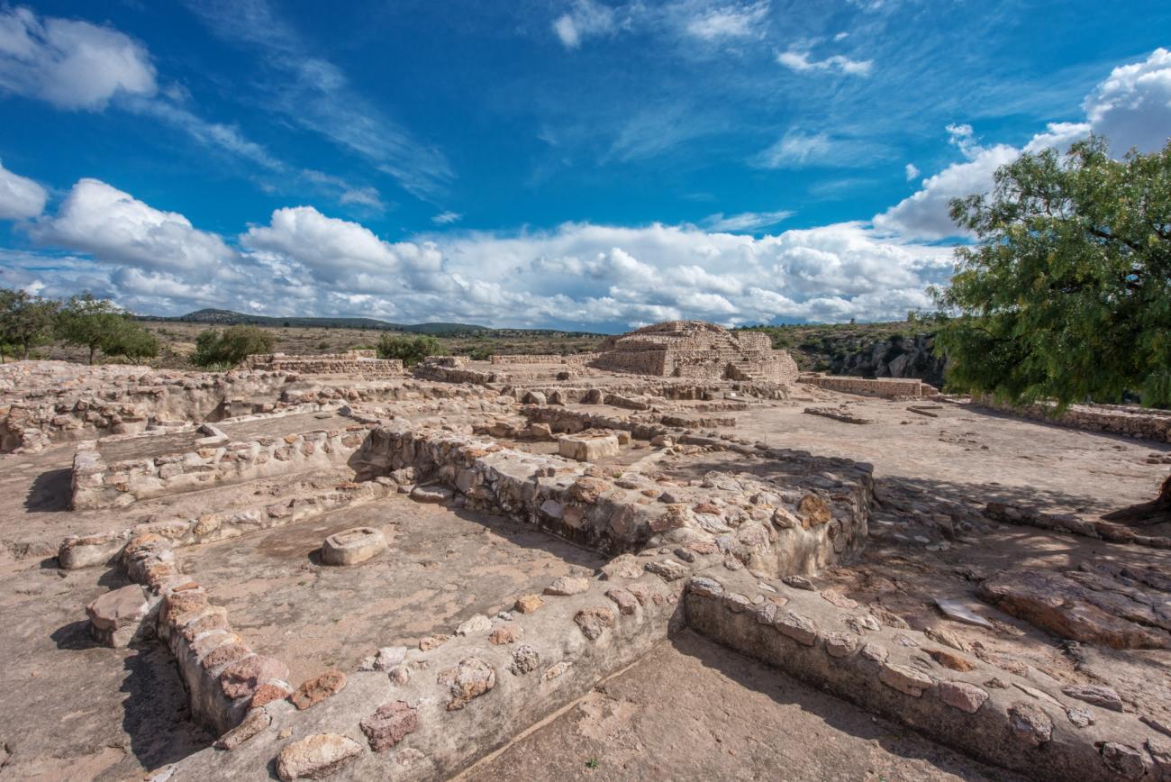
The Llano Complex is located at the foot of the hill in the lower section, an area which was surrounded by rooms. Here, two adobe fireplaces, milling instruments and pots were found. At the peak, the ceremonial Cóporo Complex is located; the natural surroundings were exploited to make this a sacred space. Finally, in the vicinity of the hill is the Gotas Complex, where archeologists found a shrine.
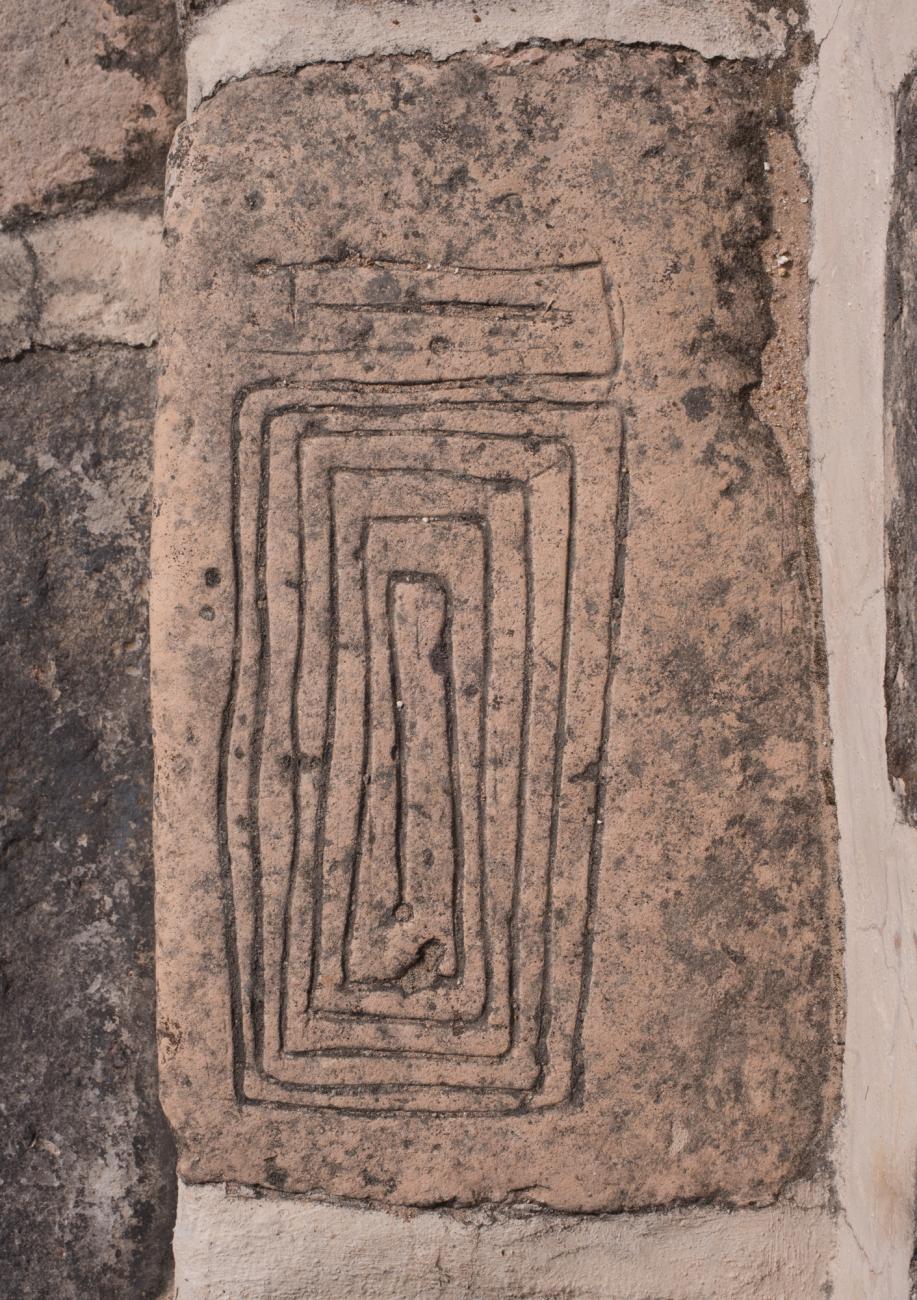
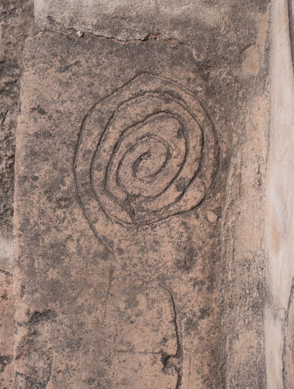
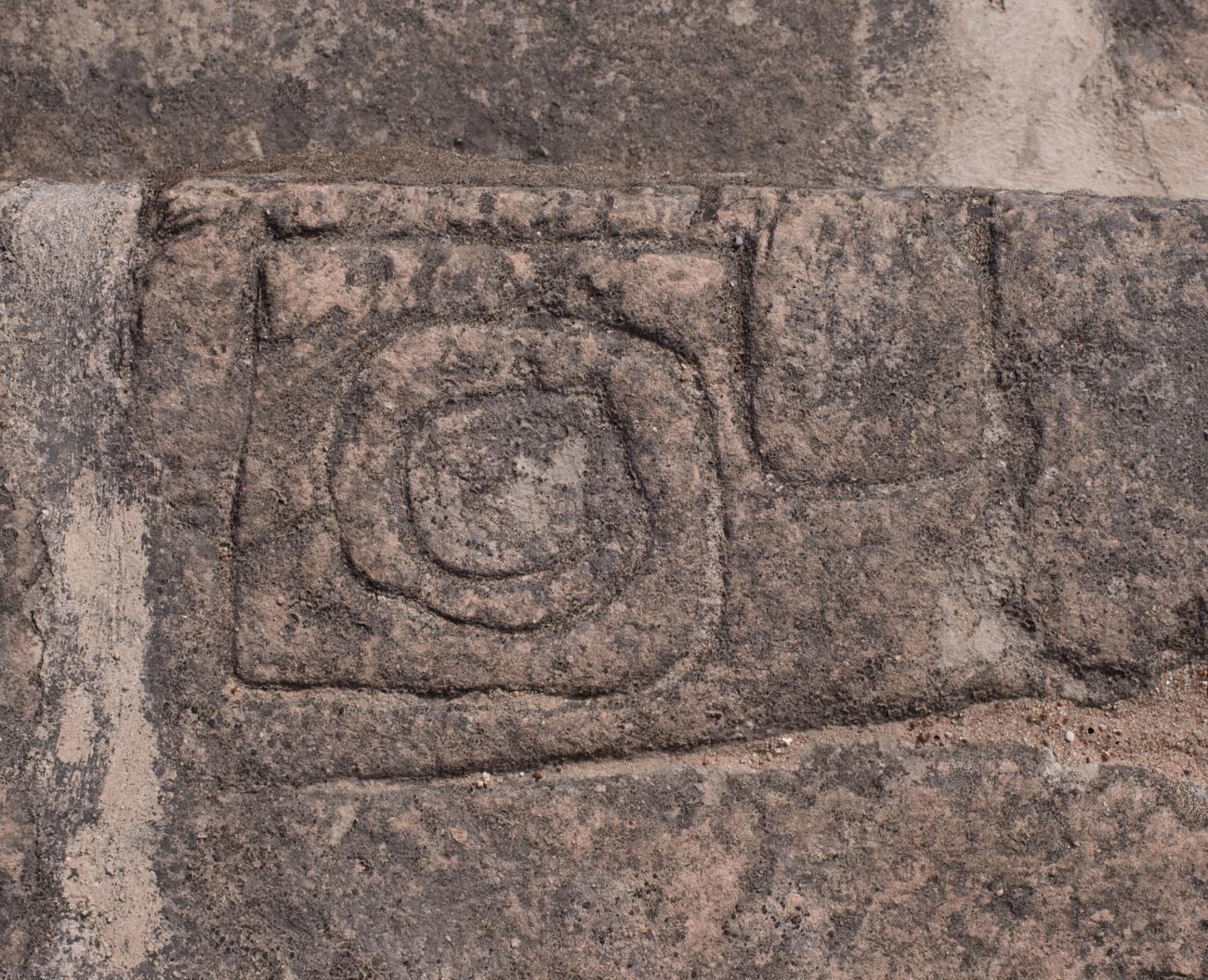
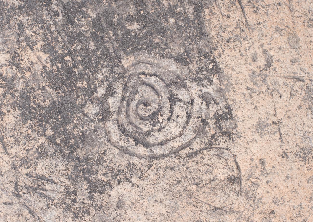
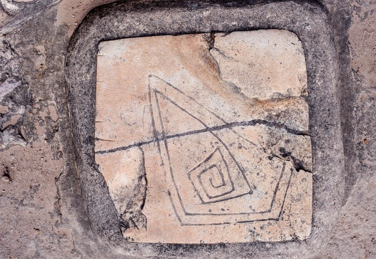
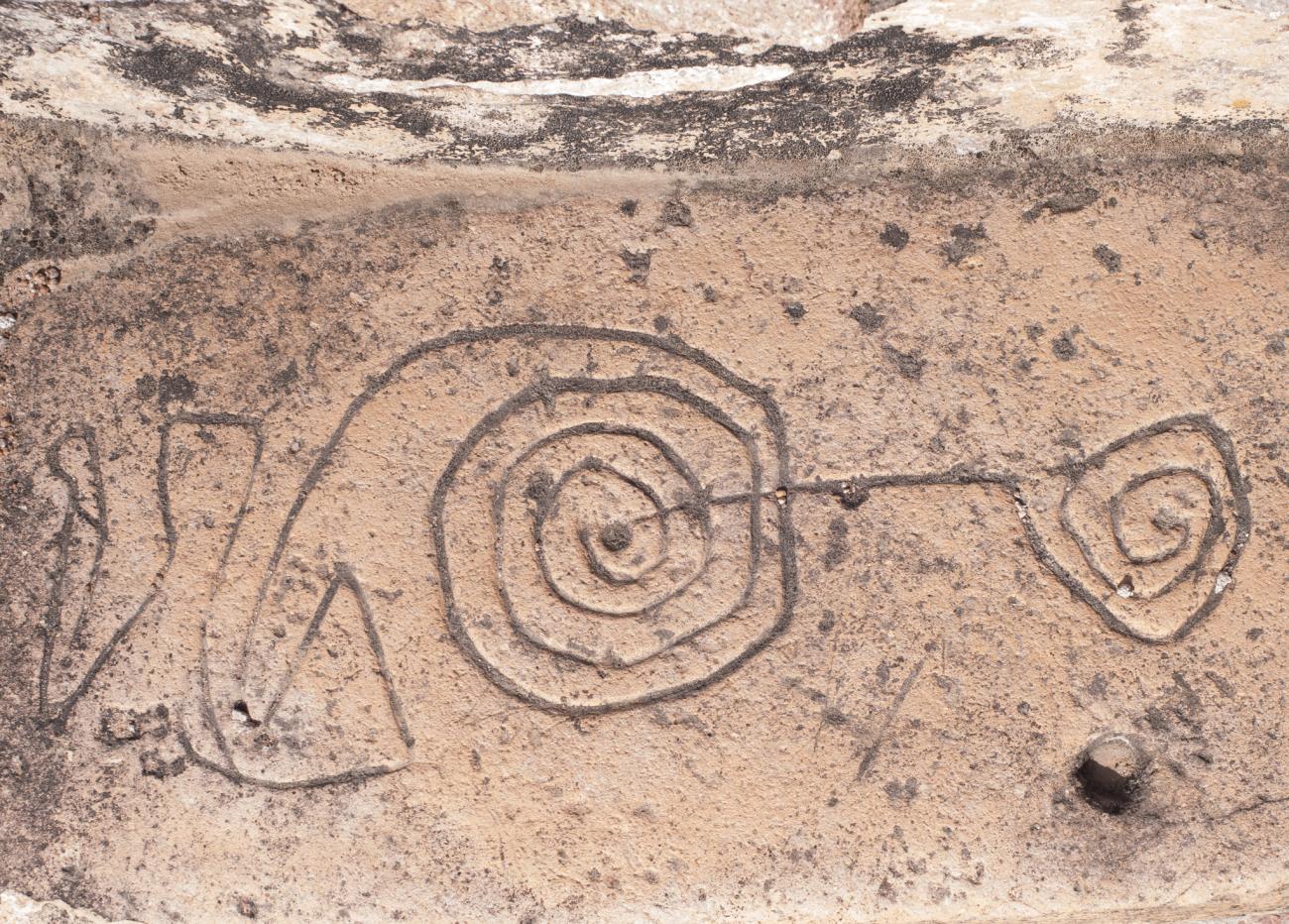
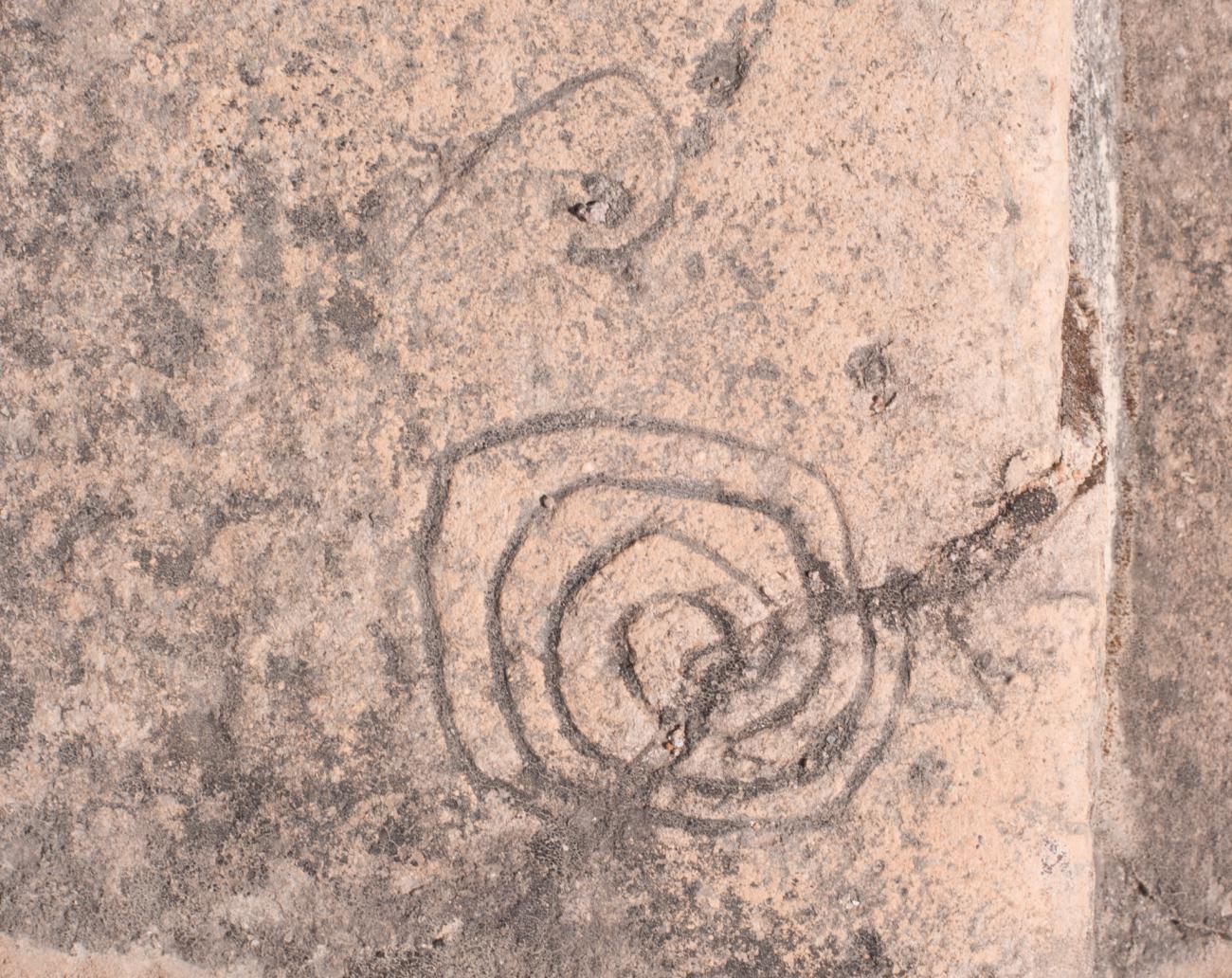
Most notably in the staircases, petroglyphs are visible with geometric designs and animal symbols. Circular spirals (linked to water) and quadrangular spirals (linked to fire) both appear frequently. The petroglyph in the Cóporo Complex is also very noteworthy. It consists of a triangular spiral pointing to the north, which suggests that the settlers carefully observed the movements of the sky.
- Dirección del Centro INAHGuillermo González Leónguillermo_gonzalezleon@inah.gob.mx+52 (473) 733 0857ResponsableAna Ruth Villalpando Alvaana_villalpando@inah.gob.mx+52 (473) 733 0858, ext. 20800
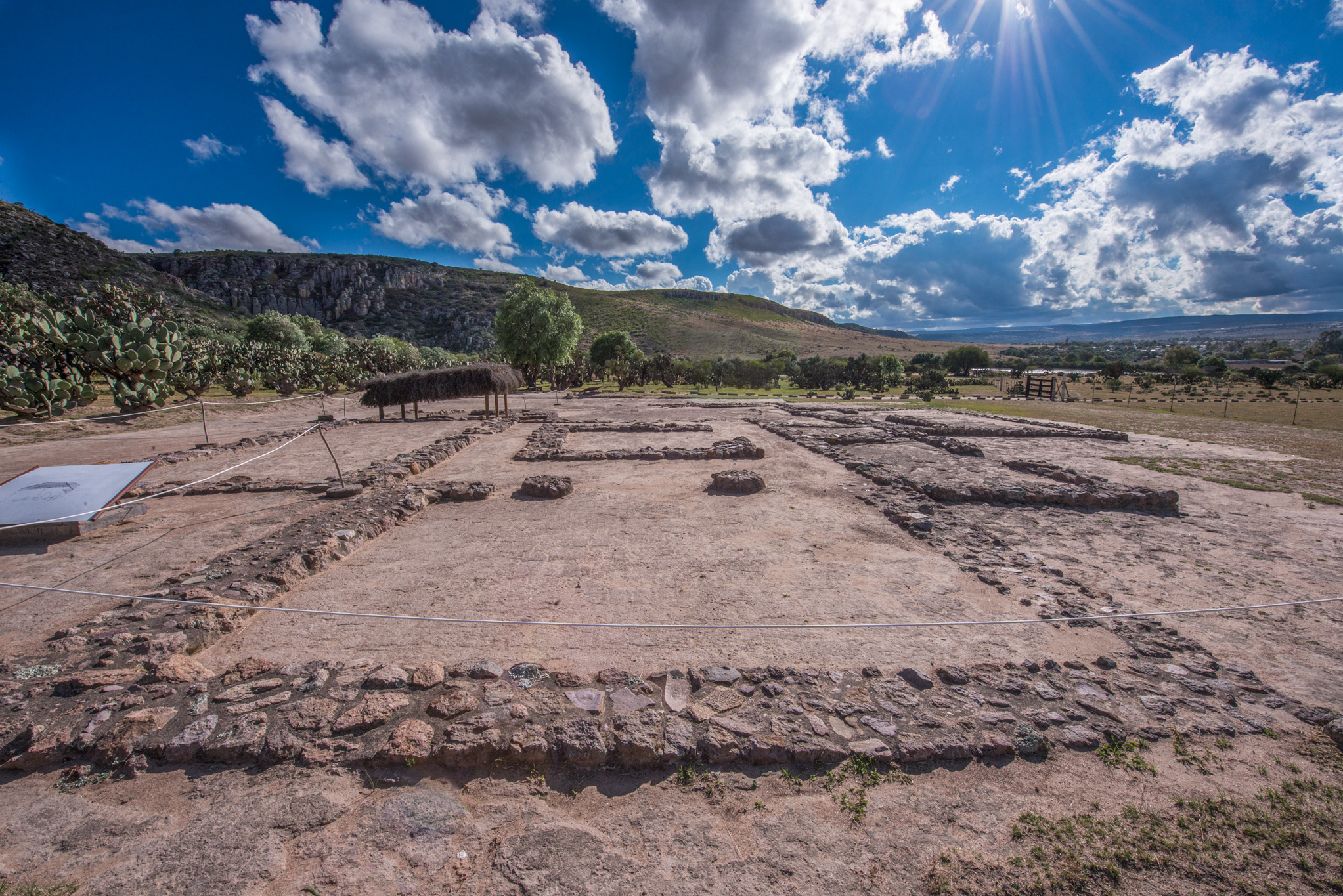
Conjunto Llano
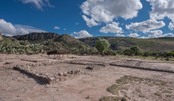
This is the place where the housing units and workshops are located. Here it is possible to appreciate a series of rooms oriented to the four cardinal points, distributed around a patio. What stands out in this unit is the location of the stoves in the area corresponding to the kitchen.
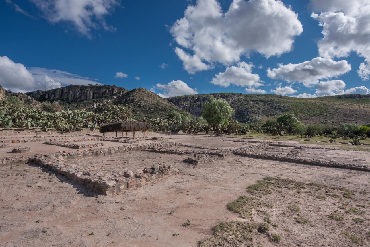
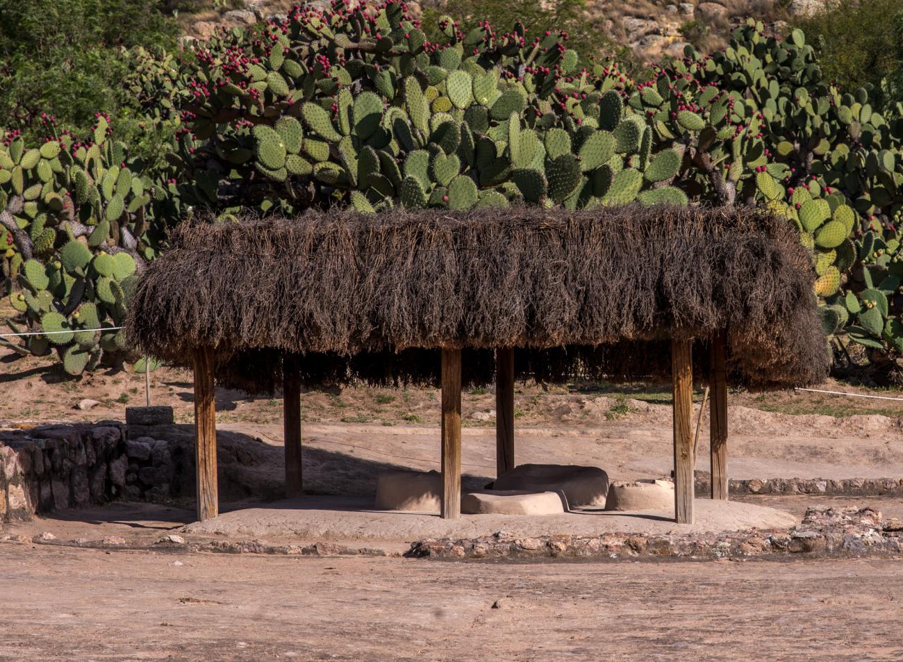
This is the place where the housing units and workshops are located. Here it is possible to appreciate a series of rooms oriented to the four cardinal points, distributed around a patio. What stands out in this unit is the location of the stoves in the area corresponding to the kitchen.
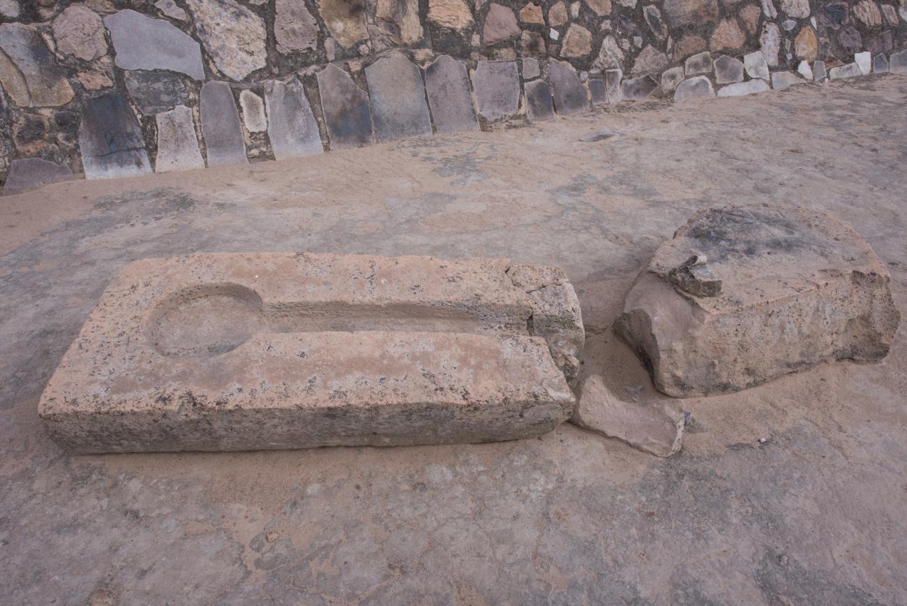
Housing unit: Housing unit located on the plain of the archaeological zone with a view of the Vigía hill.
Housing unit: Housing unit located on the plain of the archaeological zone with a view of the kitchen hearths.
Kitchen hearths: Stoves of the kitchen of the housing unit of the complex of the plain.
Housing unit: West area of the housing unit.
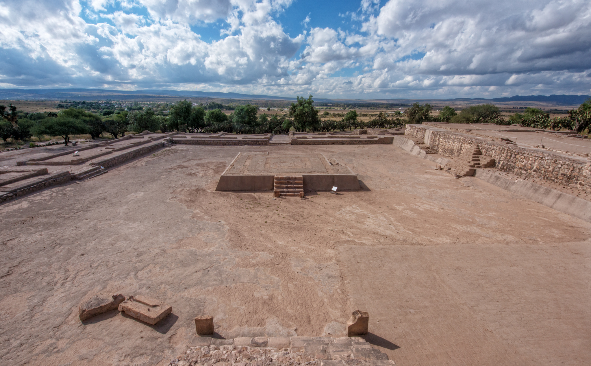
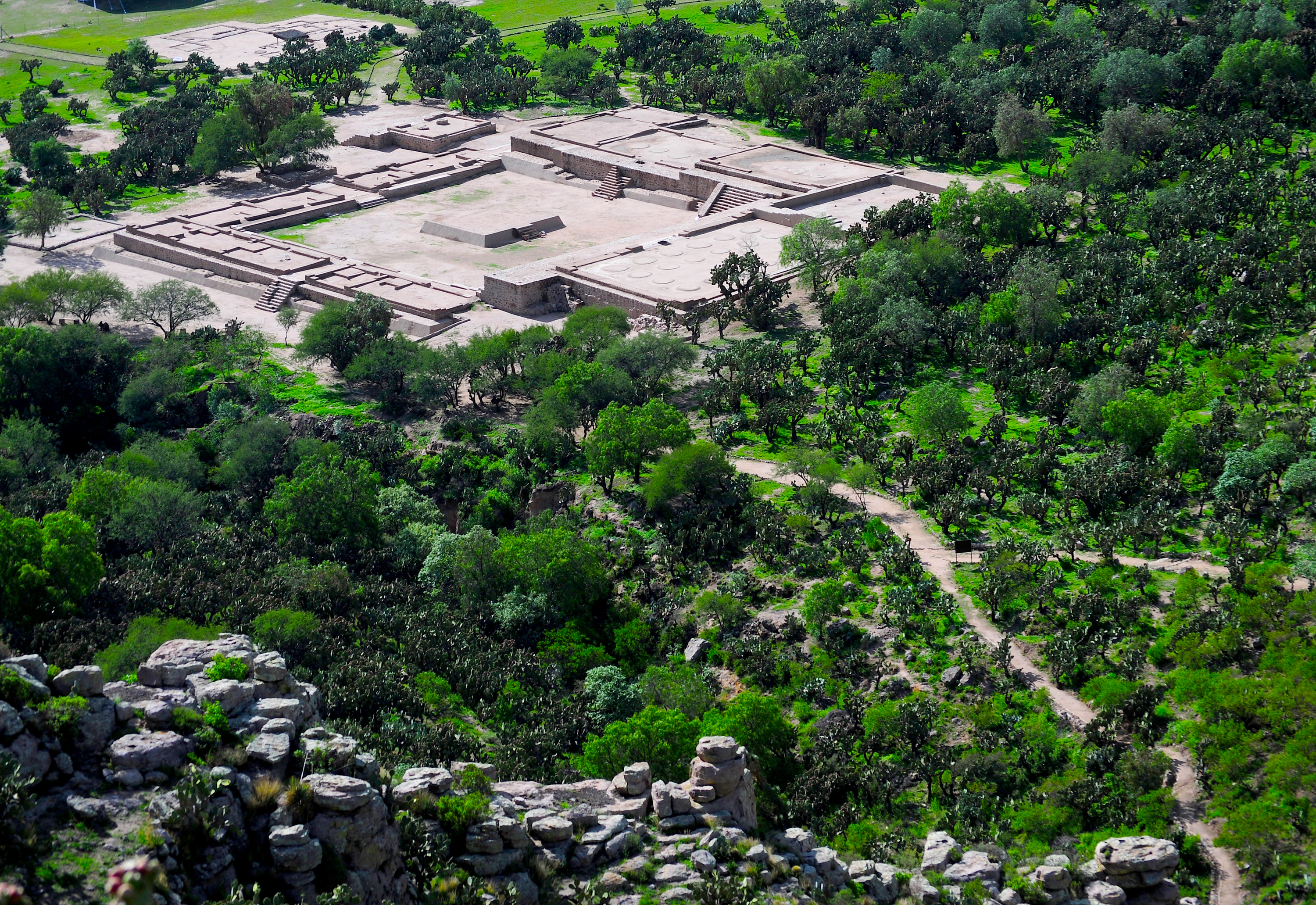
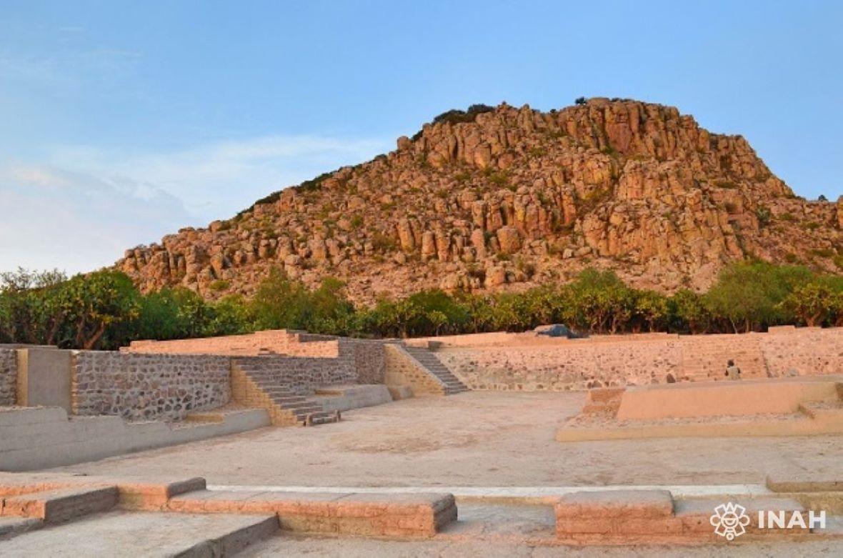
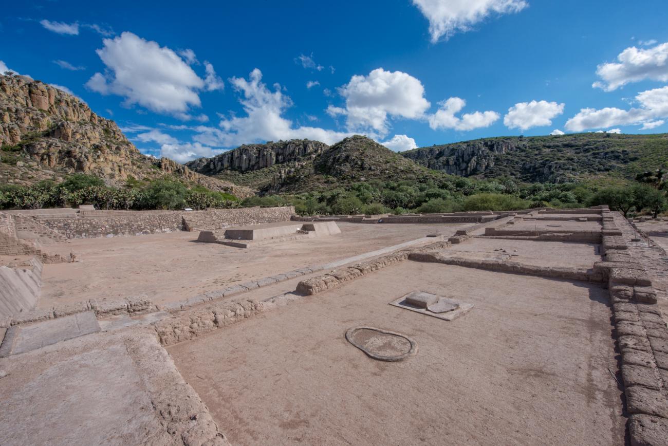
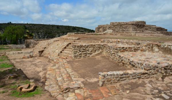
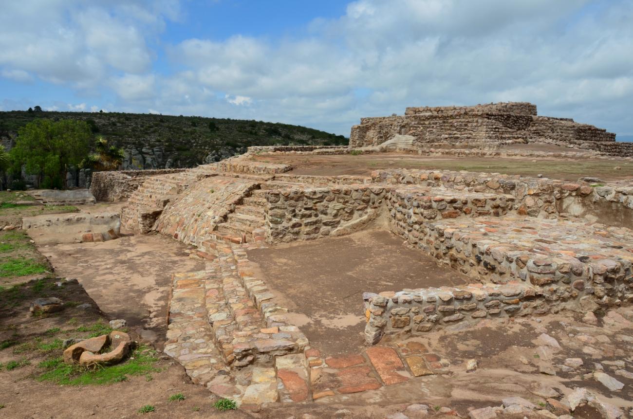
Plaza del Ocaso o Conjunto Gotas
View of the Plaza del Ocaso, which is the civic-administrative area. It is located in Conjunto Gotas, on the slopes of the hill. It consists of four platforms oriented to the four cardinal directions, while its main entrance is located to the west.
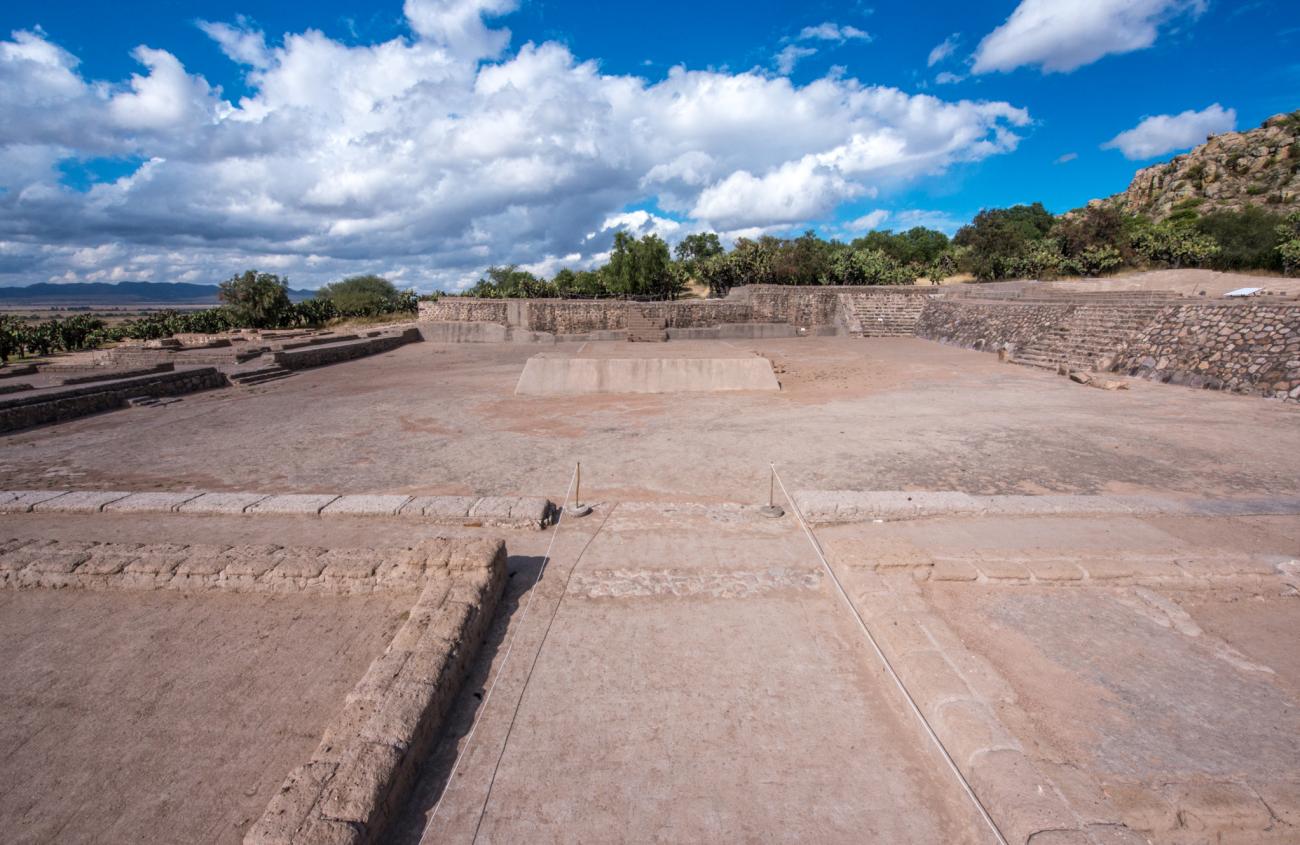


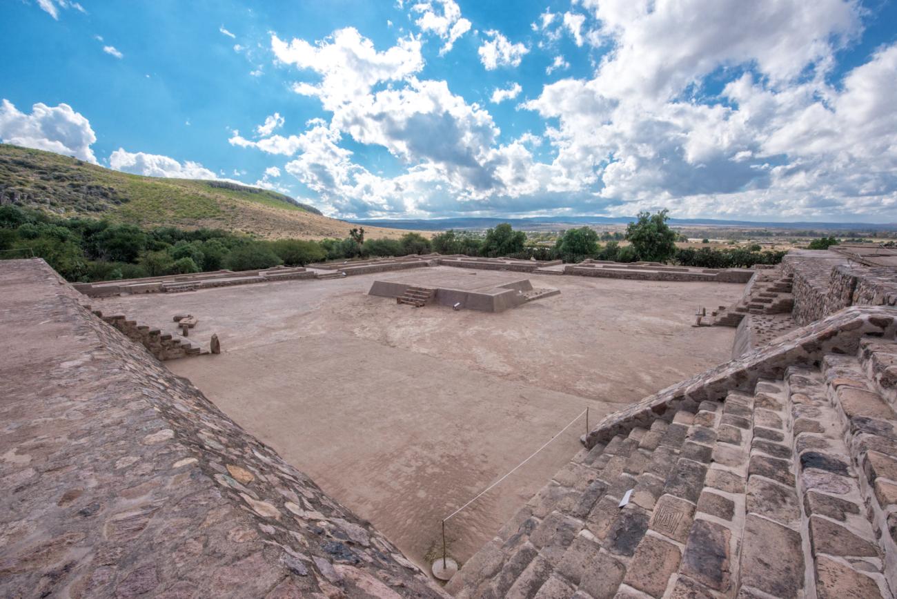
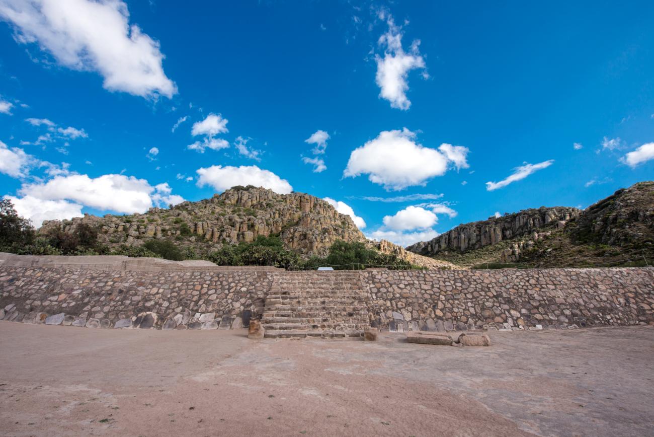
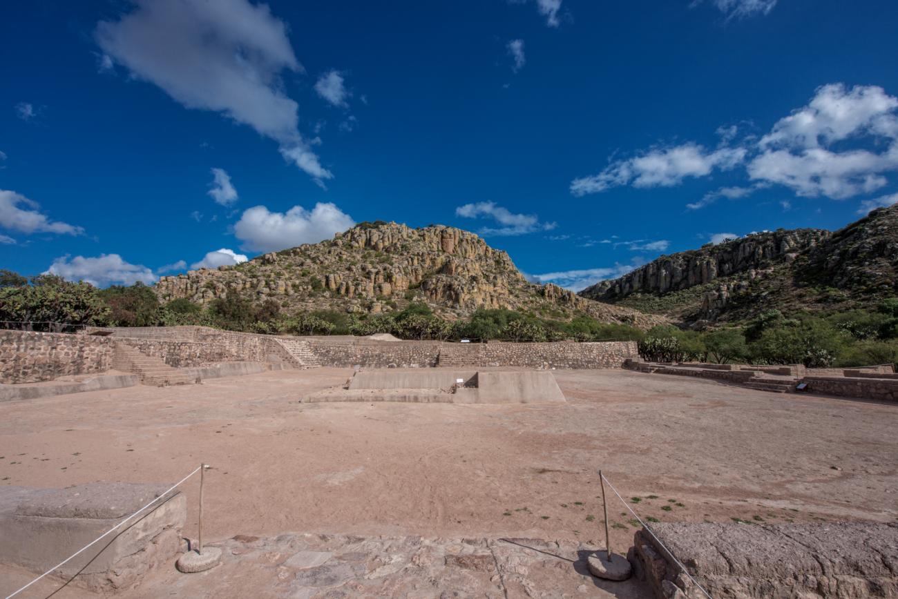


View of the Plaza del Ocaso, which is the civic-administrative area. It is located in Conjunto Gotas, on the slopes of the hill. It consists of four platforms oriented to the four cardinal directions, while its main entrance is located to the west.
Plazuela del Ocaso: South access to the Plazuela del Ocaso.
Plaza del Ocaso: View of the interior of the Plaza del Ocaso with stairway and petroglyphs.
Central Altar: Located in the Plaza del Ocaso, its main entrance faces east towards the main hall.
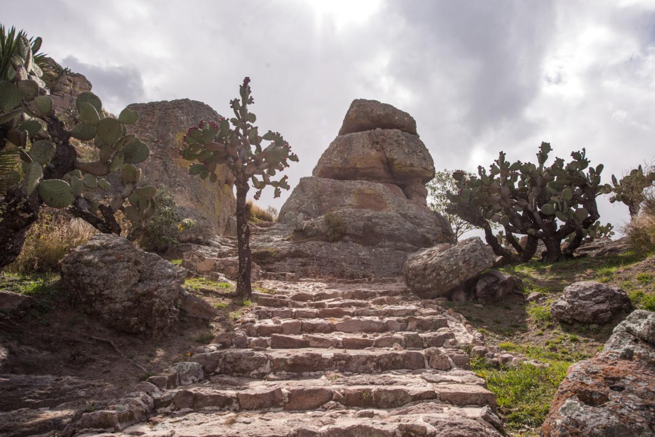
Stairway: Stairway of the North Platform. In its steps there are petroglyphs allusive to water and fire.
Offering Vessel
Hall of the Sunset: View of the Hall of the Sunset.
Plaza del Ocaso: Main access to the Plaza del Ocaso.
North structure: North structure in the shape of an inverted “T”.
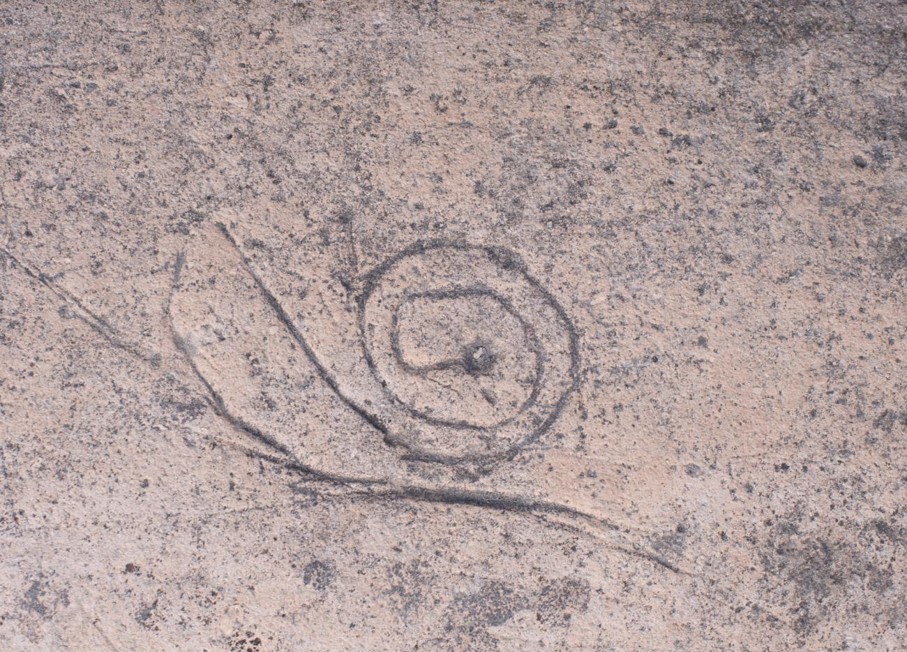
Access to structure: Petroengraving in the form of a rectangular spiral related to the underworld and the dry season, located on the north stairway.
Cuarterío: Petroengraving in the form of spiral located in the north stairway.
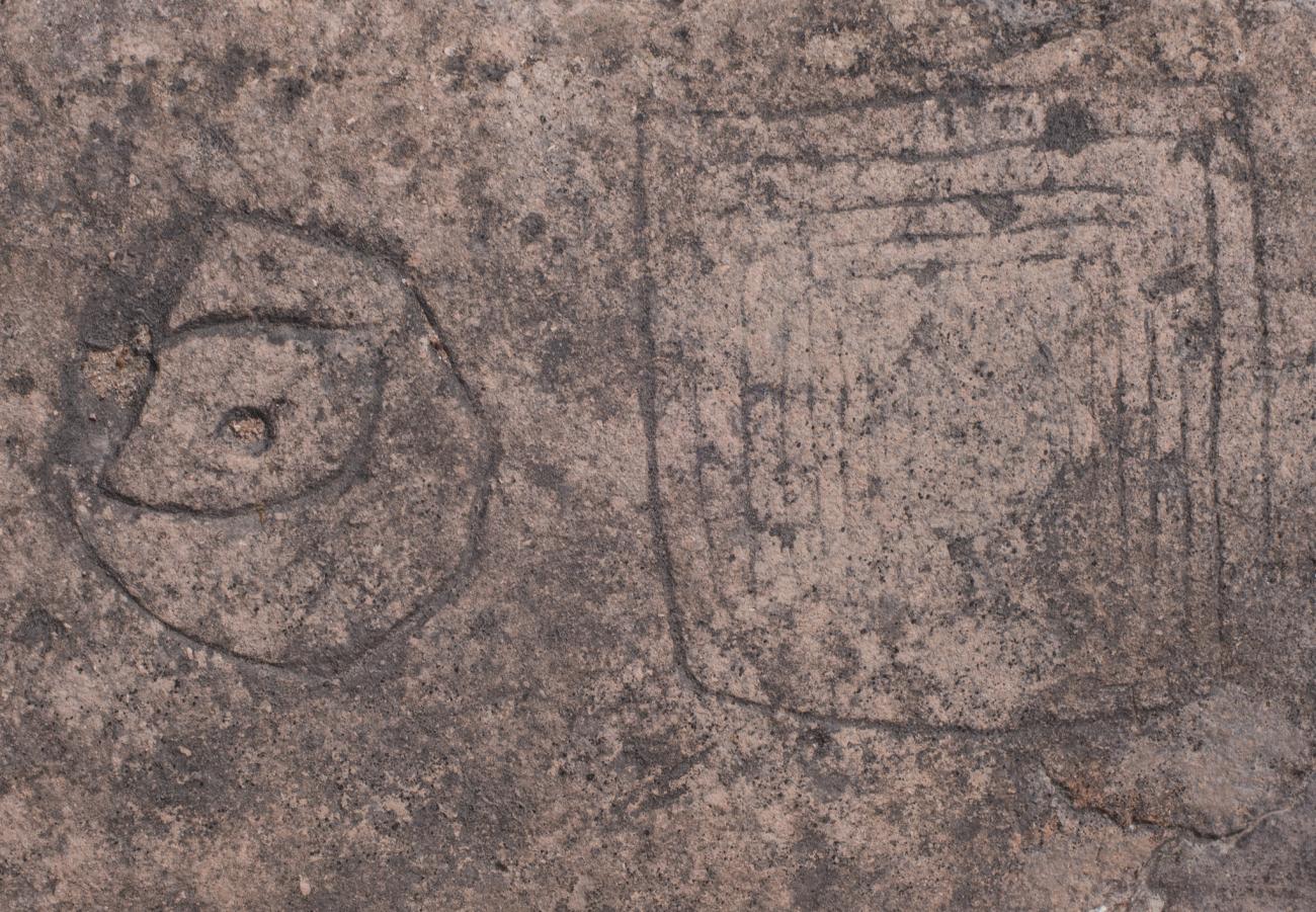
Circular Petroengraving: Circular geometric petroengraving and quadrangular spiral petroengraving.
Spiral Petroengraving: Petroengraving in spiral form with circular center and quadrangular finish.
Geometric Petrogravure
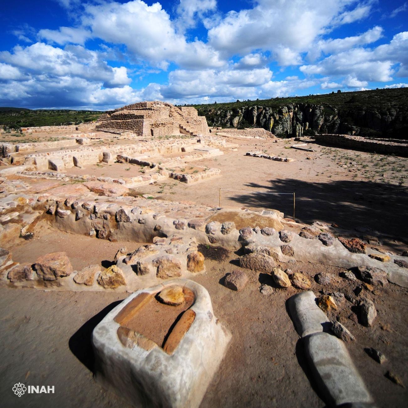
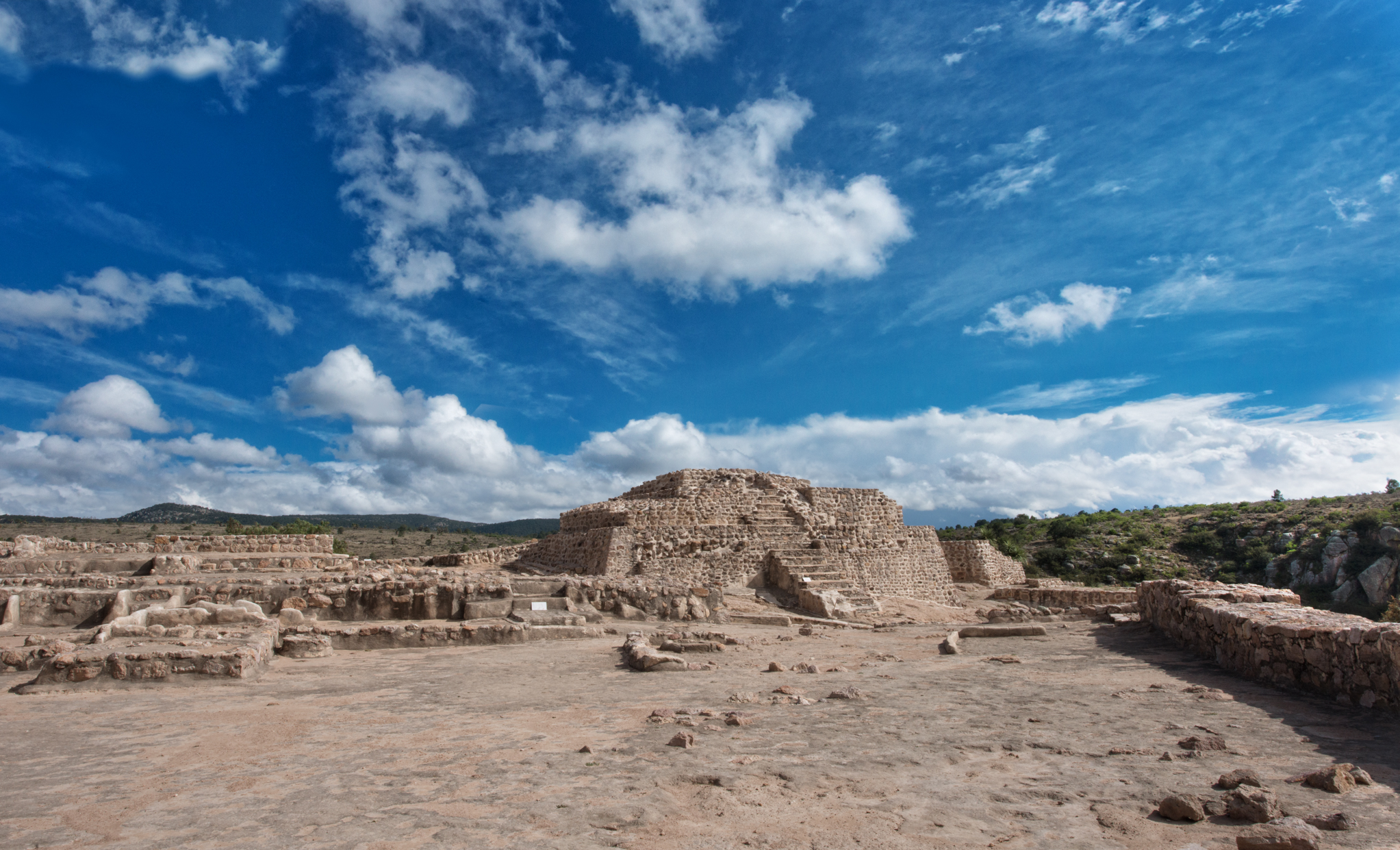
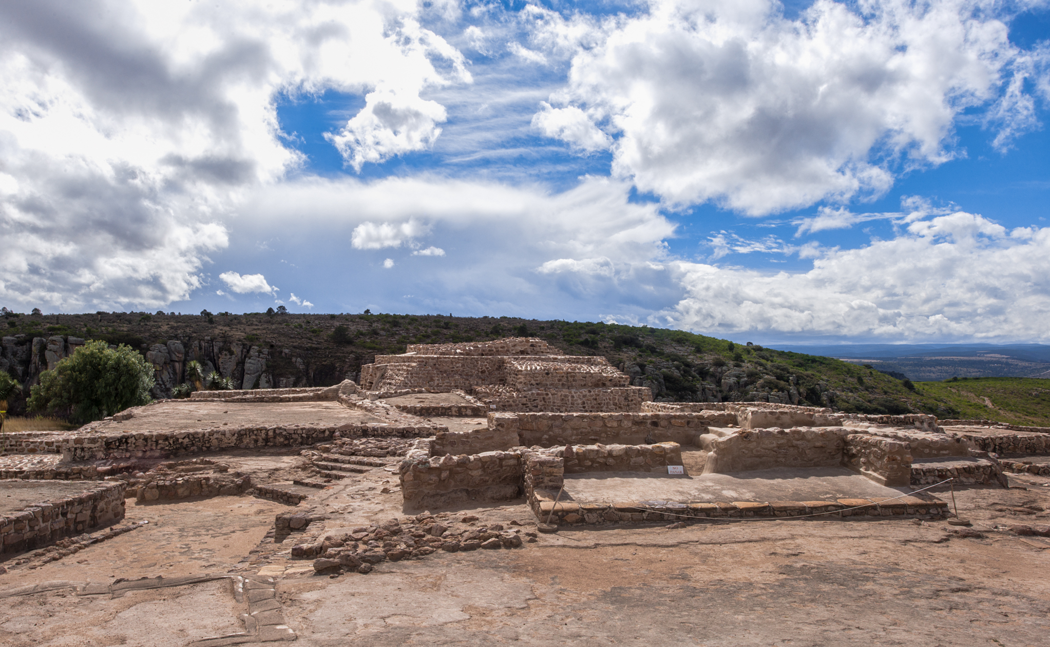
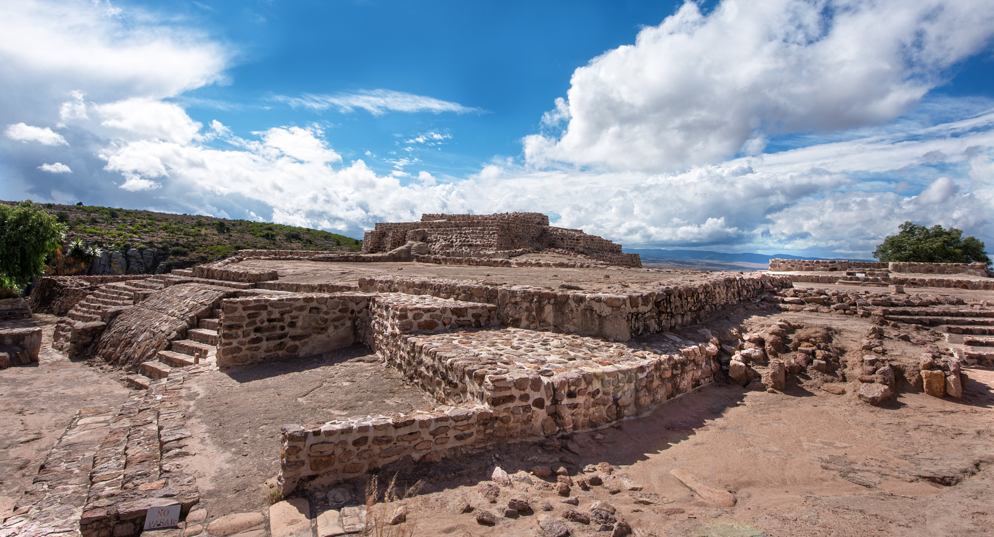
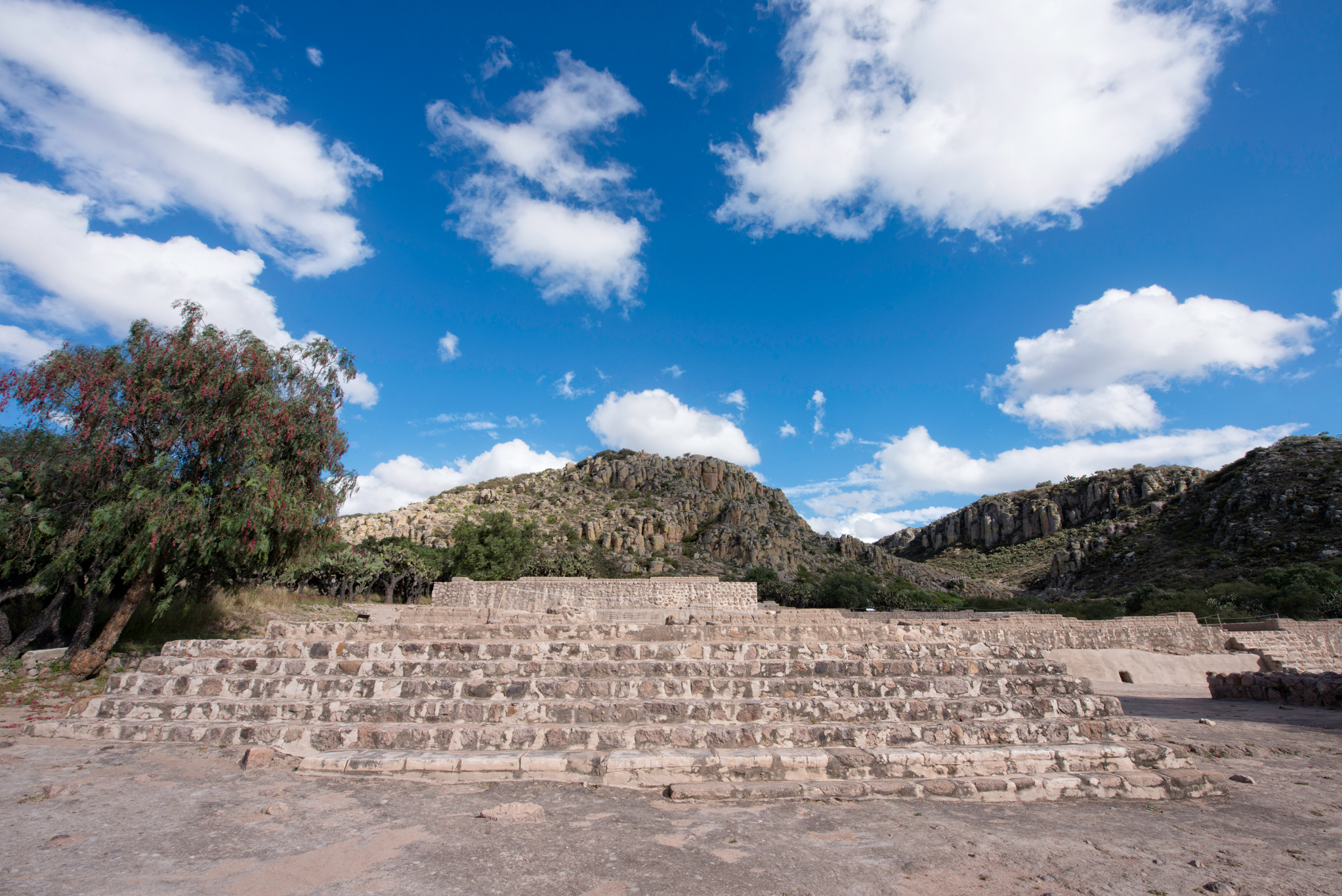
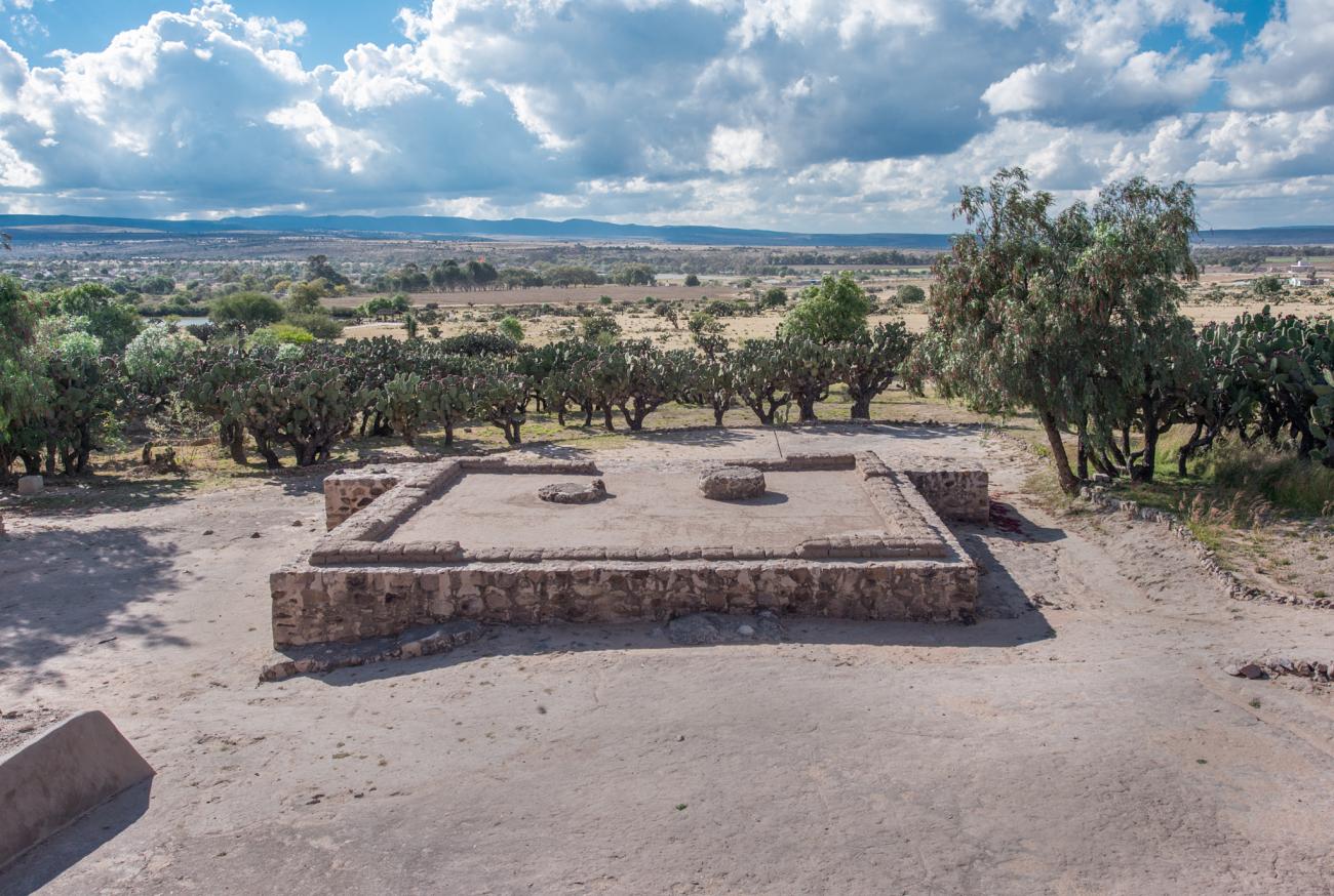
Conjunto Cóporo, área cívico ceremonial
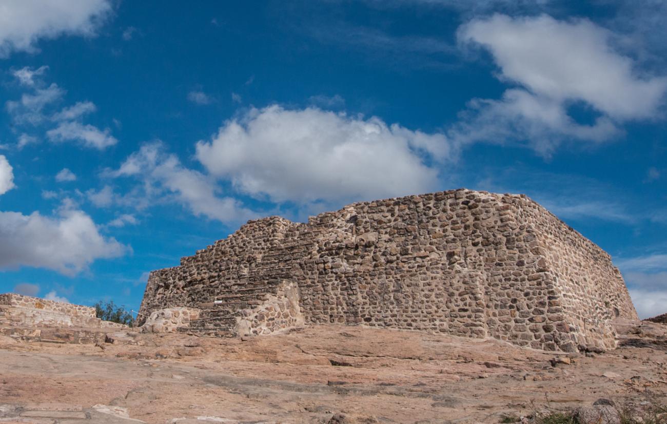
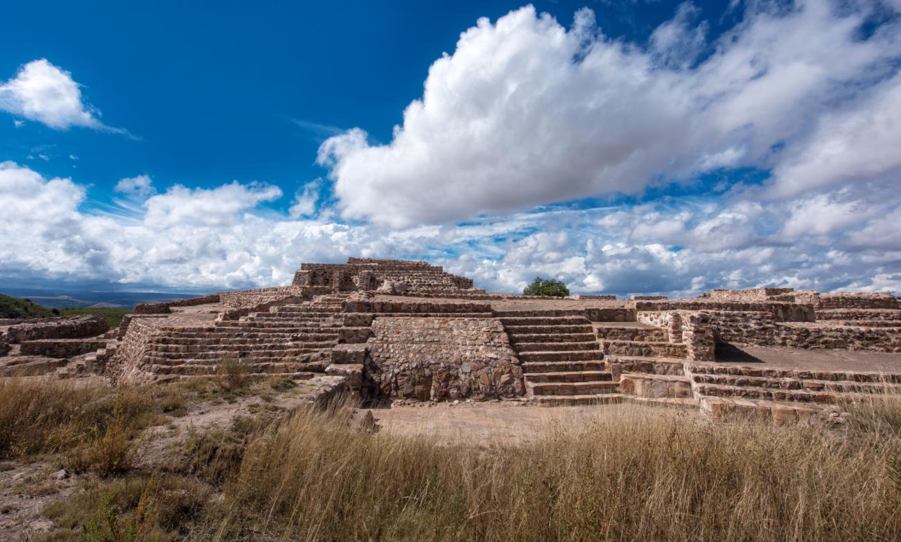
It is the civic-ceremonial area located at the top of the hill. In this place there is a pyramidal base oriented towards the sunset, where the elite people, such as priests and rulers, lived and lived.

It is the civic-ceremonial area located at the top of the hill. In this place there is a pyramidal base oriented towards the sunset, where the elite people, such as priests and rulers, lived and lived.
Pyramidal base: It is part of a civic-religious area, it is located at the top of the Cóporo hill and it is composed of four constructive stages.
Annex: Distribution of halls and rooms in the ceremonial area of El Cóporo, home of hierarchs and priests.
Temple-Hall: Temple Hall, annexed to the pyramidal base.
El Cóporo complex, rooms and halls: Petrogravure in the form of a spiral related to water and movement, located in the Cóporo ensemble.
Halls: Petroengraving in spiral form related to water and movement, located in the Cóporo ensemble.
Spiral Petroengraving: Petroengraving in the form of a triangular spiral oriented towards the north.
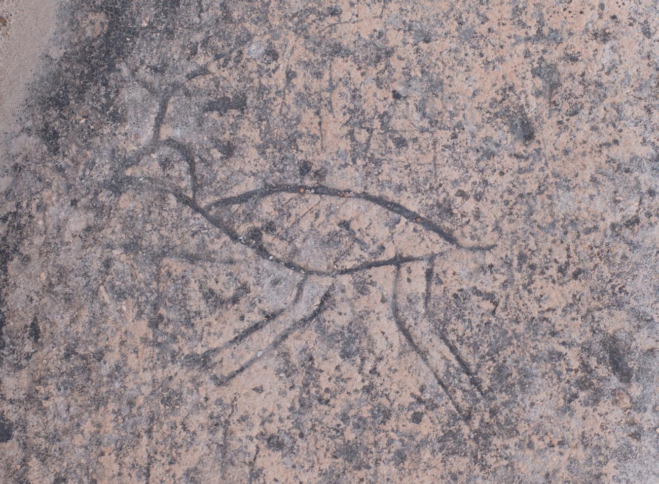
Petroengraving: Petroengraving with zoomorphic representation.
Geometric petroengraving: Geometric petroengraving formed by two spirals.
Spiral petroengraving
Geometric petroengraving: geometric petroengraving formed by two spirals.
Spiral petroengraving