
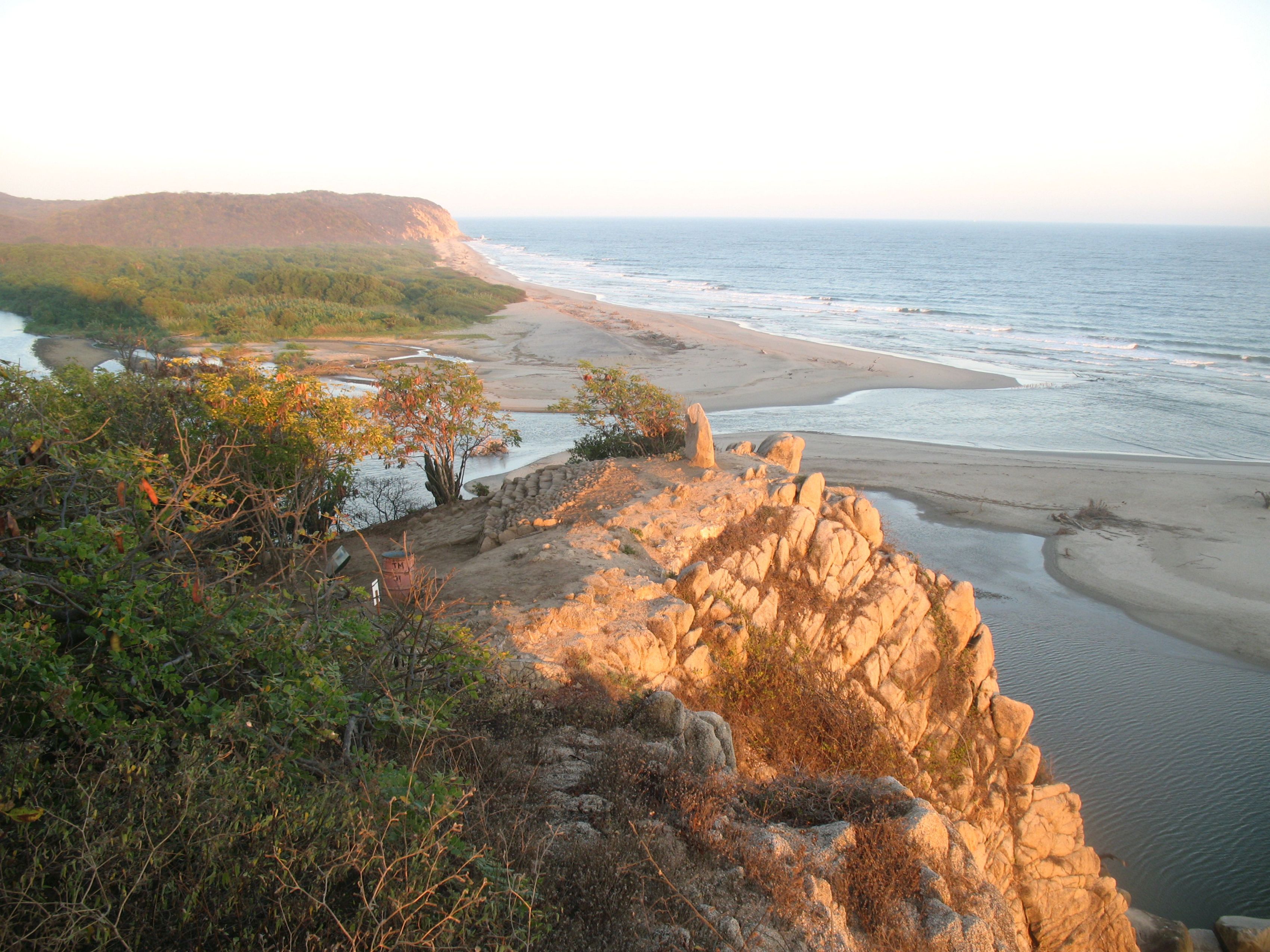


Bocana del Río Copalita
Close to Bahías de Huatulco, this site was a ceremonial center. It is located on the hills near the cliffs of the Oaxaca coast, within the Eco-Archeological Park, a wonderful natural setting.
The Bocana del Río Copalita site lies six miles west of Santa Cruz Huatulco, in the district of San Pedro Pochutla, Oaxaca. It consists of a central area of 89 acres divided into a low mountainous or hilly region where the first pre-Hispanic settlement was founded, and another of alluvial soil which records the first stage of expansion and grandeur.
Archeological investigation of the site began in 1998, when strategies were proposed to protect and preserve it. The Research and Preservation Project for the Bocana del Río Copalita Archeological Site in Huatulco, Oaxaca has now completed nine seasons of archeological field and laboratory research.
As regards life in Copalita, It is calculated that Bocana del Río Copalita was already a substantial settlement by the Late Preclassic (400 BC to 200 AD), when its population occupied most of the natural elevations next to the sea and the mouth of the Copalita river. The social, religious and political structure of Copalita’s society was developed between the Late Preclassic and the beginning of the Early Classic. Its later complexity can be seen in the site’s lower region.
By approximately the end of the Early Classic (600 AD), the site had a plaza surrounded by several buildings and a Mesoamerican ballgame court. Copalita’s growth was tied to its nature as a civic-ceremonial center similar to other important Mesoamerican cities.
This stage of occupation extended into the Middle Late Classic, and we finally see signs of the place’s decline and abandonment in the Postclassic.
The civic and ceremonial structures and greatest concentration of residential terraces are located in the main settlement, which covers approximately 89 acres. As site explorations have concentrated on only some of the structures, there are therefore others which have not been uncovered and whose architectural characteristics are still unknown.
However, a certain outline can be distinguished that suggests a civic and ceremonial space of considerable size, made up of a series of temples, residences for the elite and a ballgame court, as well as terraces and residential units. It is important to mention that the site includes different stages of construction and different periods of occupation, and this is therefore an account of the existing architectural components within the site’s boundaries.
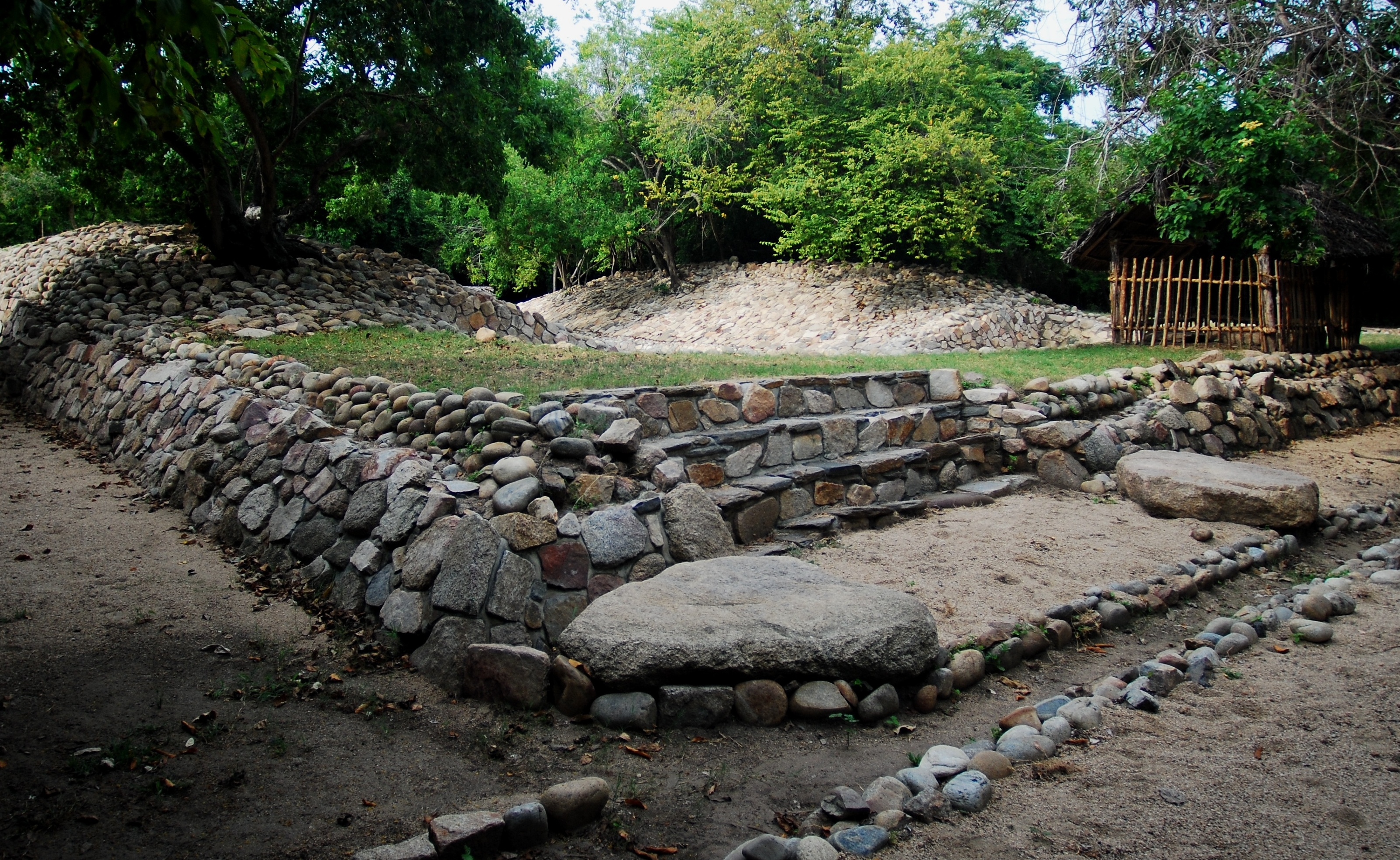
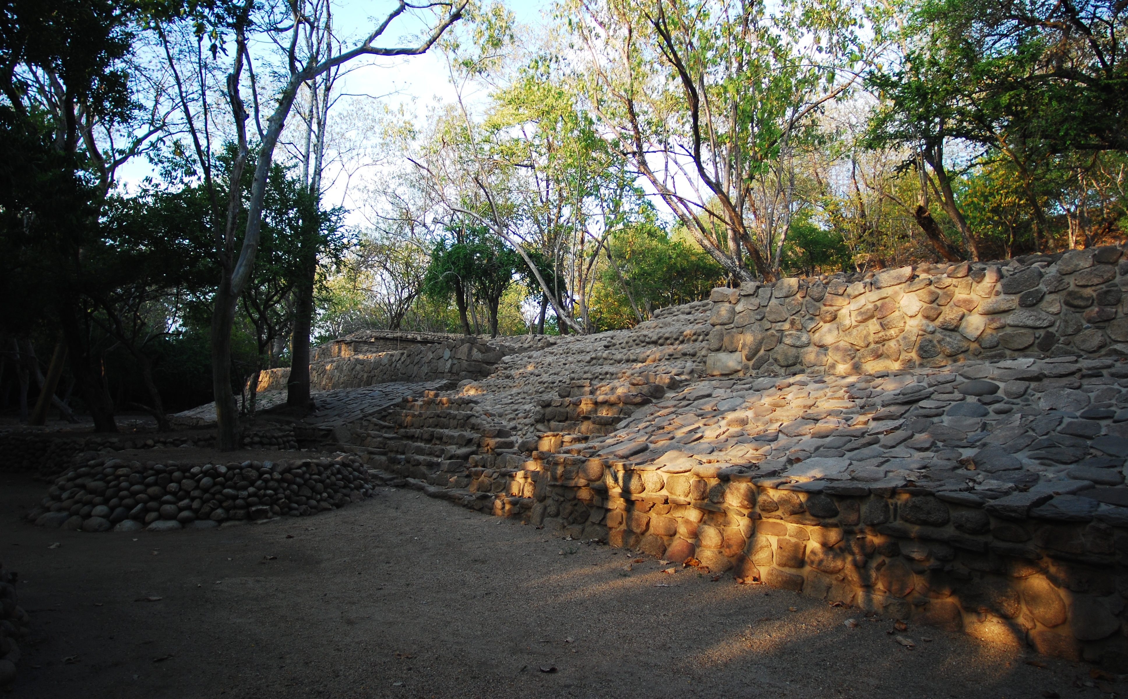
Five civic-ceremonial buildings are located in the zone of alluvial soils. The Acropolis indicates the outline of a plaza that was presumably open on its western side. Structure III (cemetery) lies to the north and Structure I is to the south. Both structures have yet to be excavated, although they do represent the Mesoamerican pattern of spaces of a ceremonial nature associated with the role of the ballcourt, which is located to the southwest of this area.
The site museum was inaugurated on October 5, 2010, when the Copalita archeological site was partially opened to the public.
- Dirección del Centro INAHJosé Manuel Bañuelos Ledesmajosemanuel_banuelos@inah.gob.mx+52 (951) 513 0389
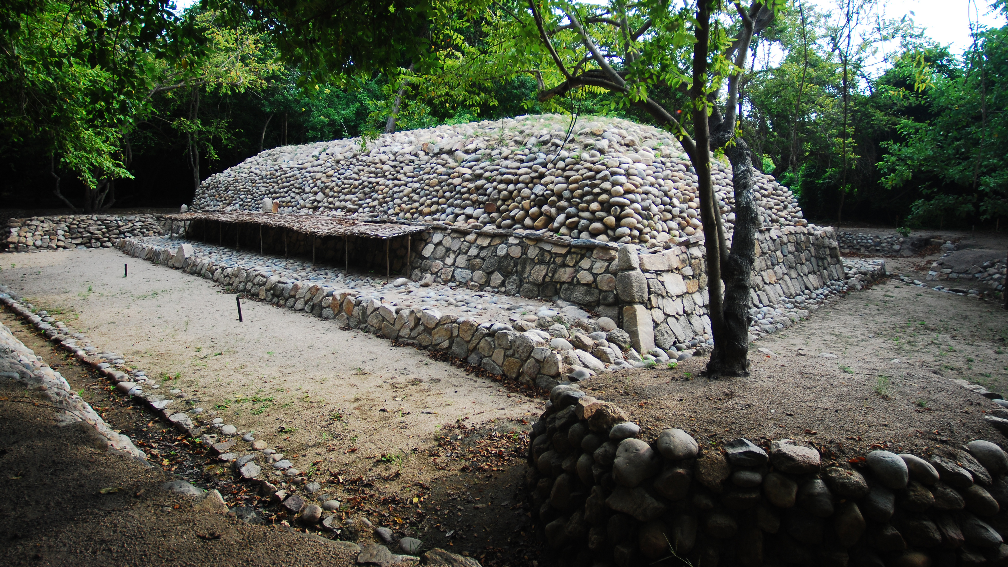
Acrópolis o Estructura IV
It is a natural elevation that was conditioned as an architectural structure.
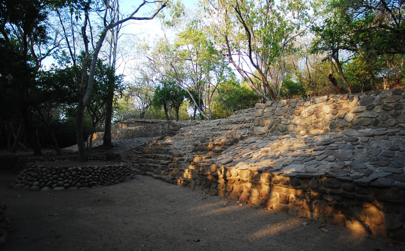
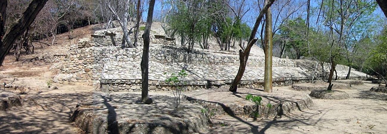
It is a natural elevation that was conditioned as an architectural structure. It is composed of two bodies, the access of the first one leads both to a main plaza and to a small patio, it has several slabs of considerable dimensions that are distributed in the vestibules and that, possibly, served as stelae. In both bodies there are several stone alignments that indicate the existence of foundations of rooms and/or platforms. This suggests that this structure was used for ceremonial events and as a dwelling for the main characters of the pre-Hispanic population.
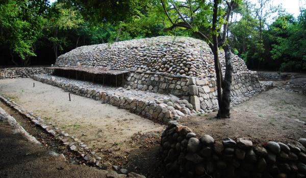
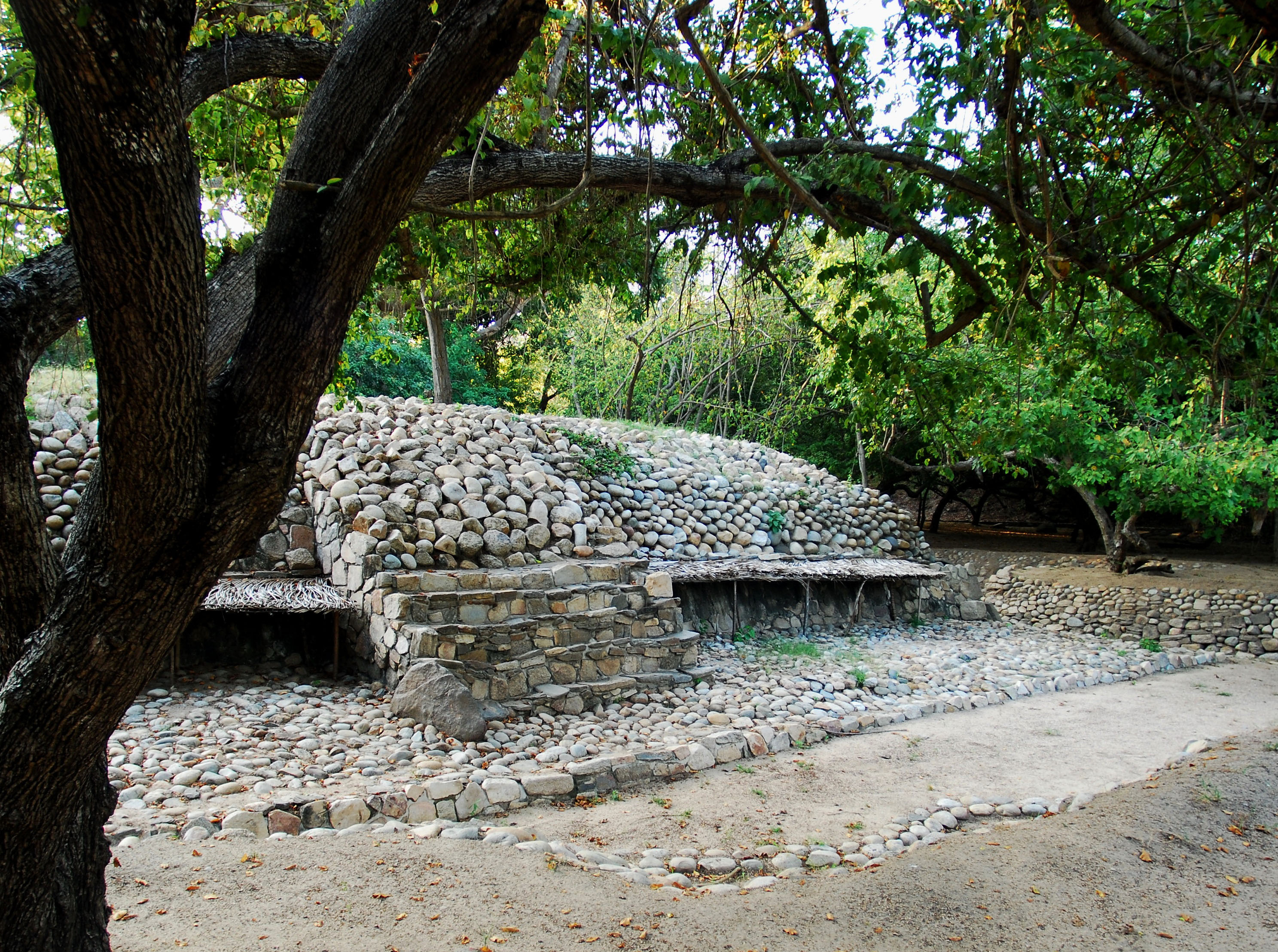
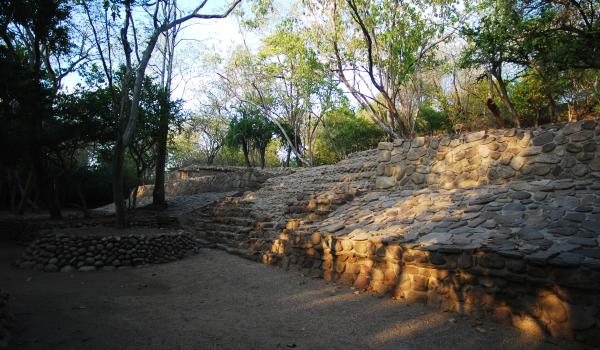
Templo de la Serpiente o Estructura II
It is located south of the civic-ceremonial area. It is a rectangular structure oriented north-south, 9.30 m wide by 21.25 m long and 3.72 m high. This structure without alfardas has a staircase attached to the first body of the building.
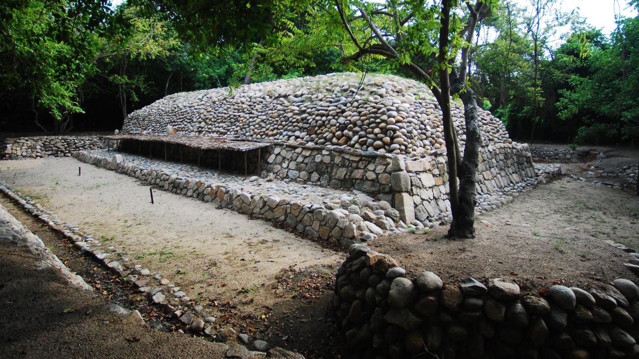

It is located south of the civic-ceremonial area. It is a rectangular structure oriented north-south, 9.30 m wide by 21.25 m long and 3.72 m high. This structure without alfardas has a staircase attached to the first body of the building. It was called Temple of the Serpent because fragments of stones with effigies of this animal were found in it. This building is at the entrance of the main plaza and is possibly associated with other low platforms that enclose an open courtyard along with the ball game, however only the northwest section of one of these has been liberated.
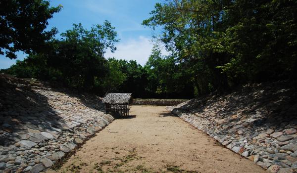
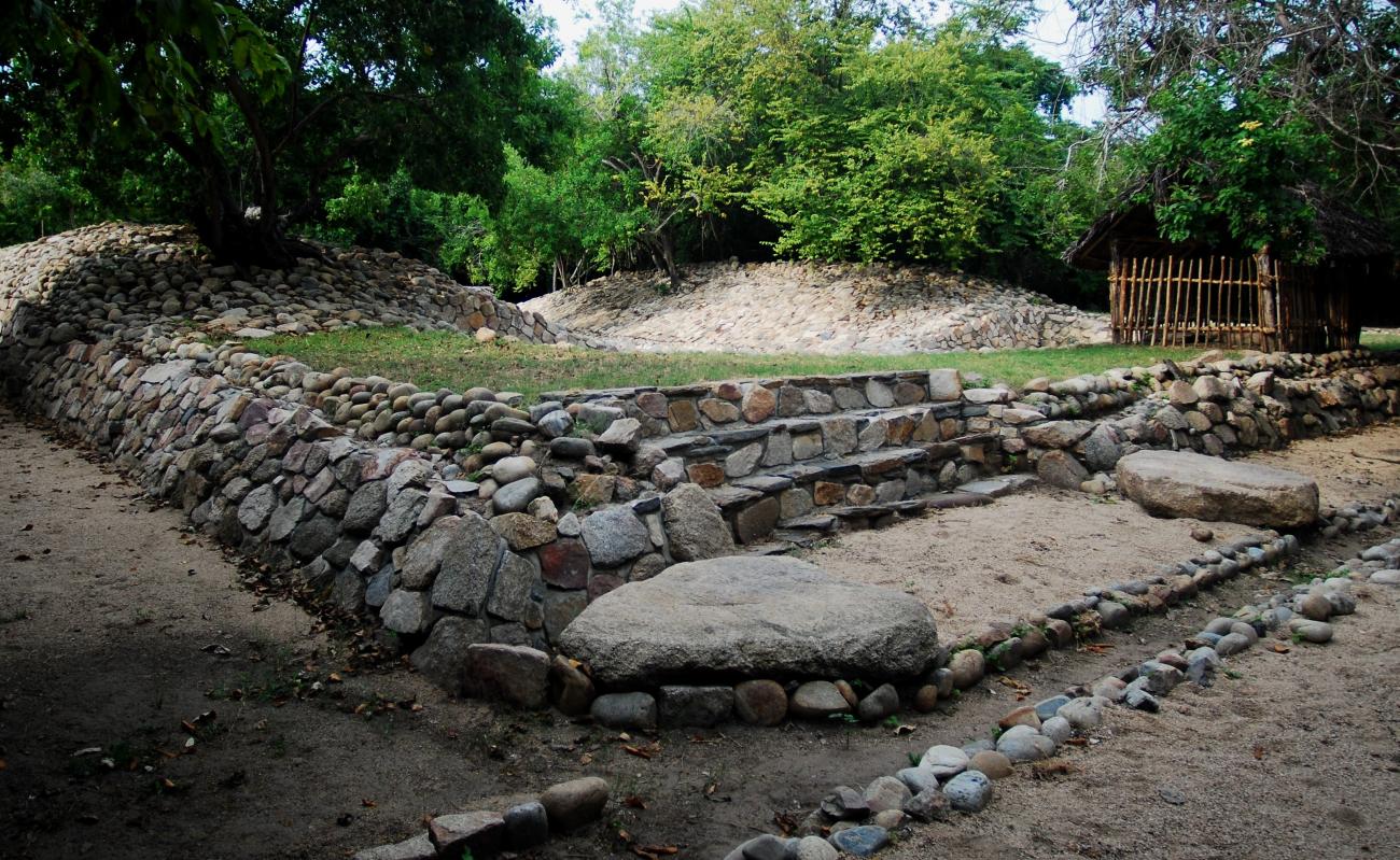
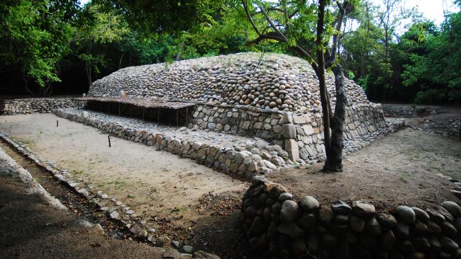
Juego de pelota o Estructura V
It is located approximately 15 m to the southwest of the main plaza. It is oriented north-south and is composed of four structures that together form an “I”. The east and west platforms are approximately 2m high and the interior patio measures 3 x 20m.
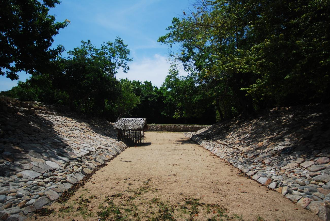

It is located approximately 15 m to the southwest of the main plaza. It is oriented north-south and is composed of four structures that together form an “I”. The east and west platforms are approximately 2m high and the interior patio measures 3 x 20m. The south and north heads have a height of almost 1.50 m; in the north head a stone engraved in low relief was found showing the numeral 4. It should be noted that originally the stone was located vertically in the center of the head, with the engravings directed towards the playground. Another engraved stone is found in the central part of the interior bench of the east structure and seems to present the calendrical glyph 5 reed.