


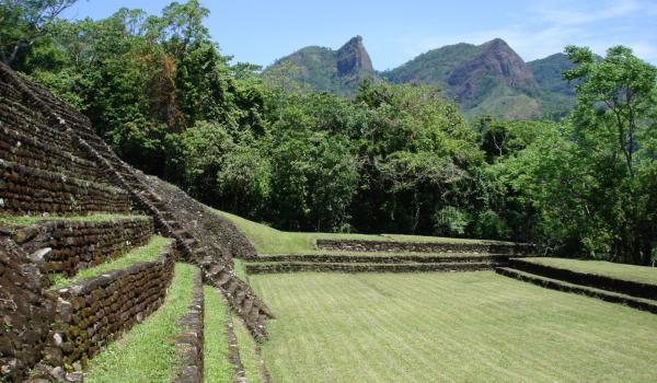
Malpasito
This site is characteristic of the Zoque culture, close to the Olmec and the Maya, but different. Thirteen hundred years ago its founders flattened the irregular terrain and formed artificial terraces on which to erect their delicate constructions, as well as producing fine pottery.
Malpasio is in the corner of Tabasco bordering the states of Chiapas and Veracruz. Between 600 and 900 it was occupied by groups related to the Zoque, who managed to build a modest city, becoming the political and economic center of a small province between the Pava and Amacoite mountain ranges.
The city influenced the growth of smaller settlements on the slopes of the mountain ranges. There was an abundance of natural resources thanks to the humid tropical climate, with good growing conditions for corn and cacao.
The inhabitants had a pottery tradition which featured white or cream finishes, with innovations acquired from the Gulf coast of Mexico, such as local adaptations of fine orange colored pottery.
Malpasito may have been dominated by more important sites located in the northeast of Chiapas, such as San Antonio and San Isidro, which have shared cultural traits in terms of ceramics and architecture, and whose people were ancestors of the Zoque chiefdom of Quechula, which was encountered by the Spanish conquistadors.
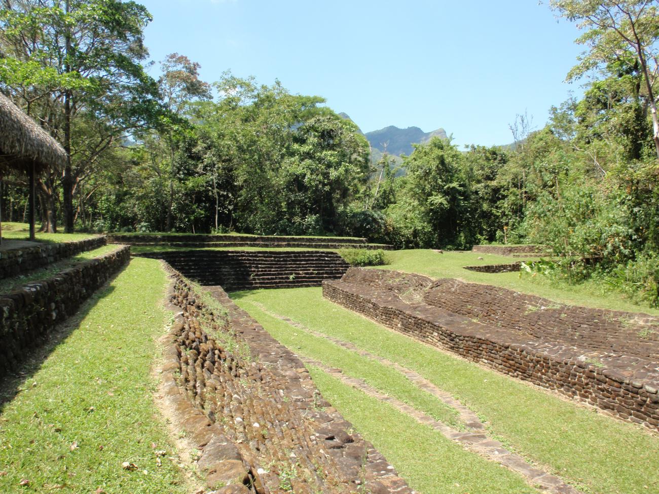
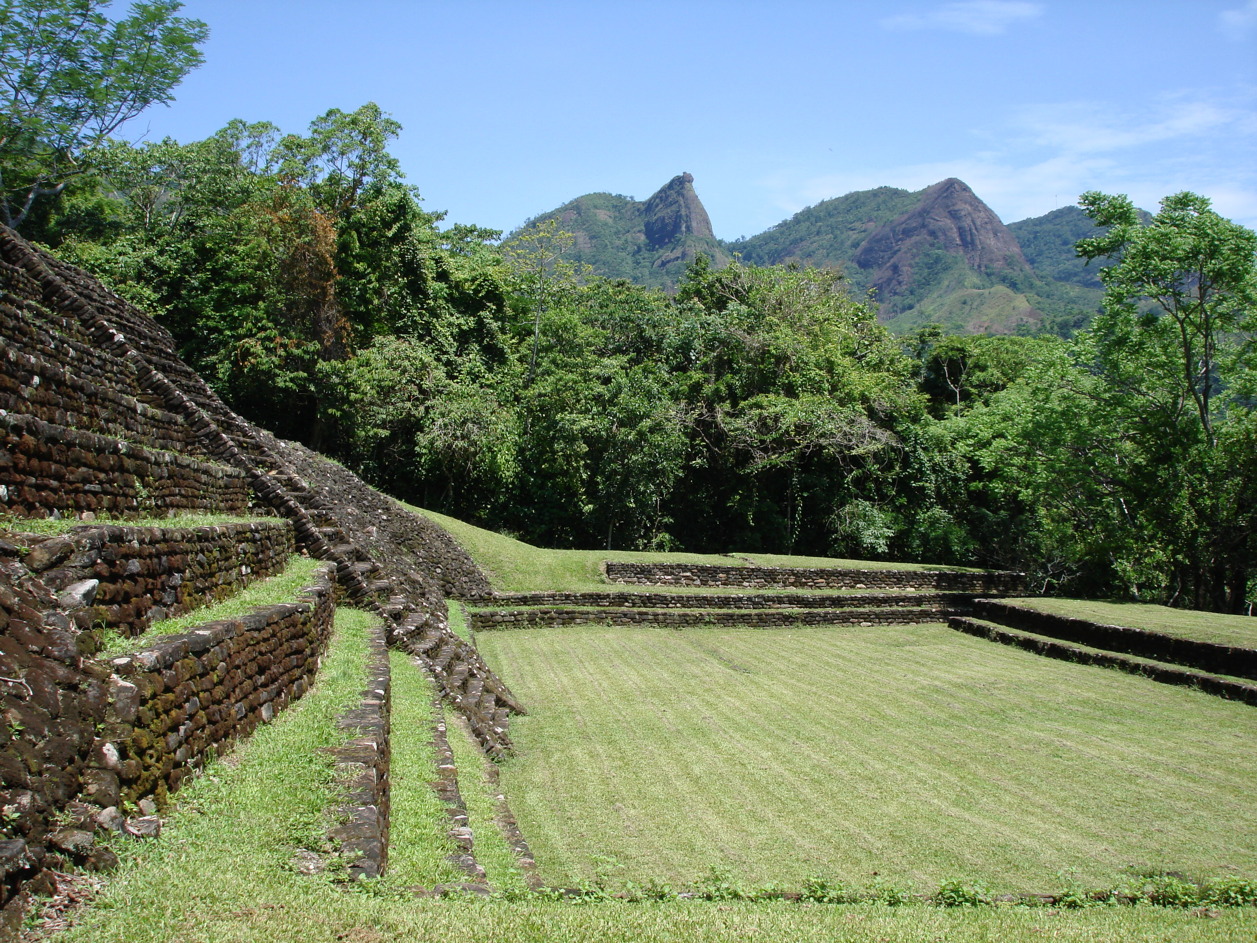
The archeological site is strategically located on the slopes of the mountain and between two small valleys which determine the sole point of entry at the northeast end. With its 53 buildings, the monumental area covers 35 acres. The architecture is distinguished by the use of rectangular platforms built from cut sandstone blocks joined with mortar.
The distribution of buildings in the civic-ceremonial area was carefully planned, both on the hilltop and along the curves of the artificial terraces, which implied the possession of the sophisticated engineering knowledge needed to integrate the architectural elements into the natural topography.
By contrast, the location of buildings in the residential area was determined by the shape of the land, water sources, and easy access to farmland, which is why low hills were chosen, as can be seen in the northern area of the site. These platforms might have supported houses or temples roofed with high truncated conical roofs, built from perishable material such as wood and a species of grass or palm fronds.
- Dirección del Centro INAHCarlos Arturo Giordano Sánchez Veríncarlos_giordano@inah.gob.mx+52 (933) 352 1022Coordinación de Zonas Arqueológicas de la región de Los Ríos, TabascoPrisilia Jannet Lagunes Celisprisilia_lagunes@inah.gob.mx+52 (993) 352 1033

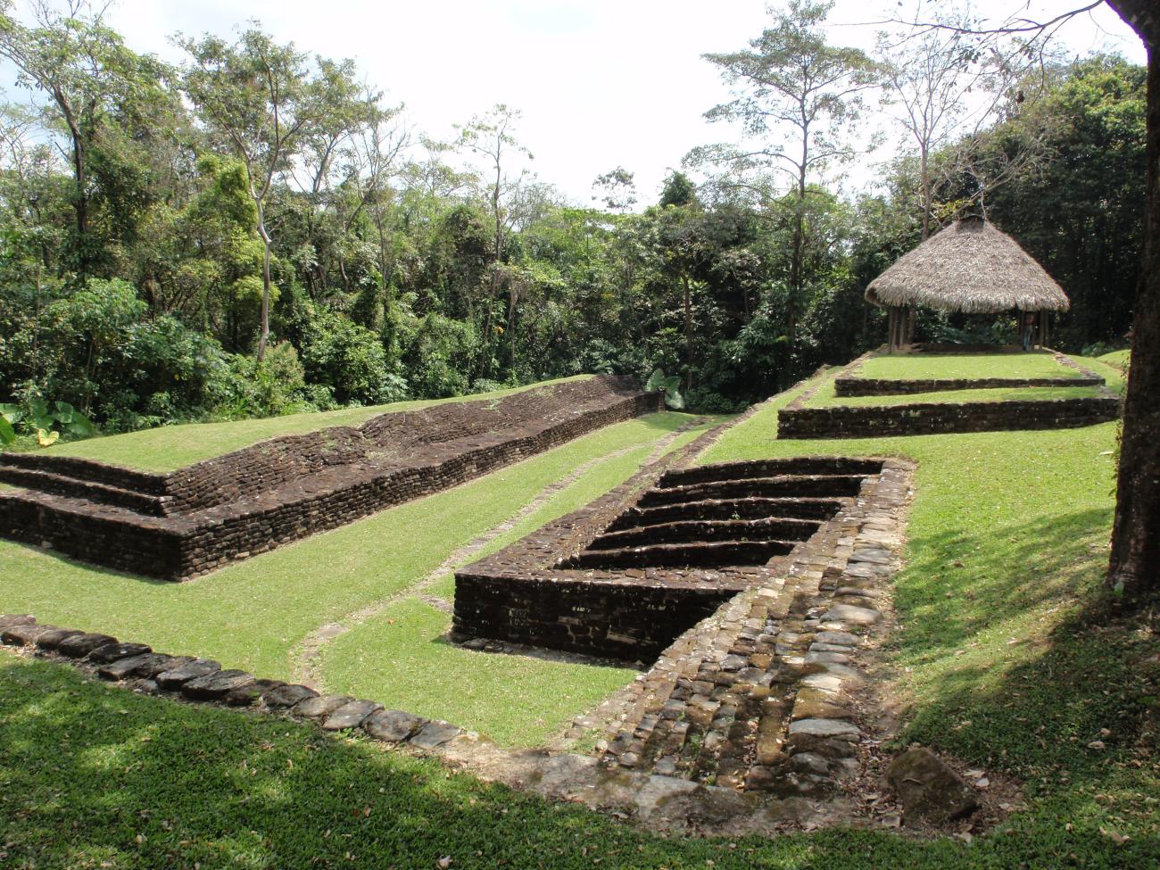
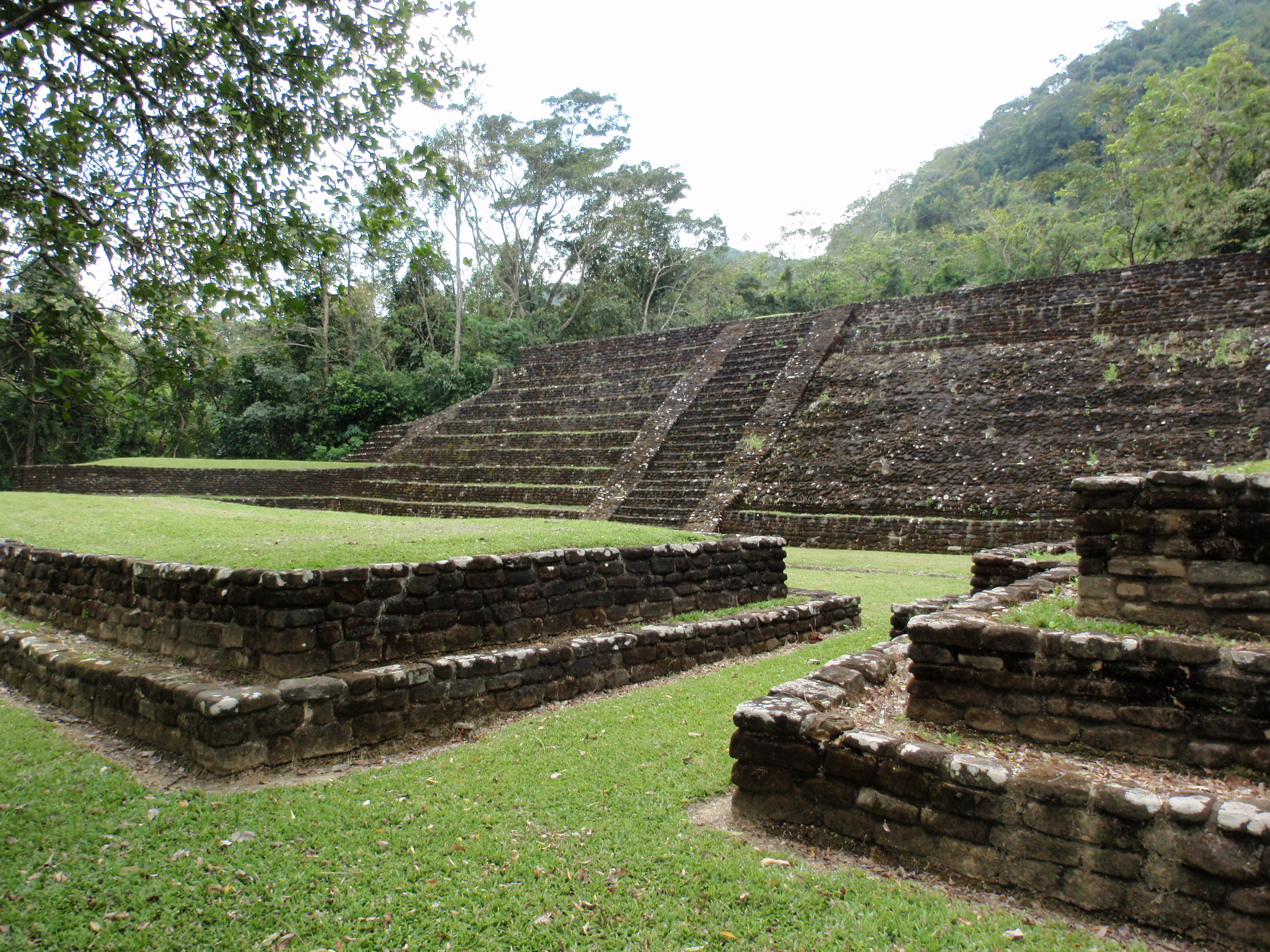
Juego de Pelota
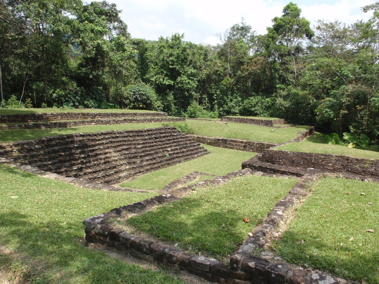
It consists of two rectangular structures, with an access stairway, which delimit a “T” shaped uneven court. One end is open and the other closed, and there are no sidewalks. The court has a drainage system, built with sandstone rocks, which prevents water saturation during the rainy season.
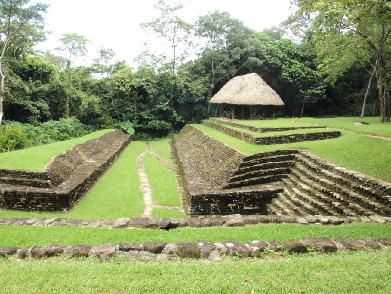

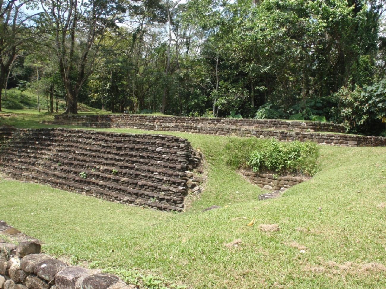
It consists of two rectangular structures, with an access stairway, which delimit a “T” shaped uneven court. One end is open and the other closed, and there are no sidewalks. The court has a drainage system, built with sandstone rocks, which prevents water saturation during the rainy season. Another architectural element present in this structure is a hollow located in the second body of Building 19 (on the left side), which possibly had a function similar to a ball game scoreboard.
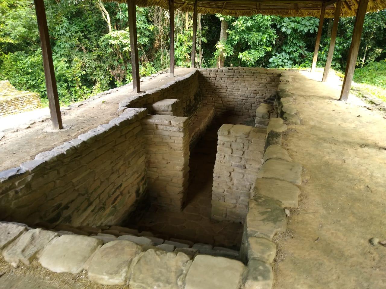
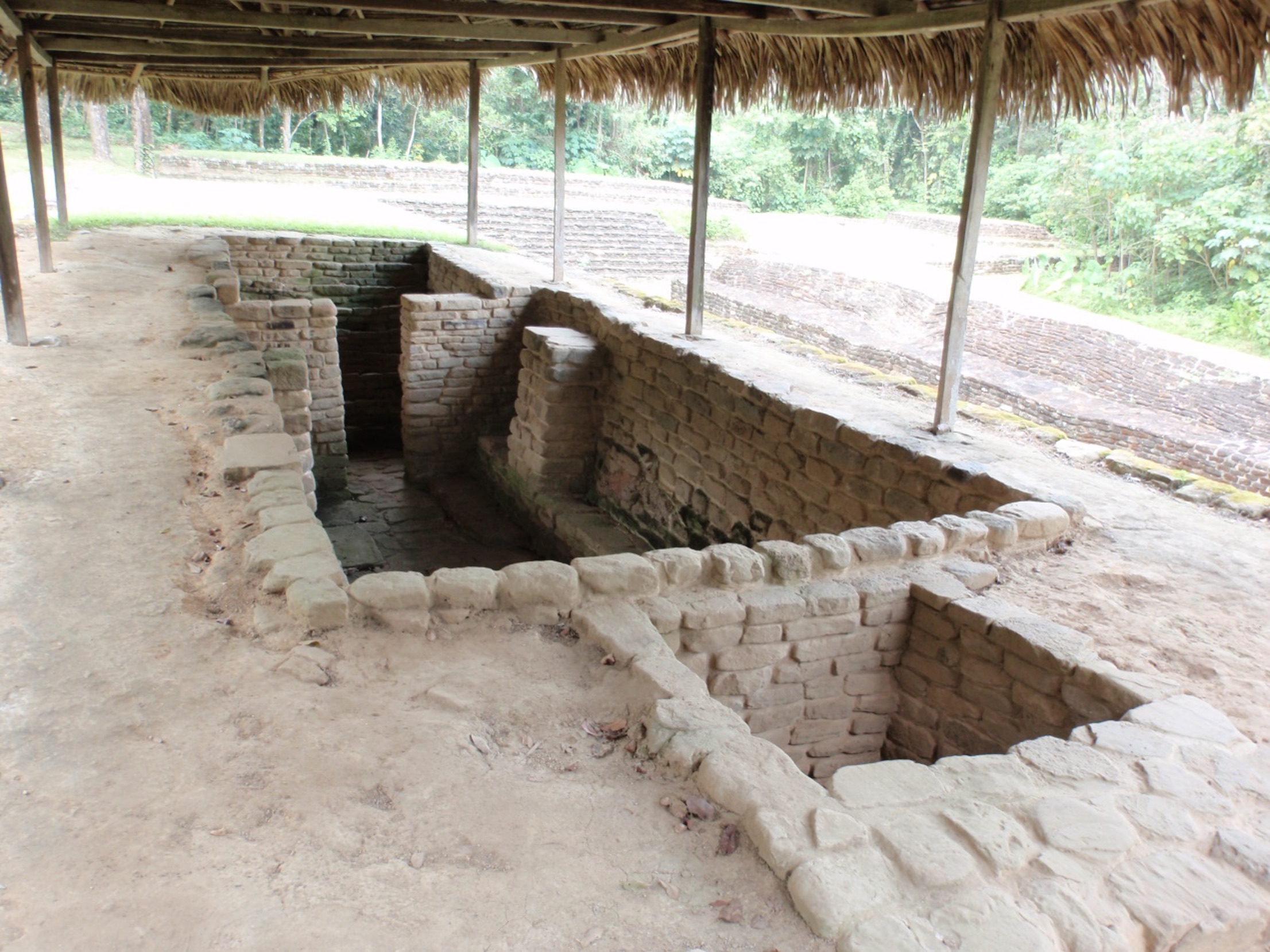
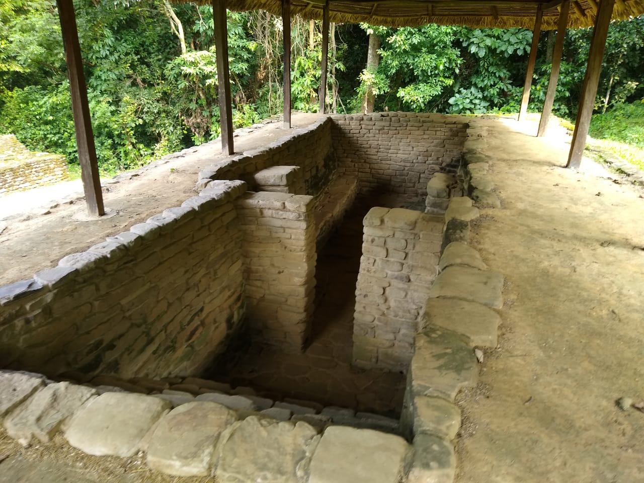
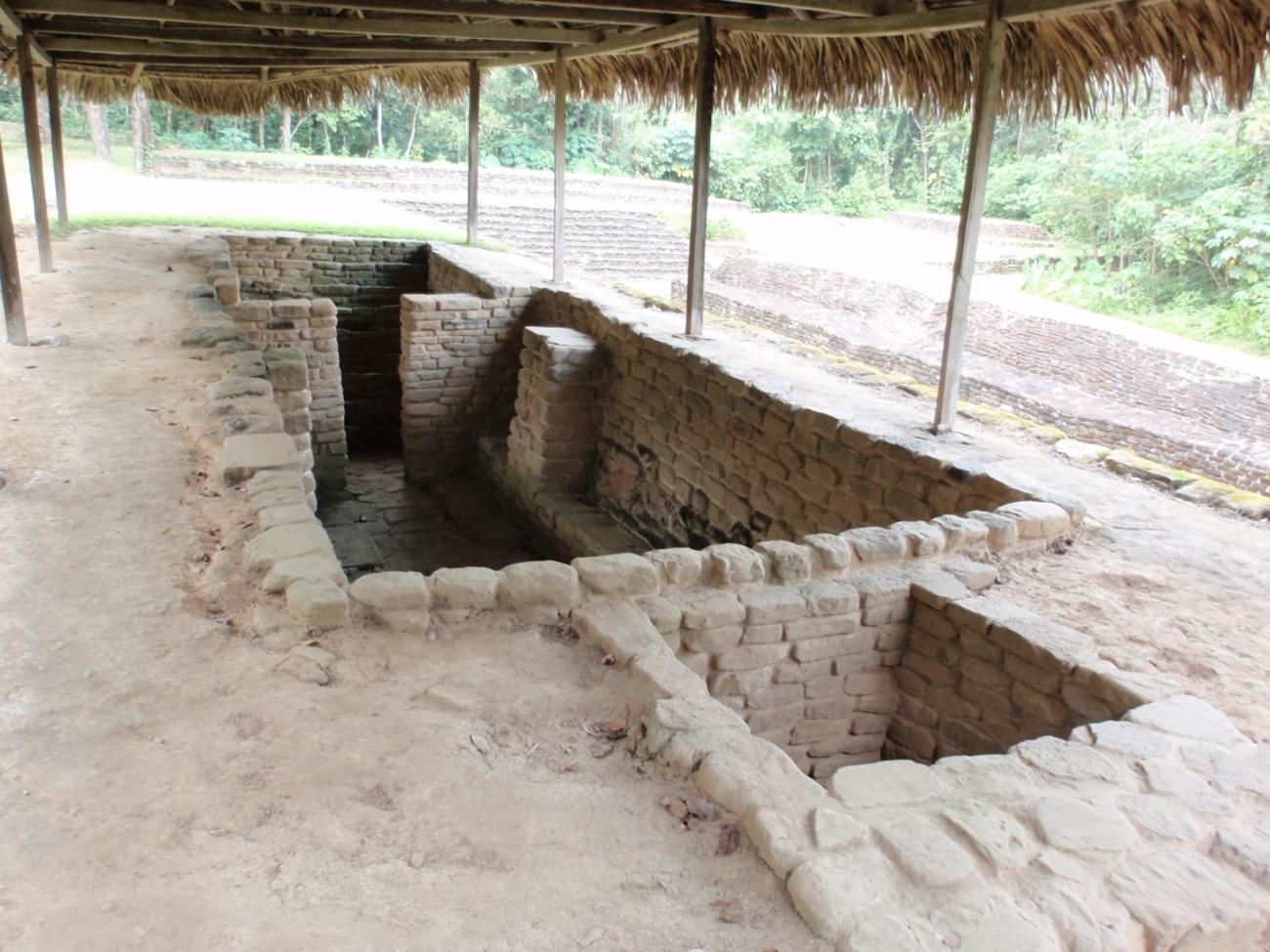
Steam bath: Associated with the ball game, a steam bath is located at the top of Structure 18. It is a subway enclosure 11.40 m long, 3.80 m wide and 1.79 m deep. It is provided with a steam room with lateral benches, flagstone floor, remains of mud used as plaster on the walls and a quadrangular space where the fire was lit to produce steam by throwing water on the southeast wall of the room. Its proximity to the Ballgame indicates that its sacred functions were linked to the ritual of the game.
Structure 18: It is a rectangular foundation that delimits the south side of a ball court. It is integrated to the peralte of the immediate superior terrace, reason why its height is variable; in the north facade it reaches 4.35 m of height, with four staggered bodies limited by three vertical walls of masonry and a wall in slope located in the second body. In the south façade the height is lower, barely reaching 0.50 m with only one vertical body, which at the same time delimits the Main Plaza. The interspaces between the walls and the top of the building have compacted earth floors. Only in the interspaces of the first body of the north façade was a flagstone floor found.
Structure 22: It is a rectangular structure with a maximum height of 3.90 m and closes the head of the Ball Court on the west side. It is composed of two stepped bodies of low height contained by vertical walls. On the west façade it presents a single body to compensate for the difference in levels on the ground. The west façade is covered by a stairway through which you can access from the court to the top of the building. Possibly it constituted the main ceremonial scene of the Ball Game in Malpasito.
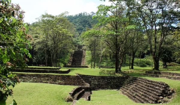
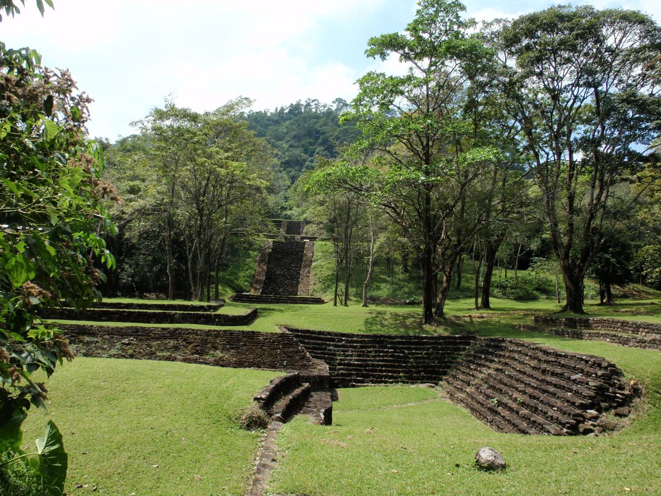
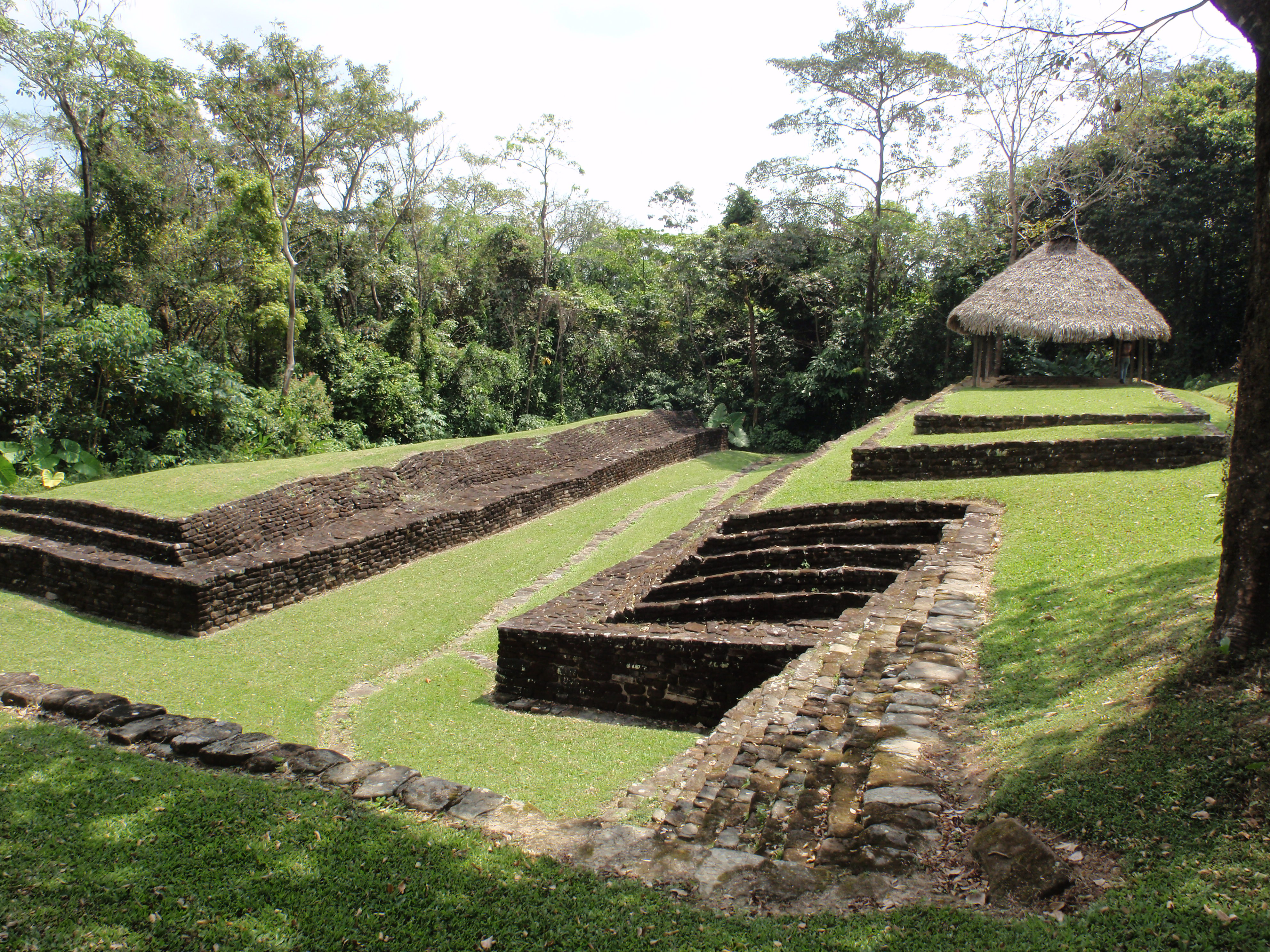
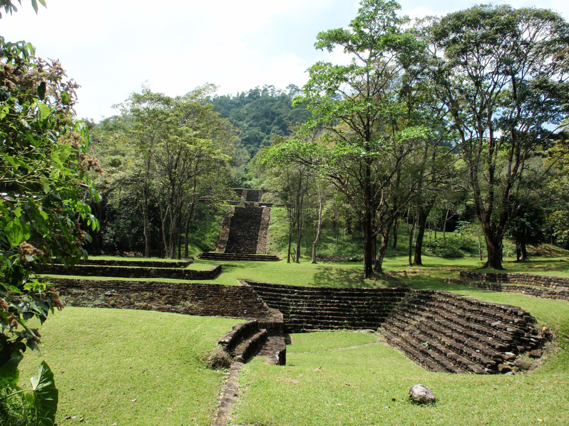
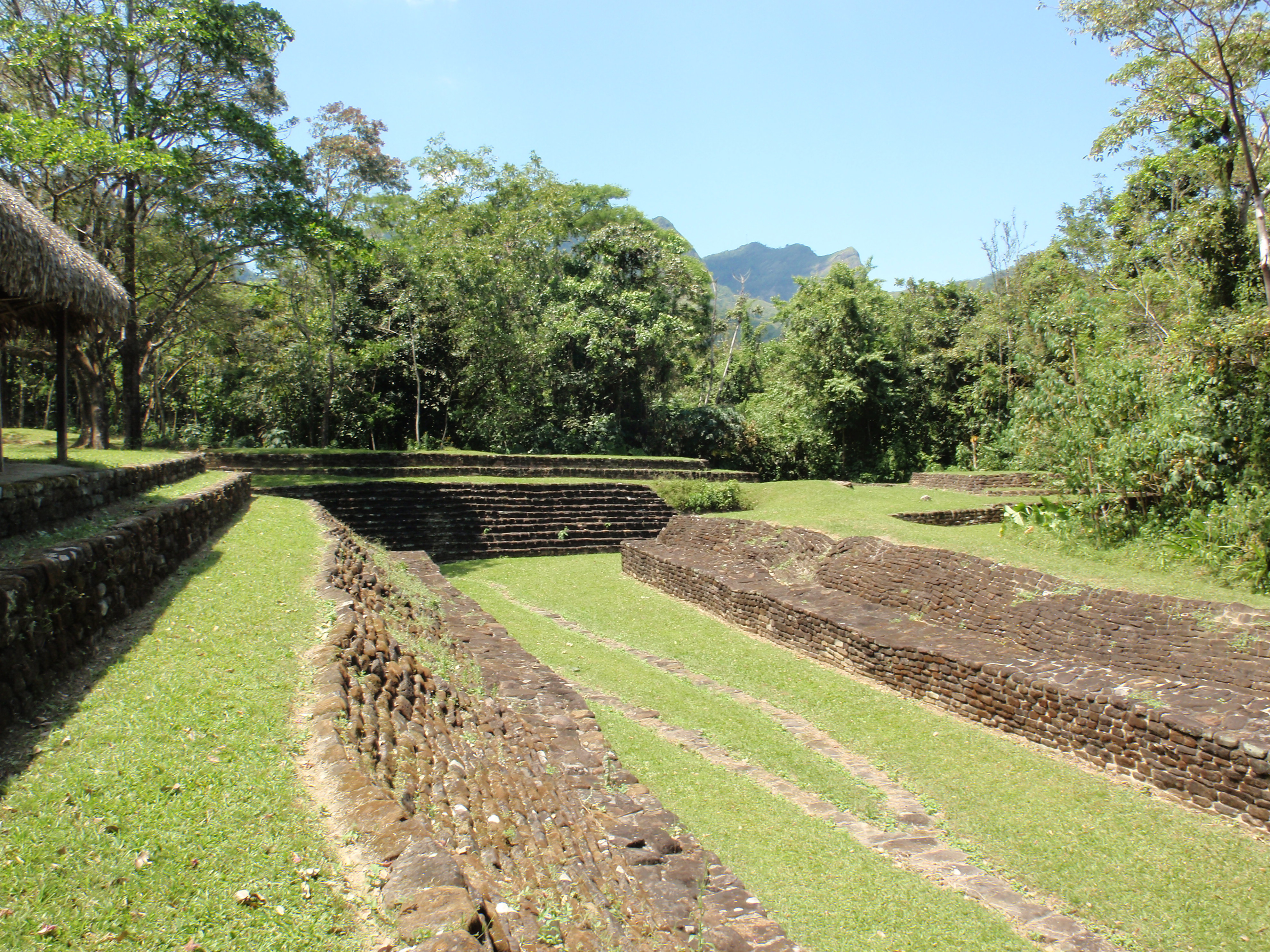
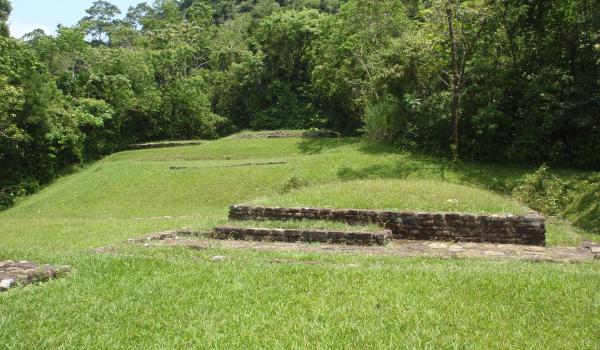
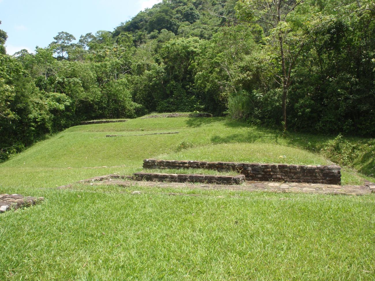
Plaza Principal
Located between the Ball Court and the South Plaza, it was the most important public space of the site.
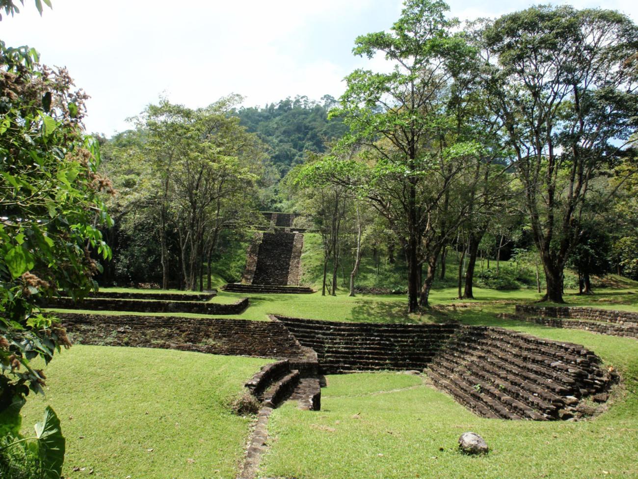
Located between the Ball Court and the South Plaza, it was the most important public space of the site. It occupies an approximate surface of 2,275 m2 and is delimited to the north and northeast by Structures 18 and 22, to the south by Structures 13, 16 and 17, to the northeast by Structure 28 and at the east and west ends it is open. During the 1999 season a quadrangular altar located in the center of the plaza was explored.
The photograph shows a view of the civic-ceremonial area: on the lower terrace the Ball Court, in the middle the Main Plaza, then the stairway of the South Plaza complex and above the stairway of Building 10, which leads to the Acropolis.
Building 28: It is located on the west side of the Main Plaza. At the top of the building there are rectangular masonry elements that functioned as pedestals for the wooden columns that supported the roof of perishable materials.
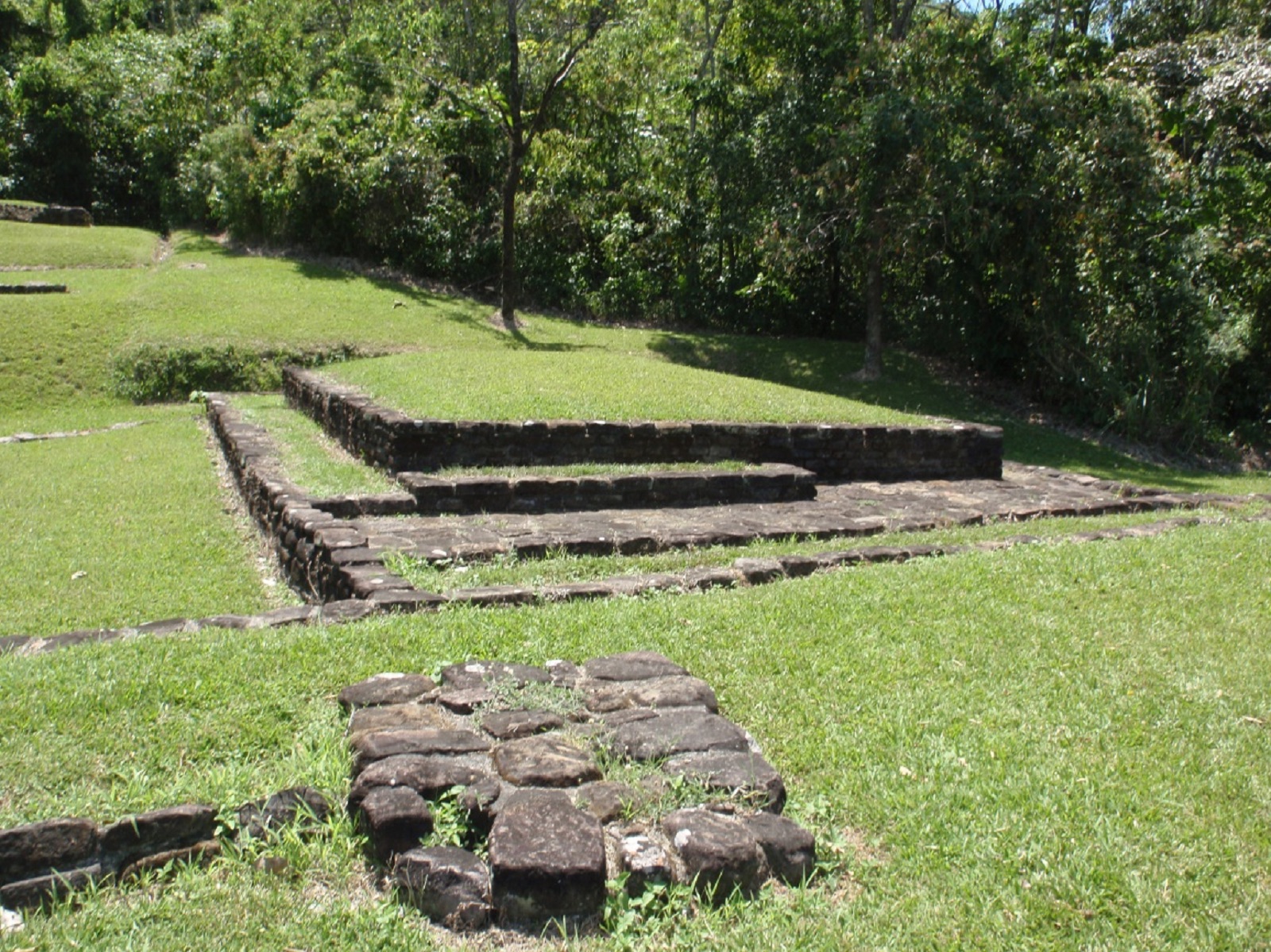
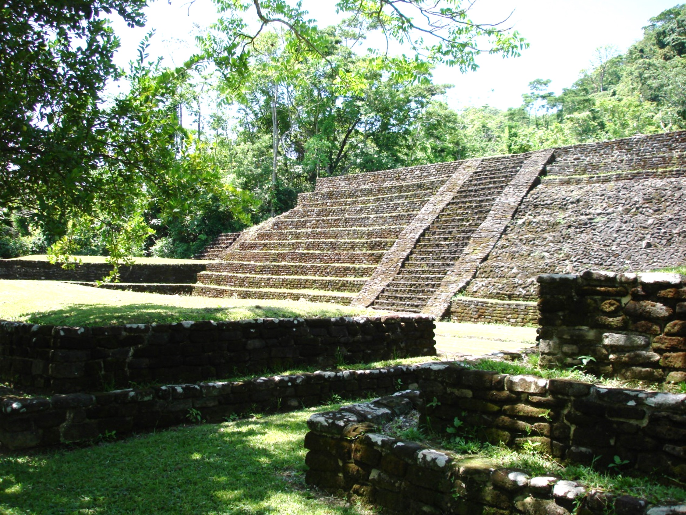
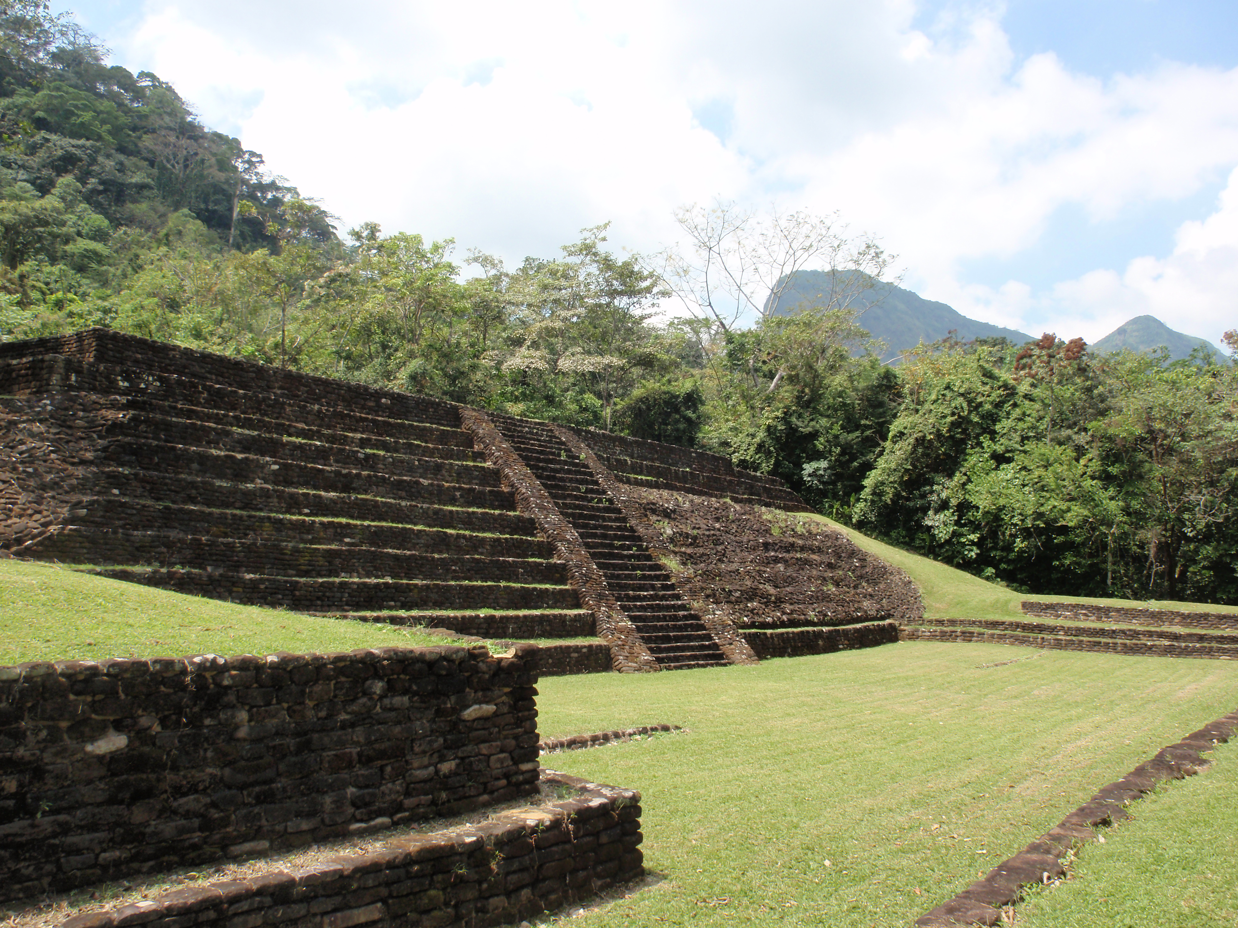
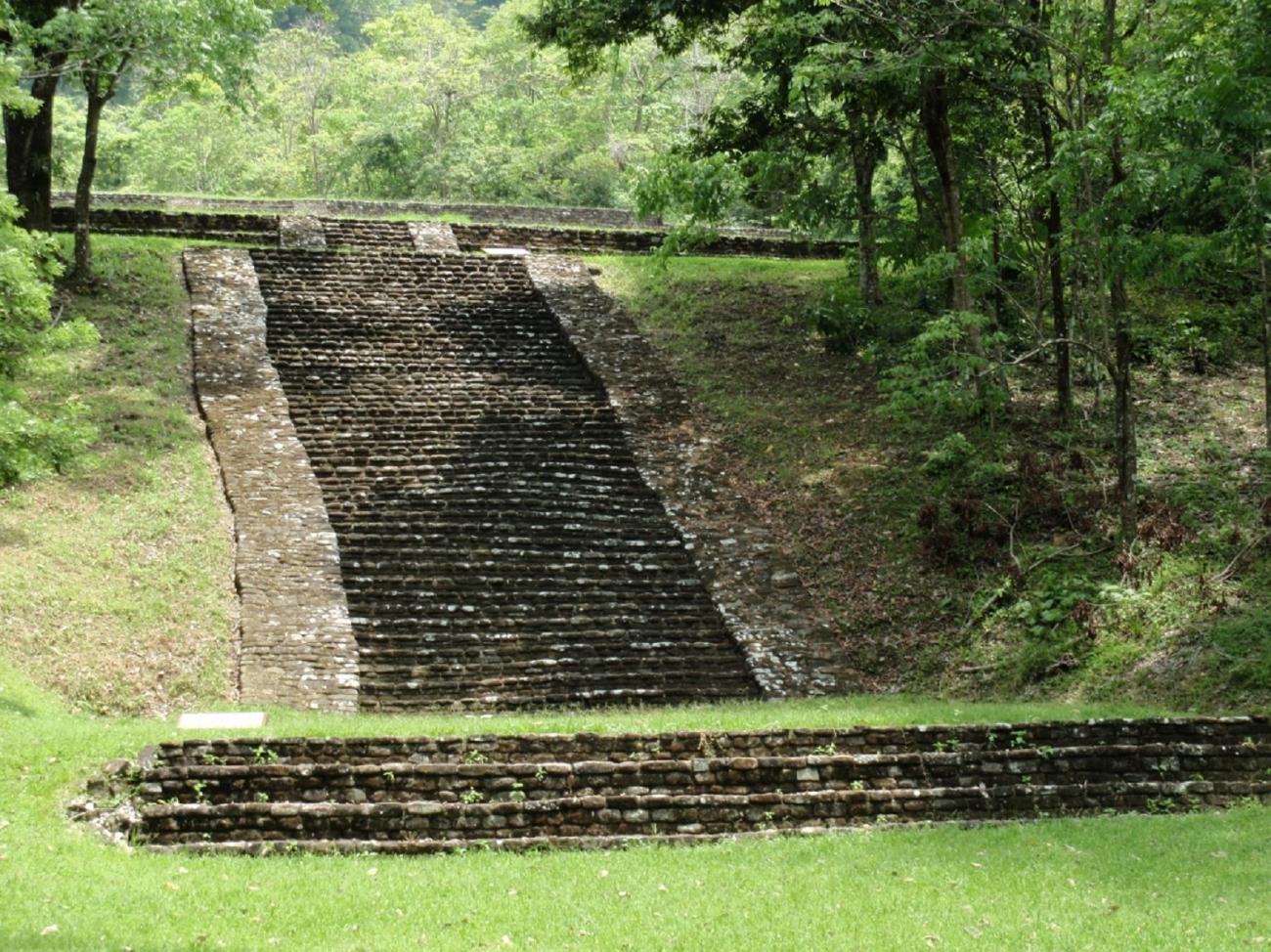
Structure 13: It is an elongated rectangular platform with a maximum height of 1.20 m, composed of two staggered bodies delimited by vertical masonry walls. The most important façade is located on the north side of the Main Plaza, occupies the upper part of the slope of the terrace and is provided with a large staircase divided into three sections: the first one starts from the level of the Main Plaza and leads to a wide vestibule, and the second one presents robust alfardas and leads to a narrow corridor that surrounds Structure 13 up to the lateral accesses of the South Plaza. Finally, the third section is a narrow stairway with alfardas that ascends to the top.
Associated with this building, five offerings composed of vessels deposited inside rectangular masonry boxes, covered with large rocks as lids, were discovered. These elements were built inside the core of the building between 10 and 15 cm below the floor, aligned on a longitudinal axis from east to west.
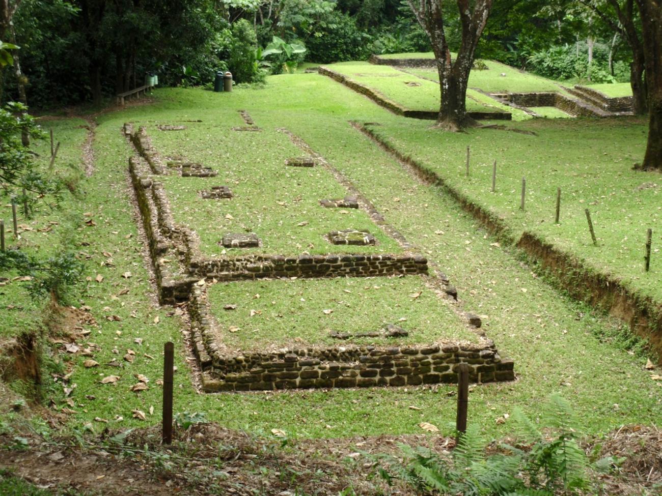
Structure 17: Located 20 m northeast of the South Plaza, it occupies a small terrace with an intermediate height between the Main Plaza and the South Plaza. This part of the terrain was excluded from the embankment works that originated the slope of the terrace. It is a rectangular platform affected on the west façade by the erosion of an adjacent gully; it is 7.20 m long by approximately 5.15 m wide. It is composed of a single body delimited by straight masonry walls, with a maximum height of 0.80 m. Inside, the ceramic and lithic material found was scarce and was deposited on a compacted floor of yellowish brown clay mixed with gravel.


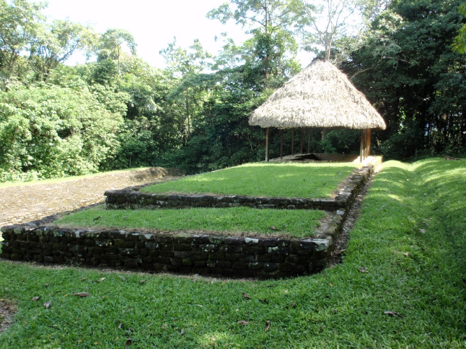
It has a surface area of 37 m long by 15 m wide and is divided into two levels. Of the four buildings that delimit it, Structures 10 and 13 stand out, both for their dimensions and location on the slopes of the terraces, and for the existence of an axis of stairways that, from the Main Plaza, allows access to the entire architectural complex. The accesses to the plaza are narrow corridors located in the southeast and southwest corners of Building 13. As a whole, the South Plaza was a space destined for civic-religious events with restricted access, unlike the Main Plaza.
Structure 10: Delimits the south side of the plaza and is attached to Structures 11 and 12. It is a 9 m high foundation, built on the slope of the third terrace of the archaeological site, in ascending order. It is composed of 11 staggered bodies, integrated by vertical masonry walls and separated by narrow interspaces; in the south, west and east facades the number of bodies varies from one to three according to the natural level of the terrain. The main access is located in the center of the north façade, where there is a stairway delimited by robust alfardas and 28 steps that go from the level of the plaza to the top of the building. At the top are seven aligned construction elements that functioned as plinths for the wooden columns that supported the roof made of perishable materials.
Acrópolis
Located on the two upper terraces of the site, it occupies a space of 3,600 m2. It is composed of Buildings 6, 7, 8, 9A and 9B, which are distributed around four courtyards at different levels.

Located on the two upper terraces of the site, it occupies a space of 3,600 m2. It is composed of Buildings 6, 7, 8, 9A and 9B, which are distributed around four courtyards at different levels. The exploration of Buildings 9A and 9B uncovered two rectangular platforms and a masonry drainage in the northeast courtyard. These constructions functioned as a residential unit, inhabited by the ruling group of Malpasito. Due to its location, it was a space out of visual reach but with ample visibility of most of the site.
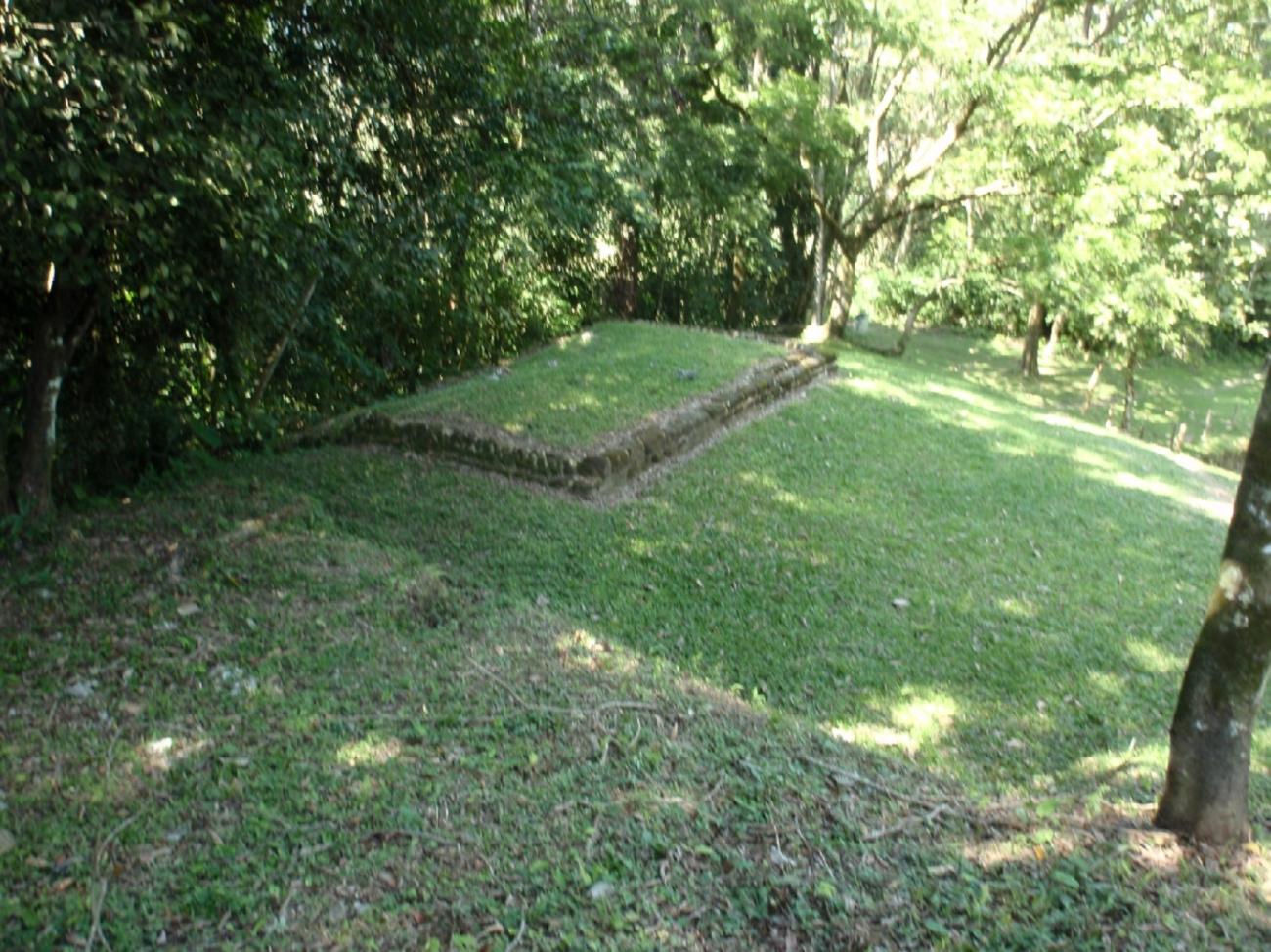
Structure 7: Located at the north end of the Acropolis, it is a rectangular structure with a maximum height of 0.75 m, composed of two staggered bodies. On its north side, it is integrated to Building 10 through a terrace covered by a floor of sandstone rocks, and a small sidewalk in the northeast corner that marks the access to the construction. This building was possibly used by the rulers to carry out some kind of private ceremony, since it is out of the visual domain from any point located on the lower terraces.
Structure 9A and 9B: Rectangular structures located at the south end of the Acropolis, composed of a single body partially covered by masonry walls that do not exceed 0.70 m in height. They are attached in a "T" shape, as functionally complementary enclosures of residential character, complemented with a rectangular patio in front of the north façade of both buildings and another one towards the west façade.
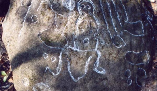
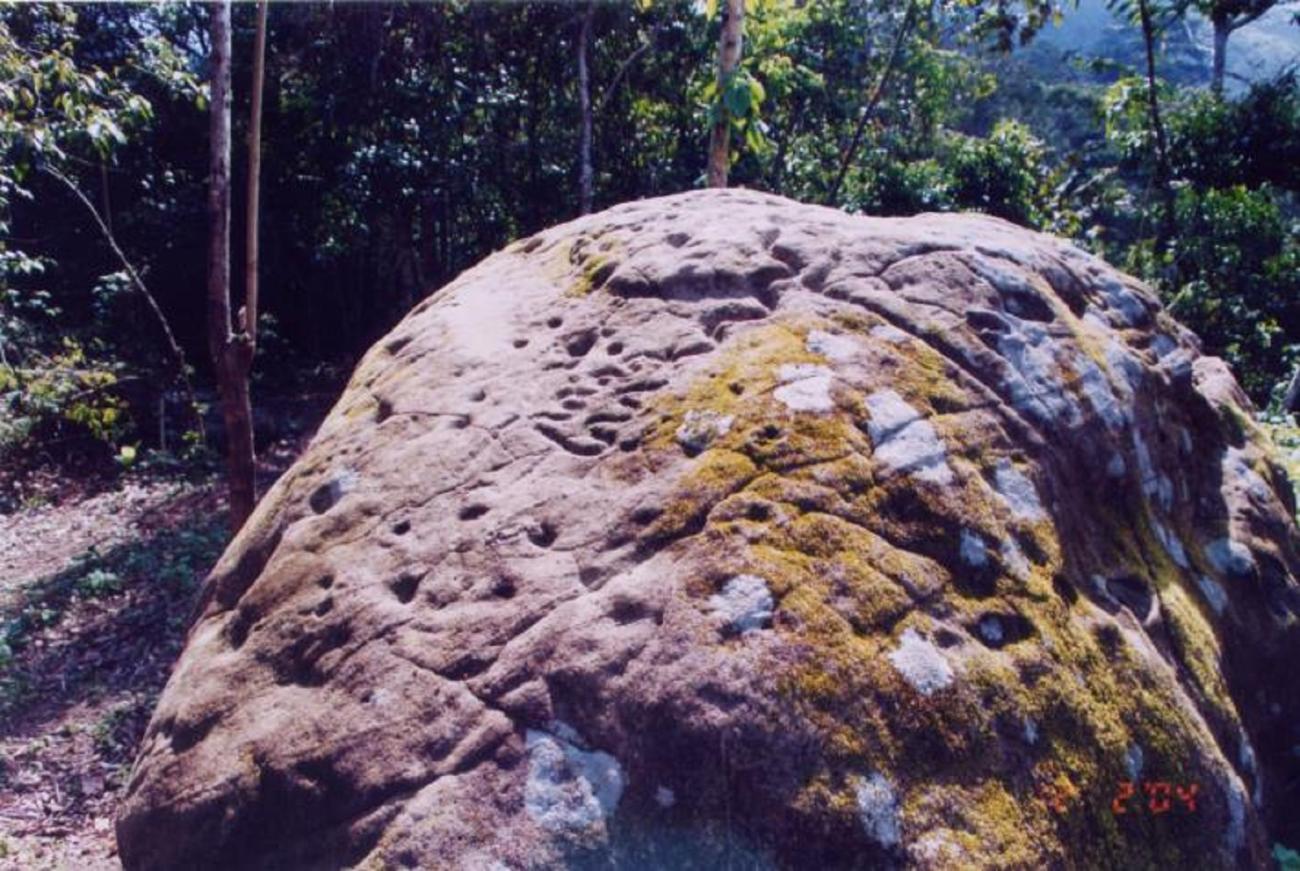
Petrograbado 13
It is located approximately 730 m north of the monumental area of the site. It is a sandstone rock 1.29 m long, 1.18 m wide and 0.79 m thick. It presents geometric, architectural and anthropomorphic designs. The engravings were made by percussion and wear.
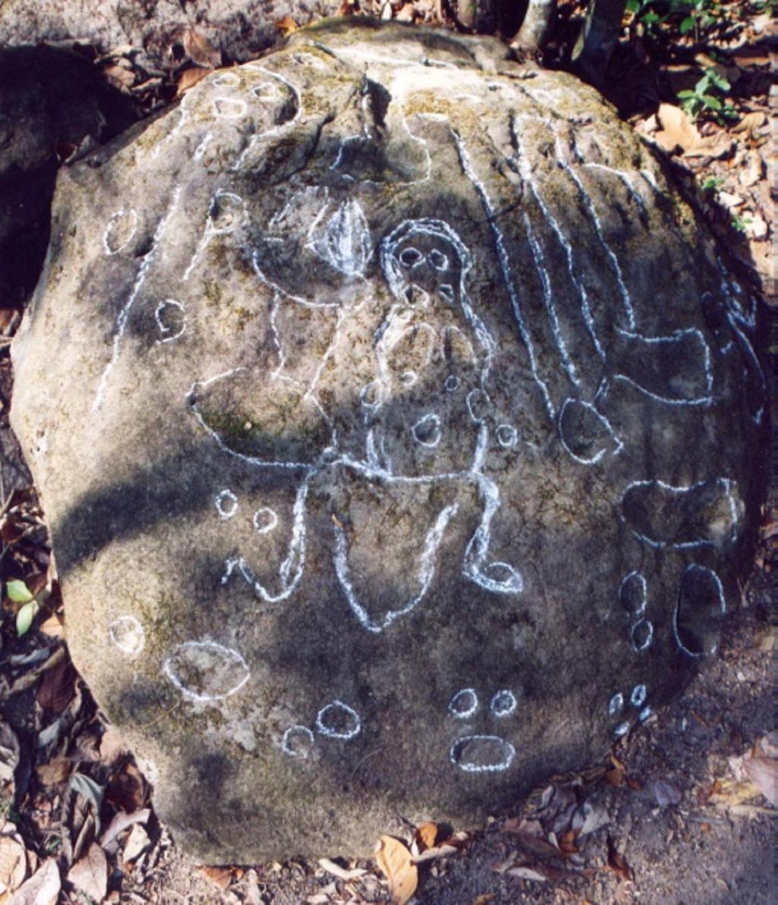
It is located approximately 730 m north of the monumental area of the site. It is a sandstone rock 1.29 m long, 1.18 m wide and 0.79 m thick. It presents geometric, architectural and anthropomorphic designs. The engravings were made by percussion and wear. The representation of an anthropomorphic character wearing a high headdress in the shape of a truncated cone with two pairs of aligned points stands out. The face of the character is oval and has eyes indicated by two small circular cavities; another slightly larger cavity indicates the mouth, it has no nose and the neck is not differentiated. Three curved lines outline in a simple way the upper extremities and the contour of the chest. Towards the left side of the personage there are two hollows in the shape of "I" that resemble ball courts. To the left there is another face, apparently anthropomorphic, with the eyes and mouth represented by simple cavities; in the lower part of the face there are straight lines and dots, as if they were coming out of the neck of the personage. Towards the right side of the personage, the designs consist of hollows and lines, in addition to points located in a dispersed way throughout the rock. In the lower right part of the central character, there are two representations composed of depressions that indicate the eyes and the mouth.

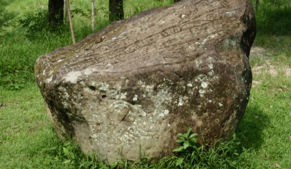
Petrograbado 36
It was located approximately 700 m north of the monumental area of the site. It is a sandstone rock 1.46 m long, 1.17 m wide and 0.76 m thick, with geometric, anthropomorphic and zoomorphic designs engraved by percussion and wear.
It was located approximately 700 m north of the monumental area of the site. It is a sandstone rock 1.46 m long, 1.17 m wide and 0.76 m thick, with geometric, anthropomorphic and zoomorphic designs engraved by percussion and wear. There are 10 human faces represented with simple strokes and dots to indicate the facial contour, eyes and mouth. There are also feline prints represented by a semicircular hollow and four or more dots for fingerprints. Straight and curved lines combined with dots complement an abstract design.
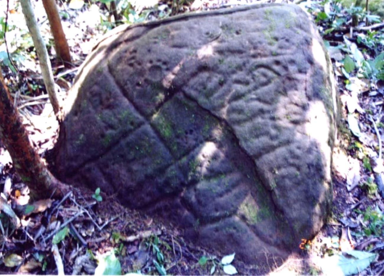
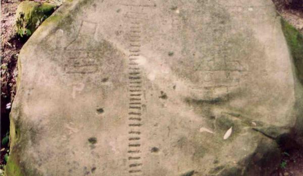
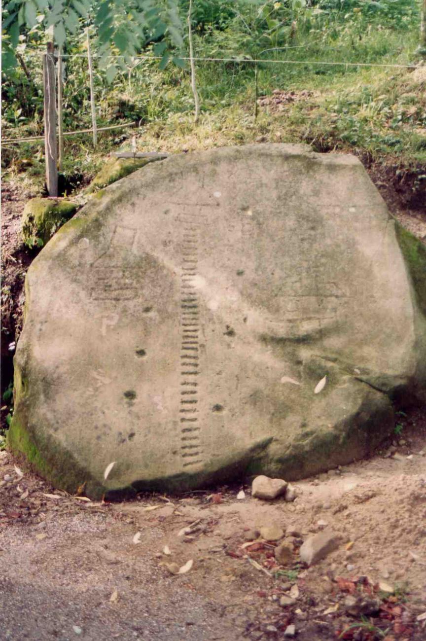
Petrograbado 42
Located approximately 730 m north of the monumental area of the site, it is a sandstone rock 3.70 m long, 2.70 m wide and 1.76 m thick, with geometric and architectural designs.
Located approximately 730 m north of the monumental area of the site, it is a sandstone rock 3.70 m long, 2.70 m wide and 1.76 m thick, with geometric and architectural designs. The engravings were made by percussion and wear, they have the form of straight lines, curves, onculants, points and hollows. Two designs in the form of "I" stand out, possibly related to the courts for the ball game. There are also parallel horizontal lines that form a design similar to a ladder; below one of these "ladders" there is a simple anthropomorphic face, represented by dots that form the eyes and, below them, a horizontal line that resembles the mouth.
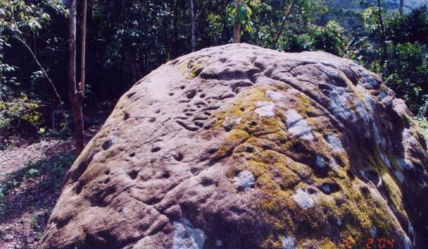
Petrograbado 112
It is located 400 m southwest of the site along a path that leads to the Madrigal waterfall. It has architectural representations that illustrate the elevation of the buildings, mainly the form of the roofs.
It is located 400 m southwest of the site along a path that leads to the Madrigal waterfall. It has architectural representations that illustrate the elevation of the buildings, mainly the form of the roofs. The petroglyphs were made in sandstone rock and constituted one of the forms used by the ancient inhabitants of Malpasito to transmit public messages according to a common code of meanings that reflects the interaction of the society with its natural environment.
Petrograbado 130
Recovered during the construction of the Ocozocoautla-Las Choapas highway at kilometer 122, it was moved and deposited at the access to the archaeological zone. It is a sandstone rock 2.90 m long by 2.00 m wide and 2.11 m high.
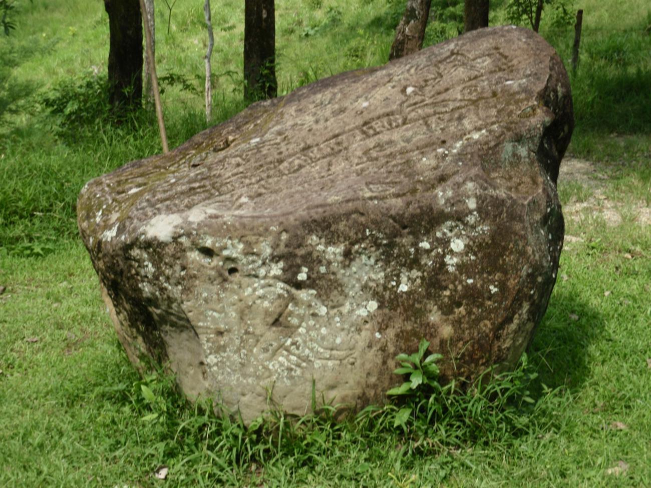
Recovered during the construction of the Ocozocoautla-Las Choapas highway at kilometer 122, it was moved and deposited at the access to the archaeological zone. It is a sandstone rock 2.90 m long by 2.00 m wide and 2.11 m high. It presents engraved designs by means of the technique of percussion and wear among which the representation of a stylized deer stands out, as well as faces, possibly anthropomorphic, delimited by incisions; the eyes are indicated with points and the mouth with a groove. Spirals, straight and curved grooves combined with rows of dots are also observed.