


Dzibilchaltún
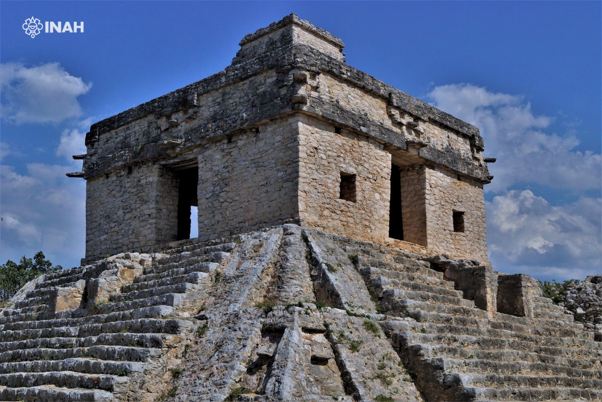
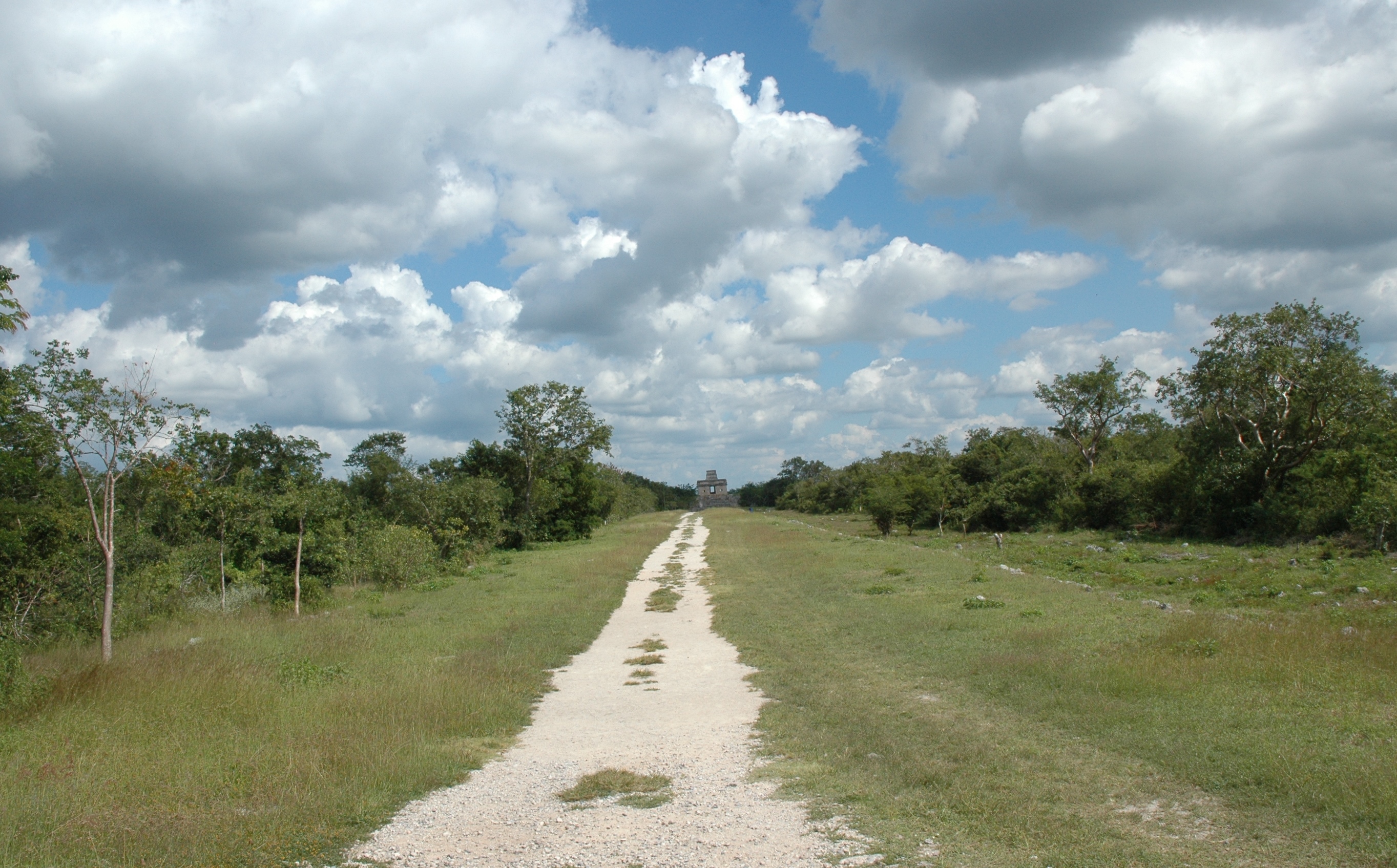
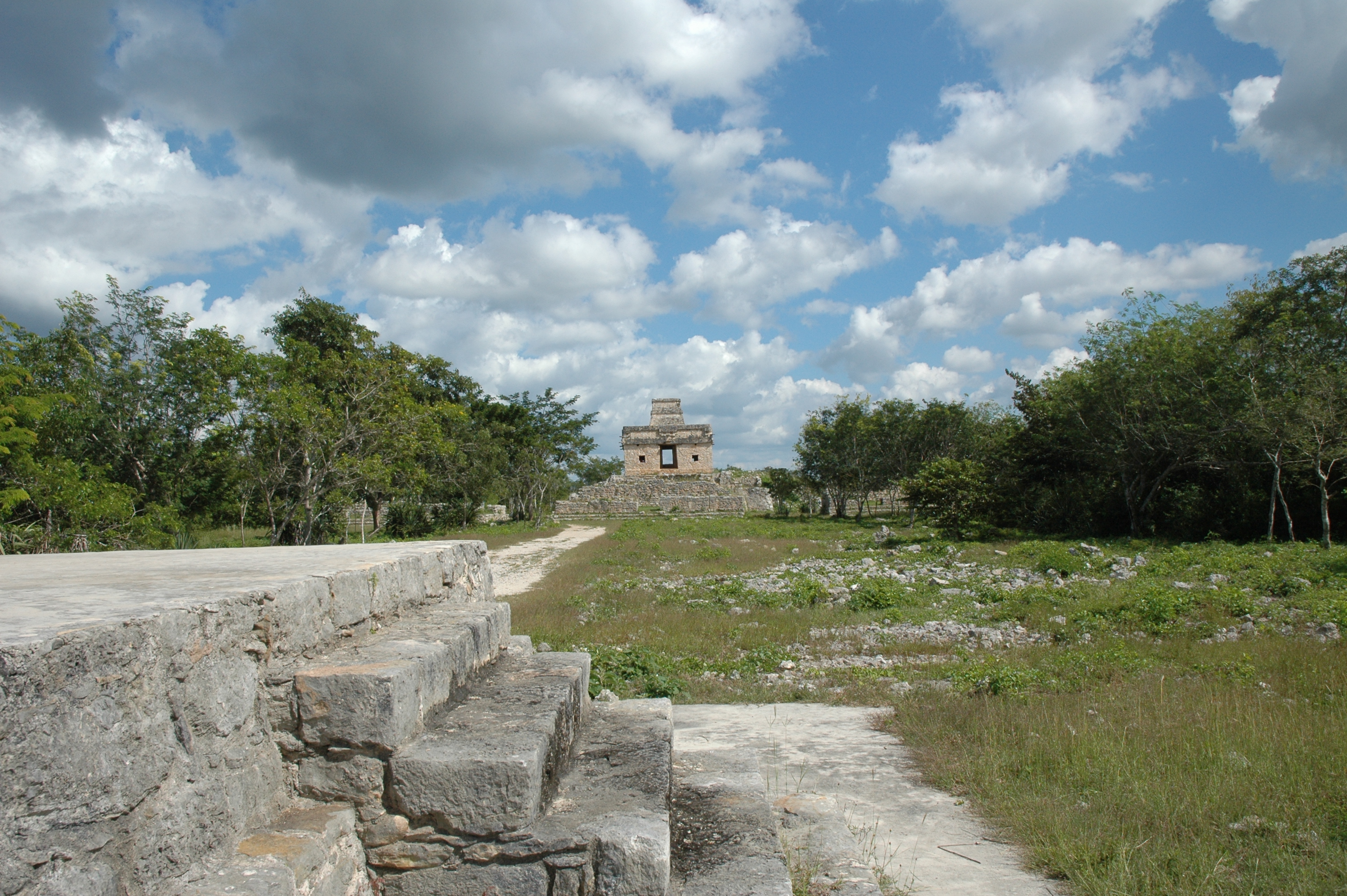
The Temple of the Seven Dolls attracts hundreds of visitors at the spring and fall equinoxes, when the sun shines through the building and illuminates the doorway. There are numerous admirable stelae, beautifully carved, and an open cenote (underground pool) with crystal clear waters.
The Dzibilchaltun archaeological site is situated seven and a half miles to the north of the city of Merida, in the state of Yucatan. The area of the site approaches eight square miles and it includes the remains of various pre-Hispanic settlements of different periods. The Central Plaza as it is found today dates from a period of occupation in the Late Classic period, between 850 and 1100 AD. However, much older buildings that were buried by the infill of more recent buildings were discovered during the survey of the structures surrounding the Xlacah Cenote, and these are from the Middle Preclassic period, probably dating around 600 BC. Despite the fact that the center of the site which we now know as Dzibilchaltun was occupied from early times, there was a much larger and more influential city called Komchen a few miles to the northwest. Komchen dominated the northwest region of the Yucatan peninsula in the final stage of the Postclassic period and for much of the Classic, probably owing to its extraction and trading of salt, an important resource which was exchanged for jadeite from the Motagua River region on the present-day border between Guatemala and Honduras, as well as for ceramics from the central Petén and the west of Chiapas.
Dzibilchaltun had taken over control of the northwest region of the peninsula from Komchen by the end of the Classic. A large population, possibly close to 25,000, lived in the vicinity of the ceremonial city center organized around three large plazas and five long avenues paved with limestone mortar, which is why they are known in Maya as sacbeob, or sacbe in the singular, literally meaning "white roads." It is likely that during the Late Classic (around 800 AD), the name of the site might have referred to "the five that spring from the mouth of the celestial serpent," which alludes to the divine tetrarchies which inhabit the various regions of the world according to pre-Hispanic thought, such as the four k’awiles, bacabes or pahuatunes which live in the four points of the sky. In this case it could refer to a group of five deities associated with the Milky Way, which is sometimes described as a heavenly snake that dwells in the night sky. The fact that the urban plan of the Late Classic settlement includes a system of paved roads whose orientation fits with the four points of the compass on a symmetrical pattern which emerges from two central plazas suggests that the name of the city was derived from its shape.
The investigation of Dzibilchaltun fell into two important periods. The first was led by Edward Wyllys Andrews IV, a US archaeologist, who, before the Second World War, directed the compilation of one of the first maps of Mesoamerica in conjunction with George Sturt of the National Geographic Society. Then at the end of the 1950s, Andrews returned with a team of researchers from the Middle American Research Institute of the University of Tulane, in addition to staff from the National Geographic Society working under the supervision of the National Institute of Anthropology and History (INAH). Over the period of a decade of work in the area, this team of researchers carried out underwater archeology in the Xlacah Cenote and restored the Templo de las Siete Muñecas ("Temple of the Seven Dolls") as well as mapping an area of over 12 square miles. The second period of exploration has been directed by Rubén Maldonado Cárdenas, a Mexican archeologist who has dedicated a substantial part of his professional career to Dzibilchaltun since the late 1990s. Practically all of the structures around the Central Plaza were excavated and consolidated by his team over a twenty-year period. Of particular note was the burial of Kalomte’ Uk’uw Ux Chan Chaak, an important Late Classic period monarch.
The Temple of the Sun or House of the Seven Dolls, named after the seven ceramic human figures found during the excavation of the site in the 1950s, is a square-based pyramid comprising two bodies, of medium height and with broad and well-worked steps on the four sides culminating in an elegant roofed temple with doors facing east and west. At dawn on the spring and autumn equinoxes of 21 March and 21 September respectively, a powerful beam of sunlight crosses both doors of the shrine at the top for an instant. It was believed that this was a sign sent by Kinich Ahau, the sun god, to indicate the time for sowing or harvesting. The Mayan astronomers and builders took great care to ensure that this marvel worked.
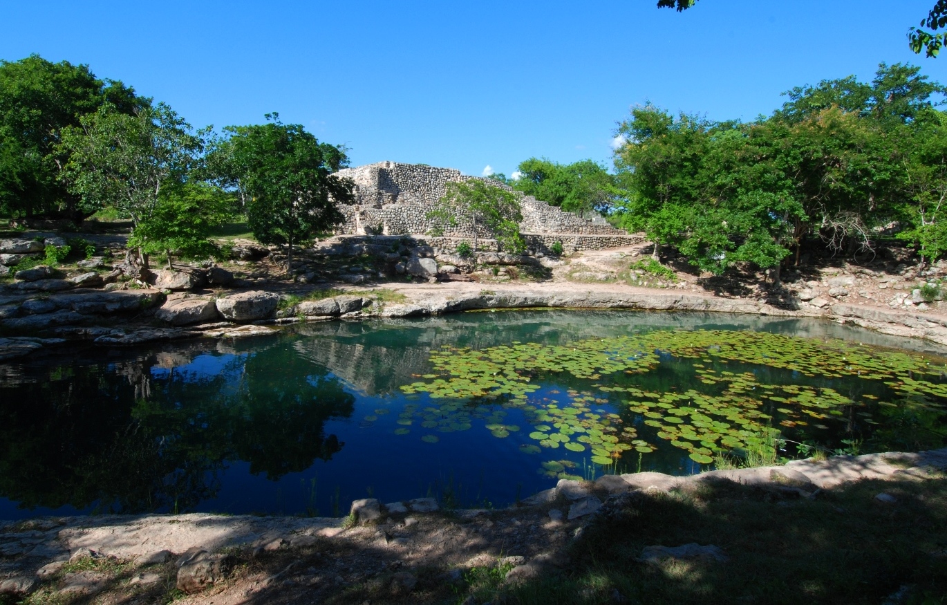
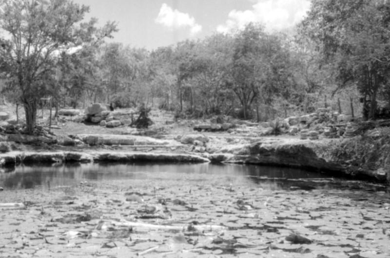
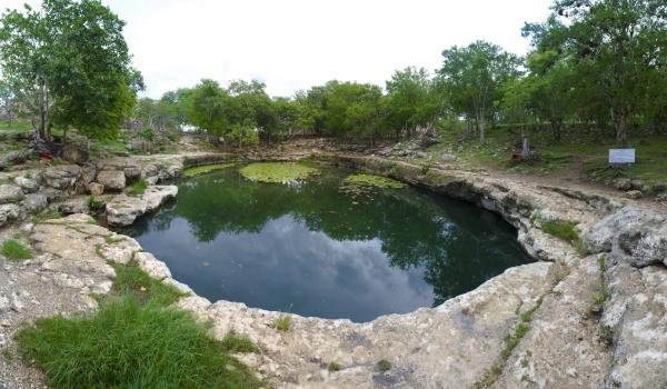
Of the city’s stone-surfaced roads connecting the center to the periphery, there is a long road connecting the city center to other complexes in the surrounding area, especially the shrine of the great stele, with its great stairway, the excavated residential complex of Group 4, and the pyramidal structures which line its route to the crystal clear waters of the Xlacah Cenote, which means “old town” in Maya. The cenote, which measures 130 feet wide by 330 feet long, with a depth of 130 feet, is one of the largest of the peninsula and archeological finds, principally ceramic vessels, have been discovered inside it. Before reaching the cenote the route takes visitors through a notable open chapel built by the Franciscans in the sixteenth century, soon after the Spanish conquest. The final essential stop on the itinerary is a visit to the rich and well laid-out Museum of the Mayan People.


- Dirección del Centro INAHVictor Arturo Martínez Rojasvictor_amartinez@inah.gob.mx+52 (999) 913 4034ResponsableIlan Vit-Suzanilan_vit@inah.gob.mx+52 (999) 922 0193
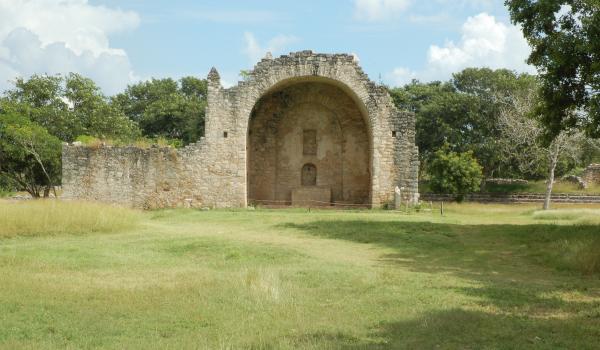
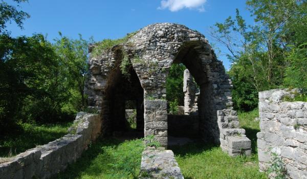
Capilla abierta
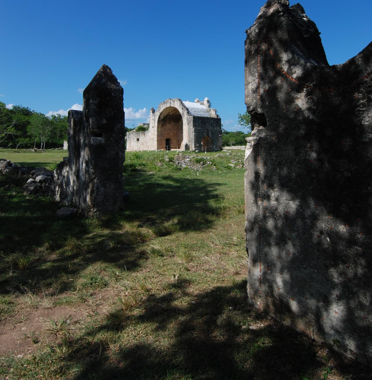
Religious structure built by the Spaniards at the end of the XVI century in the middle of the Central Plaza of the old pre-Hispanic settlement. It consists of a large stone apse and is covered with a barrel vault where the Christian altar was housed.


Religious structure built by the Spaniards at the end of the XVI century in the middle of the Central Plaza of the old pre-Hispanic settlement. It consists of a large stone apse and is covered with a barrel vault where the Christian altar was housed. It also has an elongated platform that ends in a semicircle in front of the altar.
Estructura 46
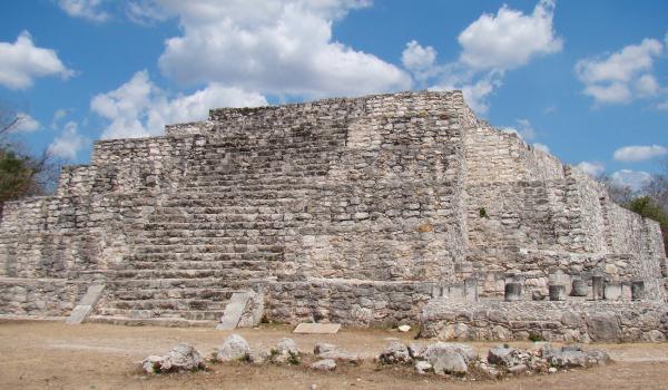
It is the highest pyramidal base of the site. It is located against the corner of the long Structure 44, in the southwest sector of the Central Plaza.

It is the highest pyramidal base of the site. It is located against the corner of the long Structure 44, in the southwest sector of the Central Plaza. Up to this moment it has not been completely excavated and consolidated, behind its main facade, the east, a substructure with slopes similar to those of the Temple of the Seven Dolls was discovered, whose style keeps certain reminiscence with the great slopes of the main Temples of Tikal. The rear façade, the western one, defines a short sacbé that connects the cenote with the ball game.
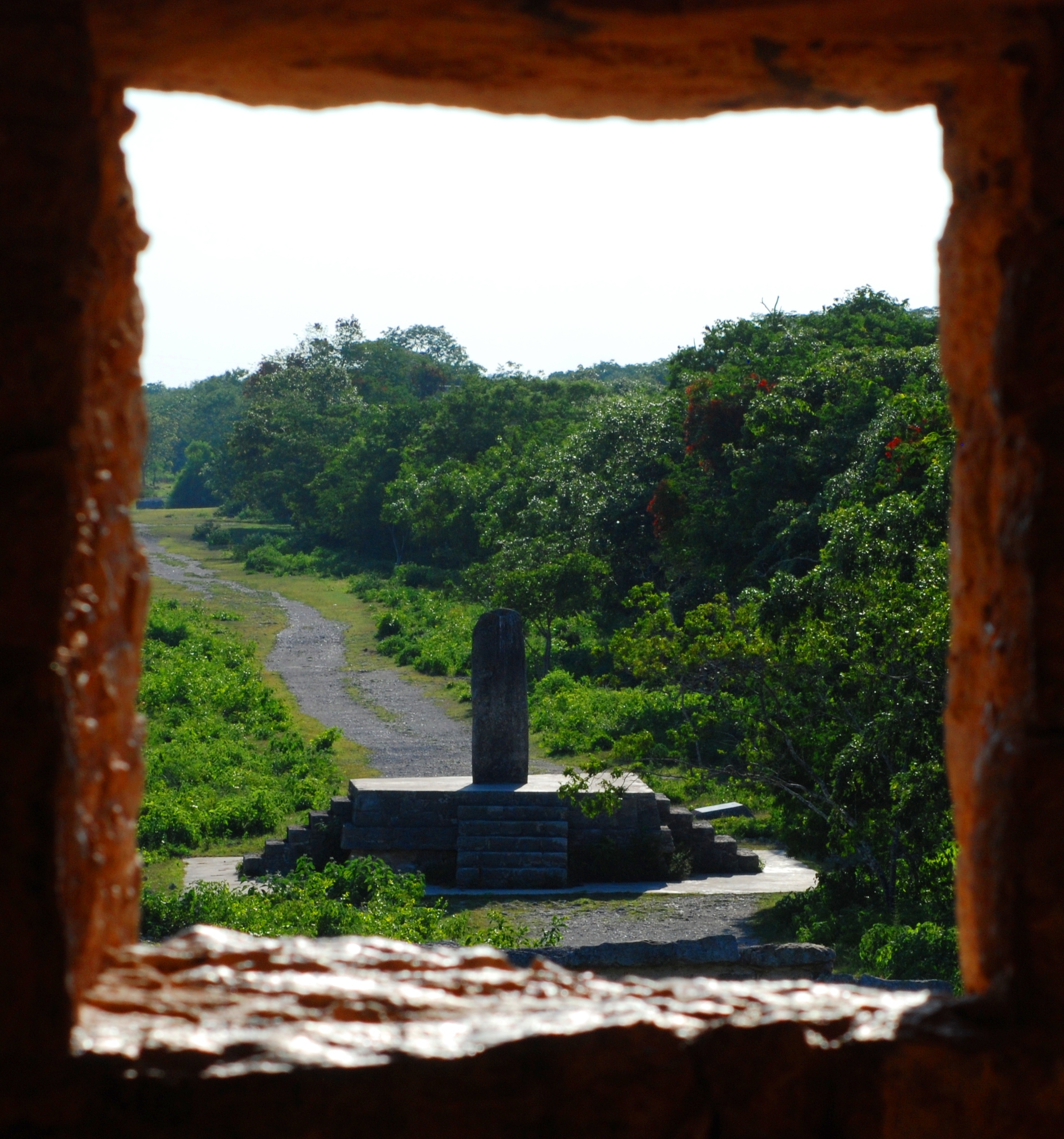
Estructura 48
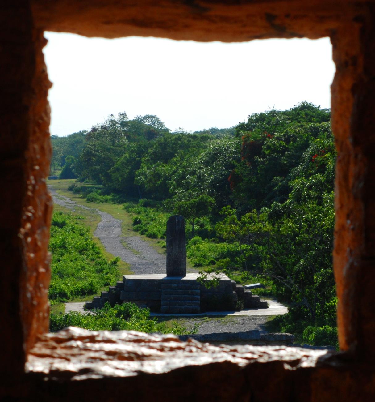
It is part of an arrangement of three small square platforms, of low height, on which a plain stela was placed, preserving the same orientation in each one of them. This means that it is an alignment of three altars and that the front of the stelae is perpendicular to the alignment axis.


It is part of an arrangement of three small square platforms, of low height, on which a plain stela was placed, preserving the same orientation in each one of them. This means that it is an alignment of three altars and that the front of the stelae is perpendicular to the alignment axis. This last one has a north-south orientation, practically perpendicular to the sacbé that leads to the Temple of the Seven Dolls. The altars are located on the east side of the central plaza. Structure 48 is the altar in the center.
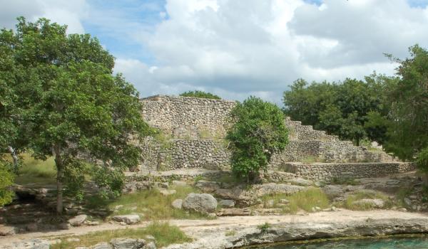
Cenote Xcalah
It is the largest of the three cenotes at the site and was an important source of water supply. Ritual objects used for self-sacrifice were found in its interior, due to the belief that the cenotes served as access portals to the underworld.


Estructura 36
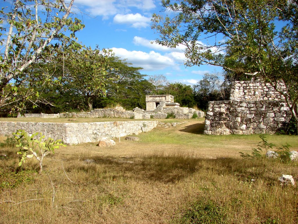
This structure is one of the tallest buildings in the Central Plaza. It is made up of five superimposed bodies, a central stairway and a frontal platform that houses small shrines open to the plaza.

This structure is one of the tallest buildings in the Central Plaza. It is made up of five superimposed bodies, a central stairway and a frontal platform that houses small shrines open to the plaza. The whole structure has a different alignment from the rest of the buildings in the Central Plaza. Its deviation, close to 15º, recalls the alignments of Teotihuacán or Uaxactún. At the top of the main structure there was a temple with masks and sculptural elements similar to the Puuc style, although with a greater stylistic influence of Chichén Itzá. In a substructure, buried by the filling of the front platform, two stelae commemorating the period of rule of Kalomte' Uk'uw Ux Chan Chaak were reused. One of them was cut in two parts, just at the height of the ruler's face. The fragment with the body was placed horizontally, as if it were at rest, while the head was placed vertically on top. The original stela is located in the Museo del Pueblo Maya, inside the Dzibilchaltún Archaeological Zone.
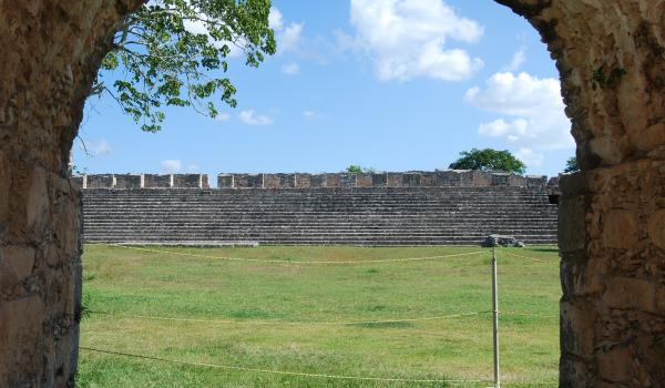
Juego de Pelota
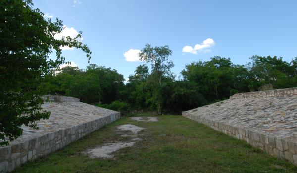
Although this structure does not differ from other spaces for the ball game in the Maya area, its location in the urban system of Dzibilchaltún is very special.


Although this structure does not differ from other spaces for the ball game in the Maya area, its location in the urban system of Dzibilchaltún is very special. It is important to highlight the relationship of this structure with the Cenote Xlacah and the Central Plaza, as well as with the two sacbeo'ob located in the northern part of the plaza, with an east-west alignment. This relationship is important, since in pre-Hispanic thought the flow of the sun across the sky is divided into three transcendent moments, each associated with a cardinal direction: sunrise is identified with the east, sunset with the west, the position of the sun at the zenith with the north and, in addition, the south corresponds to a position of the sun at the nadir. The latter means that the southern region represents the underworld, the interior of the earth, where the twin heroes of the Popol Vuh play ball with the lords of death, to later emerge triumphant as the sun and the moon. In Dzibilchaltún, this mythological conception was built into the urban environment, since the ball game is located south of Cenote Xlacah, a portal to the underworld.
Estructura 44
This is one of the longest archaeological buildings in the Maya area. It is made up of four superimposed bodies whose length reaches 130 meters and its height exceeds 10 meters.

This is one of the longest archaeological buildings in the Maya area. It is made up of four superimposed bodies whose length reaches 130 meters and its height exceeds 10 meters. At the top, a series of long spaces were built, open to the Central Plaza through a sequence of openings that resemble an elevated portico. The building was constructed in stages. The oldest is located near the Cenote Xlacah and possibly corresponds to the end of the Preclassic period (around 600s BC). Later it was extended to the east, increasing its length until it reached its present dimension. This increase must have corresponded to the end of the Classic (800). The building also presents another substructure that was preserved after the archaeological exploration works, near the midpoint of the long building. This substructure preserves a charcoal drawing of a procession of characters in profile. Given its fragile state of preservation, this substructure is not open to the public.
Templo Parado
It is known by the name of Templo Parado because it was the only building that was preserved in 1941. It presents early architectural characteristics and some traces of the Puuc style.


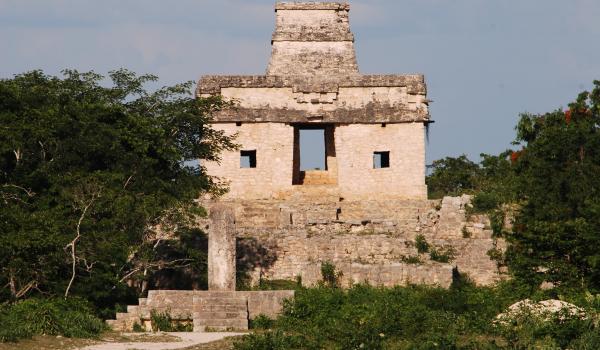
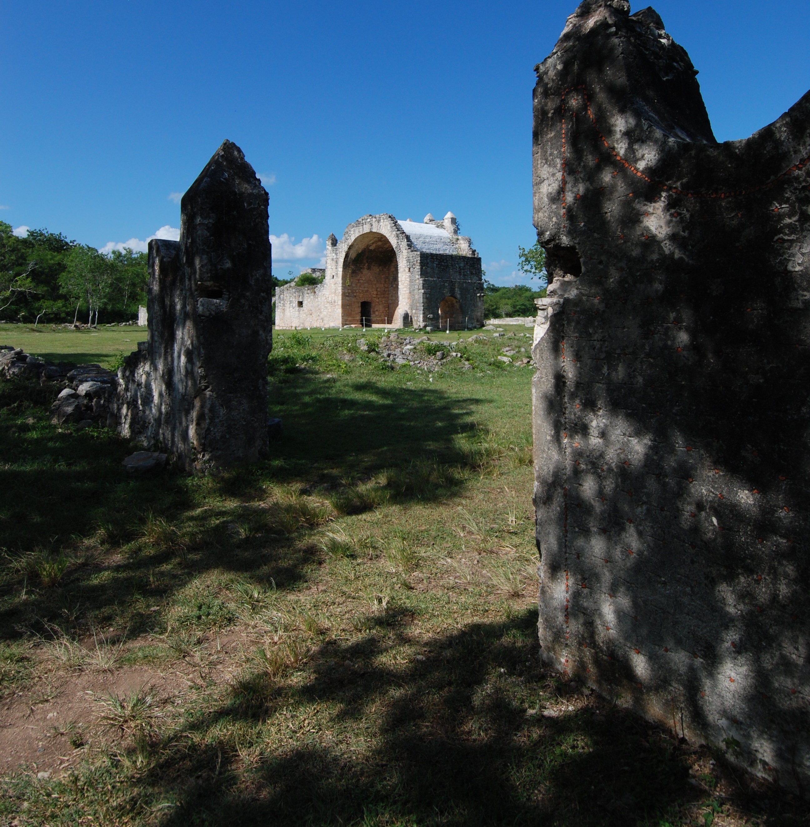
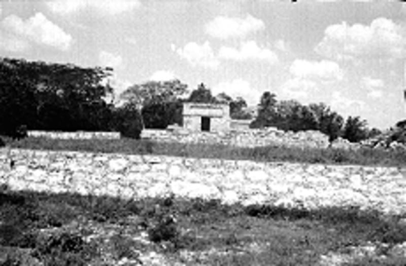
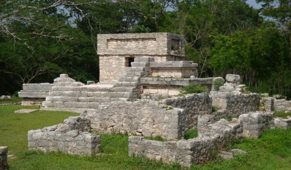
Templo de las Siete Muñecas
Building from the end of the Middle Classic period (around the year 750), whose architectural typology and alignment with the four cardinal points suggest an astronomical and calendrical function.

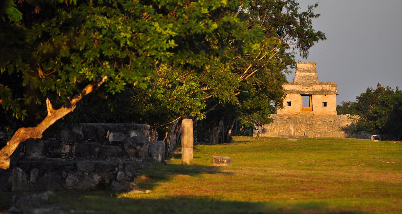


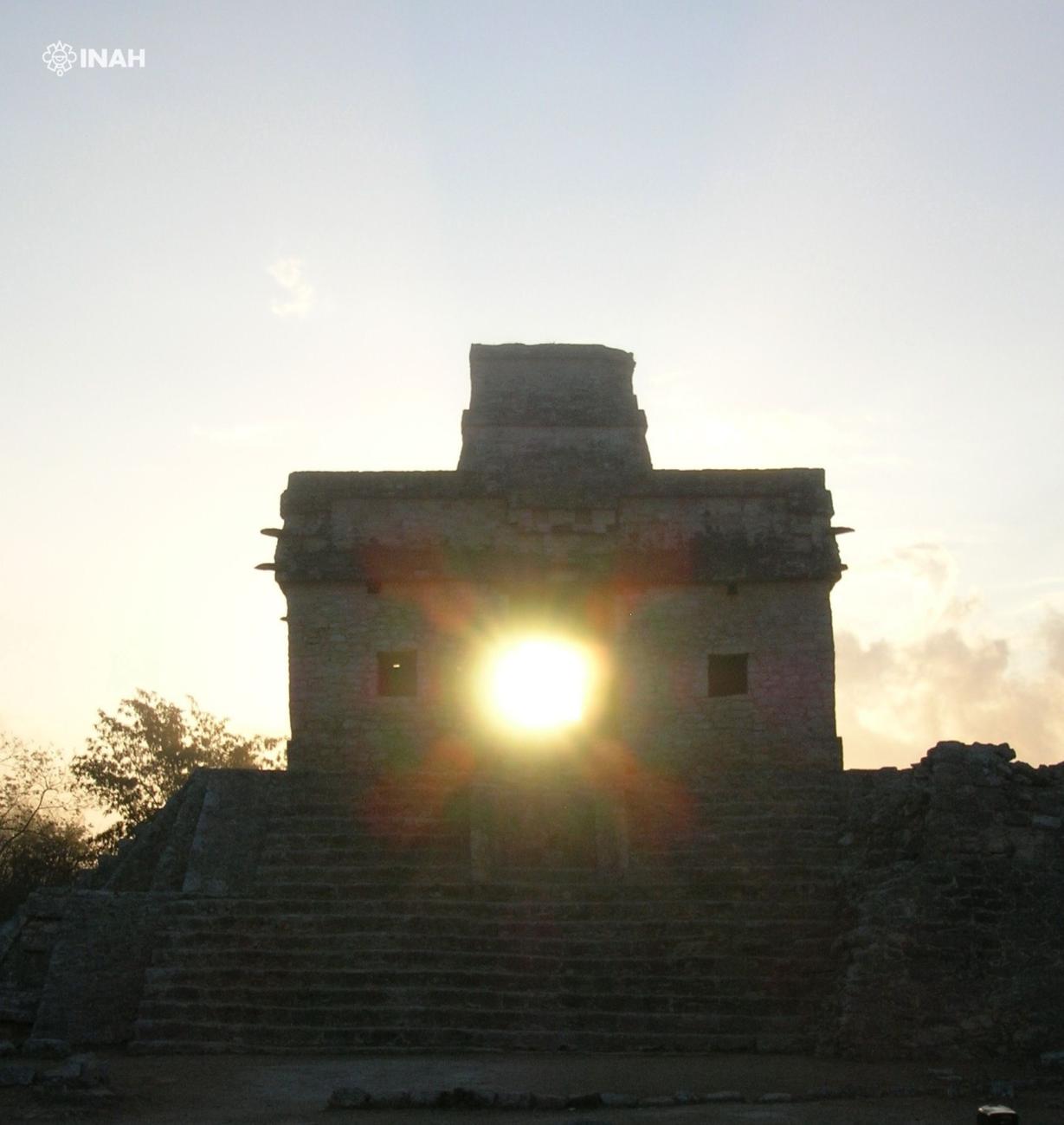
Building from the end of the Middle Classic period (around the year 750), whose architectural typology and alignment with the four cardinal points suggest an astronomical and calendrical function. The quadrilateral plant of the building is practically aligned with the cardinal points, only has a deviation of 4º east of north, making that the thresholds of the west and east facades, as well as those of the central room, have an alignment that allows to glimpse the dawn during the days near the equinox from the main sacbé and certain structures in the northeast corner of the Central Plaza. These conditions have made the Temple of the Seven Dolls a unique building in the Maya Area.