


Xpuhil
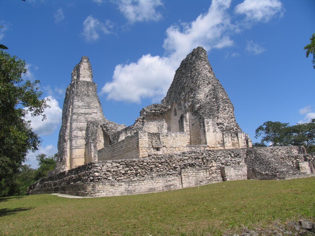
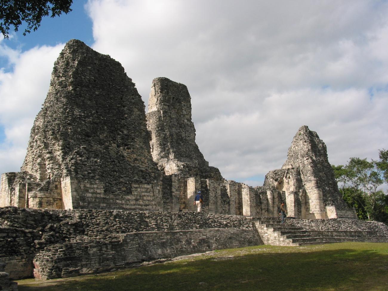
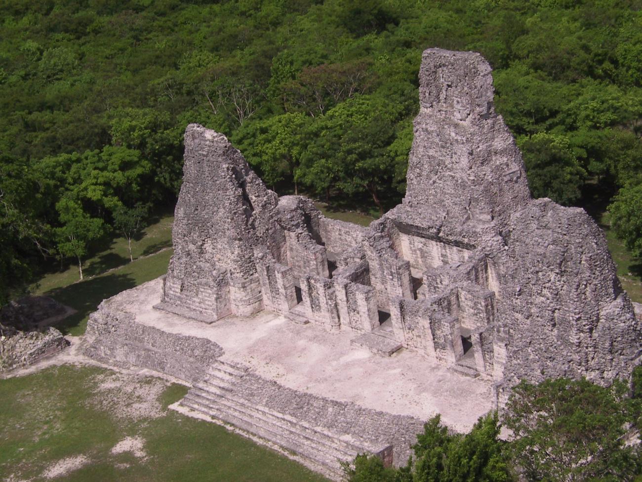
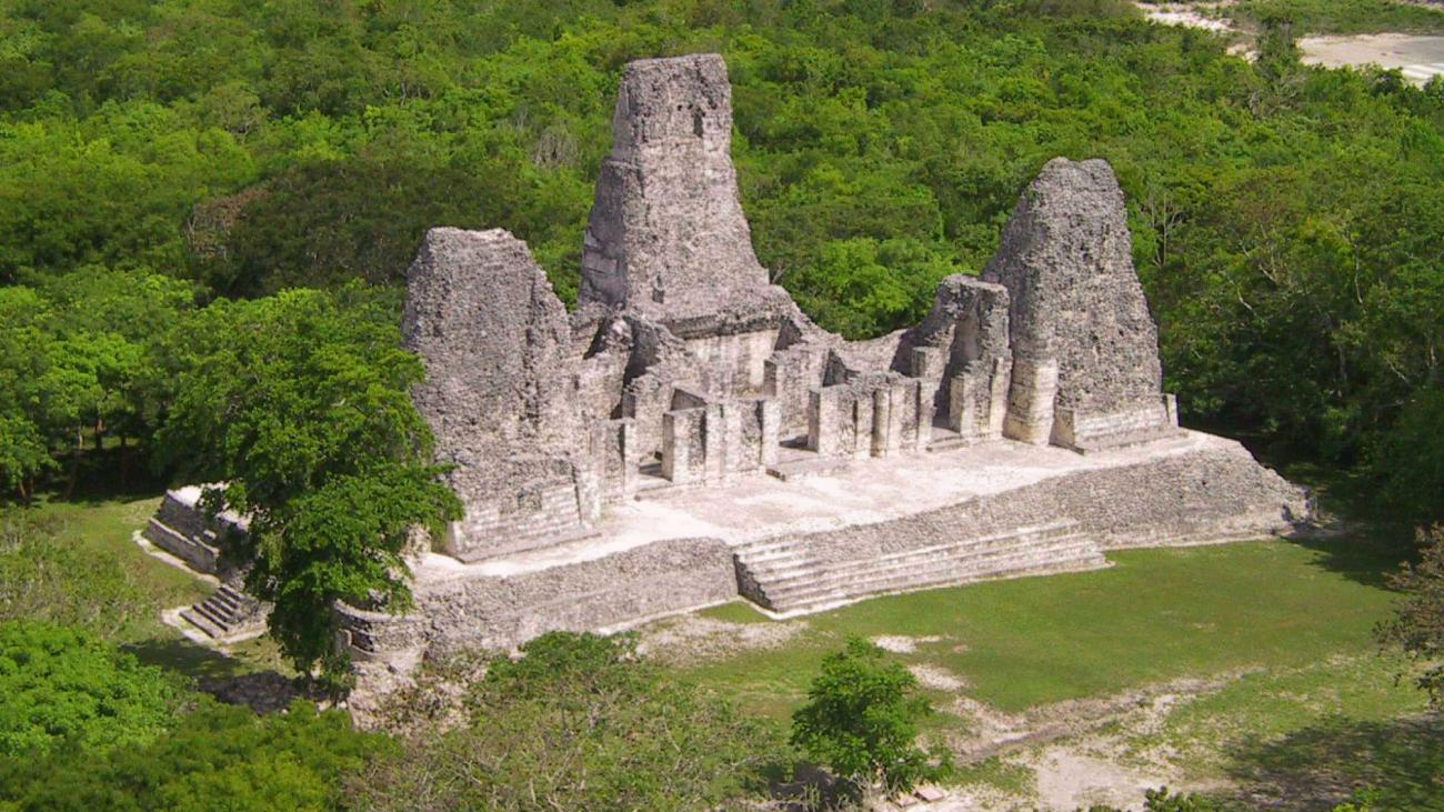
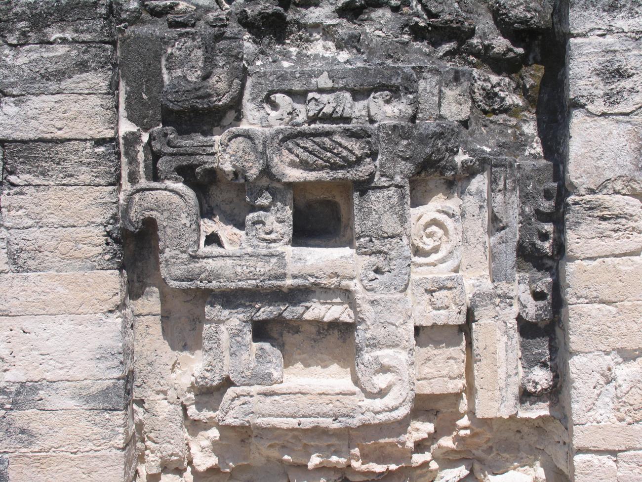
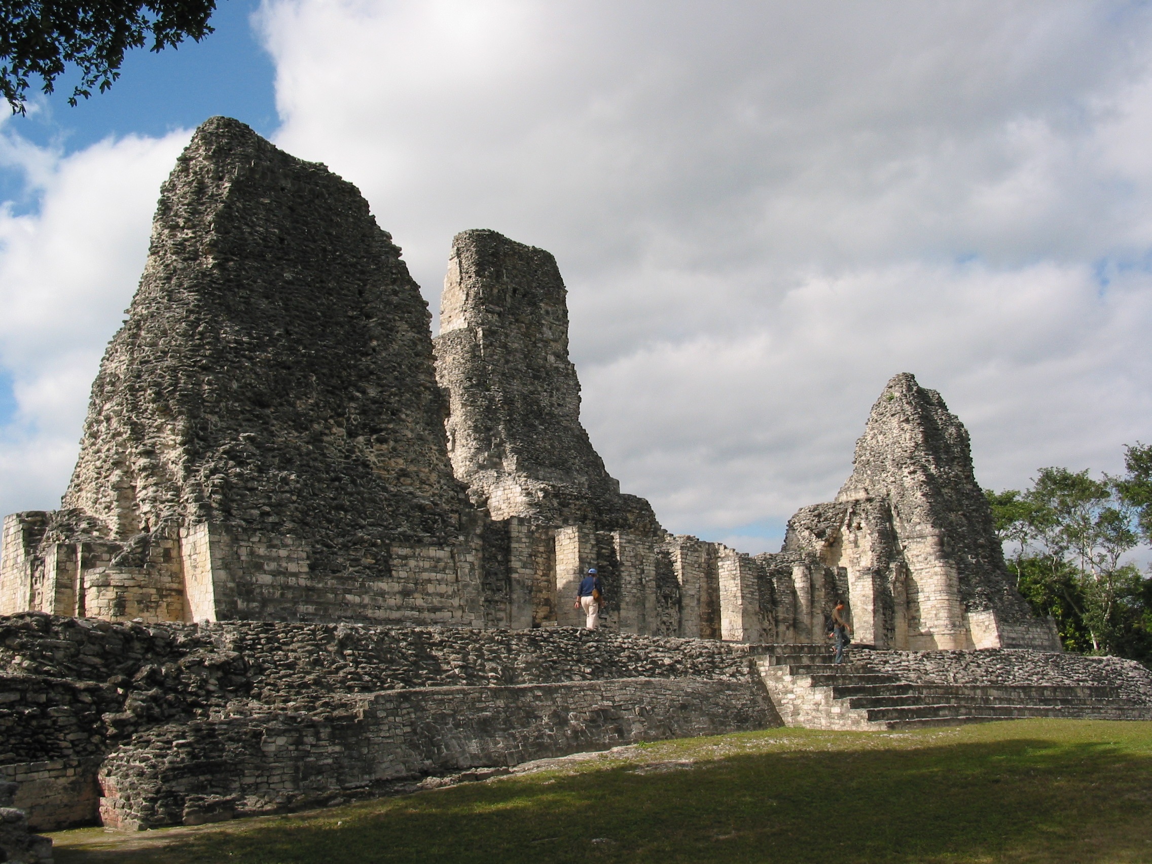
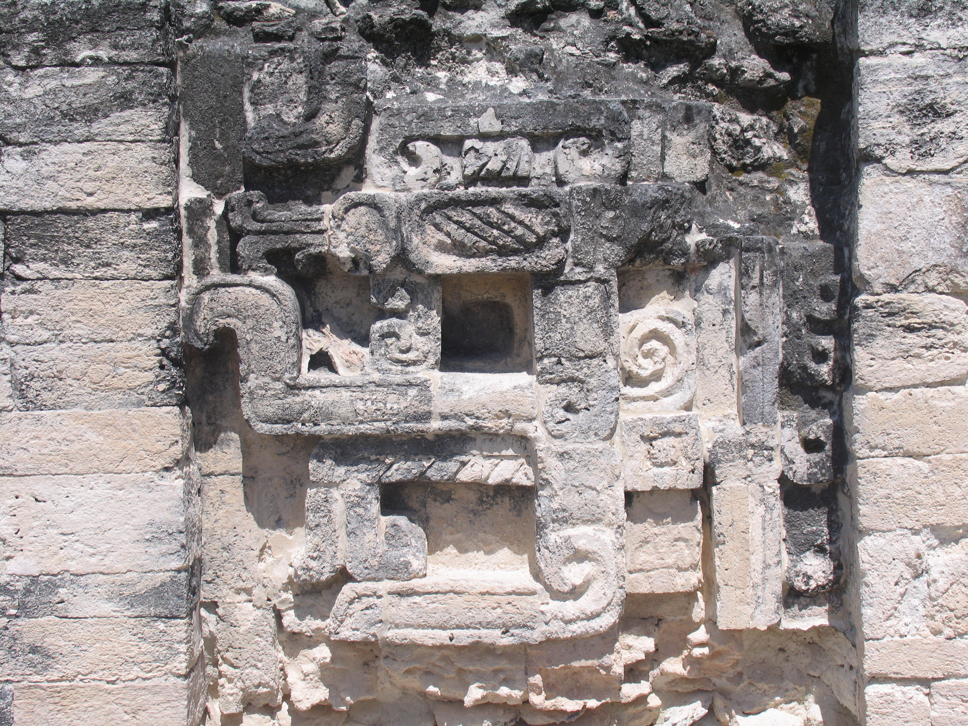
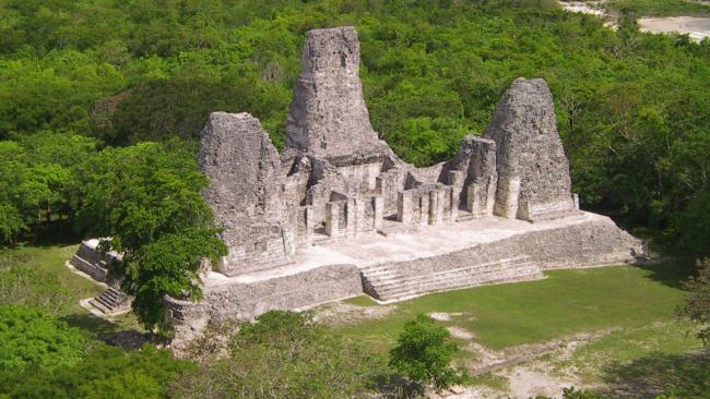
Monstrous serpent jaws are depicted at the entrance to the temples. This is associated with the Río Bec style, in which the horizontal takes precedence together with pairs of high, narrow towers crowned with small temples. The three towers in the Building of the Towers have been standing for thirteen centuries.
The Xpuhil archeological site is situated in the south of Campeche state, within the region known as Río Bec. Even though evidence of occupation during the Formative (300 BC) and Early Classical periods is minimal, the earliest monumental architecture is associated with the Petén tradition and is represented in the domed sub-structures of group XX. The affiliation with the Petén traditions can also be perceived in the ceramics identified in the ancient settlement.
The site reached maximum development towards the end of the Classical period; this corresponds to the latest stage of construction and shows characteristics of the Río Bec style. Indeed, the vast majority of the ceramic materials can be dated to the Late Classical period. There is a theory that by this stage Xpuhil functioned as an administrative sub-center for the capital in the city of Becán, which enabled it to interact with other communities in the same area, as well as neighboring regions.
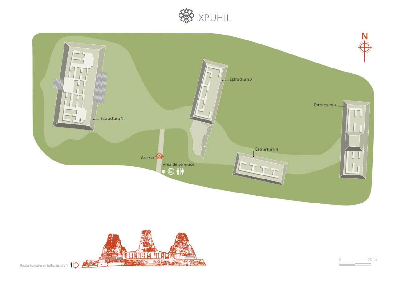
It should be noted that the area of the pre-Hispanic site that is open to the public, and under the protection of the INAH, is only a single building complex known as Group I, which comprises some of the many buildings that form part of the archeological area. Altogether, around 25 building complexes have been reported to date.
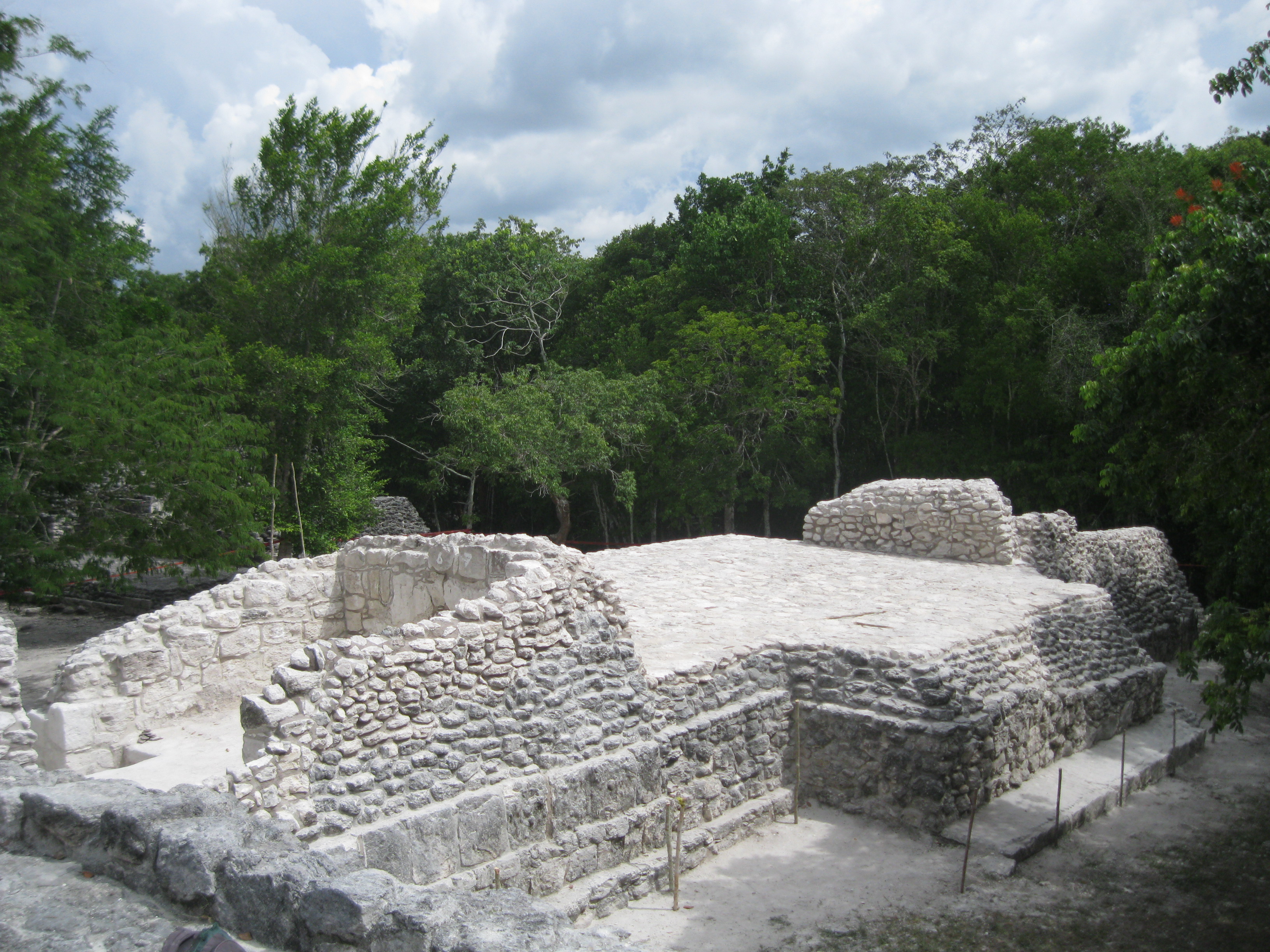
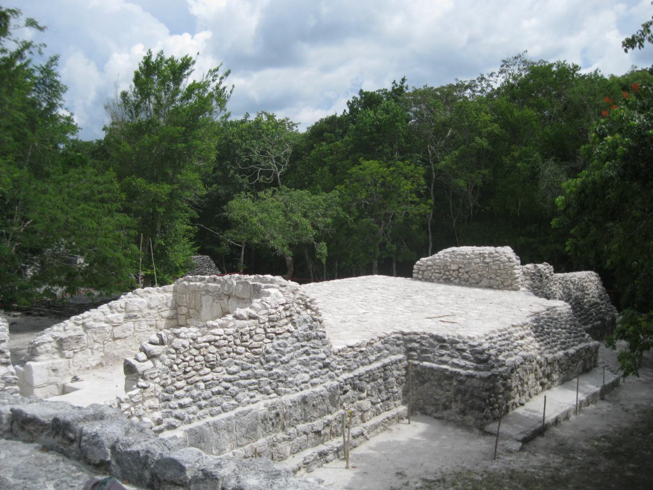
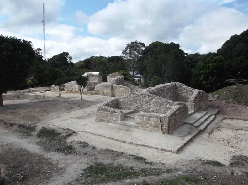
Group I of Xpuhil is comprised of various buildings which are generally quite small, with the exception of structure I-1, known as the Building of the Three Towers. The group has a linear distribution, with all of the monumental buildings found in a straight line which runs from east to west.
Group II extends to the south of the first group, outside the public area, and is most well-known for its main structure known as Los Pájaros (“The Birds”); it is thought that this was possibly a temple and it has a roof comb hung with stucco masks which have been quite well preserved. Chronologically, it dates back to the Bejuco and Chintok phases of the Late Classical period.
Many of the other groups are distributed inside and around the perimeter of the present-day municipal center of Calakmul. Such is the case of Group III, with around ten structures, seven of which demarcate two plazas, one of them closed and the other open towards the south. According to the evidence found, it dates from the Late Classical period. To date the buildings of the southern plaza have been excavated.
Group XX, also known as Kitam, is located within the urban area and is comprised of a massive plinth upon which eight buildings have been constructed. They are distributed around three courtyards, the central courtyard being the largest and assembling the principal buildings. Connected to this plinth are other buildings, both large and small, as well as terraces built on the adjoining land and water cisterns. The nomenclature of the pre-Hispanic structures is taken from regional words for trees and plants, for example Huayas, Chintok, Chacá, Amapolas, Ramones and Zapotes, though some are given the names of the man-made elements which characterize them, such as Metates (“Grinding stone”) and Calzada (“Road”).
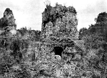
The existence of Xpuhil was reported in the 1930s by the U.S. researchers Karl Ruppert and John Denison, from the Washington Carnegie Institution, who published the results of their studies in 1943. Later, various important investigations were carried out on the site by scholars such as David Potter (1969-1971), Agustín Peña and Abel Morales (1977), Román Piña Chan and Guadalupe Landa (1983-1984), Paul Gendrop (1981-1983), George Andrews (1987-1988), Ricardo Bueno and Ángeles Cantero (1992-1995), and Vicente Suárez (since 2013), among others.
- Dirección del Centro INAHAdriana Velázquez Morletadriana_velazquezm@inah.gob.mx+52 (981) 816 9111Operación de Zonas Arqueológicas del Centro INAHCandelaria del Carmen Duarte Patzarqueologicas.camp@inah.gob.mx+52 (981) 816 9111, ext.138016

Grupo I
It is the only one open to the public and stands out for the building called the Three Towers. It was built on a hill following a linear pattern.


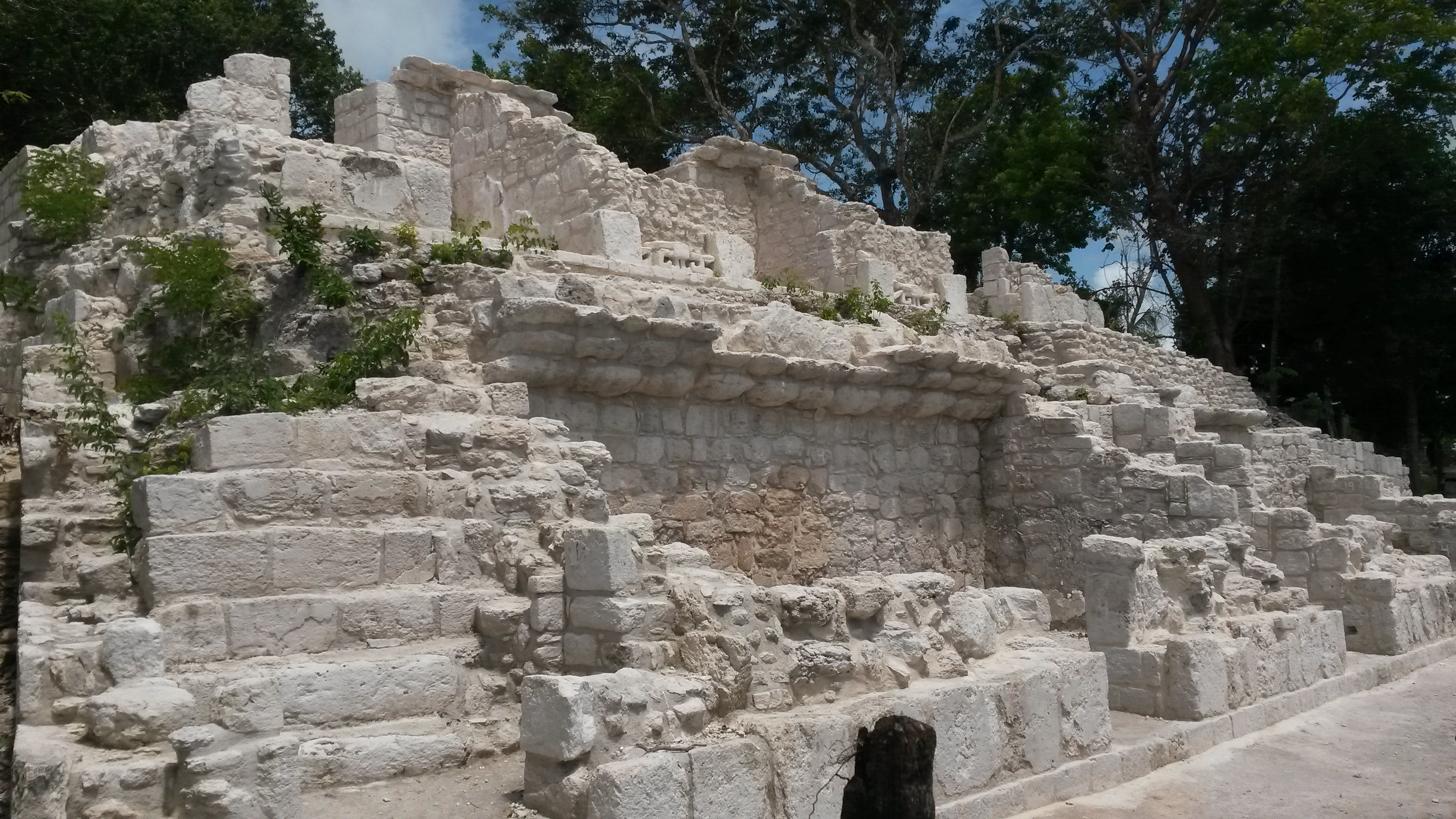
It is the only one open to the public and stands out for the building called the Three Towers. It was built on a hill following a linear pattern. The monumental structures are located on an east-west axis, forming plazas open to the north, and the main facades are arranged towards the east, with the exception of Structures III and VI-2, whose front facades are oriented to the north, where the low ground is located. In addition to the masonry buildings and small mounds, some albarradas have been recorded to the south and west of the group, as well as several hollows that could have functioned as quarries or watering places.
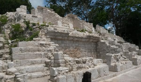
Structure I-1: It is the most important of Xpuhil, it has greater dimensions with respect to the others and it is characterized by its three towers, being the central one the highest; all of them show the distinctive characteristics of the region. The building is formed by a platform located on a limestone outcrop, its façade faces east and has 12 double bays with sidewalks. Both sides of the main openings are decorated with cascades of stylized masks arranged in profile. Among the decorative elements we observe symbols of mats linked to power. It has been stylistically dated to the end of the Late Classic period (around 760) and is considered one of the last examples of classic Río Bec architecture.
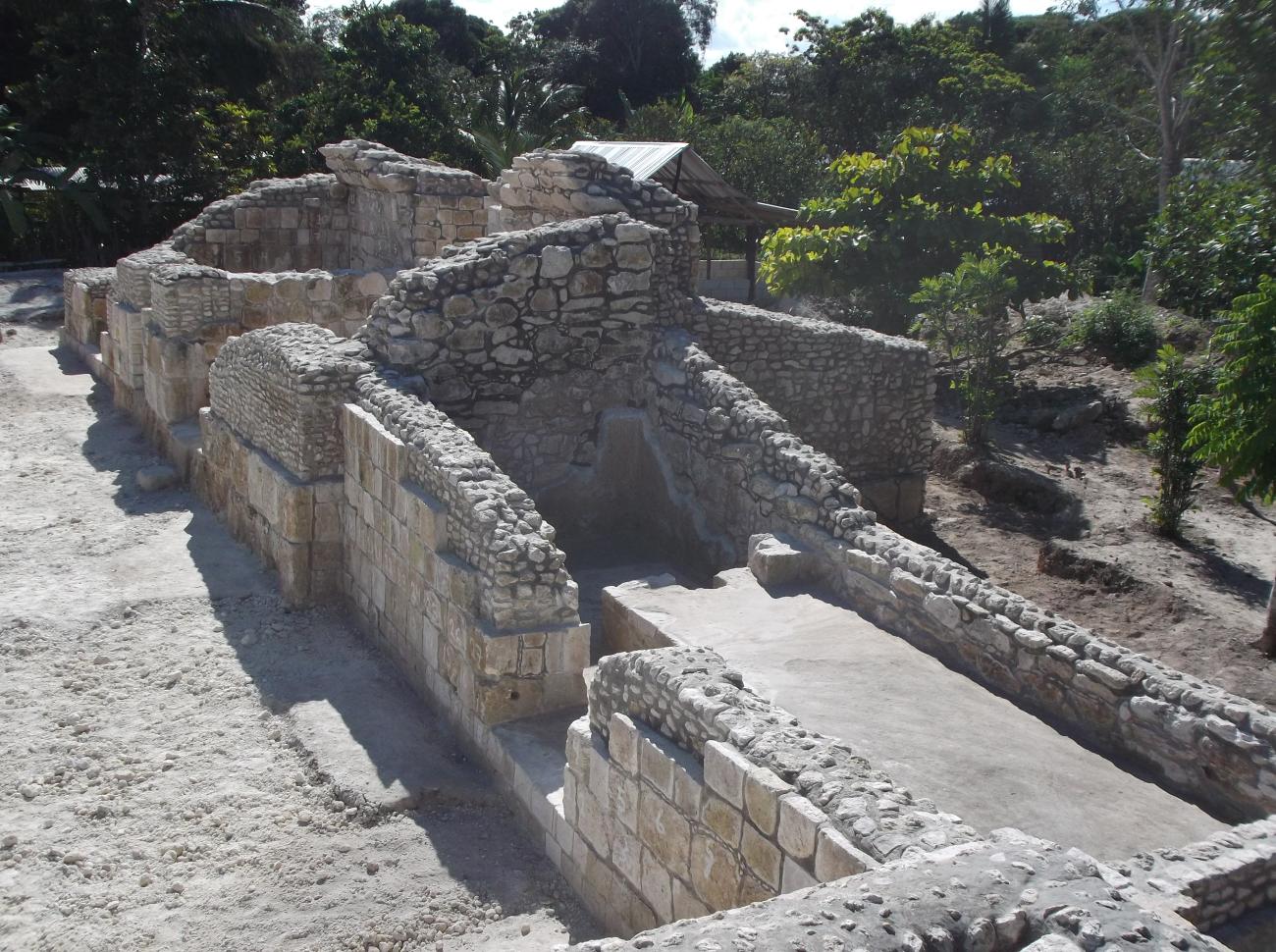
Structures 1-2 and I-2A: Structure I-2 dates from the end of the Classic Period and is a building classified as an elite residence, judging by its architecture. For its part, building I-2A is a little later, but was also occupied by the ruling class.
Structure I-3: Building I-3, whose façade faces north, has a platform with a projecting stairway, as well as the simulation of two small towers formed by a pair of double bays, joined together by a masonry massif.
Structure I-4: Structure I-4, facing east, has a base with a pyramidal body in the center, flanked to the north and south by double bays, the last of which has a double access.

Grupo III
It extends to the south of the first, outside the urban area. It is known for its main structure, called Los Pájaros, possibly was a temple and has an openwork crest with masks that remains in relatively good condition.


It extends to the south of the first, outside the urban area. It is known for its main structure, called Los Pájaros, possibly was a temple and has an openwork crest with masks that remains in relatively good condition. Chronologically, it dates back to the Bejuco and Chintok phases of the Late Classic period. However, many of the other groups are distributed inside and on the perimeter of the current municipal capital of Calakmul. Such is the case of Group III, where we found a dozen structures, seven of which delimit two plazas, one of them closed and the other open to the south. According to the recorded evidence, it dates from the Late Classic. At present, the buildings of the south plaza have been intervened.
Structure III-5: It divides the aforementioned plazas and consists of four rooms with independent access, each one oriented to a cardinal point, which are arranged on a low platform. All the rooms have benches and were originally vaulted.
Structure III-6: It has four rooms that once had a vault; the central ones communicate with each other. However, one of them presents late modifications.
Structure III-7: It consists of a semirectangular platform that supports a structure whose main façade faces west, where the open plaza of the group is located. It contains four rooms, most of them with benches inside. Two of the rooms also have a view to the west, while at their ends there are as many rooms facing north and south, respectively, all of them originally vaulted.
Estructura Chacá
During its last construction period, the Chacá Structure acquired characteristics related to the late Rio Bec tradition. Among these are six intercommunicated rooms in pairs, with traces of having been vaulted and all with a view to the east.

During its last construction period, the Chacá Structure acquired characteristics related to the late Rio Bec tradition. Among these are six intercommunicated rooms in pairs, with traces of having been vaulted and all with a view to the east. The central access of the main façade was flanked by masks made of stone mosaics, arranged in cascades.

The buildings symbolized and carried out mixed functions which secured the elite’s political and economic control of the community.