


La Quemada
Its origin remains a mystery. Some authors associate it with Chicomoztoc, a mythical place that the Aztecs passed through on their way to the Valley of Mexico. A powerful center of government, at its height it governed over 220 settlements and produced very distinctive architecture.
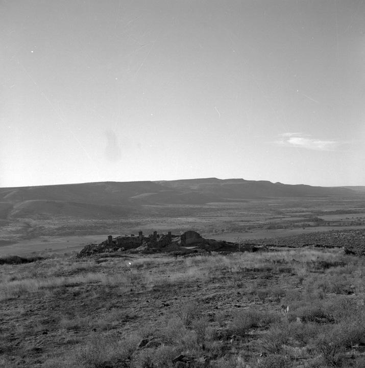
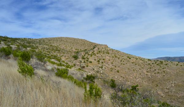
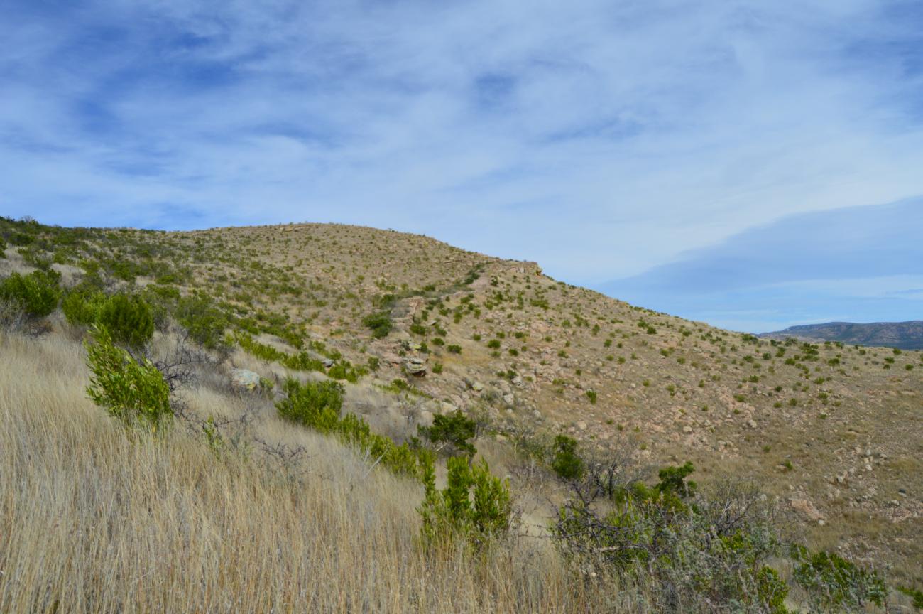
It was the biggest pre-Hispanic settlement in North-Central Mexico; no other achieved its monumental scale. It was active from the fourth to the twelfth centuries of the Common Era and at its peak (from 600 to 850) it was a governing center which controlled 220 surrounding settlements. It had a network of roads, paved with slabs over a firmly compacted clay infill. They connected to areas which supplied natural resources such as clay deposits, timber and vegetation, as well as manufacturing workshops, farming villages or sanctuaries for religious processions. In other words, these pre-Hispanic roads had various uses.
The site came to have a complex hierarchical organization and its architectural diversity testifies to the different areas of social power, such as housing for the elite, palaces, temples or public squares and ballgame courts, which could be accessed by people of different social status.
Various hypotheses have been put forward regarding the site’s origin and the background of its inhabitants. At first, it was believed that as well as groups of successor tribes of hunter gatherers from the north, settlers from Teotihuacan or people linked to this city may have lived here. Perhaps it had a defensive use against Chichimeca invasions. It may also later have become the capital of the Caxcan people, or a federation of this and other northern ethnic groups. By the time of the Spanish Conquest, it had been uninhabited for centuries.
In 1615, the evangelist and historian Fray Juan de Torquemada identified the site as one of the places where the Nahua people stopped during their pilgrimage from the north, and in 1780, the Jesuit priest Francisco Clavijero thought he saw Chicomóztoc (“place of seven caves”) in La Quemada, where the Seven Nahuatlaca Tribes came from. Thanks to the excavations and studies which began in the 1980s, it was possible to determine the archeological site’s timeline as beginning the Classic and Early Postclassic periods, developing in parallel to that of the neighboring Chalchihuite culture.
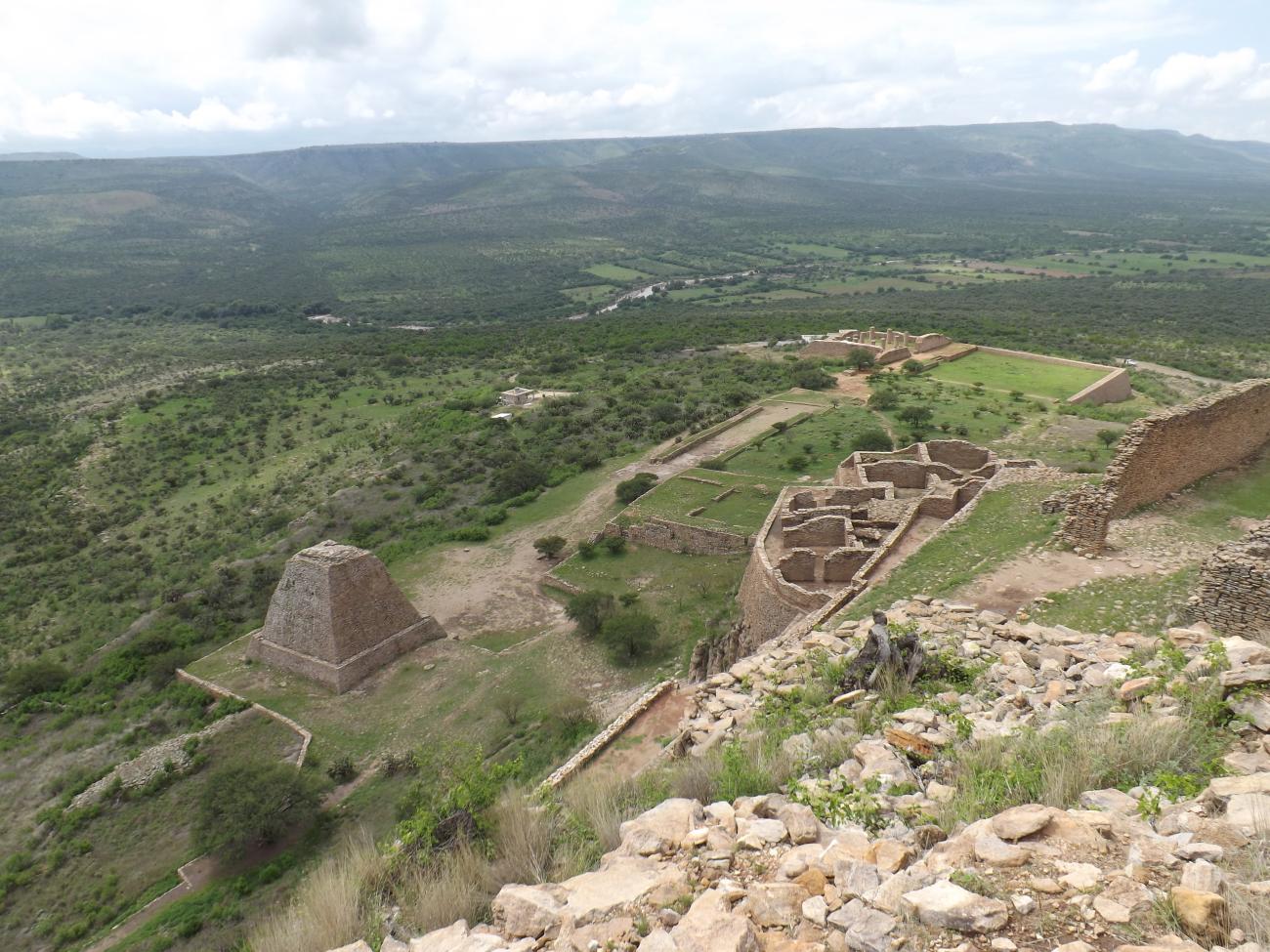
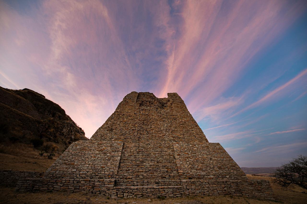
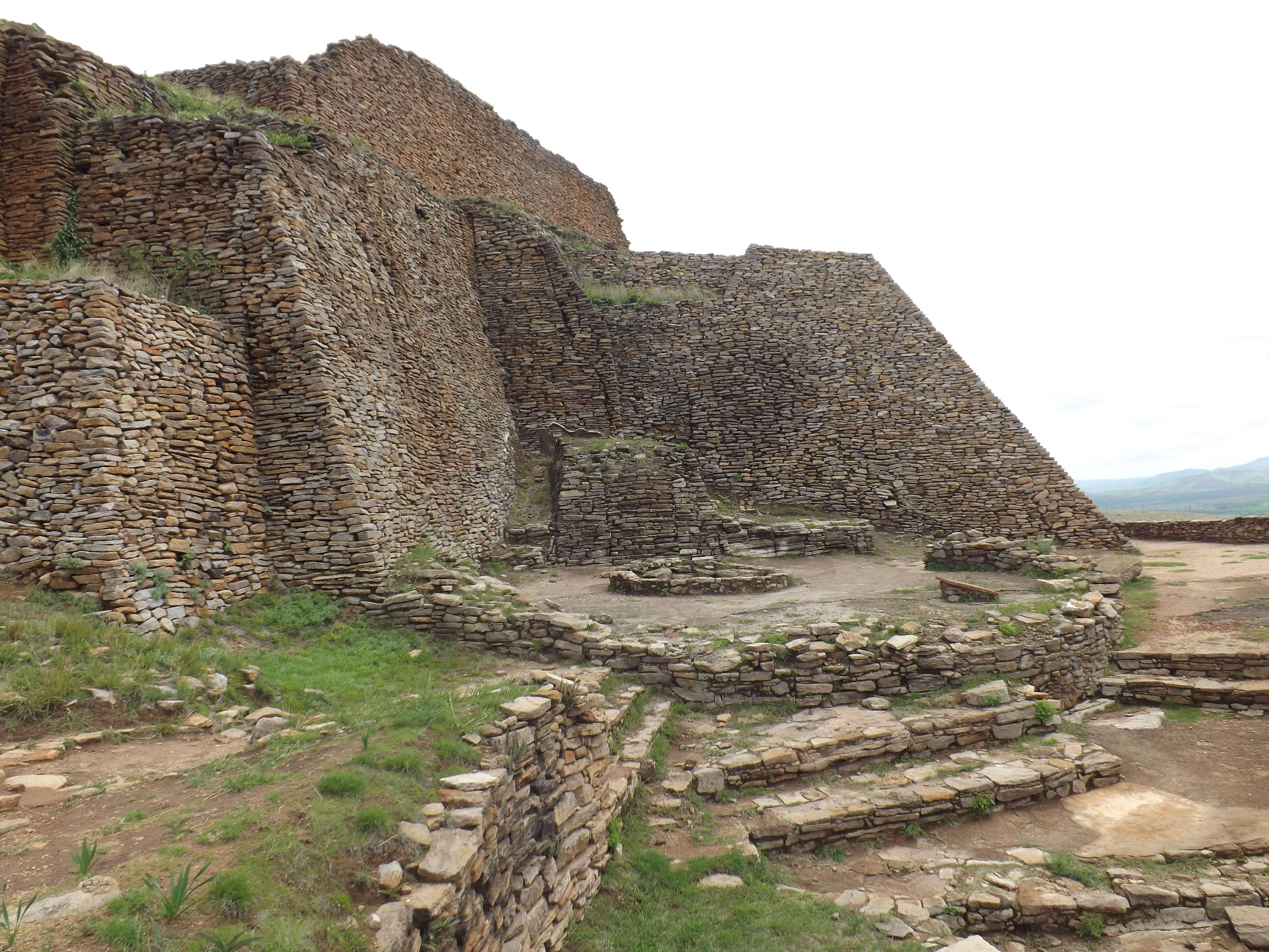
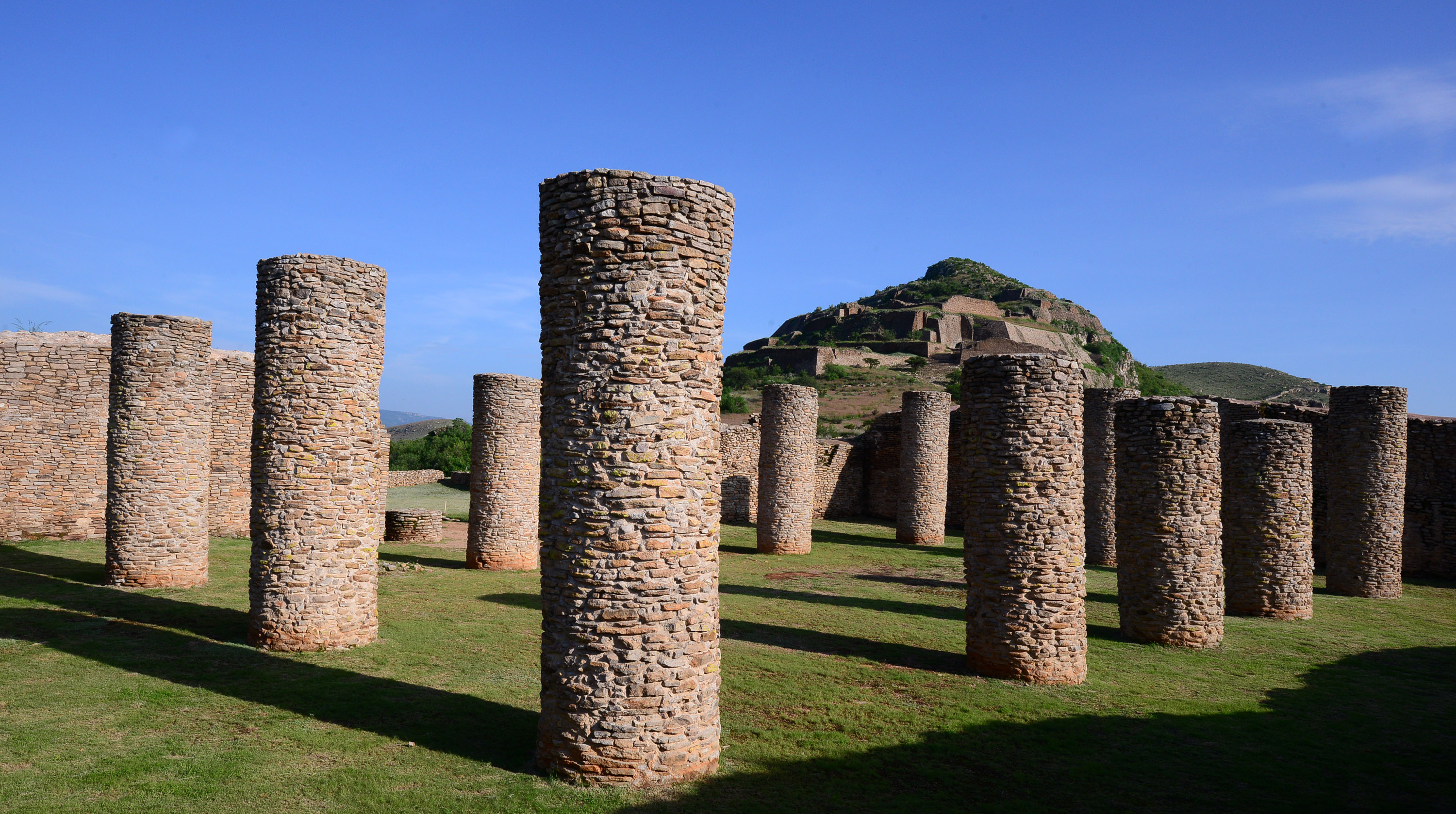
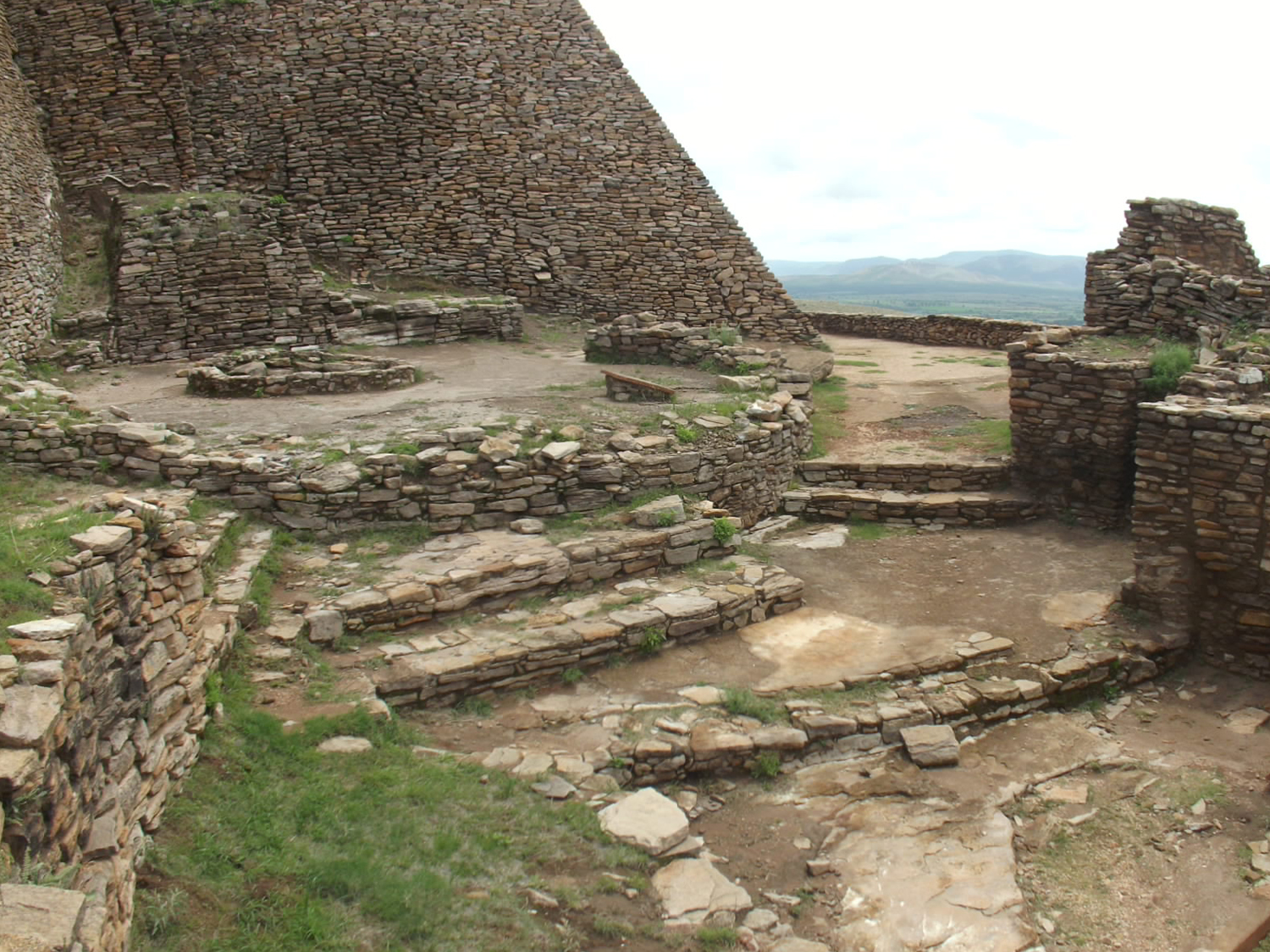
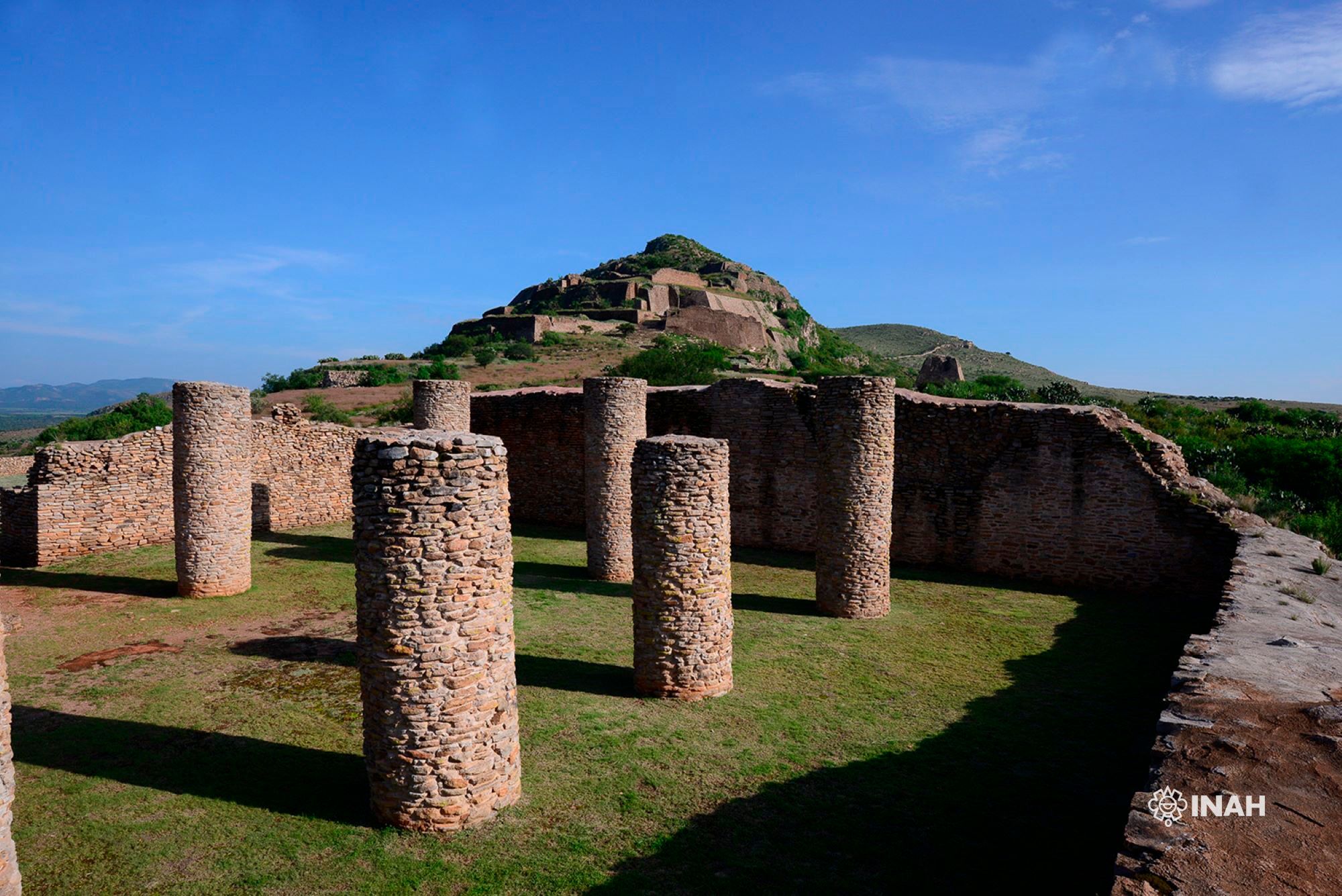
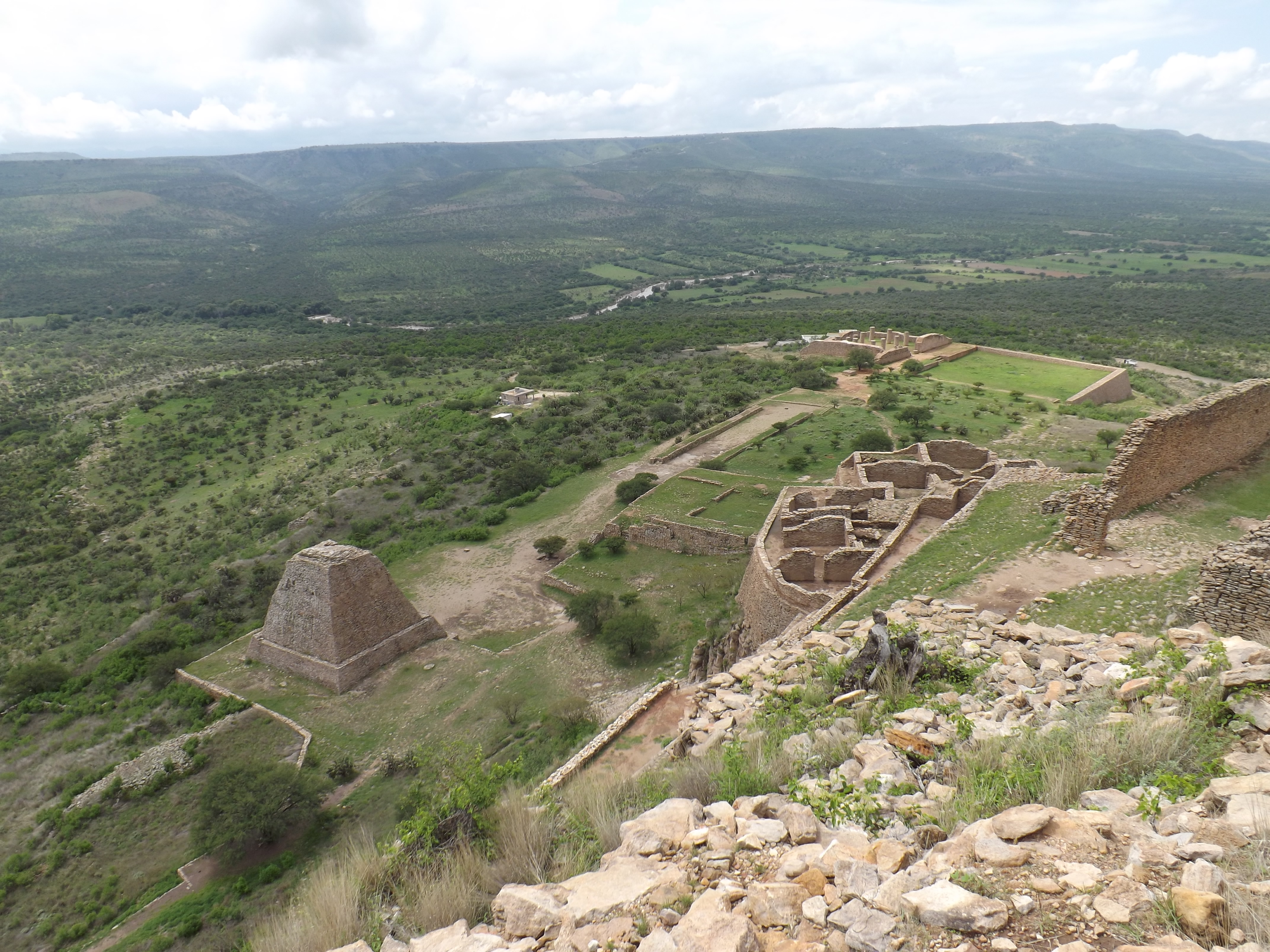
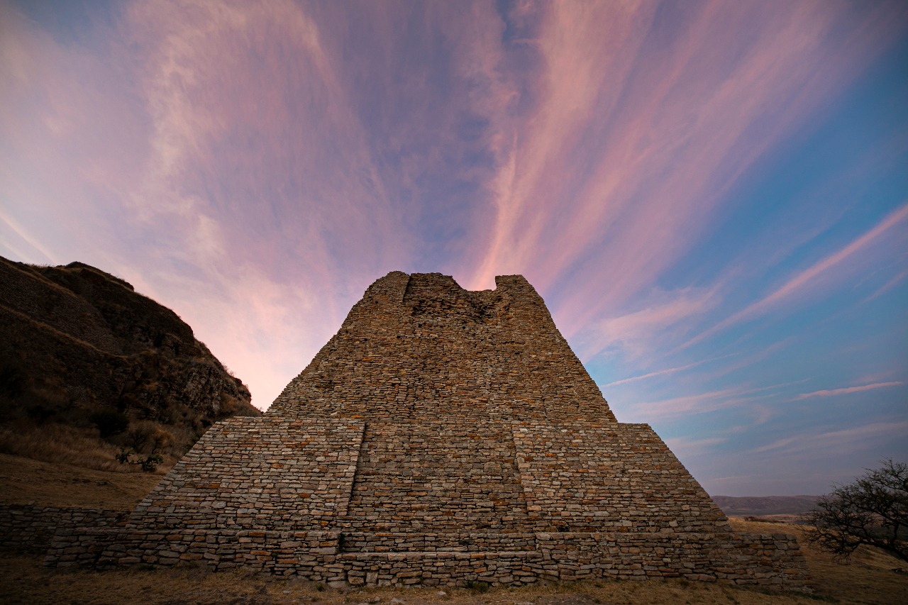
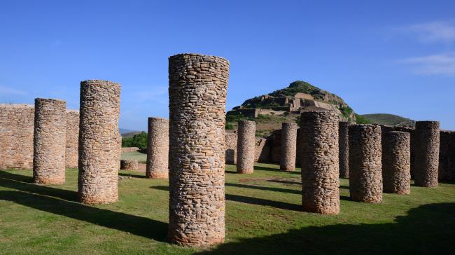
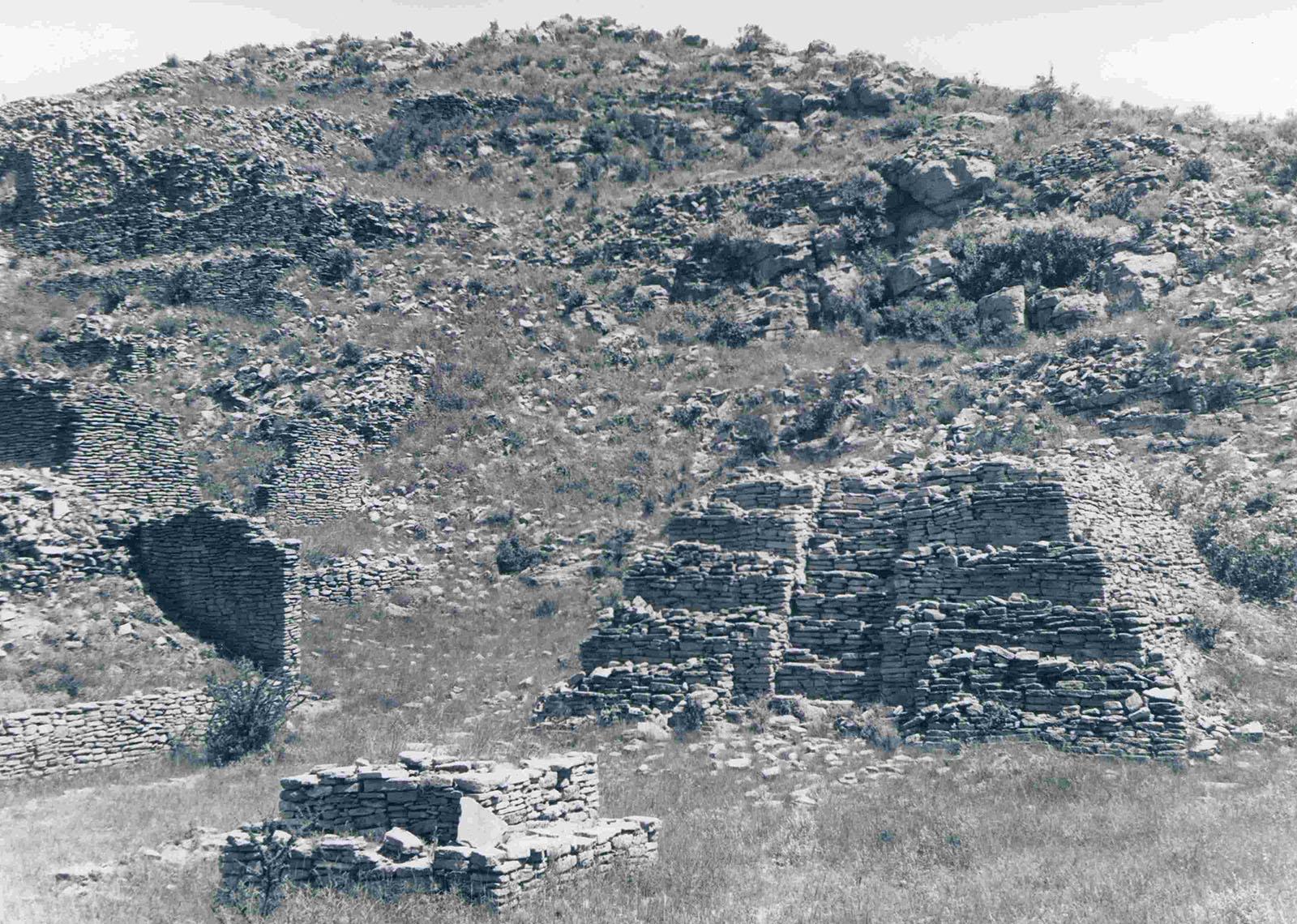
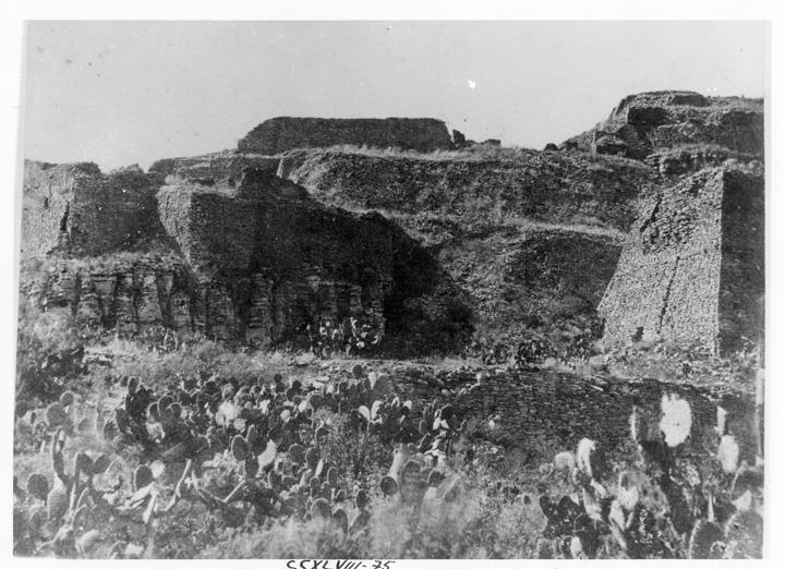
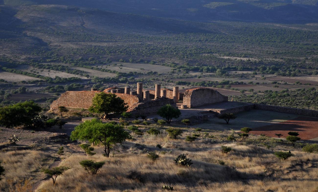
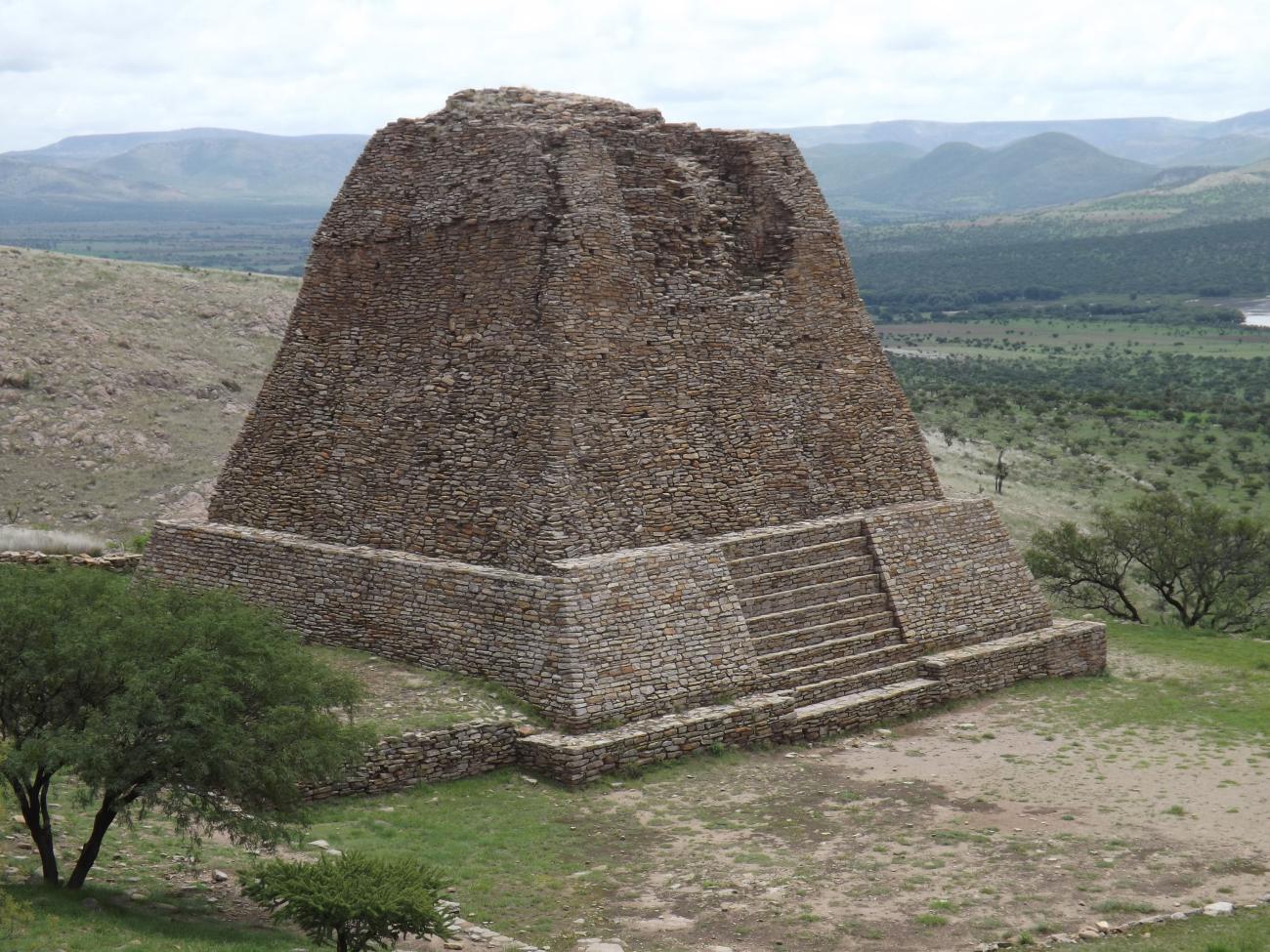
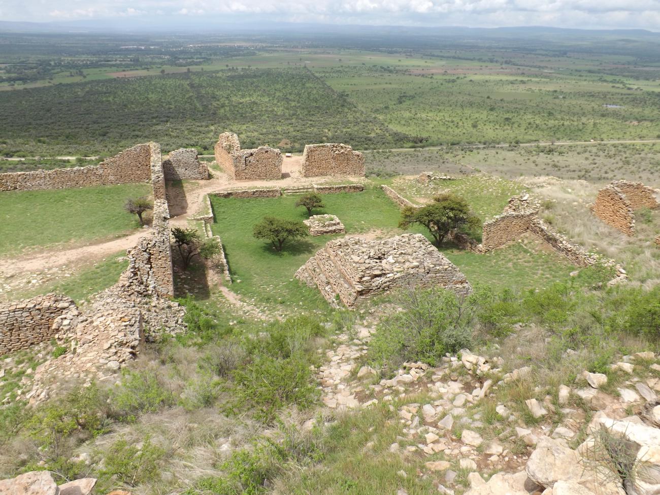
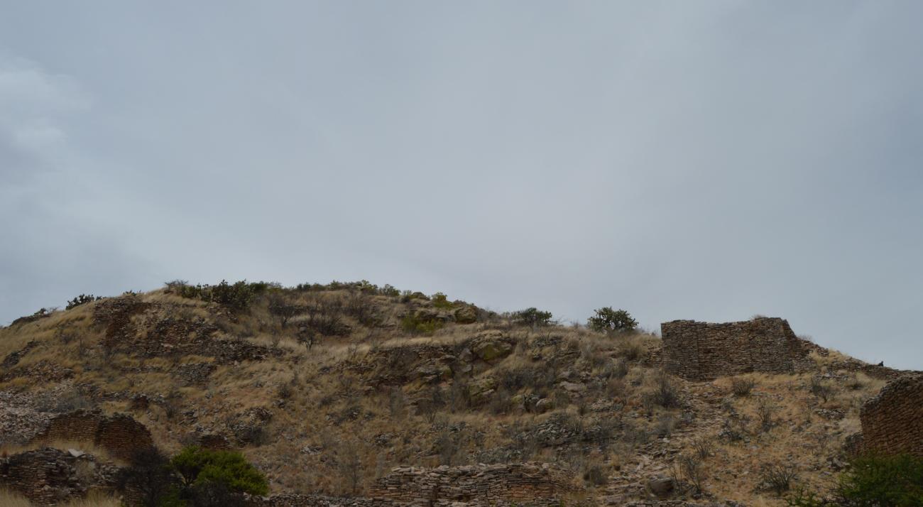
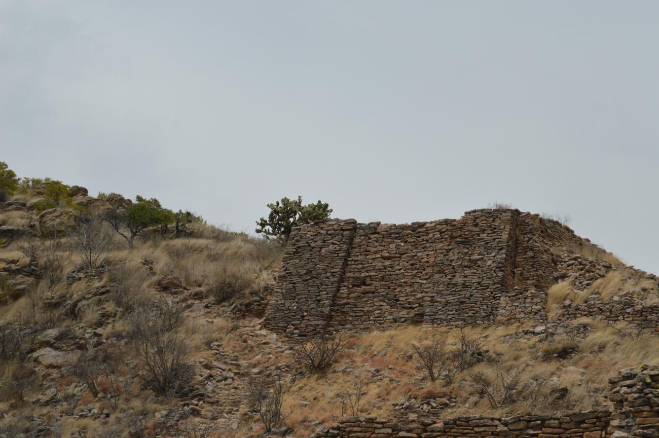
La Quemada contains structures far greater in size than any other archeological site in the region. For example, La Ciudadela (“The Citadel”), a complex surrounded by an 2,626 feet wall to the north, with walls measuring 20 feet in height and 13 feet in width; el Salón de las Columnas (“The Hall of Columns”), which extends over an area of 134 by 105 feet and may have had a roof 20 feet in height, or the Ballcourt, which at 262 by 49 feet is the largest in the area, with lateral walls of 10 and 16.5 feet in height. The Pirámide Votiva (“Votive Pyramid”) may be added to the list, with its sloping walls that are 33 feet in height, and the remains of a staircase which has collapsed at the top, where there used to be a temple. The housing areas consisted of a sunken courtyard with a temple overlooking them, like in Mesoamerica.
All of these structures were raised on platforms and terraces built on the hill of La Quemada, and the walls and columns are elegantly constructed with slabs of volcanic rock known as porphyritic rhyolite. In turn, these were coated with a clay stucco and possibly a mural decoration which has been completely lost, but can be deduced from other ancient pre-Hispanic cities. On some walls it is still possible to see the polished lime whitewash, whcih gives the city its overall appearance of elegance.
Nowadays, we know that La Quemada was an urban pre-Hispanic settlement which controlled the Malpaso valley and extended its trade network to the canyons of Southern Zacatecas, the region of Tunal Grande, the Altos de Jalisco and part of present-day Guanajuato and Michoacán.
- Dirección del Centro INAHRaúl Pacheco Pérezraul_pacheco@inah.gob.mx+52 (492) 922 5085
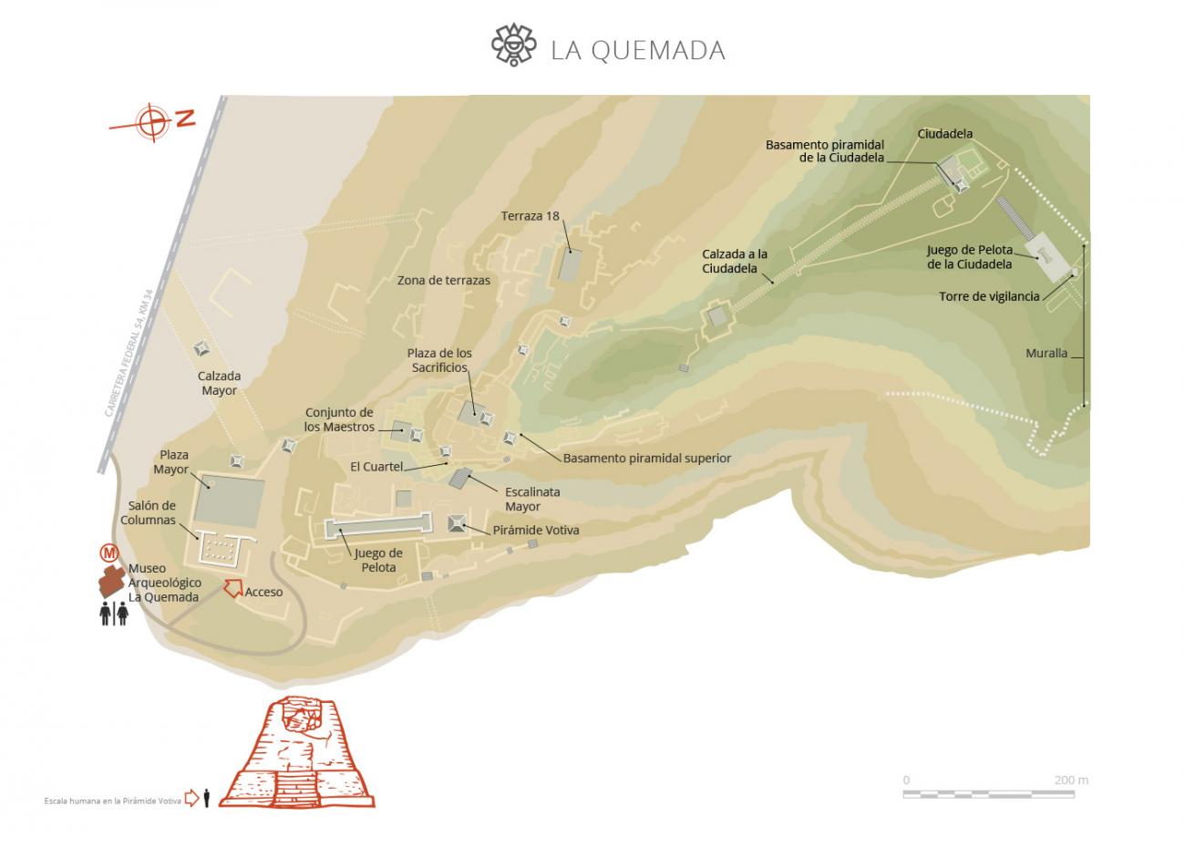
Nivel 1
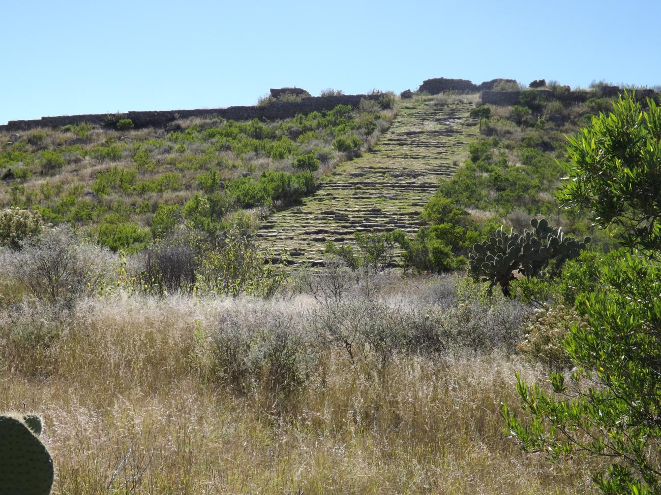
The ancient builders transformed the hill to adapt it and erect a settlement where the main civic and ceremonial, administrative and residential buildings were located.

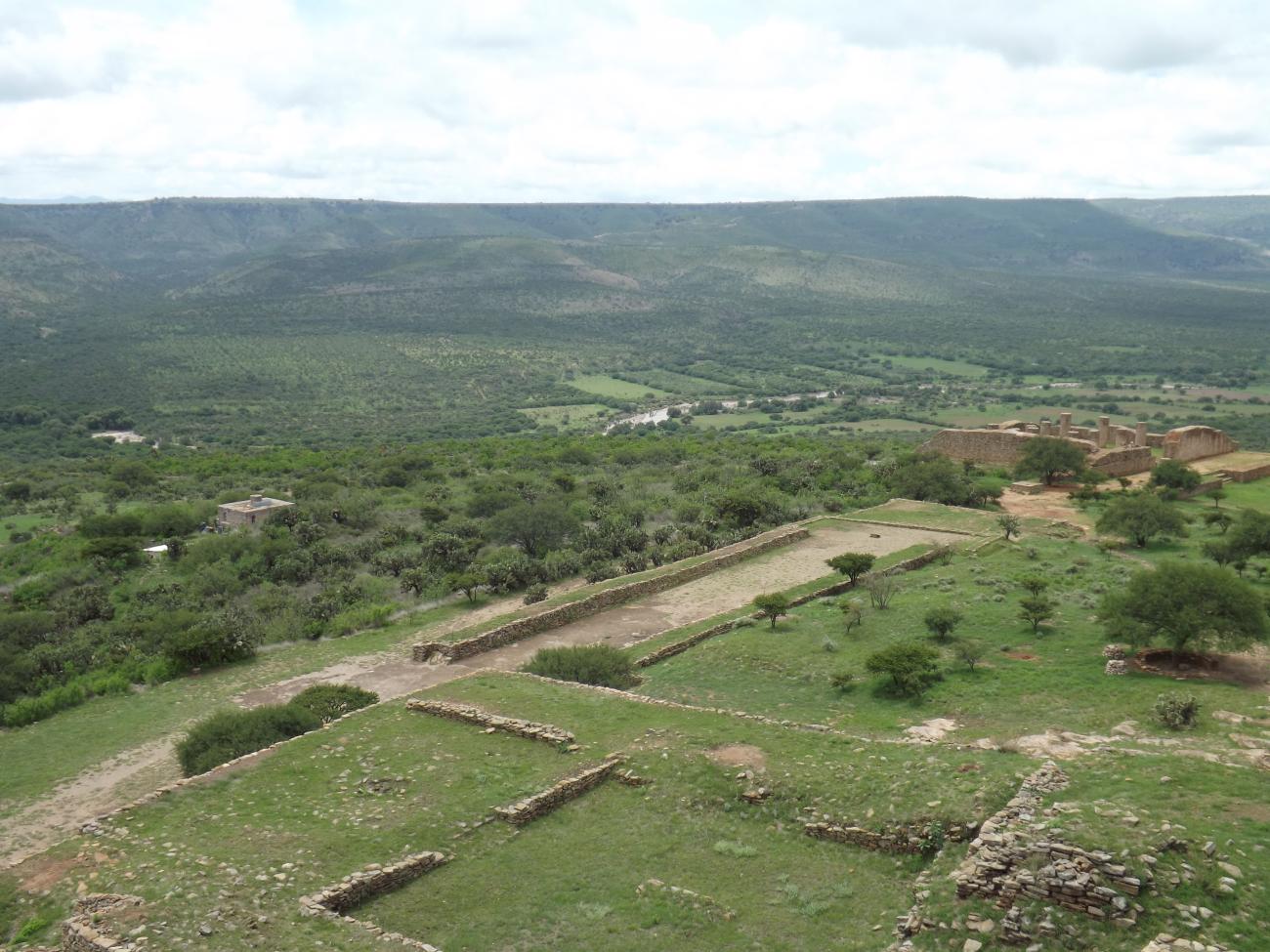

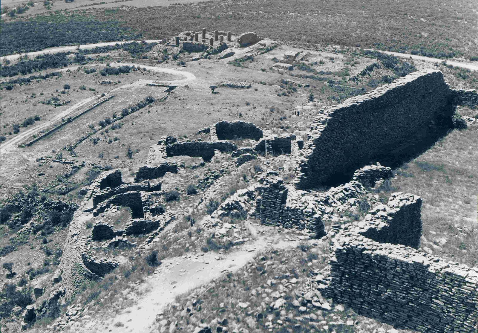
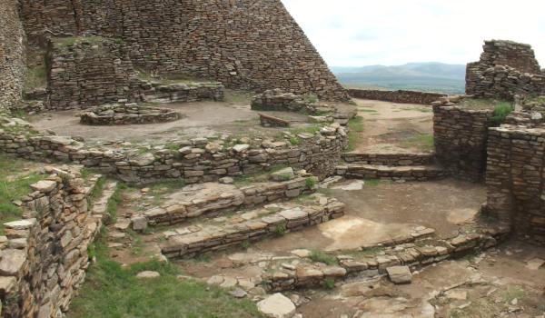
The ancient builders transformed the hill to adapt it and erect a settlement where the main civic and ceremonial, administrative and residential buildings were located. In this way they took advantage of the topography and created five levels or large occupation terraces; the southern part of the hill had a gentle slope, since the other slopes were cliffs. In the southern and lower part of the hill is the first level, where the Hall of Columns, the Main Plaza, the Court for the Ball Game and the Votive Pyramid are located. Because of its buildings, wide spaces and easy access, it is considered that this sector of the settlement was public.
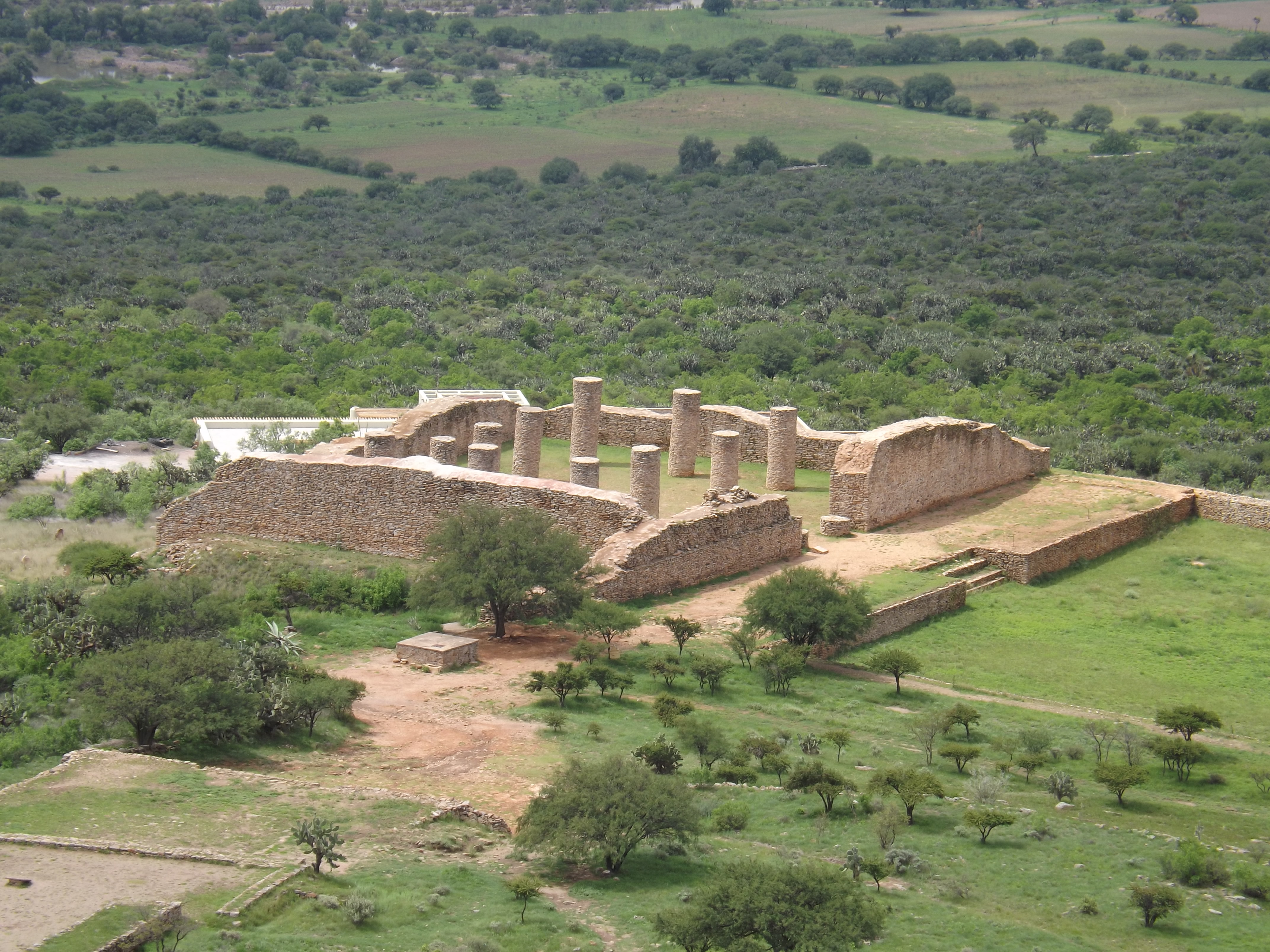
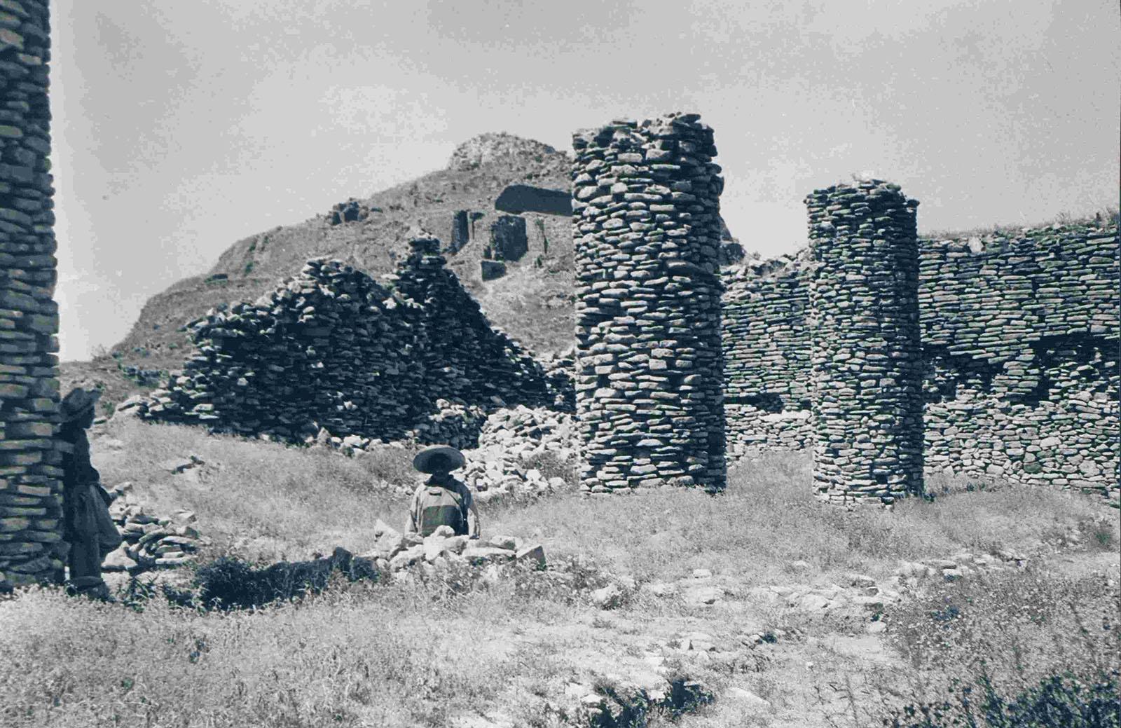
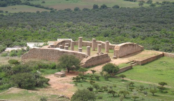
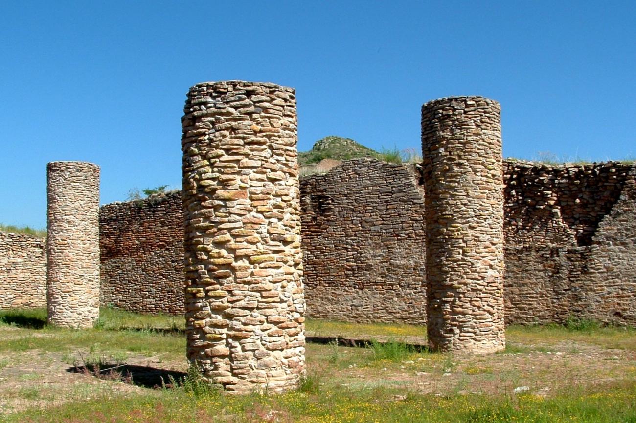
Hall of Columns: The first explorers called this building as The Cathedral, due to its monumentality; currently it is known as Hall of Columns due to the presence of these architectural elements, characteristic in the site. This important building represents the main construction due to its architectural spaces and function. The dimensions of this hall make it the largest roofed space, where eleven masonry columns stand approximately six meters high. The columns are distributed parallel to the walls, and leave an open space in the center, where there was a pit. In the access there were two columns that supported a beam to form the enclosure, leaving the opening to enter. This meant that it was dark inside, where some people gathered. In front of the Hall of Columns there was an arcaded space, as shown by the footprint of some columns on the floor, which made a separation between private and public spaces.
Main Plaza: This space is located in front of the Hall of Columns and is part of its composition because this place was the private part where agreements were made between the main authorities of the place. On the other hand, the Main Plaza was the public space where ceremonies were surely held and where people gathered to observe the activities and listen to the authorities' announcements.
Ball Game Court: The ball game activity was important among the different Mesoamerican cultures, since it represented the struggle between day and night. In the Archaeological Zone of La Quemada there are three ball games; the largest is the one located on the first level, between the Hall of Columns and the Votive Pyramid. This court measures 80 meters long by 15 meters wide and has a Latin I shape. The axis runs from north to south, so its headers keep this disposition at the ends. The southern head has a stairway and a small platform through which the court could be accessed. The walls are arranged east-west, with a current height of one meter; however, these walls were larger during the time of their use. At the beginning of the walls, above the heads, there is a ramp where the ball was probably rolled to start the game. It had a flagstone floor and, like the walls, probably had a polished and decorated mud finish. In the extreme northeast several pre-Hispanic burials were detected.
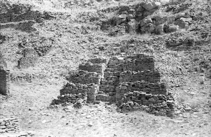
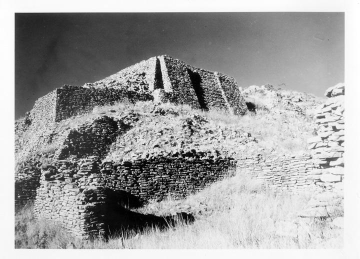
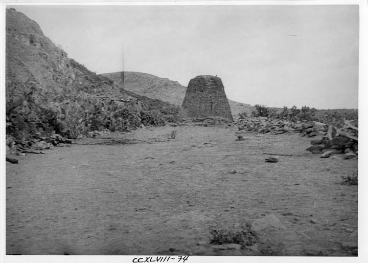
Votive Pyramid: The dimensions of this pyramidal building and its location in the foreground of the ancient city denote its hierarchy in the site. Surely in this space the main deity had his residence, which was venerated with offerings, dances and sacrifices. It is called votive because it is considered a space of worship or devotion where vows or promises were made.
The building originally consisted of a single body, that is, what now appears as a platform, actually continued its walls to the top with its staircase in the center. However, by the process of destruction these walls were lost and, when it was intervened in 1955 by the archaeologist José Corona Núñez, it was decided to raise only this part to provide stability to the monument.
Nivel 2
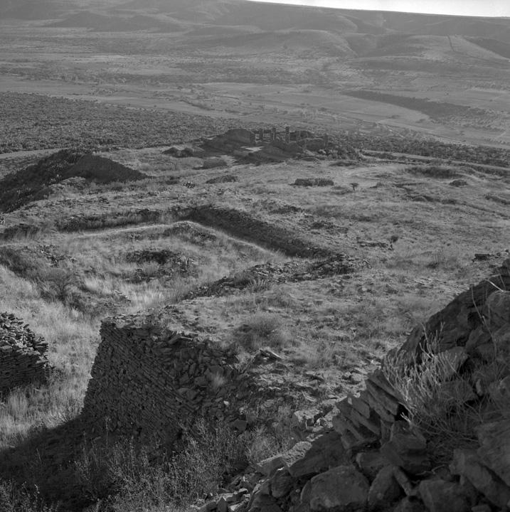
The hill is ascended to a second level by two staircases, which show a control in its access, converting the following spaces as private areas where the elite resided and had some ceremonial spaces.

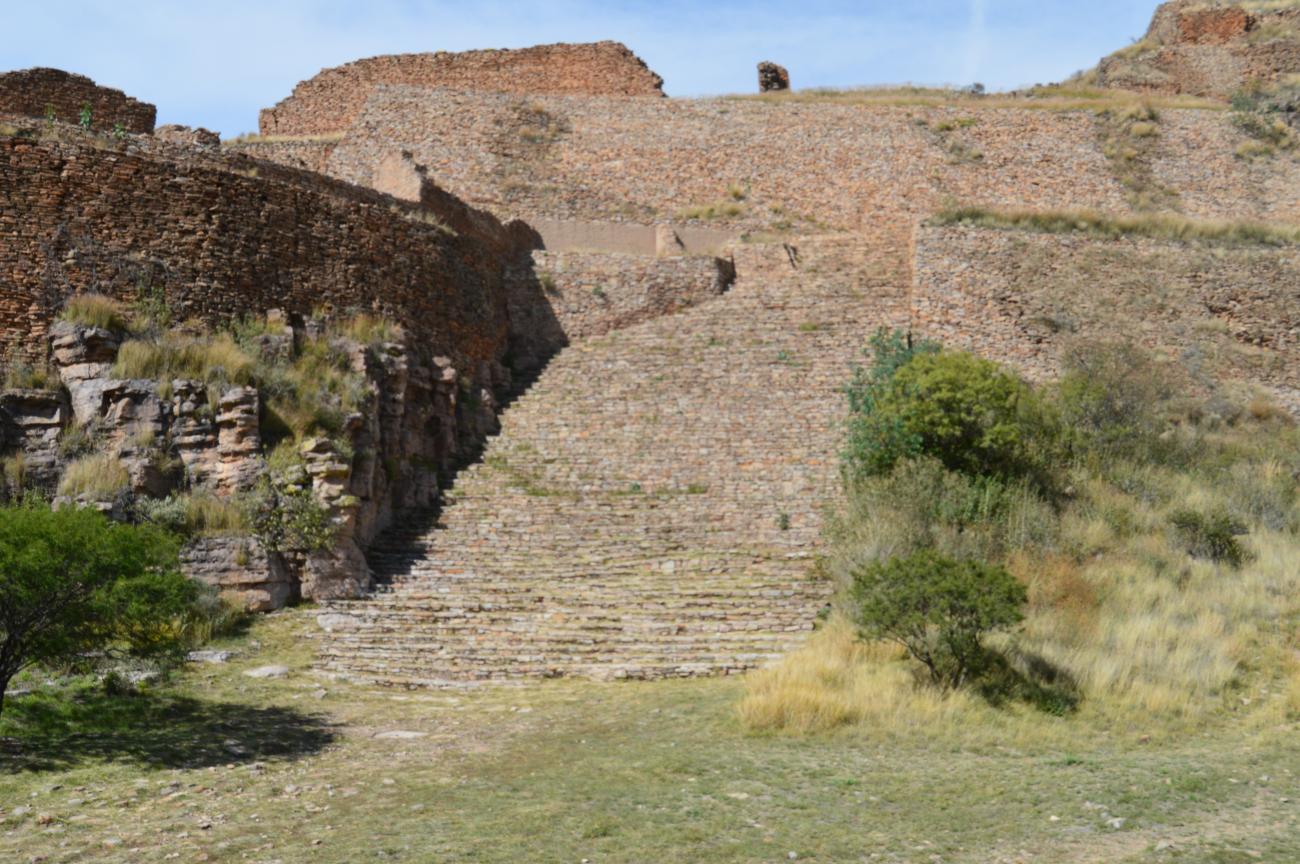

The hill is ascended to a second level by two staircases, which show a control in its access, converting the following spaces as private areas where the elite resided and had some ceremonial spaces. For a long time this sector of the settlement was also known as The Acropolis, due to its location at the top of the hill. In this second level stand out El Cuartel, El Conjunto de Los Maestros and a small Pyramidal Basement with its circular plaza.
Main Stairway: The main stairway owes its name to its large dimensions, in turn, because of its location and orientation, it has been called the Great Solar Stairway. In this idea it is considered that this staircase is created so that the sun ascends to the top of the hill where another pyramidal base is located where it rests to continue its journey, this moment corresponds to the zenith. This stairway presents one of the main accesses to the second level together with the south stairway, although both have a control for the entrance of people. The main stairway presents two visible stages in its steps; the first one is of circular form that reached half height, later the stairway is extended to reach the second level. At the end both staircases seem to have been closed with walls to avoid the entrance.
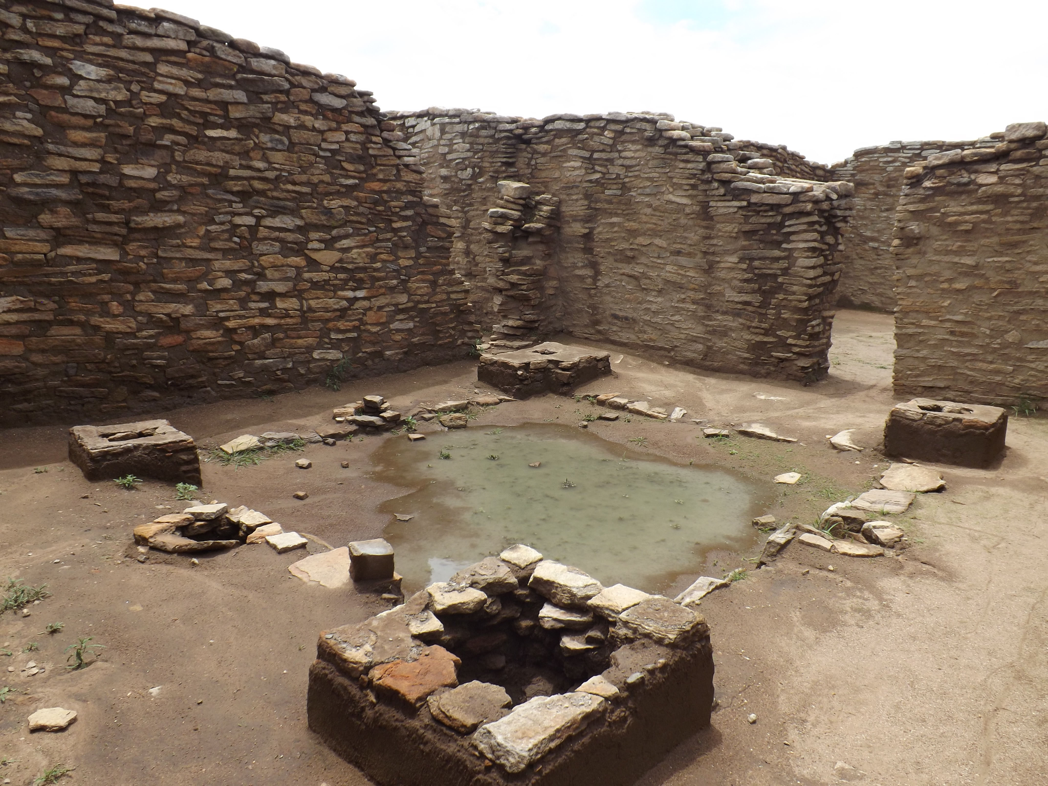
El Cuartel: Its name is due to the fact that this part of the hill was considered as the Acropolis, where the presence of the great cliffs on which it sits, looked like a defensive fortress, therefore, in this space was a military barracks where warriors gathered. The archaeological explorations began at the end of the fifties by Pedro Armillas, later, other interventions continued that have allowed to determine that this space was a residential area of the ruling elite. There are several rooms arranged around courtyards, connected by different corridors. In the place there was a second floor which was accessed through a notched staircase.
Pyramid Plaza Circular Set: In this second level is a small pyramidal base that shows the use of the bedrock of the hill, which was carved to integrate it to the platform that supports this base. The base is a common building in the place, however in this case with the particular characteristic of having a circular plaza in front of it. In this circular plaza an ossuary was found with several human individuals arranged in the place in a ritual way.
Los Maestros Ensemble: This space corresponds to a plaza, which is delimited by three platforms in whose center an altar is located. On the east and south platforms there are several smaller rooms, while on the west platform there is a large hall, and to the north of the plaza there is a pyramidal base. This is a pattern repeated in the urban layout of the site, suggesting group spaces with a common sense, whether of kinship, common background, guild or social.

Nivel 3
Level 3 is composed of a large plaza called El Conjunto de los Sacrificios; delimited by large halls, this level extends along the southwest sector of the hill.
Level 3 is composed of a large plaza called El Conjunto de los Sacrificios; delimited by large halls, this level extends along the southwest sector of the hill.
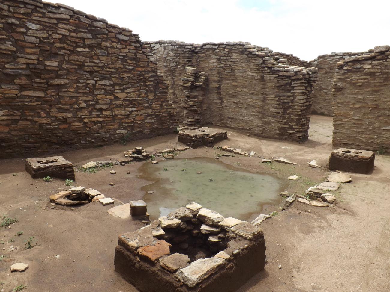
Sacrificial Square: This architectural space is unique in the site due to its composition and structures present. Two large halls limit the plaza to the south and east, while to the west there are a series of rooms and to the north a pyramidal base; an altar was erected in the center. The pyramidal base stands out for its staggered form, as it was conceived, which is distinguished from the rest of the pyramidal bases existing in the site, which are made up of a single body. Between the pyramidal base and the central altar, a sculpture carved in stone in the shape of a woman carrying a baby on her back was found; both figures lacked a head.

Nivel 4
Level 4 is close to the top of the hill. In this space there is a pyramidal base and several housing complexes that continue up to the middle part of the hill where there is a plaza delimited by platforms.
Level 4 is close to the top of the hill. In this space there is a pyramidal base and several housing complexes that continue up to the middle part of the hill where there is a plaza delimited by platforms.
Pyramidal Base: Almost at the top of the hill is a pyramidal base which is accessed by a large staircase still buried by the ancient landslides. It has been suggested that this space is where the sun rests during its ascent to heaven. The building faces south, where the entire settlement can be seen on its southern side.
Nivel 5
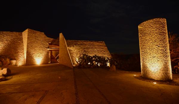
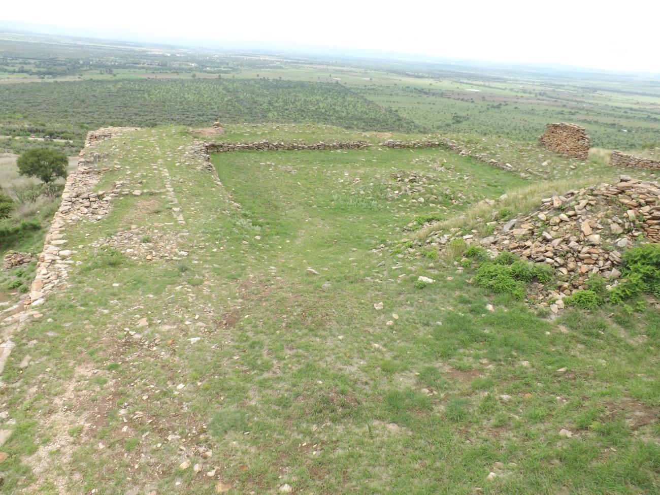
Level 5 is located in the northern part of the hill and is known as La Ciudadela. This space is delimited by a fence and its access is located in the middle part of the hill; a causeway connects the south access with the plaza of the Citadel.
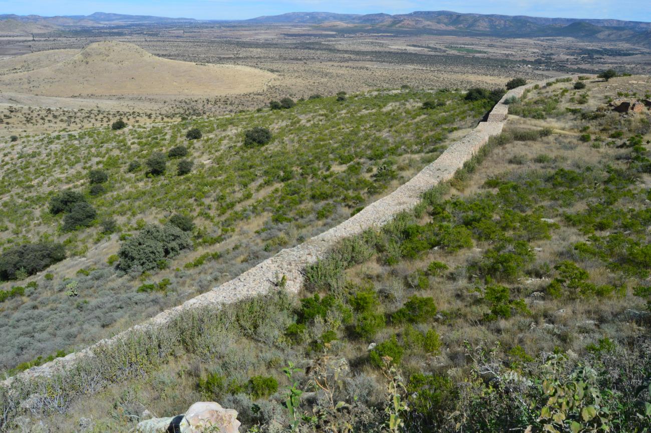
Level 5 is located in the northern part of the hill and is known as La Ciudadela. This space is delimited by a fence and its access is located in the middle part of the hill; a causeway connects the south access with the plaza of the Citadel. In the northeast access there is another great stairway that leads to a ball game court and to the great wall that surrounds all this sector.
The Citadel: The Citadel derives its name from being a space delimited by a wall and later by a great wall. Upon entering through its southern access, a roadway leads to the plaza, which is delimited by three platforms and a large hall on its northwest side. In the center there is an altar of great dimensions composed of three bodies. On the northeast platform there is a pyramidal base. In the northwest part a great hall was built, where remains of wood corresponding to props that supported the roof were found. The hall is similar to the Column Hall of the first level with the distinction that the masonry columns were replaced by wooden props. There are also eleven columns and in the access there are other two that supported a lintel; at the front of the hall there was a portico.
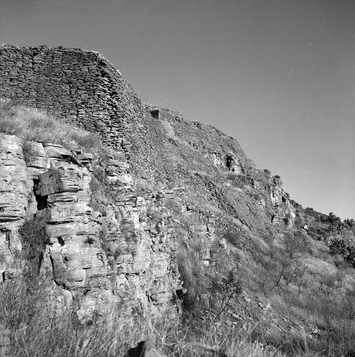
The Wall: There is a great Wall 605 meters long, with an average height of 4.5 meters and 3.75 meters wide. It has been considered as an architectural element of defensive character.

The architectural spaces of La Quemada