


Becán
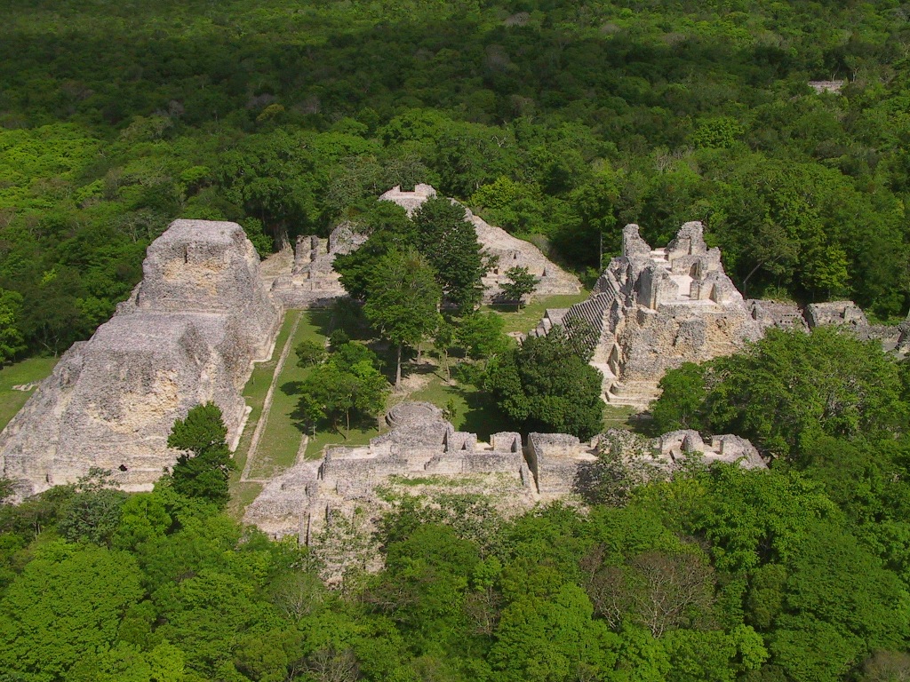
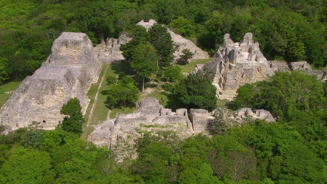
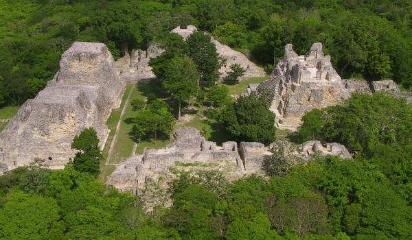
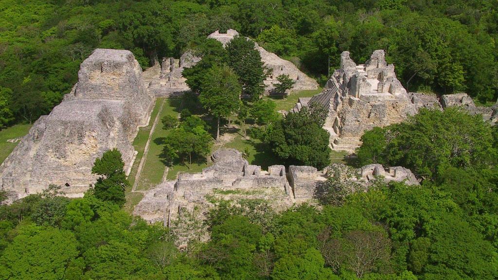
A powerful regional capital, as evidenced by its monumental constructions, Becán also boasts something found nowhere else in the Maya area: a fosse surrounding the site’s most important buildings, which has seven entrances.
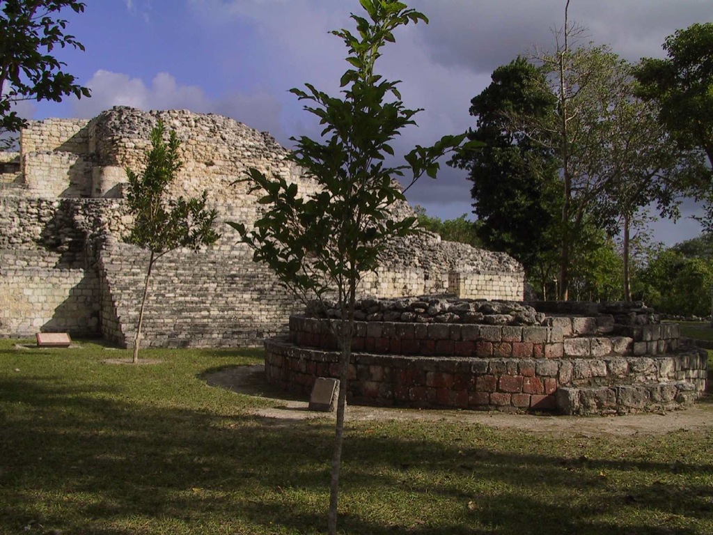
The archeological site of Becán is located in the southeast of the state of Campeche. In Yucatecan Mayan, its name means “path, hollow or ravine formed by running water.” It has also been interpreted as “path of the serpent," in allusion to the large, irregularly shaped fosse surrounding the center of the pre-Hispanic settlement.
The archeological site of Becán was first recorded in 1934 by the US researchers Karl Rupper and John Denison, who made an expedition to the south of Campeche under the auspices of the Washington-based Carnegie Institution and went on to produce a brief but significant study of its architecture. Later, from 1969 to 1973, Edward Wyllys Andrews IV and Richard Adams of Tulane University (New Orleans) conducted explorations of the Río Bec region, including Becán, and this brought to light more information about the architecture, systems of habitation, defense and farming, as well as the ceramics and stone carving, among other things. Various researchers attached to the National Institute of History and Anthropology (INAH) have since continued exploration, restoration, and conservation work, and communicated their findings: Agustín Peña (1977-1978), Román Piña Chan (1983-1985), Ricardo Bueno (1991-1994), Antonio Benavides (1995), Vicente Suárez (1995-1996, 2009), and Luz Campaña (1999 to 2001).
The site’s occupation can be traced back to the Middle Preclassic (600-300 BC), although the earliest structures found so far have been dated to 100 AD, namely the plinths with foundations for homes. By the end of the Preclassic period (300-250 BC), the original settlement consisting of a handful of houses had developed into a town with a much denser population. The surrounding lands were successfully farmed, and the site’s strategic location between the Gulf Coast and the Caribbean enabled it to control local trade routes.
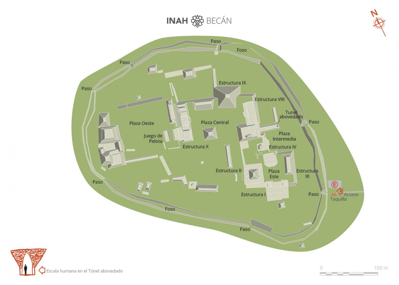
The central part of the settlement is located within a perimeter defined by a fosse with a parapet, a construction that dates back to the end of the Preclassic. This fosse has seven entrances, each formed by a sort of solid bridge carved directly out of the bedrock and removing the local sandy limestone, also known as “sascab”; masonry work completes the volume. The fosse measures 6200 feet long and an average of 52.5 feet wide, with a depth varying between 4 and 18.7 feet.
This fosse served a number of purposes and was never designed to contain water; instead, it was part of a drainage system for the city center. It is believed to have originally been a quarry or bank from which large quantities of building materials were extracted in order to build the monumental structures. At the same time, it was designed to demarcate Becán’s civic and ceremonial area, created by three architectural complexes known as West, Center-North, and East, each one with its plaza named in the same way. This also provided a defensive aspect to this part of the site, from which the elite could exercise their political and economic power.
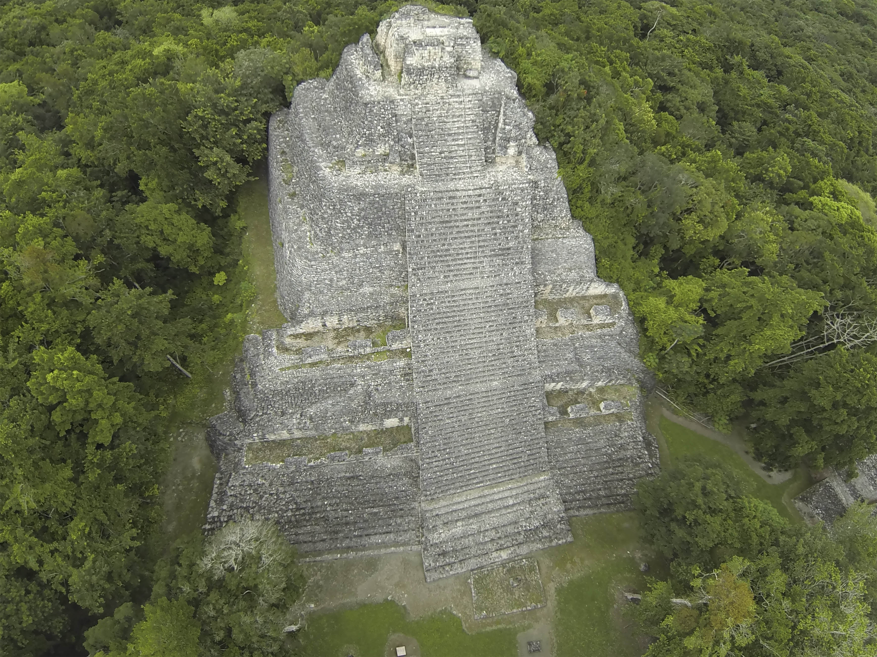
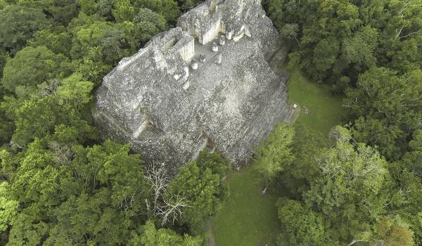
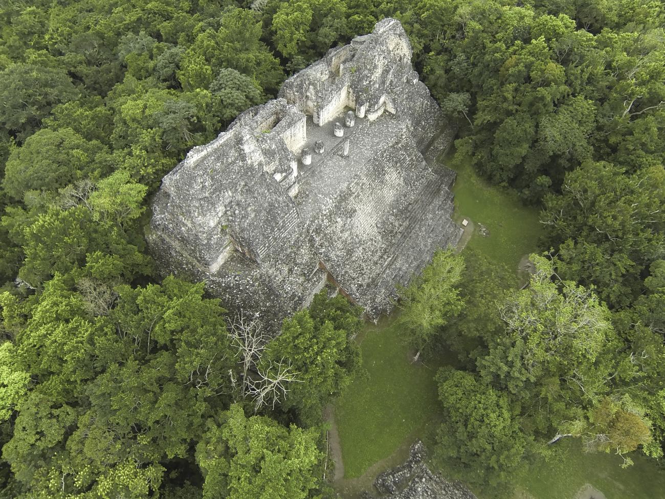
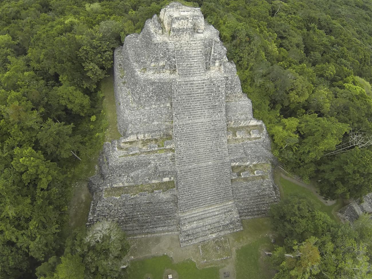
Early in the Classic period, the entire southern region of the current territory of Campeche was under the influence of the Petén sites. The link with Petén was obvious, as we can see in both the pottery and the architecture. Becán’s Structure XI, rising 138 feet tall, is not only the highest structure but also representative of the architecture of Petén in the Preclassic and Classic periods.
During the Classic period, various stelae were erected to commemorate the local dynasty’s important events and achievements, such as the investiture of new rulers, conquests and anniversaries. During the Late Classic (600-900 AD), Becán consolidated its position as capital of the entire Río Bec region, and it stands out from other sites in the area for its antiquity, longevity, the profusion and density of monumental buildings, as well as the quality in the elaborately carved stonework in many of these structures. This is a sign of a large population and well-organized labor system, under the control of the local ruling class, all of which led to the development of the community and Becán’s administrative and religious buildings. Becán is believed to have maintained control over population centers such as Chicanná, Chaná, Xpuhil, Hormiguero, Payán, Culucbalom, Manos Rojas, and Okolhuitz, with which it interacted at a regional level.
Becán distinguishes itself most of the other settlements in the Río Bec region as much for having been built around a nucleus as for the monumental verticality of its buildings that have been uncovered. These towering architectural volumes conceal other, older buildings within. The majority of the site’s structures in its final period of occupation were built between 600 and 800 AD.
Its architecture follows the Río Bec tradition: the buildings are mainly built on a semi-quadrangular base, with numerous chambers supported by a platform. They are flanked on each side by several towers with steps that simulate a pyramid with unclimbable steps with a temple on top, also simulated or at least only semi-functional. Examples of this include Structures I and VIII. Astronomic observations were possibly made in the former, which stands 49 feet tall, while the latter was used for religious activities.
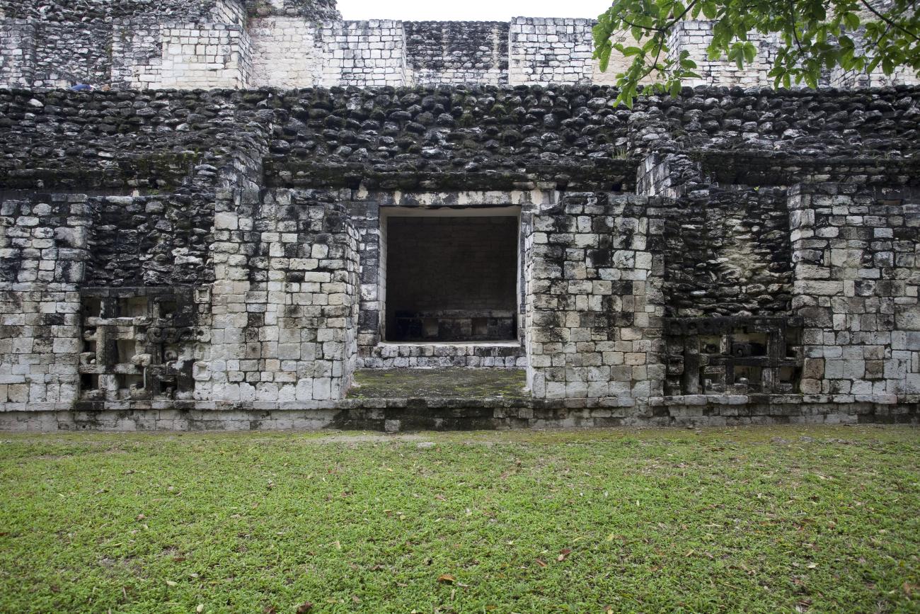
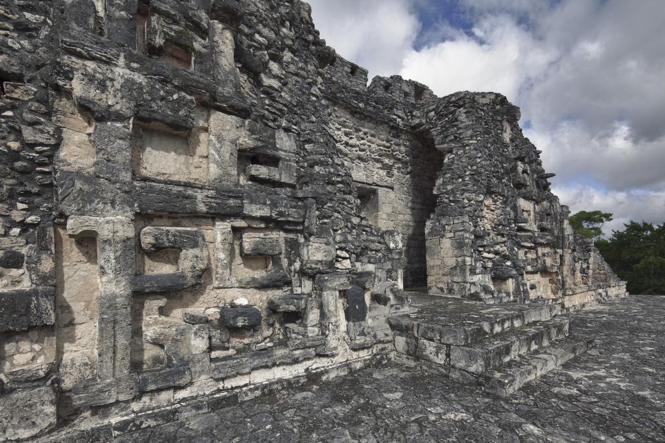
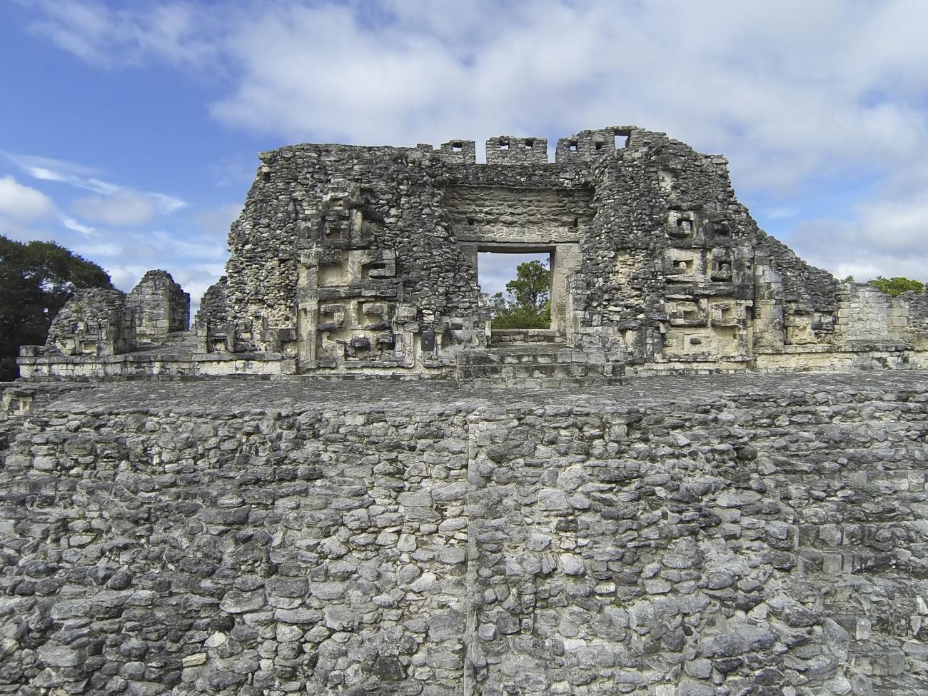
Cylindrical masonry columns clad in expertly carved ashlars are notable architectural features. Río Bec architecture commonly includes decorative motifs of panels with highly stylized snake heads shown in profile, openwork checkerboard and cross decorations, stepped decorations and a series of three small tambours at the base of the buildings.
Construction work decreased significantly in the Postclassic period: the occupants preferred to continue using or partly dismantling the existing buildings. In around the year 1000 AD, the Maya city of Becán began to decline and was occupied by other communities with greater political and economic power. The population gradually dwindled, and it began to be overgrown by the dense forest vegetation.
- Dirección del Centro INAHAdriana Velázquez Morletadriana_velazquezm@inah.gob.mx+52 (981) 816 9111Operación de Zonas Arqueológicas del Centro INAHCandelaria del Carmen Duarte Patzarqueologicas.camp@inah.gob.mx+52 (981) 816 9111, ext.138016
Plaza del Este
In this group is located the so-called Intermediate Terrace, as well as an open plaza where the site is currently accessed after clearing the moat, which is achieved by crossing a pre-Hispanic bridge.

In this group is located the so-called Intermediate Terrace, as well as an open plaza where the site is currently accessed after clearing the moat, which is achieved by crossing a pre-Hispanic bridge. The East Plaza is surrounded by structures I to the south, II to the west, III to the east and IV to the north. Two late structures in its interior break with the original design of the plaza.
Structure I: Composed of two levels of rooms. At the height of the second roof, two tall masonry towers rising 15 m, characteristic of the Río Bec style, can be seen at the ends.
Structure III
Plaza Oeste
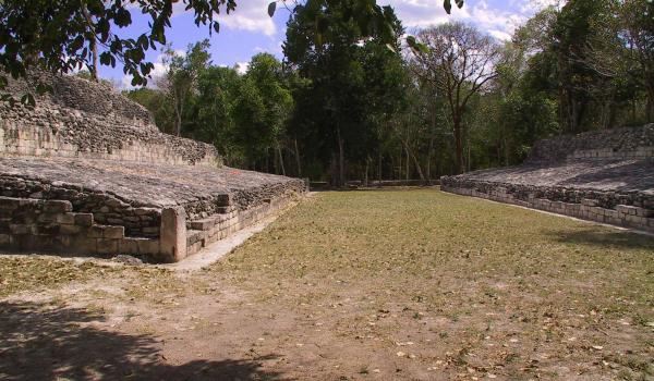
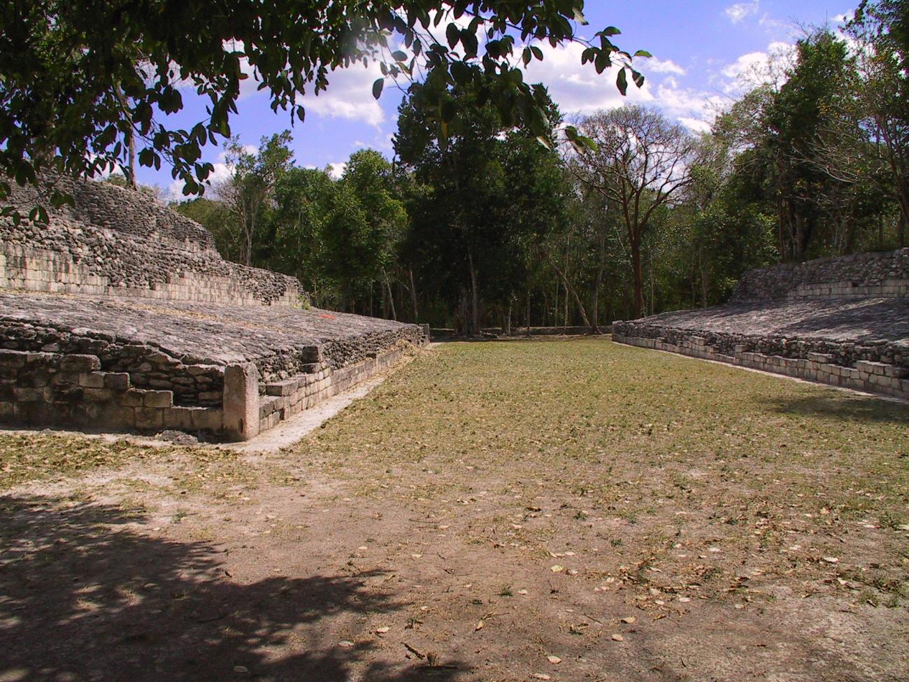
In it, the ball game stands out, formed by two parallel buildings located on a north-south axis, with the characteristic slopes facing the court. It did not have rings or stone rings, apparently it was equipped with markers in the corners, possibly made of wood or other perishable material.
Grupo del Norte-Centro
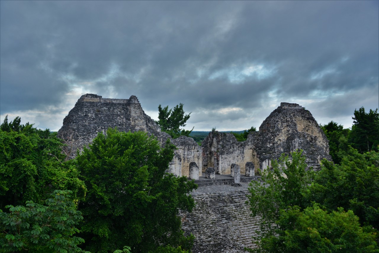
In this group is located the Central Plaza, larger than the East Plaza. It had a stucco floor in its heyday and has the most spectacular structures of Becan: the VIII (east), the IX (north) and the X (west).

In this group is located the Central Plaza, larger than the East Plaza. It had a stucco floor in its heyday and has the most spectacular structures of Becan: the VIII (east), the IX (north) and the X (west). Seat of great celebrations, it has a couple of stelae that commemorate historical events. Unlike other open spaces, its shape is rectangular and it is delimited by more than four buildings.
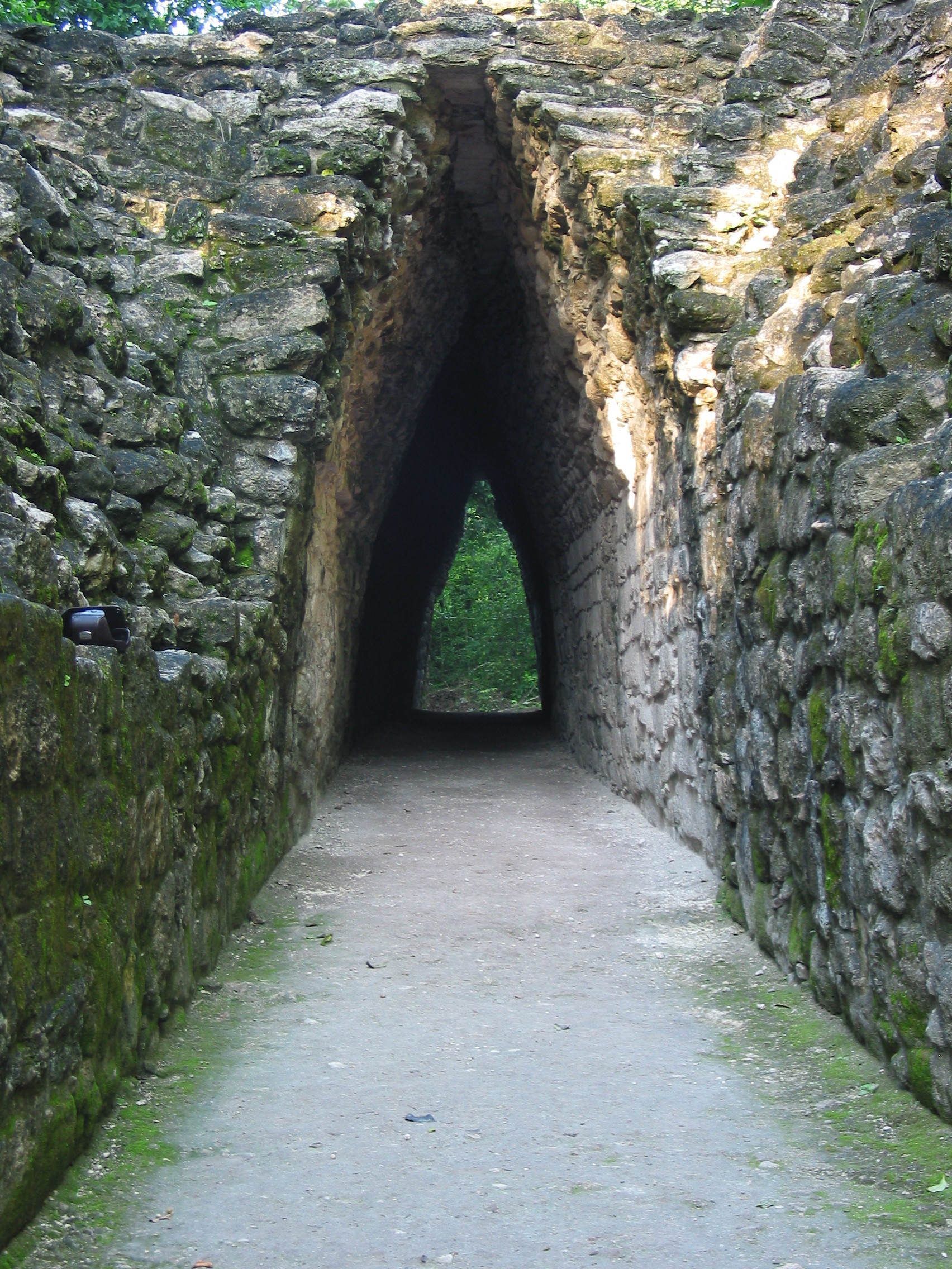
Structure VI: It rises eight meters above the level of the terrace and limits it to the north. Its characteristics are unknown due to the degree of destruction, but it had three small mounds on three of its sides and a larger one on the remaining one. On the south side there is a narrow corridor 1.70 m wide by 2.80 m high and 66 m long, roofed with a vaulted ceiling.
Structure VIII: It consists of a great basement with nine rooms that could have served for the fasting and place of prayer of the priests. At the ends it has two towers that were possibly topped with crests.
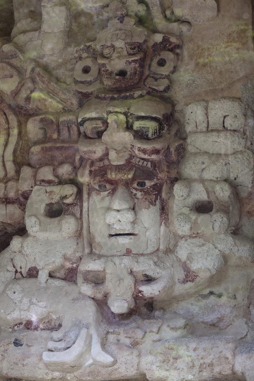
Structure IX: It is the most imposing and tallest of Becán, as well as one of the few examples of temples on a pyramid in the Bec River region. It shows vestiges of three architectural phases that evolved over 900 years. It is distinguished by its masks, smooth slopes and rooms on the sides of the stairway. Inside the upper platform a funerary chamber was built at the beginning of the Classic period where an offering was deposited.