Malpasito
Its name derives from the ejido (communal farm) village Malpaso Huimanguillo.
This site is characteristic of the Zoque culture, close to the Olmec and the Maya, but different. Thirteen hundred years ago its founders flattened the irregular terrain and formed artificial terraces on which to erect their delicate constructions, as well as producing fine pottery.
About the site
Malpasio is in the corner of Tabasco bordering the states of Chiapas and Veracruz. Between 600 and 900 it was occupied by groups related to the Zoque, who managed to build a modest city, becoming the political and economic center of a small province between the Pava and Amacoite mountain ranges.
The city influenced the growth of smaller settlements on the slopes of the mountain ranges. There was an abundance of natural resources thanks to the humid tropical climate, with good growing conditions for corn and cacao.
The inhabitants had a pottery tradition which featured white or cream finishes, with innovations acquired from the Gulf coast of Mexico, such as local adaptations of fine orange colored pottery.
Malpasito may have been dominated by more important sites located in the northeast of Chiapas, such as San Antonio and San Isidro, which have shared cultural traits in terms of ceramics and architecture, and whose people were ancestors of the Zoque chiefdom of Quechula, which was encountered by the Spanish conquistadors.
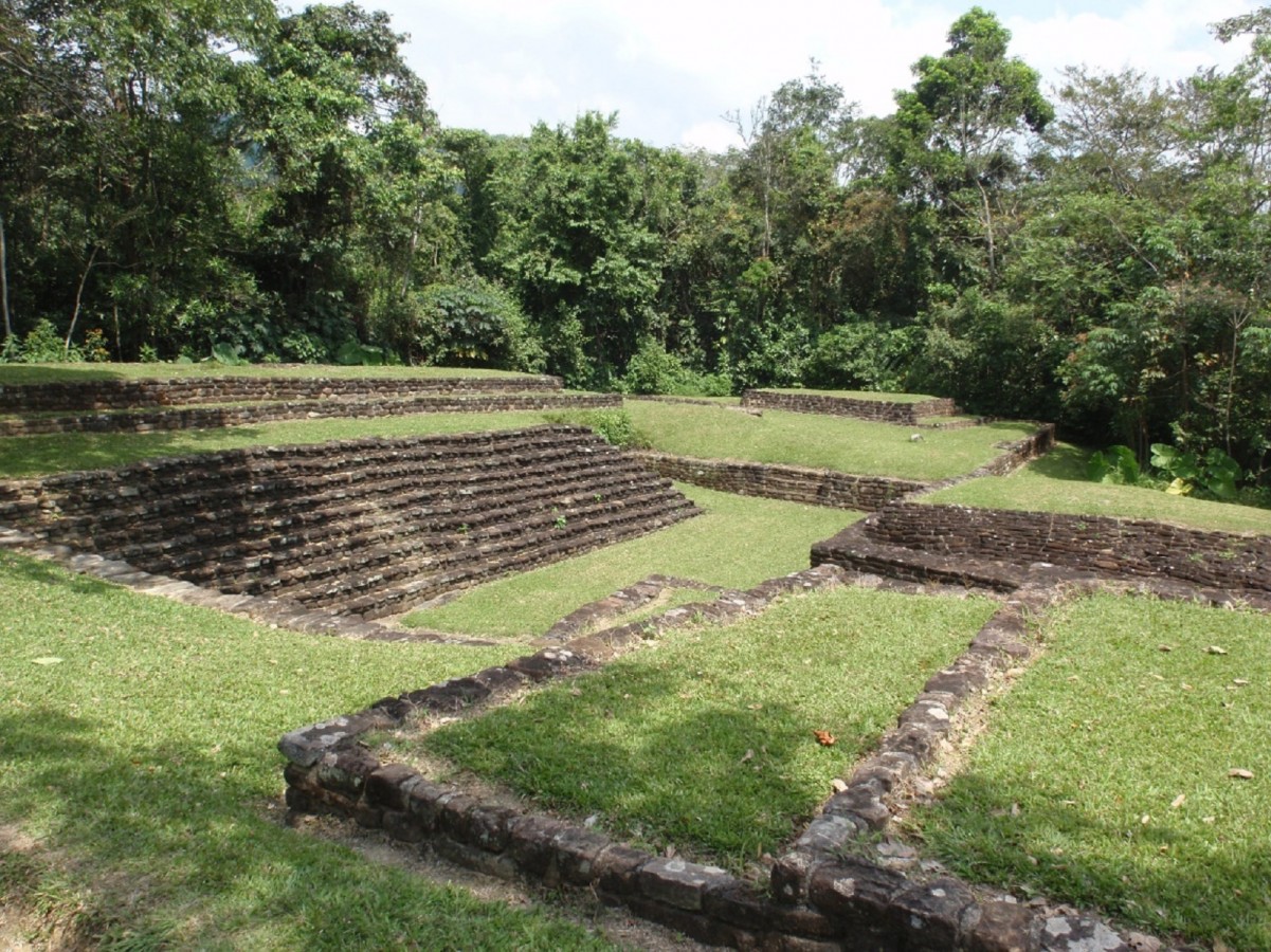
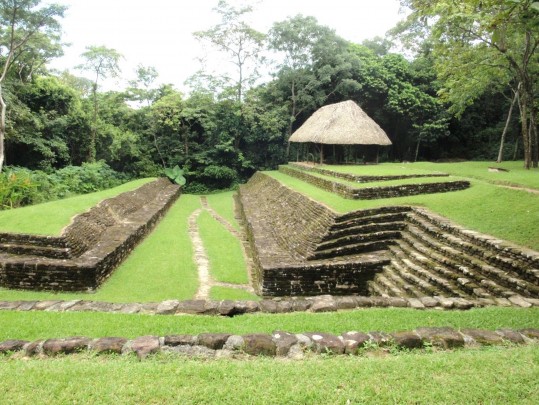
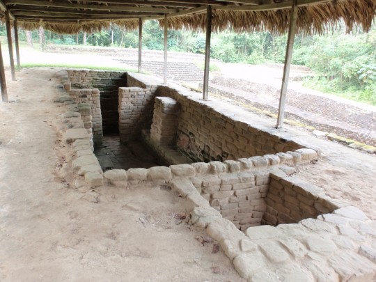
The archeological site is strategically located on the slopes of the mountain and between two small valleys which determine the sole point of entry at the northeast end. With its 53 buildings, the monumental area covers 35 acres. The architecture is distinguished by the use of rectangular platforms built from cut sandstone blocks joined with mortar.
The distribution of buildings in the civic-ceremonial area was carefully planned, both on the hilltop and along the curves of the artificial terraces, which implied the possession of the sophisticated engineering knowledge needed to integrate the architectural elements into the natural topography.
By contrast, the location of buildings in the residential area was determined by the shape of the land, water sources, and easy access to farmland, which is why low hills were chosen, as can be seen in the northern area of the site. These platforms might have supported houses or temples roofed with high truncated conical roofs, built from perishable material such as wood and a species of grass or palm fronds.
Did you know...
- Malpasito’s proximity to the Mezcalapa River connected it to a main communication route, which facilitated trade with the settlements between the Pacific and Gulf coasts of Mexico.
- The design of the civic-ceremonial area made reference to the symbolism which this town ascribed to the mountain range and the hills as important elements of their world view.
An expert point of view

Francisco Apolinar Cuevas Reyes
Centro INAH Tabasco
Practical information
Temporarily closed
Monday to Sunday from 8:00 to 17:00 hrs
$75.00 pesos
Se localiza en el extremo sur del municipio de Huimanguillo, Tabasco.
Services
-
+52 (993) 352 1022, +52 (993) 352 1030
-
This email address is being protected from spambots. You need JavaScript enabled to view it.
Directory
Coordinadora de las Zonas Arqueológicas de la región de Los Ríos, Tabasco
Priscilia Jannet Lagunes Celis
This email address is being protected from spambots. You need JavaScript enabled to view it.
+52 (993) 352 1033 y 352 1022


