

Archaeology of Quintana Roo
The Pre-Hispanic Cultures of Quintana Roo
The ancient Maya cities in what is now Quintana Roo remained hidden in the jungle for centuries, while archaeological exploration focused on other regions. Beginning in the 1970s, the presence of the National Institute of Anthropology and History (INAH), growing interest from archaeologists, road construction, the founding of new settlements, and advances in technology made it possible to identify and document Maya sites in the region.
Living in Harmony with the Environment
The Maya built their understanding of the world and life itself based on their surroundings. Like the earliest settlers of Quintana Roo, they saw the sea as a rich source of food and raw materials. They also discovered in it an extraordinary means of communication, which allowed them to travel across the Yucatán Peninsula, throughout Central America, and perhaps even to more distant areas of the Gulf of Mexico.
The First Large Settlements in Quintana Roo
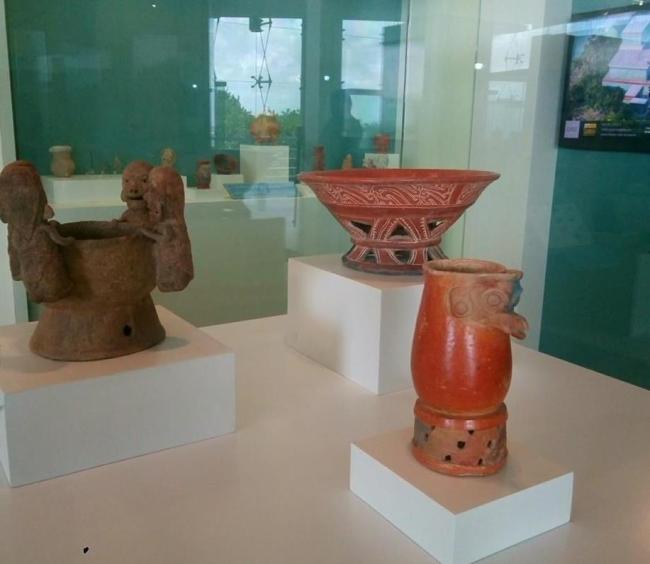
The first inhabitants of present-day Quintana Roo settled in small camps set up while foraging for food. Skilled in making and using stone tools, they relied mainly on animal protein, wild plants, roots, berries, and tubers. Hunting, fishing, and gathering gave them deep knowledge of plant and animal life cycles, which led to domestication. By the second millennium BCE, they were already cultivating maize—a grain that would become the foundation of the regional diet and a staple across Mesoamerica.
The Rise of Maya Power
After 300 BCE, Maya ruling groups began to establish dynastic lineages. The authority of kings was legitimized through their descent from ancestors of divine origin, believed to have lived in ancient times. Each dynasty expanded its power through warfare and alliances with other cities. Political, diplomatic, and religious events were recorded on stelae, monuments, and buildings. Thanks to the decipherment of Maya writing, we now know much about the lives and achievements of these ancient kings.
The Splendor of the Cities
Maya cities were built on elevated terrain with good drainage, near fertile land and water sources. Their layout reflected social hierarchy and cosmic beliefs, with every element of the urban landscape serving as a cosmological symbol. Plazas, stelae, and temples symbolically echoed the primordial sacred landscape of jungle, mountain, and cave. Farmers in surrounding areas mirrored this worldview in their own landscapes—among forested hills, caves, and cenotes.
The Maya House
Maya temples and palaces were surrounded by vast agricultural fields inhabited by rural communities that supplied the urban centers. The typical dwelling was a simple oval or rectangular structure with wooden walls and a thatched palm roof. Families and work groups lived in household compounds that included living quarters, storage areas, kitchens, animal pens, beehives, refuse pits, and even small temples.
Times of Change
Pinpointing the decline of the powerful Maya political systems in Quintana Roo is challenging. Research suggests there was not one single collapse but rather many, occurring under different circumstances and timelines. However, most seem to have taken place during a critical period between the 9th and 10th centuries CE.
The Brief Rise of a Giant
Around the 9th century, Chichén Itzá competed with neighboring cities for control over land and resources. Growing tensions with Uxmal and Cobá led to conflict and the breakdown of alliances. The rulers of Chichén Itzá then allied with other Maya groups, such as the Chontal, and established a new regional order. This alliance allowed them to accumulate unprecedented power in the Yucatán Peninsula beginning around the year 1000.
Return to the Sea
After the fall of Chichén Itzá and Mayapán, the Yucatán Peninsula became divided into various autonomous provinces known as kuchkabalob. Some grew wealthy and relatively powerful by controlling salt-producing regions and coastal ports. Important seaports of the time included Tulum, Xcaret (Polé), Xamanhá (Playa del Carmen), Xelhá, and Ichpaatún. Each kuchkabal had several central cities, governed by a regional leader (halach uinik) or local chief (batab), who managed territories with shifting borders depending on alliances or conflicts with neighboring provinces.
First Encounters
During Christopher Columbus’s fourth voyage (1502–1504), the first recorded encounter between European explorers and Maya merchants occurred on an island near the coast of Honduras. A few years later, in 1511, a Spanish ship bound for Santo Domingo struck a reef north of the Yucatán and sank. Only two survivors reached the coast of Quintana Roo: Gonzalo Guerrero and Jerónimo de Aguilar.
Rediscovering a Glorious Past
Following the establishment of the Territory of Quintana Roo in 1902 and the rise of the chicle and fine timber industries, the first archaeological excavations were launched. In 1916, Sylvanus Morley carried out the first scientific exploration at Tulum, Tancah, and Xelhá, followed by research in Cobá and Cozumel. In 1923, Samuel K. Lothrop published the first major architectural study of the Eastern Coast.
