


Los Cerritos de San Cristóbal Tepatlaxco
Located very close to San Martín Texmelucan, the origin of the early settlers is unknown. A fortified site with a strong Olmec influence, it maintained trade relations with a number of villages in the Puebla-Tlaxcala valley. Most notable are the plinths built on the edge of the ravines.
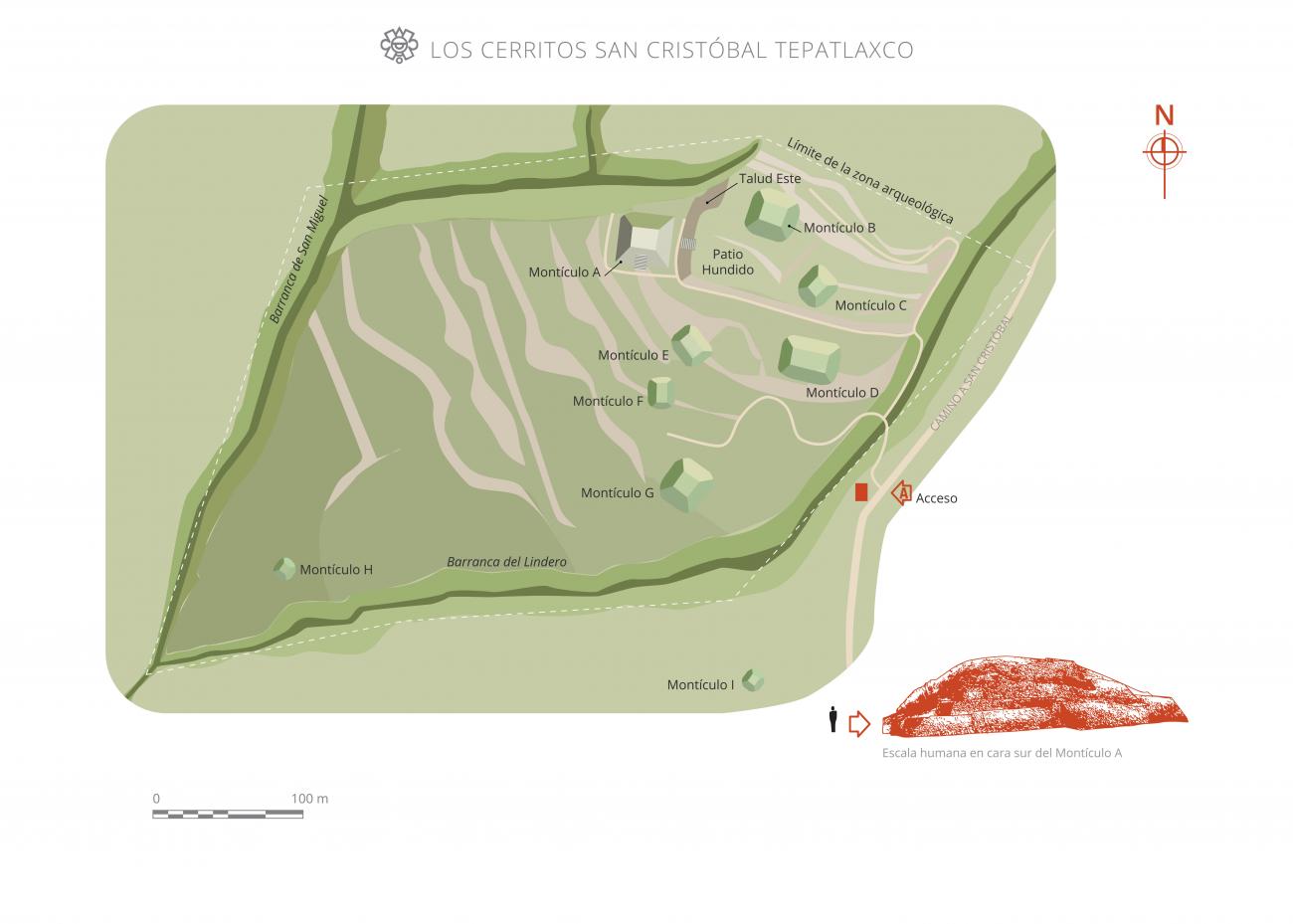
The site is located 1.2 miles from San Martín Texmelucan, on the lower southwestern flanks of Cerro Totolqueme, and half a mile to the north of Atoyac River, in the town of San Cristóbal Tepatlaxco, in the state of Puebla. Much of the archeological zone is limited to the south, east, west and northwest by ravines that become deeper towards the north.
This site was given the name of the nearest town, which is derived from the Nahautl words tecpan- (palace), tlachtli- (ballgame) and co- (place). Tecpantlaxco therefore translates as "in the ballcourt of the palace." There is, however, another interpretation in which the name is thought to be derived from the word Tepatlaixco, which means "plain of rocky ground" or "enclosed by stones." It is popularly known as "the hills of San Cristóbal Tepatlaxco."
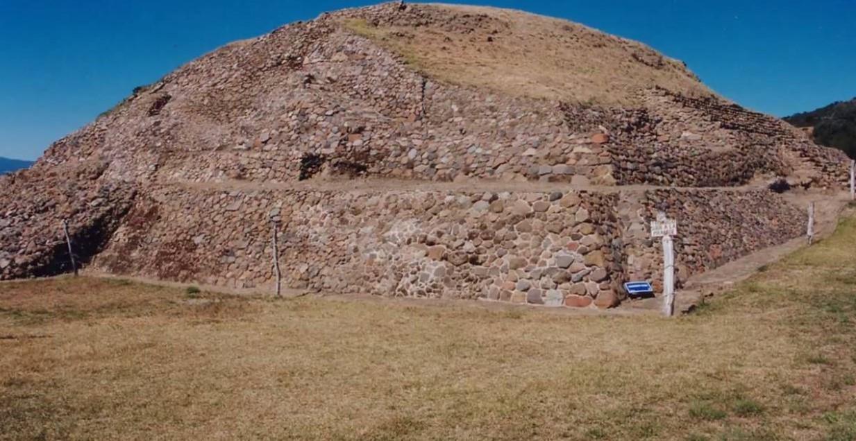
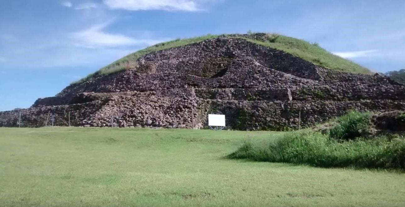
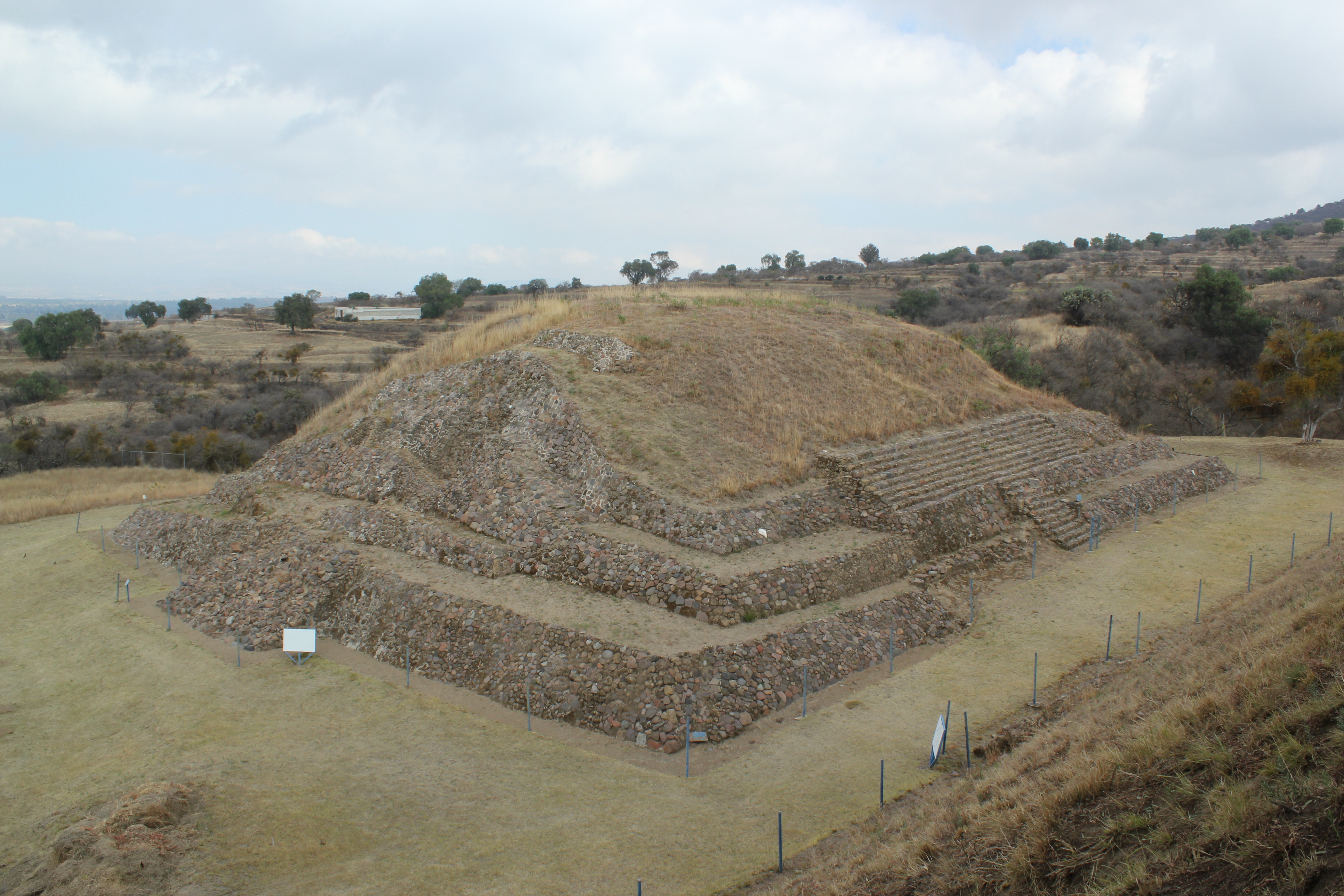
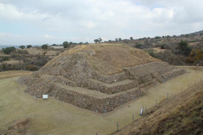
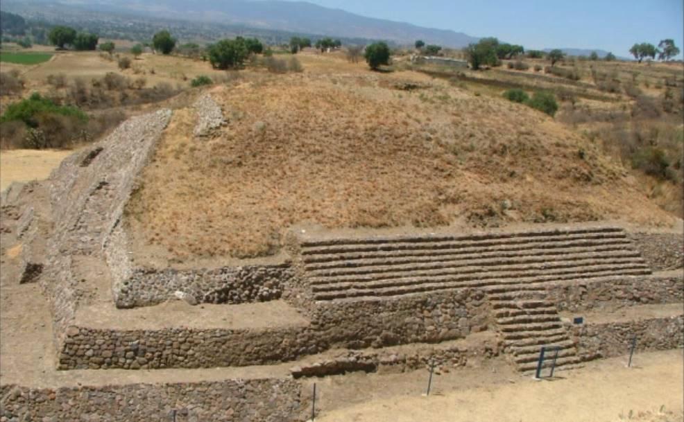
The archeological site was inhabited between 300 BC and 600 AD and is thought to be a fortified place of Olmec influence. However, we only really know that the inhabitants of Tepatlaxco must have maintained trade and family relationships with the inhabitants of Tlalancaleca, San Martín Texmelucan, Moyotzingo and numerous settlements in what is now the Puebla-Tlaxcala Valley. These relationships are inferred from elements and materials found onsite which are similar to those from the aforementioned areas. The site has nine pyramid bases with heights ranging from approximately 8 to 30 feet. However, as these bases lie at the edge of the ravines, they appear to be taller.
The temples and platforms were built using irregular blocks of tepetate stone, and then clad in river pebbles and a layer of stucco (crushed limestone), leaving a smooth and shiny finish.
- Dirección del Centro INAHGustavo Donnadieu Cervantesgustavo_donnadieu@inah.gob.mx+52 (222) 213 7390
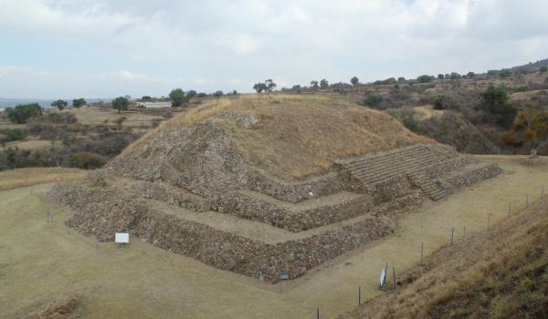
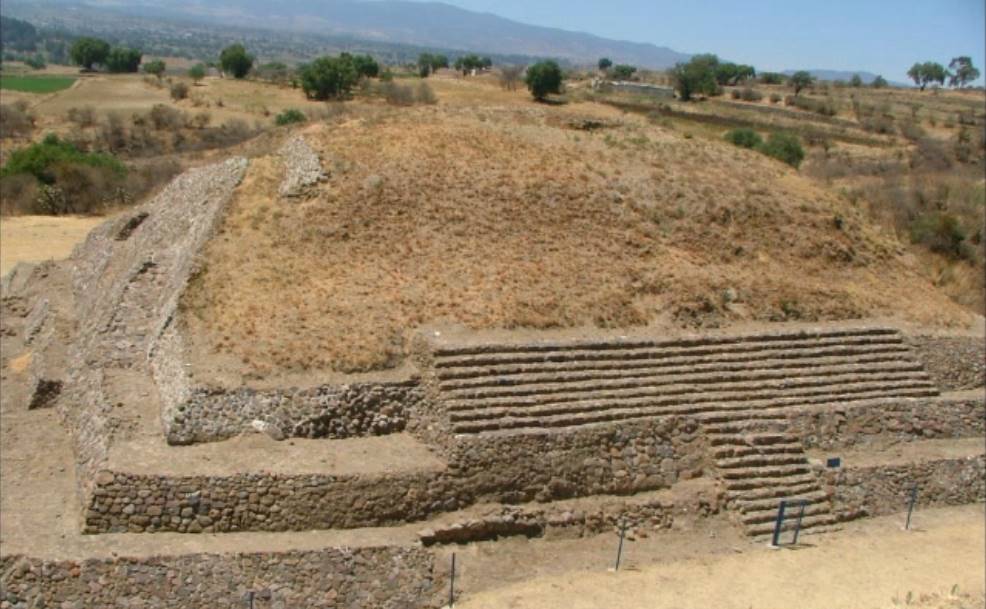
Montículo A
Pyramidal base of approximately 7 m in height, founded on a platform of 1.70 m in elevation.

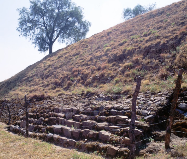
Talud este
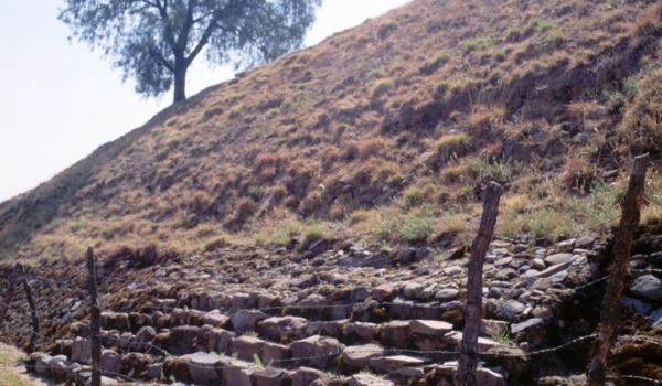
The slope lies directly on the irregular surface of the hill and has a north-south orientation.