


Cerro de Las Ventanas
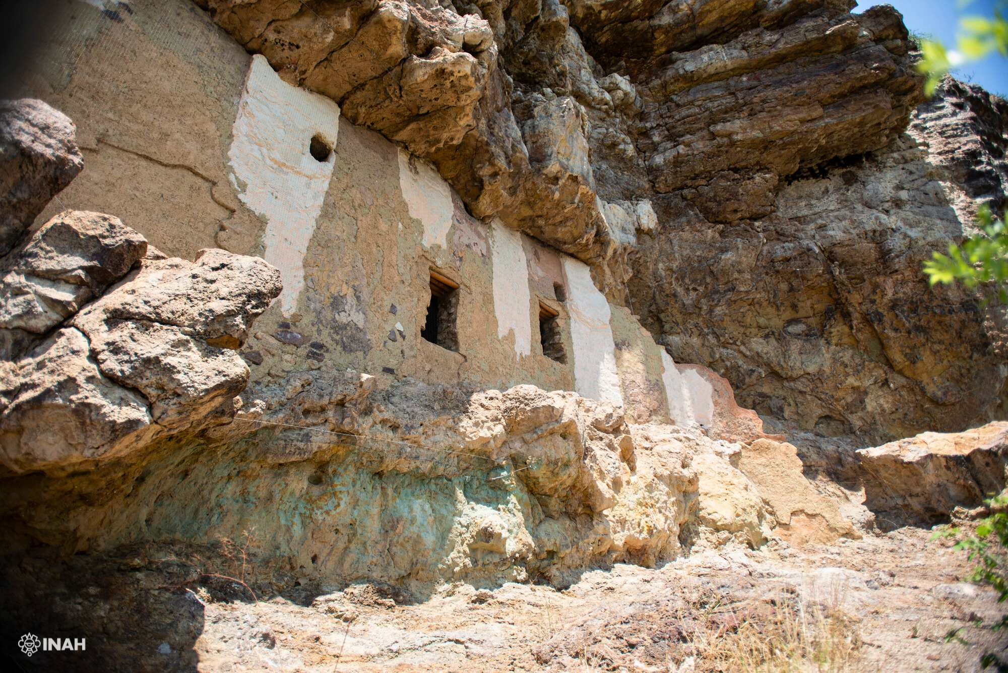
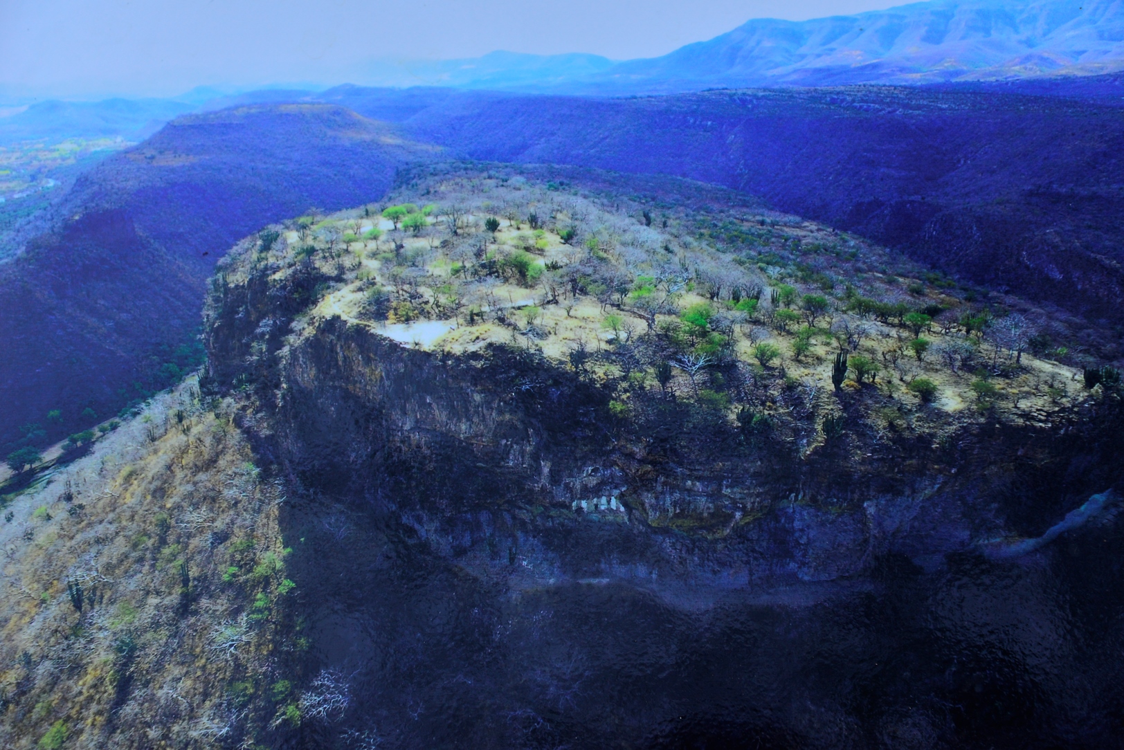
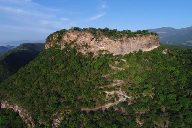
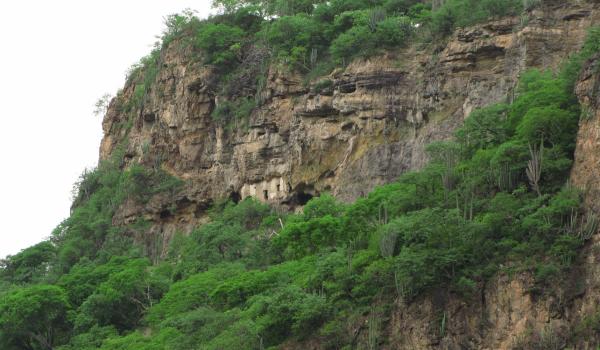
The majestic Cerro de las Ventanas rises close to the southern end of the Juchipila Canyon. It was named after the pre-Hispanic remains found in a rock shelter under the mountain’s highest crag. The shelter has a stone wall covered in clay with a few holes which look like windows from a distance.
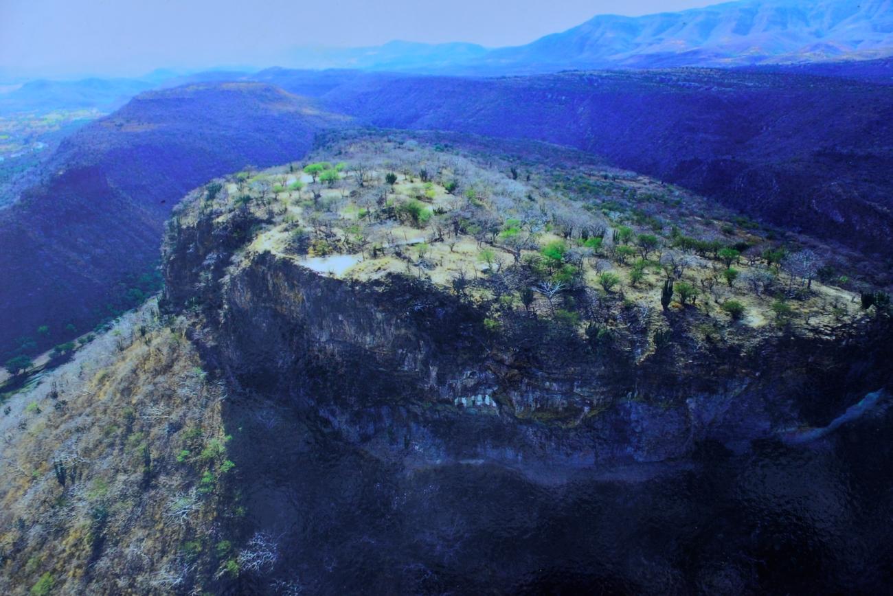
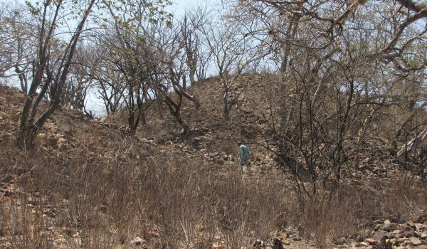
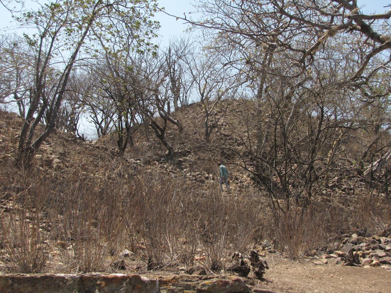
Contrary to what we might expect, this ancient settlement has many archeological remains distributed across practically the whole of the mountainous terrain, extending up to the neighboring Cerro Chihuahua. These remains include a monument complex covering the whole summit of the Cerro de las Ventanas.
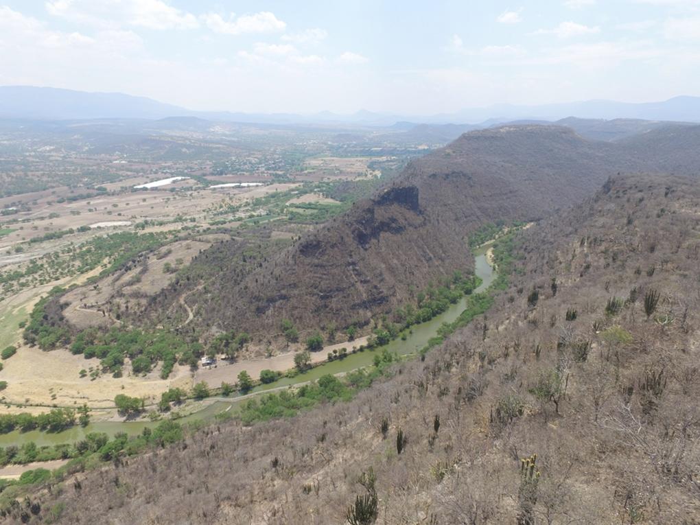
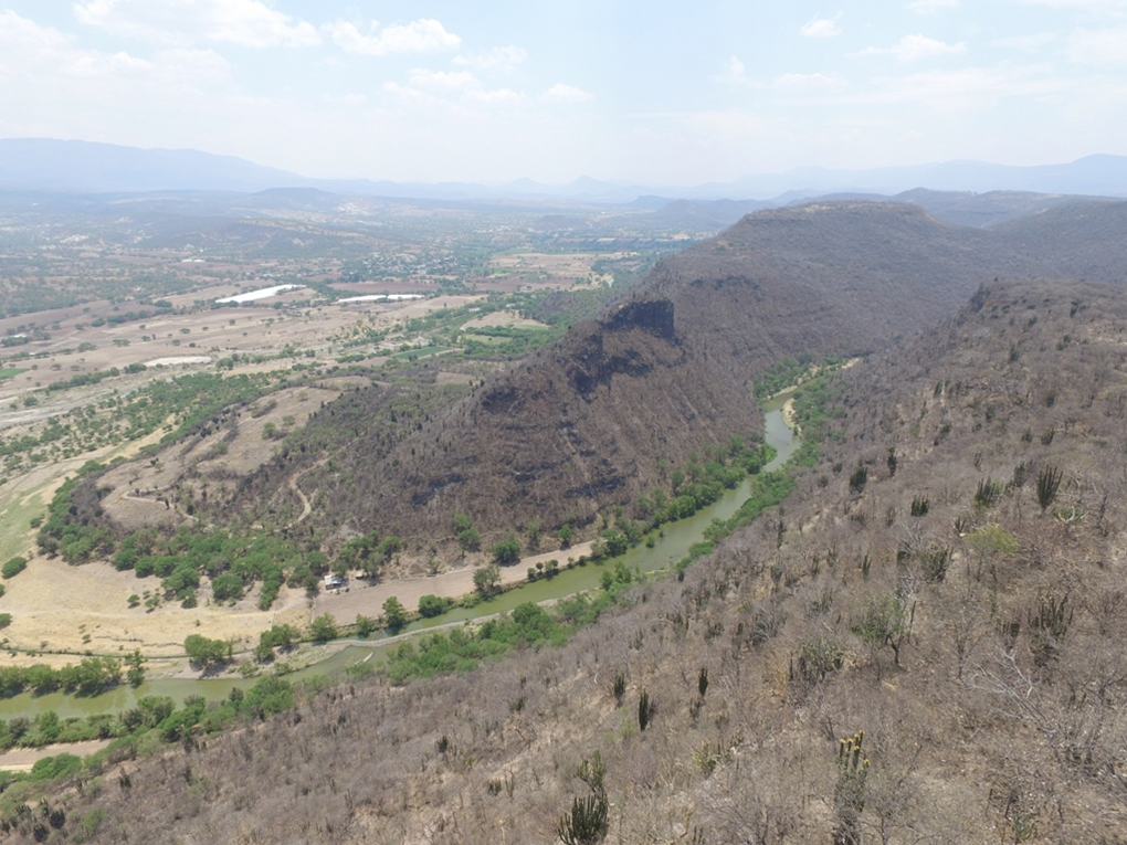
There are remains of shaft tombs dating to the first centuries AD very close to the mountainside. This was a sedentary society which practiced agriculture. Since the Cerro de las Ventanas is surrounded by a curve of the Juchipila River, it is probable that the cultivation of crops was one of the principal activities of the ancient inhabitants, making use of the river banks for this purpose.
Various terraces and platforms have been found on the east side of the mountain slopes. These modified the terrain by countering the slope to create flat spaces for dwellings and possibly for cultivation. Adaptations of this nature can also be seen in other areas of the mountain, serving as the foundations for building complexes used for ceremonies between the seventh and fifteenth centuries.
Topographical adaptation for architectural purposes altered the appearance of the mountainside, building a cultural landscape which served as a place of worship for at least seven or eight centuries.
Several human burials of different periods have been uncovered on the lower parts of the mountainside with grave goods and offerings consisting of sea-shell bracelets, pots, clay figurines and copper ornaments in later burials.
Human occupation was interrupted a couple of centuries before the arrival of the conquistadors, although the region continued to be inhabited by Caxcan groups.
The region was known as Xochipillan, or the place of the flowers, possibly because of its fertile soil. Around 1530 Cristóbal de Oñate founded the modern town of Juchipila close to a settlement known as Tlatlan or Tlaltan. The Caxcan were tired of the abuses of the Spanish and in 1541 they led an indigenous rebellion which threatened the conquest of New Spain. The episode ended in the famous battle of Cerro del Mixton, which the Spanish won.
There has been relatively little research into the Cerro de las Ventanas. One of the few exceptions was the photographic work of the Czech anthropologist Aleš Hrdlička, who documented the site’s emblematic remains in 1902, without excavating them. Many decades later, between 1988 and 1991, the U.S. archeologist Elizabeth Mozzillo carried out surveys and excavations which included taking samples for radiocarbon dating, which gave results from between the years 20 to 1405 AD.
A complex of terraces to the east of the site was explored between 2002 and 2006, as well as topographical surveys of the highest part of the Acropolis. They were directed by Dr. Nicolás Caretta. Subsequently, between 2008 and 2010, the archeologist Armando Nicolau Romero undertook some research and as part of his role he carried out some minor maintenance. Later, Marco Santos Ramírez took over responsibility, partially clearing the Plaza de los Altares.
Since mid-2014 Cerro de las Ventanas has been the focus of a comprehensive research and conservation project managed by the Zacatecas office of the INAH, under the charge of the archeologists Laura Solar Valverde, Luis Martínez Méndez and Peter Jiménez Betts. Good work has also been done to make the archeological site more accessible to the public. A Visitor Services Center was designed and built as part of this project, establishing the basic infrastructure for the site’s operation and management. Currently, the site is temporarily closed.
- Dirección del Centro INAHRaúl Pacheco Pérezraul_pacheco@inah.gob.mx+52 (492) 922 5085
Las Ventanas
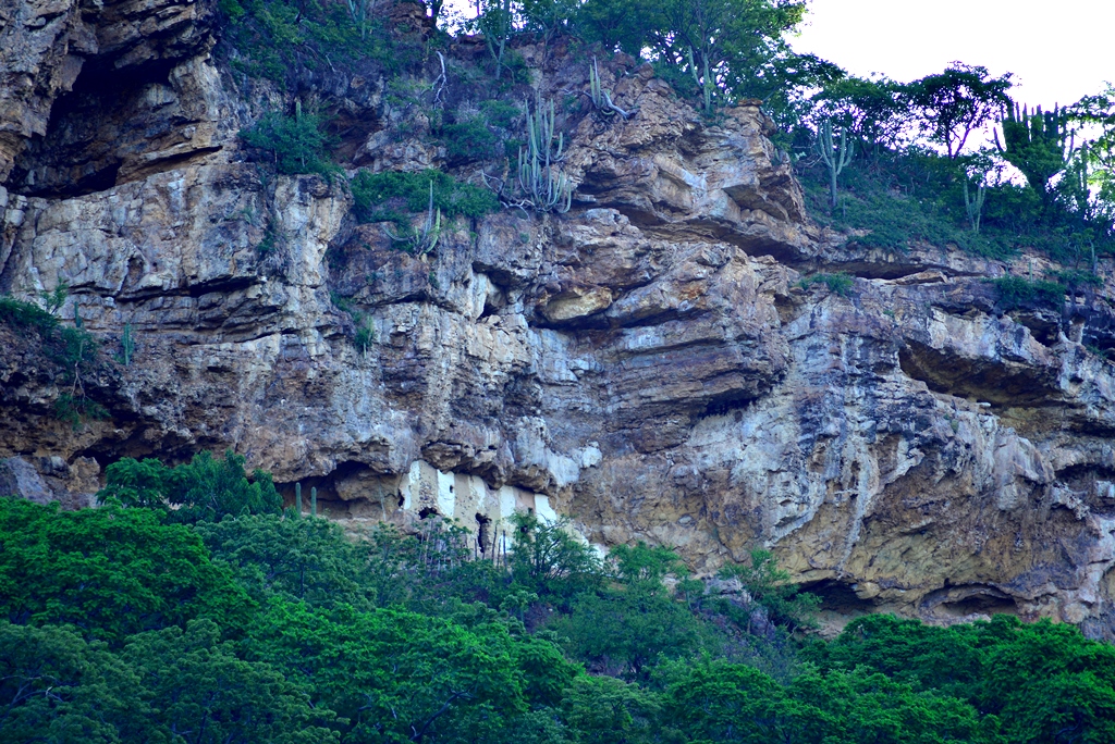
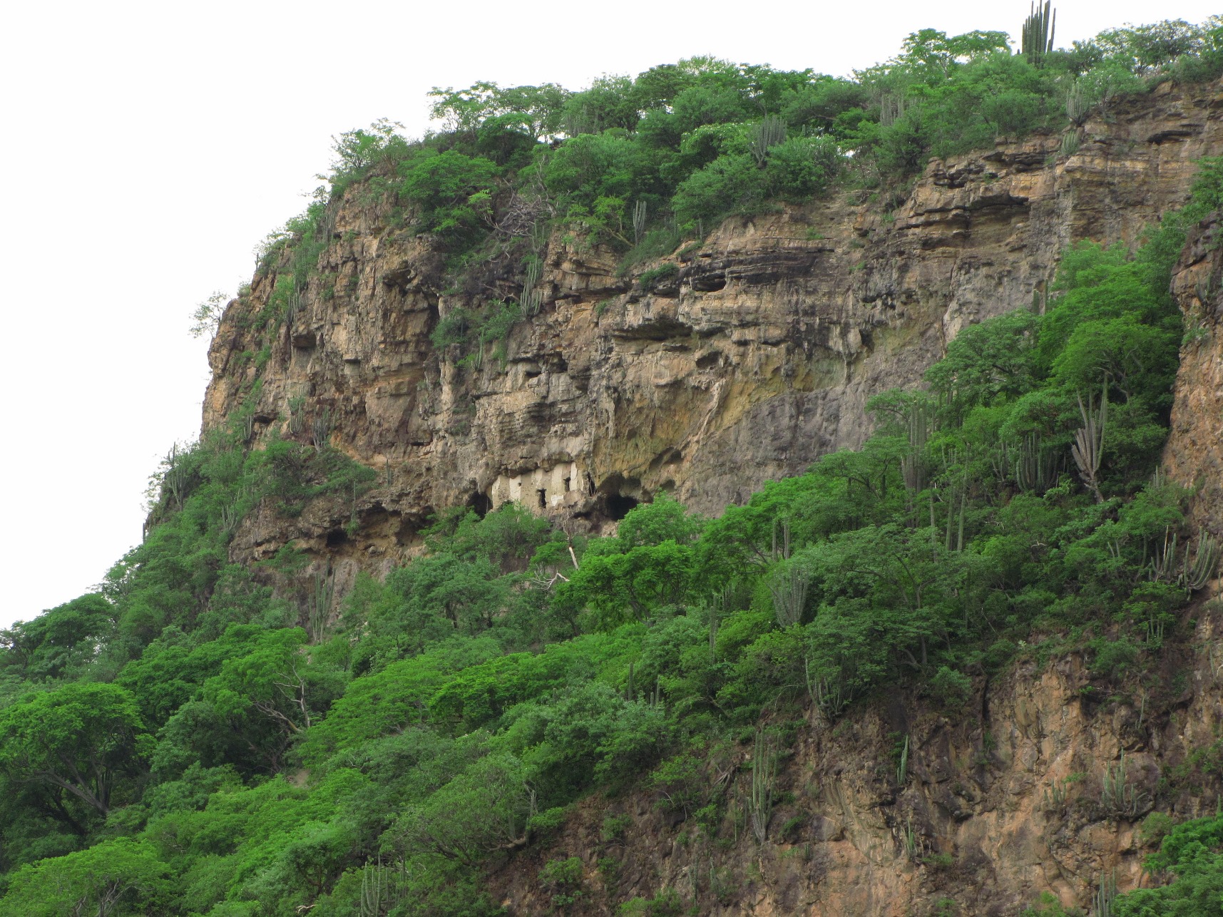
On the highest crag of the hill, facing east, is located the vestige known as Las Ventanas, in a rocky shelter approximately 12 m long and 3.5 m high. The wall that covers the covacha conserves remains of its original masonry, which showed alternating stripes of two colors by way of decoration.

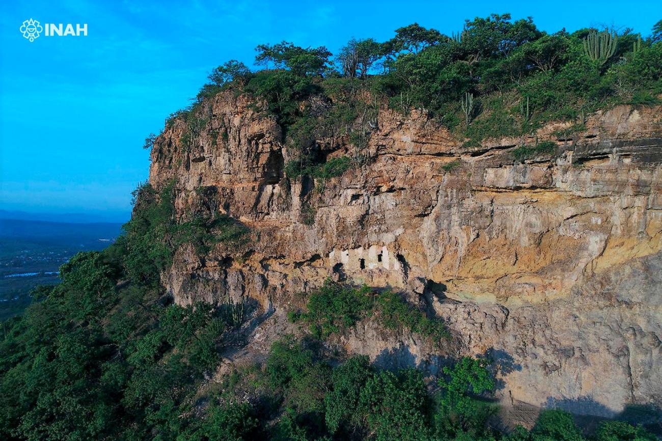
On the highest crag of the hill, facing east, is located the vestige known as Las Ventanas, in a rocky shelter approximately 12 m long and 3.5 m high. The wall that covers the covacha conserves remains of its original masonry, which showed alternating stripes of two colors by way of decoration. The construction system is based on masonry joined by means of mud mixed with grass.
Recently it was possible to obtain a dating by radiocarbon associated with the construction of this element, which places it around the VIII century of our era. The restoration of the rock shelter is currently underway, as part of the recovery process of this iconic feature that has been vandalized for several years.
Acrópolis
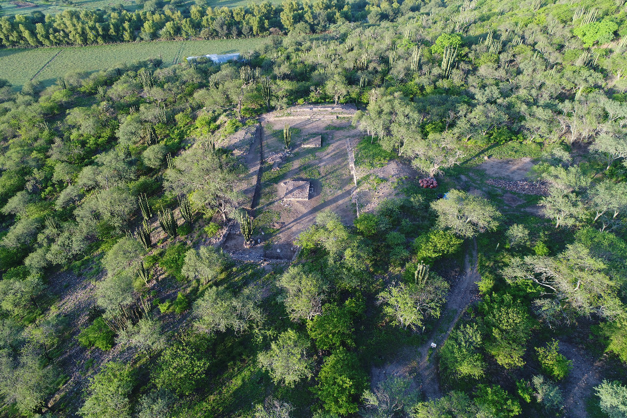
The main construction program of the settlement, built on the top of the hill, seems to date from the same period as Las Ventanas. It is approximately 10 hectares where buildings of different characteristics are distributed around squares and patios, on platforms and artificial terraces.
The main construction program of the settlement, built on the top of the hill, seems to date from the same period as Las Ventanas. It is approximately 10 hectares where buildings of different characteristics are distributed around squares and patios, on platforms and artificial terraces. In this complex the construction system stands out, based on overlapping thin slabs.
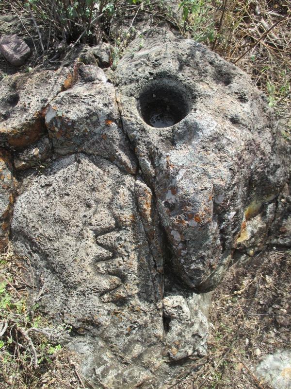
In the surrounding hills there are smaller architectural complexes and several groups of petroglyphs with anthropomorphic and zoomorphic motifs, along with stone jícaras and stairways, among other elements.
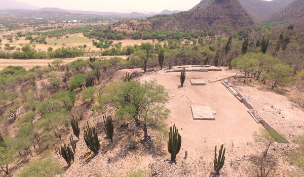
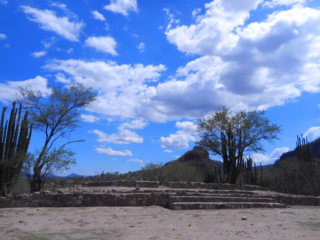
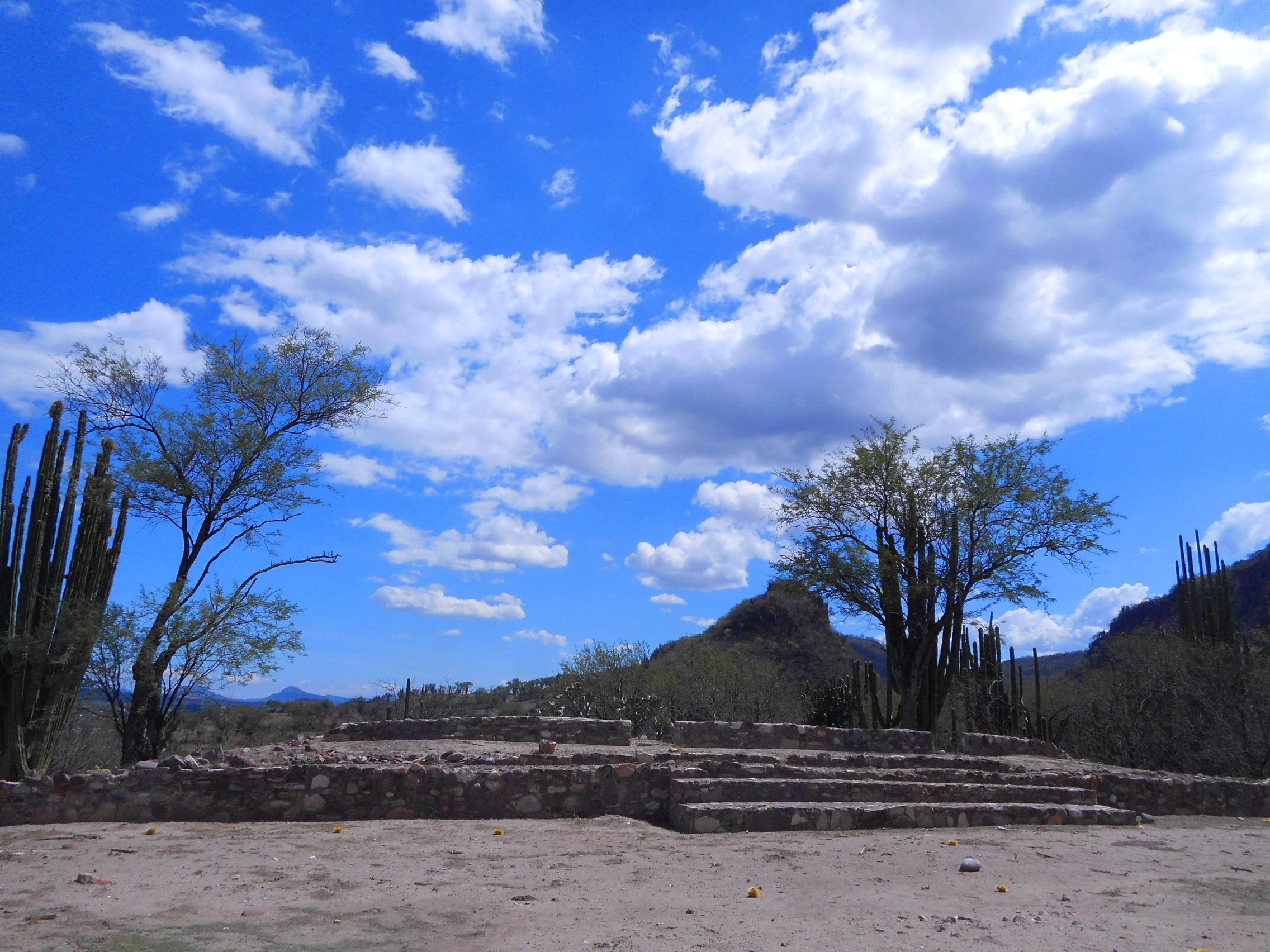
Plaza de los Altares
Other groups of buildings are located on the middle slope of the hill, of which only a plaza with two central altars, delimited by an elongated platform and some pyramidal bases, has been explored.
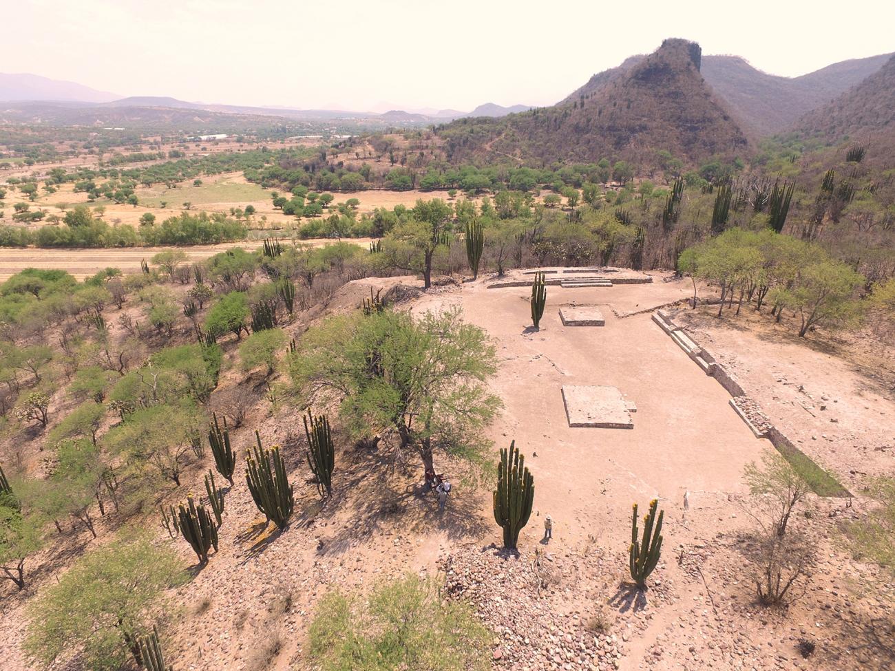
Other groups of buildings are located on the middle slope of the hill, of which only a plaza with two central altars, delimited by an elongated platform and some pyramidal bases, has been explored. This space, which is still under investigation, seems to correspond to a later stage of occupation, possibly between the tenth and fourteenth centuries AD.
In order to regularize the opening of the archaeological zone to the public, explorations are currently being carried out in the Plaza de los Altares so that, once it is completely free, it can be fully restored.