


El Chanal
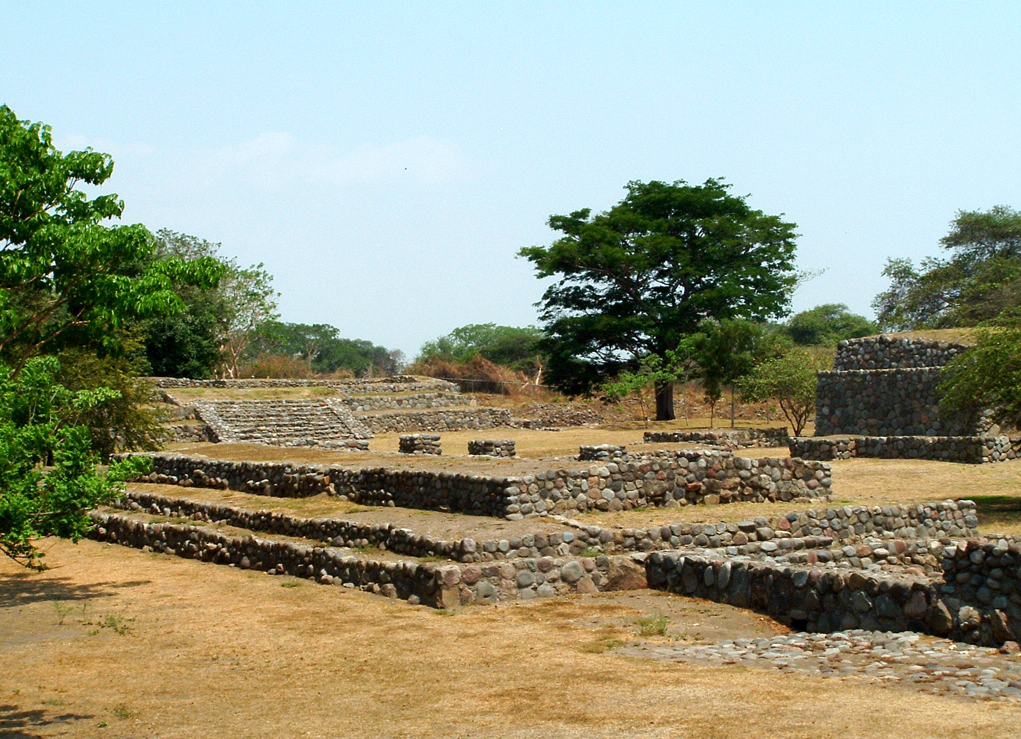
El Chanal is one of the most important sites of the Postclassic period in Western Mesoamerica, due to its unique architectural characteristics, its location, its time period and the size of the territory it covers.
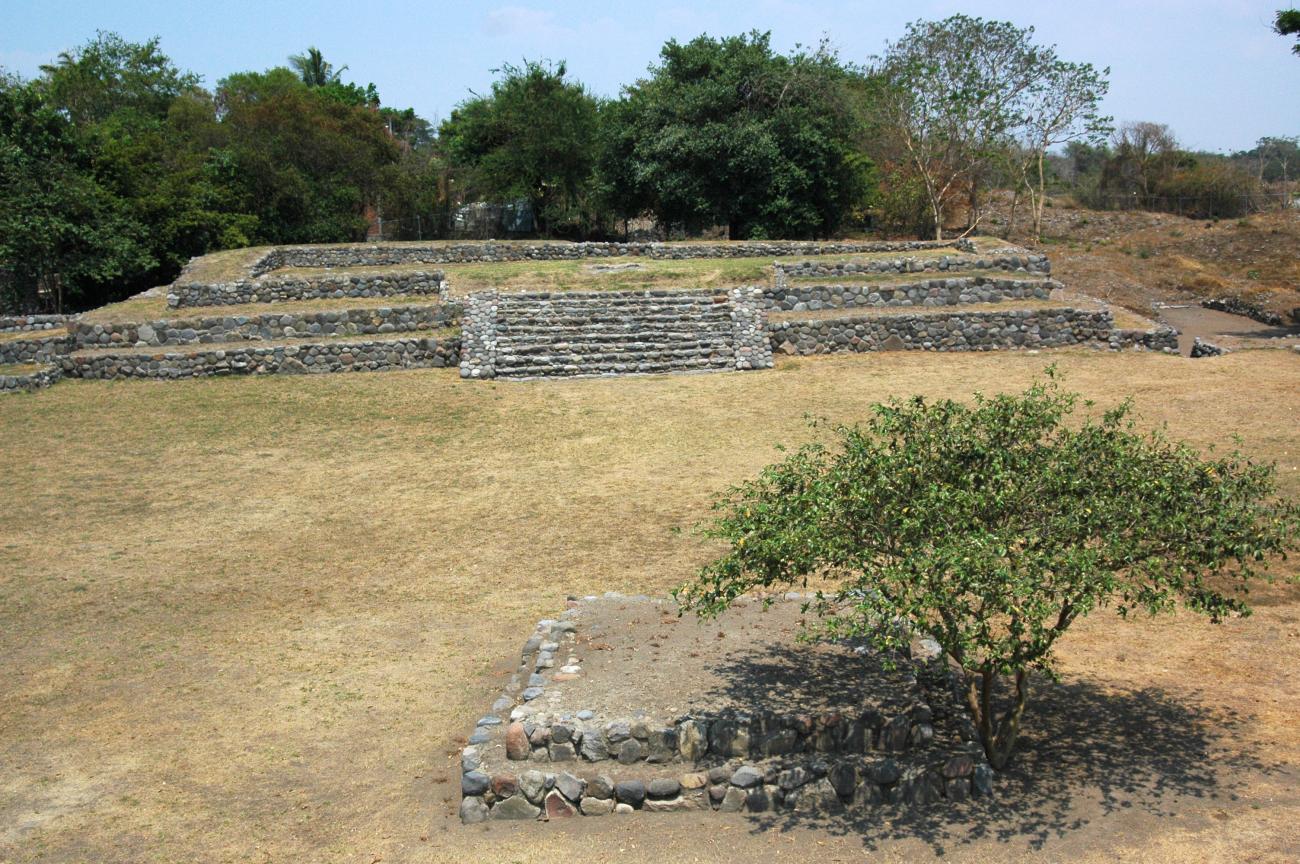
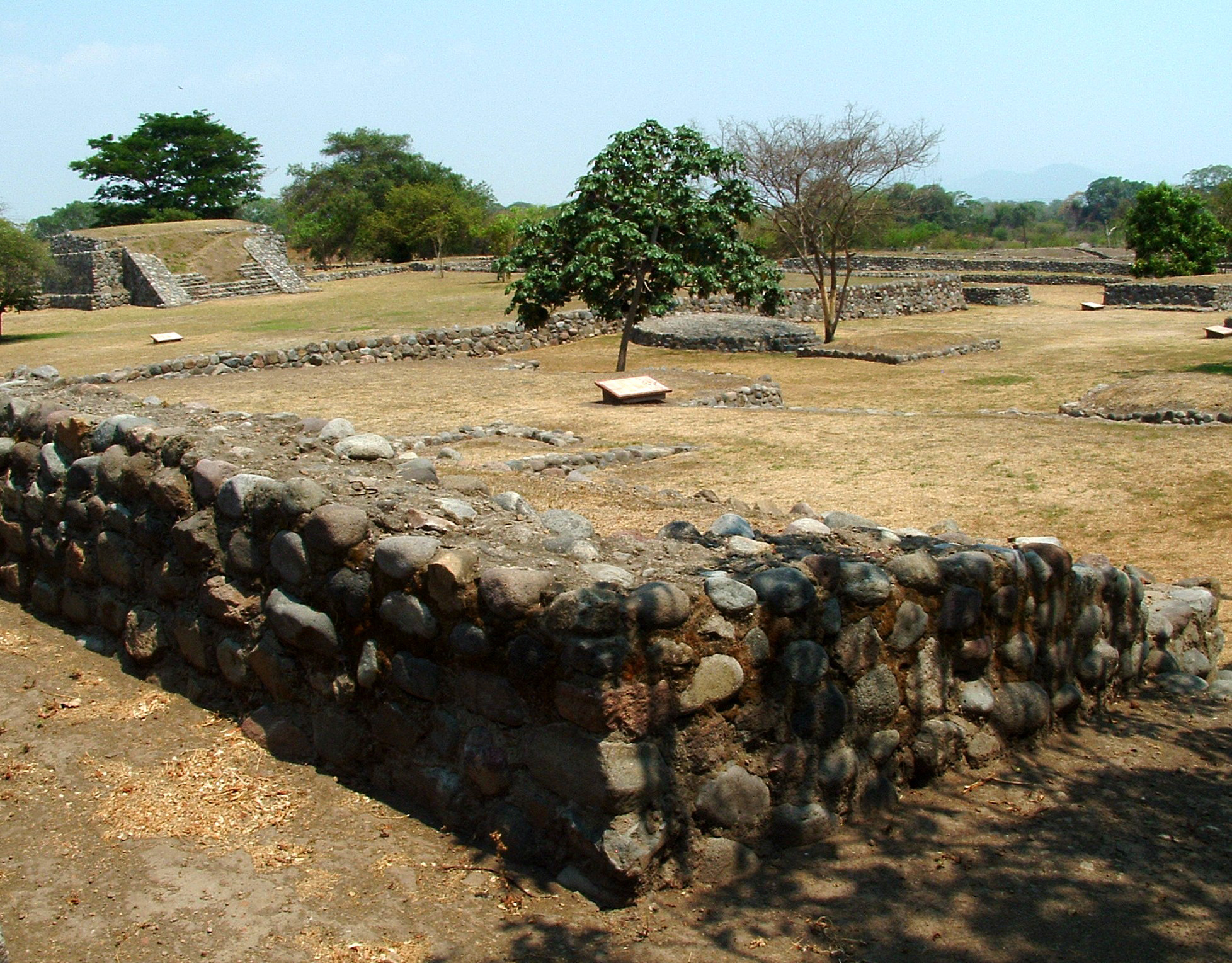
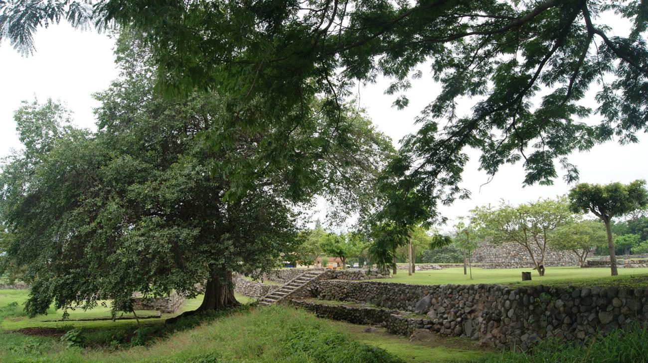
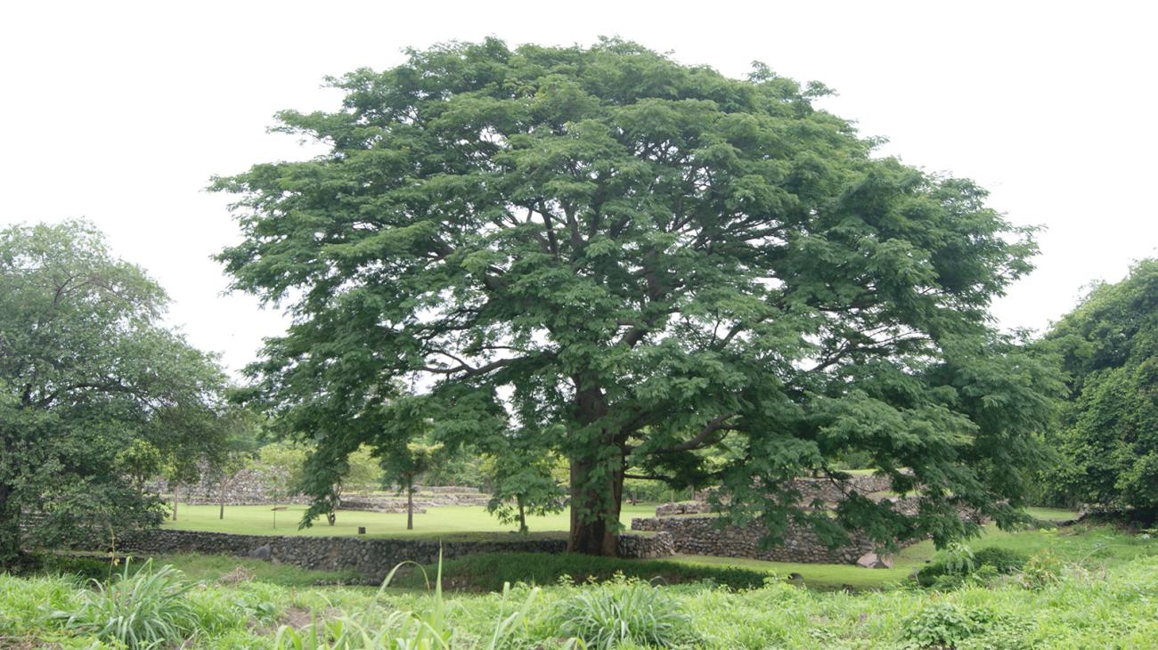
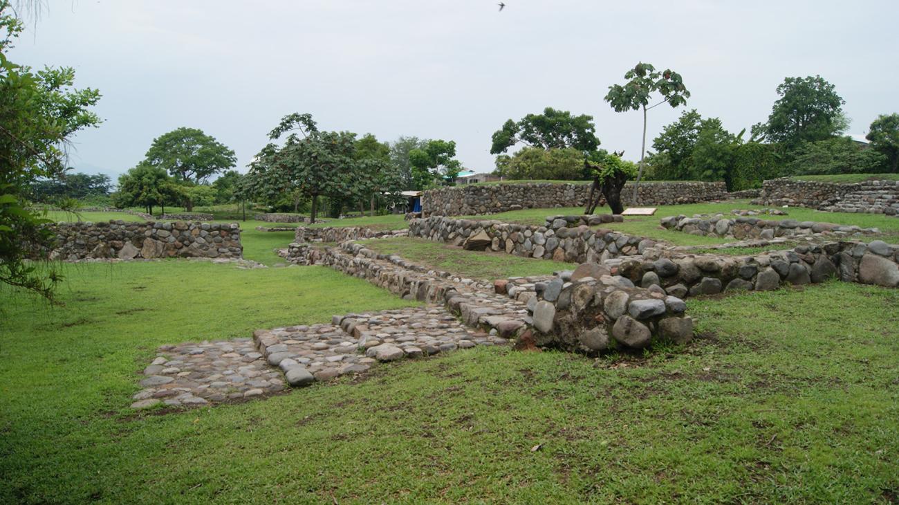
This space handed down by the ancestors of the Mexican people covers land in the towns of Villa de Álvarez and Colima, where the area open to the public is found. The people who lived in this area knew how to take advantage of the valley’s bounty in order to survive and they were able to appropriate everything that it offered them. They built their city, which is recognized for its architecture, on both banks of the Colima river. It spans an area of a little over 445 acres.
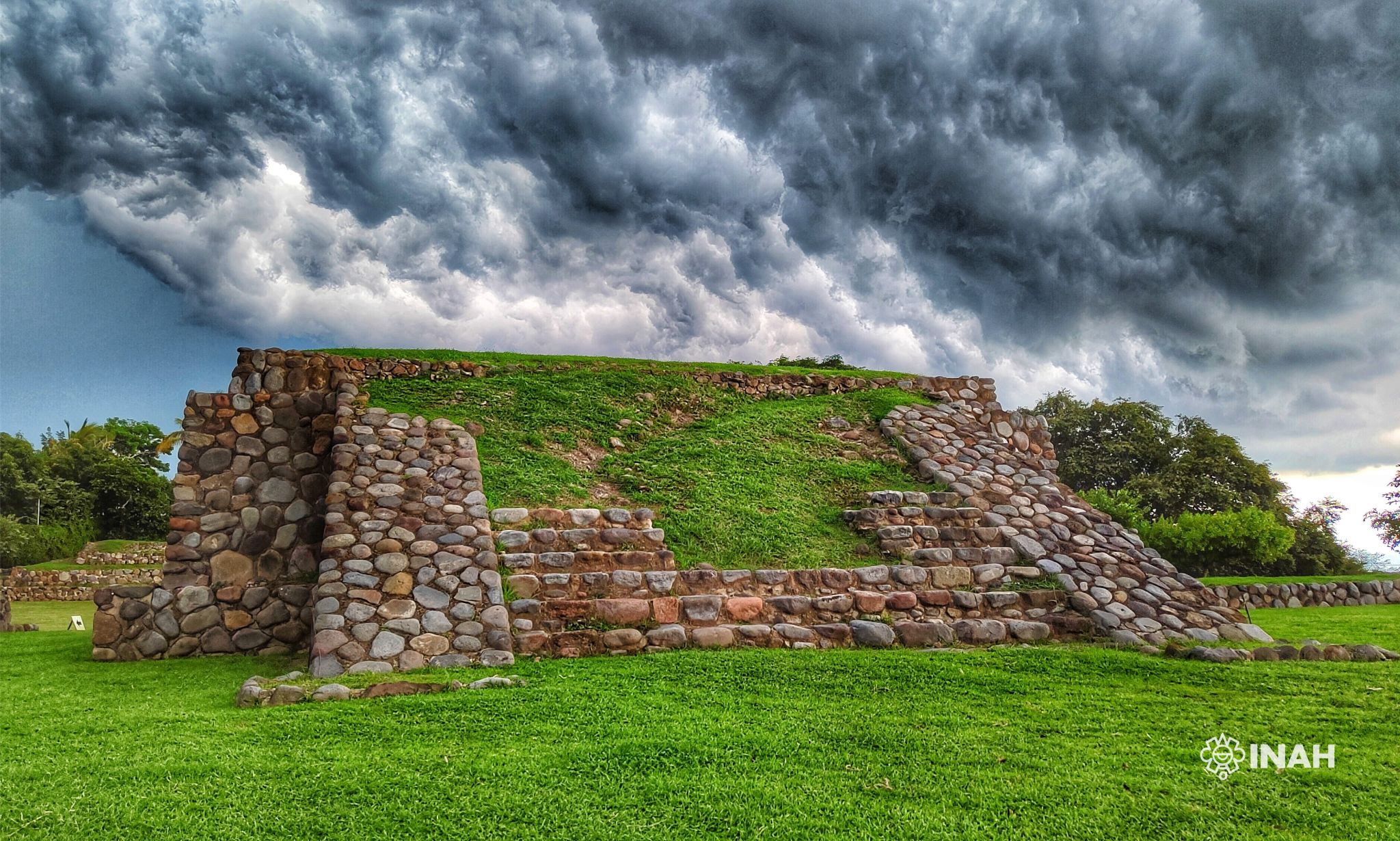
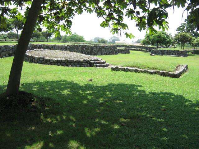
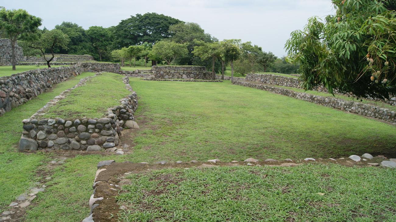
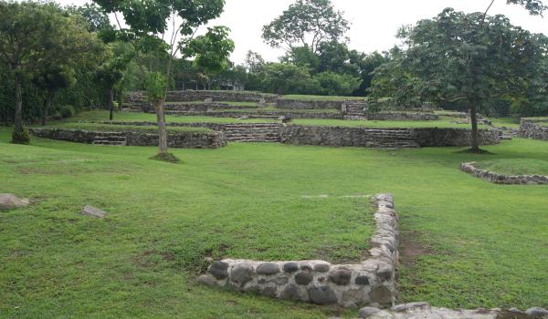
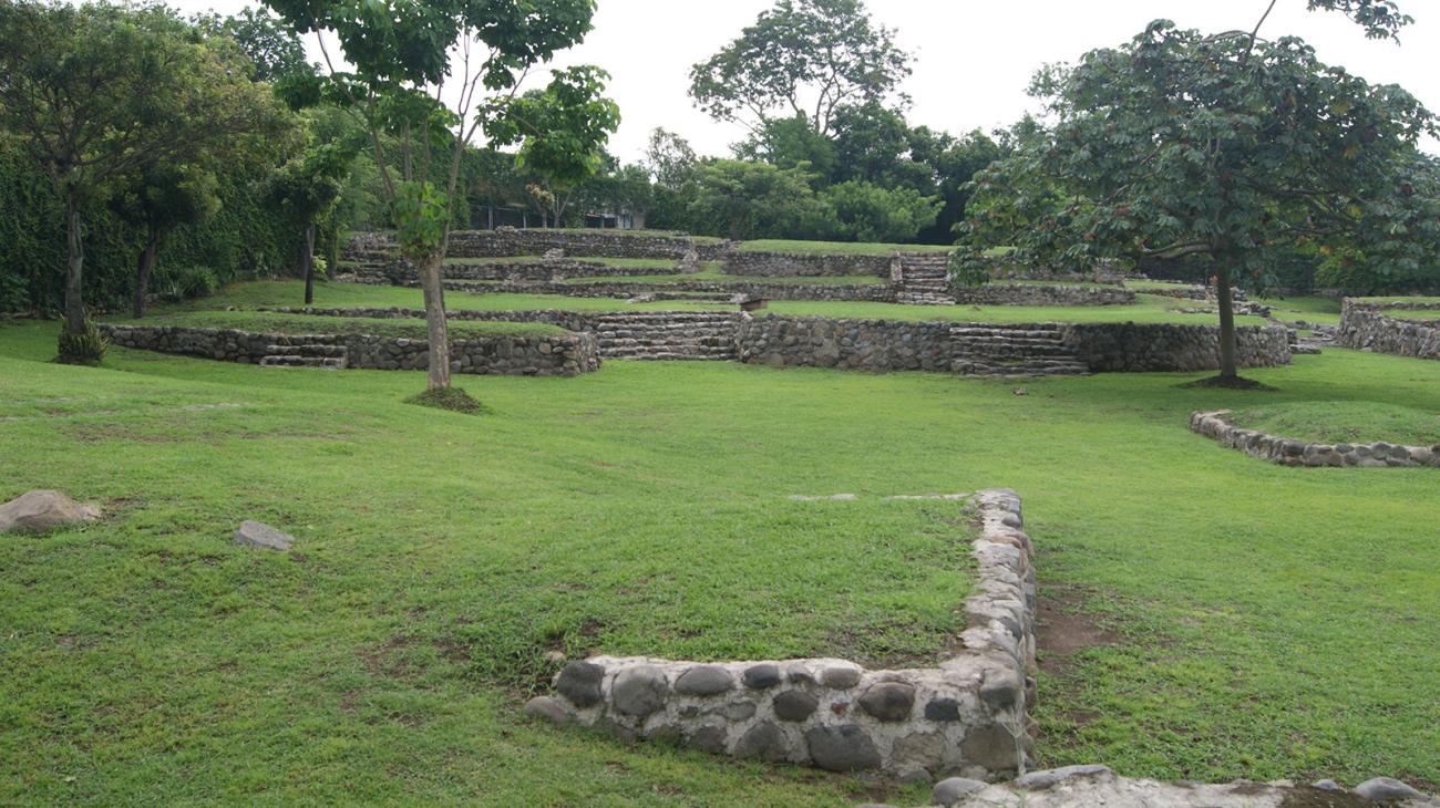
Although a large part of the remains were found buried—waiting to be studied and released from their ancestral enclosure—today it is possible to enjoy closely connected ceremonial buildings, among which temples, palaces, altars and a ballgame court are found. Around this religious complex, there are also various blocks of residential buildings, each with an entry stairway. The formation of a small plaza can be distinguished in the center of each of them.
The houses were made using small tree trunks arranged vertically and continually to define the walls. These were then covered with a mud plaster, which gave a very fine finish to the inside and outside of the dwellings. For the roof, they used a tough, wiry grass from the region.
On first encountering the valley, the Spanish conquistadors saw that it was mostly inhabited by dispersed, Nahua-speaking groups, which is why this ethnic affiliation was attributed to the site. It should be mentioned that, although this claim has been acceptable so far, DNA tests have not been carried out to confirm or dismiss it.
The various discoveries and the analysis of the recovered materials have been able to account for various activities of the groups who lived in this area. With reference to metallurgy, the search shows the manufacture of decorative objects, such as breastplates and bells, as well as tools, particularly needles (which there are a lot of). Ceramic fragments were also recuperated with metal stamps or imprints inside, which indicates that copper, silver and gold were melted.
It is also important to mention the production of pottery which was used for many purposes, from domestic to religious. Many of the pots’ designs, both in shape and in decoration, are completely local. However, there are ceramic remains which are intimately linked with the Aztatlán tradition (based on codex decorative designs) and have designs with a strong influence from the ceramics of the Chupicuaro tradition. With regard to long-distance trade, the turquoise objects and the Plumbate style vessels stand out, which were not made locally.
Although there is not a lot of archeological information referring to agriculture, the food requirements of a large city had to be secured through the production of various crops, especially the growing system known as the milpa (pumpkin, corn and chilies). According to a few historical sources, it is thought that they also farmed cacao and cotton.
The settlers in El Chanal used stone to make decorative elements and everyday utensils. As for polished stone, there are some functional objects, such as axes, hammers, polishers, grinders and milling stones (metates), as well as decorative and sumptuary objects, such as carved stones and some sculptures found in funeral bundles. The polished stone corresponds to the working of obsidian, a raw material originating from Michoacán, which was used to make blades and arrowheads.
In the second decade of the twentieth century, a group of enthusiasts interested in the area, led by professor Miguel Galindo, began to systematically record the ancient material remains which they discovered in various plots of the Colima valley. As a result of this work, in 1939 the recently created INAH sent the archeologist Roque Ceballos to carry out an assessment of the site and to promote the creation of a museum. Over time, the archeologists Vladimiro Rosado Ojeda, Isabel Kelly, Nicolás García, María de los Ángeles Olay Barrientos followed suit and, from 2008, Andrés Saúl Alcántara Salinas led the El Chanal Archeological Project.

- Dirección del Centro INAHAlex Ochoa Lozanoalex_ochoa@inah.gob.mx+52 (312) 313 4946Administración de la Zona Arqueológico y Museo de SitioJuan Enrique Cortes Brizuelajcortes.col@inah.gob.mx+52 (312) 313 4945, ext. 15800

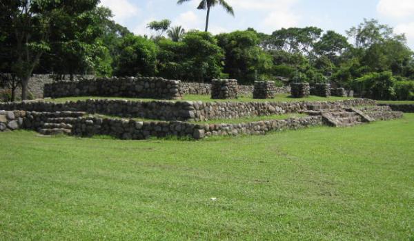
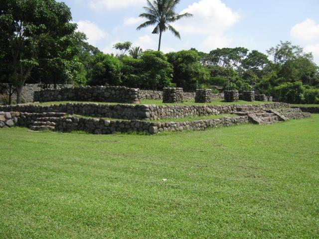
Plaza de los Altares
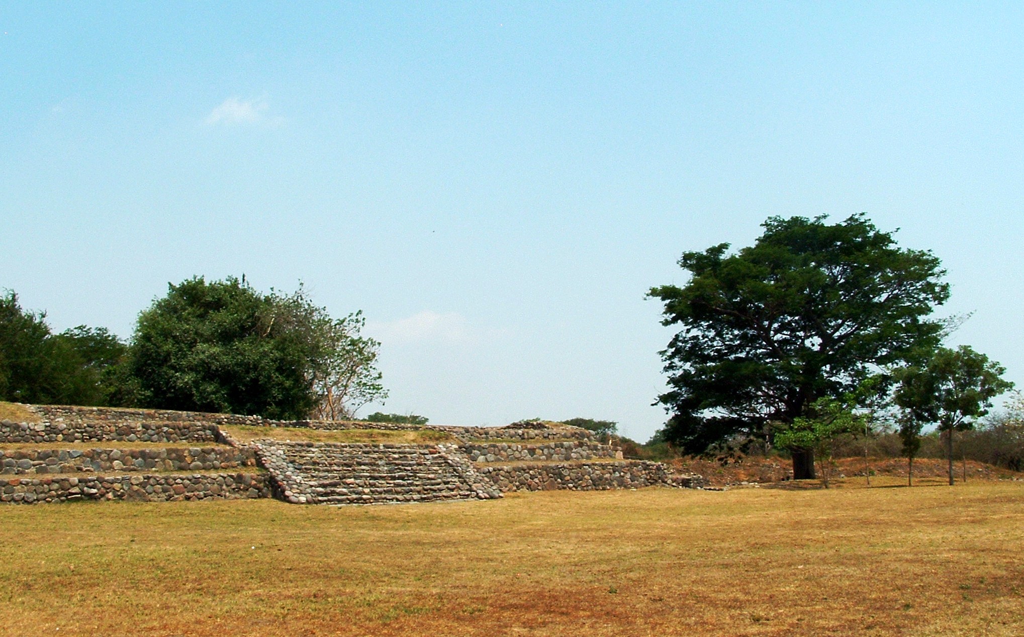
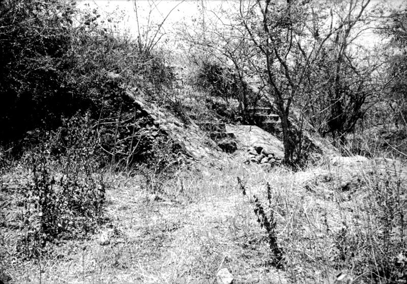
It extends in the middle of an open space and had to do, most probably, with the rites that took place in its two altars. The first one, rectangular in shape, was found destroyed by looting.
It extends in the middle of an open space and had to do, most probably, with the rites that took place in its two altars. The first one, rectangular in shape, was found destroyed by looting. The second, circular, offered interesting evidence, since a total of 19 burials were recovered from its interior and six from its exterior. It is undoubtedly that the ceremonial spaces were fundamental for the social organization, because in them acts and rites were carried out where the gods legitimized the authority of the priests and the governing elites.
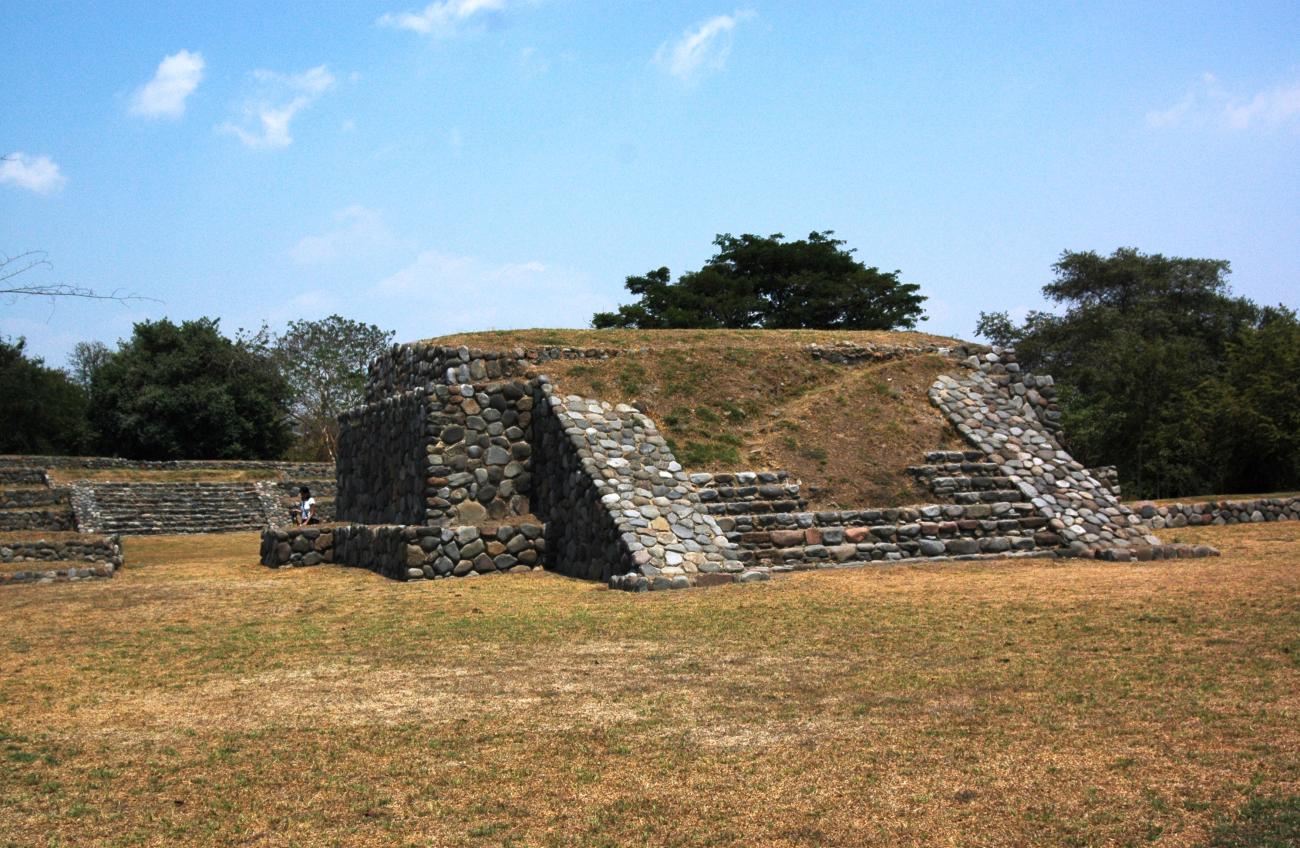
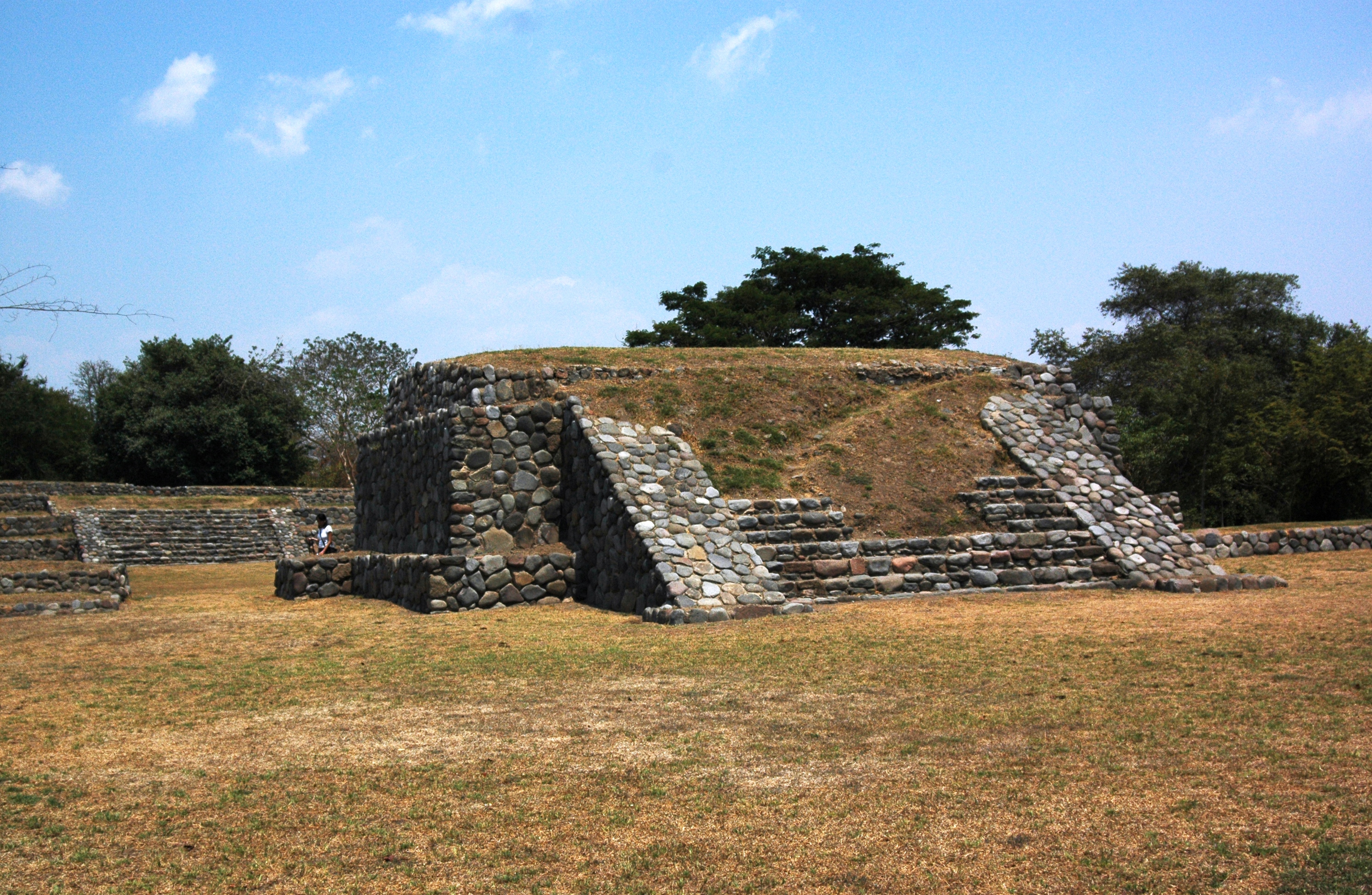
Structure 3 or Circular Altar: It is built in honor of Ehecatl. It is an element with a greater symbolism, because in it was carried out the deposition of human remains as a cemetery; however, they were not buried in a common way for its time, because instead of burying the body in a flexed or seated way, wrapped in a funeral bundle, these individuals were cremated so in their remains there were clear traces of having gone through high temperatures, between 300°C to 900°C.
Due to their location inside the architectural element and the way in which the bodies were prepared, it can be inferred that these were very important people for society, such as priests, high-ranking figures or ball players, who were assigned a dignified place where they could be venerated.
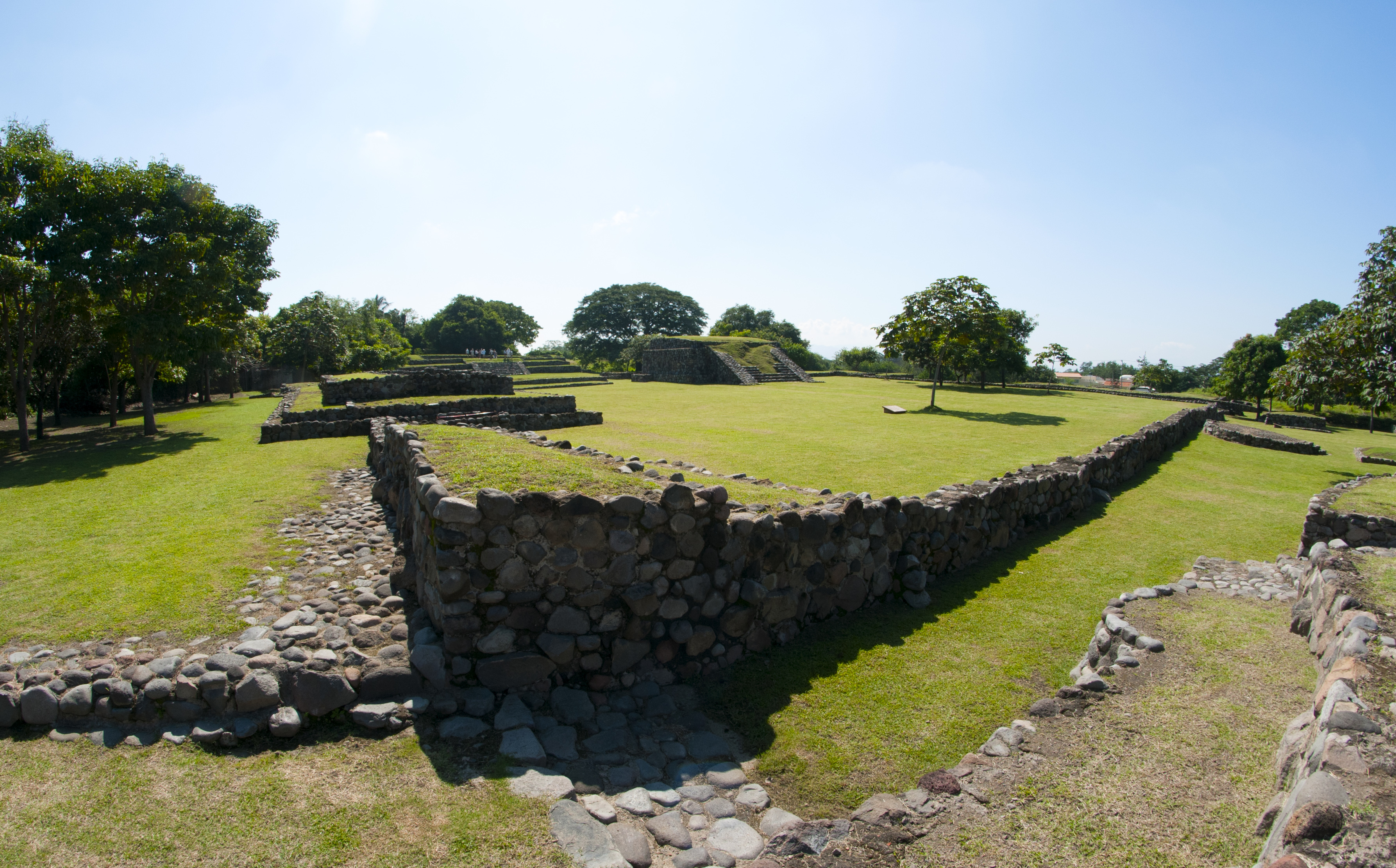
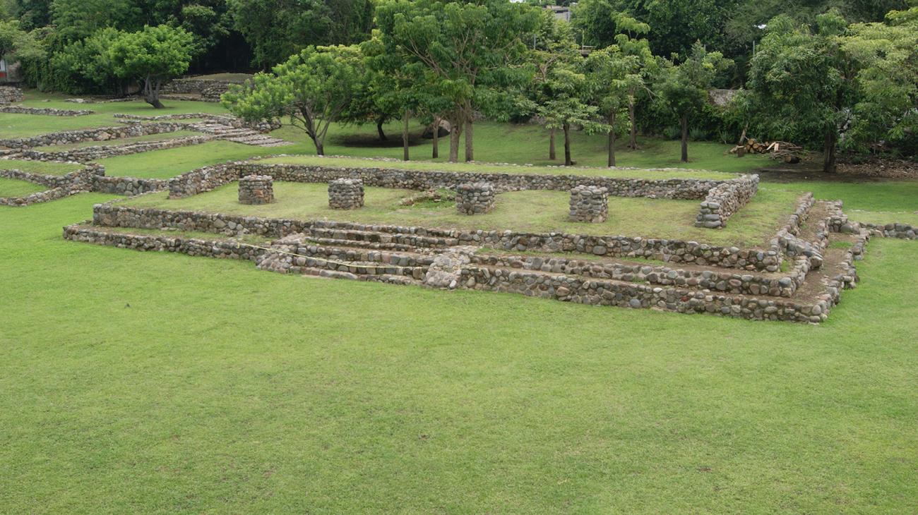
Juego de Pelota
It is located to the south of the Plaza del Tiempo and is separated from it by a narrow corridor. The central patio of the game is oriented from east to west, its surface measures 38 by 13.50 meters. An interesting fact is that the head courtyards are different.
It is located to the south of the Plaza del Tiempo and is separated from it by a narrow corridor. The central patio of the game is oriented from east to west, its surface measures 38 by 13.50 meters. An interesting fact is that the head courtyards are different. The west is closed by a mound with a small staircase in front and the east by a low platform; to the east of it is the double tier through which access to the Plaza of the Day and Night.
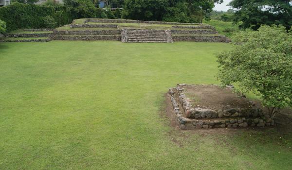
Plaza del Día y de la Noche
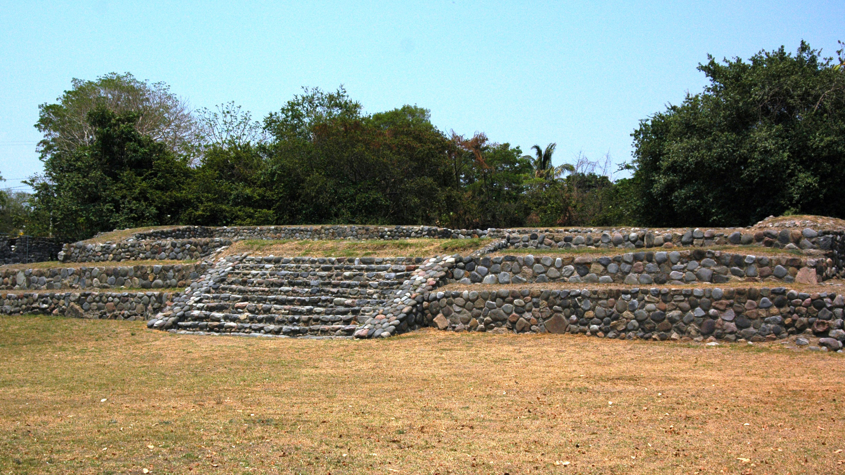
It is the one with the largest dimension in open spaces, it has a building of great proportions, both in extension and height, and could be considered as a Palace. It also has an altar and two access stairways.
This Plaza must have been of daily use among the population.
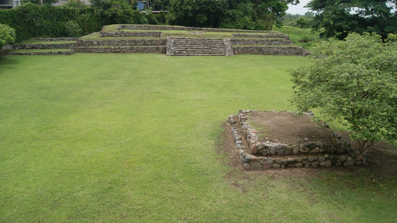

It is the one with the largest dimension in open spaces, it has a building of great proportions, both in extension and height, and could be considered as a Palace. It also has an altar and two access stairways.
This Plaza must have been of daily use among the population.
Main stairway: Located at the southern end, it has two alfardas and a height of just under three meters; it must have been used by the population to enter the sacred precinct.
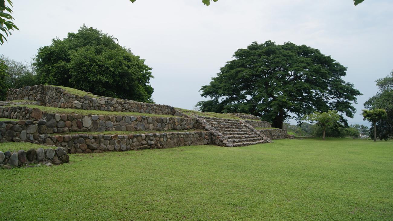
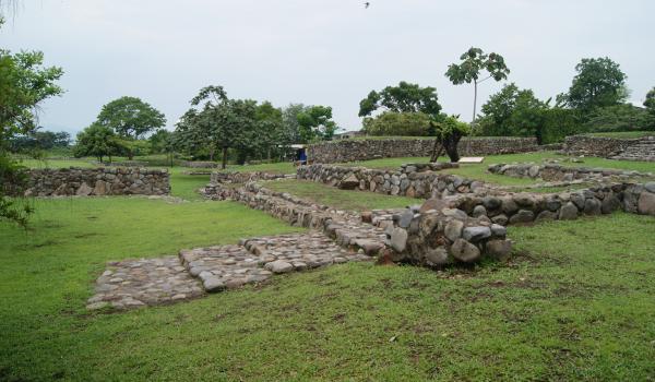
Plaza del Tiempo
It is aligned to the east of the Day and Night Plaza.
It is a restricted area, since it has only one access located in a small space between the Main Temple and the platform that divides both plazas; there is no direct access stairway.
It is aligned to the east of the Day and Night Plaza.
It is a restricted area, since it has only one access located in a small space between the Main Temple and the platform that divides both plazas; there is no direct access stairway.
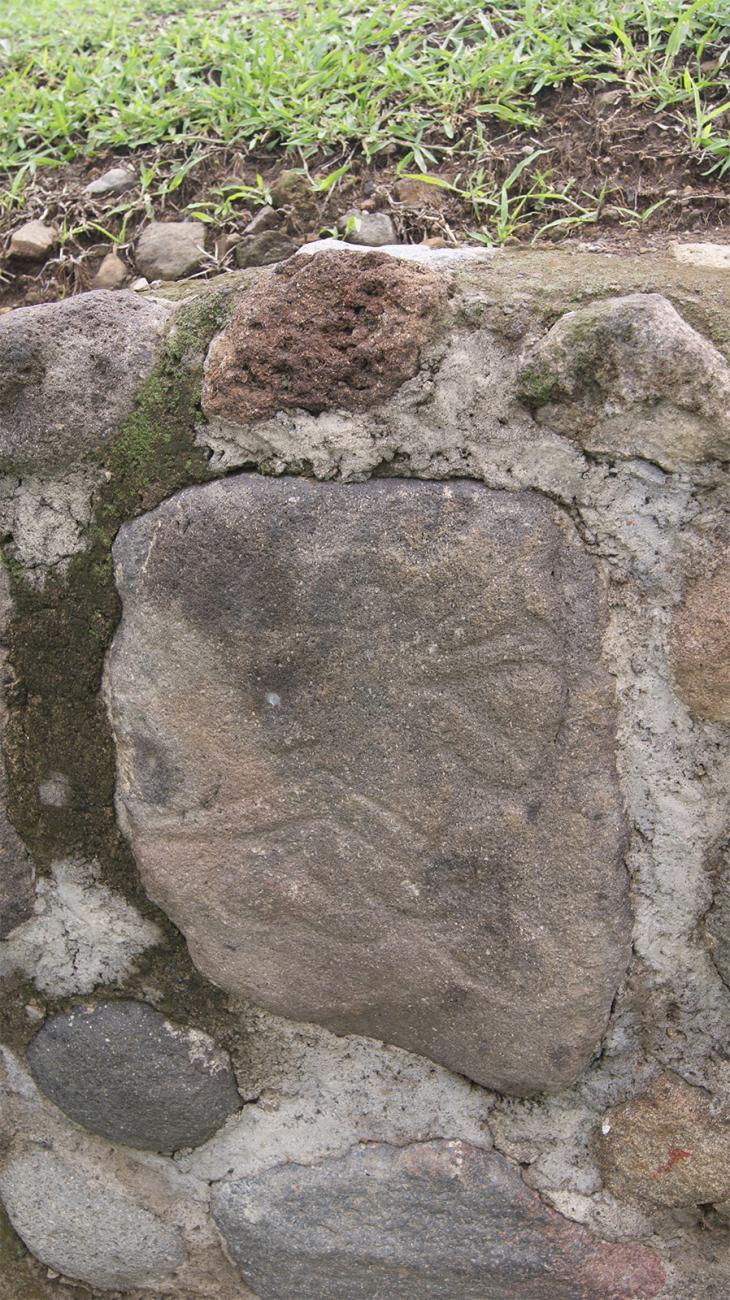
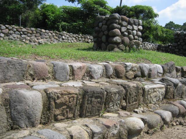
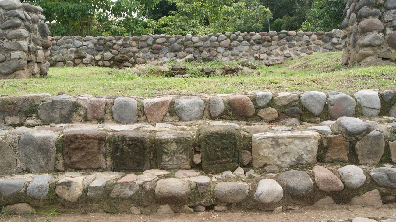
Structure 2: A singular building, of large dimensions, located on the east side of the Plaza. It presents a different manufacture from the rest of the buildings of the archaeological zone, because it has masonry columns in its interior that, probably, served to support a very heavy roof; in addition, in its interior there is an oven in the central part. The façade has a staircase delimited by two alfardas, preserving in one of the steps four ashlars carved with different decorative motifs. The use of this square must have corresponded to important festivities with restricted attendance.
Plaza del Agua
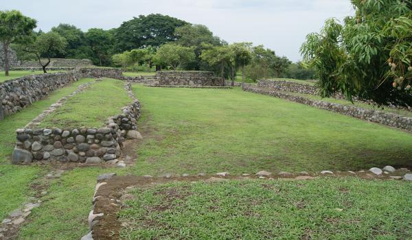
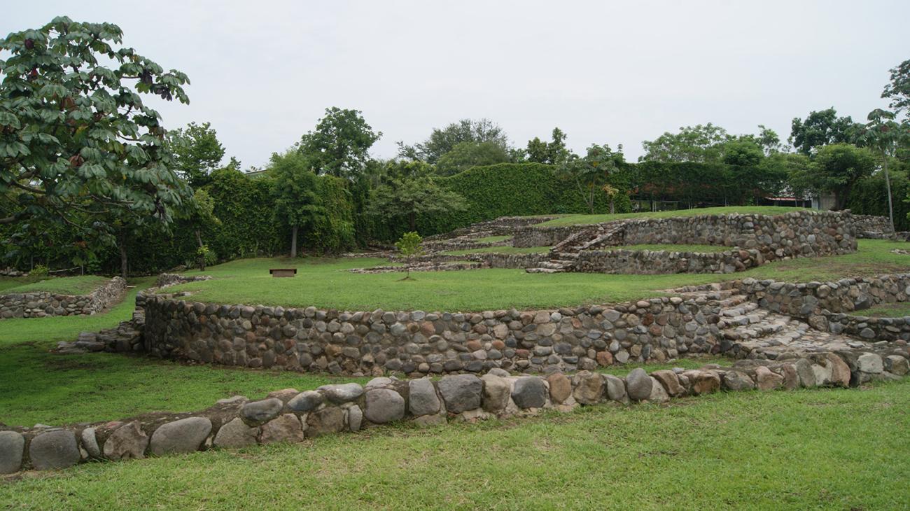
The natural elevation of the terrain was used for its construction, to which a series of low platforms were adapted to form interior patios, corridors and open plazas. Some cleared spaces show the presence of cobblestones.
The natural elevation of the terrain was used for its construction, to which a series of low platforms were adapted to form interior patios, corridors and open plazas. Some cleared spaces show the presence of cobblestones.
In the case of the Plaza del Agua, we can observe the existence of a rock, at ground level, in the center of which a receptacle was carved to collect rainwater. We must not forget that the inhabitants of El Chanal were at the expense of a severe agricultural cycle, that is why there is a constant presence of stone altars that reproduce, at manual scales, the images of gods to whom they worshipped and implored for the most precious gift: water.
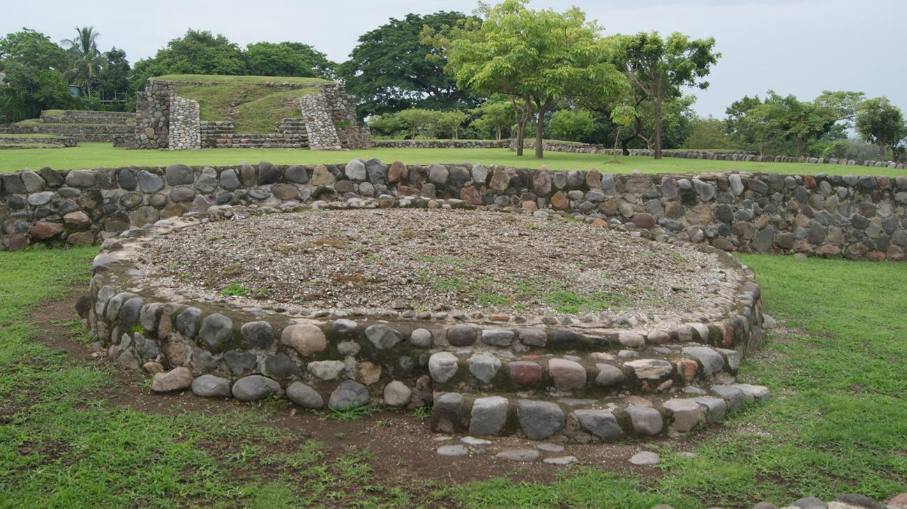
Plaza Redonda
It has a rounded shape and is characterized by dominating both the Plaza de los Altares and the Plaza del Tiempo. It is striking that, of the two structures in front, one is built on a platform that significantly elevates the upper enclosure.
It has a rounded shape and is characterized by dominating both the Plaza de los Altares and the Plaza del Tiempo. It is striking that, of the two structures in front, one is built on a platform that significantly elevates the upper enclosure. This idea of contrasting complementary and distinct elements seems to be a constant in its architecture.