


Chakanbakán
A large and prosperous Maya city inhabited from 300 BC, with imposing plazas and monuments, one of which displays stucco facade masks of a god in the shape of a jaguar, plus some surprising sculptures reminiscent of the Olmecs.
The Mayan city of Chakanbakan is located in the lower Peten lakes area, in the region characterized by the Río Bec architectural style. This pre-Hispanic settlement belonged to a series of cities in the lower Peten with common characteristics. The surrounding area was rich in natural resources, enabling the inhabitants to build a protected city and to develop its culture in comfort. During the Late Preclassic Chakanbakan appears to have exercised social, political and economic control of the region.
The importance of the city grew to the extent that it managed to survive and experience a resurgence during the Classic period, when the dimensions of the traditional structures of the period were added to. Its dominant role over a small territory and the presence of raw materials allowed it to become an important producer and exporter of flint tools and other goods. Nevertheless it failed to retain its independence, since the region’s social, political and economic power was focused relatively nearby in the city of Calakmul. Even so it created trading links outside its region with cultures at the heart of the Central Highlands. Despite the importance it acquired, the effects of the Mayan collapse inexorably led it to the same fate, and the city was inexplicably abandoned.
During the Postclassic it continued to attract settlers from the region and the small temple on the top of the pyramid, known as a "nohochbalam," continued as a site of rituals where offerings were left to the deities. It had already been abandoned by the arrival of the European conquistadors and never recovered, even in the following centuries when the "cehaches," or indigenous people who remained free from the control of the conquistadors, dominated the region.
The houses were constructed from bahareque (sticks with a mud covering) and thatched with guano palm, and they must have been clustered close to the civic-religious center where the largest buildings stood. The construction of various structures began in the civic-religious center when the Late Preclassic was in full swing from 50 BC to 300 AD. The first pyramidal temple was built and subsequently renovated more than once in the same period and the following one. In one of these constructions the priests ordered 14 sculptures to be made representing the jaguar on both sides of a flight of steps on the facade of the sections. The facial features of these enormous feline stucco masks are still reminiscent of certain traits of the Olmecs, ancestors of the Maya.
During the Proto-Classic (50 BC - 250 AD) there was a significant increase in population density and at the same time in city planning. Although it was fully determined in the previous period, the new buildings began to mark out the future of an important medium-sized city. By that time, the culture had reached its apogee. The settlement appears to have achieved its maximum size and peak of development in the Early Classic (250 - 600 AD), when the principal constructions were modified and new ones were built. The Acropolis was built in various sections.
The population lived from farming, hunting, to a small extent fishing, and from trade. The type of social, political and economic organization was a useful means of advancement for the city and the region, and also helped to maintain links with other regional and distant external cities.
The Mayan city of Chakanbakan was built in a strategic location which made it easy to repel any external attacks by land or water. The features of the terrain are exceptional, the layout of the central sector, which was built on the higher ground, and the erection of extraordinarily large structures enabled the populace to remain safe from flooding and hurricanes.
- Dirección del Centro INAHMargarito Molina Rendónmargarito_molina@inah.gob.mx+52 (983) 837 2411
Grupo arquitectónico de los mascarones
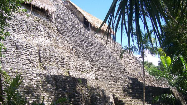
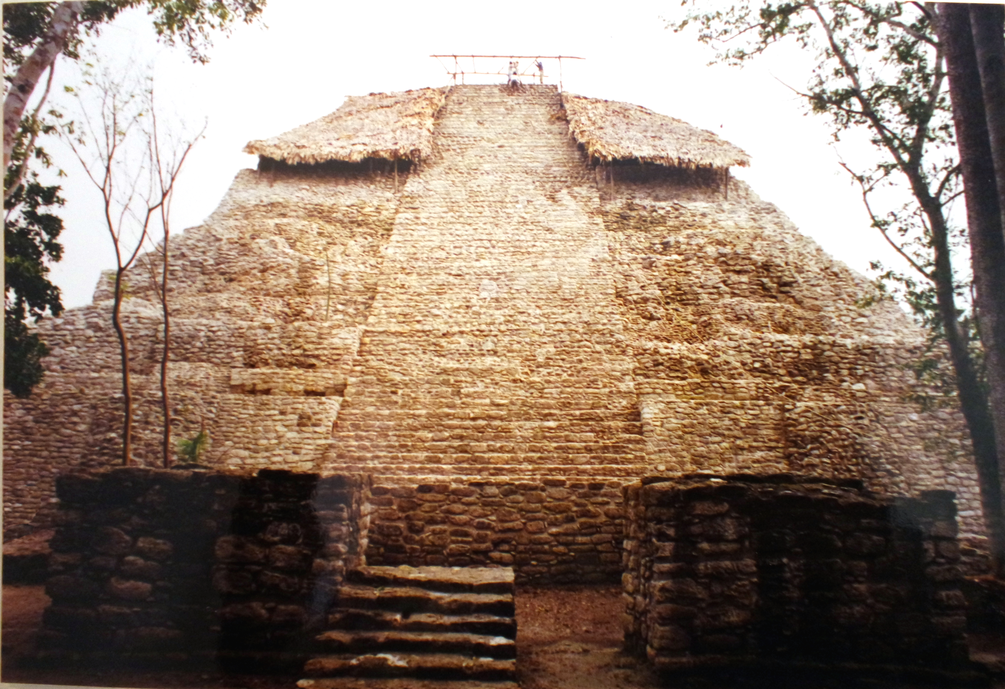
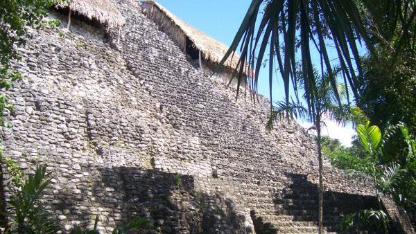
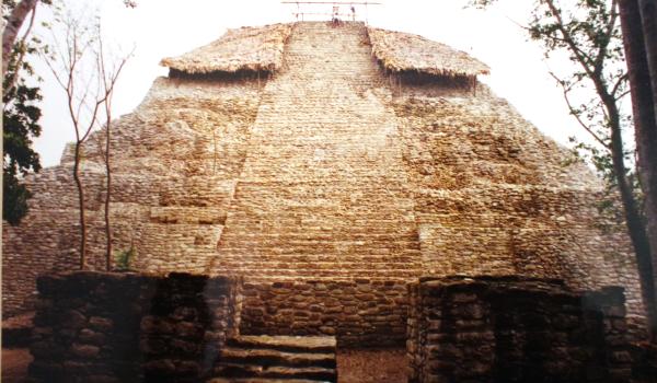
The Architectural Group of the Masks or Pyramid of the Masks is located to the north of the civic-religious center and is part of the monumental area of the site.


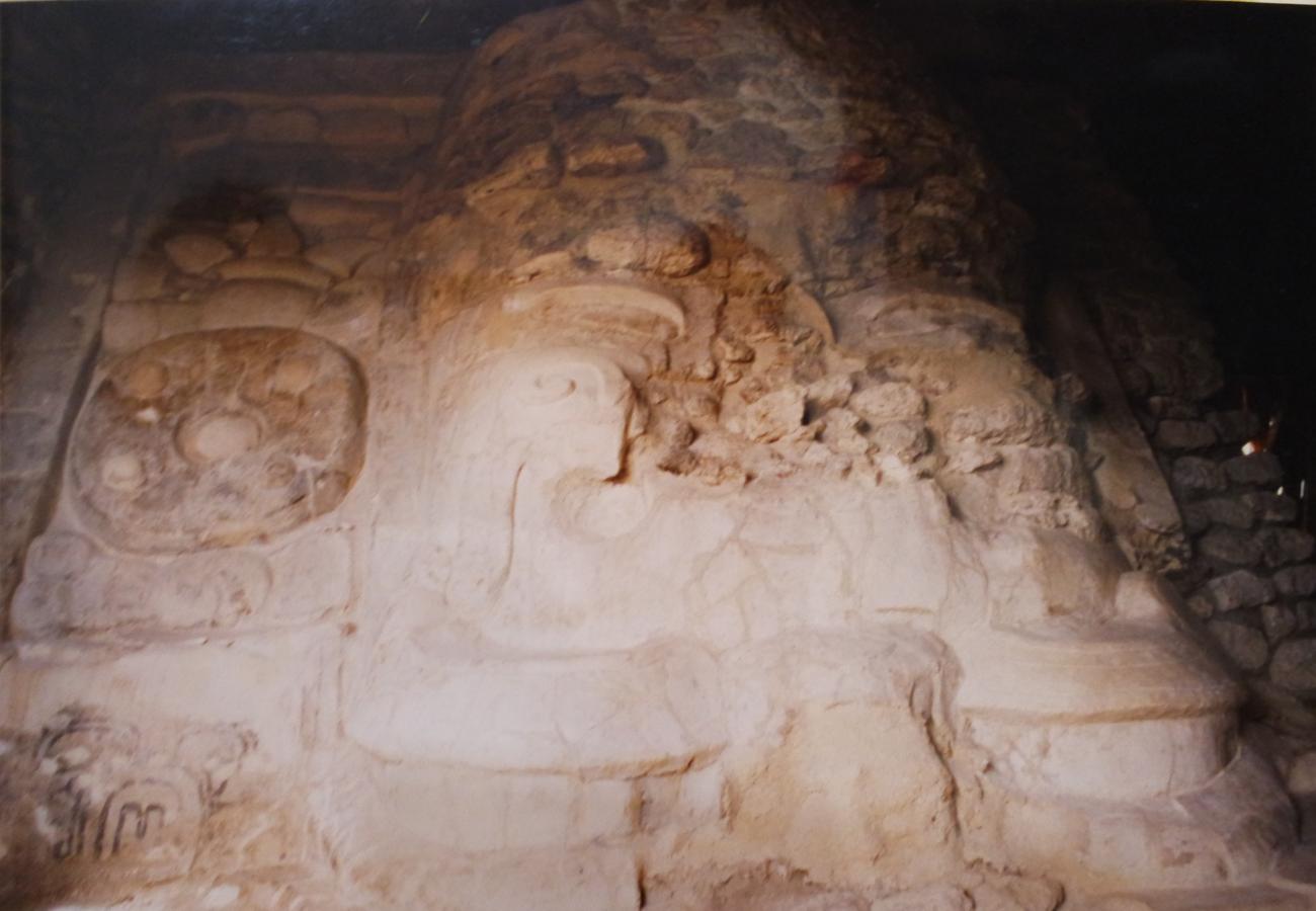
The Architectural Group of the Masks or Pyramid of the Masks is located to the north of the civic-religious center and is part of the monumental area of the site. This pyramid is oriented towards the south and is composed of eight bodies with a central stairway on the south façade and in the three upper bodies, on the sides of the stairway, are the masks.
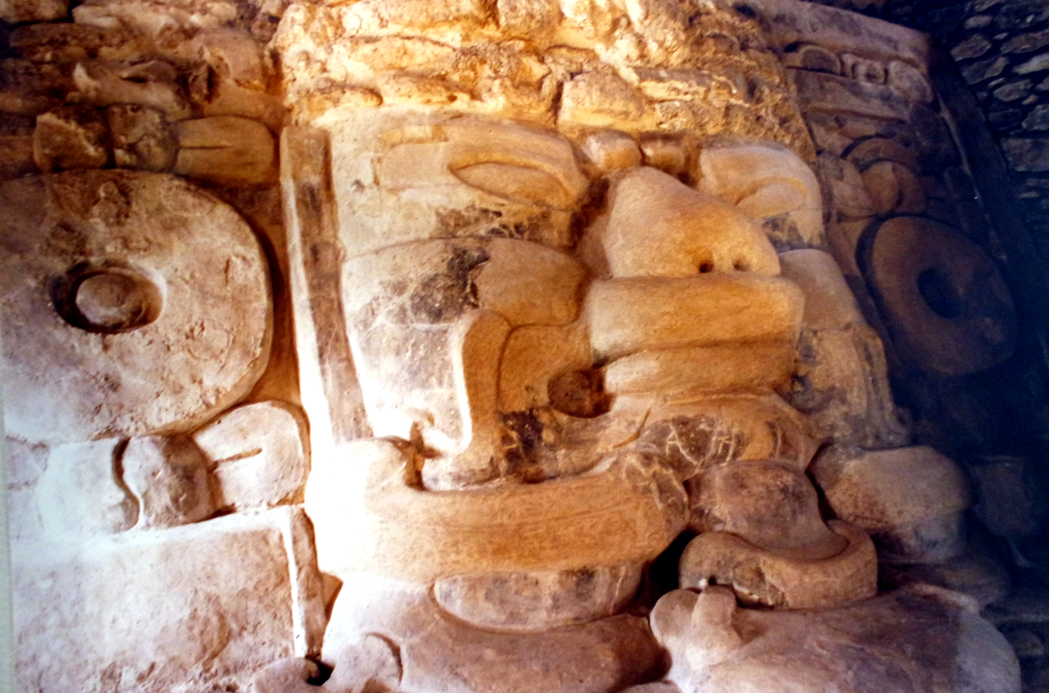
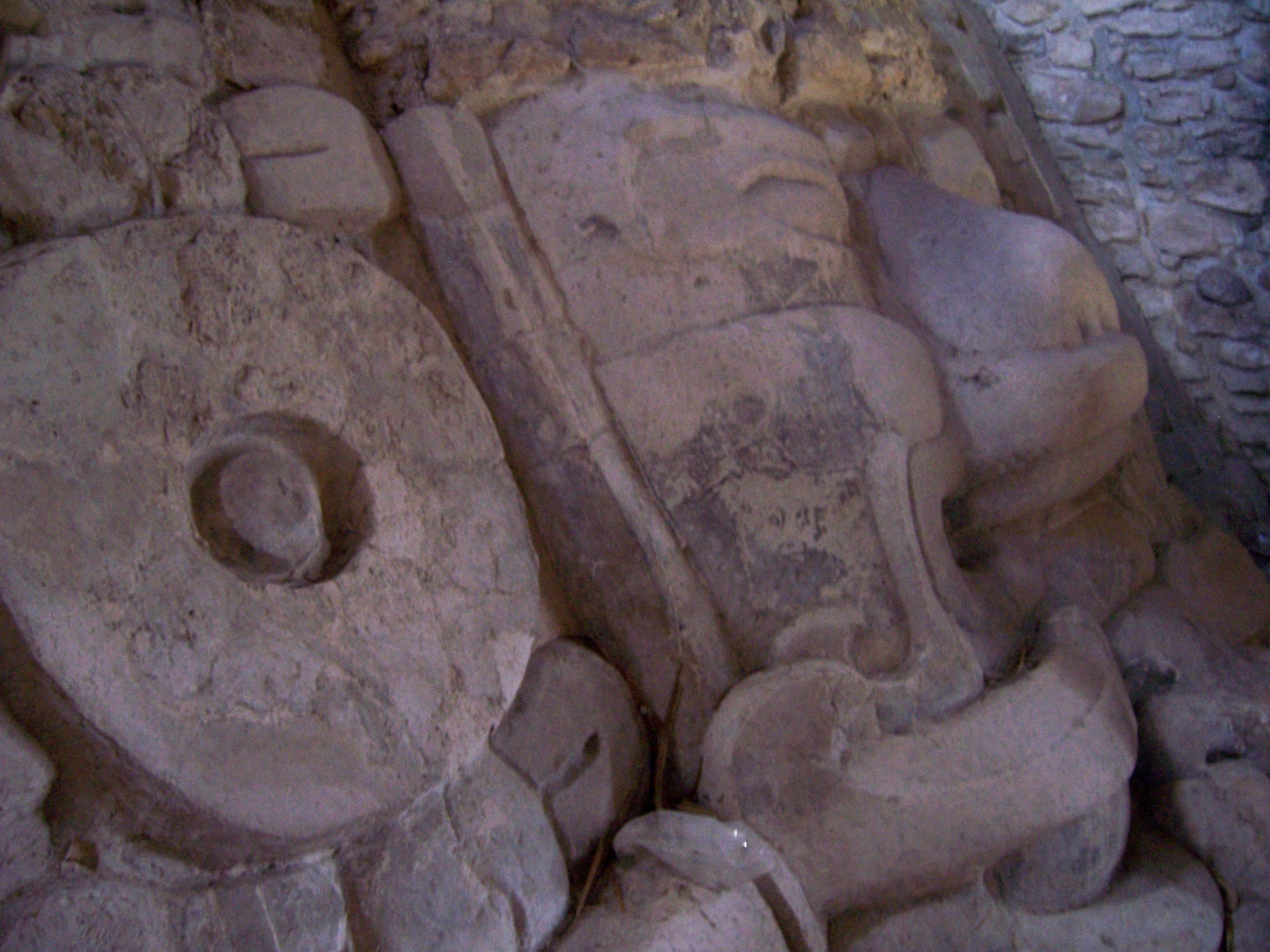
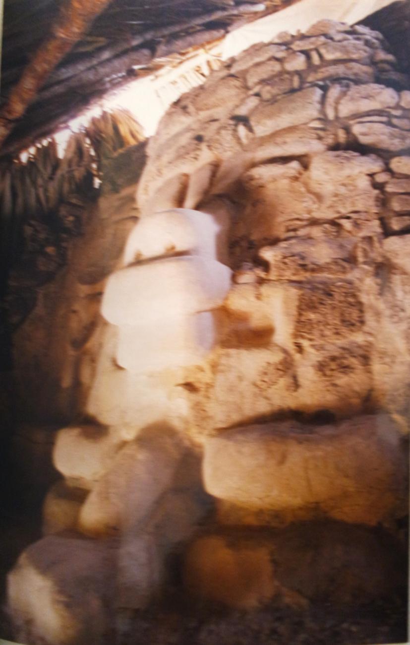
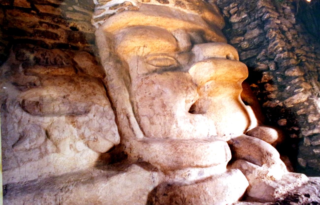
Mask 00: Modeled in stucco and attached to the slope of the last body of the pyramid on the east side of the stairway. Its dimensions are 3.10m long by 2.9m high. The mask shows an anthropomorphic face with remains of the right earflare, in the inferior part it has a zoomorphic face with remains of black paint.
Mask 0: Modeled in stucco and attached to the parameter of the last body of the pyramid on the west side of the stairway, it is oriented towards the south. Its dimensions are 3.90 in length by 3.20m in height in slope. It is an anthropomorphic face with a zoomorphic face below. It conserves the left earflare, part of the right one and remains of a stone structure that supported a headdress. The anthropomorphic face has feline features with thin eyes and prominent cheekbones, it also has remains of black designs on the right cheek, lips and eyes.
Mask 1: It was the first to be discovered, it measures 5m wide by 4m high, it is an anthropomorphic face with earflaps and mustache with a zoomorphic face underneath. It has elongated and thin eyes with prominent cheekbones, thick nose with upper lip and mouth in the shape of a maw. It preserves remains of the decoration in black color in the eyes of the zoomorphic face and the stone structure of the headdress.
Mask 2: It is attached to the parameter of the penultimate body of the pyramid on the east side of the staircase, facing south. Only the chin and the right cheek are preserved, also the right earflare was preserved in its entirety.


