


Playa del Carmen (Xamanhá)
Water from the north. Gets its name from the present-day city where it is located.
One of the first Mayan settlements seen by the Spanish conquistadors in 1518, opposite to the island of Cozumel. Its Maya name means “water from the north.” There are eight groups of small buildings lined up between the beach and the jungle; there are fragments of paint and one of the last Mayan dates recorded.
About the site
The Playa del Carmen archeological site is to the south of the modern port city, in the municipality of Solidaridad, on the east coast of Quintana Roo. It has an area of one square mile, in the Playacar residential development.
To date 19 groups of civic and religious buildings have been identified, and the rest of the settlement surrounds these structures. A characteristic feature is the presence of dry stone walls or banks, less than 40 inches in height, which surround pieces of land known as plots, the majority of which contain groups of structures. The distribution pattern is noteworthy. The coastal area has the main architectural groups and the plots with the highest density of structures, while the inland plots had significantly fewer buildings. The best conserved buildings are in groups B, C and D, particularly Structure C-1, which is the site’s largest, and which conserves fragments of mural painting including one of the latest known calendar dates in the Mayan region. Group C also has a U-shaped wall surrounding a complex of principal structures.
Playa del Carmen shows signs of occupation from the Late Preclassic to the Postclassic, and has been identified as the pre-Hispanic settlement of Xamanha, which was mentioned in various writings of the colonial period. The climate is predominantly subhumid and hot, with an annual rainfall greater than 60 inches. The environment is mainly low semi-deciduous tropical forest, where the trees and bushes blend into tropical savanna, with an abundance of fauna particular to this ecosystem.
The Spanish who accompanied Montejo in 1527-1528 said that the site was a small town of fishermen, but investigation has revealed that it was a dense settlement of stone buildings and platforms for wood and palm tree houses. The conclusion was reinforced by López de Cogolludo, who wrote that Xamanha was visited by two Franciscan friars. The site’s indigenous population went into a general decline after the mid-sixteenth century, making Playa del Carmen economically unattractive to the Spanish encomenderos. The threat of piracy only worsened the situation. By 1656 the site was practically uninhabited.
Archeological investigation of the site began in 1918 when the Carnegie Institution of Washington made its first report. In 1926 Mason and Spiden organized an expedition, but it was not until 1937 that 17 members of the Mexican Scientific Expedition under Luis Rosado Vega explored the site. Playa del Carmen was included in the Archeological Atlas of Quintana Roo in 1959, and since then all traces of remains have been investigated. It was not until 1978, however that INAH began a rescue project to ensure the conservation of the site, as well as carrying out an analysis of the burials and the ceramic remains. Since then the Archeological Rescue Department has kept watch over the integrity of the site, occasionally bringing in teams of archeologists to work together on the site when tourist complexes are being built.

INAH-Archivo Técnico de Arqueología
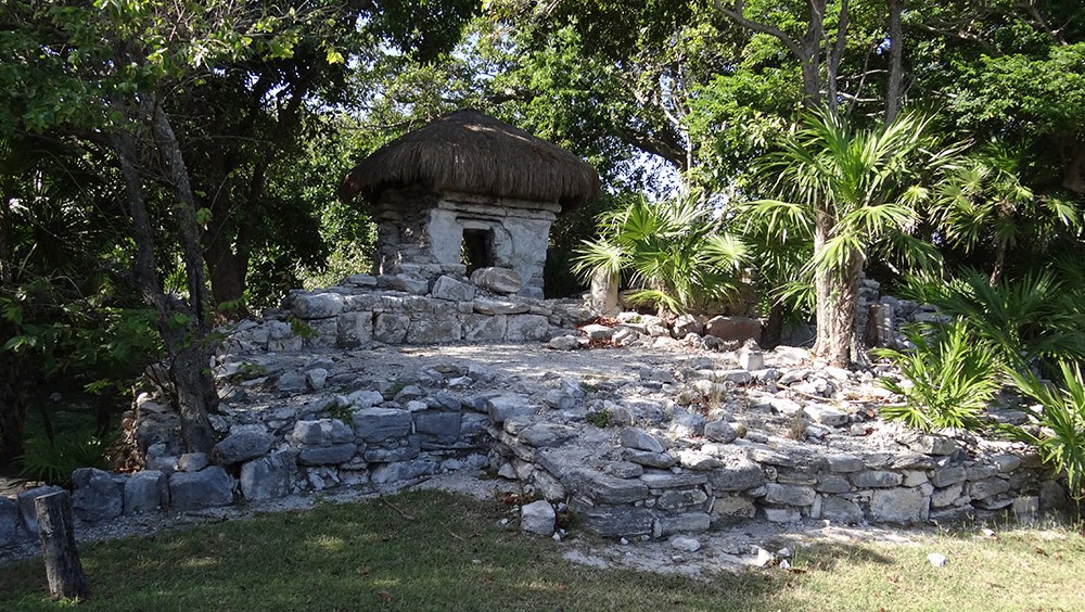
Ventilation holes in the side of structure N-1 at Xamanha

INAH-Archivo Técnico de Arqueología
Monumental platform at Xamanha

INAH-Archivo Técnico de Arqueología
Structure A1

INAH-Archivo Técnico de Arqueología
Structure B-1

INAH-Archivo Técnico de Arqueología
Structure B-2

INAH-Archivo Técnico de Arqueología
Structure C-1

INAH-Archivo Técnico de Arqueología
Structure C-2

INAH-Archivo Técnico de Arqueología
Structure C-3

INAH-Archivo Técnico de Arqueología
Structure C-4

INAH-Archivo Técnico de Arqueología
Structure D
Practical information
Temporarily closed
Monday to Sunday from 08:00 to 17:00 hrs
Free entry
Se localiza en el municipio de Solidaridad, Quintana Roo, a pocos minutos del centro de la ciudad de Playa del Carmen.
From the city of Cancún, take Carretera Federal 307, Cancún-Tulum, in the direction of Playa del Carmen. The site is located in the Playacar development.
Services
-
+52 (983) 837 24 11
-
This email address is being protected from spambots. You need JavaScript enabled to view it.
Directory
Encargado de la administración de la Zona Norte
Williams Ferneli Tun Cab
This email address is being protected from spambots. You need JavaScript enabled to view it.
+52 (983) 837 24 11


