


Soledad de Maciel
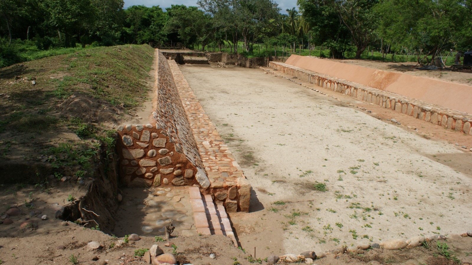
The original name of the site was revealed in 2009, when systematic excavation of the ballcourt uncovered an engraved stone, which was deciphered using sixteenth century sources as the toponym “Xihuacan.”
Built from river stones and adobe, this ancient city might once have been as important as Teotihuacan. 2,500 years ago it was the capital of the Costa Grande in the present-day state of Guerrero. Inhabited by Tomils, Cuitlatecs and Tepoztecs, it has a partially excavated ballcourt which could be the largest in Mesoamerica.
About the site
The ancient city of Xihuacan was the main Cuitlatec religious center. Its territory covered the Costa Grande of the present-day state of Guerrero and the Sierra Madre del Sur between the municipalities of Petatlán and Zihuatanejo. The area was known as Cuitlatecapan, the “fiefdom of the Cuitlatecs,” after the group who inhabited the place from 2,500 BC and which in the sixteenth century covered a vast area between the coast and the Tierra Caliente. Its occupation dates from the Preclassic period. The most ancient area is on the top of the Cerro de Los Brujos, where figurines known as Baby Face and Pretty Woman were found. The Ceremonial Center is the second complex, an example of the innovative use of earthen architecture built around 450 AD taking astronomical references from the planet Venus, the Sun and the North Star to determine the layout. The construction process involved making an adobe platform to level the terrain in an area of 72 acres where four massive buildings were erected, one of which was Mound B with adobe and baked clay cladding. These structures define a plaza whose northern part is associated with a palace area, the ballcourt and the southern slope of the Cerro de Los Brujos, incorporating them into the ceremonial landscape. Both these areas are surrounded by a system of artificial channels connected to the river San Jeronimo. Water still flows through them giving the settlement the air of a mythical island. The collapse of Xihuacan occurred around 1350 AD, after a meteorological phenomenon flooded the complex, leading to the gradual abandonment of the settlement.
Practical information
Tuesday to Sunday from 08:00 to 17:00 hrs. Last entry 16:00 hrs.
Free entry
Se localiza en la Costa Grande de Guerrero en la comunidad de Soledad de Maciel.
From the city of Acapulco take Federal Highway 200 to Petatlán-San Jerónimo, then take the road to Soledad de Maciel, the site is 3 km away.
Services
-
+52 (747) 471 7121
-
This email address is being protected from spambots. You need JavaScript enabled to view it.
Directory
Jefe del Departamento de Protección y Resguardo de Bienes Culturales
Héctor Torres Calderón
This email address is being protected from spambots. You need JavaScript enabled to view it.
+52 (747) 472 2604


