


Tenam Puente
Fortification
Spectacular platforms with retaining walls, plazas, palaces, shrines and dwellings. Maintained important commercial relationships (300-1200) with the neighboring region, the Gulf Coast of Mexico, the Central Depression of Chiapas and the Guatemala highlands.
About the site
The Tenam Puente archeological site is located eight miles southwest of the city of Comitán, in the state of Chiapas. The name of the site is made up of two words. According to Marcos Becerra, Tenam is derived from the Nahuatl word “tenamitl” which means fortification. However Blom has stated that Tenam also applies to a complex of ruins in the region, and that the name of the farm where they are located was added to distinguish them from the other pre-Hispanic sites.
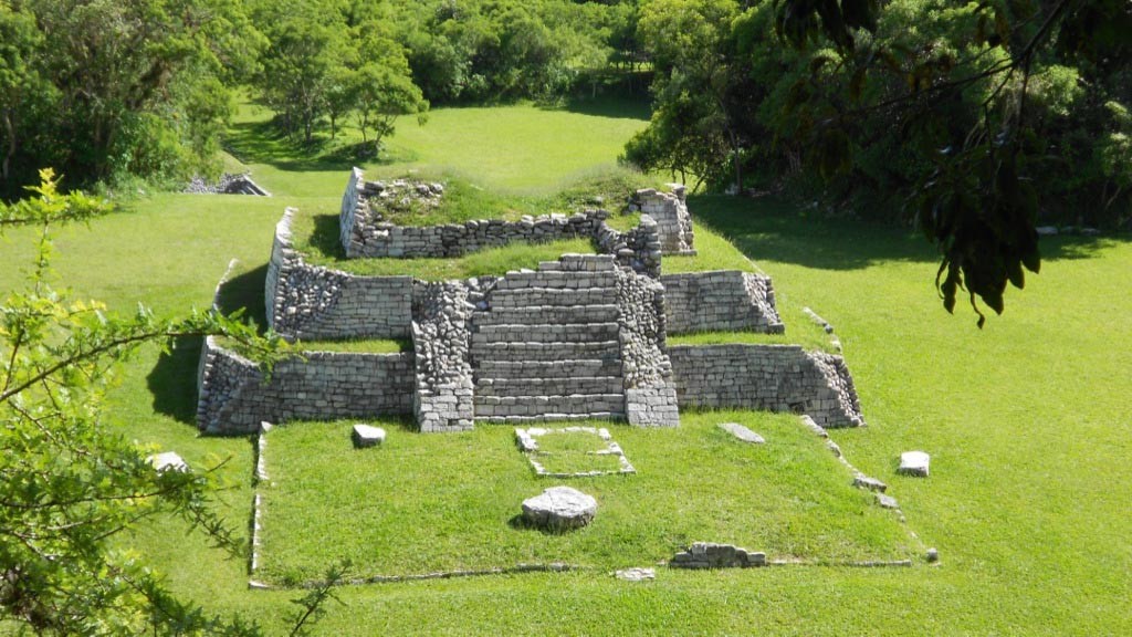
Tenam Puente is classed as a civic ceremonial center, it is situated at 5,250 feet above sea level, on a group of hills on the sides of the valley of Comitán. It covers an area of three quarters of a square mile and the various building complexes made the most of the natural shape of the land. The tops of the hills were chosen for the sites of the main complexes. The principal settlement is made up of approximately 60 structures which are spread out over a series of hills.
This site was one of the most important political entities of the Eastern Highland region of Chiapas. This was a Mayan culture settlement. Its apogee was during the Late Classic (600-900 AD) and the start of the Early Postclassic (900-1200 AD). This meant that new structures were being built continuously, the hills were modified and levelled out with long and high terraces at different levels. The acropolis was created with well-defined interior areas for people to circulate, while the three ballcourts found here denote the importance of the site at the regional level: this is the only site identified to date in the Comitán valley and neighboring areas which has so many ballcourts.
Map

Did you know...
- Tenam comes from the Nahuatl tenamitl which means "fortification," "wall" or "defense." However, in tojolabal it means "thin pot or jar."
- The second name comes from the old El Puente ranch, which comprises the nucleus of the Francisco Sarabia ejido.
- The local inhabitants still use one of the buildings of the archeological zone to carry out the ceremony of the Virgin of the Heart of Mary in the month of August.
- The importance of pre-Hispanic burials in the archeological zone is indicated by the architectural features.
- The presence of diverse cultural features comes from the Mayan Lowlands, which leads us to suppose a great migration took place.
Practical information
Temporarily closed
Monday to Sunday from 8:00 to 17:00 hrs. Last entry 16:00 hrs.
$75.00 pesos
Se localiza a 13 kilómetros al suroeste de la ciudad de Comitán, Chiapas.
From the city of Comitán de Domínguez, take the Pan-American Highway 190 towards Cuauhtémoc city; after 8 kilometers take the turn off on the right to Francisco Sarabia ejido; the archeological zone is two kilometers further down the road to Baños de Santa Rita Uninajab.
Services
-
+52 (961) 612 8360
Directory
Encargado de la Operación del Sitio
Gabriel Lalo Jacinto
This email address is being protected from spambots. You need JavaScript enabled to view it.
+52 (961) 612 2824, exts. 168000 y 168001


