Chinkultic
Cave with descending steps
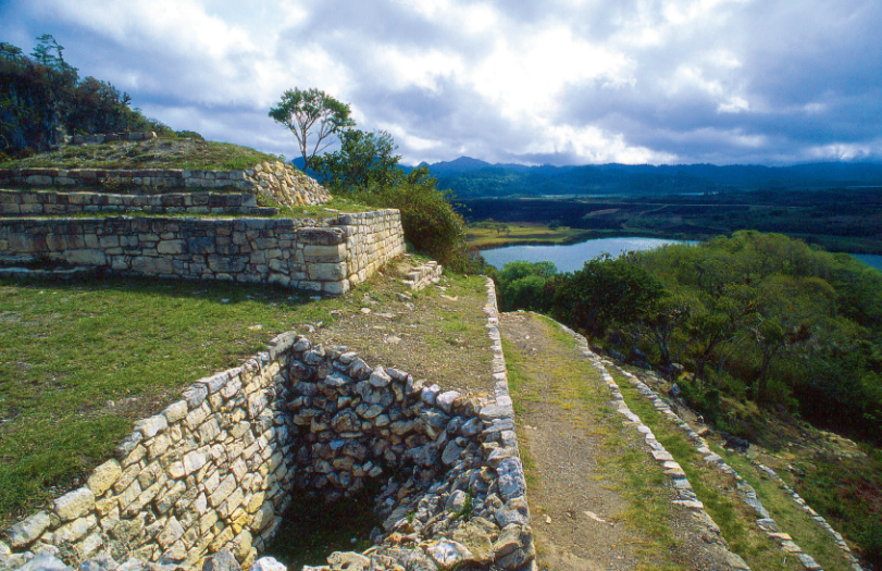
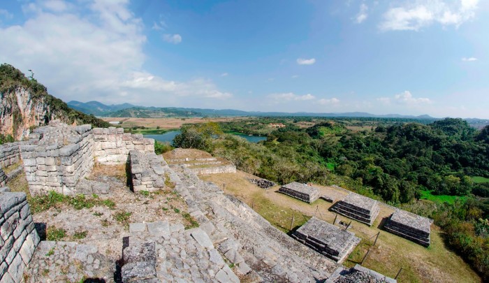
The great city of the lakes of the ancient Maya, near the Guatemala border, with buildings cleverly adapted to the irregular shape of the hills. It has a very large ballcourt and the Plataforma de las Lajas (Platform of the Stone Slabs) was built from the largest cut stones in the whole of Mesoamerica.
About the site
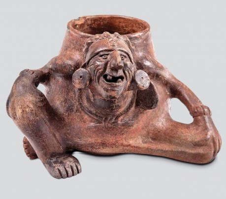
This Mayan city in the state of Chiapas reached its peak between 750 and 900. It is close to the border with Guatemala, in a mountainous region dotted with lakes and cenotes, very close to the Montebello lakes and the town of La Trinitaria. Its name in Maya could mean “the cave with descending steps,” or the “stepped cenote.” The site was first settled around 50 BC and it was abandoned by 1200 AD. The pottery found at the site indicates that it was a very important trading center. The sun and Chaac, the rain god, were worshiped most extensively.
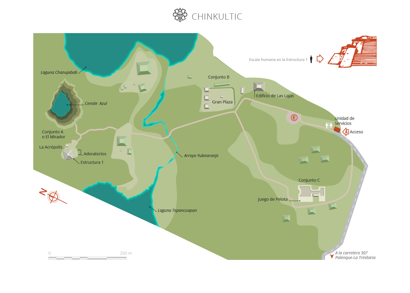
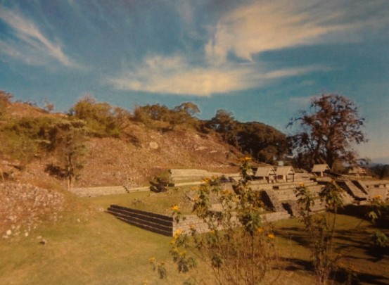
The site’s monuments are divided into four complexes: El Mirador ("The Lookout") with its Acropolis; Complex B with the Plaza Hundida ("The Sunken Plaza"), Complex C with its ballcourt and Great Platform and Complex D with its great Pyramid and the Plataforma de las Lajas ("Platform of the Slabs"), made from great slabs of stone measuring 16 inches by eight feet 6 inches, the largest in Mesoamerica. The whole site can be viewed from different perspectives from either El Mirador or the Plaza Hundida.
The German Eduard Georg Seler explored the site in the final years of the nineteenth century. In 1923, Frans Blom and Oliver La Farge cleared the way to the ballcourt and recorded its figures and glyphs for the first time. Enrique Juan Palacios provided a general description of the site three years later. In 1928 Frans Blom calculated that Chinkultic was built between 591 and 897. Sixteen years later Sylvanus Morley and Eric S. Thompson visited the site and discovered Stela 10, which also had a figure and glyphs. In 1958, Gareth W. Love visited the site with the support of the New World International Foundation. A new archeological project started in 1966 under the direction of Stephan F. de Borhegyi, sponsored by Milwaukee Public Museum in Wisconsin, and the following year Guillermo Bonfil of the INAH began the systematic excavation of Chinkultic.
TEXT CHANGED
Map
Did you know...
- The site is known as “our little mountain” in Tojolabal, the language spoken by the Mayan group which currently lives in the state of Chiapas.
- The cenote and lakes were of great religious significance and played an important role in the lives of the people of Chinkultic.
- The Cenote Azul (Blue Cenote) was partially excavated in 1970 and a series of finds and bones were recovered.
Practical information
Monday to Sunday from 09:00 to 16:00 hrs.
Free entrance
Se localiza a 47 kilómetros de la ciudad de Comitán y a 34 de La Trinitaria.
From the city of Comitán de Domínguez take the Panamericana 190 to La Trinitaria; at kilometer 12 take the exit for the Lagos de Montebello National Park, continue for 42 kilometers to the Miguel Hidalgo ejido, then take a road to the left for 1.5 km to reach the archeological zone.
Services
-
+52 (961) 612 8360
Directory
Encargado de la Operación del Sitio
Gabriel Lalo Jacinto
This email address is being protected from spambots. You need JavaScript enabled to view it.
+52 (961) 612 2824, exts. 168000 y 168001


