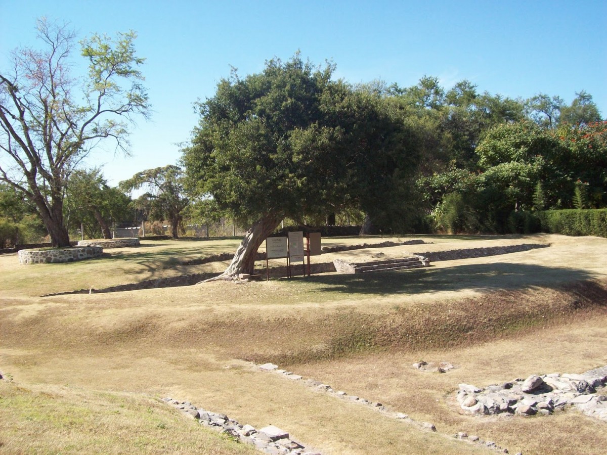
Las Pilas
Gets its name from a swimming place in a wooded area.
Surrounded by springs, its inhabitants were highly adept in the management of underground water and they built a complex system of channels for collecting and storing water. It was a site for the worship of water, with remarkable burials in the channels.
About the site
Did you know...
  • INAH began the excavation of Las Pilas after intervening when a mound was destroyed to construct a swimming pool.
  • The two water collection systems were similar, but the later one is better preserved.
  • The stored water was used for irrigation to boost intensive farming.
  • The site occupied the eastern side of the natural swimming spot, where there is still an ancient spring. For a number of years the spring supplied water to the town and this might be what gave the site its name.
  • Mound 6, to the south, is on private land which was confiscated by a bank. It is in the process of being donated to the Morelos INAH Center.
Practical information
Wednesday to Sunday from 09:00 to 16:00 hrs.

$75.00 pesos


  • Discount for senior Mexican citizens
  • Discount for Mexican students and teachers
  • Sundays free for Mexican citizens
  • Free entrance for Mexicans under 13 years old
Se localiza en el municipio de Jonacatepec, al noroeste del estado de Morelos.

From the city of Cuautla, take the road that leads to Izúcar de Matamoros as far as the Amayucan junction, and take the exit for Atotonilco. The site is 2 km further on, within a bathing area.

Services
  • Sanitarios
  • Visitas guiadas
  • +52 (777) 314 4048
  • direccion.mor@inah.gob.mx
Directory
1749
11_estructura_1_de_la_plaza_A
12_estructura_1_vista_desde_el_centro_de_la_plaza_A
INAH-Zona Arqueológica de Las Pilas
Structure 1, seen from the center of Plaza A
2_estructura_2_de_la_plaza_A
INAH-Zona Arqueológica de Las Pilas
Structure 2 in the Plaza
4_estructura_3_de_la_plaza_A
INAH-Zona Arqueológica de Las Pilas
Structure 3 seen from Structure 2
51_estructura_2_vista_desde_la_3_plaza_A
INAH-Zona Arqueológica de Las Pilas
Structure 2 seen from Structure 3
Structure 4 in the background, seen from Plaza A
Altiplano Central
Rodeada por manantiales, sus habitantes se especializaron en la explotación de mantos acuíferos y construyeron una compleja red de canales para concentrar y almacenar el preciado líquido. Fue un lugar de culto al agua, en el que llaman la atención los entierros encontrados en los canales.
Surrounded by springs, its inhabitants were highly adept in the management of underground water and they built a complex system of channels for collecting and storing water. It was a site for the worship of water, with remarkable burials in the channels.
Toma su nombre de un área arbolada que se destinó a balneario.
Gets its name from a swimming place in a wooded area.

LEGAL NOTICE

The contents of this website belong to the Instituto Nacional de Antropología e Historia de México, and may be downloaded and shared without alterations, provided that the author is acknowledged and if is not for commercial purposes.

Footer MediatecaINAH

Guardar
Lugares INAH

Idioma