The province of Acalan-Tixchel must have been very important in the pre-Hispanic period. The papers of Pablo Paxbolom Maldonado list 76 towns in the earliest years of the Spanish conquest, which would indicate its importance at that time. Based on the work of Scholes and Roys, and other surveys, 148 archeological sites have been discovered in the province.
The survey was divided into five sub-regions named as follows: the Coast, Lower and Middle Candelaria, Upper Candelaria, the Caribe river and the San Pedro river, each with a principal site as center of local government. This is how El Tigre was identified as the capital and San Román, Santa Clara, Salto Grande and El Anonal as the regional centers, all surrounded by third-tier archeological sites typified by the presence of mounds of a certain prominence around the plazas, plus other structures. Fourth-tier sites are residential areas with platforms and low structures. Finally, fifth-tier sites are on lake shores and river banks, but situated at strategic points for the monitoring and control of the movements of canoes, people and commerce along the length of the Candelaria river, the Laguna de Términos and other tributaries.
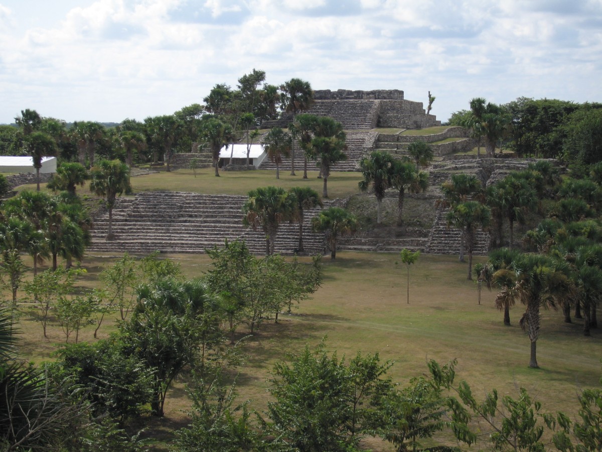
As is often the case with the centers of monument complexes, El Tigre has a principal ceremonial center in which the site’s most prominent buildings surround the most important plazas. In the ceremonial center of El Tigre, Structures 1, 2, 3 and 4 are built around two large plazas, with each of the buildings serving a distinct function.
When looking at the plan of the ceremonial center of El Tigre, it is apparent that the E-group is aligned with Structure 4, which has been called triadic on account of being composed of three closely linked structures. This structure was modified during the Classic and Postclassic. In the majority of cases, triadic buildings are situated to the east of E-groups, set on the same axis as the central buildings and generally marking out a second plaza adjacent to the preceding group, which is the case at El Tigre. The relationship described above is reproduced with the same orientation and with the central axis of Structures 2, 3 and 4 nearly perfectly aligned in an east-west direction.
Another variant related to the blueprint of plazas with E-groups is the presence of large buildings situated to the south, which commonly form part of the plaza, although spatially distant from it. At El Tigre, Structure 1 stands on the south side of the first plaza, but this is separated from Structures 2 and 3 which make up the E-group.
Ballcourts are always associated with ceremonial centers. At El Tigre there are three of these; the first in the principal plaza is oriented east-west; another to the north of the plaza but not within it has smaller dimensions and a north-south orientation, and a final one lower down and outside the ceremonial center which is reached by a sacbe. Only the ballcourt within the great plaza has been excavated, and this is notable for its lack of enclosed end zones. The proximity of the ballcourt to the E-group is also worth noting, since the former is reached by a one-mile-long avenue running from the lower sites.
The Chontal Maya of El Tigre erected Structures 1, 2, and 3 at specific points, since if we draw an imaginary line along its east-west axis, it would cross the axis of alignment at precisely the midpoint between the other two. The spatial layout of the site was based on clear geometry. This alignment corresponds to the rising and/or the setting of the sun, particularly common sun-related orientations in the early period of these buildings. As a result of the excavations of the two structures we can conclude that they were were built in the Late or even in the Middle Preclassic.
Cosmological, astronomical, political and economic factors played a very important role in the construction of the buildings at El Tigre, and this is evident in the architecture of the ceremonial center. Without a doubt the heart of the site is defined by the E-group in the two principal plazas and the triadic set, all of which was planned in the Preclassic and modified in the Classic and Postclassic.


