Mayapán
The flag of the Mayas
The last great city of the ancient Maya, walled, reminiscent of Chichen Itza once it had fallen. With a population of up to 12,000, founded 1,300 years ago, buildings with significant Maya-Toltec influence but with its own style, and an unexpected mural painting of great value.
About the site
The pre-Hispanic settlement of Mayapan is located 26 miles to the southeast of the city of Merida, in the municipality of Tecoh, just over a mile south of the village of Telchaquillo.
Archeological investigations have proven that Mayapan was inhabited from around the birth of Christ to the fall of the city around 1450 AD. The evidence for the dating is scarce as none of the buildings of the original city have survived; all were demolished to use their stone in new temples and houses. Our information is not very precise, but it appears that the site, or its surrounding area, was inhabited from the Early Classic (300-600 AD). On the other hand the walled city of Mayapan, founded in the thirteenth century was the most important center of Mayan civilization during the Postclassic (1250-1450 AD), in other words ending shortly before the arrival of the Spanish.
This great Mayan capital ruled the provinces in the northwest and north-central region of the Yucatan peninsula. Mayapan seems to have been an important population center. Its grandeur was reflected in the large volumes of its buildings and their dense concentration. Around 1560, Fray Diego de Landa mentioned that according to local tradition, Mayapan was founded by Kukulcan, who ruled for a while before leaving for central Mexico. The principal rulers then decided to form a government together under the leadership of the Cocom family, as they were the richest and had the most ancient lineage. Around the mid-fifteenth century the capital was burnt and destroyed, and the rulers retired to their provinces, leaving the city of Mayapan abandoned.
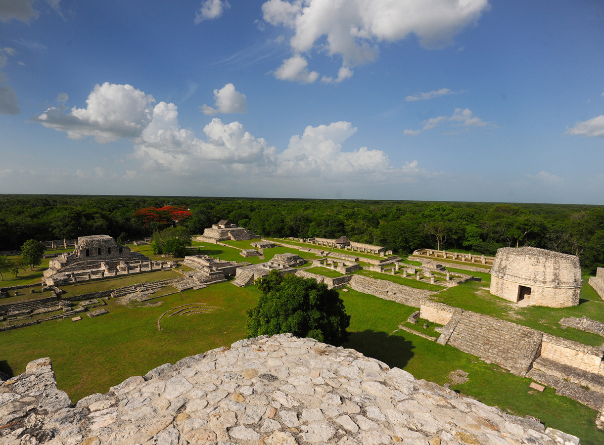
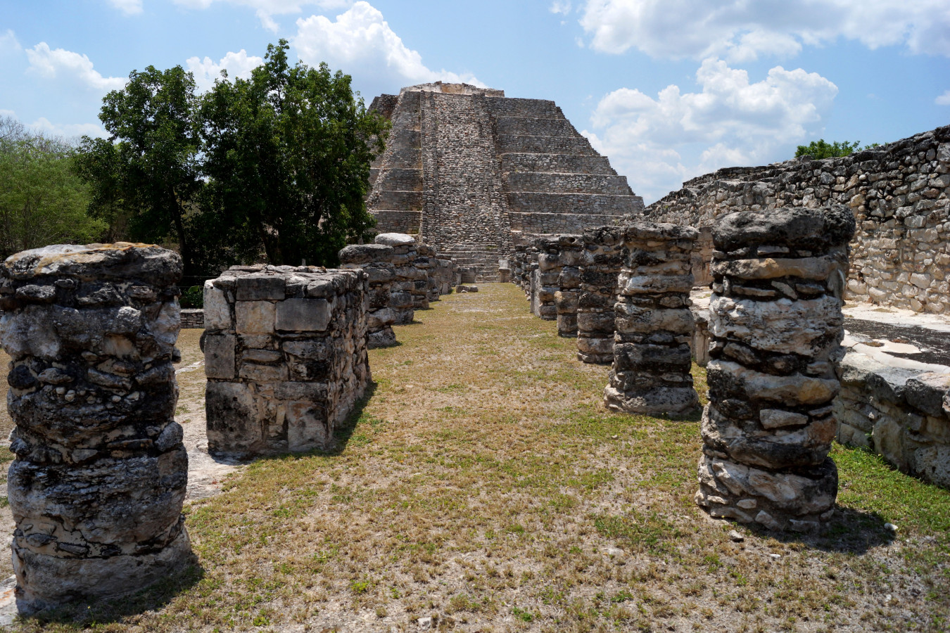
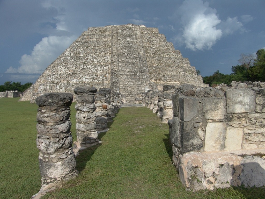
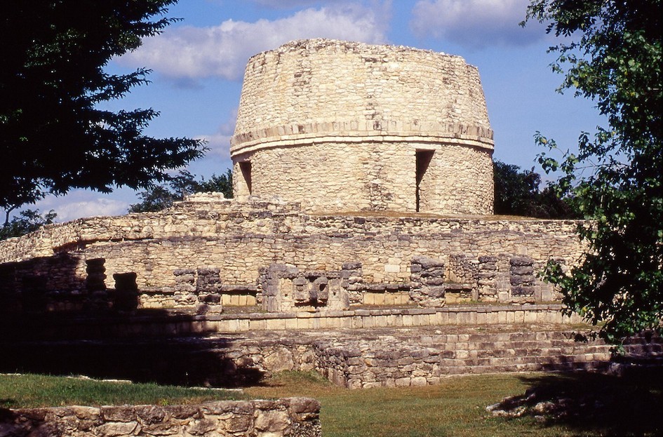
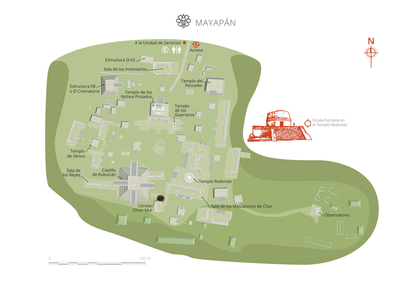
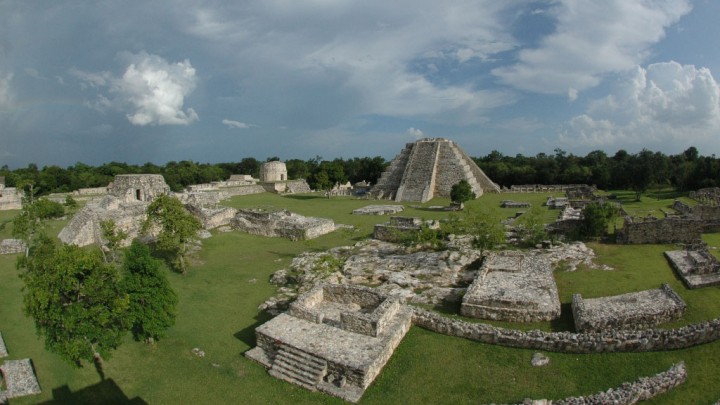
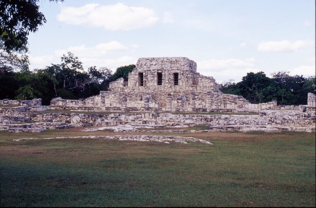
The strong influence Chichen Itza had on the architectural style is evident from the buildings. Mayapan’s main building was known as “El Castillo de Kukulcan” (“castle of Kukulcan”), and copied the building of the same name at Chichen Itza, but on a smaller scale. The site of Mayapan covers more than one and a half square miles, in which there were around 4,000 structures. The central area included civic, administrative and religious buildings, as well as the residences of the governing class. It had spaciously built hypostyle halls, temples and shrines on top of plinths with wide doorways divided by columns, an altar to the rear and benches to the sides. Round buildings known as observatories were also typical.
The core area of the site was surrounded by a wall, with the residential area outside, mainly in the southeast area. The dwellings were very tightly packed, just like the buildings’ dry stone walls, known locally as “albarradas.”
Map
Practical information
Temporarily closed
Monday to Sunday from 08:00 to 17:00 hrs. Last entry 16:00 hrs.
$75.00 pesos
Se localiza 43 km al sureste de Mérida y a 2 km de Telchaquillo.
From Mérida, take state road number 18. From the municipal seat of Tecoh it is necessary to head to the town of Telchaquillo, which is 1.5 km from Mayapán.
Services
-
+52 (999) 944 4068, +52 (999) 944 0033
-
This email address is being protected from spambots. You need JavaScript enabled to view it.
Directory
Administrador del Centro INAH Yucatán
Felipe de Jesús Flores Laguna
This email address is being protected from spambots. You need JavaScript enabled to view it.
+52 (999) 913 4034, ext. 398006


