


Tehuacalco
Place of houses of the holy water
Pyramids and palaces surround the great central plaza of this stately location that was never dominated by the Mexicas. Surrounded by hills that coincide with the points of the compass, the site reproduces the scheme of the pre-Hispanic universe. Its deities were the gods of fertility, the sun, the hills and water.
About the site
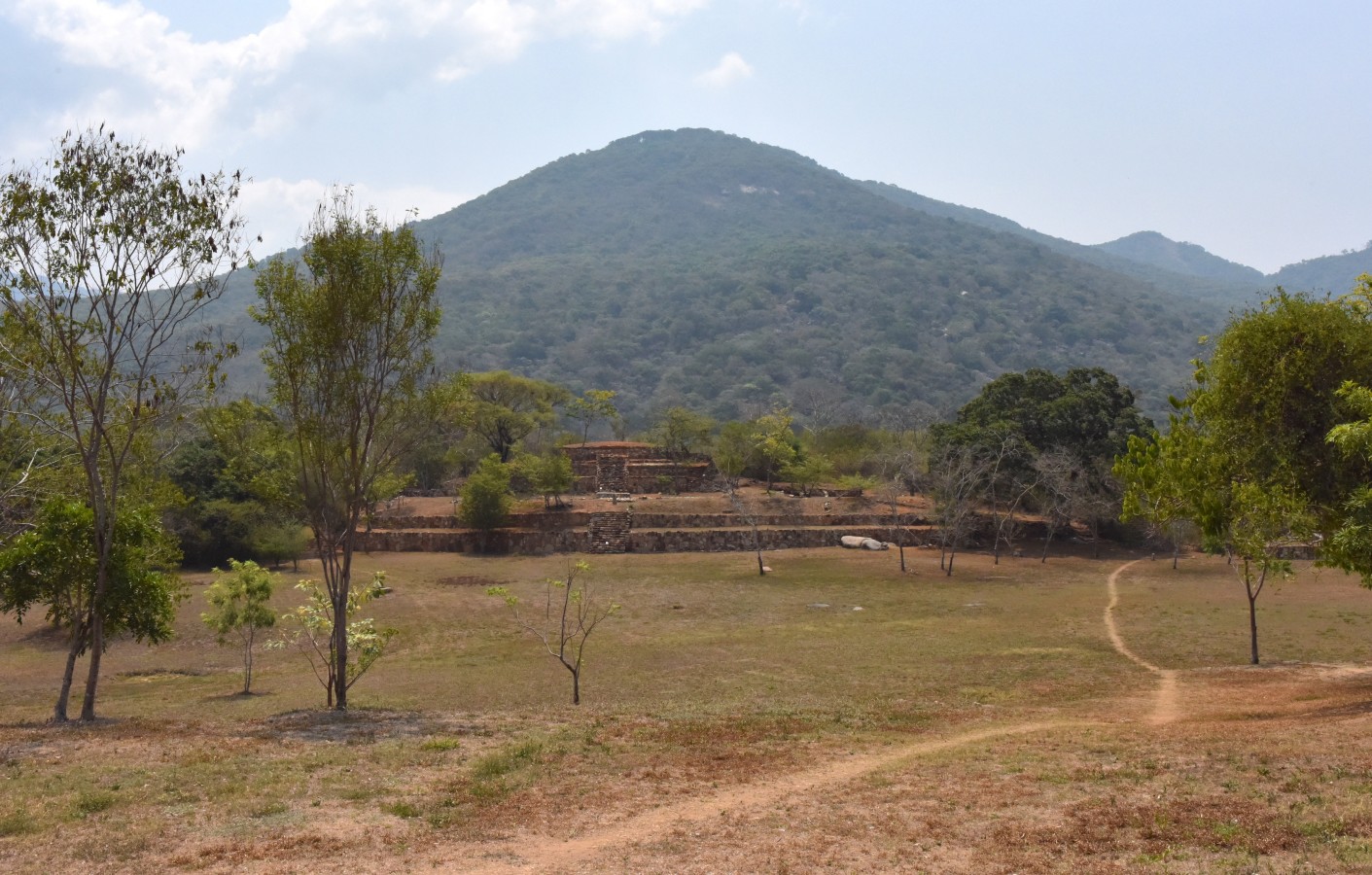
The Tehuacalco archeological site is located in the Sierra Madre del Sur mountain range, at one end of a long corridor which links the Central Plateau with the Pacific coast. Its strategic position in relation to this corridor conferred great importance and a favorable situation for its growth as a large population center, although in reality it was its immediate context that led it to become a great ceremonial center. It is set on a broad ridge surrounded by peaks which appear to encircle the urban center. Four of these hills coincide with the pre-Hispanic idea of the earthly plane being divided into four cardinal directions. As a result of Tehuacalco's position between these four peaks that “marked” these directions, rituals were held here and a sacred geography was established. That is to say, each mark and feature of the landscape bore strong divine significance, making it a center for religious rituals.
Tehuacalco was a pre-Hispanic settlement covering 200 acres, comprised of a civic-ceremonial center dedicated to the worship of water and the mountains, a surrounding population, and other temples, caves and petroglyphs in the outskirts of the urban nucleus. The name Tehuacalco must have been given by the Nahua groups who arrived after the Conquest to take the place of the local ethnic groups who had almost disappeared. The place name may be derived from the terms tetl/huacalli/co: place of the stone box, or Teoacalco, from teo/atl/calli/co: place of houses of holy water or place of water temples.
The site has eight principal archeological complexes, as well as ten smaller structures. The area with the larger structures covers 30 acres. As for the configuration of the civic and ceremonial center, the structures surround a large rectangular square and were oriented towards and aligned with the most prominent hills on the horizon. These hills establish clear visual lines that mark significant days in the solar year, such as the equinox or the solstices.
As a ceremonial center, Tehuacalco not only had civic, ceremonial, administrative and residential buildings; it also had an area full of ritual elements, from the landscape itself (like the sacred hills and caves) to petroglyphs and natural springs. All of these elements made it a ritual site and reflected its essence as a place of worship and veneration of the gods of agriculture and water. As well as the natural characteristics of the environment and the site’s own architecture, blocks of granite and sandstone were found attached to the walls of some plinths. They are engraved with motifs which are considered to be elements belonging to the urban iconography. These designs give character and identity to the monuments.
Most of the blocks discovered display aquatic elements such as spirals and raindrops, which confirm the idea that Tehuacalco was a center for the worship of water. Motifs related to celestial bodies, such as Venus, can also be observed, as well as the presence of gods of water and earth.
Occupation of the site dates back to just before the year 650, when its geographical location and surroundings helped it to become a major ceremonial center. Throughout the following centuries, the large pyramidal bases were built and it reached its peak in the year 1000. Following its decline, from 1350, when rivalries began between different ethnic groups in the region, people began to leave. However, some structures and caves continued to have ritual uses, and other sections of the site maintained a residential use until the site was finally almost completely abandoned. This left a smaller group of inhabitants in areas of the ceremonial center who continued with ritual activities.
Map

Did you know...
- In Tehuacalco, worship of the mountains and rain means the majority of the offerings placed were river pebbles, consecrating the ceremonial space dedicated to water.
- The settlement was organized by social class, which can be seen through the structural systems used in the housing, which ranged from mud and clay huts for the general population to paved courtyards in the palace area.
- In the ballgame court, a stone was found with symbolism relating to the Fuego Nuevo (“New Fire”), showing that a ceremony for the start of the calendar was carried out in Tehuacalco
- In the excavations carried out between the years 2006 and 2008, care for the environment and conservation of plant species was promoted. Thanks to this, an extraordinary space was created to which the fauna displaced by over-hunting—including wild boars, armadillos, deer and iguanas—have returned.
Practical information
Tuesday to Saturday from 09:00 to 16:00 hrs. Last entry 15:00 hrs.
$75.00 pesos
Se localiza en el ejido Carrizal de la Vía, cerca de Tierra Colorada, dentro del municipio de Chilpancingo, Guerrero.
Services
-
+52 (747) 471 7121
-
This email address is being protected from spambots. You need JavaScript enabled to view it.
Directory
Jefe del Departamento de Protección y Resguardo de Bienes Culturales
Héctor Torres Calderón
This email address is being protected from spambots. You need JavaScript enabled to view it.
+52 (747) 472 2604


